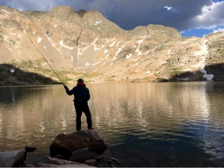
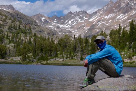
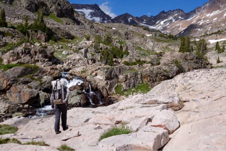
Live dispatches via satellite from an expedition in Montana’s Absaroka-Beartooth Wilderness: Day 12 – Exit to the Beartooth Cafe
Day 12: July 20
The younger ones woke up early this morning which means one of two things: we did not hike enough hard miles yesterday, or today is the final day of the trip and the exit trailhead awaits.
Regrettably, it’s the latter.
Often at the end of these trips, I’m ready for a hot shower, a real meal, and some time back home to do civilized things. This time, I’m ready to pick up a resupply in Cooke City and continue heading south, weaving in and out of the Absaroka Crest en route to Togwotee Pass.
But alas, that will have to be deferred to another day.
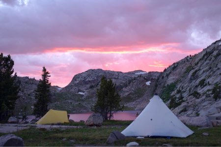
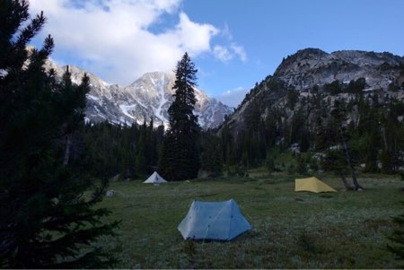
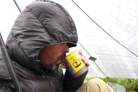
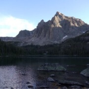
Sitting in my shelter this morning, drinking a coffee with a view of Mount Villard out my door, I couldn’t help but reflect on the value of spending time in Wild Places and attempting objectives worth suffering for.
We have been out for 12 days, through talus and trial, and remain happy friends still. Such is the outcome of being part of our little community of Venturing Scouts and their families that appreciate the benefits of spending time in wilderness, and with each other.
I’ve called Montana home for more than two decades now and have spent more time in the Absaroka-Beartooth Wilderness than any range of mountains other than the Olympics of Washington State. I call the A-B my home range. Having hiked nearly all of its trails, caught fish out of more than 75% of its 300+ fishable waters, and climbed its highest peaks and passes, this trip was a reminder that I feel like I’ve barely scratched its surface. Over the past 12 days, I’ve seen new vistas, traveled new off trail routes, fished new lakes, and collected new experiences with a very competent team of outstanding young men, with whom I would travel through the wilderness anytime.
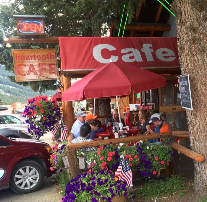
See you for elk burgers at the Beartooth Cafe in Cooke City.
Until next time —
Godspeed,
RJ
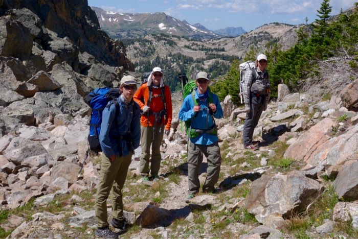
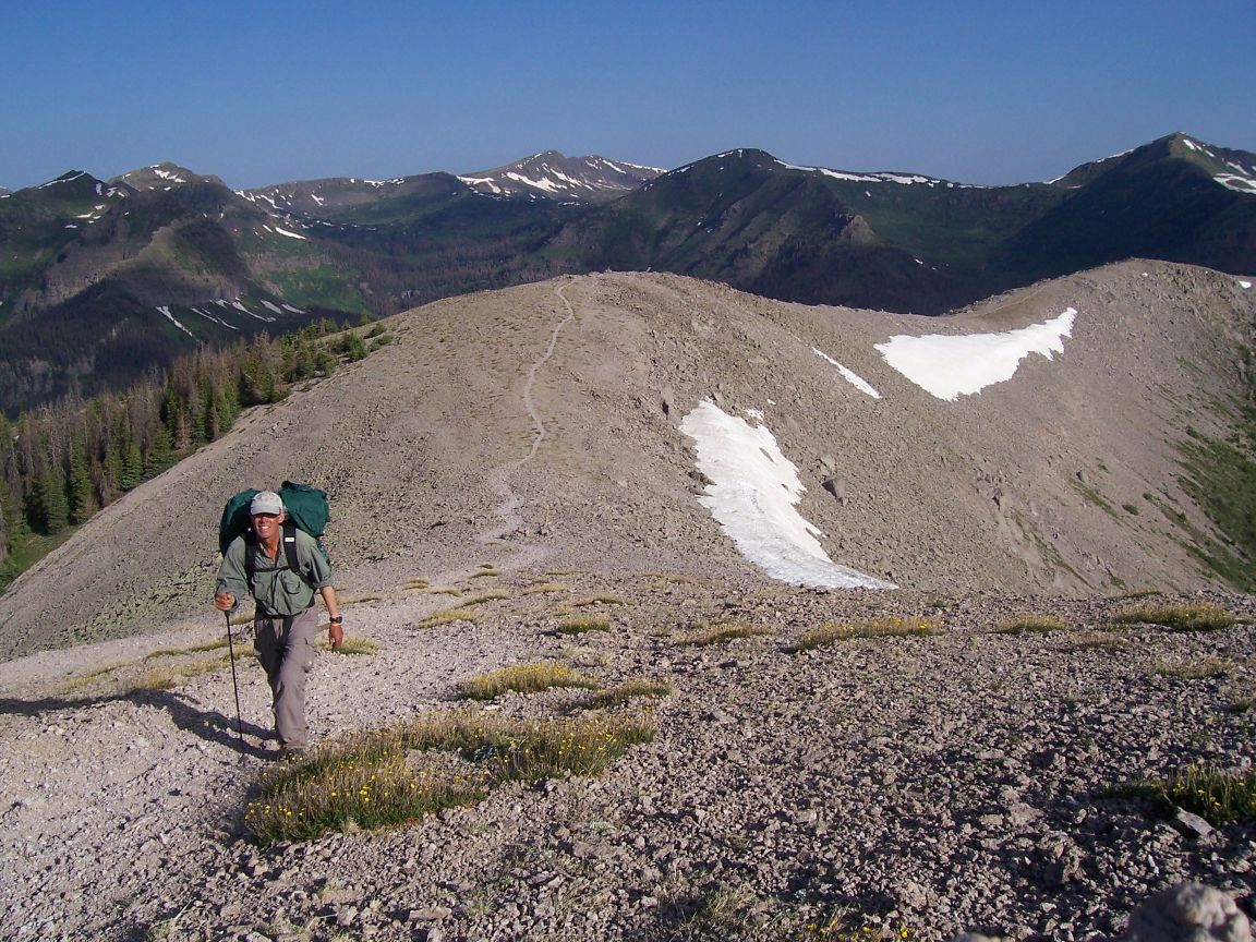
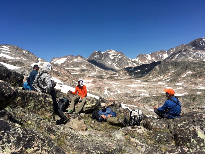
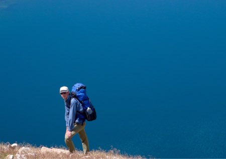
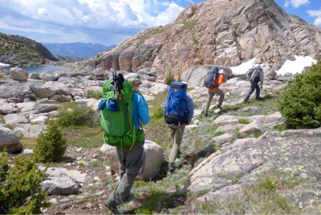
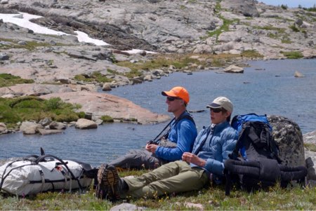
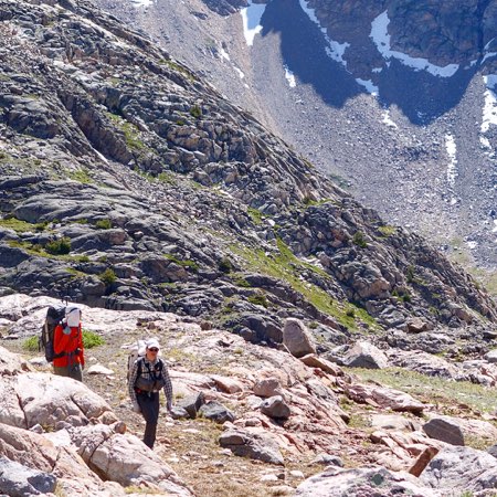
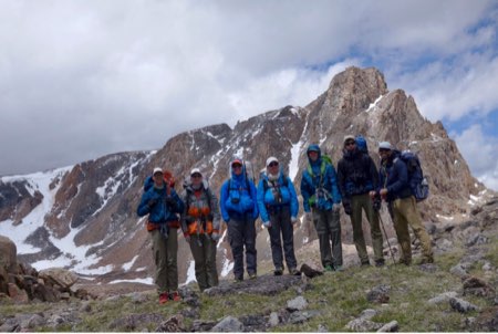
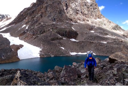
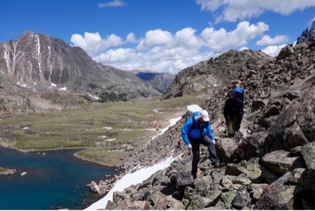
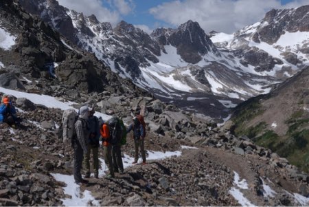
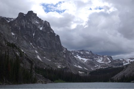
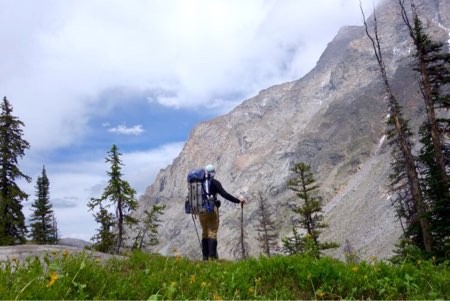
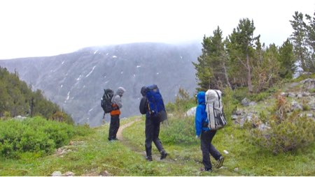
Erick (15), Nikolas (17), Kristofer (14), and Chase (18) getting ready to leave the talus and tundra of the high country this morning.End of the Line: Cooke City, Montana.
About Crew One
Crew One is a Venturing Crew of the Boy Scouts of America, chartered by Backpacking Light to promote expedition leadership and wilderness high adventure skills development in youth 14-20 years of age. Learn more at Crew1.org.
Take a Hike in the Beartooths and Learn Wilderness Travel Skills with Backpacking Light
Get away for a few days with like-minded wilderness enthusiasts and learn the skills of ultralight wilderness travel with Backpacking Light: join us on a Wilderness Adventures Trek.
Follow this live expedition blog as Backpacking Light’s Ryan Jordan, Eric Vann, and five others weave their way through glacial cirques, tundra meadows, and talus fields in Montana’s Absaroka-Beartooth Wilderness July 9-20. Dispatches will be posted to the Backpacking Light Facebook page, Instagram feed, and the backpackinglight.com home page.
Live dispatches via satellite from an expedition in Montana’s Absaroka-Beartooth Wilderness: Day 10 – Sky Top Lakes
Day 11: July 19
I got to bed late last night due to negotiations with the mountain goats that were not entirely successful. Only one guyline got nicked and fortunately didn’t result in any more damage than a dislodged tent stake which I found this morning.
Last night was our warmest night, with the temperature not dropping below 40 degrees F. This morning’s clear skies came with a blazing sun and only a slight breeze, promising a hot day of trekking, for the mountains at least.
We left camp mid-morning and started walking up a steep talus slope towards a col that divided the Sky Top Lakes and Aero Lakes Basins. Upon reaching the col, which sits right below The Spires, we enjoyed expansive views of the south faces of Glacier Peak and Mount Villard.
We scouted a few different routes down and decided to head south through a gentle draw filled with snow and easy talus. From the bottom of the draw at the Rough Lake-Upper Aero Lake col, we dropped down to Upper Aero Lake and skirted its southeast shore on granite ledges and tundra benches.
The Aero Lakes (Upper and Lower) have to be seen to be believed. They are alpine oceans compared to what most people know to be “alpine lakes”. Each of them a mile long and nearly as wide, it takes several hours to circumnavigate their rugged shorelines.
Upper Aero Lake sits at an elevation of 10,140 feet above sea level and has a surface area of 292 acres. It receives a plant of nearly 30,000 Yellowstone Cutthroat every six years and they grow to fat, healthy proportions. Lower Aero Lake sits just below 10,000 feet, is a little smaller at 190 acres, and is populated by trout that drift down the creek from Upper Aero. Since Upper Aero was last planted in 2012, I was banking on the probability that by now the fish would be big, and still plentiful.
We moseyed down to the rocky tundra between the two lakes and set up camp on the softest bench we’ve seen since we left the meadows below Whitetail Peak a week ago.
We got the shelters set up just in time before a thunderstorm moved in and dumped rain and hail on us. Once the storm subsided, I treated and drank a liter and a half of water to get caught up from a hot, dehydrating hike, and tried to soothe the severe sunburn on my right hand – I forgot my Glacier Gloves – a mistake I regret. For the past several days, we have been trekking at high altitudes in intense sun, over lots of snow. It’s been tough to manage the UV exposure.
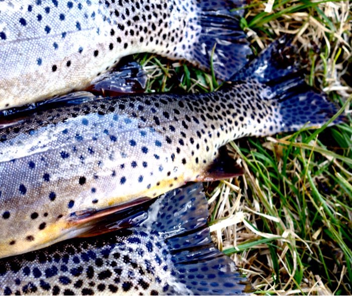
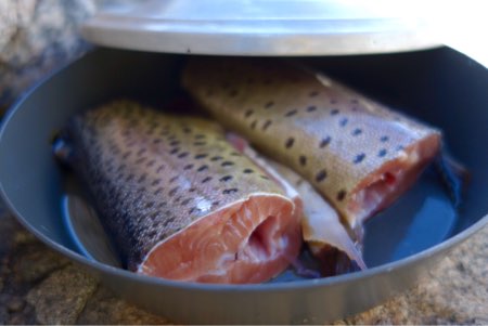
This evening, I strung up the tenkara rod and managed to bring three fat trout back to camp. By the time I had poached and deboned the fish, we had a fry bake filled to the brim with three pounds of meat for dinner.
After dinner and the moonrise I presented a case study that stimulated a lively discussion about legality, ethics, and morals – a mental exercise that allows for the exchange of different ideas and perspectives in a way that challenged us all.
I also wrote a celebratory Haiku about our trip, and shared it with the group tonight, with feeling:
Ye Rock of my soul
Let your love overwhelm me
My sweet sweet talus.
Upon retreating back to my tent, and writing this journal entry from my chair with my down quilt draped over me, I notice the grunting of what has now become a regular visitor: a mountain goat is rustling around somebody’s pee spot about 20 feet from my tent.
Tomorrow we exit.
Godspeed,
RJ
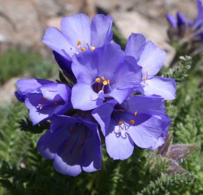
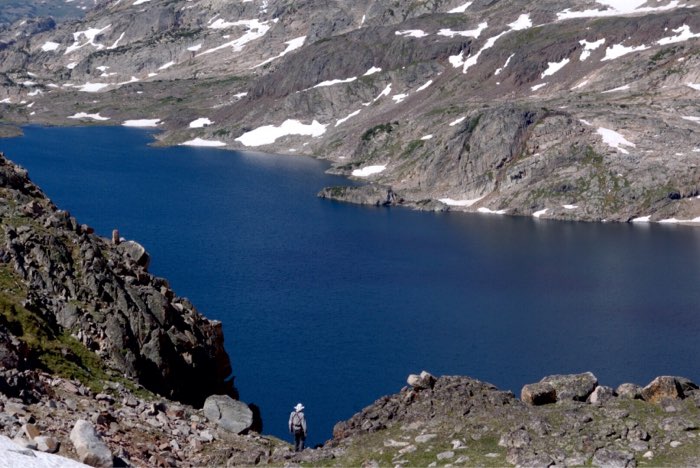
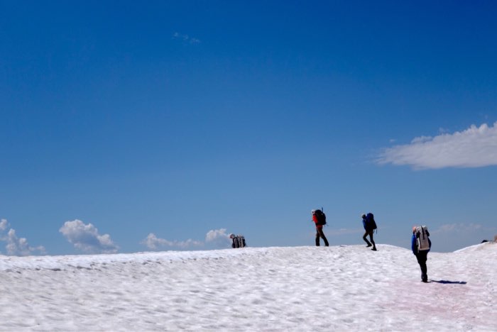
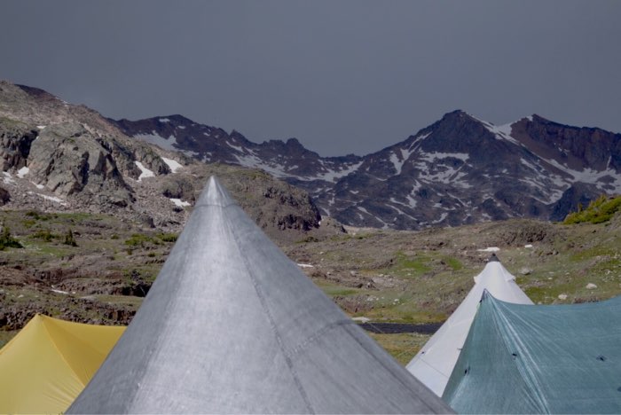
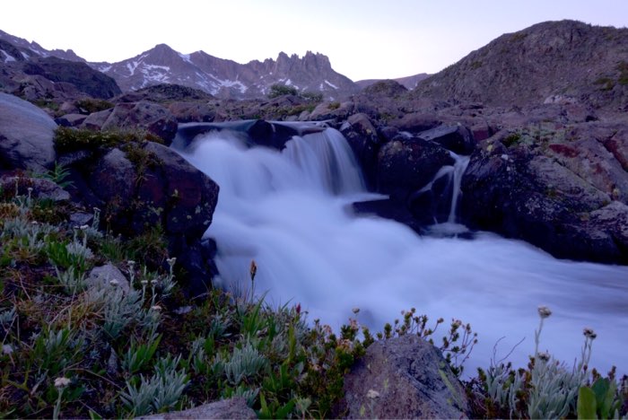
A sampling of the delicate and beautiful wildflowers found in the cracks of talus slopes above 10,000 feet.Chase peering over the edge of a steep couloir while scouting a route down to the alpine ocean that is Upper Aero Lake.Trekking over a snow-covered pass along the divide between the Sky Top Lakes and Aero Lakes Basins.Our last night’s camp – a cozy collection of ultralight shelters. Can you name them?Tonight’s dinner: 18-19 inch Yellowstone Cutthroats from Lower Aero Lake.A waterfall near camp, Mount Villard and The Spires on the horizon.
Follow this live expedition blog as Backpacking Light’s Ryan Jordan, Eric Vann, and five others weave their way through glacial cirques, tundra meadows, and talus fields in Montana’s Absaroka-Beartooth Wilderness July 9-20. Dispatches will be posted to the Backpacking Light Facebook page, Instagram feed, and the backpackinglight.com home page.
Live dispatches via satellite from an expedition in Montana’s Absaroka-Beartooth Wilderness: Day 10 – Sky Top Lakes
Day 10: July 18
Last night’s rowdy thunderstorms created an electric air. Before the lightning came, we heard the humming in our carbon fly rods and felt the static in our hair.
After the worst of the storms plowed through camp late last night, I heard grunting coming from the direction of my Ursack, and my pee spot. Shining my light over, I saw a mountain goat pawing at my food bag, which was tied to a chockstone secured in a boulder crack. I shooed it away with a granite fastball which sent it trotting over towards Eric’s tent. Fine by me. I put in earplugs, and went back to sleep.
In the morning, I listened intently to Eric’s own goat story…
We left Fossil Lake and wandered up the meadowy draw of its inlet until we found talus and snow that took us up a snakey route to a high col dividing the hydrology of Fossil and Cairn Lakes. From there, we climbed up to the Absaroka Crest once again and entered the beautiful Sky Top Lakes basin.
Not satisfied with the 4.5-star views in the lower basin, we proceeded higher over talus, snow, and granite ledges to the Fourth Lake, and are now camped in rocky tundra there at 10,436′.
Our view into the upper cirque is unparalleled, framed by Tge Spires, Mount Villard, the dramatic South Face of the Montana High Point, Granite Peak, and Cairn Mountain. I can see Granite’s summit out the doors of my pyramid tarp, just two miles away.
Two high point parties wandered through en route to establishing their base camps for an attempt at Granite’s summit tomorrow. One fellow was wearing a Backpacking Light cap and turned out to be a customer from California. It always warms my heart to run into BPLers “in the wild”!
In addition to their beauty, Sky Top Lakes are famous for weather, fish stories, and the highest concentration of mountain goats in the range.
This is a hostile spot. The wind blows incessantly here, and through the years I have experienced some of the worst storms the Beartooths have to offer in this drainage. There is no cover – no trees or shrubbery of any sort – only rock and snow. The high peaks concentrated in this area create their own drama when prevailing weather slams into them. The lakes are some of the last to melt in the Beartooths. Once, almost 15 years ago, I visited here in August and Lakes 5, 6, and 7 were still frozen.
And, if I’ve ever seen a fish in these lakes, I won’t be writing anything about it.
A mountain goat ewe and tiny, curious kid have been visiting us all afternoon, licking our pee spots and wandering to and fro through camp. I don’t have the heart to hurl another rock at the ewe or the adorable little kid (those innocent dark eyes…ugh!), so I’ll just keep the Ursack a little closer tonight and maybe head over by Eric’s tent to pee.
Skies are clear as I write this at 10 pm, and the wind is howling and whistling through the ridge tops. But it’s warm enough to sit in my chair with my sleeping bag draped over me, huddled in my down parka, and watch the light of the full moon cast its eerie glow on the Sky Top Glacier as the last light turns the sky from blue to indigo.
Goats are mewing in our camp and I can hear the footprints of the ewe, and what sounds like a few dozen of her closest friends, trotting to and fro. I hope they don’t trip over the myriad guylines that are spun like a spiderweb to secure my tent in the Sky Top Winds.
Tomorrow is our last full day in the Wilderness and we plan to make the most of it by pursuing large trout over the divide to the west.
Godspeed,
RJ
Hanging out at the hydrologic divide between the Fossil and Cairn Lake drainages.Sky Top Lakes with The Spires on the left, Cairn Mountain on the right, and Granite Peak in the distance.Trekking through the Sky Top Lakes basin over snow and stone.Mountain goat ewe and kid on a knoll in camp, waiting for one of us to pee.
Follow this live expedition blog as Backpacking Light’s Ryan Jordan, Eric Vann, and five others weave their way through glacial cirques, tundra meadows, and talus fields in Montana’s Absaroka-Beartooth Wilderness July 9-20. Dispatches will be posted to the Backpacking Light Facebook page, Instagram feed, and the backpackinglight.com home page.
Live dispatches via satellite from an expedition in Montana’s Absaroka-Beartooth Wilderness: Day 9 – Fossil Lake
Day 9: July 17
The day broke calm and clear, but frosty.
I had pitched my tarp at the base of a west-facing forty-foot cliff so I didn’t get to enjoy the warmth of the morning sun. Instead, I shivered as long as I could and then packed up my chair and coffee kit and moved to a sun-warmed granite slab overlooking Lake of the Winds’ eastern shore.
After some fishing, we packed up and had a map session, using the big map spread out in an oriented position on the slab and secured at its four corners with granite stones. Now that we were entering the final 1/4 leg of our trek, we reviewed our exit options in case there was too much snow for us to safely cross Sky Top Pass. A doe and buck mule deer wandered into the back of our campsite and curiously looked on while we searched for more lakes with big trout prospects on the map.
We left camp and circumnavigated slabs and ledges around the lake’s south shore and then started a nearly direct line due NW towards Fossil Lake. Our first pass, a Kindergarten climb of only 80 vertical feet, dropped us into the beautiful Gallery Lake basin with a pretty waterfall cascading into the lake’s northeast shore.
From Gallery, we got distracted talking about silly things and got suckered into an inviting climb to the north of our target pass, which was going to drop us into our intermediate destination at Lake of the Clouds.
Instead, we found ourselves more than half a mile northeast of the lake in a little tussocky meadow containing the headwaters of the lake’s inlet stream.
Realizing our error, we decided to stay on this bearing and enter the Fossil Lake basin via a pass that was a a bit west of the route that most backpackers take from Lake of the Clouds, and upon our arrival at this seldom-visited 10,280-foot col, we enjoyed one of the finest scenic vistas I have ever seen in this range.
We stopped here for a long time, solving world problems and such (which seem easier when your packs are off and you’re restfully reclined in a patch of wildflower-laced tundra), as well as identifying all of the peaks on the horizon.
These peaks included a spectacular panorama comprised of some of the Big Ones of the Beartooths: Iceberg Peak (11,552′), Mount Wilse (11,831′), Glacier Peak (12,200′), Mount Villard (12,344′), the Montana High Point, Granite Peak (12,799′), and Cairn Mountain (12,200′).
While at the pass, we were able to recon our exit route over the Villard-Granite col and were surprised to see its east face choked with much more snow than we thought would be there. Giant cornices that we could see with the naked eye from five and a half miles away still protected the top of the col. And so, since we don’t have our snow climbing gear with us, we will have to formulate an alternative exit plan…
The route down was steep and a little precarious, as we walked “over an invisible fall line” to a deep, unnamed lake tucked away on a high bench overlooking Fossil Lake.
On the way down, we discovered talus litter: a deflated helium party balloon, undoubtedly released by accident by some crying kid at a four-year old birthday party down in Billings. This is the second balloon that we’ve found in high elevation talus on our Crew expeditions, so now we are wondering about the wilderness impact of helium balloons at parties down in town…
We reached Fossil Lake in the mid-afternoon and are camped on its exposed North Peninsula. We managed to catch several nice cutthroat trout, a half dozen of which made their way into our dinner stews.
I took a swim today in the lake and I think my heart stopped beating when I dove in. It was the coldest mountain swim I’ve had in a decade. I may be getting too old for this sort of nonsense. Once I recovered with a hot coffee and some time engulfed in my down jacket and sleeping bag, I came back to life and fished for a bit more. We were caught a bit by surprise as a thunderstorm moved in, so we scurried back to our tarps and broke down our carbon fishing rods just as lightning bolts flashed overhead.
As we are a late dinner under the nearly-full rising moon, a giant meteor streaked across the southwestern sky, in a flaming glory of orange, green, and blue. We saw bits break off of it and vaporize quickly, but the meteor disappeared across the horizon with no apparent intent of burning out soon. None of us had ever seen anything quite like it.
This brings us to the end of our ninth day. Ominous dark clouds are building up to the west, and thunder is booming, so it’s time now to batten up the hatches and brace for the next round of storms.
Tomorrow: Sky Top Lakes? After that, maybe we wander out to the southwest and walk into Cooke City, where we can get burgers.
Godspeed,
RJ
Eric Vann looks at the horizon of Big Beartooth Peaks, with Fossil Lake in the distance.Chase, Nikolas, Kristofer, and Erick descend into the Fossil Lake basin.Erick descending steep slopes towards a deep, blue, unnamed lake.
Follow this live expedition blog as Backpacking Light’s Ryan Jordan, Eric Vann, and five others weave their way through glacial cirques, tundra meadows, and talus fields in Montana’s Absaroka-Beartooth Wilderness July 9-20. Dispatches will be posted to the Backpacking Light Facebook page, Instagram feed, and the backpackinglight.com home page.
Live dispatches via satellite from an expedition in Montana’s Absaroka-Beartooth Wilderness: Day 8 – Lake of the Winds
Day 8: July 16
I slept well last night, and felt good enough this morning to walk.
We broke camp in the late morning and made the short trek over rocky tundra to Lake of the Winds via Z Lake. We took our time and arrived at camp in the early afternoon.
Lake of the Winds is notorious for two things: large finicky cutthroat and, as the name indicates, wind.
Lake of the Winds is perched on a high bench with lots of weather exposure and little protection. Camping in the wind is problematic up here for backpackers who expect to have a relaxing sit by a nice fire in the evening.
After setting up camp, the winds picked up, the crew scurried to the big tent (an HMG Ultamid 4) and played cards.
I dressed in my storm gear and went fishing.
In spite of whitecaps on the lake, the wind blowing my line every which way, and graupel pelting my face, I managed to sneak enough temptation along the deep shelf at the edge of the talus to get into several tangles with large trout.
The trout were winning, spitting out my fly or breaking me off. So I switched to heavier tippet and finally managed to land a 19-inch Yellowstone Cutthroat. After a little more fishing and one smaller trout, my numb hands were done and I walked back to camp, a forked willow stick carrying my dinner fare.
With the others getting rather excited about me bringing a leviathan back to camp, they grabbed their fishing rods and headed down to the lake themselves. I cleaned one fish (saving the other for the other cook group), poached and deboned it, and put the meat in the fry bake to ready it for dinner later.
A makeshift fireplace and chimney has been constructed at our camp with flat stones stacked and arranged against a large boulder on a granite slab. A few of our Crew improved it by filling in the cracks with mud, so the fireplace now works as designed. This is the problem with having a bunch of engineers and engineer’s sons together in the wilderness.
Needless to say, the fire that has been built within it is creating a monumental amount of heat that is welcome in this cold, windy environment.
After a dinner of Alfredo noodles with more than a pound of ghee-fried trout meat added (for me and my cooking partner), we cleaned up and noticed a very strange phenomenon.
No wind.
So we went fishing again, caught more trout, cooked more trout, and ate more trout.
By the time Round 2 was done, it was dark, warm, and calm. For the first time on our trek, we are enjoying a warm, windless night at a famously cold and windy spot.
I’ve been here half a dozen times over the past two decades and this is the first time I’ve enjoyed an evening here without weather trauma – we are indeed enjoying a relaxing sit by a nice fire…
Tomorrow: crossing the crest via an easy col to fish-filled Fossil Lake.
Godspeed,
RJ
Trekking along tundra benches to avoid talus – there are lots of sneaky routes that maximize efficiency of you look hard enough.Eric and Erick taking a break at an unnamed lake.A Lake of the Winds cutthroat ready to go in a Banks Alpine Fry Bake.Sunset at our camp above Lake of the Winds.
Follow this live expedition blog as Backpacking Light’s Ryan Jordan, Eric Vann, and five others weave their way through glacial cirques, tundra meadows, and talus fields in Montana’s Absaroka-Beartooth Wilderness July 9-20. Dispatches will be posted to the Backpacking Light Facebook page, Instagram feed, and the backpackinglight.com home page.
Live dispatches via satellite from an expedition in Montana’s Absaroka-Beartooth Wilderness: Day 7 – Talus and Snow
Day 7: July 15
In spite of yesterday’s “short mileage rest day” I am more fatigued today than I’ve been so far on the trip, and more fatigued than I’ve been on any backpacking trek since the day after we finished the crest of the Chinese Wall in the Bob Marshall Wilderness two years ago.
My strength seems to decay a little every day, and I wonder if I’m in need of a true, do-nothing rest day at this point. I didn’t start the trek strong or rested and the first several days were accompanied by some unusual intestinal distress, and maybe it’s catching up to me. I’ll see how I’m feeling in the morning and play it by ear. There were points in the day today where I simply wanted to snap my fingers and be home.
We started the morning with a Crew meeting at our camp at Flat Rock Lake.
I like to do these meetings at the halfway point of our expeditions. It gives us a chance to regroup in an intimate setting as a team, take inventory of physical, emotional, and mental stock, and provide some food for thought on topics related to expeditioning and leadership.
This morning’s conversation focused on the concepts of “team vs. community”.
In our discussion, we came to the realization that “team” is a group of people working towards a common goal, and that “community” is a group of people having shared values and respect for each other. In expeditioning, both team and community must exist. One of the most powerful things I’ve watched on these last three annual Crew expeditions is that we operate with a peer leadership model. There is no captain or patrol leader, no duty roster, and no assigned roles, as occurs in more traditional Scouting settings.
The diversity of expertise that each of our 14-18 year old members bring, combined with the community that already (and previously) exists, makes for a cohesive team framework that has allowed this group to accomplish some incredibly challenging wilderness travel objectives over the past few years. This year we are further learning that competition and scorekeeping kills expedition community and fragments the team, compromising our goals. This morning we renewed our commitment to preserve these values on our expeditions.
Today we traveled a high route between Flat Rock Lake and Desolation Lake via Copepod, Till, and Big Butte Lakes.
The terrain throughout most of the day was talus (much of it loose and sharp) or snow (much of it rotten and lying atop cavernous talus). We traveled five or six miles, and they were hard-earned.
We actually took a wrong turn at one point and ended up down a drainage we weren’t expecting. None of us bothered to look at the maps, because the “route” that was naturally revealed to us was so inviting
Up here on this part of the plateau, the terrain is a jumbled mass of seemingly random granite domes and talus piles. They hide drainages and seams, creating convoluted passageways from one basin to another. Our GPS has been useful (when we look at it; sometimes we get distracted by the fun of endless talus-hopping).
In the mid afternoon, one of our Crew Members slipped on loose scree and his trekking pole fell down to the bottom of a small ledge. I went down to retrieve it and stumbled in some loose, sharp talus and fell into the rocks. The whole thing happened quite fast and I wasn’t too sure what was happening until I felt various bits of piercing pain in my knee, shoulder, ankle, and hand.
I regrouped a few minutes later on a soft patch of tundra and discovered the injuries to be not so dramatic but rather annoying. The worst of them was a broken pinkie finger accompanied by lots of blood from the flesh stolen from it by the offending talus rock. I dressed and taped it to its neighboring finger, and it seems only to interfere moderately with scrambling for now. Its constant throbbing reminds me that we are off trail and remote in a relatively hostile mountain environment.
The ankle bone and shoulder are only bruised but the knee is rather troublesome when trying to balance on one leg while carrying a 40 pound pack. Another argument for a rest day, perhaps. I found myself talus-hopping quite gingerly for our last mile and a half to camp.
Tonight we are camped on tundra at the expansive mini-ocean of Desolation Lake. My last visit here was on an epic winter traverse of the Plateau eight or so years ago with Jörgen J., Mike M., Mike C., Ryan C., and others. Desolation Lake was a fitting name then, and remains so today. We are alone here tonight and there is no apparent sign of frequent human visitation to this beautiful, high-altitude golden trout fishery.
There is more snow up here than we thought, and we’re eager to see what the conditions on the east-facing couloirs and slopes look like as we travel further west towards our exit. We need our exit over Sky Top Pass to be mostly snow free as we are not prepared to travel steep and exposed snowfields since we have no axes or traction.
Godspeed,
RJ
Camp at Desolation Lake.Climbing out of Flat Rock Lake this morning with the massive west face of Sky Pilot Peak in the background.
Follow this live expedition blog as Backpacking Light’s Ryan Jordan, Eric Vann, and five others weave their way through glacial cirques, tundra meadows, and talus fields in Montana’s Absaroka-Beartooth Wilderness July 9-20. Dispatches will be posted to the Backpacking Light Facebook page, Instagram feed, and the backpackinglight.com home page.
Live dispatches via satellite from an expedition in Montana’s Absaroka-Beartooth Wilderness: Day 6 – In Search of Trout
Day 6: July 14
Today will be a well-needed recovery day, with a few less trekking miles and more fishing time.
After fishing the early morning midge hatch at Maryott Lake, we enjoyed a lazy morning there in the warm sunshine and left camp in the late morning.
En route, we enjoyed pleasant off trail walking over talus, tundra, granite ledges, and snow, stopping to fish at Crystal and Alp Lakes before heading up higher for the night.
We arrived at our destination, Flat Rock Lake, in the early evening. After setting up our shelters, we brewed coffee and washed our socks. And then, tenkara rods in hand (and one spinning rod), set out to add a few trout to the ones we packed up from Alp Lake in a snow-filled zip bag.
The Beartooth Plateau’s highest lakes (those near and above 10,000 feet), which are found along the route we are trekking now, are still very cold this time of year and the fishing can be challenging. Thankfully, the spinner brought a few healthy (fat!) foot long cutthroats to the shore. Those of us fishing tenkara all got skunked here this evening.
For dinner: trout Alfredo by moonlight. My cooking partner and I decided to add some pizazz to ours, so we fried it in a fry bake with a handful of crushed jalapeño kettle chips – ending another glorious day in the Beartooths.
I am camped on a little patch of tundra at 10,129 overlooking the lake below, with the Copepod outlet waterfall providing the soundscape. The night is chilly, clear, starry, and the waxing moon is bright.
Godspeed,
RJ
Fishing (tenkara) for dinner at Flat Rock Lake.This is Kristofer. At age 14, he’s the youngest and newest member of our team. Learn more about us at the Crew One Website.Trekking up the upper Sierra Creek drainage, a fantasy land of waterfalls and tundra.
Follow this live expedition blog as Backpacking Light’s Ryan Jordan, Eric Vann, and five others weave their way through glacial cirques, tundra meadows, and talus fields in Montana’s Absaroka-Beartooth Wilderness July 9-20. Dispatches will be posted to the Backpacking Light Facebook page, Instagram feed, and the backpackinglight.com home page.
Live dispatches via satellite from an expedition in Montana’s Absaroka-Beartooth Wilderness: Day 5 – Crossing the Crest
Day 5: July 13
Today we (attempt) to cross the Absaroka Crest to the Beartooth Plateau, where easier terrain and world class alpine lake fishing awaits.
The clear skies at dawn this morning make me hopeful for a high altitude traverse that is absent of the drama that comes with wind, cold, and rain.
Between the Beartooth Highway and the Stillwater River, there aren’t many places to cross the Absaroka-Beartooth Crest if you aren’t a backpacker with some mountaineering skills.
The two easiest spots, perhaps, are High Pass, which we would attempt today, and Sky Top Pass, which will be the key to our exit next week.
High Pass is visited occasionally by day hikers coming from the south via Donelson or Two Bits Lake. The terrain is mostly Class 1 with only a little bit of Class 2 talus here and there.
Far fewer backpackers traverse High Pass. The route north and east, the route we were ascending, poses difficult travel. So you have to want it.
We left camp “mid-morning” with rain jackets on as we walked into a weak storm system that would release intermittent bits of sleet and snow on us for the next few hours.
Our route took us through creekside willows and bogs before delivering us at the foot of a nasty glacial moraine strewn with sharp, car-sized talus.
We opted for the steeper terrain of grass, granite slabs, and snow flanking the moraine until we reached the beautiful Sky Pilot Lake. Here, we rested, ate, and hid behind our backpacks out of the bone-chilling wind while taking in the view of one of the Beartooth’s most dramatic, pyramidal peaks immediately above: the SE summit of Sky Pilot Mountain.
We skirted the south end of the lake, climbing loose scree and talus above steep snow that plunged sharply into Sky Pilot Lake’s icy blue waters. I can feel the fatigue in my legs and back, after several thousand feet of climbing over the past few days. I’m looking forward to easier days and more rest when we get to the Plateau, so I can recover a bit before attempting the difficult traverse of Sky Top Pass next week.
By mid-afternoon, we reached the first of High Pass’s passes. High Pass is a two-pass pass, with a lake in between (High Pass Lake). The gentle pass was covered in a flat talus and snow field, which was a welcome reprieve from the steep climbing required to get here.
We descended the pass and reached Maryott Lake by late afternoon.
We are camped on little tundra benches overlooking the lake, and surrounded by the jumbled topography of the Beartooth Plateau. It’s cold here (we are at 10,500 feet or so), with a bit of a breeze (just enough to numb hands and cause a chill if you’re not hiding behind a large rock), but beautiful. It feels only a little hostile, but very remote.
I tried to fish tonight into the headwind and managed to land a 13 or 14 inch cutthroat before retreating to our sheltered kitchen to warm up.
It’s been a cold trek. I’m burning a lot more calories than I’m consuming and I’m constantly hungry. I’m looking forward to sunshine and rising trout, soon!
Godspeed,
RJ
Follow this live expedition blog as Backpacking Light’s Ryan Jordan, Eric Vann, and five others weave their way through glacial cirques, tundra meadows, and talus fields in Montana’s Absaroka-Beartooth Wilderness July 9-20. Dispatches will be posted to the Backpacking Light Facebook page, Instagram feed, and the backpackinglight.com home page.
I woke up at 5:30 am noting an orange glow through the wispy fabric of my Cuben Fiber pyramid shelter.
Unzipping the door, I was elated to see the day dawning clear with the first fiery tinges of morning alpenglow descending from the summit of Whitetail Peak.
I brewed coffee from the warmth of my sleeping bag, not wanting to brave the crisp morning air quite yet. After journaling and reading for a little bit, I fell back asleep.
The warm morning sun invited us to lounge around in camp, where we felt the need to thaw out after the past 60 hours, which have been very cold and wet. As such, we got off to a lazy start, not hitting the trail until, well, let’s just call it “mid-morning”…
We might question our lack of intention, not knowing what would be ahead of us today.
The climb up and over 11,037-foot Sundance Pass was steep and beautiful. We were treated to expansive views of the snowy Whitetail-Castle cirque that made it difficult to keep our eyes on the rocky trail. Near the top of Sundance’s interminable switchbacks, a cold wind funneled through the pass. I climbed the remaining 100 vertical feet in a down vest and rain jacket just to stay warm, in spite of carrying a 45 pound pack up a steep incline.
After snacking at the top we made a hasty descent to September Morn Lake, where we veered off trail. It will likely be the last time we travel on a trail for the next 8 days.
A steep bushwhack down a forested slope, with a little small talus, brought us to First Rock Lake and our third major alpine valley of the trip.
We spent a little time here in the mid afternoon enjoying more snacks and the pleasant warmth of being alone and remote in the Beartooths.
More bushwhacking and Class 2 scrambling through giant talus led to the headwaters of Second Rock Lake, a hopeful camp for us. We spooked a young and curious bear, who ambled up the talus above us with grace and ease that made me both envious, and awe-inspired.
Unfortunately, the meadows around the inlet were still swamped and the woods were thick with blowdowns, so we soldiered on up the canyon. By now, it was past our dinner time.
More bushwhacking and a steep climb up moose and bear trails. Cooling temperatures. Dark clouds heading our way. Running out of daylight. And the ominous black granite of the 3,000-foot NW face of Beartooth Mountain rising above like a sentinel protecting the upper cirque. We were tired, out of trail snacks for the day, and just about bushwhacked out.
Finally, we stumbled across a dry grassy bench rimmed by subalpine fir, just barely big enough for our shelters, and called it a day in the waning daylight.
We celebrated with “pizzas” made in fry bakes (fried cheese on the bottom as a crust, with tomato paste, pepperoni, and tortilla bits layered on top), and were just finishing dinner when the heavens broke loose. I hastily cleaned up and made it to the shelter of my tent just as the peak of high winds and driving rain hit our camp.
We are at 9,400 feet. The sound of Lake Fork Creek rumbles below through a boulder garden. Beartooth Mountain rises vertically, directly above our camp. I’m camped among willows, with bear scat underneath my ground cloth.
And the cold and wet have returned again. Wind howls through the treetops and ridges above.
Tomorrow we continue up valley to its head, attempt to cross the Absaroka-Beartooth Crest, and begin a weeklong traverse of the Beartooth Plateau.
Godspeed,
RJ
Follow this live expedition blog as Backpacking Light’s Ryan Jordan, Eric Vann, and five others weave their way through glacial cirques, tundra meadows, and talus fields in Montana’s Absaroka-Beartooth Wilderness July 9-20. Dispatches will be posted to the Backpacking Light Facebook page, Instagram feed, and the backpackinglight.com home page.
Live dispatches via satellite from an expedition in Montana’s Absaroka-Beartooth Wilderness: Day 3 – A Break in the Storm
Day 3: July 11
Temperatures plummeted last night as the full force of the storm hit. Sleet, graupel, and snow with the wind howling eerily across the ridges above.
We stayed in our tents well into morning to ride out the worst of it.
During a break in the storm, I got up and moved our fire pit (built atop a hearth of flat stones) and cooking area in a heavily forested hollow behind a large boulder to give us protection.
One by one our crew members showed up as we boiled water for breakfast and coffee. We spent the entire morning here feeding the fire and drying wet clothes as best as we could.
And then we saw something: our shadows!
The sun was not visible by any stretch of the imagination but it was clear that it was now a few degrees warmer and the clouds were a little thinner.
Expecting to ride out the storm here another night, but wanting to be as close to the base of Sundance Pass (tomorrow’s objective) so we can get back on schedule, we had a discussion: should we stay or should we go?
So we packed up hastily, wanting to take full advantage of this possibly brief weather window to at least move up the valley a few miles.
By late afternoon, we reached a campsite and dropped our packs to scout up the valley a little further. After exploring the very breezy area above Sundance Lake, we retreated to our packs and settled in at a wildflower-blanketed meadow, with a fire and cooking area tucked back among large spruces flanking the meadow.
After pitching my shelter, I snuck back into a tree grove to get out of the wind and fetch an appetizer from my snack bag. Except there was nothing left. The cold has amped up my metabolism and I’ve already stolen food from snack bags allocated to future days.
Even after dinner I remained hungry, and I really hope we can fish soon…I made a few freezing casts this morning on the creek to no avail.
Evening brought declining temperatures, more wind, and intermittent views of the 12,000 foot peaks rimming the head of this valley. The most dramatic of all is Whitetail Peak and its iconic north face, triangular summit, and NE Couloir, a 2,500 foot stripe of steep snow rising from the valley floor nearly to its summit. I climbed this couloir with my friend Alan many years ago (2002?) and it remains one of the highlights of my experiences in this range.
By 9 pm, the temperature has dropped too much for me to stay warm, so I went to the tent, zipped up, tightened up my down parka hood, put on my down booties, snuggled deep into my down quilt, and settled in for another cold night.
Godspeed,
RJ
Follow this live expedition blog as Backpacking Light’s Ryan Jordan, Eric Vann, and five others weave their way through glacial cirques, tundra meadows, and talus fields in Montana’s Absaroka-Beartooth Wilderness July 9-20. Dispatches will be posted to the Backpacking Light Facebook page, Instagram feed, and the backpackinglight.com home page.
Live dispatches via satellite from an expedition in Montana’s Absaroka-Beartooth Wilderness: Day 2 – Traversing a Pass in the Storm
Day 2: July 10
Booming thunderstorms and torrents of rain came shortly after I crawled into my tent last night.
I wasn’t able to get a good satellite signal with the iSavi, since Sylvan’s north face was blocking the space view, so I lied in bed thinking about potential exit routes if one of the lightning bolts ignited a tree near our camp. It wasn’t lost on me that we were camped in a tinderbox filled with piles of dead fuel accumulated during decades of forest ecology at work.
Unable to craft an acceptable outcome for such an emergency, I put in earplugs and went to sleep.
I woke up in a pool of water.
I think the wind blew the lip of my ground cloth out under the edge of my shelter, creating a convenient irrigation system that delivered quite a lot of water into my wilderness bedroom.
Thankfully I was sleeping atop a two and a half inch thick mattress and stayed mostly dry. I wrung out what I could from the edges of my 19 oz down quilt, and started packing up. We’ll see if this “water resistant down” is worth anything…
The “storm” hadn’t arrived yet but the temperature was dropping.
By the time we left camp this morning, we were dressed in rain gear and took our first steps in thunder, lightning, and hail larger than any peas I’ve ever eaten.
The route to our target pass was off-trail through forest brush. Eventually we emerged to subalpine fir, tundra, talus, and even some wobbly tussocks with ice water channels flowing between them.
By the time we reached the pass, the rain had turned a bit white and the high wind was causing it to sting our faces.
At this moment I recall thinking that this was one of the most hostile trekking days I’ve had in a few years. To keep morale up, we practiced foreign accents and non-indigenous expletives (“Bloody stinging hail! ‘Tis a bugger!”)
We dropped down to the Mary Lake basin and huddled in the scrub trees to eat and drink. A break in the storm gave us a reprieve and boosted morale with a few rays of sun.
After a jarring descent (back on trail now) to the valley, we rested once again and chatted with Ranger Jenny for a bit. She grilled the younger ones with LNT questions and they all passed. She was shocked, and maybe impressed, that we were heading into the Big Storm as part of a 12 day trek. She and her partner were heading home.
More cold and wet trekking took us a little ways farther up the valley of the West Fork of Rock Creek. Tired, cold, and hungry, we decided to camp around 4 pm. We are again in the trees, with the river nearby and gigantic cliffs flanking our camp. They rise more than 2,500 feet from their base to their top.
After setting up shelters we all changed into dry clothes and napped while the rain pounded down outside. I was wearing all of my clothing to stay warm.
Then, silence: a break in the storm.
We managed to build a fire and cook a quick meal before the storm returned. With temperatures dropping constantly, and the wind picking up, we were now being basted by sideways blowing snow.
Clean dinner, tie up the Ursacks, retreat to the shelters, get warm.
Time to settle in for what promises to be a cold night.
Godspeed,
RJ
Follow this live expedition blog as Backpacking Light’s Ryan Jordan, Eric Vann, and five others weave their way through glacial cirques, tundra meadows, and talus fields in Montana’s Absaroka-Beartooth Wilderness July 9-20. Dispatches will be posted to the Backpacking Light Facebook page, Instagram feed, and the backpackinglight.com home page.
Dispatches from the Beartooth Plateau: Up, Up, and Over – Our First Plateau Traverse
Day 1: July 9
The beginning of any expedition is almost always accompanied by chaos.
There are loose end tasks that must be wrapped up, and it seems like the number of those tasks grows exponentially as the expedition departure time gets closer.
Inevitably, I get little sleep the night before I leave. I’m usually packing and repacking my pack, checking and rechecking my gear, and working late to try to tie up all those loose ends. Plus, there’s always a mix of nervous excitement and trepidation about a big trip, which contribute to poor sleep quality. This may be why I’m always so tired on the first day. It doesn’t take long for the adrenaline to wear off and you realize that you have a steep mountain to climb, and your pack is heavy, and you’re going to suffer a bit.
This was my hardest Day 1 in awhile. A 51-pound pack combined with a few thousand feet of elevation gain in warm temperatures has a way of sapping the enthusiasm right out of you.
Nevertheless, we plodded along for eight or so miles up and over the Red Lodge Creek Plateau and are now camped on a forested bench above beautiful Crow Lake.
The mosquitoes here are moderate, and it’s a headnet night.
We are currently traveling along one of the routes for this years’ Wilderness Adventures treks (our Silver Run trek). It’s a pretty spectacular first day that includes travel on one of the iconic, barren, tundra plateaus capped with a dramatic descent while staring at the imposing 3,000 foot tall northwest face of Sylvan Peak. What an incredible sight!
I brewed a coffee and roasted sausages over a fire for dinner, then wrapped them in a tortilla slathered with ketchup and mustard from the little packets – these things boost my spirits.
Thunder is booming in the distance, but I can still see stars for now. I wonder if, and when, the forecasted cold front will hit.
Tomorrow we go off trail, up and over a remote high pass…
Godspeed,
RJ
Follow this live expedition blog as Backpacking Light’s Ryan Jordan, Eric Vann, and five others weave their way through glacial cirques, tundra meadows, and talus fields in Montana’s Absaroka-Beartooth Wilderness July 9-20. Dispatches will be posted to the Backpacking Light Facebook page, Instagram feed, and the backpackinglight.com home page.
How to plan food for a 12-day backpacking trip: Live dispatches from an expedition in Montana’s Absaroka-Beartooth Wilderness.
Day 1: July 9
Late last night, upon realizing that my starting pack weight for this trip would exceed 50 pounds, I decided to keep my ultra comfy camp chair and jettison some food instead.
The great thing about trekking in an area known for its legendary alpine trout fishing, and carrying a very light tenkara rod, is that you have confidence (which is sometimes confused with reliability) of gourmet fish dinners every night.
Confidence is a great way to reduce pack weight.
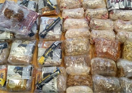
I dropped my breakfast rations to 5 oz/day (oats/granola with freeze dried berries, nuts, seeds, and Nido), dinner rations (various homemade and packaged meals) to 6 oz/day, and snacks (nut butters, cured bison meat, waffle cookies, cheese, chips, and energy gel) to 11.5 oz/day. This gives me 22.5 oz of food at a caloric density of about 118 Cal/oz, for a total daily ration of about 2,700 Calories.
That’s pretty thin for a 12 day trip at high altitudes with cold weather expected.
So I hope to catch, and eat, many pounds of fish en route.
Stay tuned, we’ll see how it works out.
We hit the trail in about an hour.
Follow this live expedition blog as Backpacking Light’s Ryan Jordan, Eric Vann, and five others weave their way through glacial cirques, tundra meadows, and talus fields in Montana’s Absaroka-Beartooth Wilderness July 9-20. Dispatches will be posted to the Backpacking Light Facebook page, Instagram feed, and the backpackinglight.com home page.
The purpose of this article is simple: I want to teach you how to choose backpacking equipment for inclement weather by documenting my thought processes as I select clothing, sleep, and shelter systems for a summer trek. The process will be illustrated as a case study: my equipment selection for a 12-day summer trek in the Absaroka-Beartooth Wilderness in Southwest Montana.
Introduction
The purpose of this article is simple: I want to teach you how to choose backpacking equipment for inclement weather by documenting my thought processes as I select clothing, sleep, and shelter systems for a summer trek. The process will be illustrated as a case study: my equipment selection for a 12-day summer trek in the Absaroka-Beartooth Wilderness in Southwest Montana.
I will be placing significant emphasis on going as light as possible for several reasons:
I’ll be carrying 12 days of food and supplies, without resupply;
I’m rehabilitating a nagging back injury so won’t be able to carry as much as I normally can (I’m usually OK with 50-55 lb starting pack weight on longer trips);
Most of our planned route is off-trail;
I’ll be carrying some “extra non-backpacking gear” (more on that below), so I want to save weight in my base kit as much as possible.
Although the equipment I selected is based on my planning process for a Beartooth Plateau (Montana) backpacking trip, the information herein would be applicable to most western U.S. mountain ranges during the summer. These ranges might include the Northern Rockies of Montana and Idaho / Continental Divide Trail, the Colorado Rockies, the Uintas, Glacier/Yellowstone/Grand Teton National Parks, the High Sierra, and the Northern California / Oregon Cascades / Pacific Crest Trail.
Some changes, of course, might be necessary for other environments during the summer, such as the drier and warmer deserts of the southwest and inland northwest, and the wetter climates of the northern Pacific Crest / Washington Cascades / Olympics.
Note: I’m staying away from brands and models of gear in this mini-treatise, and focusing on form and function. In some cases, I have linked to reviews, manufacturer’s websites, or retailer’s websites of products that I’ve personally used and like (and is the gear I’ll be taking on this trek).
Environmental Considerations
Rugged terrain over glacial moraine at high altitudes, combined with a hazardous weather forecast, emphasizes the need to plan carefully.
The following represent the primary environmental considerations that guided my equipment selection:
High altitudes – most of our route, and almost all of our camps will be above the treeline (> 10,000 feet).
Wind – exposed terrain at our camps and the high altitude of our route results in generally windy conditions.
Storms – seasonal considerations and high altitudes mean that we’ll be trekking during the peak of the summer thunderstorm season.
Insects – because we are taking the trek in mid-July, we’ll be camping during the peak of mosquito season.
Bears – both grizzly and black bears are present.
Remoteness – we’ll be traveling through areas that are not-so-remote, as well as through areas that see very few visitors.
Terrain – most of the trip will be off-trail across a wide variety of terrain, including meadowy tundra, talus and scree, glacial moraine and high passes up to Class 2+, steep snow, and even some bushwhacking.
Climate – during July, we expect high temperatures at these altitudes to be in the range of 55 to 70 degrees, and low temperatures to be in the range of 30 to 45 degrees; cold fronts are common during the summer here, and can deliver freezing rain, hail, graupel, and snow.
Our route would keep us above the Beartooth treeline for most of its course, keeping us exposed to wind and storms during the expected cold front.
Other Considerations
Group travel – we are traveling as a group of seven. Some members are sharing food, cooking, and shelter; some are not.
Fishing – we expect fishing to be outstanding, and there’s no way we’re going to leave our fishing gear at home; this will be a consideration in meal planning for me.
Photo/videography – much of the route will be spent “location scouting” for our Wilderness Treks program, so we’ll be bringing along a camera kit (or two) to shoot photography and video that will be used to give participants and prospective participants a sense of magnificence of this incredible place!
Expedition publishing – we’ll be publishing journal and photo dispatches live from the trip, directly to this website, as well as to social media accounts.
Last Minute Considerations
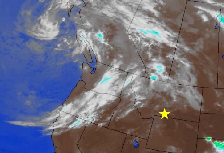
The day before we left, a storm off the Pacific Coast gained some strength and began to move inland.
The National Weather Service issued a hazardous weather advisory, calling for high winds, severe thunderstorms, and … snow. With low temperatures for the first few days of our trip projected to be in the 20s (F) and high temperatures in the 30s (F), it threw a bit of a wrench into my planning for what I was hoping would be a mountain sunshine vacation!
The bottom line is that this was a very slow-moving cold front and would likely be impacting our weather for the first 4 or 5 days of the trek.
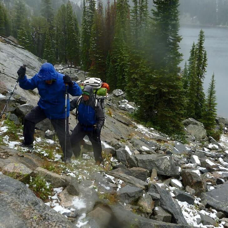
Snow and freezing conditions are never out of the question in the Beartooths. This photo was taken on during the final third of a two week trek during our exit off the Beartooth Plateau down a remote, trail-less lake chain system.
How to Choose Backpacking Gear for Inclement Weather: Clothing Layers
I like to (mentally, at least) compartmentalize my clothing into three distinct systems:
Trekking clothing;
Storm clothing;
Camp clothing.
In short, trekking clothing is what I wear next to my skin all day, storm clothing is what I put on while trekking in bad weather, and camp clothing is what I wear to stay warm in camp (or during other long periods of inactivity in cold conditions).
This system dictates where I stow my clothing in my backpack. I wear the trekking clothes, keep the storm clothes handy near the top of the pack (or in an outside pocket), and I stow the camp clothes deep down inside my pack (usually with my sleeping bag) since I’m not likely to have to access them on the trail.
Of course, there is crossover: on a particularly cold day, I may need access to an insulating jacket (camp clothing) at lunch, or have to wear a rain jacket (storm clothing) in camp.
Trekking Clothing (Base Layers Worn While Walking)
However, for this trip, I’m expecting plenty of foul weather and very little warm weather. I’m not expecting to encounter temperatures over 60 deg F until, perhaps, our last day or two of trekking once we finally drop below 8,500 feet.
For these temperatures, and considering that we’ll have breezy conditions on the plateau above 10,000 feet (where we’ll spend most of our time), making the case to wear a woven trekking shirt becomes less compelling. I’d rather have the comfort of a highly functional layering system for inclement weather trekking, so I’ll have to rely on something else for protection from biting insects (more on that later).
The various scenarios to consider when planning a layering system for inclement conditions include some combination of wind, precipitation, and cold temperatures:
Wind (none -> high)
Precipitation (none -> high)
Temperature (warm -> cold)
The probability that we would encounter “extreme” conditions while trekking on this trip, given the hazardous weather forecast, is quite high. Therefore, the primary question I want to ask at this point is
What will I add to my trekking clothing as wind and precipitation increase in intensity, and temperatures drop?
The Torso
I know that simply wearing a lightweight merino wool hoody under a rain jacket wouldn’t be enough by itself to stay warm in this type of weather, so I have a few options:
Add mid layer(s) to this system (more versatility);
Replace the lightweight merino wool shirt with a thicker/warmer base layer (simpler).
I like simpler, so option #2 is tempting. However, the need to have my trekking clothing be as comfortable as possible in as wide of a range of conditions as possible trumps everything else. I know from experience that my lightest weight merino wool hoody is comfortable while trekking even in very warm conditions (> 60 deg F). In addition, it dries faster than a thicker layer. Therefore, I’m going to opt for #1 and add mid layers to my system.
The mid layers I own and use include the following:
The wind shirt is almost a non-negotiable item for me. It is the single layer that I wear more than any other and find it to be the most versatile piece of clothing I’ve ever used. Being able to wear it as an outer shell in cool/cold and dry/light precipitation conditions makes it invaluable. I know there is a trend for some to ditch the wind shirt and move back to a traditional layering system using a fleece jacket/vest instead. Fleece is more breathable, and in some (colder) conditions, more comfortable than a wind shirt. However, this decision comes with a higher weight penalty and less versatility in high winds and warm/buggy conditions.
This three-layer system – the ultralight merino hoody, the wind shirt, and my rain jacket – are what I would need to stay warm in all but the most hostile conditions. However, we are expecting hostile conditions. What to do if the temperatures drop into the 30s, precipitation is heavy wet snow, and winds are breezy?
That’s easy. I’m going to camp! Those are terrible conditions for hiking, and I’d rather hang out in my shelter, drink coffee, and write in my journal.
The Insurance Layer
But I need a little bit of insurance to buy me some time between that moment on the trail where you realize how bad this sucks, to the bliss of finding a suitable campsite to hole up in. That time could be on the order of an hour or two or three, depending on terrain, so I at least want an “insurance” layer to help preserve my body heat.
That’s where my super light 3 oz down vest comes in. Throwing this on between my merino shirt and my wind shirt, and topping off with the rain jacket, means that it’s pretty close to my skin for good core warmth, and far enough away from the elements that it doesn’t suffer the demise of getting (too) wet from perspiration condensing in the clothing system.
My four-layer system for inclement weather trekking includes a 6 oz merino wool hoody base layer, a 3 oz down vest, a 4 oz wind shirt, and a 5 oz waterproof-breathable rain jacket.
The Legs
The legs are much simpler, because they generate more heat while hiking, and stay warmer.
If the weather changes during the day, I may add the long johns over my trekking pants (just to keep things simple and fast), and then top off with my rain pants.
Head, Hands, and Feet
Head. I already have a thin merino hood on my base layer shirt, a wind shirt hood, and a rain jacket hood. Also, I’m usually wearing my crushable nylon brim hat with all of this. Therefore, it seems odd that I would need any additional head covering for summer weather, even bad weather.
However, for the worst case scenario described above (cold, wet, and windy), I do find that a little bit of extra around my head and neck goes a long way. I keep a mini neck gaiter stuffed in my rain jacket pocket for just such a scenario, and if it really gets bad, I plan to add a very light fleece hat.
Hands. I rarely take gloves in the summer, but since we are expecting cold, wet, and windy conditions with temperatures in the 20s and 30s, I will bring a simple but foolproof system that includes a lightweight fleece mitten with a waterproof shell mitt.
Feet. What an incredibly challenging thing to deal with in conditions like these. We are trekking during the early season, so there will be stream crossings that require wading. Sub-freezing temperatures at night will freeze shoes and socks. Wet meadows, lots of precipitation. And then later in the trip, dry and warm.
A waterproof-breathable shoe combined with a high gaiter makes the most sense on a trip like this, but waterproof shoes are a terrible idea for stream crossings.
It’s reasonable to expect that feet will stay warm while trekking, and be very cold in camp. Dry socks for bedtime must be made a high priority. And squishing around in cold, wet shoes and socks while in camp is probably not a very good idea.
If the chance of inclement weather were slight, I’d suffer well with non-waterproof trail running shoes, three pairs of trekking socks (2 to hike in, 1 dry pair for sleeping), and no gaiters. I’ll keep the non-waterproof trail running shoes and two (not three) pair of trekking socks, but I’ll add:
Trekking: A light pair of calf-height gaiters (2 oz) for trekking in snow and wet tundra; I like that gaiters also preserve a little ankle heat which contributes to foot warmth;
I’m expecting my down gear to suffer the inevitable demise of accumulated condensation over the course of the first few (up to four or five?) days of the trek before I can count on drying it out in the sun. Therefore, I have three options to consider: take the chance and suffer as I watch my ultralight down gear wilt, take a higher fill down jacket and/or quilt as insurance, or go with a synthetic insulating layer and/or sleeping quilt? Or of course, some combination of these things.
My lightest down gear (jacket, 8 oz + quilt, 14 oz) weigh a combined 22 oz and are plenty warm when they’re dry! I would have no problem using these items down to freezing temperatures.
The heavier synthetic jacket and quilt weigh a combined 32 oz, are not as warm as the down gear, but would maintain body warmth at lower temperatures if they contained any accumulated moisture. Also, I could sleep in all my clothes, even if they are damp, and wake up in the morning with dry clothes! I wouldn’t be able to do this (as effectively) with down sleeping gear.
A hybrid system (synthetic quilt and down jacket) solves some of these problems, but if I’m going to pack some extra weight, my gut tells me to simply pay attention and be careful, and spend the extra weight on some more down fill! My final setup thus will weigh a combined 28 oz, keep my original 8 oz down parka, and replace my 14 oz down quilt with a much warmer 20 deg F / 20 oz down quilt.
My Backpacking Bed
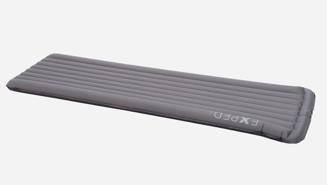
Bed comfort is increasingly important to me as I get older and appreciate the ability to recover overnight after a hard day of trekking. To keep morning backaches away, I use an 8-oz short-length inflatable mattress combined with an inflatable pillow. The pillow is topped with the Waldorfian luxury of a goose down slipcase.
How to Choose Backpacking Gear for Inclement Weather: The Shelter System
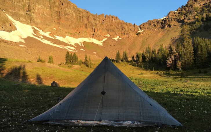
My little Cuben Fiber CT3 pyramid shelter pitched in a golden amphitheater in the mountains near my home in Montana.
The advantages of this 13 oz shelter system include:
Full perimeter protection from wind, rain, and snow;
Plenty of headroom (more than four feet usable) near the peak for sitting up and moving around comfortably;
Side entry door opens wide for expansive views and ventilation on mild nights.
Conclusion: About the Trek
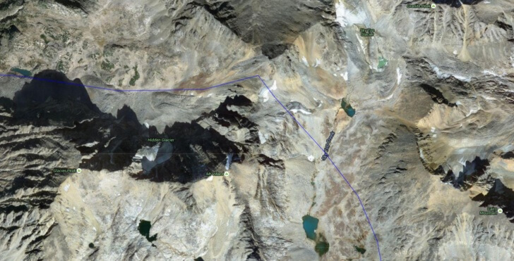
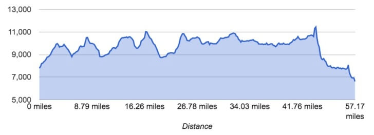
Starting on July 9, we’ll be traveling in the Absaroka-Beartooth Wilderness, including a traverse of the Beartooth Plateau, for 12 days. Our traverse will include about 60 miles of travel, most of it off-trail, and including two remote crossings of the Absaroka Backbone (divide).We’ll be scouting trekking routes and camps for this seasons’
Our goal is to explore some lesser-known lakes and find out where the biggest trout in the Beartooths are found!
Eric and I will also be scouting trekking routes and camps for this seasons’ Wilderness Treks program, so be sure to follow our live dispatches, which will be published daily on the home page via satellite, with images also posted over on our Instagram feed.
Membership Required
This feature requires an active Backpacking Light Membership.
Premium Articles
You're currently viewing a free preview of a member exclusive premium article. Our premium articles include in depth journalism and insights from the Backpacking Light editorial team.
Get full article access by subscribing to a Premium or Unlimited Backpacking Light membership!