gps
- GEAR • Gear Reviews
- GEAR • Market Reports
- GEAR • Gear Guides
- GEAR • Gear Checklists
- GEAR • Make Your Own Gear
- GEAR • Gear Testing & Research
- SKILLS • Tips, Tricks, and Hacks
- SKILLS • Wilderness Skills
- SKILLS • Training
- SKILLS • Trip Planning
- SKILLS • Food Preparation
- PLACES • Trips
- PLACES • Routes
- CULTURE • Essays
- CULTURE • Stories
- CULTURE • Issues
- CULTURE • People
- CULTURE • News
- CULTURE • Media Reviews
- ARCHIVES (Before 30.Nov.2015)
- SEARCH LIBRARY
- TRAILHEADS
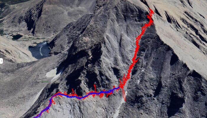
By the Numbers: Can New GPS Technology Save Your Life? Under the Right Conditions, it just Might
Stephen Seeber compares iPhone and Garmin Fenix GPS tracks for accuracy and reliability.
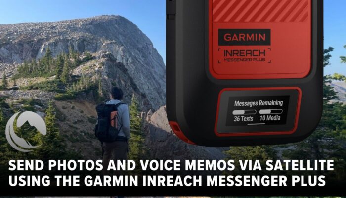
Garmin inReach Messenger Plus Review
The Garmin inReach Messenger Plus can send short text, photo and audio messages, weighs 4.1 ounces and has an MSRP of $500.
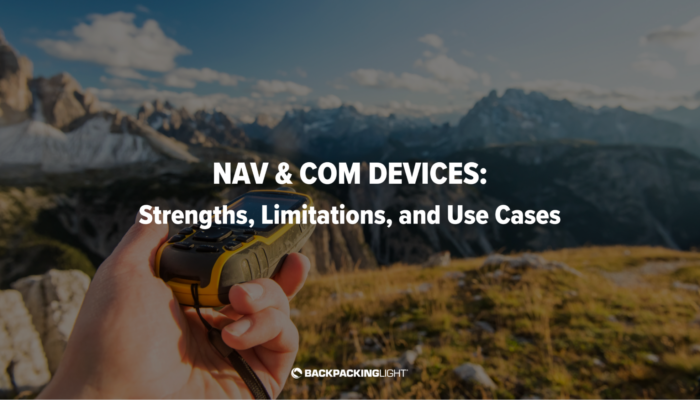
Navigation and Communication Devices: Strengths, Limitations, and Use Cases
In this video, I will cover various types of navigation and communications devices, their benefits and limitations, and use case scenarios where you might use one or a combination of multiple devices.
Outdoor Research Flurry Sensor Glove Review (Updated)
The Outdoor Research Flurry Sensor Glove (2.5 oz / 71 g, $40) is the warmest glove I've found that I can use effectively with a smartphone.
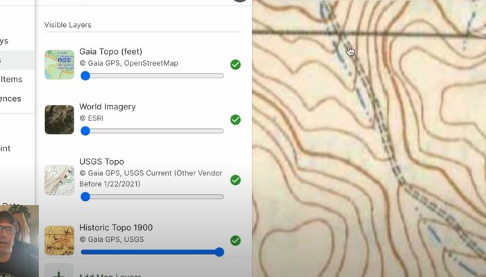
How to use Gaia GPS to Find Hidden Backcountry Routes
Learn Ryan Jordan's process for discovering hidden backcountry routes by integrating current base maps, satellite imagery layers, and historical USGS maps.
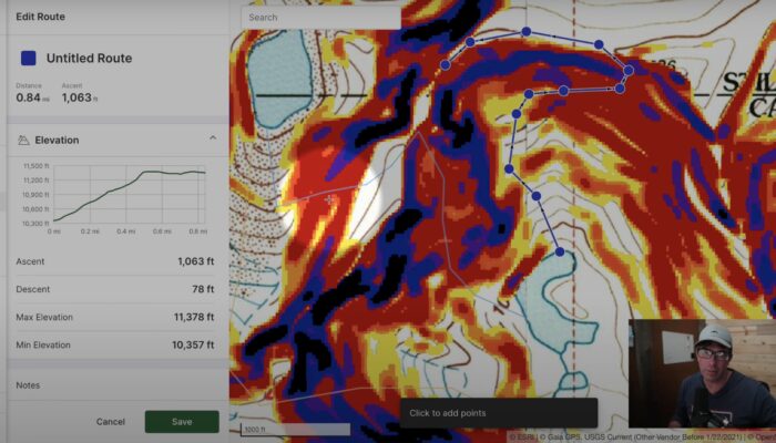
How to Use Gaia GPS Slope Angle Overlays & Satellite Imagery to Plan Off-Trail Routes
In this video, I walk through how I use slope angle overlays and satellite imagery to plan off-trail mountaineering routes, focusing on Gaia GPS as the digital mapping software.

How to Manage Electronics and Batteries in the Backcountry (Member Q&A)
Considerations for managing backcountry electronics including portable battery packs, batteries in cold temperatures, headlamps, cameras, satellite communicators, fitness watches, smartphones, and more.

Followed in Plain Sight
Shilletha Curtis recounts a harrowing encouter and invites the reader to see the world through her eyes.

GPS: The Good, The Bad, and the Ugly
BPL author Rex Sanders tackles the pros and cons of navigating by GPS in a short blog post that includes links for further info.
Navigation & GPS App Reviews & Gear Guide
This Gear Guide features GPS App Reviews, including AllTrails, Gaia, Google Maps Offline, Guthooks, Hiking Project, MapMyHike, Outdoor Active, Ramblr, REI - National Parks, Spyglass, and ViewRanger.
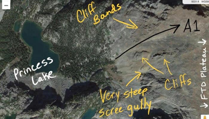
Resources, Tools, and Processes for Planning Nontechnical, Off-Trail Backpacking Routes
The purpose of this article is to document the process I often use to plan and execute off-trail trips in the mountains using digital mapping and navigation tools.
 New Ultralight GearSee the latest releases in ultralight cottage-brand gear from small makers.