Introduction
The purpose of this article is to document the process I often use to plan and execute off-trail trips in the mountains using digital mapping and navigation tools. My overall goal is to provide the reader with part of a framework that can be used for planning mountainous, off-trail routes that are achievable by hikers without mountaineering experience in a safe and efficient manner.
Route Planning Objectives
The decision to visit a particular region for a backpacking trip may include one of the following:
- It is close to home and does not require a lot of travel.
- It is far from home, so it feels exotic.
- “I saw others hiking here on Instagram, and it looks like a neat place.”
- My family is visiting the in-laws and this nearby wilderness area will be a nice place to decompress.
However, once you have settled upon the overall region, it is time to plan the actual route. This process is more nuanced and complex, so now that you are away from the in-laws, you will have to drill down to determine more specific objectives.
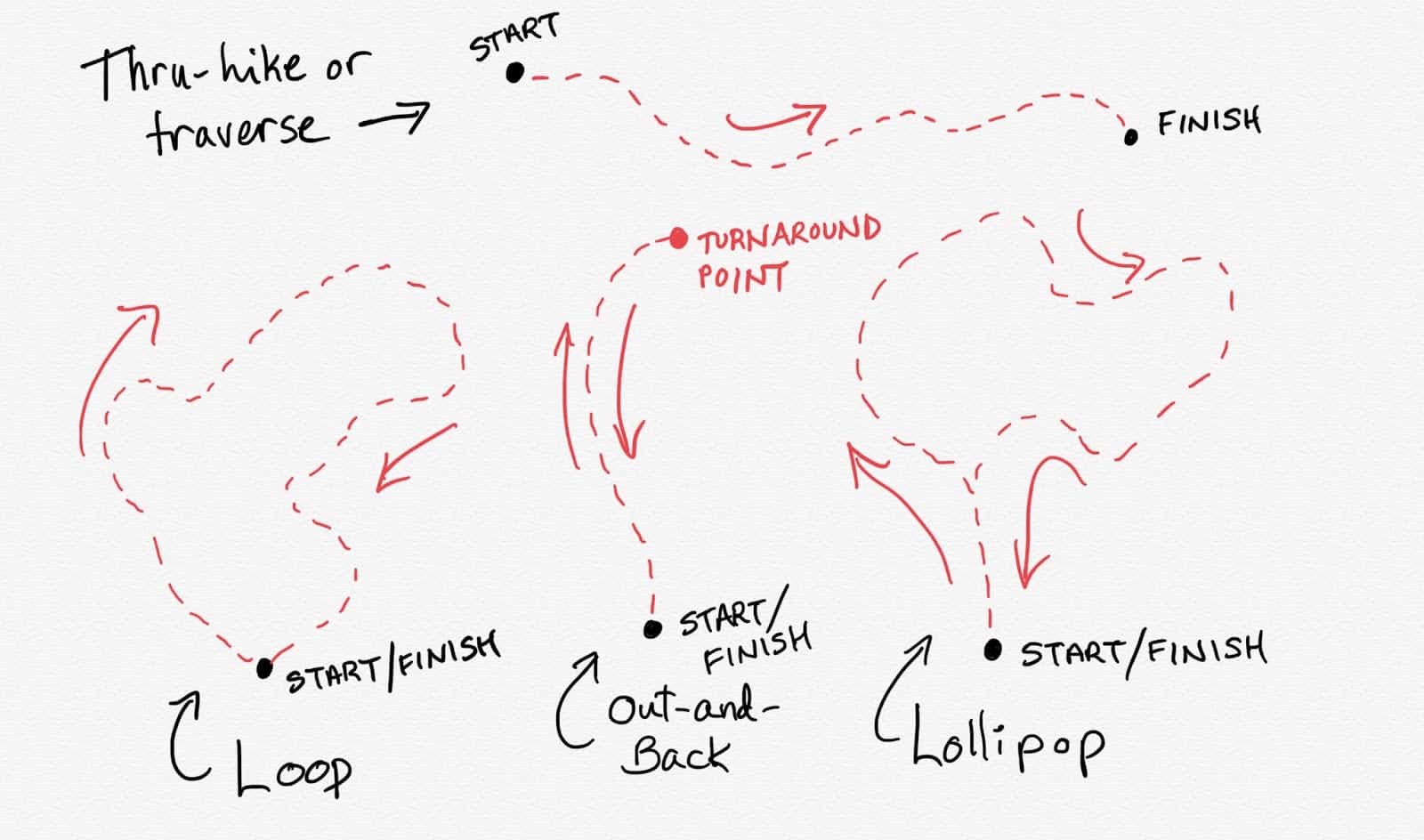
Objective #1: Achievement of a Progress Goal
The most common way to plan a route is to plan a path from point A to point B (a traverse or thru-hike) or a path that starts and ends at the same location (a loop). Out-and-back and lollipop routes are common as well.
 Objective #2: Visit Specific Places
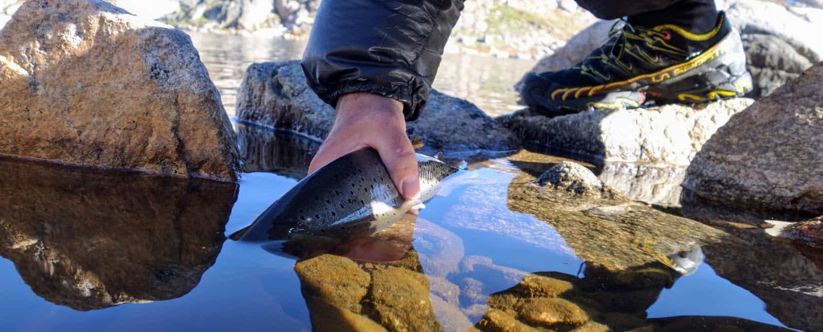
Part of your route planning process may include the need to visit a specific place as an objective, and this preliminary need may then dictate the start and/or end point of a trip. Fishermen may be seeking trophy trout at a particular lake, climbers may be tackling a particular route on a peak, and photographers may be wanting to capture an image of a particular scene.
Objective #3: Maximize Aesthetics
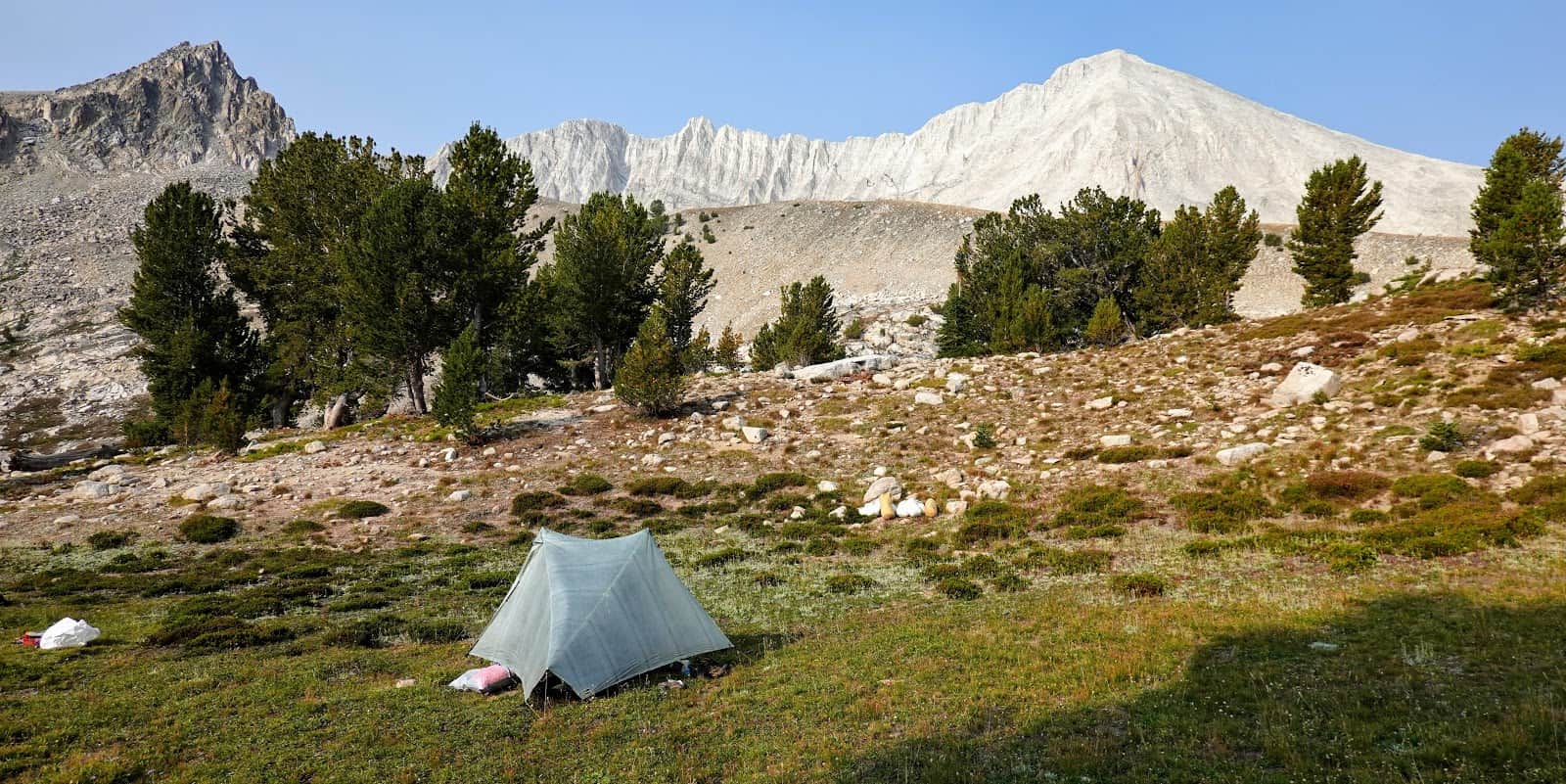
A route may take on the aesthetic preferences of the hiker. For example, in the case where two routes traverse the same mountain range between points A and B, aesthetic values may come into play when making a decision. Aesthetics may include things like the comfort afforded by camping locations or scenic beauty.
Objective #4: Maximize Efficiency
Planning an efficient route is a numbers game and an exercise that appeals more to left-brained hikers. An efficient route might be one that minimizes the mileage, elevation gain/loss, or travel time between points A and B. Maximizing efficiency requires an acute understanding of terrain and topography.
Objective #5: Minimize Risk
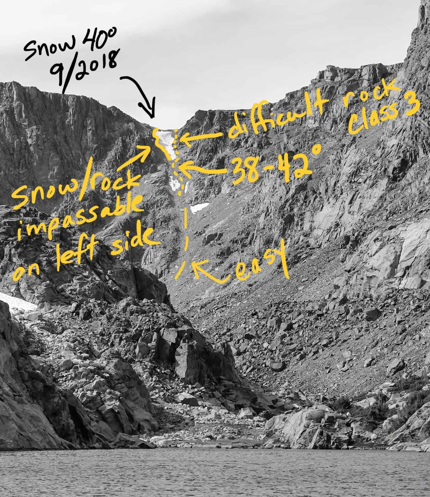
When planning a route that is designed to minimize risk, environmental and other objective hazards must be considered. Terrain steepness and difficulty, exposure to inclement weather while hiking and camping, river crossings, and snow conditions are a few things that must be considered when assessing the risk of a particular route.
These are the five objectives I usually consider when planning a route. You may have a different list!
Route Planning Resources
In the old days, I planned my routes at a kitchen table with USGS quadrangle maps and a pot of coffee. Sometimes, depending on the area I was visiting, I’d read hiking or climbing guidebooks for additional beta. Now, between the internet and digital imagery, we have access to a large body of information that we can tap into for route planning resources.
Trip Report Websites
Trip report websites provide some of the best sources of beta for obscure routes.
The ones I use most often include the Backpackinglight.com Forums and Summit Post. My gateway into these websites is most often a Google search for specific place names (lakes, peaks, trails, etc.).
Youtube
Youtube is becoming an increasingly valuable resource as well, as video production becomes easier and cheaper for the masses.
I’ve discovered some value out of trip report videos posted by others. Sometimes, it’s nice to see video examples of surrounding terrain and camping areas, or to see water conditions in backcountry whitewater canyons when planning a packrafting trek.
Google Image Search
A Google Image search can be valuable for evaluating the scenic beauty of various places, or for collecting beta on off-trail routes by examining high-resolution photos taken by others.
I use Google image search primarily to see what the routes over obscure mountain passes might look like, by searching for images of peak and/or lake basin names.
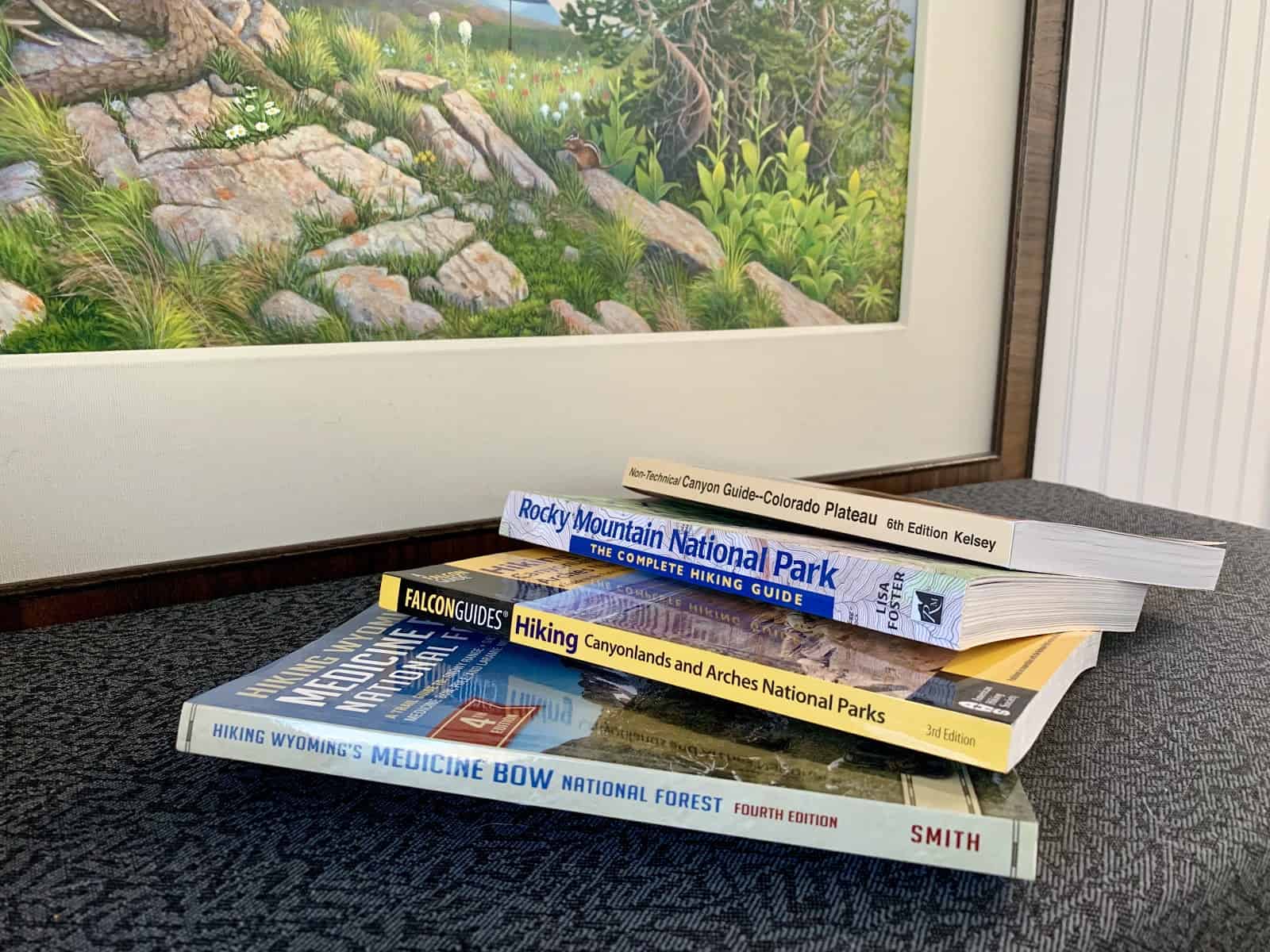
Guidebooks
Hiking guidebooks such as those offered by Falcon Press provide valuable information for beginning and intermediate hikers looking for interesting trails that others have done.
Long distance trail guidebooks and databooks are considered all but essential for those planning thru-hikes, and provide additional information about resupply and other logistics (e.g., lodging, dining, transportation). A wealth of information is available for popular long distance trails like the Appalachian Trail or the Pacific Crest Trail.
Climbing guidebooks offer beta for off-trail travel that can be invaluable for more experienced hikers wanting to plan more creative routes. Some of my favorites include The High Sierra, Washington Scrambles, The Beckey Guides for the Cascades, and Select Peaks of Greater Yellowstone.
Fishing guidebooks aren’t just for fishermen. They often contain descriptions of obscure off-trail routes to lakes and streams found in remote wilderness areas. Marcuson’s fishing guide has given me more meaningful beta about hiking in the Absaroka-Beartooth Wilderness than virtually any other resource. Reading the published fishing journals from old-timers like Finis Mitchell not only reveal valuable route information, but also add immensely to your understanding of the pioneers that trekked before you.
Maps
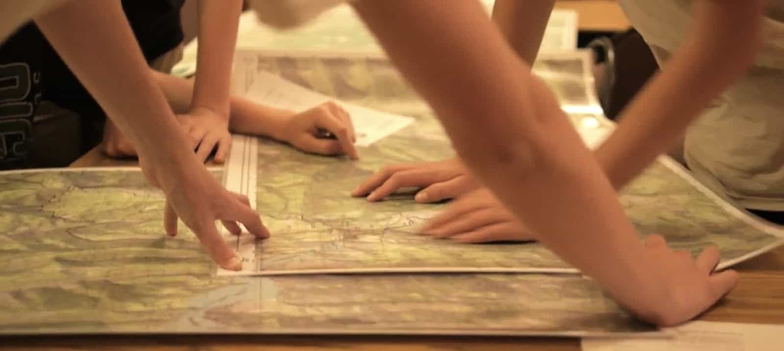
Topo maps remain the de facto standard for both backcountry route planning and real-time navigation. Paper maps offer the advantage of being able to see larger areas at once. Spreading paper maps across a large table is a useful practice for planning longer routes.
USGS quadrangle maps (1:24,000 scale) provide the best detail for planning off-trail routes, but you shouldn’t rely on their outdated trail locations and property boundaries. Digital (e.g., web-based) maps like Caltopo or Hillmap offer the advantages of access to entire world-wide topographic map sets, additional layers (e.g., route shading, slope angles, satellite imagery), and route-making (and route analysis, e.g., mileage, elevation gain/loss) using integrated path and waypoint tools.
Trail maps that are up-to-date and based on the latest GIS data are valuable for identifying the exact location and status of maintained trails. My favorite trail maps are 1:100k maps from Beartooth Publishing and Trails Illustrated – they are waterproof, lightweight and compact, cover large areas, double-sided, and durable. Just as you shouldn’t rely on 1:24k USGS quads for trail navigating, you shouldn’t rely on 1:100k trail maps for complex off-trail travel.
Satellite Imagery
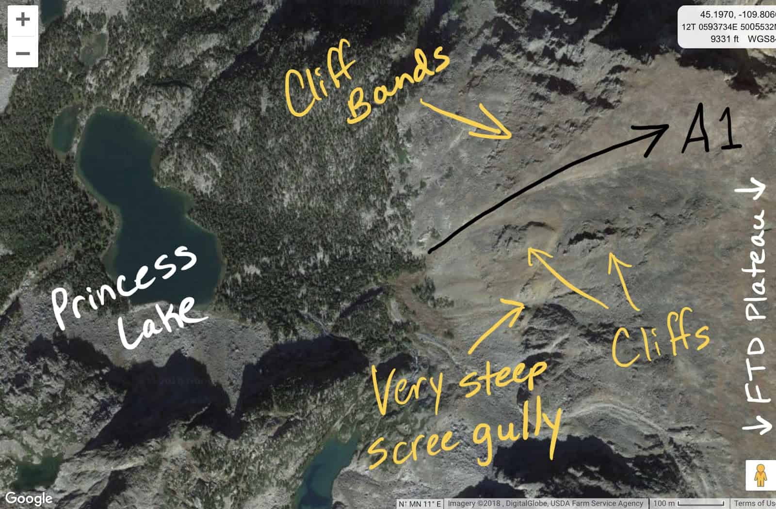
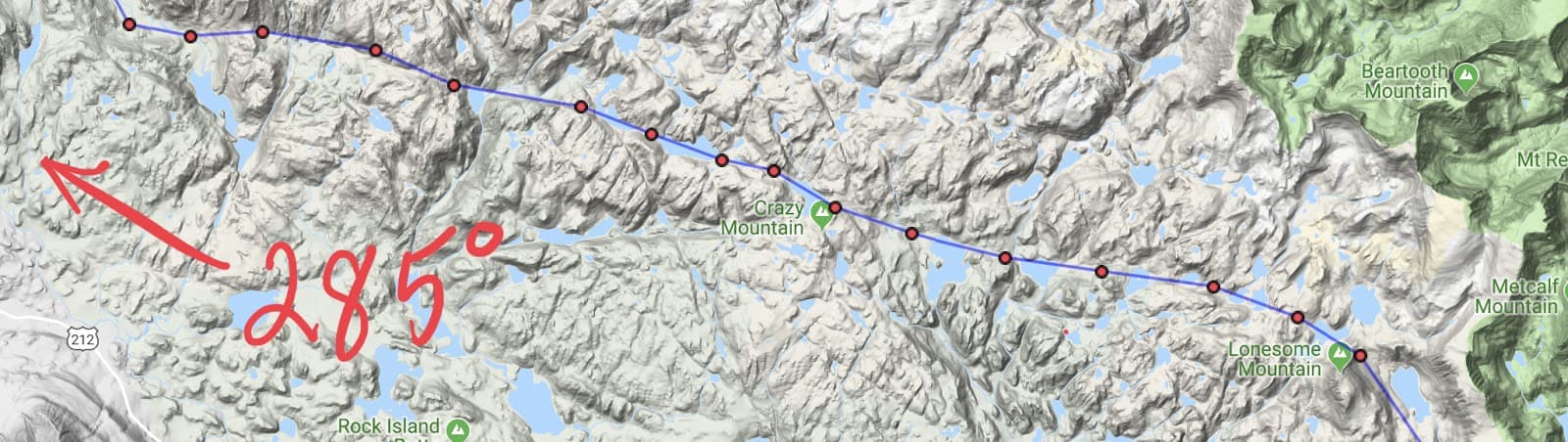
Satellite imagery can provide information about terrain and ground cover that can’t be gleaned from other sources. I use satellite imagery layers in Caltopo to look at rivers (for both packrafting and points of crossing), to identify wildfire burn areas (not my favorite places for off-trail travel!), to identify potential camping locations, and to identify cliffy terrain for alpine routes.
Google Earth is the best tool I’ve found for identifying extremely steep terrain that may pose problems for non-technical trekking. It’s based on satellite imagery, but perspective can be changed to a profile view that gives a much better feel for steepness. In addition, being able to “fly over” a route and visualize it before you attempt it is very exciting!
The Route Planning Process (A Case Study)
How Route Planning Works
As much as I’d like to give you a route-planning formula based on linear logic, it just doesn’t work that way.
This formula used to work out OK when I first started backpacking, but it doesn’t handle the complexity of the type of trips I enjoy today.
Give the plethora of route-planning resources that are now at our disposal, it might be assumed that the planning process is chaotic.
In order to distill the chaos, it’s tempting to simplify it. Remember the good old days (a paper map and a pot of coffee at the kitchen table)? There’s still some real value in planning routes that way.
But if you’re into research, data collection, and analysis, then organizing all this methodically and intentionally is worth a little bit of time.
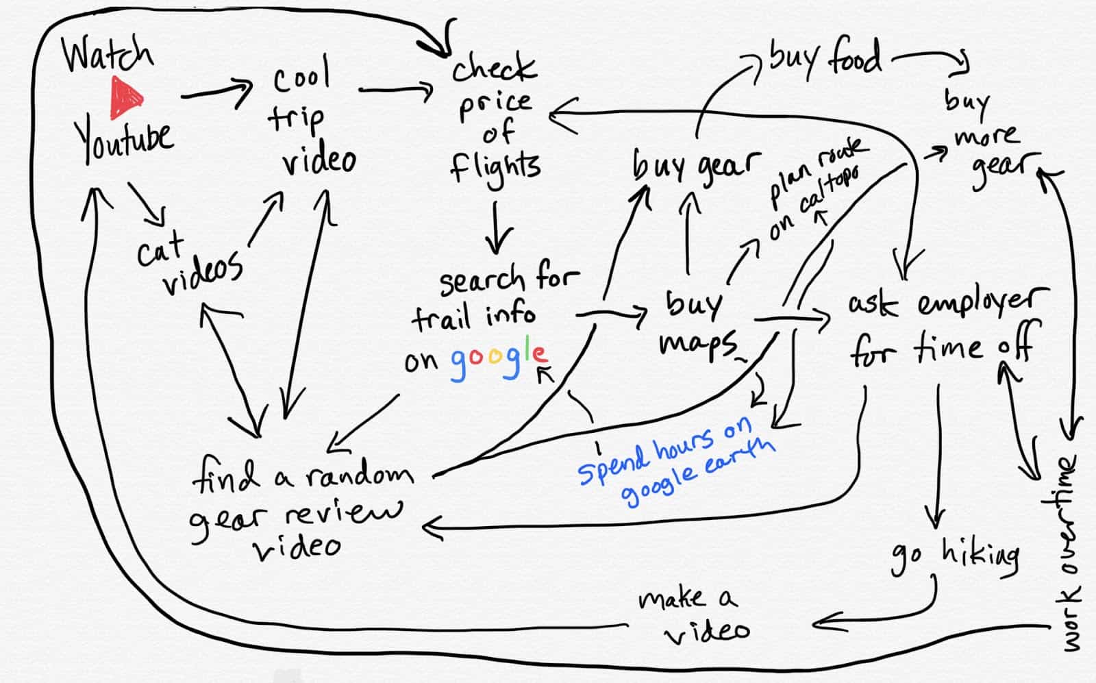
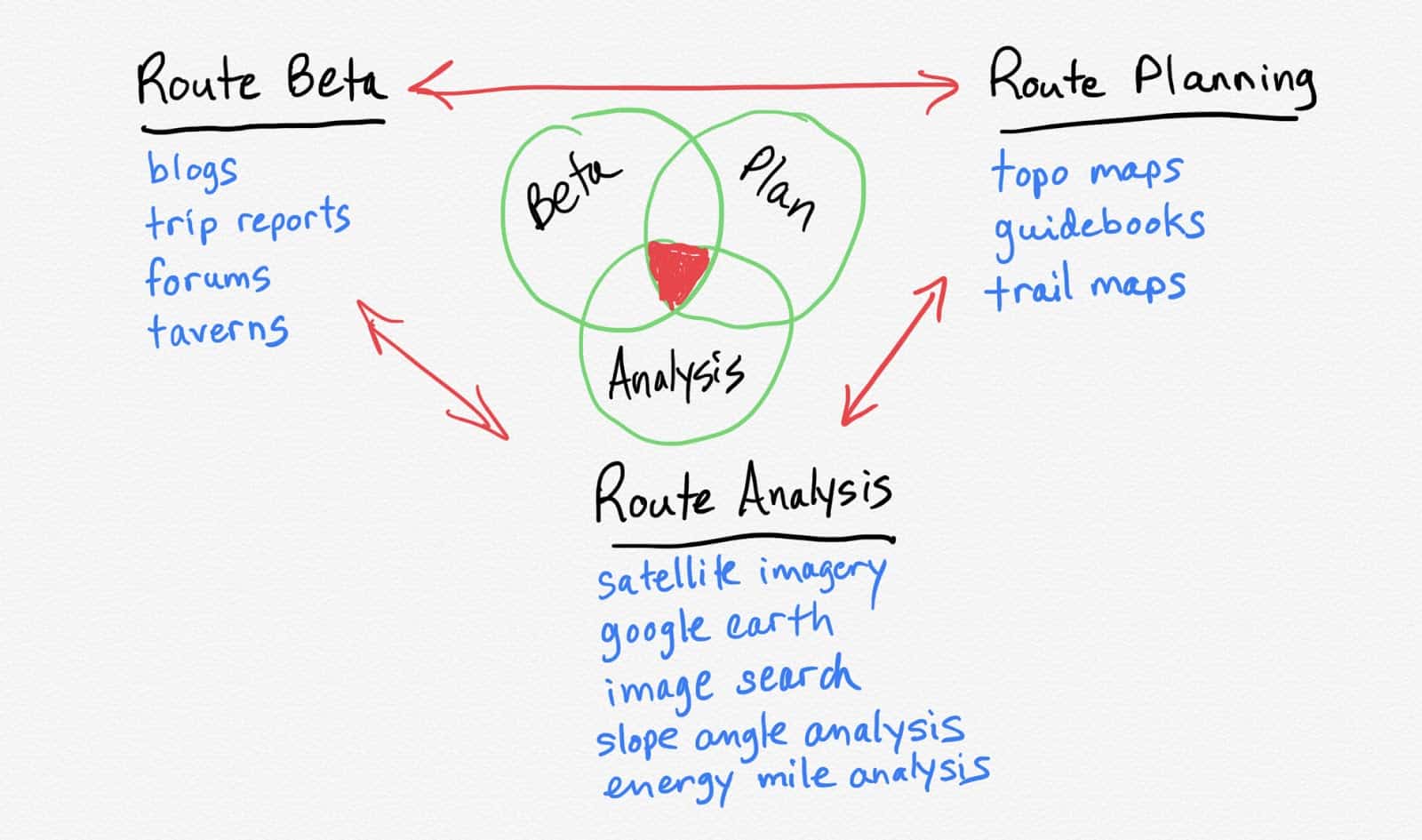
Instead of chaos, I see modern route-planning effectively modeled by a mesh network, where the nodes (black/blue in the image below) represent the resources and the paths (red) represent the processes. The overall route plan evolves via any combination of paths that follow a logical progression towards meeting the hiker’s objectives.
Let’s illustrate this route planning process with a case study!
Member Exclusive
A Premium or Unlimited Membership* is required to view the rest of this article.
* A Basic Membership is required to view Member Q&A events

Discussion
Become a member to post in the forums.
Companion forum thread to: Resources, Tools, and Processes for Planning Nontechnical, Off-Trail Backpacking Routes
The purpose of this article is to document the process I often use to plan and execute off-trail trips in the mountains using digital mapping and navigation tools.
This was a fantastic read, one I wish I had consumed before my own trip into the Absaroka-Beartooth this autumn ;) Much appreciated, Ryan! It is difficult to find detailed, intricate and helpful guidelines for such matters.
Thanks for the article. This is literally exactly what I was looking for.
I was just on google earth planning a route through the Gore Range in Colorado and I was wondering what the best way to plot a course through some pretty rough high altitude terrain would be. Your slope angle analysis tool as well as energy mile and difficulty multiplier are two fantastic concepts.
Question: Do you have any type of multiplier that you add in for hiking at altitude? I’ll be going over some 13,000ft passes and obviously this is way more taxing than lower elevations but I’m wondering if there is some kind of standard multiplier or rule of thumb.
Great stuff!
Become a member to post in the forums.