
Introduction
We trust the U.S. Global Positioning System (GPS) for accurate locations to help guide us through the wilderness – either through smartphones and similar devices or via paper maps with reasonably correct feature positions. Global Navigation Satellite Systems (GNSS), like GPS, have revolutionized position, navigation, and timing. Yet, they have a variety of physical limitations and human-caused problems that can lead hikers astray.
Backpackers can work around many GPS issues by maintaining spatial awareness. One shouldn’t just keep hiking until an expensive smartwatch tells you to turn. Instead, periodically match electronic or paper maps with real-life features like creeks, ponds, peaks, and passes. Then you might recognize when GPS is misleading you.
The Good

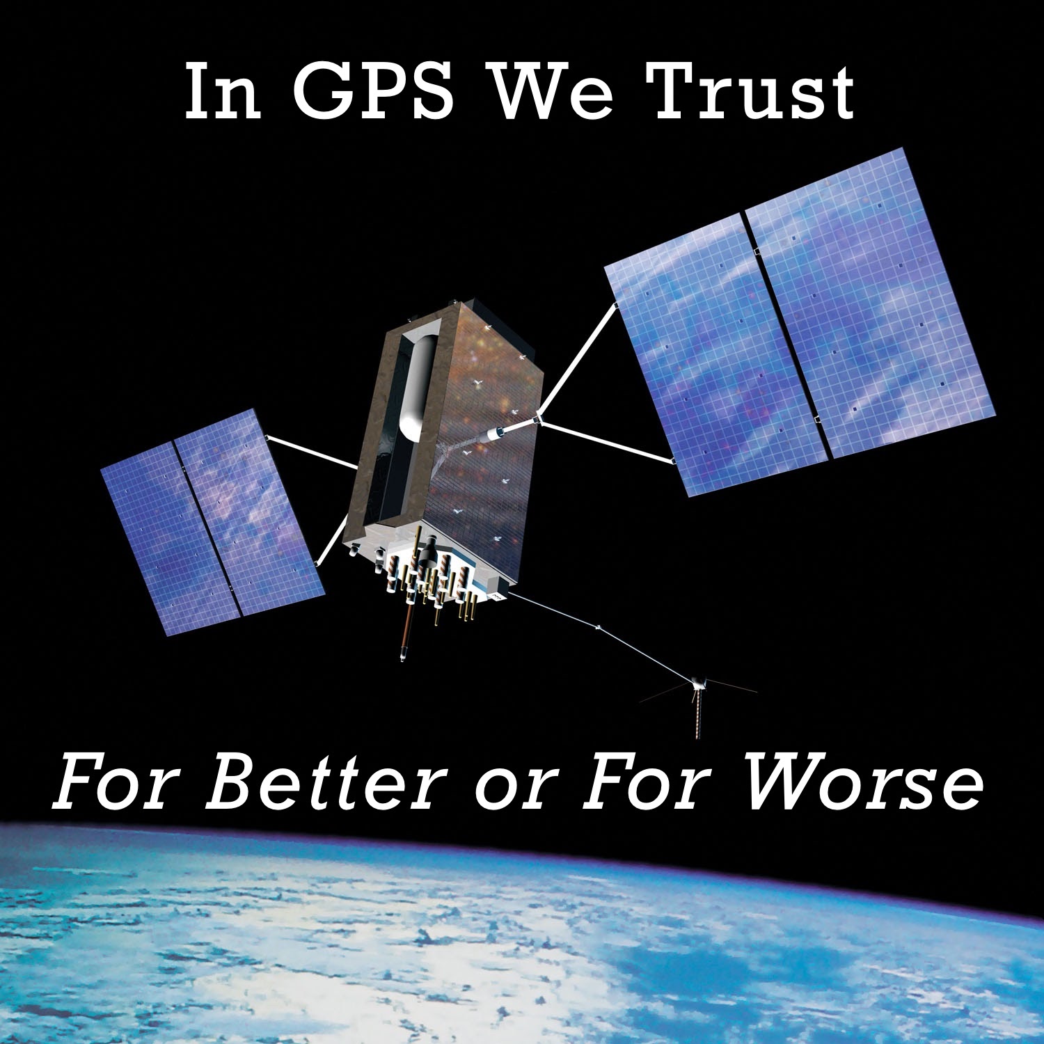
The recently-created U.S. Space Force now runs GPS, including 31 satellites in orbit. With a clear view of the sky, smartphones, GPS mappers, satellite communicators, and even smartwatches can often determine your position to less than 6 feet (2 meters). Just a few decades ago, the best global radio-navigation system (Omega) was accurate to about 4 miles (6.4 kilometers), using a receiver bigger than a suitcase – plus a large antenna and a power supply. Many backpackers got much better positions using a good map and a cheap compass.
GPS satellites are also equipped to detect nuclear bomb detonations and relay Personal Locator Beacon (PLB) rescue messages.
The U.S. Federal Aviation Administration (FAA) operates the Wide Area Augmentation System (WAAS) using three geostationary satellites that cover North America. WAAS provides real-time corrections to GPS signals distorted by the atmosphere, and can more than double the position accuracy. The FAA designed the system to support aircraft, but most GPS devices used by backpackers include WAAS receivers. The European Union runs the comparable EGNOS system for Europe. Similar schemes improve GNSS accuracy in some other areas of the world.
Yet the U.S. Government continues to improve GPS technology. They’ve started launching the next generation of satellites, that by the late 2020s, using new receivers could give positions with three times more precision. Are you standing on the left side of the trail, or the right? And do you need a smartphone to tell you? The new satellites also include stronger signals and other technologies that will make getting an accurate position in dense forests even easier.
There are three other GNSS networks operating today. The European Union supports Galileo, providing 3.3-foot (1-meter) location accuracy from 22 satellites. The Russian Federation runs GLONASS, including 24 spacecraft supporting 9.2-foot (2.8-meter) positions. And finally, BeiDou, launched and operated by the People’s Republic of China, using 35 satellites to yield locations as good as 7.7 feet (2.3 meters). All three networks are planning or implementing upgrades to accuracy.
These systems work very similar to GPS. In fact, many devices can receive and process signals from multiple networks. Access to more satellites results in faster positions and better coverage in cities, forests, and canyons. However, devices in the U.S. may legally use only GPS and Galileo at this time.
The Bad

GPS and the other GNSS networks have their problems. Despite launching ever more powerful satellites, trees, buildings, and mountains can block the signals due to simple physics. Solar flares can scramble satellite messages. And GPS radio waves can bounce off buildings and mountains creating multipath errors, potentially offsetting your reported location by hundreds of yards (meters). Smartphones and similar consumer devices are especially vulnerable.
Your GPS position might not match what’s on your map for many reasons. Every map uses a datum or simplified mathematical model of the Earth’s shape, and there are several available. But if your smartphone reports your latitude and longitude, or UTM coordinates, using a different datum, your plotted position can be off by many yards (meters).
Plus, maps can have errors. Even USGS Topo maps have varying standards for accuracy. That peak you are standing on might look like it’s still many yards (meters) away on your GPS device; yet another reason to trust your lying eyes instead of a smartwatch.
Of course, all GPS devices require batteries and electronics that can fail in many ways. You don’t want to be staring in disbelief at a blank screen deep in the backcountry if that’s your only means of navigation.
The Ugly

Even worse, human activities can jam or spoof GPS – intentionally or unintentionally. Jamming happens when another radio signal on the same frequency overpowers the message you are trying to receive – and GPS signals are notoriously weak. Spoofing is when someone sends fake GPS signals that lead you astray. But spoofed and jammed radio waves don’t stop at one receiver.
Jamming
Jamming is much more common than you might think. Drivers use cheap but illegal GPS jammers to prevent the tracking of trucks and cars. One truck with a jammer, parked next to Newark Liberty International Airport in New Jersey, interfered with aircraft landings until authorities tracked it down. Even cars and trucks with jammers traveling on nearby highways cause problems. An illegal jammer left running in a car parked at a trailhead with good views could block GPS signals for a large area.
Three poorly designed amplified TV antennas made GPS useless for ships, boats, and researchers at Moss Landing harbor in California, triggering a lengthy investigation. A rural TV antenna could have the same impact on hikers, especially if mounted high enough to pick up distant stations.
Military jamming exercises in the U.S. have caused many problems for civilian airplanes, including leading some of them off course. BPL community members occasionally report GPS issues at the same time they see military aircraft overhead.
What’s even scarier is that when we get self-driving cars, GPS jamming could cause nightmares on the way to and from the trailhead.
Spoofing
For many years, experts considered GPS spoofing too hard to pull off effectively. But now step-by-step instructions using inexpensive parts and open-source software are on YouTube. There are multiple reports of spoofed boats, ships, planes, drones, trucks, and cars going off course.
An accidental spoofing attack at a GPS conference in Portland, Oregon scrambled many smartphones in unexpected ways, some for several hours even after the transmissions stopped. Most phones reported a position in France until experts took extraordinary measures to reset the device. Even the U.S. military is looking for non-satellite navigation systems as backups to GPS.
Hackers could potentially install a GPS spoofing app on your smartphone or smartwatch without your knowledge. These apps trick your device into showing an alternate location, without sending radio waves. Some people deliberately install one to fool a workplace-installed tracking app or gain advantages for delivery drivers. These apps are also favorites of some Pokémon Go players. A long-forgotten or well-hidden app could cause serious problems in the backcountry.
Conclusion
GPS and similar systems are remarkable technologies that have transformed many hidden and visible parts of modern life. I wouldn’t want to go back to pre-GPS position, navigation, and timing for many reasons.
However, GPS problems can be much more than an inconvenience for backpackers mindlessly following smartwatch directions. If you ever activate a PLB or press the SOS button on a satellite communicator, these devices also send your GPS position. While that’s normally a huge help for search and rescue teams, there are many reports of inaccurate GPS locations leading them astray – or even forcing them to give up the search entirely.
It’s important for trekkers to stay found almost in spite of multi-billion-dollar navigation systems, $1,500 smartphones, and matching $900 smartwatches. We need to use GPS networks and GPS-dependent devices wisely, recognizing when they mislead us, and staying safe when they fail. A simple paper map, an inexpensive compass, and a few easy-to-learn skills can turn a potential disaster into an inconvenience.
More Information
GPS.gov
A wealth of information for the general public and professionals.
GPS report cards
https://www.nstb.tc.faa.gov/DisplayGPSReportCardArchive.htm
The FAA publishes monthly updates on the accuracy and availability of GPS.
Official GPS jamming or spoofing notices
https://www.gps.gov/support/user/
The U.S. government usually warns of planned GPS disruptions. Some other countries (including the UK) provide similar notifications. Worth checking just before you head into the wild.
Related Content
More by Rex Sanders
Review
- Ryan Jordan’s in-depth review of the Garmin inReach Mini
- Andrew was disappointed by the Spot X
Forum
- Our community gets into a spirited argument over the role of electronics in the backcountry
DISCLOSURE (Updated April 9, 2024)
- Backpacking Light does not accept compensation or donated/discounted products in exchange for product mentions or placements in editorial coverage. Some (but not all) of the links in this review may be affiliate links. If you click on one of these links and visit one of our affiliate partners (usually a retailer site), and subsequently place an order with that retailer, we receive a commission on your entire order, which varies between 3% and 15% of the purchase price. Affiliate commissions represent less than 15% of Backpacking Light's gross revenue. More than 70% of our revenue comes from Membership Fees. So if you'd really like to support our work, don't buy gear you don't need - support our consumer advocacy work and become a Member instead. Learn more about affiliate commissions, influencer marketing, and our consumer advocacy work by reading our article Stop wasting money on gear.

Discussion
Become a member to post in the forums.
BPL author Rex Sanders tackles the pros and cons of navigating by GPS in a short blog post that includes links for further info.
Good article. I don’t use GPS and there’s only been a few times in over a decade of backpacking (including lots of off-trail hiking in the West and Southeast) where I’ve really wished I had it.
Once when I was hiking up in the middle of winter to an abandoned lookout tower to spend the night and had some navigational issues and ended up bivying in -5 F temps (which I was prepared for, but not excited about) only about .1 miles from the lookout. If I’d had the GPS location I would’ve kept going rather than calling it quits after I became exhausted and it got dark.
The other time was in a recently burned area in the Wenaha-Tucannon Wilderness in WA/OR where the trail totally disappeared in new growth. I got pretty turned around up there but was able to re-orient myself eventually. It was a long day and I was more frustrated by the slowing of my pace than any real sense of “danger”.
Both times I ended up with memorable experiences (and entertaining stories) and, since I was prepared for things not going according to plan, there wasn’t any real risk involved. “Make plans, but don’t plan on them . . . ” and all that.
I suppose what I’m most curious about in regard to GPS (as someone who has no immediate plans to incorporate it into my hiking gear collection) is the impact it has on the experience of the user. Mostly in regard to the actual cognitive process of navigation, immersion in the landscape, situational awareness, and overall appreciation of the experience. I tend to skew more the side of engaging in backpacking as an “art” rather than a “science” and I savor the mystery of not knowing if I’m a mile away from the lake I’m trying to reach or 0.893 miles away. I’ll get there when I get there and it will be beautiful; there’s no satisfaction I gain from the details.
An acquaintance of mine who was a long-time environmental professor at University of Idaho and led semester long field trips based out of a research station in the Frank Church-River of No Return Wilderness said that there was a profound difference among students when just looking at plot sites on GPS vs. pulling out a topo map and seeing how everything connects — watershed to watershed, plateau to peak, etc. The GPS was useful for the specificity of science but obscured the “big picture” view of things, at least in his estimation.
There’s a really good podcast episode (I think of Hidden Brain) about an American tourist in Scandinavia who followed a car GPS deep into total wilderness despite lots of hints he was on the wrong track (increasingly bad roads, etc). Thanks Rex for all this info – it totally filled in some knowledge gaps for me.
“Wenaha-Tucannon Wilderness in WA/OR where the trail totally disappeared in new growth.”
I wonder if that was the same trail I ‘suffered’ through last year. Completely overgrown for a number of miles, didn’t look like anyone had been on that trail for years, lots of downed trees to climb over/under. I had gps and it didn’t help. :-) My hiking partner lost his gopro on that trail. An interesting trip.
Andrew — pretty sure I heard that podcast, too. It was an interesting story, for sure. Outside Magazine also had a similar story about the phenomenon that is well-worth reading: https://www.outsideonline.com/2135771/your-gps-scrambling-your-brain
“What, we wonder, is our now habitual use of navigation tools doing to our minds? An emerging body of research suggests some unsettling possibilities. By allowing devices to take total control of navigation while we ignore the real-world cues that humans have always used to deduce their place in the world, we are letting our natural wayfinding abilities languish. Compulsive use of mapping technology may even put us at greater risk for memory loss and Alzheimer’s disease. By turning on a GPS every time we head somewhere new, we’re also cutting something fundamental out of the experience of traveling: the adventures and surprises that come with finding—and losing—our way.”
It focuses most on use in non-wilderness settings, but does touch on its use in the backcountry a bit.
It noted that GPS might be making the backcountry safer (a good thing!) as SAR calls in national parks had dropped from 2004-2014. I’d be curious as if SAR calls are lower now than in 2014 since use of national parks has increased and many new visitors are often underprepared for the realities of wilderness areas, with some relying on their phone or PLB as bail-out option.
@doug-i The trail that I got lost on was around Smooth Ridge, above Fairview Bar. I could follow the trail well enough from Fairview Bar up to the ridge (finding its start was a bit hard, but the switchbacks were pretty distinct). Once I got on the ridge it was a mess and I didn’t reconnect with the trail until a mile or more later, that took me about 2 hours to get to. It was a long day for me as I had planned to hike from Fairview Bar to Oregon Butte and getting lost just made it feel that much longer. If you found a bandana and a Write-in-the-Rain notebook out there it was mine — I slipped on a downed tree and the bottom of my cargo pocket ripped without me knowing, so I didn’t realize I had inadvertently littered until later.
I have always carried a printed map but rarely look at them any more. It’s becoming more rare every trip. There are a few reasons.
To add to Ben’s list
I can’t imagine not using both a GPS and a map. My hiking frequency has increased lately and I have encountered quite a few people on the trail using phone based GPS and they cannot reconcile what the phone tells them with what terrain they are on. “Can you tell me where the trail is?” was The most common interaction I had last weekend. Followed by “Where is the road?”
I don’t start a trip without 3 mapping sources: I start with a guidebook and sometimes photocopy the small guidebook map of the trip; then the regional paper map goes in my pack; finally the route on Gaia in my pants pocket. Gaia has saved my bacon twice recently where markers were down or missing and knowing my ‘precise’ location helped me find the concealed intersection of trails.
I worry about people new to hiking that are out there with only their phone and no understanding of how GPS works or how to read the map on the phone.
“I worry about people new to hiking that are out there with only their phone and no understanding of how GPS works or how to read the map on the phone.”
I’ve often met these folks, and try to be as helpful as possible. This year the NH White Mountains seem to have attracted an onslaught of visitors. Fortunately, many of the rescuers are volunteers; otherwise Fish & Game and the Forest Service would probably go bust. I think it is because folks in more heavily populated areas would just like to get to someplace outdoors where they can enjoy the fresh air without a mask on. I feel the same, but don’t have to travel to get to my bushwhacking routes where I see nobody, ever. And they are great practice for areas where designated trails have not been maintained and have grown over as mentioned above.
Like the first poster above, I don’t use GPS. Have read many manuals, and learned a lot, but not the skills needed to dispense with laminated sections of USGS paper maps. There have been a number of trainings, but they all cost several hundred dollars, not in my budget at the time. For me, the maps are also essential for planning long distance hikes, and if there is a problem, having a ‘big picture” to find routes to the nearest highway. So carry trail maps of the entire region, along with the more detailed USGS sectioned maps.
Rex Sanders’ article scares me a bit about getting trained. Do carry a little Garmin 301 to record points for others’ reference, and a PLB, the smallest and lightest I could find. The 301 has a screen to select the datum of the map. Am surprised that a smart phone app would not have the same.
Used a PLB only once, and it brought the K9 deputy and his dog, Ivan, to a parking lot over 50 yards away. Fortunately, the PLB was an older model with a strong flashing light, and the deputy was just leaving when he spotted it. He told me some hikers use PLBs in the middle of nowhere. My shelties were scared ____less to get in the back seat of the cruiser with Ivan, until they realized he could not get out of his cage.
When recording waypoints, I’ve often noticed that the coordinates change later in the day, even standing in exactly the same place. So Rex is probably right about the error potential. But it is not so much about perfect accuracy as about how close the GPS gets. Except maybe for rescues in heavy storms, for someone badly injured, and their location must be pinpointed. Just such occurred in the Whites some years ago, and a fatality resulted.
I know one thing, I’ll never drive or even ride in a self-driving vehicle unless it’s a hearse, in which case it won’t matter.
A runner ended up running a 49 mile marathon because of a GPS app failure……
A GPS failure meant this runner completed 49 miles in the virtual London Marathon
I suspect hundreds have done the same without GPS. I really find it reliable and easy to use. A GPS makes it MUCH more likely that I don’t do extra miles. Most times I have gotten off route, it has been my phone GPS that has shown me my error.
This New York Times opinion piece “America Has a GPS Problem”
https://www.nytimes.com/2021/01/23/opinion/gps-vulnerable-alternatives-navigation-critical-infrastructure.html
describes many of the issues outlined in my article. Plus a law passed in 2018 was supposed to have a GPS backup system running by 2020. Obviously they’ve missed that deadline, and there’s lots of finger-pointing and not-my-probleming going on.
I’d be surprised if mere mortals, like backpackers, ever get a usable GPS alternative from the U.S. Government.
Note that GPS jammers and spoofers usually work against the other systems, like Galileo, GLONASS, and BeiDou.
Time to brush up on your map and compass skills?
— Rex
In case you need another reason to avoid backpacking near war zones and other disputed areas:
Russian military trucks are jamming commercial airplane navigation systems
https://fortune.com/2022/04/01/russia-military-trucks-jamming-commercial-airplane-satellite-navigation-systems/
Many reports of jets losing GNSS signals (GPS, Galileo, GLONASS, …) near Ukraine, plus eastern Finland and Kaliningrad (between Poland and Lithuania). Mostly not a big deal, these aircraft can use inertial navigation systems instead.
Smartphone-dependent backpackers – not so much. Good to have backup maps, a compass, and the skills to use them. Jamming compasses isn’t feasible – yet.
— Rex
I’m a member of a local orienteering club, where we regularly do 3-6 hour off-trail navigation challenges. I also teach Map & Compass as a volunteer to members of my local outdoors club.
I’ve also owned and used handheld GPS receivers for years, going back to a GPS receiver module that plugged into a PalmPilot PDA (anyone else old enough to remember those? ) that I used to use for geocaching. These days, I carry and regularly use an InReach, and have a number of different GPS enabled mapping apps on my Pixel 6a smart phone.
There’s a good article from 2011 describing a SAR incident where a PLB was in use.
https://blog.oplopanax.ca/2011/08/personal-locator-beacons-from-the-rescuer%E2%80%99s-perspective/
In the SAR incident article, the author describes some of the limitations of the PLB system: how some (older) PLBs do not use satellite GPS to calculate their position, and how even the GPS enabled PLB’s may truncate the position they transmit so that it may only be accurate to +/- 125 meters. When Rex talks about “inaccurate GPS locations leading them astray…”, this sounds like an issue that’s more/or less specific to PLB’s. While I can’t cite specific online references, my understanding is that in terms of location accuracy, Satellite Messaging devices like the InReach typically send out a more accurate location than PLB’s, due to the problems with PLBs described above (and in the case study article).
There was some mention of inaccuracies due to different map datums when plotting coordinates by hand. That seems like an old problem. WGS84 has been the standard datum for ages. If you’re still using an old map set to NAD27, that sounds like a “you” problem and you need to get updated topo maps with the correct datum.
While it’s still possible for buildings, mountains, and steep canyons to cause multi-path errors, using a device like an InReach in an emergency situation seems to consistently deliver more accurate information for SAR teams than PLBs have. I can’t recall reading any incident articles or posts where the GPS position transmitted by an InReach device led SAR teams astray. In addition, InReach and similar devices are two-way communication devices. In the original SAR scenario described above, the party in need of rescue could have clarified their position via InReach text messages so long as the people in distress knew their position and could communicate it clearly. (e.g. we’re not near a lake/pond. Just south of us, we can see our creek joins another fork coming from the west and runs downhill to the east.)
One instance where having a GPS-enabled mapping app on my smart phone was extremely useful has been hiking the JMT. There are areas along the trail where it’s much easier to take advantage of an established campsite rather than spend time searching for a suitable, pristine location to camp. This can be particularly true when it’s at the end of a long day, and the wife is getting “hangry” and eager to stop for the night. Elizabeth Wenk’s databook of known campsites along the JMT includes GPS locations for each. This has made it much easier to reassure the wife that we should be able to find several potential campsites just a few hundred meters ahead.
Overall, I think GPS, along with satellite messaging systems like InReach, has made a huge positive impact in the safety of people who decide to recreate in the outdoors. It’s not perfect, and I will still recommend that people carry a paper map and know how to use a compass, but I don’t judge people who use it.
Here’s a list of backup systems to GPS being evaluated:
https://www.transportation.gov/pnt/gps-backup-demonstration-participants-and-technologies
WGS84 is standard map datum? For up here, north of the 49th parallel it’s NAD83. I mostly use CGVD28 for my vertical datum as that’s what all the construction guys use though the government standard is CGVD2013 which can be around 60cm different where we are.
I just downloaded the 2019 USGS Topographic map for a state park near me (Southeast Michigan)
Here’s what’s printed at the footer:
According to Google, the difference between NAD83 and WGS84 is about 1 meter.
As a hiker, NAD83 and WGS84 are functionally equivalent. I’m not a surveyor.
Caltopo has two Datum settings: NAD27 and WGS84. There is no NAD83 in Caltopo, and it’s the sister-application to SARTopo used by SAR Teams throughout California, or so I’m told.
I just checked the Gaia GPS app, and it’s the same: only two datum selections are NAD27 and WGS84.
My Garmin GPSMap 62s has NAD83, but based on the other evidence, it’s seems largely academic.
@covecs Thanks for that list. Here’s my take.
– Anything using satellite signals can be jammed and possibly spoofed, and could have problems with multipath errors similar to today’s GPS. The good news is that signals from low-orbit satellites like Iridium, Globalstar, and Starlink should be much stronger than GPS. But next-generation GPS should be more resistant to jamming and spoofing, too.
– eLoran has been under start-stop development (mostly stop) for many years. The old analog Loran-C system was useless for backpackers; lets hope eLoran is better. Someday.
– Metropolitan beacon systems, mesh networks, and blended wireless positioning systems should work well in town. Backcountry – not so much, despite the marketing photos.
– Inertial measurement units are shrinking in size and improving in accuracy, but to quote an expert:
https://www.gpsworld.com/the-true-value-of-inertial-navigation-an-interview-with-brad-parkinson/
Probably the best case scenario for backpackers is GNSS plus “most of the above.” Maybe in the iPhone 20 :-)
Not on the DOT list:
– Gravity and magnetic anomalies. On the horizon for decades. Requires precise grav or mag maps over the areas of interest. Developing the maps is not cheap. Only useful for rapidly moving receivers like jets and cruise missiles.
– Terrain matching. Look down optically or by radar from high above, measure elevations, and match to stored maps. Not practical for backpacking, especially in forested areas.
A few more notes:
– GPS multipath errors are real and can be significant:
https://backpackinglight.com/forums/topic/gaia-multipath-error/
– SAR gave up in this case after receiving GPS coordinates from an un-named device. Root cause of the problem unknown.
https://backpackinglight.com/forums/topic/hiker-survives-14-days-thanks-to-persistent-day-hikers/
As I noted in that thread, “At that spot the difference between NAD27 and WGS84 is about 52 meters.” The difference varies by location, and not in obvious ways.
– NAD83 is almost stupidly complicated, including several versions and time dependencies. For backpackers, NAD83 and WGS84 are “close enough” in North America for the foreseeable future.
– I have no insight or experience with Canadian datums. U.S. datums are hard enough.
No navigation system is perfect or infallible. One of the big dangers is assuming they are.
— Rex
GNSS multipath errors are a big deal for Google.
They’re putting a lot of effort into fixing that problem for large cities. Sometimes throwing tons of data and computing at a mess can help. Who knew that WSS* was such a problem?
https://insidegnss.com/end-game-for-urban-gnss-googles-use-of-3d-building-models/
Hoping Google extends that fix to the mountains. At least for a few years.
— Rex
* Wrong-Side-of-Street
I’m trying to find and document cases of GPS “weirdness” for hikers in the Southern Sierra Nevada in California in the area of Mt. Whitney and south. “Weirdness” would be reported positions significantly different from your known location, and then working again sometime later. “Significantly different” would be many miles away, more than accounted for by multi path due to signal reflection off of the granite. I am trying to understand if the times published by the FAA and USCG for nearby “GPS Interference testing” are correlated with hiker observed “weirdness”, if any.
In the early days of GPS, we had many really bad results.
It turned out that the software was largely responsible for this. The GPS unit would pick up a couple of satellites, often poorly, and calculate a position. Then when it got a new satellite, it would look at what it was saying and discard the data if it clashed with the initial sometimes poor fix. The GPS units could discard half a dozen good signals like this, and tell you that you were a long way away. Short of turning the GPS unit off for a few minutes, there was no way to tell it to restart.
A friend was driving along a ridge next to the cliff line on one side. The GPS was insistent that he was a few km away – over and beyond the cliff line! He put the GPS away and read the road signs.
Has the SW been improved since then? Dunno. Sure hope so!
Cheers
My very first Gps receiver was a Megellan unit that plugged into the expansion slot in a Handspring Visor PDA. This was a Palm pilot clone that has a “cartridge” expansion slot on the back. I didn’t have any but the most basic highways shown on the map. It was notoriously battery hungry and could take a long time to get a good sync. I found a handful of Geocaching waypoints with it. I then bought one of the first Lowrance handheld receivers. Back then they were trying to compete with Garmin, Delorme, etc. There were parts of Michigan where it always would have huge positioning error. No idea why.
When our club did a climbing trip to Olympus in 2011 we bought a Delorme unit from a store after the rangers told us the last several miles of trail were still buried in snow not to mention Snow Some, etc. It never got a good lock and ate through a pair of batteries in several hours. We ended up returning it when we got back. I suspect bad firmware or a faulty device.
I later purchased one of Lowrance’s newer receivers and it worked great and so does my Garmin Gpsmap 61s.
The only time I take a handheld now is winter ice climbing to find the ice at pictured rocks. Can be hard to locate without having a GPS with preloaded waypoints. So far no positioning or reception issues.
The first half of life I worked for a big, bad major petroleum company. I was in charge of a pipeline mapping program. We got to use all the newest technology, including GPS unit mounted on a Kelty pack frame. It was cumbersome, but man was it accurate for early 1990s. I think this was before DoD mandated the spatial issues. We field tested with points triangulated by ground survey. The GPS (maybe by Magellan) was accurate within less than 10 feet as I recall. At that time, computer drawn maps were just becoming more common in the professional world, but not topo maps. I was later on a GIS study team which was really cool technology for 1995. Back then, memory and processing speeds were at a premium. Over time Ive found my Garmin Oregon 650 more accurate than my Garmin watch. My phone GPS, whether Gaia or Caltopo, have been quite accurate on location, but there is a fair bit of elevation bounce as satellite pickup changes. I still carry a topo map of my hike area as it would be foolish not to do so!
Become a member to post in the forums.