Topic

Hiker survives 14 days thanks to persistent day hikers


Forum Posting

A Membership is required to post in the forums. Login or become a member to post in the member forums!

Home Forums Campfire On the Web Hiker survives 14 days thanks to persistent day hikers

Viewing 25 posts - 1 through 25 (of 32 total)
  • Author
    Posts
  • #3671382
    Rex Sanders
    BPL Member

    @rex

    Pretty amazing story:

    “If a father and his two kids had not heard a cry for help, and didn’t give up when rescuers did, a hiker stranded in the Santa Fe National Forest for 14 days may have never made it out of the wilderness. “I’m not sure he had more than a day or two left,” said John Utsey, who was the first to find the hiker in distress.”

    https://www.krqe.com/news/new-mexico/hiker-survives-being-stranded-for-14-days-in-santa-fe-national-forest/

    I hope the stranded hiker fully recovers.

    — Rex

    #3671417
    David Thomas
    BPL Member

    @davidinkenai

    Locale: North Woods. Far North.

    Wow, SAR had the GPS location and couldn’t find him?!?  I can understand the victim might have been unresponsive, but since he couldn’t have moved far, something seems odd.

    Maybe different GPS datum?  How far off could that put them?  A very quick bit of Google-fu finds differences are usually only a few meters, but that “The difference between WGS 84 and NAD 27 can be as much as 200 meters.”  That would explain not finding an unresponsive guy in rough terrain when you thought you had an exact location.

    We trust GPS to do so much, but a hand-sketched map (showing water course, prominent trees, a hill); or taking a series of photos with one’s phone as you leave the area (and adding an arrow to show where), would have helped in this case.

    A guy I co-led trips with had a big communications screw up after a bad foot injury can eventually communicated to authorities through other hikers, a Boy Scout troop, etc; as a fatality and two injured horses (no horses were ever involved).  Ever since, I’ve considered waterproof paper and a sharpie as critical emergency gear.

    #3671475
    Bob K
    BPL Member

    @seventy2002

    Maybe different GPS datum?

    My money’s on a transcription error as the information is passed from the reporting party to SAR.

    #3671492
    AK Granola
    BPL Member

    @granolagirlak

    Articles like this just raise a zillion questions. We’ll probably never have all the answers.

    #3671534
    Rex Sanders
    BPL Member

    @rex

    Here a datum, there a datum, everywhere a datum datum
    Old Macdonald had a farm, eee eye eee eye yo

    Many years ago I wrote small programs to convert between datums for an obscure part of a government agency that also makes maps. There are a LOT of datums, with important differences for people who need to measure things in centimeters. Won’t go there for this post.

    The story gave a pretty good description of the hiker’s location, roughly here:
    https://www.google.com/maps/place/35°48’55.2%22N+105°46’19.0%22W/@35.829012,-105.807581,12.28z/data=!4m5!3m4!1s0x0:0x0!8m2!3d35.815341!4d-105.771935

    At that spot the difference between NAD27 and WGS84 is about 52 meters (57 yards). An unresponsive person lying on the ground in dense enough vegetation might be hard to find if your coordinates are that far off. But SAR crews often get much worse locations than that and still find people.

    As others said, a written description with pictures and GPS coordinates could have helped. And as Karen said, we’ll probably never know what happened.

    This time there was a good outcome – thanks to someone who wouldn’t give up.

    — Rex

    #3671558
    Brad P
    Spectator

    @brawndo

    Since it appears it was not unsafe to get to the man, a lesson learned is the person who found the man should have gone with the rescuers the first time. That’s very easy to say in hindsight and I’m not criticizing. They thought they had the necessary info.

    #3671562
    Kevin Babione
    BPL Member

    @kbabione

    Locale: Pennsylvania

    I’m guessing a couple of factors entered into him not accompanying the rescuers:

    • He had his kids with him and, although we don’t know the ages, he probably didn’t want to leave them alone
    • He’d been hiking all day and may have been tired and would thus slow down the rescuers
    • By giving the GPS coordinates, as mentioned above, he probably thought he had pinpointed the victim’s location
    #3671630
    Philip Tschersich
    BPL Member

    @philip-ak

    Locale: Kodiak Alaska

    We are obviously missing some critical details; probably a communication breakdown between the reporting party and the SAR team.

    Here at Fish and Game we always use decimal degrees. Most mariners and the USCG use degrees and decimal minutes. Some folks still use degrees minutes seconds. If you don’t specify the coordinate system you are reporting in and the person you are relaying to isn’t paying attention, it can result in huge errors even if the actual digits being relayed are correct.

    Not long ago I was talking to the 9-1-1 dispatcher about a lost hiker. The hiker had cell reception and called for help; it was after dark and they were stuck in heavy brush above a cliffy ravine. I don’t think they were able to give their position, but the 9-1-1 call system transmitted a location automatically to the dispatcher. The dispatcher read a long string of numbers to me and it took me a second to realize they were in decimal degrees with the longitude given first (the dispatcher did not convey a sense they understood what the numbers meant). I quickly plotted the location to make sure it was logical given what else I knew about the scenario. We were able to hike to the lost party and the case was easily resolved. Someone unfamiliar with decimal degrees may have shoehorned the digits into degrees and decimal minutes and ended up far from the correct location.

    Always be explicit about your coordinate units.

    #3671632
    John S.
    BPL Member

    @jshann

    In one of the early (or first) plb-activated rescues at Big Bend NP, the helicopter had trouble locating the hiker on Elephant Tusk. It was not until they saw him signaling with an emergency blanket that they finally locked onto where he was (cliffed out on a ledge). It must be that hard to see a tiny person if no other factors help locate them, even with both frequencies coming from a plb. But that was an air search and not ground search.

    #3671650
    Rex Sanders
    BPL Member

    @rex

    One more possible hiccup: GPS multipath errors could have offset the reported position by hundreds of meters – and smartphones are particularly vulnerable, though PLBs and satellite communicators aren’t immune. Since the distressed hiker was near the bottom of a steep canyon, all the more likely.

    https://backpackinglight.com/forums/topic/gaia-multipath-error/

    Best if you can double-check a critical GPS location with a map to see if it makes sense. But if you don’t know where you are, or all you have is a string of numbers (as Philip explained) …

    — Rex

    #3671653
    d k
    BPL Member

    @dkramalc

    A while back I saw an article, maybe even on this site, about an app (what3words) that translates GPS coordinates into words.  The idea being that in a search and rescue scenario, there may be trouble understanding a verbal transmission, and it’s also easy to remember.  Emergency response crews supposedly can use this information to determine the GPS location.  That might have been helpful in this situation, if the problem was due to a transcription error and not just that the guy was hard to see.

    https://what3words.com/clip.apples.leap

    #3671655
    BlackHatGuy
    Spectator

    @sleeping

    Locale: The Cascades

    There’s an app for that as well.

    #3671662
    Philip Tschersich
    BPL Member

    @philip-ak

    Locale: Kodiak Alaska

    What 3 Words is interesting, but it could bring in a raft of other issues. Most words it uses are common English words. But like anything spoken, they need to be clearly conveyed. And some words are not obvious. It uses the word “souk”. I had to look that one up (a Middle Eastern Bazaar). ///souk.lift.plant is not near ///soup.lift.plant. If you heard “souk” over a bad cell connection or scratchy radio, you may end up with “soup”.

    If you get a number wrong in conveying a lat/lon, depending on it’s position (in the integer string) it could be either bad or inconsequential. There is some built-in logical error checking available. If you are off in the latitude by 10 degrees, that will be super obvious and can be fixed. If you are off at the 4th decimal point, it probably does not matter. So there you have 2 transcription errors that can be overcome. But if you get one word wrong in W3W, you are on the other side of the planet and it’s hard to logically deduce your way right. It also uses both plural and singular versions of the same word. ///hoods.sheets.scrape is different than ///hood.sheets.scrape is different than ///hoods.sheet.scrape. Happily the locations are not too close together so could be narrowed down by process of elimination. And I thankfully haven’t run into it using homonyms. But for folks with zero understanding of coordinate systems, W3W could be useful.

    Lastly, how can you trust a system that does not have a location for ///bacon.lettuce.tomato but does for ///beacon.lettuce.tomato?

    #3671669
    Geoff Caplan
    BPL Member

    @geoffcaplan

    Locale: Lake District, Cumbria

    Philip –

    Well, the location of my desk where I do my programming is ///bitter.input.cycles – rather a poetic description of the testing and debugging process!

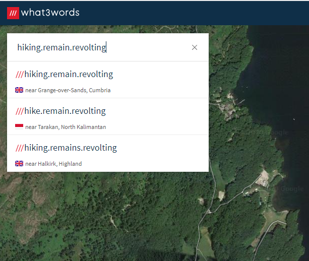
    While my bed – I kid you not – is at ///hiking.remain.revolting (really must remember to shower when I get down from the hill…)

    I take your point about the ambiguous spellings though Great idea for an app, but it’s a pity they didn’t put more effort into choosing less ambiguous words – even if they had to go to 4-word locations to do it. On the other hand, any emergency phone operator should be savvy enough to ask the caller to spell out the words.

    To be fair I don’t think it was envisaged for safety-critical usage – more to tell your friend where to meet you in the park or on the beach. That’s how it’s advertised on their website.

    This incident makes a powerful case for carrying a GPS enabled PLB with a homing signal and strobe. I also carry a whistle advertised as the loudest in the world. As the walker was conscious he could have used all of these and probably had a quick rescue.

    But you see so many people in the hills who are totally unprepared. Last weekend the weather was lovely in the Lake District but there were thundery showers forecast for the evening and these can be pretty unpleasant. I saw people up on the tops in sneakers, jeans and T-shirt with nothing else – not even carrying water in the blistering heat. There’s no reception so online mapping doesn’t work. I was stopped twice by people asking for directions – they barely knew which hill they were on, and had to guide someone off the hill in the gathering dusk.

    We need a bigger effort to educate people. If this poor guy had been carrying even so much as a whistle he might have saved himself a harrowing ordeal…

    #3671676
    Geoff Caplan
    BPL Member

    @geoffcaplan

    Locale: Lake District, Cumbria

    PS – just checked on the What3Words website, which is what a SAR team would probably use to locate you.

    They have a disambiguation dropdown when you search, which would help you choose a sensible location:

    #3671697
    Brad P
    Spectator

    @brawndo

    At Philmont, the maps use UTM instead of long/lat. GPS devices can provide UTM as well and it’s a lot easier to use.

    #3671725
    Philip Tschersich
    BPL Member

    @philip-ak

    Locale: Kodiak Alaska

    If anyone is looking for polka.party.location, it’s on the island of Crete. Figures.

    #3671735
    Mammoth Codger
    BPL Member

    @mammothcodger

    Locale: San Diego

    Has anyone been able to locate bob.curmudgeon.gross ?

    #3671772
    Bob K
    BPL Member

    @seventy2002

    how can you trust a system that does not have a location for ///bacon.lettuce.tomato but does for ///beacon.lettuce.tomato?

    I couldn’t trust such a system. Too easy to confuse beacon and bacon, even with a good connection.
    findmeSAR.com displays location in decimal degrees, degrees and decimal minutes, U.S. National Grid, and UTM.

    #3671794
    John S.
    BPL Member

    @jshann

    And who knows what the finder (Utsey) knows about using a gps to get coordinates. He may not have had WAAS enabled, or other issues in attempting to get accurate gps coordinates.

    #3671806
    Rex Sanders
    BPL Member

    @rex

    WAAS improves 2.5 meter GPS position accuracy to 0.9 meters, based on average FAA measurements:

    https://en.wikipedia.org/wiki/Wide_Area_Augmentation_System#Comparison_of_accuracy

    WAAS on/off shouldn’t have made much difference in this situation. But certainly other issues could have come into play.

    — Rex

    #3671964
    Kevin Buggie
    BPL Member

    @kbug

    Locale: NW New Mexico

    My initial gut reaction to local news reports was that something was off with this rescue (like the victim didn’t want to be found?), but then I read/saw the guy had some of the lighter packing knowledge to use a smart water bottle and Sawyer and that his back was actually broken I believe. That sounds legit and glad the rescue was successful!

    #3671993
    John S.
    BPL Member

    @jshann

    Rex, well that shows you my uncomprehensive knowledge of how a GPS works..lol ; ).

    #3672031
    Rex Sanders
    BPL Member

    @rex

    As long as I’m geeking out on navigation systems, since that was once an important part of my job:

    WAAS signals are transmitted by satellites in geostationary orbits “hovering” over the equator. From New Mexico (and most of the Northern Hemisphere) that’s more-or-less in the southern sky.

    That particular rescue location was in a deep east-west canyon. Meaning, probably, no path to southern WAAS satellites, and therefore no WAAS signal. Even if you were listening. Remember, WAAS was built to help aircraft navigate, which rarely have anything blocking the southern sky.

    And then there was that trip in the 1980s where we used three very different but state-of-the-art navigation systems. They frequently gave us simultaneous positions more than a mile apart. Pick a point, any point!

    In 2020 …

    In GPS We Trust. Always.

    For Better or Worse.

    — Rex

    #3672127
    Peter Howd
    BPL Member

    @peterhowd

    Locale: Northeast

    Geez Rex – Some of your fellow Deer Creek survivors might take issue with “obscure.” Can we go with under appreciated?

Viewing 25 posts - 1 through 25 (of 32 total)
  • You must be logged in to reply to this topic.
Forum Posting

A Membership is required to post in the forums. Login or become a member to post in the member forums!

Get the Newsletter

Get our free Handbook and Receive our weekly newsletter to see what's new at Backpacking Light!

Gear Research & Discovery Tools


Loading...