So, just throwing out some travel plans here. I have alloted 5 days for this trek if needed, Hopefully in 4. My plan at this point is to see how day 1 goes and if shit hits the fan I will bail at Mortimer Gulch Trailhead and campground where I will have my truck parked. This would be at the earlist sunday night to stretch into Monday afternoon depending on conditions. If anyone needs to bail at the same location around that timeframe i guess we would find out then, but thats my backup plan. If i’m not there by Monday afternoon i suppose i’m lost or heading to the finish. Black 2014 GMC Sierra will have some water and snacks in the bed for those in need. Hopefully I will not see you there :)
Topic
Bob Open 2017
Become a member to post in the forums.
- This topic has 263 replies, 33 voices, and was last updated 9 years, 1 month ago by
 .
.
Gibson is our bail option as well; get much past that and bail options start to get a little slim :)
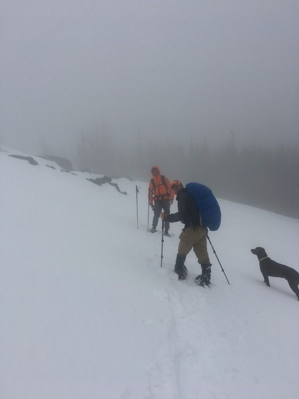
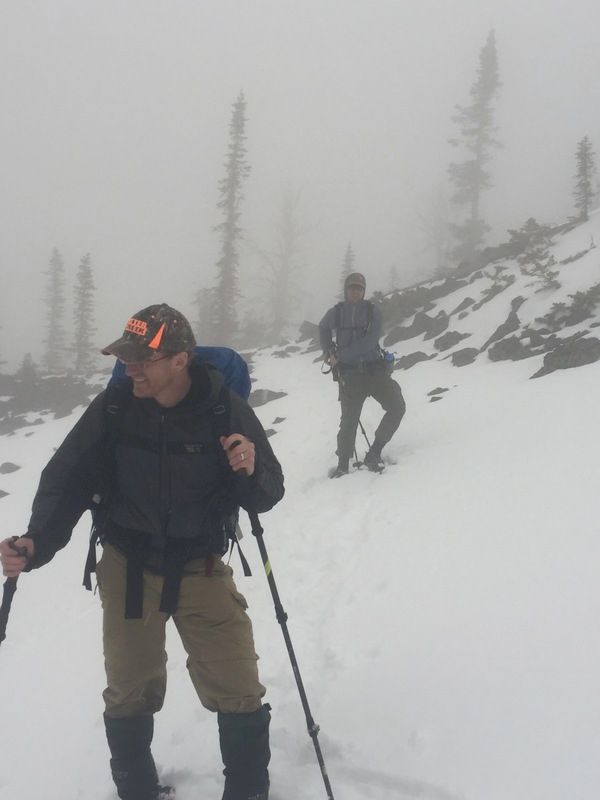
a little Bob training in the Elkhorns :)
Longtime listener, first time writer. Home base is Missoula so I’ve been able to get into the Bob this spring on snowshoes and skis. I’ll be at the start looking to take a run at this thing and really excited for the highs … and even the eventual lows (I’ve read all the previous trip reports). Not one to post much but thought I’d introduce myself to the group. If anyone is in Missoula and wants to chat training, contour lines and mental preparation, shoot me a message! As days get closer, I’m happy to volunteer a room and floorspace to anyone in need and a shuttle ride that Friday.
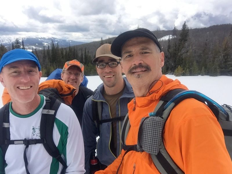
Photo from this weekend. Tromping training.
welcome aboard Kyle :)
Anybody have any insight on the crossing at Young’s Creek ford? I’m guessing it’s a swimmer this time of year.
Hey John, I definitely think it would be a swim. It might be better to try to cross each of them separately, or that could end up being 2 swims, ha. I also think the fords up higher on Youngs would be tricky Memorial Day weekend, although the route I am hoping to read someone’s account of won’t make it that far up Youngs ;)
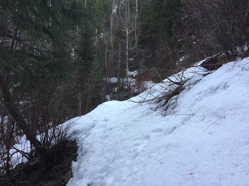
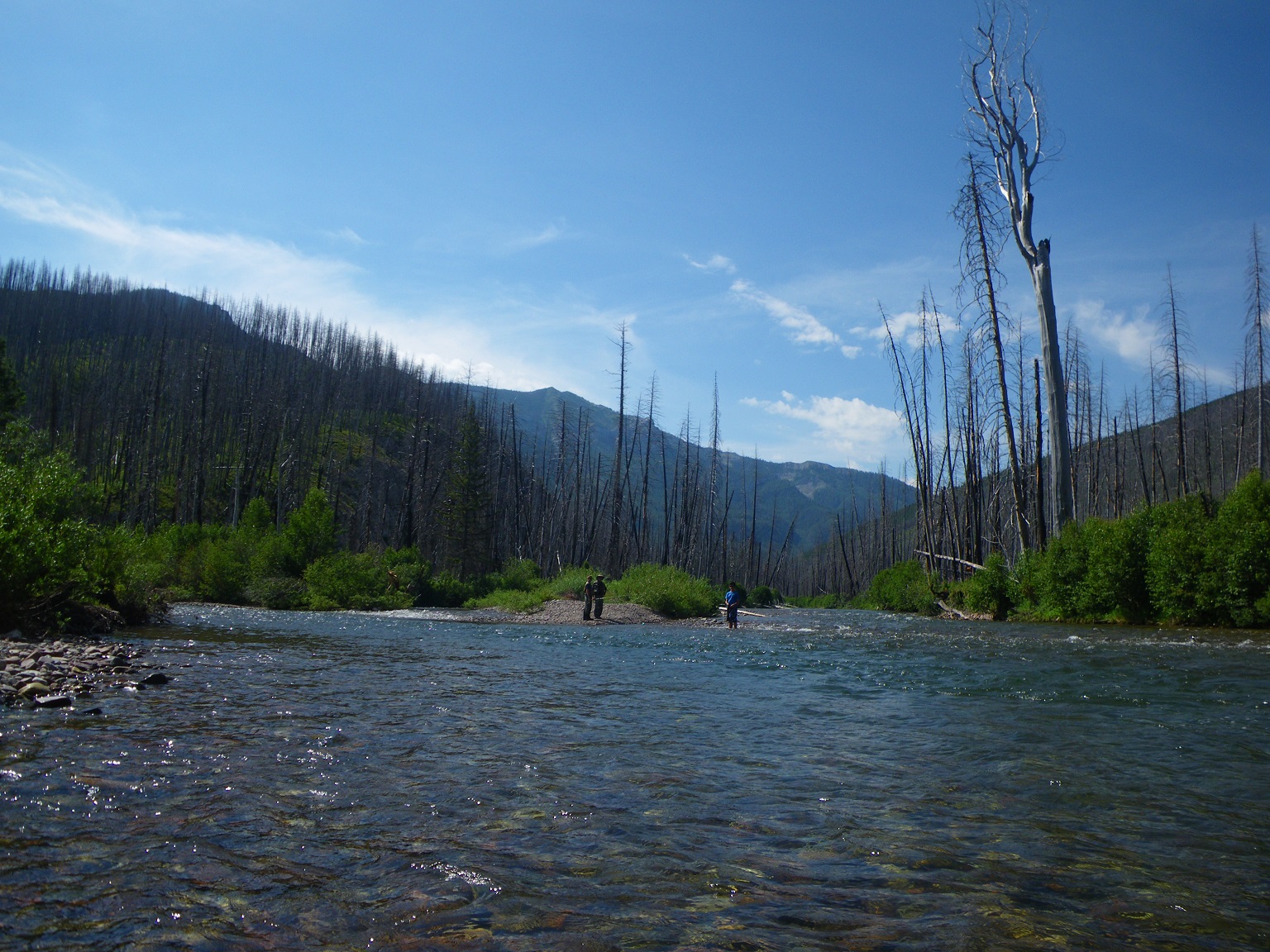
This is Youngs Creek Ford in mid-July:
So who’s bringing a life vest, haha? I’m not crazy about swimming multiple crossings solo. Packrafters got a lighweight recomendation?
The MTI Journey is a good option, 12 oz. and relatively inexpensive. Some folks carry a snorkel vest for less bulk; don’t know the costs there, but Dave C referenced a 480 denier model in a different post.
Another option entirely would be to use dry bags for your down gear (which you might want to do anyway, considering the precipitation this year), then add air prior to the crossing and use your pack like a kid’s paddle/kick board. Not sure how comfortable I’d be with that method in high water though.
Looks to be a very challenging year for the BMWO. Good luck to all!
Anyone have info on camping around the finish? My wife and dogs are most likely going to camp at or near Lake Inez so they are close to pick me up. I saw the one group site at Lake Inez is already reserved and the other sites are first come, first served. Given the holiday weekend, I am guessing those sites might fill up before she gets there. Same with Lake Alva.
Hopefully I’m wrong and walk up sites will still be available but I figured someone might have a better idea. Thanks.
it’s a really small campground iirc (been a decade or longer since I’ve been there); Lake Alva has considerably more sites to camp, but your correct Memorial Day is typically a big weekend in the Swan
my only suggestion is, if possible, try to get a site Friday (even though you might not need it until Sat)
The forecast looks good enough that I took the plunge and bought some new skis for the Bob Open. I went with the only real choice on the market today: Voile Objective BC’s (fishscaled alpine ski).
Current route plan has an estimated 59 miles on snow.
Scott: Check out lifevests from airplanes. You can pick them up on eBay for $20 or so, and they’re light (2-4oz). Remove the unneeded features (CO2 cartridge) and just blow it up by mouth.
I’m not sure a life jacket is a great idea though. As a backup while fording, sure, but for swimming it might add more drag than it’s worth.
Dan- wish I could ski worth a hoot, sounds fun :)
while it probably won’t make too much of a dent, we’re looking at some abnormally warm temps mid to late week- mid 70’s to even low 80’s; up to this point it’s been an extremely pleasant (read cool) spring- hope this is just a short lived anomaly
@dandydan I would be interested in which boots/bindings you’d choose for this sort of endeavor?
Our mich crew put in a solid 40+ mile hike this weekend , 4,000 up , 4000 down , obviously not on one hill around here, but a good shake down cruise of new gear – watching the snow pack like everyone else- sure be nice to catch a few real warm weeks to melt , then freeze hard for the open — just deaming —
Another option for camping lacking a campground site is any gated road off of any forest service road. IME they are fairly flat for setting up a tent and some even have fire pits from other dispersed campers. Just a thought.
I would be interested in which boots/bindings you’d choose for this sort of endeavor?
I really like the “tech” (aka Dynafit) system, as opposed to something else like telemark/NNN etc. With tech bindings and plastic boots, you can have quite good downhill ski performance, which is important if you’re doing a steep decent down through trees etc. Telemark can work, but any XC type of binding is usually outgunned on forested, off-trail descents, so you end up doing more crashing than skiing.
Within the tech realm, there is lots of good gear, but I think the best bindings are the Dynafit Superlite 2.0. They are expensive, but they’re darn light (360g for pair) and very capable. They have a flat position, optional brake etc. Top notch. I have the older original Superlite’s, which don’t have a brake and can’t go flat, but otherwise are really nice.
For boots, I haven’t done any research in ~2 years so I’m not up on the latest and greatest. I’m using Scarpa Alien’s, which are awesomely light and actually stiff enough to ski okay, but the downside is that your feet get soaked easily. They have large cutouts in the shell to save weight but these let snow/water in. Mine do have rubber flaps over these cutouts, but water still gets in and my feet are always drenched after a day of spring skiing.
Thanks for the reply, Dan. With that gear you’re favoring skiing over hiking, based on this years conditions?
Surely you must be carrying light trail runners too?
Sorry, I don’t mean to try and expose your strategies! I just always find this transitional time in the mountains challenging. Harvesting corn is great, but often getting to it is less than fun. At least with my full AT gear, which even with Dynafit type interfaces, is adding a lot of weight to the pack once on dirt.
Yeah I’ll have trail runners for sure. I’ll be quite happy to take those ski boots off whenever I can.
All in, the ski gear is 10-11 lbs. It’s a lot, but not that different than carrying rafting gear. I think the skiing gear will pay off in added efficiency, but it’s hard to say.
question,- looking at topo maps , the trails are numbered, how many are actually labeled out in the bob ?
thanks , dan and the mich crew
signs are pretty abundant and well marked when it comes to any trail intersections from what i have seen over the last two years.
IME there is quite a bit of signage in the Bob but don’t always expect it. Case it point: last year I walked right past the sign to the Palisade Lake trail (actually over it as it was broken on the ground) and proceeded up the trail about 500 yards before Thad shouted at me to turn around.
anyone using or has used the Gaia GPS app for phones? Input? thinking of leaving my Garmen 650 at home to shave some weight.
I’ve used it the last two years and will again this year; not sure what kind of phone you have, but my iphone6 had almost 50% battery left both years using airplane mode and no tracking (well very occasional tracking)- I still carry a recharger though just in case- it’s also a 150 lumen flashlight- BD Ember
Scott,
I used the GAIA app the last 3 years for the Open with no issues. I was amazed at how much faster it was than my old Garmin at going from “off” to having a location fix. I go through and disable a bunch of normal settings, put it in airplane mode, then leave it off in my pack. I’ve usually just taken it out to help navigate over passes where the trail is covered in snow, or for some reassurance at unmarked trail junctions. Make sure to download maps when you have wifi prior to the trip. On day trips I usually turn tracking on and it will last through the day unless it gets cold. Leaving it on and not tracking might last a couple days? I recommend just leaving the phone off until you need it for a trip like the Open.
Become a member to post in the forums.
advertisementYour privacy is protected: We do not transmit your user data to third-party ad platforms or advertisers, and we do not host third-party tracking pixels. Backpacking Light serves ads on its own custom, native, and internal platform.
 Titanium Pot GrabberUltralight titanium pot grabber weighing just 4.5 grams.