Topic

Bob Open 2017


Forum Posting

A Membership is required to post in the forums. Login or become a member to post in the member forums!

Home Forums Campfire Hiking Partners / Group Trips Bob Open 2017

Viewing 25 posts - 226 through 250 (of 264 total)
  • Author
    Posts
  • #3470817
    David Chenault
    BPL Member

    @davec

    Locale: Queen City, MT

    The start.

    It truly was as enjoyable just being at the start this year as it has been actually toeing the line in the past.  A wee bit sad I wasn’t out amongst it to actually see yet another year of totally unique conditions, but being able to know about it through everyones eyes more than makes up for it.  Makes for a healthy reminder of the sleepless nights I endured before I started my proto Bob traverse in 2011, and the first Open in 2012.

    This year I refrained from public comment in the weeks leading up so as not to provide anyone with false encouragement.  It is a great relief to see that once again everyone made excellent choices, pushed themselves, but stayed safe.

    Great that a ski route has finally been logged.

    Great that Thad made that log crossing, it looks both tempting and terrifying.

    Great (in a perverse way) that a strong winter can so thoroughly remind us that human trail work is of transitory benefit.  I went down Gordon during a ski traverse last March, and cursed those final 5-6 miles that emerge into a burn.  Night and day from the mostly simple cruising through the pines further upstream.

    #3470825
    Kyle P
    BPL Member

    @pucko25

    Locale: Missoula

    Hey all, here’s my trip report. Hats off to everyone for fighting through what sounds like insane downfall and coming out the other side.

    I’ve had the Bob Marshall Wilderness Open on my radar since 2013. At that time, there were way too many unanswered questions about my wilderness abilities to responsibly show up at the start. So I decided that I was going to take the next few years and make progress answering those questions. After many trips into the Bob, testing the limits with personal day-hiking records and extended ski-touring trips, I started to get comfortable with big miles on my feet … at least one day at a time.

    Training for the open consisted of big shoulder-season day-hikes and overnight hikes where I’d be rooting for inclement weather. One of my friends described it as getting comfortable with being uncomfortable.I took advantage of being in Missoula with close proximity to The Bob with hikes to Pendant Pass, some overnights in the North Fork of the Blackfoot area and a couple trips to random passes to familiarize myself with a lot of miles on dirt, snow, and everything in-between. Navigating on snow when the trail disappears was something I knew I had to be confident in before committing to this.

    The second part of training that has been talked about plenty in the past is getting mentally ready. I specifically visualized myself in the moment of each section of this trip as well as turn-around scenarios. What would I do if I woke up on day two and my knee was throbbing?  How would I handle being completely soaked as the temperature dropped below freezing?

    Strategy:

    118 miles in three days start to finish. My route had me floating the North Fork of the Sun to just above the gorge, following the Sun River up to White Pass, Down White River to the South Fork, up big Salmon, over Pendant. Out at Owl Creek and then a lot of forest-road miles to Inez.

    I wanted to packraft, so my route finding started there. The White River has been on my list for a long time. I also wanted to find an excuse to put in some miles on the South Fork, hence the Big Salmon drainage. Packrafting also broke days one and two into three parts. Hike, Raft, Hike. With the weather, this ended up being a great mix. I could put in early miles, raft in the heat of the day and “ice” the legs, then put in more miles in the evening.

    Day One: 8:00 a.m. to 12:30 a.m.

    West Fork Teton Cabin (start) to Pretty Prairie.

    21 Mile Hike

    18 Mile Packraft

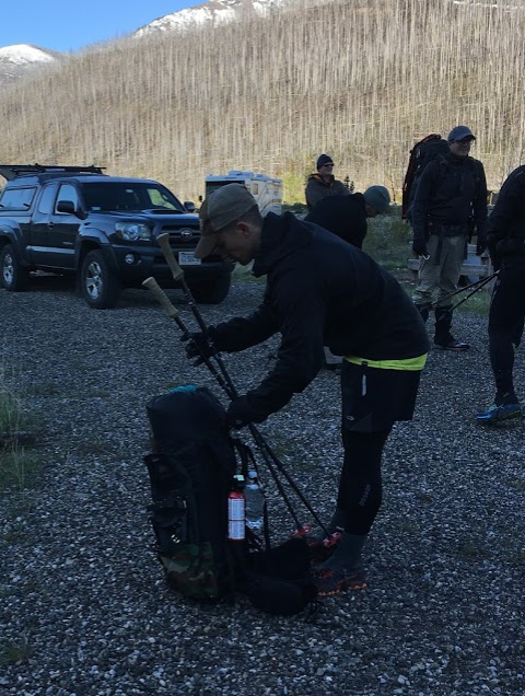
    After looking at the picture of the participants at the start year after year, it was a bit surreal being on the other side of the camera with my pack on and trekking poles in hand, about ready to start walking.

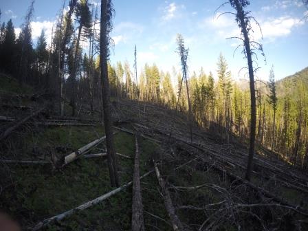
    Setting off with an amazing crew, we stuck together up and over the first snow-covered pass combining efforts breaking trail. As Tyler mentioned, our group was together until I peeled off at Route Creek about 13 miles in and headed toward the North Fork of the Sun following the creek. The bushwhack from the trail to Route Creek was maybe a mile and it was slow going. I had to cross the creek multiple times to find level ground, the logs were spaced just far enough apart making dead-fall hopping pretty difficult. The first low-point of the trip came when I snapped a trekking pole in half. I didn’t give both poles much of a chance to last the entire trip, but to have it happen so early was, for whatever reason, pretty crushing. Tenacious tape combined with a skip-strap proved fruitless, so I strapped the pole on my bag the remaining 104 miles. The first low of the trip coming earlier that expected.

    My first look at the North Fork of the Sun River. A bit smaller than I anticipated, which slowed the heart-rate slightly but certainly didn’t take any of the edge off knowing there would be a lot of river miles ahead with two big spikes in water levels in the last few weeks to move a lot of wood around.

    Floating the North Fork of the Sun was amazing. I switched between paddling to make miles and kicking back and thinking about just how freaking cool this was (and how lucky I was that the sun was shining). Around river mile ten, I let my guard down. A log stretched across the entire river and I hesitated: I can float under that. There’s definitely enough clearance. I think there’s enough clearance. There’s definitely not enough clearance. Too late. With the water pretty high, there was no such thing as an eddy. I paddled to the bank, grabbed a bush and the water quickly began entering the boat. The boat filled up pretty quickly, tipped, and I exited. This took about .5 seconds. I was able to stand and guide me and the boat safely under the tipped up log: turns out we probably could have made it without all the fanfare. Needless to say, the remaining river miles were taken with a bit more caution, awareness and measure of safety.

    I planned to take out before the gorge to hike up the Sun River for White Pass. When I exited a mile or so before the gorge, I noticed my SPOT was blinking bright red. At first I thought I’d accidentally hit SOS and a helicopter was on its way. Nope. The spill in the North Fork must have killed it. I knew my friends and family were following along. I also knew my last spot was going to be somwehere in the middle of the North Fork of the Sun river. I decided to hike to K&L Ranch and try and find a way to get the message to my wife that I was still alive and well. As I briskly walked into camp: “hello?” “Hello??” I thought this might be it. If nobody was at K&L I might just have to cut my losses and hike out Gibson.  Then one of the cooks appeared. “Dial 1 then the number.” Yes! “My spot died, I’m alive, still on the planned route, meet me at Lake Inez Monday night. Okay I gotta go.” The cook offered me some leftovers which I politely declined :)

    Then it was off for some night hiking under the northern lights (I almost forgot about those, Thanks Tyler!) and set up camp at 12:30. Just as I was getting into my tent, I saw a headlamp coming up the trail. It was Matt! We chatted for a minute with my feet elevated. Said our goodbyes and I was asleep instantly.

    Day Two: 5:30 a.m. to 1:00 a.m.

    Pretty Prairie to Tango Creek

    28 mile hike.

    15 mile packraft.

    Awake at 4:30, walking by 5:30. Enjoyed the miles up the West Fork of the Sun in solitude and amazing scenery. I knew I had two big challenges in the first part of my day. Time would tell just how big.

    First, the West Fork of the Sun river ford. My first attempt was embarrassing. Immediately sweeping my legs out from under me, I was soaked. Tries two and three were better, but still pretty pathetic. I went back to the trail after hiking up a bit to see if there was an easier spot. Nothing. I put my pack down and thought, I’m just going to inflate my packraft. But then I decided I could do it. I consider myself a strong swimmer, I had a full size PFD in my pack and the consequences below the ford were pretty minimal. I was confident in my abilities to make this happen. I picked up my pack, cinched everything down firmly, made some weird psych-up noises and went for it. Four big steps, a jump, a forward crawl and a firm grip on a small tree branch and I was across feeling really good.

    Second Obstacle: White Pass snow conditions. Though they were not ideal, they were not horrific. A long slog up with some side-hilling, plenty of post-holing and about 200 yards of snow-shoeing and I was at the pass. Unfortunately I crested the ridge too high and spent 30 minutes in rotten snow fumbling around trying to get down to the actual pass and trail over the continental divide (sorry if you followed those tracks, Matt).

    Up next was floating the White River. I’m going to quote the man himself, Dan Durston from the 2013 open.

    “Rafting the lower 6mi of the White River was awesome. I don’t write this flippantly: The White River was the best 1.5 hrs of packrafting I’ve ever done. Greg and I deemed it “sporty but not dangerous” with a few class III bits to spice up the wonderfully continuous class II water.”

    A stretch of river I will not soon forget. Side note for anyone looking to packraft the White, about 400 yards from the confluence, there’s a wire hanging across so keep your head on a swivel. You can make it under with no issue on the north side of the river, but it was pretty tough to see.

    From there it was cruising into the confluence with the South Fork of the Flathead. To experience floating into the South Fork at around 10,000 CFS was tough to put into words. I’m not sure why the confluence of a river is so cool, but being back there in one of the more remote parts of this amazing wilderness was a highlight of the trip.

    The South Fork was a cruiser and was certainly the highest I’d ever seen it having floated it twice before during summer months. Certainly a different mood to the water.

    A big question for me was whether I was going to go through the effort of portaging the packraft from the South Fork to Big Salmon lake and paddle the 3+ mile lake to stay off the feet. As I sat on a log at my take-out eating some sour-patch-kids mixed with trail-mix, I decided the three miles off the feet combined with reports of downfall along the lake, combined with low wind, combined with the novelty of the whole thing … I set out with my pack on carrying the inflated packraft on my shoulder for the mile hike to the lake. I learned maneuvering blowdown with a packraft is a delicate process. Once on the lake I tried to make quick work of the paddling. I couldn’t decide if the energy being used paddling a lake was less than the energy required to just hike. I paddled to shore a couple times to try and gauge my paddling speed compared with hiking and I was satisfied with the progress, plus I did notice a lot of blowdown.

    I reached the end of the lake around 9:00 p.m.planning to hike well into the night.The one time I needed to efficiently and effectively pack up the raft and gear was my slowest time of the trip. It took me 45 minutes to get my pack in order. Frustrated, cold, wet, and followed by a couple mosquitoes, I was actually relieved that it was just walking miles from here on out. I love packrafting, but the North Fork of the Sun, the White River and the massive South Fork took complete focus and high alert. Mentally I was ready to put one foot in front of the other without the risk of flipping into icy cold water. Up the drainage with a headlamp on in dense forest, so much for a mental break. Singing country music so loud I’m surprised the crews a couple drainages down couldn’t hear me. About four miles into my night hike, I heard what sounded like a pretty good sized creek ahead. I remember saying out-loud, “I don’t think I have this in me” before I even coming to the ford. Based on other trip reports, creeks sounding larger and looking larger than they are after the sun goes down is a real thing. It was a knee-deep breeze. A few more miles and I set up camp at Tango Creek above the lake with the largest wilderness day of my life behind me and the longest hiking mileage day of my life in front of me.

    Day Three: Tango Creek to Lake Inez Campground (Finish)

    5:30a.m. to 10:30 p.m.

    34 Mile Hike

    Up at 4:30 walking by 5:30. Now on a total of seven hours of sleep, I was amazed how focused I was able to stay and how my body had seemed to give-in to the fact that this was how it was going to be. I strangely wanted to find that line when my body would say, that’s enough. I ended up finding it on a random forest road about two miles from Lake Inez. More on that in a minute.

    The last obstacle I had circled on my map were the Big Salmon Creek crossings. I’d done a lot of visualization to prepare for the trip. Visualizing myself post-holing for two miles up White Pass, navigating rapids and portaging around dangerous water in the packraft. I especially visualized the moment when I approached the Big Salmon Creek crossing. I did because I knew at this point in the trip I would be mentally exhausted, physically drained and ready to be heading toward Pendant Pass: the formula for a really bad decision. I had prepared myself for the option of turning around. Fortunately I had made a big deal out of a pretty manageable crossing and even found a big tree to scurry across.

    Highest moment of the trip was marching up toward Pendant Pass: four miles to the last pass of the trip, views of the Mission Mountains, Upper Holland Lake and the home stretch. </span>

    I mentioned visualization as a big piece of my training, trying to put myself in all the moments of this trip. I did not, however, practice any of this mental training as it applied to the last 17 miles of forest road. I guess I just kind of wrote it off as “I’ll figure it out when I’m at Owl Creek.” What was I thinking? When I arrived, I knew it would be about 17 miles. Doing the math, I flagged down a biker and had them send a message to my wife: “Hey, I ran into Kyle at Owl Creek. He said you can pick him up between 9:30 and 10:30 tonight.” Now I had my deadline. I’d sketched out a couple options on both sides of Hwy 83 and decided the West Side of the highway had some forest roads with less elevation gain. I’ll spare you all the details, but as I hiked up, down, up, down around and through, what felt like, two miles of downed logs on a forest road that clearly gets no use, I was finally experiencing the low that I’d managed to somehow avoid.

    This is a forest road.

    It didn’t help that from 2:00 to 10:15 when I walked into the campground, there were mosquitoes following me the entire way.

    I wore my rain pants, Houdini hood, gloves, buff and sunglasses for maybe ten of my 17 miles. The last two miles were brutal as I think my body was finally starting to come down as it realized we were not in an apocalyptic survival march, but rather, this was entirely self inflicted.

    62 hours and 11 minutes later, I walked into Lake Inzel campground where Chrissy, my wife and pre Bob and post-Bob support team was there with a Burrito and a giant bag of popcorn.

    Since finishing, reflecting on the time spent moving efficiently through the Bob Marshall Wilderness in solitude is something I can’t seem to stop doing. The support of friends, family and fellow BMWO’ers was something I’m really thankful for.

    For anyone interested: more pictures and a map of my route:

    Map:

    https://drive.google.com/open?id=1i4t8gHeWwIqMDJHl1KTDvd4E9Vk&usp=sharing

    All Photo Folder

    https://goo.gl/photos/w2KcwWKoAUN8tS8R6
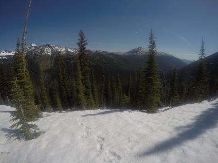
    #3470836
    CARLOS C.
    BPL Member

    @lamboy

    Locale: Mid Atlantic

    Man you guys are Savages. Well done to all that undertook this event regardless of the outcome.

    #3470842
    John N
    BPL Member

    @airlocksniffer

    Locale: Montana

    Way to grind out the last miles Kyle.  Can’t say we regret catching a ride back to Inez from Lindbergh Lake Rd vs hiking 11 more miles on the highway.  I wouldn’t complain a bit if future Open events started and ended on a trail vs road miles (especially ended ;)

    #3470851
    Tanner K
    BPL Member

    @tannerk

    Locale: Montana

    Well done everyone. I am glad to hear everyone had a safe journey and love the trip reports.

    I hate the road miles too, but it is the best way to make multiple route options more possible on the E-W or W-E routes and still have high mileage. I hope to be there next year, but depending on what Dave comes up with will likely set my own end point to maximize my potential for interesting routes in areas of the Bob I have not yet been to. I just don’t have the motivation to suffer through the fatigue and pain of these things on a road, or trail I have been on numerous times. I would rather do the 10 extra miles in the wilderness than on a FS road.

    #3471067
    Mike M
    BPL Member

    @mtwarden

    Locale: Montana

    curious how everyone is feeling?  last year I had some pretty extensive soft tissue/ligament/tendon damage in the front of both ankles  – I think from trying to jog with the pack

    I have some foot tenderness, but knock on wood, I think I’ve escaped any longer lasting issues

    #3471068
    Derek Larson
    BPL Member

    @derek-larson

    Locale: La Sierra Gorda

    Last night, Chase and I completed the third leg of our post BMWO Tri-state Karaoke Triathlon (drinking & singing at various dive bars of Montana, Idaho, and Oregon). Reflecting on my last-second decision to come to the BMWO and hike with Chase, I am glad to have made the trip. Yesterday, I purchased an Ultimate Direction PB Adventure Vest 3.0, and am excited to see how  it can be configured to get me across the Bob in 2018.

    A few thoughts:

    • I am disappointed to have not attempted the bikeraft circumnavigation of the BMWC that I plotted a few months ago. Private land would’ve been an issue east of the RMF, but it would’ve been a unique way of staying within the guidelines of the BMWO and float the Teton, Sun, Dearborn and Blackfoot Rivers.
    • While Chase and I didn’t have to deal with the road miles at the end, we did talk quite a bit before the event of finishing at Holland Lake instead of Inez in order to avoid the final death march. It appears that many shared the same thoughts. I suppose if the majority voiced this concern in the months prior to the event, we could’ve come to a consensus and included an alternate end point.
    • I wore Skechers Ultra Trail running shoes and absolutely loved them. I am on the fence about using neoprene socks in the future. It seems like I only wore the neoprene socks because I had shoes that were a half-size too large (to accommodate the socks) and didn’t want to take the socks off to risk getting blisters (because the shoes were large).
    • It would be great if someone could coordinate a group shuttle in the future and we could arrange for someone to be on stand-by to pick up those who bail, instead of relying on family members/friends of participants. For out-of-towners, this is the biggest headache to deal with each year, and I imagine many folks don’t come due to the uncertainty of getting to the start or finish.

    So it goes…

    The people who come to this event are what makes this special. I hope to see you all again.

    #3471080
    John N
    BPL Member

    @airlocksniffer

    Locale: Montana

    Mike M covered our route so I’ll add some thoughts and more pics of this year’s Open:

    • Definitely approached this year with a little more caution than the last two years given snowpack and stream flows.  I was pleasantly surprised by the former and the latter was as expected.  I would have been fine w/o shoes but the 2 lbs of insurance is nice to have.
    • It was hot!!  This was especially noticeable slogging through the burn on lower Gordon Ck.  Need some kind of protection in addition to sunscreen for my neck, maybe a floppy sombrero (made of cuben fiber of course).  Convertible pants would be nice as well.
    • Amazed at how lush and green the Sun River valley was.  Beautiful part of the Bob I had not been in yet.
    • I felt pretty decent the entire way. My feet were sore pretty much all the time and I definitely had a slower pace as the day wore one but overall happy with how I fared physically.  I didn’t eat and drink nearly enough as I should have but it’s really hard to keep up with that.
    • First time running Hydroskins.   I like them.  They don’t seem to hold nearly as much water as my merino Darn Toughs.  Feet stay comfortable in the snow and no blisters that I can attribute to them.  I did use some Smartwool liners with them.
    • The MSR Shifts have awesome traction.  There was some hard, steep snow on the decent into Nesbit Ck and I didn’t slip at all.  Once I got them adjusted correctly they were pretty sweet.
    • There is deadfall you have to climb over to get to the shitter at Shaw Cabin.  Not funny.
    • Found dropped gear on the ground and was able to find both owners.  It benefits you that I’m slower!
    • The mosquitos from Owl Creek on were pretty bad.
    • Our exit was plan D.  Didn’t scout enough of the FS Roads from Owl Creek to Inez, which maybe would have had us go the whole way. Don’t regret not though.  Trails > Closed Logging Roads > FS Roads > Hwy
    • Peanut butter M&M’s are a good bedtime snack.
    • Always a great honor sharing the Bob with so many badasses.  Already looking forward to next year!

    #3471082
    David Chenault
    BPL Member

    @davec

    Locale: Queen City, MT

    Great stuff from everyone.  Way to suffer it out Kyle.

    My hope for next year is to coordinate some kind of Friday evening dinner in a place a little more conducive to hanging out and socializing, ideally very close or right at the start.  The various small restaurant/bars aren’t going to be a viable option anymore due to crowd size.  Ideally some kind of shuttle will be manageable as well, though to be blunt keeping the logistics intimidating has to a certain extent been intentional, to keep out those who might not be committed enough.  I’d say something similar about having a rescue driver on standby; it can be invaluable and inconvenience shouldn’t keep you from bailing when you should (been there, done it), but a too ready bail option encourages mental weakness.

    Road walking sucks.  Some years it has been a necessary evil to keep an even handicap over multiple routes.  This year the finish placement was quite deliberate; with the Holland Gap as by far the easiest route over the Swan anyone picking that route was going to have to pay for it.  Conversely, anyone not wanting much road walking was going to have to pay for that too, as those who went up Babcock found out.  There just aren’t that many options like the 2015 route which both made for a variety of finish options and have the finish right at the end of the singletrack.  It’s important that anyone going in to the Open spend a lot of time thinking about exactly what they want out of it, and why.  I cut my trip short in 2014, had a great time, and don’t regret the decision, but I also don’t kid myself that due to shortcomings in physical and logistical prep I didn’t complete the route I intended to.  I don’t intend to get into the business of policing what counts as a finish, as that totally misses the point, but I also hope no one is ever tempted to hitch a ride down a section of dirt and gloss over that in their public account, as they would only be cheating themselves.

    All of this is to say that seeing everyone psyched at the start and reading about the profound journeys after is a massive reward for me, and I’m committed to both improving the logistical and social aspects in the future while maintaining the overall ethos.  See everyone next year.  Condon to Indian Meadows in one idea I’ve been throwing around, Monture to Swift Reservoir another.

    #3471086
    David Chenault
    BPL Member

    @davec

    Locale: Queen City, MT

    John, is that moose along lower Danaher (never actually hiked that stretch, so I’m not sure).  Is so that’s one more piece of evidence of that place being moose heaven.  Seen one each time I’ve gone through on the creek.

    #3471091
    John N
    BPL Member

    @airlocksniffer

    Locale: Montana

    Actually that moose was spotted on the trail coming down into the Young’s – Danaher confluence.  We also saw a cow and calf along the Sun.


    EDIT: Yes along the lower Danaher (my reding skillz are realy gud)

    #3471093
    Mike M
    BPL Member

    @mtwarden

    Locale: Montana

    Dave- it might be too long, but have you thought about a route starting/ending Great Bear <-> Scape Goat?  would encompass the entire Complex, again might be too long???

    #3471099
    Ed Tyanich
    BPL Member

    @runsmtns

    Following on MIke’s suggestion, what about Marias to North Fork of the Blackfoot or Maria’s to Indian Meadows, or same routes South to North?

    #3471100
    Matt L
    BPL Member

    @mattl6722-2

    Summary:  West Fork Cabin to Morrell Falls TH (DNF)

    80 hours total

    55 hours of travel

    98 miles (according to 2 min track intervals)

    Day 1:  West Fork Teton Cabin to Pretty Prairie

    0800-0100 (17hrs);  36 miles

    Starting off was exciting, and like Kyle mentioned, a bit surreal, after watching along for several years until I could participate.  I headed up Olney/Nesbit Pass in a group of 7: Kyle, Derek, Chase, Jon, Justin, and Tyler.  I was able to stay with the group until it got steep, then I fell behind.  I caught up again on the summit and we descended together. Heading towards Gates Park I fell behind again and began relying on a system where I would trudge along slowly, take short breaks only when absolutely necessary, and then leapfrog the other guys; then they would pass me again.  Initially I had wanted to be all by myself, but I have to admit it was comforting being around others considering this undertaking.  Also an advantage to traveling with others is the information you can learn.  Derek told me (from what Mike told him) that travel south towards Gibson would be easier on the east side of the NF Sun.  Wow, great help!  I left Gates Park ahead of the group, other than Kyle, who had already floated by.  Jon, Justin, and Tyler then broke off west and Derek and Chase were behind me.

    I kept looking over my shoulder for Derek and chase, expecting them to pass me at any time, but only twice I saw them as specks way behind.  That was huge motivation to keep going faster and longer!  It was dusk as I passed through the ranch (I took the shortcut because gates were open and no signs saying “no trespassing”).  As I was starting to need a headlamp I took a wrong turn.  I followed the 202 low water trail (obviously under water but had a lightly used trail next to it) because it was the only marked trail that I saw.  After it ran out, I ended up scrambling up steep hills to the real trail and finished with an easy (yet tiring) walk under headlamp to Pretty Prairie where I talked to Kyle and camped about 400m away.  This was the most I had ever walked in a day!

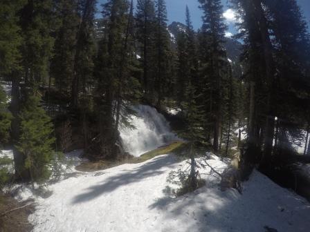
    Day 2:  Pretty Prairie to White River Park

    0700-2100 (14hrs);  25 miles

    I woke up leisurely since I wanted to recover.  I learned soon that Kyle had already left and I followed his tracks.  I was sluggish going up to White River Pass due to the constant uphill and sporadic downfall.  The WF Sun River ford was my first experience with what I consider a scary ford.  It pulled my feet out from under me and only my head and pack stayed up.  I wasn’t too shook up but it did open my eyes to what might be coming.  I slowly followed Kyle’s tracks up the pass.  It was afternoon when I was up on the pass and the snow soft; I post-holed even where Kyle didn’t.  It took a lot out of me.  I knew with how slow I moved, I wouldn’t make my goal of Big Prairie today.  Just keep moving ….

    I also started to develop right ankle pain throughout the day.  It felt like a sprain but was probably nothing other than overuse.  The downside to living in Chicago, is not getting my feet and ankles acclimated to the angle of climbing uphill and downhill, something that stairs and step ups can never simulate due to always moving to a flat foot.

    The SF White River ford was difficult but went better.  It was pushier than the WF Sun, but smoother, and I improved my technique.  I made camp at a trail junction half way between White River Park and White River Butte.  I couldn’t sleep because my ankle was so painful;   I had to take Advil, unfortunately.  I am not a fan of NSAIDS, unless it is for pain relief (I side with the camp that NSAID’s and icing only help with pain relief and actually slow healing – partially due to reversing the flow of the lymphatic system, which aids removing waste products from an injured area)  That is all I’ll go into – send me a message if you want to go deeper into this).


    Day 3:  White River Park to Babcock Creek

    0630-2030 (14hrs);  23 miles

    I got started earlier start and soon passed Jon, Tyler, and Justin at Big Prairie, knowing that they would be passing me again shortly.  I got to Gordon Creek.  At this point, solo fords were wearing on my nerves.  The only comfort was knowing there were people behind me.  Undeterred, I quickly waterproofed my kit, cinched it tight, and walked upstream 50m to allow for downstream movement.  I eyeballed a log sticking two feet off shore to jump off of.  I briskly walked up and tried propelling myself off the end of the log into deep, fast water.  The log broke.  I sunk straight down and frantically began swimming as I was being carried away.  About half way my hands hit rocks and I could walk carefully across the remainder.  Tyler, Jon, and Justin forded upstream at a better spot it seems.  I saw them from across the creek and then kept moving on, only to have them breeze by me in a little bit!

    Soon after they passed me, we all ran into Thad.  I kept going south (again, my strategy was to take short breaks and get out ahead of the group).  Thad caught up and we walked together to the junction with Babcock Creek.  I went down the worse of two options to proceed south along Youngs Creek.  This would involve fording Youngs immediately then Babcock.  It took 20 minutes of travel along 400m of swamped trail, swamped shore, and blowdowns on a trail under 5 feet of water, just to get to Youngs Creek.  I turned around.

    I made an important decision as I talked to Thad back at the trail junction (the other guys had gone around to ford Babcock upstream already and I never saw them again … part of my decision too, knowing I would be trailing them as I forded difficult rivers.  I was losing my nerve for crossing big, fast, gnarly rivers solo.  I asked Thad if I could stick with him as he wanted to cut through Babcock Creek to travel west (this was my original plan before I became grounded in reality about the difference between planning routes on a computer at home versus actually moving through the terrain!)  Thad was a pleasure to talk and travel with.  We camped about halfway down the supposed maintained trail (several fields of blowdowns!)  My ankle was killing me … I couldn’t touch it and I couldn’t pull my foot towards my shin at all!!

    Day 4:  Babcock Creek to Morrell Falls TH

    0600-1600 (10hrs);  14 miles

    Thad and I headed out to the unknown.  While parts of the unmaintained trail surprised us with how great it was, others were what you would expect.  The final 400 meters ended in a huge blowdown field, so we just went downhill and began bushwacking.  We stayed close to Babcock as we climbed upstream, looking for a place to cross.  Then we followed a ridge all the way up- about half on snow (which made it much easier!) until we could see Grizzly Basin.

    Going down the basin was not straightforward and certainly not fast.  There were many spurs with their individual drainages eventually all funneling into Morrell Creek.  There were also cliffs, which were luckily circumvented by switchback-like benches.  We followed grizzly tracks for part of it, knowing they probably wouldn’t lead to a cliff.  Thad was very tolerant of my slow pace.  What an outdoorsman he is too!  I felt very comfortable having him with me and appreciative of the skill/knowledge he demonstrated.  We had to ford Morrell creek pretty far downstream on the maintained trail.  Luckily the first was manageable and the second we used many logs.

    The last miles downhill were painful but they led to a beautifully kept trail from the falls to TH.  I limped along (now with my left ankle hurting even more than the right) and we arrived at the TH where I said goodbye to Thad.

    I waited for my wife, disappointed that I couldn’t finish, but accepting of the outcome.  I probably could have made it but at what cost?  I need to be able to run and move at work next week!  My physical conditioning could have been better.  I wasn’t able to workout as disciplined as normal the last 6 months due to working insane amounts of overtime … sometimes up to 16 hour days and no days off for several weeks.  Being slow is tolerable but the killer is lack of preparation for the feet and ankles.

    Recently I’ve been doing a lot more mental training … books, podcasts, videos, etc.  Stoic philosophy really appeals to me and it makes a big difference for a trip like this.  Finding what works for you is key.  I relied on self-talk and mental cues to get me through tough times.  Remembering, as the book title states, “The Obstacle Is The Way,” kept me grounded in reality and smiling (or trying to) when I saw a challenge.  Emotional control to adversity is constant and flowing.  Occupying your mind with task-focused thoughts rather than self-focused thoughts keeps you from feeling sorry for yourself.  Mindfulness training helps as well, especially to develop focus and avoid mind wandering that leads to mistakes.  The list goes on and on …


    Other Lessons Learned:

    1. Don’t cut the maps. I had at least 1 bail/alternate option eliminated because I had cut the maps too tight to my known route options.
    2. If you don’t bring a stove, don’t be silly enough to think you will have time to heat a cup of water over a fire for coffee (assuming you care about getting up and going)
    3. Bring sunscreen even if you don’t usually burn. I do love my early start at a SWEET farmer’s tan though… wife loves it too ;)
    4. Bring more NSAID’s than you think you’ll need, just in case you need to manage pain for a long time.


    Sidebar Conversation:  Nutrition

    I have been ketogenic for a couple years now on and off.  But since last August (14AUG17 to be exact) I have eaten NO direct source of carbohydrates other than veggies.  A better way to put this is:  I don’t eat sugar.  Of course there are carbs buried in many foods … but the trick is to minimize those and keep total daily carb intake under about 20-30g.  Protein must be moderated as well and the rest of the calories come from fat.  Anyway, I’ve become “fat-adapted” and don’t need to eat as much food or as frequently.  I was curious to see how this would affect my travels in the Bob.  I wouldn’t recommend doing this unless you’ve been keto for at least 6 months and have even experimented with fasting 1-3 days.  Early attempts would result in worse than normal performance.

    Below are the foods I ate and the total calories.  These are approximates since some of these foods fluctuate in calories.

    4 hard boiled eggs (78×4=312)

    10 pieces of bacon (45×10=450)

    8oz pepperjack cheese (110×8=880)

    5oz sliced pepporoni (130×5=650)

    .75lbs salted macadamia nuts (230×12=2760)

    TOTAL CALORIC INTAKE: 5052


    Sidebar Conversation:  Garmin Inreach Explorer SE

    I just switched from SPOT to Garmin.  First, as a disclaimer, years ago I carried an ACR PLB (bulky!) and loved it because it was just something in case of a serious emergency.  I hesitantly switched to SPOT because of the size and for the comfort of my family during solo travels.  But I despised the intrusion into my private experience away from people and technology.  I’ve gotten used to it … and I have learned that the benefits outweigh the negatives.  Now I just purchased the Inreach.  Here’s my point:  everyone in an event like this one could benefit and have fun from specifically using the Garmin Inreach Explorer to be able to 2-way text each other.  Or whatever device … I heard that SPOT is working on a 2-way messaging device too.

    Case in point:  Thad split from Jon and Mike.  Thad waited hours for them, not knowing if they were going to link up again or go out Gordon Pass.  Thad didn’t mind the rest and he can blaze through the woods like an animal (and everyone really has to play independently out there at a base level so this wasn’t a critical issue).  When I met up with Thad, I was able to send a message to my wife and ask her to locate Mike M on his SPOT page.  She informed me he was near Gordon Pass.  So boom!  We are at ease knowing that there is no need to wait or feel bad about moving on.  Again, not a big deal, but it would be SO nice to send messages directly to each other if everyone is on an Inreach device.  All you have to do is share with everyone your Inreach email address and you can send direct messages from device to device.

    I also texted my wife and asked how far behind Chase and Derek were.  I was able to find out they bailed (so I could stop looking over my shoulder, sweating about when they were going to catch my slow ass! LOL).  Even though I wanted to be solo for the experience, I learned that having support out there and traveling with other people at times is just the comfort I needed to have a better experience.


    Sidebar Conversation: Recovery

    Today is Friday.  I am still staying off my feet for long periods of time.  The issue is swollen ankles and junky tissue … mostly a calf stiffness issue.  This will be very temporary.  I use two tools that are priceless (and remember, no ice and no NSAID’s):

    1. Mobility exercises (check out mobilitywod.com)
    2. MarcPro (check out marcpro.com) This creates non-fatiguing muscle activation to improve healing.

    Otherwise, I walk and move as much as I can without causing pain.


    Sorry for the long report!  It was great meeting all of you and participating in this event!

    Matt

    #3471106
    Sam Haraldson
    BPL Member

    @sharalds

    Locale: Gallatin Range

    The logical gaps to be “filled in” by future routes are denoted by the big fat black lines on this map.
    That however doesn’t mean they’d make for a unique experience – just cover the Complex thoroughly.

    The option for a middle checkpoint is an option as well.  A place where you need to hit and then head off in a new direction which would allow for routes that started and ended near each other but required traveling a distance similar to crossing the Complex entirely.

    The BMWO history map can be viewed in detail here: https://caltopo.com/m/ND5U

    #3471107
    Mike M
    BPL Member

    @mtwarden

    Locale: Montana

    Matt- great report!  You did happen to pick a doozy of a year for your first event :)  My guess is you now have the “bug” the rest of us have, which means we’ll see you next year :)

    I’m pretty sure I’m going to make the switch to Inreach as well

    Agreed- Thad is an animal, somewhat surprised he didn’t convince you to limp on to the beer stash :)

    #3471108
    Matt L
    BPL Member

    @mattl6722-2

    Ha! He wouldn’t tell me where it was because he thought I’d steal it! LOL … until I told him I’m a gin guy.


    Yeah… it only took about 12 hours post event to forget all the reasons I told myself I’d never do it again.  The grandness of what this event is sunk in when near my finish at Morrell Falls I said hello to two older guys as they neared the falls.  I said, “How ya doing?” and they replied “Winded, but almost there.”  Without judging, I laughed inside my head at the absurdity of 2.7 miles compared to what I had just been through.  It just put things into perspective.

    #3471128
    Kyle P
    BPL Member

    @pucko25

    Locale: Missoula

    Love the write ups. Based on reports, I need to spend a day following Thad around in the woods.

    #3471147
    David Chenault
    BPL Member

    @davec

    Locale: Queen City, MT

    “…that moose was spotted on the trail coming down into the Young’s – Danaher confluence.”

    I know where to go if I ever draw a tag.  Too bad at fall flows it would be mostly dragging a packraft for the first ~20 miles to get a moose out.


    #3471148
    W I S N E R !
    Spectator

    @xnomanx

    Great stuff everyone.

    #3471149
    David Chenault
    BPL Member

    @davec

    Locale: Queen City, MT

    All the Open routes, save 2014, have been 55-60 miles as the crow flies.  This seems to work out for 2.5 days for faster folks, 3-4 for the slightly less fast.  A pretty digestible length as far as time off.  Rogers to Marias took Kevin Sawchuk and I 5.5 days in fall of 2009.  We had darn tough conditions and didn’t pick the fastest route, but I think we could expect a 80-90 mile straight line course to fall in the 4-7 day range for most.

    Are folks interested in that?  The core of participation thus far has been regional “locals” but I’m not opposed to making them take a bit more time off work if that will lure in a few more folks from out of state.  A longer course certainly has more personal appeal, but for me people in Matt and Kyle’s shoes this year are the core audience.  Adding another 36 hours of commitment is not to be taken lightly.

    #3471166
    Mike M
    BPL Member

    @mtwarden

    Locale: Montana

    very valid point- with the three day weekend, you can at least get close to finishing up

    having said that, I wouldn’t be opposed to a longer route either

    there are still several routes in that 50-60 mile straight line, possibly exhaust those first and then consider longer????

    it’s all good :)

    #3471188
    Kattt
    BPL Member

    @kattt

    I am really in awe of you all doing this. Thanks for the stories and the pictures. Just wow.

    #3471224
    John N
    BPL Member

    @airlocksniffer

    Locale: Montana

    I like the length and the extended weekend for the Open but would consider something longer as well.  Maybe a future Open could be a traverse of the Mission Mtns?  Also hope I didn’t come across a bitching about the roads-they are a necessary evil for many of the routes.  Ke sera sera.

    Dave, a moose hunt in there would be epic, if not for the critters then the pack out.  May just have to set up camp and eat the whole damn thing just to get out!  Only 1 tag available in HD 150 though so I’m guessing some years of gathering points would be necessary.  Fall Bob Open Moose Hunt!!

    #3471228
    Jeffs Eleven
    BPL Member

    @woodenwizard

    Locale: NePo

    I’m with Carlos, y’all are savages!

    I look at the mileage breakdowns, I read the damage report, and I bow.

Viewing 25 posts - 226 through 250 (of 264 total)
  • You must be logged in to reply to this topic.
Forum Posting

A Membership is required to post in the forums. Login or become a member to post in the member forums!

Get the Newsletter

Get our free Handbook and Receive our weekly newsletter to see what's new at Backpacking Light!

Gear Research & Discovery Tools


Loading...