Topic
Bob Open 2017
Forum Posting
A Membership is required to post in the forums. Login or become a member to post in the member forums!
Home › Forums › Campfire › Hiking Partners / Group Trips › Bob Open 2017
- This topic has 263 replies, 33 voices, and was last updated 6 years, 10 months ago by
 Mike M.
-
AuthorPosts
-
Feb 28, 2017 at 7:41 pm #3453567
they must be keeping it close to the vest :)
definitely looks like a few opportunities to get some floating in, probably not as much as last year, but still some
we’re three months out now, hope everyone’s training is going well- I missed a week in February with a bad cold, but other than that getting 30-40 miles in a week with some good snowshoeing thrown in for good measure
Mar 1, 2017 at 10:03 am #3453647I haven’t really put the pack on much (at all), but I intend to over these last 12 weeks. In any event, I should arrive to the start at least a backpack lighter than last year. I’ve been waiting for a car part to arrive for over a month, so I’ve been doing quite a bit of walking around town as a result. A recovery run day is 6 miles, and I walk the kids to school another 4, so I get in a minimum of 10 miles walking/running each day, with long running days typically 16-20 miles, or more. I might have to find a pair of snowshoes this year, if Badger Pass keeps getting clobbered with more snow.
Mar 1, 2017 at 10:44 am #3453654They (Badger Pass) were down about a foot with our short stint of warm weather, but they’ve gained it back in the last couple of days, with the forecast calling for 4-5 more days with snow.
Obviously a lot can (will) change in 90 days, but should prove to be interesting nonetheless :)
Mar 1, 2017 at 11:19 am #3453661I’m keeping my fingers crossed for a massive snow melt. I can find mileage and elevation and wet feet and all the rest, but snowshoeing is my weak link…don’t get a lot of opportunity to do it.
Plus the base weight just looks so much better without 50+ ounces of snowshoe on my back :)
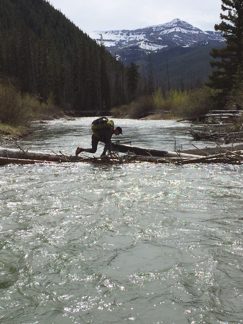
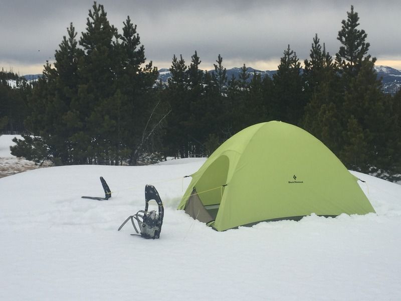
Mar 1, 2017 at 12:56 pm #3453685I always hope for more snow to hopefully keep the fire season in check but hope to not have miles of snowshoeing during the Open. In 2015 I packed them but never put them on. Last year I didn’t pack them and never felt like I needed them. Time will tell based on route choice whether I pick up a pair of Shifts or just roll the dice. I’m okay with some melt as well but one that hopefully slows down prior to the start so stream/river crossings don’t get too hairy. Here is Mike recovering from a near tip into Strawberry in 2015:
 Mar 1, 2017 at 1:35 pm #3453696
^ lucky SOB! :)
Mar 13, 2017 at 12:05 am #3456271Finally got off my butt 2 weeks ago and put a little vert in. This 2 day / 20 mile ascent is all I’ve logged for training thus far, but I’m going full time backcountry ski bum for April which should strengthen the legs. 19 days until I’m nomadic until October.

I’m hoping this snow keeps piling up and I can finally do my ski route. I actually quite like the course for skis this year. If only I had some wheels to attach to them for the final 10 miles out the forest roads.
No raft for me.
Mar 13, 2017 at 5:10 pm #3456413Dan- nice country! :)
I had a good training weekend. Snowshoed about a 15 mile loop Sat & Sun. I got into a stretch of really (really) tough snow for about 3 miles or so- was breaking through to my knees and even my waist sometimes. That stretch chewed me up and spit me out!
Still a great trip though.
 Mar 13, 2017 at 7:01 pm #3456447
I’m getting really excited about a ski route. I’ve got a route in the works that I think will be awesome if the snowpack stays up. I’d like solid coverage above 5700′.
Mar 13, 2017 at 8:16 pm #3456467skiing would be neat for sure; Badger Pass is holding tough at ~ 100″, but we’re getting some above normal temp weather for the next week at least so, I look for it to start falling for the near term
Mar 13, 2017 at 8:28 pm #3456471Thinking of driving out to the finish line, camping at the campground for a couple of days, just to say hello to folks. Or, since there’s only 6 sites, would I have trouble finding a spot?
Mar 13, 2017 at 10:11 pm #3456495I’m not sure on the sites, but it would be great to have a finish line party!
Mar 13, 2017 at 10:55 pm #3456509That would be cool Doug.
That picture is great Dan.
Mar 14, 2017 at 12:59 pm #3456624Mike’s log jam brings back some good memories!
I am most likely not doing the Open this year. A new job and new family member are making me extra picky with my time away from home, and last year had me wondering what I was doing rushing past places like Scapegoat Mountain instead of hitting some of those highlights. I do love the main objectives of the Open though, and plan do something similarly strenuous this year but tailored more to places I haven’t visited yet (and minus the logging roads ;) ). I definitely plan to participate again sometime – “retiring” after a bail would not sit too well with me!
I will be following along and can’t wait to read the reports. I like Dan’s ski route idea – not necessarily going to be the fastest point to point route but probably will see the best country. If it doesn’t work out Dan, hit me up one of these years. I have been wanting to do a ski trip through the Bob in March/April when the snow pack is a little more reliable.
Mar 14, 2017 at 3:46 pm #3456670I found this video a couple years ago of a Bob ski traverse.
 Mar 14, 2017 at 7:54 pm #3456749
what a great video! thanks for posting that up Sam- if that doesn’t get a guy stoked for an adventure, nothing will
Mar 14, 2017 at 11:46 pm #3456814That video is great. Gets me stoked.
Tanner: I’m probably going to be living a lot closer to the Bob starting this fall – likely somewhere in the southern Canadian Rockies. I’d love to do a March/April ski traverse next spring.
Mar 15, 2017 at 9:05 pm #3457022We’ve got a group of 5 guys from mich. committed, training and excited about doing the open this year. Looking for any imput on routes – over the last several years i’ve spent 5+ weeks in glacier but only limited in the Bob- been studying topo maps – any suggestions ?
Mar 16, 2017 at 6:39 am #3457070I would suggest using both google earth and caltopo to get the very best idea of what each route entails- definitely look at multiple routes. Obviously the shortest route doesn’t always equate to the quickest route. The number of passes, elevation, river crossings, snow all impact rate of travel. On caltopo use the fixed slope shading overlay- it will potentially show you where you have a higher chance of encountering snow. The past fire overlay may give you some insight into where you might encounter more blown down. It’s probably a good idea to have some bail points figured out, although after a certain point you’re pretty much all in.
If you look at past events you’ll see that rarely does anyone have the same route, some overlap here and there, but it’s always fun to see the variety of different routes chosen :)
Mar 16, 2017 at 11:37 am #3457145Thanks mike , will be digging in deep this weekend- water crossings are a big concern- the snow machine missed us this year but looks like you guys got hammered
Mar 16, 2017 at 1:25 pm #3457178Dan M: I like to start on CalTopo using the Google Terrain layer and imagine some routes from A to B. So I pick some valleys and mountains that might be good to travel in/on/around. Then I switch to the USGS layer and see where the trails and passes are and try to reconcile the two. There are trails in most valleys, but not that many passes. If you start zoomed in enough to see the trails, you can lose site of the big picture.
As you plan, consider the snow line (might be between 5500 – 6000′), burn zones (there is a CalTopo layer for burn zones), water crossings etc.
Mar 16, 2017 at 2:59 pm #3457197RE: river and stream crossings. Really is dependent on the weather the few weeks to a few days before. Warm and sunny you should expect higher water, especially in the afternoon. One thing you can count on in the Bob in the spring: you will get wet and likely have wet feet more often than not. Last year I applied Bonnies Balm periodically and prior to sleep and had fewer issues with maceration. I’m also bringing some Hydroskins socks this year to keep my feet warmer when wet. Dedicated sleep socks are always a good idea. Also a good idea to scope out any available pack bridges you can detour to if a river crossing looks sketchy. Swimming the S Fork in May is not high on my bucket list.
Mar 19, 2017 at 11:45 pm #3458051I’m definitely in again this year. Was up in the air for a bit, but I’m really psyched that, barring something unforeseen, I’ll be at Teton Pass with the group. I think a buddy from Fairbanks and one or two from Missoula will join me. Or, they will all bail and I’ll do it anyway! Time to buckle down and get some mileage on my feet.
Keeping an eye on the snow, have to say I’m not hoping for a ski. Anybody pack rafting?
Mar 21, 2017 at 6:02 pm #3458458I’m not keen on loads of snow either, Tyler, mostly due to the fact that it would mean I might have to buy extra stuff before the Open.
I may take along the packraft, so long as Chase is up for it. I just spent big money getting two Anfibio Buoy Boy PFDs shipped from Germany to Mexico.
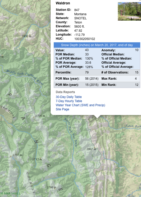
Mar 21, 2017 at 11:43 pm #3458548Nice to see that snow get deeper and deeper :)

Currently 43 inches of snow at 5600′ near the start line and only 10 weeks to go.


-
AuthorPosts
- You must be logged in to reply to this topic.
Forum Posting
A Membership is required to post in the forums. Login or become a member to post in the member forums!
Our Community Posts are Moderated
Backpacking Light community posts are moderated and here to foster helpful and positive discussions about lightweight backpacking. Please be mindful of our values and boundaries and review our Community Guidelines prior to posting.
Get the Newsletter
Gear Research & Discovery Tools
- Browse our curated Gear Shop
- See the latest Gear Deals and Sales
- Our Recommendations
- Search for Gear on Sale with the Gear Finder
- Used Gear Swap
- Member Gear Reviews and BPL Gear Review Articles
- Browse by Gear Type or Brand.


