mapping
- GEAR • Gear Reviews
- GEAR • Market Reports
- GEAR • Gear Guides
- GEAR • Gear Checklists
- GEAR • Make Your Own Gear
- GEAR • Gear Testing & Research
- SKILLS • Tips, Tricks, and Hacks
- SKILLS • Wilderness Skills
- SKILLS • Training
- SKILLS • Trip Planning
- SKILLS • Food Preparation
- PLACES • Trips
- PLACES • Routes
- CULTURE • Essays
- CULTURE • Stories
- CULTURE • Issues
- CULTURE • People
- CULTURE • News
- CULTURE • Media Reviews
- ARCHIVES (Before 30.Nov.2015)
- SEARCH LIBRARY
- TRAILHEADS
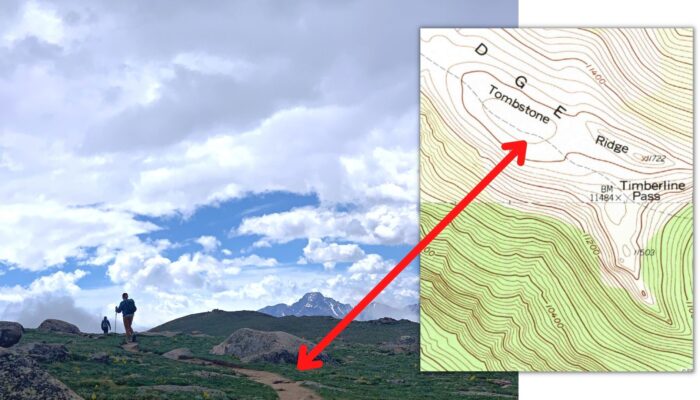
Using lines of position to fix your location on a map
Learn how to identify and use lines of position to help fix your location on a map while traveling in the backcountry.
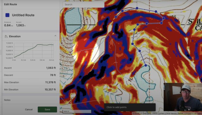
How to Use Gaia GPS Slope Angle Overlays & Satellite Imagery to Plan Off-Trail Routes
In this video, I walk through how I use slope angle overlays and satellite imagery to plan off-trail mountaineering routes, focusing on Gaia GPS as the digital mapping software.

Episode 33 | Digital Route Planning
Andrew and Ryan discuss some digital tools useful for planning your route effectively. Also: An interview with FATMAP founder Misha Gopaul.
advertisementYour privacy is protected: We do not transmit your user data to third-party ad platforms or advertisers, and we do not host third-party tracking pixels. Backpacking Light serves ads on its own custom, native, and internal platform.
 Anniversary SaleMay 15 to 25 - REI's biggest sale of the year.