Managed to avoid bugs, bears, and bushwhacking by taking an early season trip out on the Canadian Shield! The Mantario trail is a rugged 63km trail that straddles the border between – you guessed it – Manitoba and Ontario in Canada. In previous summer trips on the trail, I’d battled ticks (literally dozens hanging on pant legs, crawling up tent walls, etc), mosquitoes (you haven’t seen bug pressure until you’ve walked around a Manitoban swamp), and heat (30° celsius without being able to take breaks in the shade; see aforementioned bugs). By going in early May, the brush hadn’t yet grown in over the trail and the low overnight temperatures took care of the bugs. The absolutely perfect hiking weather made me wonder why more folks weren’t out!
Day 1:
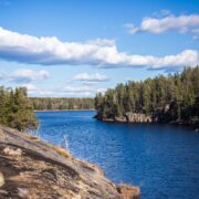
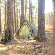
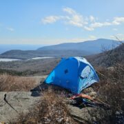
After overnighting in the car at the southern trailhead, I rolled out of bed, grabbed my pack, and munched on an apple while starting out. Watching the sun rise as I walked my through some of my favourite parts of the trail was a highlight for sure. The trail winds its way through lovely woods, over beaver dams, and crosses a couple of railway tracks before getting into the brushy lowlands and open granite slabs that characterize this area. There are no massive elevation gains or losses, but winding up these granite ridges and down and around the wet, forested areas between keeps it interesting! I stopped to cook a big breakfast a couple of hours in, overlooking Caribou Lake. I soon passed the only other group I saw doing the whole trail that weekend, and enjoyed that special kind of peace of mind that comes with knowing that you are the only human around in a vast tract of wilderness. I kept up a good pace as the day wore on, even as the path got rougher and less distinct the farther I got from the trailhead. Rolled up to my destination for the day, Olive Lake, around 4pm – not bad for a 32km day! I set up my slightly wonky MYOG tent for its first night out in the wild, and spent the evening reading, eating, and relaxing. Saw a river otter swim along the bank and enjoyed listening to loon calls as the sun dipped below the horizon.
Day 2:
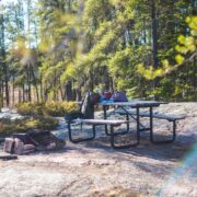
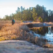
It was another glorious early morning, but this time I dilly-dallied around taking pictures in the semi-frozen marsh just outside of camp for a while before actually taking off. My ankles were feeling a little stiff after navigating all of the rocky, uneven terrain the day before (especially after a winter of being babied in supportive ski boots), but soon warmed up as I followed a familiar pattern of meandering ups and downs. I appreciated the cold nighttime temperatures, as the swampy valleys were much easier to navigate when semi-frozen! I pushed a little farther than I usually would before breakfast to reach the highest viewpoint of the trip, and made a couple of phone calls while my socks dried and my rice cooked. This next section seemed the most remote to me, and I had to work a little harder to stay on track – got turned around once, but managed to correct myself pretty quickly. I enjoyed being well out of society, and didn’t think twice about my unbrushed hair or sloppily applied sunscreen until many kilometres later, when I neared the northern end and got a couple of odd looks from day-hikers. Since my ride wasn’t coming to pick me up until the next morning, I stopped at a lovely spot along Big Whiteshell Lake and set up camp for the night about 5km short of the trailhead. It wasn’t a designated site, so I had to practice my bear hanging skills, and took a good chunk of the night aiming (and missing) throws. Other than that, another tranquil evening watching the waves lap up on the granite shore.
Day 3:
A quick hike out, then ate ramen and stretched at the parking lot while waiting to be picked up! Squished my poor sore toes into climbing shoes for some bouldering in the area with my partner before heading home.







Home › Forums › Early season on the Mantario