Part II: A High Country Romp Amidst Piru’s Peaks
A week or so before the overnighter with my girlfriend, a fellow avid Los Padres hiker and loose acquaintance of mine suggested we team up for a trip sometime. Over a series of subsequent emails, we began to compare notes on our own Los Padres “to do” lists. There were a few hikes and/or destinations that, as of yet, had eluded both of us. One destination in particular, an isolated high peak (by Los Padres standards) way out in the Sespe was high on both of our lists.
It didn’t take much convincing for either of us to decide that a peak bagging, off trail scramble to Cobblestone Mountain and some of its surrounding peaks ought to be the site for our first collaboration. Next thing we knew, we had a date set for what would turn out to be one heck of a day hike!
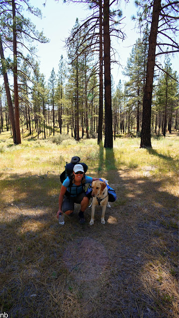
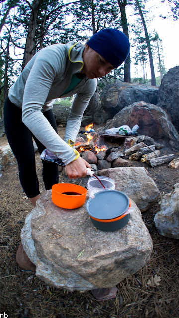
As the Cobblestone hike immediately followed my overnight trip with my girlfriend, it was a bit of a whirlwind Sunday afternoon unpacking from one trip while simultaneously packing for another. Given the off-trail nature of the impending hike, a smaller, tough, climber’s rucksack was deemed the proper tool for the job rather than the typical UL hikers pack. It would turn out to be mostly loaded down with (not quite enough) water and (too much) camera gear. After getting about 4.5 hours of sleep, I was off at 3:30 a.m. to meet up with my partner for the loooong drive to our trailhead.
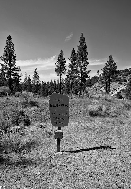
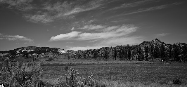
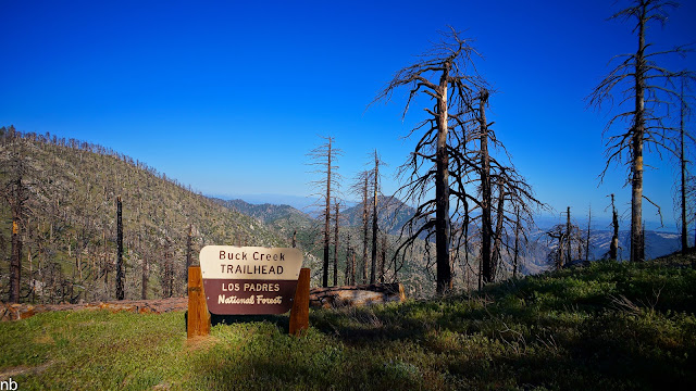
Several hours later, after a long, rough and windy 4wd Forest road, we reached the end of the road and our lonely trailhead. This was a new area of the Forest for both of us and the views enjoyed from up above 6,000’ elevation at the trailhead as the sunrise did its thing was a beautiful sight. Right there from the parking lot, in plain view were our peaks for the day. Looming off to the right, mostly by itself was the day’s principal goal: 6,699’ Cobblestone Mountain. As we slung our packs over our shoulders and headed out, I couldn’t help but feel like we were heading out into an area that sees very little use despite the irony of the unexpectedly well-maintained trailhead sign and handicap parking space at the road’s end.

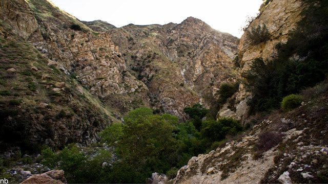
Cobblestone, front and center
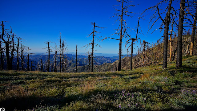
This area wasn’t always so remote and forgotten though… back in the 40s and 50s, a few official hiking and equestrian trails use to cross this landscape, including a couple of different routes up to the top of Cobblestone. By the mid-60s however, those trails had already been abandoned by the FS and left to revert back to the wild. By the 80s, the route to Cobblestone was already taking on a bit of a legend status amongst Los Padres hikers as being a brutal, pain in the a$$ bushwhack and scramble. Things haven’t improved since then… The 2006 Day Fire burned through the area and for a couple of brief years, may have opened up the country a little bit for off-trail travel. However a few healthy years of rainfall and re-growth mixed with unburned swatches of brush and numerous skeletons of trees lost in the fire have subsequently re-consumed the area.
Evidence of the Day Fire abounds. Unfortunately very few new pines are sprouting up to take the place of those lost in the fire.
Our first peak for the day was a simple minor detour off the historic trail to the summit of “Sewart” Mountain (apparently the “t” in Stewart was accidentally dropped decades ago and the new name, Sewart, has stuck ever since). Short sections of tread were visible on the approach to Sewart as we quickly stepped over and around more fallen trees than I experienced on the overnight hike just the two days prior. The official summit is nestled amidst some granite boulders a 100’ or so above the trail. We stopped for a brief moment to check out the summit register (it turned out to be ruined by a combination of year’s worth of fire and rain) and pick our route along the ridgelines for the next portion of the hike.
On the way to Sewart Peak.
A nice stretch of tread atop Sewart. Cobblestone and White Mountain are dead ahead.

Panorama from atop Sewart.

Checking out the trail register… or what’s left of it.
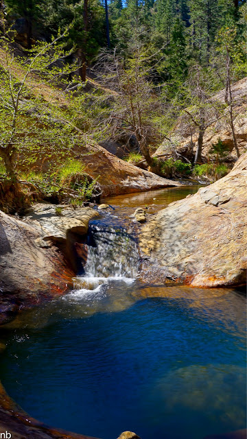
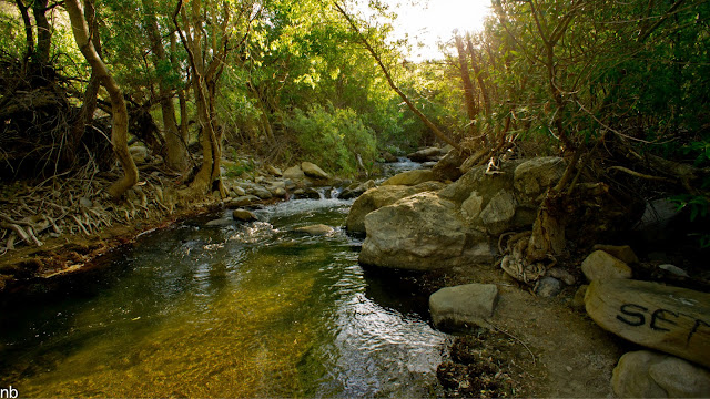
From Sewart, our route took us steadily downhill toward the top of the Buck Creek drainage. Along the upper rim of the canyon, we cached some water in the hollowed out remains of a burned out tree for the hike out. The area has a reputation for being very hot and dry (there are a surprising number of geographic features in the area with “Devil” in their name), so I packed water accordingly: 3.25 liters to take with me on the walk, 2.5 liters for the cache and another 2 liters, frozen, underneath the truck in the shade waiting for me back at the trailhead. Early in the day, the temps were cool and a refreshing steady wind blew along the ridgelines, but by the end of the day, the temps would climb easily into the low 90s and the wind would turn hot and dry. No reliable water sources are to be found in the area without dropping way down into the canyons below. Even then, reliable water is a bit of a gamble.
The view from our water cache, overlooking Buck Creek.
From our cache, we continued our steady descent, climbing over fallen trees, bashing through thick chaparral, getting stabbed by yuccas and trying to dodge the dreaded Poodle Dog bush. Intermittent stops were necessary, when we could actually see out past the immediate brush, to gauge our progress and make sure we’re still headed in the right direction. A few miles in, the route bottomed out where the flank of the Sewart Mountain formation met the start of the White Mountain ridgeline. This point marked the start of our first climb of the day and set the tone for what would come to be a pattern: lose 1500’ of elevation and then gain it back, over and over for 13 miles.
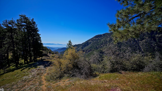
The lower ridge of White Mountain was more of the same thick bushwhacking but somewhere along the way, the brush gave way to a defined ridge covered in (still living!) mature pines and carpeted in grasses and wildflowers. It was a downright sublime setting parked on top of the ridgeline with commanding views. The ridgeline itself, in spring, could be arguably worth the walk.
Serene setting atop the White Mountain ridge.

Walking the ridgeline.
It didn’t last long however, before it was time to leave the clear ridge behind and take the plunge off the south face of White Mountain down a steep and loose 45 degree slope, slipping and sliding our way through more scratchy and poky brush to a small saddle 1,000’ below us which would be our approach to Cobblestone.
The view from the saddle, looking into the headwaters of Agua Blanca Creek.
The ridge we descended from White Mountain to the saddle. Our route pretty much followed an imaginary line straight up and down over DS’s head.

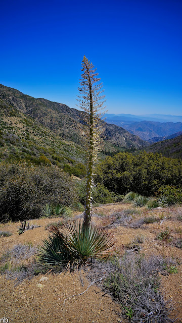
The saddle was dotted with these delicate, small flowering succulents.
From the saddle, there was no discernible route up the 1500’ north face climb of Cobblestone Mountain. Instead, we planned to simply hike straight up the face, detouring around thick brush or rocky faces when necessary.

A Panoramic view of White Mountain from about halfway up Cobblestone.
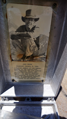
While steep, the climb up to Cobblestone ended up not being quite the epic challenge it looked from afar. It wasn’t long before we were making the final approach to the summit proper where a small clearing was dotted with boulders, one of which had a metal Sierra Club register box on it, like the ones found in the Sierra Nevada. This one was dedicated to early Sierra Club member John Cross.
Summit view.

Peak register exterior.
Peak register interior.

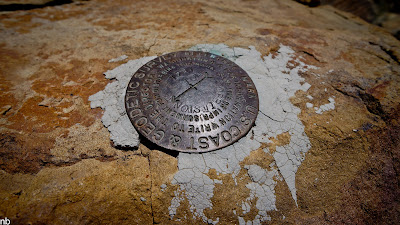
USGS Benchmark.
The views from the top of Cobblestone are impressive to say the least. Santa Cruz Island was visible to the west, off in the distance past the Topatopa mountains that frame Ojai and Santa Paula. To the north, Pine Mountain and the rough location of my previous days’ hike were visible. To the south, the 5 freeway and the various peaks and mountains that make up Angeles National Forest were visible, and to the east, way off in the distance we could just barely make out the peaks of the southern Sierra. Below us, we could see some of the canyons that would feed into our next hike along the Piru that would be coming up in a few days. We spent a while on top of Cobblestone, reading through the past register entries and enjoying the views. Turns out we were the first people to reach the summit of Cobblestone in 2012. Judging by the infrequency of visitors, we might also be the last visitors for 2012!
View toward Malibu and the Santa Monica Mountains.
Reading through the registers is always fun. The highlights of this register included a multi-page “ode to cobblestone” poem and a long entry from a multi-time summiter that ended with a “I heart Cobblestone.”
Having spent enough time on top of the summit, we retraced our route back down to the same saddle. From here we then loosely followed our same route, back up the steep 1000’ face to White Mountain. This loose, brushy and steep climb was made that much harder by the now high afternoon sun beating down on us. It would prove to be, by far, the hardest part of the day’s hike. It was probably also responsible for later troubles to come…
Another view from the saddle before starting the climb back up to White Mountain.
Having made it back to the top of the White Mountain ridgeline, we took a well-deserved rest in a shady grassy spot before continuing out along the ridgeline to the proper summit of White Mountain, another mile or so away. The ridge gently dips up and down, staying mostly within a pleasant park-like setting until the final scratchy and sun-exposed bushwhack climb to the summit. The summit was unremarkable in the most basic sense of the word, just a cramped clearing beat down by the sun and ringed by dead burnt brush. A short break here revealed the makings of trouble… We were a good 4 miles from our water cache and I was down to about ½ L of drinking water left. I run hot on even the coolest of days and this day’s heat was already taking an effect on me. Now the added stress of worrying about running out of water would compound my woes.
The pleasant walk toward the White Mountain Summit.
The view from White Mountain summit back to the start of our hike, just on the other side of the peak in the center of the frame.
I let my partner know that I was having a bit of trouble with the heat and that I was almost out of water. We planned to take it real slow on the hike back and find a pace I could comfortably hold. This worked for a while until we got down to the base of Sewart Mountain before even this was on the verge of no longer being a viable strategy. I was cooked. My limited ability to think clearly at the time, led me to believe that I was dancing around the edges of heat exhaustion, a serious condition that could quickly devolve into even bigger problems. The last two mile climb back to our cache has to be the slowest, most frustrating hike of my life. I had nothing left for energy and precious little water. I’d trudge along for 15 minutes, stop, and rest, curse myself for not bringing more water or for even attempting this hike this late in the year, and then start over. I ran out of water just before making it to our cache. Totally and utterly spent. I scared myself a bit with this one, letting myself get so run down and close to real trouble.
I collapsed into a pile of hot, sweaty, tired limbs on the ground, stripped off clothes and proceeded to chug down a liter and a half of what turned out to be quite hot water without so much as a pause. I chased it with a ¼ liter more of super concentrated Gatorade which seemed to have brought me back to normalcy a bit. After a bit, we got ourselves recomposed and knocked out the last 1.5 miles back to the truck with (for me) newfound energy. All told, we had covered 13 miles of mostly off trail travel with over 6,000’ of elevation gain and the same in elevation loss. A solid day’s work, especially in the heat!
Final farewell view.
Happy to be done and vacillating between some humble pie and a sense of accomplishment, we started in on the long drive back home while laying the groundwork for the final piece of this Piru trifecta which we would tackle a few days down the road.