Software
Cottage Gear Guide: Ultralight Hiking & Backpacking Gear from Small, Startup, and Cottage Brands
Discover the most unique, innovative, and ultralight backpacking gear from small, startup, and cottage brands in our Cottage Gear Guide.
DetailsUltralight, Ultra-Performance Backcountry Electronics (Revised and Updated)
In this updated gear guide, I’ll provide some insight into the backcountry electronics I use, discuss their use cases, and explain why I chose those brands and models.
DetailsFor me: Don’t leave home without it; For you: HYOH w/knowledge
I’m amazed to see the disparity between different reviews of this product. There’s a polar difference between those who want to hike without technology and those who value the functions…
DetailsPublisher’s Gear Guide Update (Nov ’23)
The Publisher’s Gear Guide has been updated. This gear guide contains recommendations in various categories by Backpacking Light Publisher and Founder Ryan Jordan. This is the gear he actually chooses to use on his own trips.
DetailsFar Out Trail Guides (App)
Far Out Guides (formerly Guthook) provide the most comprehensive long-distance trail beta available through their interactive app (both iOS and Android). Get up to date trail conditions, find water and…
DetailsHow to use Gaia GPS to Find Hidden Backcountry Routes
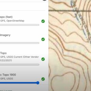
Learn Ryan Jordan’s process for discovering hidden backcountry routes by integrating current base maps, satellite imagery layers, and historical USGS maps.
DetailsHow to Use Gaia GPS Slope Angle Overlays & Satellite Imagery to Plan Off-Trail Routes
In this video, I walk through how I use slope angle overlays and satellite imagery to plan off-trail mountaineering routes, focusing on Gaia GPS as the digital mapping software.
DetailsRoute Planning Tools & Processes (Member Q&A)
Planning a route for wilderness backpacking trips in remote environments can be complicated. In this webinar, learn about route planning tools and processes that simplify planning and help you plan safe, comfortable trips in the backcountry.
DetailsHow to Manage Electronics and Batteries in the Backcountry (Member Q&A)
Considerations for managing backcountry electronics including portable battery packs, batteries in cold temperatures, headlamps, cameras, satellite communicators, fitness watches, smartphones, and more.
DetailsFatmap 3D Mapping Software
We use Fatmap 3D in our online courses and masterclasses when teaching route planning and navigation. It’s fly-through feature is terrific, and it’s much easier to use than Google Earth…
DetailsGaia GPS App
Our pick for the best online trip planning, mapping, and navigation service. It offers a terrific smartphone app that can be used in the field to access maps and track…
DetailsJoin Our Community
Become a Backpacking Light Member
Forum Access
Unrestricted access to all forums, plus the ability to post and start new threads.
Premium Content
Unrestricted access to all 2,300+ articles, gear reviews, skills, stories, and more.
Community Posts
Post new content to the community including gear swaps, reviews, trip reports and more!
Online Education
Get unlimited access to all our online education (*Unlimited membership required).
Pack less. Be more. Become a member today!


