Topic

2015 Bob Marshall Wilderness Open

Viewing 25 posts - 176 through 200 (of 344 total)
Mike M BPL Member
PostedMay 3, 2015 at 7:40 pm

Luke- sorry to hear that; I got nixed out of our Zion Traverse last Spring due to an injury- I know the feeling :(

Derek- I'll let someone else chime in on trail marking, it's been 30 years since I've been in the Bob- then the major drainages were marked pretty well, some of the lesser trails no so good.

Mike

Dan Gregerson BPL Member
PostedMay 3, 2015 at 8:37 pm

Luke: I too am sorry to miss the chance to meet; however, certainly understand the choice and hope to make it to the Packraft Roundup myself, so . . . see you there!

Derek: My experience has been like Mike's; the trails are signed for the most part at major junctions, but not 100% and I really wouldn't want to count on them. I carry a GPS mainly for times when I'm confused about which trail to take at an unsigned junction.

PostedMay 3, 2015 at 8:39 pm

Minor issue with BMWO planning: In regards the meetup at The Hungry Bear for brews; if we're shuttling to the start on Friday, we won't have an automobile. Foot propulsion only and full packs. Any one else camping at Owl Creek TH Friday and going to the Hungry Bear that evening? Secondly, is anyone planning on making possible gear changes at the start of the challenge? Is having a car at the start filled with bits of kit (i.e. snowshoes, powder baskets, extra layers, alternate bag, ice axe, etc) a good tactic for last minute gear swaps or dumps? Or do most of you veterans study Snotel data and weather leading up to start to make final kit choices 2-3 days before… I have this really great strategy to buy Dave, Greg, and Dan as many pitchers as it takes to get their primary, secondary, and secret cross country routes out of them as well as their daily mileage goals, and weather recon. Ha.

PostedMay 4, 2015 at 6:24 am

Regarding trail markings, I mainly want to know if the trails are numbered (like on the Cairn maps), named w/o the numbers, or randomly either-or. For instance, if I see a sign that reads "Big Salmon Creek Trail" and all I see on my map are numbers (i.e. "110"), it would be helpful to know that information ahead of time. I won't be using a GPS, just map & compass. I've probably answered my own question and should create a table on my map, or on a 3×5 card, that lists trails with corresponding names/numbers and other important info.

Greg Gedney BPL Member
PostedMay 4, 2015 at 8:44 am

Usually the tails are marked with the trail number that appears on the Carin Maps and those numbers have (so far) matched the USFS trail maps for the area. Most of the intersections I've come across do have trail numbers posted on signs that are mounted to trees or posts.

Always a good idea to match trail to map however. I suggest you run through your route a few times on Goggle earth so you will know the physical topography of the area for locations where the trail may be lightly used. I recall there were very few signs on the trails that Carin Maps identifies with black and red dots.

PostedMay 4, 2015 at 11:45 am

Chase, I almost always bring a few elective items, even if I don't anticipate they will be needed, just in case conditions change or new information comes to light when I arrive. That might include ice axe, supplemental clothing, and snowshoes. If not needed, I just leave them in the car. The feeling of "I hope I got this right" always accompanies locking the car for the last time. I haven't always gotten it right, btw.

The Hungry Bear is just a few miles from Holland Lake. I'm sure you'll be able to work out a pickup.

Ed Tyanich BPL Member
PostedMay 4, 2015 at 1:30 pm

As Greg wisely stated, be sure the trail matches the map. A number of years ago in the Scapegoat Wilderness there were brand new trail signs attached to a tree at the Lake Mountain junction. One side pointed one direction with the other side pointing the opposite way. It would have been easy to figure out if I actuall needed the sign to determine direction of travel, but if that happened when bone tired and in the dark it could be easy to take an unplanned detour.

Justin Baker BPL Member
PostedMay 4, 2015 at 10:11 pm

Anybody have an idea of what elevation the snow line would be at? We are planning a route and plan on avoiding as much snow as possible.

Mike M BPL Member
PostedMay 5, 2015 at 5:56 am

this might not translate exactly to the Bob, but I hit Casey Peak yesterday in the Elkhorns and was very surprised at the amount of snow above 6000'- it's been very warm (10-15 degrees warmer than average) so the snow was soft as well, not so fun wading in 4-5' of wet, crystal snow

Badger Pass (6900') reports 36" of snow, that's down quite a bit from just two weeks ago

also keep in mind, north and east facing aspects are going to being holding snow significantly longer than south and west facing aspects

PostedMay 5, 2015 at 7:09 am

Another "translation" problem since these peaks are north of the Bob, about 15 miles NW of Swift Reservoir. This is looking at the northish facing slopes of Mts. Pablo (7300 feet) and Baldy (7700 feet) yesterday.

Mts. Pablo and Baldy

David Chenault BPL Member
PostedMay 5, 2015 at 7:28 am

Derek, well used trails are typically signed obviously. More obscure trails are signed less well (think 4" by 8" moss covered sign high on a tree off to the side) and occasionally not at all. The most headscratching moments I've had navigating in the Bob have all been at poorly signed intersections deep in the forest with no ability to visualize larger landmarks. Adding to this confusion, there are plenty of side trails to outfitter camps that are not on the map. Generally these situations shouldn't result in more than 20 minutes of delay, if you're paying attention to your compass and correct quickly when you start down the wrong path.

My wife will be driving me down to the start and returning to Whitefish the next day. Anyone without a car at Owl Creek is welcome to leaves stuff with us and retrieve it later that week.

I'll answer any questions asked and give all the beta I have to give in person on Friday. My policy on not doing the same online is to avoid giving anyone without the proper mental preparation enough false confidence to show up and get themselves in trouble.

My route and gearlist are mostly finalized, I'm just waiting to see what the weather and streamflows will be closer to the day to make final tweaks. I might also make big changes a few days before if I decide I want to go somewhere different, but my route choice is more than anything else driven by wanting to see new stuff rather than speed.

PostedMay 6, 2015 at 11:00 pm

Thank you, Dave.

I too have finalized my gear list and am very much looking forward to studying the topography, weather, temps, and snow-depth/water equivalent over the oncoming weeks.

The average temps in Missoula appear to be cooling a bit this upcoming week, then rising substantially into the mid seventies the week following. I can already see the water-snow eqiv./ depth numbers tapering off a bit then plummeting into the week leading up to the event. It's going to be interesting to see how pushy the "well fed" streams/rivers are going to be…

4 months ago, Alex sent me a message on FB attempting to put together a PacNW team of 2015 BMWO challengers. This was the second time
Alex mentioned The BMWO, I hadn't heard of it prior. There was a ton of interest and right away 4 challengers were all in, including myself. 3 weeks ago two dropped out leaving just Alex and I. Now just weeks away, it feels like it was a lifetime ago when I googled "Who's Bob Marshall??" and discovered that is was he who was primarily responsible for the wilderness preservation movement and the 9 million acre Wilderness Act…I'm honored to a part of this event. Sincerely.

Lastly; the following is a helpful (although extremely comprehensive) resource for foreigners (like myself) to the Magical Land of the Bob. Data includes Trail Encounters probability, campsite encounter probability, # of human impacted sites, etc: http://merid.org/~/media/Files/Projects/FNF/Recreation/Bob%20Marshall%20Wilderness%20Complex%20Limits%20of%20Acceptable%20Change_03-07.pdf

David Chenault BPL Member
PostedMay 7, 2015 at 10:21 am

A brief suggestion on final preparation for everyone:

At this point there is little you can do for your physical state; your fitness will be what it will be at the end of this month. What you can do is mentally prepare yourself for the stress which will ensue. Having your personal life as far in order as is possible, and your cup of quality time with friends and family full to the brim, can make a huge difference. Arriving in Condon Friday night relaxed and worry-free with respect to everything besides navigation, drowning, and being eaten by bears is the way to go.

PostedMay 8, 2015 at 7:17 am

I'm kind of bored of watching the snow melt at Badger Pass using the NRCS Snotel site and need a new fix before the BMWO. What weather resources do you locals use to check out the forecast, and what locations are inputted?

PostedMay 8, 2015 at 9:15 am

Derek,
Your question gave me some inspiration to look for some additional weather and snow condition websites.
I made a somewhat comprehensive search for webcams that could be useful. The only one I could find that is even quasi-useful is the Seeley Lake cam here:
http://cmpmontana.com/Webcams
I seem to end up being disappointed by weather forecasting sites including NOAA. When a site's predictions are off by 10 degrees for a week in a row (yes, it has happened) I jettison that site and move on to something else. Recently I have been using Wunderground.com/wundermap and have been reasonably pleased. Most of their stations are located in civilized areas, not in the mountains.
There is one nice gem on Wundermap, the "Augusta" site which lies at about 5300 feet almost due east of Holland Lake. It gives current conditions and forecasts. I would not have discovered this without a little push by you. Thanks!

PostedMay 8, 2015 at 5:49 pm

Oh,boy. Another long entry.

MY PLAN
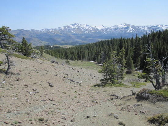
I have been pondering my approach to the BMWO. In order to make the transportation issue easier and to have my car in the proper position if I should chicken out (water crossings would be my bugaboo) I have decided to do an abbreviated course which will consist of Holland Lake>Pendant>So. Fork Flathead River>Gordon Creek>Gordon Pass>Holland Lake. I plotted several routes from Holland to Swift (including one that was about 133 miles–yikes!) and have not yet figured the mileage for my short version but it is probably about 60 miles and I may find some attractive side trips, too. This should equate to three nights, maybe two if I am feeling my oats.

Historically 12 to 13 miles is a long day of backpacking for me; I'm a recreational/social backpacker more than I am an adventurer. Even though I am not racing I realized I needed to step it up a notch or two so I have been doing some additional exercises and preparation this winter and spring; the benefits have been obvious, XC skiing and hiking have been much easier, I am not wiped out at the end of the day. I should be ready for several 20 mile days.

Perhaps, after having had a taste of it, I will want to tackle the entire course next year.

INVITATION #1
If anybody wants to join me I would like the company. Otherwise I am comfortable going solo, having gone for as many as 4 days solo once before. My style is as follows. My pack weight will be ~26 pounds including snowshoes (maybe not needed?) and packraft/gear. The raft would be used for easy crossings only (if any exist), not for cruising downstream (I am not particularly watercraft-competent). I will be eating hot food twice a day and will not be night hiking.

INVITATION #2
I would be happy to provide transportation to/from the Glacier Park Airport or Amtrak, etc. to any participant. I could even offer housing to a couple of hikers but you would be stuck with my last minute trail head arrival on the 23rd unless you make other transportation plans. If I get out of the woods and back home to a phone by the time you reach Swift I would be happy to respond to your call, drive over (about 4 hours), and provide additional transportation. PM me for my phone number.

THAT'S IT!
I will see everyone at the trail head about 7:30 am on kick-off day. Driving time from my house to Holland Lake is about 1 3/4 hours. I will sadly miss the Friday night dinner and the benefit of David's knowledge dump. (:

Dan Gregerson BPL Member
PostedMay 9, 2015 at 7:24 pm

As Dave mentioned wa-a-ay back on page one of this lengthy thread, it's unknown whether that would be available. I would be very surprised if a strong enough signal was available. Still, the country opens wide to the east from there, so… maybe; but it would be a long shot (no pun intended) and only if you have Verizon.

Mike M BPL Member
PostedMay 9, 2015 at 7:27 pm

hopefully someone can chime in for sure, but if I was a betting man- I'd say no

I picked up some useful info on iphone battery conservation on our site this week and also tweaking Gaia GPS settings, hoping to squeeze 3 days out of my phone for pics and GPS- I also picked up a Black Diamond Ember flashlight which is an adjustable lumen-5-150, but doubles as a charger w/ 2600 mAhours- which should give me close to a full charge for the phone if needed

ran a 35k race today (w/ a bout 5300' of gain), missed a sub 4 hour finish by just a few minutes :( then my wife accidently took my handheld after the race which also happened to have my truck keys, so got 4 additional "bonus" miles in!

Justin Baker BPL Member
PostedMay 9, 2015 at 8:08 pm

Ok, good to know.

How is the fishing in the area? I am planning on bringing my tenkara. Total newb with the tenkara and fly fishing in general, I have always used a spinning reel.

Also, are there any good wild edibles to look out for this time of year? You can usually find fiddleheads this time of year in the sierras.

PostedMay 10, 2015 at 1:46 pm

I'm bring a Spot Messenger to the BMWO so that the guy who's coming with me on this trip can have an idea on my status for pick-up and so that family and friends can track me from afar. While on a walk yesterday, I contemplated what phrases I should use for the two custom messages I can pre-program into the Spot before my journey across The Bob. Here's the short-list:

Check-in/OK

1) I'm going to take a break here.
2) Don't worry, I'm not dead yet. I'm just taking a break.
3) Going to sleep for a bit.
4) The weather has turned for the worse. I'm going to hunker down here until the storm passes.
5) I'm lost, out of food and need some sleep. If you don't hear from me again, I love you.

Custom Message

1) I see a dangerous animal. I think I'll take a photo.
2) This is going to take much longer than anticipated.
3) My shoes melted in a campfire last night.
4) I wish I could see where I am like you can, because I have no clue where that is right now.
5) I think I'm being followed.

This was meant to be semi-humorous, but if you're bring a Spot, what messages do you plan to use?

David Chenault BPL Member
PostedMay 10, 2015 at 5:36 pm

90% certain there is no service at Swift Reservoir. Service is very poor at Owl Creek as well.

Ordinarily the fishing in the Bob is exceptional, but high and murky water usually makes it more difficult in May.

Mike M BPL Member
PostedMay 10, 2015 at 7:14 pm

I'll probably have my OK message as "made it to camp, everything OK"

thinking about my custom message as "we're changing plans-check track", hopefully with the location and tracking they can figure out what we're doing- changing up routes, bailing, etc

the lakes if ice free would be a good bet; ice off the fishing can be really productive as they are coming off a long winter and are wanting to feed- agree w/ Dave that the streams are going to be rolling a little too much for good fishing, but you never know

Viewing 25 posts - 176 through 200 (of 344 total)
Loading...