Sounds like a remarkable experience- I appreciate the reports. I recently subscribed to Dan Durston's blog and was found his report of the experience particularly insightful. I doubt there's much like it in my native Southeast US but it'd be awesome to meet such like minded individuals.
Topic
2015 Bob Marshall Wilderness Open
Become a member to post in the forums.
- This topic has 343 replies, 28 voices, and was last updated 10 years, 5 months ago by
 .
.
Sorry guys I've been a little backed up since I got back, I should have a trip report written in the next day or so. Nice work on the write-up's. Dan, sounds like a grand time! I recall the chutes in the lower SF well, scary stuff.
Way to grind it out Alex and Chase, there's always a special prize for DFL. Look forward to the video.
Big Prairie is the hub of all science and trail maintenance in the South Fork drainage. It usually goes live in early May, and at first is supplied via pack trains from the N Fork Blackfoot TH, as unlike the route in from Meadow Creek there are no potentially severe creek crossings.
Good job everyone, thanks for coming, and see you next year.
I just want to offer my congratulations to each and every one of you for your epic efforts to cross the Bob this year. The trip reports and photos the past several years have given me great insight into the various corners of that vast wilderness. I grew up right next to it in Choteau, but I have only seen a small portion of its interior. We did a few horse pack trips on the east side when I was a kid. Then I spent an entire summer living at the Headquarters Creek campsite near the Gates Park pack bridge, doing extensive trail building. But all I know about is the Route Creek and Hdq. Cr. Passes, Beartop Lookout, Gates Park, etc. (and every inch of the trail from Headquarters Cr. to Route Cr., which we rebuilt). You've shown me much of the rest via your various trip reports, which I appreciate.
This year's event was the best one yet, with so many extremely capable hikers facing such challenging conditions. Thanks to you all for sharing your adventures with the rest of us.
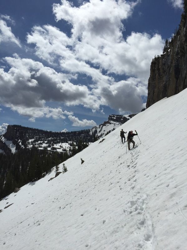
The start of the BMWO was intimidating.
Once the first couple of miles were under our belts the nerves calmed down a bit.
The hike to Gordon Pass was pretty good going; we hit the pass at 11 am and were relieved when we saw the southern exposure was almost completely bare.

Gordon Pass

Conner in good spirits.
Gordon Creek has some awesome packrafting potential!

Gordon Creek

Big bears going one way little bears going the other.
We only saw three black bears in Gordon Creek and didn't see another bear the whole trip.
We saw a ridiculous amount of Griz sign but never came face to face with one.
Ate dinner at Big Prairie and talked to the nice old early season care taker.
He told us we had a long way to go.

Big Prairie
Pushed on a couple more hours until dark and camped out in White River Park.
A nice day in the White River Valley.

White River Valley
Needle Falls was pumping!

Needle Falls
We pushed on up the White and had to get over Larch Hill before dark.

Beautiful on the way up to Larch Hill

Chinese Wall as the sun started to go down.
The traverse over to Spotted Bear Pass was pretty snowy but not too difficult, the trail was blazed by the ever elusive and speedy Chenault.
We pushed on into the dark and crashed at Rock Creek Cabin, that was a cold and damp night.
At this point our camera/gps battery was low so the pictures were on hold until the last day.
We cruised down to Gates Park and headed up the North Fork of the Sun.
It was pretty intense crossing the North Fork of the Sun and Lick Creek, they were pumping and about waist deep.
We were tired and starting to feel it in our feet and legs. But we needed to get over Sun River Pass if we had a chance of finishing in our 4 day goal.
We got over the pass, right before dark, thankful there wasn't any snow and crashed about a mile down Bowl Creek in a little meadow.
Woke up at 5 and took off determined to finish on Tuesday.
Bowl Creek and Strawberry Creek were pretty straight forward. We were slowed down by tons of blow down but the thought of finishing helped us hustle through it.
We turned up Gateway Creek and went through the gorge.
Gateway Gorge was awesome and has a very fitting name.

Gateway Gorge

Looking back down Gateway Creek
Up and over Gateway Pass. Mucky and snowy.
Headed down the S. F. Birch Creek.

I love going to the east side, its so beautiful!
We were beat up and tired at this point but determined to finish before dark.
The trail was muddy, rocky, and beat up by pack strings.
S. F. Birch Creek looked pretty good to float for the most part. There were a few sketchy looking rapids and some big gorge/ waterfalls, but they could be portaged.

Birch Creek
Next time packrafting for sure.
Crossing the main Birch Creek twice was icing on the cake.
Then the last 4 miles on solid rock around Swift was really rough on the old ankles and feet.
There were massive black clouds heading our way so we hustled to the truck and got there just as it started hailing.
Happy to be finished we sat in the truck and laughed as it stormed like crazy.
We headed to Browning ate junk food and drank pop. Then we headed back to Bigfork.
Crossing the Bob in 4 days wasn't something I ever thought I could do.
It was an amazing experience.
Next year… better shape… better gear.
-Nick
Nick (and Conner)- congratulations on a great finish and thanks for the trip report! We were very glad we didn't push it through the night and miss the sights on the east side (not to mention how tough the trail conditions were down a ways SF Birch Ck!)
We also discussed the potential for rafting on Gordon Ck, a little wood here and there, but for the most part looked like a real time saver.
Hope to see you there next year :)
Mike
Great report and photos Nick. We need to get the Flathead BPLers together at a brewery some night.
It's always fun to find out in retrospect how close everyone ends up being at various points. Impressed you guys used the Lick Creek ford, that's a tough one. In 2013 I boated across that spot. Was the trail between Gates and the Sun cut out?
It was really great to meet all of you this year and to spend a little time on the trails together. Chase, Alex, Mike and Derek I enjoyed talking means and methods with each of you over the spring. I'm looking forward to next year.
https://docs.google.com/document/d/1rPJDrnnKrpNvkJiR6_txKiI6el89XxAdzRK1PHZYfb4/edit?usp=sharing
Two more awesome trip reports. And Greg's end nicely with the simple question, "Bob5 anyone?"
Greg, I think you may have been standing in my footprints when you took the photo of Big Salmon Lake.
Bob5? Absolutely! I'm already creating a list of things I need to train on to get ready for the next edition. If water crossings and/or packrafting is all I train on, I should be ok.
I also saw my first sandhill crane on this trip.

The trail between Gates and the Sun was not cut out. There was a fair amount of blowdown, not as bad as Strawberry though.
Beers… Anytime, anywhere!
It was fun to read through all of your accounts. Sounds like I missed out on some nasty weather in there.
Dan, I was impressed to hear you felt normal again after a couple days. My ankle tendons are finally not bothering me. That V8 bottle looked pretty nasty.
I'll be heading back into the Bob and/or Missions several more times this year along with the usual trips in the home range around Bozeman. Feel free to PM me if any of you BMWOers find yourself in my neck of the woods and looking for someone to adventure with.
Greg- I enjoyed very much reading your report- you have a wonderful writing flare!
Was sorry to hear you had to hang it up; I'm sure you'll be more than good to go next year :)
Mike
Tanner: I think hiking the PCT last summer helped my connective tissues. After 2012 I was sore for weeks.
Greg: Great job on the trip report. I super enjoyed it.
What a trip!!
In 2012 a friend Ed T. told me about the BMO. I decided that would be right up my alley. I ended up unable to participate for reasons I can't remember now (life responsibilities)?? This was my year to check the BMO off my to do list. In 2012 I was intending to do it solo. This year I thought it would be nice to find a partner for safety and good company. Finding /selecting a partner was hard for me. I had to find someone that had the same goals and similar physical ability. Then Micah walked into the Outdoor Store I work at. I didn't know Micah well, but I could tell he was the quite tough guy type. I put a bug in his ear about the BMO. Three weeks later he was all in.
Goals:
.Holland Lake to Swift Reservoir in 48 hours
.Run/trot flats and downhill
.Climb Pagoda and Switchback Passes for the views
.Get me in shape for the Bighorn 100 race
Day 1
Day one goal was to cover 50-60 miles then camp. To do this we needed to make it over Pagoda Pass before dark, so we could do some night travel. We ended up at the base of Pagoda at dark, and we were in bed by 10pm. Not making the pass before dark mentally crushed me. I knew 48 hours was virtually impossible now. 40 Miles down.
Down
Day2
Day two had to be a huge day/night to make 48 hrs. Pagoda, Larchhill and Switchback passes needed climbing before dark. The Pagoda Pass climb was a great way to start the morning. I felt inspired and re-energized. I could tell Micah felt the same energy. Larchhill was next I don't remember much about this hill, but I do remember the four miles down the East Fork of Wall Creek. It took four hours of bushwack with snowshoes to cover those miles. UGG! Once again we arrived at the base of a pass at dark, so we camped at the base of Switchback. Only 27 miles on the day.

Day 3
Goal for day 3 was to get her done! Switchback pass was a hoot! Lots of snow travel and we didn't even have to use the snowshoes. We had somebodies foot tracks that we kept crossing/following, which added some comfort to our navigation. Around Dean Lake the tracks went down into a drainage, but the trail was supposed to stay high along this steep snow packed slope. We elected to stay on the slope since it was a more direct route. I was kicking steps across and about half way I was wishing we would have dropped down, but too late now. After traversing the long slope we intersected kicked in steps going straight up the slope, that we followed to the top of the ridge. We hoped nobody would use our sketch rought, and use the lower rought. The rest of our journey to Goosberry, Sabido then Gatewaypass went smoothly. When we arrived at Swift Reservoir we elected to take the trail on the NW side of Reservoir which was a bad idea. It had two very large climbs and a NF Birch Creek crossing that we didn't expect. Once we hit the gravel road we thought we had it made. We had a challenging time finding where to cross the dam and finding the campground in the dark. Thank goodness our ride out decided to camp another night and wait for us. Another night in a damp bivi and a bag a granola was not on our agenda. 38 miles for the day, 105 miles total in 62.5 hours.
Conclusion
Trip of a lifetime! We didn't make our time goal but we got lots of sleep and the journey was way more relaxed than I expected. We had tons of fun!
Thanks Dave
Les and Micah from Helena
Les and Micah


Les and Micha- great job! We shared some of the same challenging route (including some angst in Wall Ck!), we (well me anyways :) ) too wished we had dropped down below Dean Lake and then up.
We'll have to get the Helena guys together one of these evenings to swap stories and drink a beer.
Les and Micah,
It appears that all of us who went via Big Salmon Lake took a photo at the same location on the eastern shore of the lake looking west.
I think you guys running uphill to Upper Holland caused Dan to have a sleepless first night as he likely laid in his tent contemplating the average speed of a packraft + walking vs. hardcore trail runners charging through the wilderness.
I have a nice photo of you guys from the far side of the Black Bear pack bridge. I blew up the photo and noticed some kind of ointment Micah was applying to his legs. I may get a forensic specialist to analyze the photo and determine if it was some sort of steroid cream from BALCO.
Great job out there!
Derek
Great job Les. Good luck at Bighorn!
Les – loved the trip report! For some reason I thought there was 3 in your group that started running a little ways up the Owl Creek trail. I guess I didn't remember correctly, but was sure impressed to see you guys jogging up towards Upper Holland with 90+ miles to go! I kept hoping to cross paths with you guys but I think some lucky route finding kept me ahead.
A couple groups had trouble in Wall Creek and the Dean Lake area so I thought I would share how I was fortunate enough to get through without too much delay. USGS Topo maps have the trail wrong in both of these places. I am impressed with the Cairn map, as it has a better representation. I hadn't been in Wall Creek before, but did verify using GE before the trip that the trail would be where Cairn had it located. The red line below shows about where the trail is vs USGS (the GPS I used was GAIA on my iPhone and uses the incorrect USGS topo).

I've been to Dean Lake before (profile picture) but I think what helped me here is a bunch of time spent backcountry skiing where the trail location is irrelevant, and being super cautious and conservative on snow. Especially around/above some of those cliffs near Dean Lake! I knew I would be on snow until the switchbacks heading down Clack Creek, so I dropped down from the pass and stayed on low angle snow as much as possible before a relatively low angle ascent to the bench that holds Dean Lake. Incidentally, this is more or less where the trail is despite what USGS maps show:

For reference, here are some times I took from camera pics:
Wall Creek Pass: 10:02am
Spotted Bear River: 12:45pm
Switchback Pass: 4:45pm
Clack Creek switchbacks: 7:19pm
I'm by no means an expert navigator. I just wanted to give some more info on the places that seemed to cause some grief.
Nice work Les/Micah!
Tanner,
Ya we did start with 3. We had to exercise our Swift Res. pickup person for a few miles then he turned back to Holland. Sorry to get all of you excited when we started trotting. We did very little trotting the 2nd and 3rd day, our 25lb packs beat the Blank out of us. I figured we would start running and end walking any way.
I think you got around us when we camped at the base of Pagoda Pass. When we hit the White river trail heading to Wall creek we were following your tracks, I guess. I thought I would see more tracks than just yours! Pagoda took a while. I saw your tracks going down Wall Creek, we should have followed, but my GPS robot told me you did't know where you were going. So we followed the robot. (bad robot)
Later,
Les
Great details and good beta to be found here. The Cairn maps are pretty good, but the old FS data is just dodgy. Plenty of trails on that map which don't exist anymore.
Les, I snuck ahead of you guys in the White as well. I kept expecting to see more tracks, but followed only Tanner until the turnoff up to Larch Hill.
Howdy, Dave
That's right we did see your tracks turn right up Larch Hill. I wonder where we got around you at?? Can't believe we didn't see you on Spotted Bear or Pentagon area. Big country man!
Thanks Dave
In Wall Ck we ended up on the right trail, but talked ourselves right out of it due to the GPS- mistake
At Dean Lake we should have definitely dropped down to the bench and then ascended into Dean Lake
definitely a mistake :)
Les, I went east to Gates park, and then further east into the Teton drainage. Had I pushed on Monday night rather than making camp (in Phone Creek) at 8pm I probably would have finished a little after when you guys did.
The larger Larch Hill area has been the source of navigational confusion every year the Open has caused people to traverse it. I was paying particular attention, and while I didn't nail the trail over to My Lake, was close enough for satisfaction. Those are the moments which really make the difference.
I almost didn't do a "report" this year, as there is a lot to cover and such things are always reductive, but in the end there were so many near misses that I wanted to illustrate just how close many of us were to running into each other. And yet after Big Prairie no one did.
http://bedrockandparadox.com/2015/06/10/the-2015-bob-marshall-wilderness-open-report/
Let me know if I got any details wrong, please.
Become a member to post in the forums.
advertisementYour privacy is protected: We do not transmit your user data to third-party ad platforms or advertisers, and we do not host third-party tracking pixels. Backpacking Light serves ads on its own custom, native, and internal platform.
 Carbon Fiber Power Bank20,000 mAh power bank with a lightweight carbon-fiber shell.