A Link: Complete Guide to the Wind River High Route
http://www.adventurealan.com/WRHR/index.htm
Wind River High Route – A Guide
by Alan Dixon and Don Wilson
The Wind River High Route is in our opinion, mile for mile, the finest non-technical Alpine route in North America. It stays close to the crest of the Continental Divide in one of the most rugged and glaciated mountain ranges in the lower 48. The route is thrilling and the scenery spectacular.
Overview of the Wind River High Route
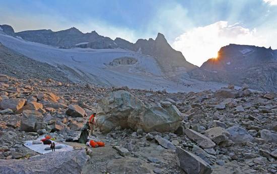
The Wind River High Route (WRHR) is similar in concept to the Sierra High Route (SHR) but Don and I feel that the WRHR is more spectacular and thrilling. Just as the SHR loosely follows the famous John Muir Trail (JMT) but spends much of its time off-trail, more closely following the Sierra crest, the WRHR in a comparable manner loosely follows the Highline Trail, many times going off-trail to stay higher and closer to the Continental Divide—a more elegant line in high glaciated terrain. When the WRHR uses trails they are higher trails, closer to the crest. It is a more challenging and more rewarding route than the Highline Trail.
The WRHR starts in the north at the Green River Lakes Trailhead and the headwaters of the Green River. It heads generally southeast to follow the Continental Divide, crossing it four times. After passing through the legendary Cirque of the Towers, it ends at the Big Sandy Trailhead. The WRHR is approximately 80 miles of off-trail and on-trail travel with about 20,000 feet of cumulative elevation gain. There are nine passes between 12,200 ft and 11,500 ft—six off-trail and three on-trail. Some of the off-trail passes have a fair amount of talus. There are few short sections of Class 3/4 travel and one glacier crossing. The recomended hiking season is late summer. This gives time for the high snowfields to melt out and reduces mosquito pressure. By mid September their is a decent chance of snow.
Our Criteria for Planning the Wind River High Route
- An elegant line closely following the crest of the Continental Divide along the finest section of the Wind River Range.
- A fit hiker should be able to do the route in seven hiking
days (we did it in 5½ days). This allows busy people to fit it into
a standard “one-week” vacation including travel days (two weekends
and the five weekdays in between = 9 days total). - A non-technical hiking route. No class 5 terrain. Short sections of class 3/4 terrain ok. Don and Alan did the trip in trail running shoes and trekking poles. [Late season only. Early season snow would significantly change the technical nature of the trip.]
- Route stays high but without being inefficient, or taking unnecessary risks to force a higher line.
- Uses convenient trail heads with an easy shuttle.
Resources for the Wind River High Route
- Text Only Version of Route Description (6) 8.5×11 pages [PDF]
- Full Mapset – (9) 11×17 pages [PDF
- Waypoints and Hiking Timetable [PDF]
- Shuttle Info
- Gear Lists [PDF]
- Other Published References (books, maps, etc.
- Potential Additions to the Route

