Jay, where is Finger Col???
Topic
JMT-
Become a member to post in the forums.
- This topic is empty.
Hey Ken the Finger Col is not exactly on the JMT–It is north of Kings Canyon, Finger Peak 12,404ft down to Enchanted Gorge. I did a big loop (80 miles) a few years back to Tehipite Valley- very Remote, only rattlesnakes and Indian petroglyphs and the Necros.
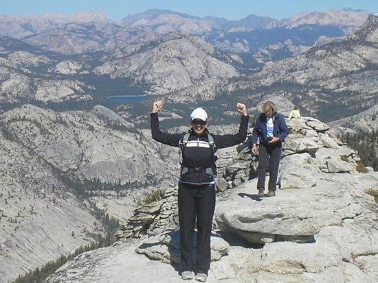
On top of Clouds Rest..
I finally figured out how to make my old Polaroid SprintScan 35 Plus work under XP – now I can go back and scan my old Muir stuff. Just started with the first two days of my '90 JMT 10-day hike – Ultralight before it was cool :-)
I'll post some stuff here in increments as it goes through the scanner, with a whole gallery at my server, too.
from my 1990 hike – I am going to scan all images worth scanning and add them to this gallery as I make progress:
I’m still messing with this gallery software, but it’s pretty slick and I’m sure I can figure out how to make the menu work in a way that the images will play sequentially if you don’t want to navigate at all, but for now this will do.
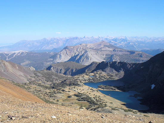
Sample shot from the first day of the hike, which was taken about 90 minutes after a pretty strong T-storm that caught us on Parker Pass. Our Route that year started at Mono Pass Trailhead just below Tioga Pass. The photo below was taken late that day south of Koip Peak pass, looking into the direction of Mammoth Mountain.

The hike was pretty fast that year (driven by the constant threat of bad weather for most of the trip), and it was pretty lightweight for the period (if you see our packs, you have to remember the ground pads were regular closed cell pads inside the packs, making them appear stuffed).
I’ll post more samples here on the forum as I keep adding slides to the above gallery.
When I’m through with the 1990 stuff, I’ll takle the slides from another year on the JMT.
August 15, 2007
I'll be back up there in late June this summer. We'll do a side trip to the B24 plane wreck west of the pass, too.
man, been a loong time…
was last there on a boy scout 50 miler – maybe 1978 or 1979
we camped on that peninsula between the lakes
horrible, horrible winds that day – coming up koip peak pass some of the gusts knocked kids over, maybe gusting up to 80mph
dad still caught a few golden trout for dinner – i tried for a bit, but the bitter cold wind discouraged me back to camp, where everyone else was hunkered down
That pass is prone to windy conditions, I think. In 1991 or 1992 I was there on a solo JMT on the same route, and I recall having to camp north of the pass due to stormy conditions. At night I had to support the tent poles frequently, as the gusts pushed them down into my face. The old 1988 model Meteor Light tent held up, though.
Next morning, I went over the pass, wearing all my gear and looking a lot like in that avatar on the left, except with hood fully closed, gloves, etc – all that in late June. By the time I got to Reds Meadows later that day, it was snowing hard all the way down to the valley floor.
got day 2 and day 3 of the 1990 trip done; day 4 is almost complete, too.
From Day 3 – heading south from Reds Meadows towards Fish Creek along the river, bypassing the JMT again in an area that now looks very different after the Rainbow fires. I prefer this route quite a bit over the regular JMT, even though it lost quite a bit of its attraction after the fire. Last summer this trail was poorly maintained and overgrown in the burn zone. Once we got out to the open granit slab area, though, it was just as great as back in 1990

On Day 4 of the hike we started near Marsh Lake, heading towards Goodale Pass following the valley west of Fish Creek. After days of storms, the ground was saturated with moisture and the warm sun on this eastern exposed valley made for some great atmosphere, plus, we were completely alone for the entire day again


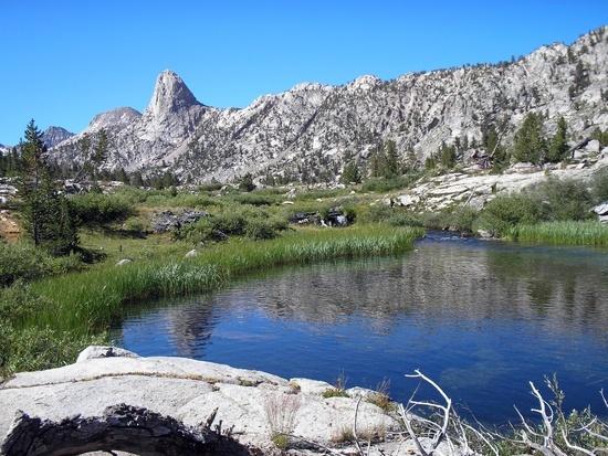
seen from Marie Lakes – Selden Pass is the notch in the middle

Big clouds building early

the dark clouds above Muir Pass were gone by 8pm – we found a ledge in the narrow upper Le Conte Canyon to pitch the tent. No tree to hang food – didn't sleep well but no bears. Bear canisters are a great invention when it comes to sleeping well in places like this

Not how you want to see these mountains while you are heading higher up the trail. This is somehwere before you get to Wanda Lake north of Muir Pass

Saw this in the woods south of Reds Meadows in 1990, in the area where years later the Rainbow Fire destroyed everything. If I remember correctly it was something like a mushroom, but I'm not sure. It definitely wasn't a flower.
It was pretty big as the boot on the left shows, and it grew in a very dark place.

did a little digging – and found it! "Calvatia sculpta"
From Bighorn Plateau after sunset

Near the Taboose Pass intersection between Mather and Pinchot passes

Sierra Wave at sunset, from Palisade Lakes towards Middle Palisade, July 1990


on the pass just north of Iva Bell Hot Springs in Fish Valley, JMT alternate route, July 2008


from the JMT on Bighorn Plateau, 1990

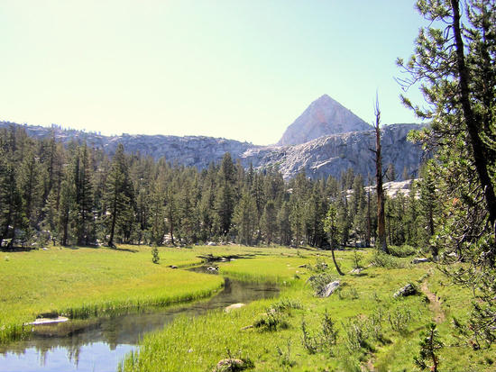
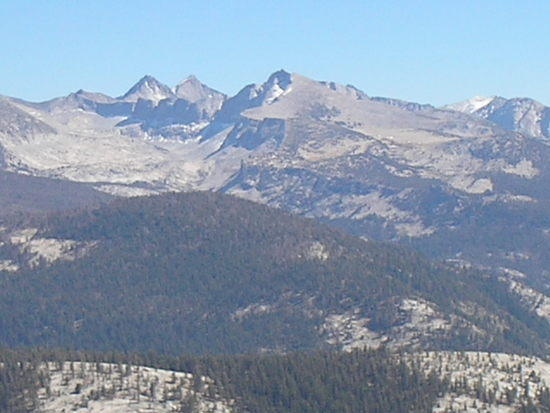
Seen from the summit of Clouds Rest, one of my favorite alternate routes on the JMT (this adds very little distance over a rather bland forest route below).

Rae Lakes
Evolution
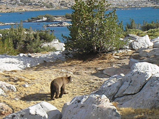
Yogi visits our camp.
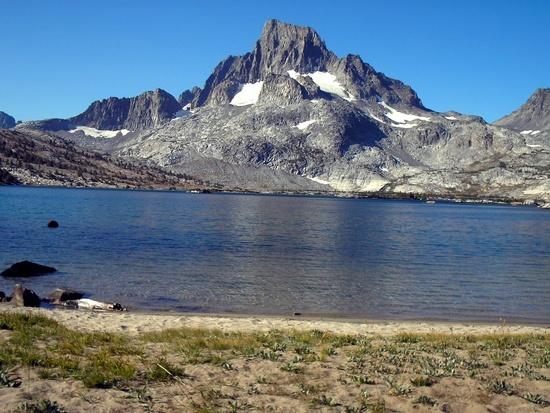
Beach front property!!
-Jay w/ Crown Royal
Become a member to post in the forums.
advertisementYour privacy is protected: We do not transmit your user data to third-party ad platforms or advertisers, and we do not host third-party tracking pixels. Backpacking Light serves ads on its own custom, native, and internal platform.
 Titanium Pot GrabberUltralight titanium pot grabber weighing just 4.5 grams.