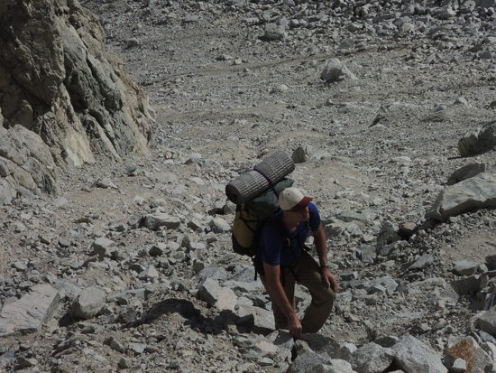
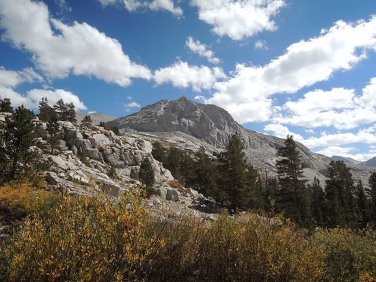
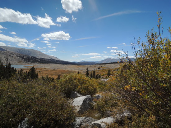
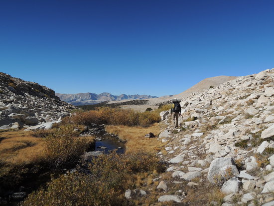
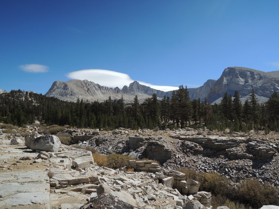
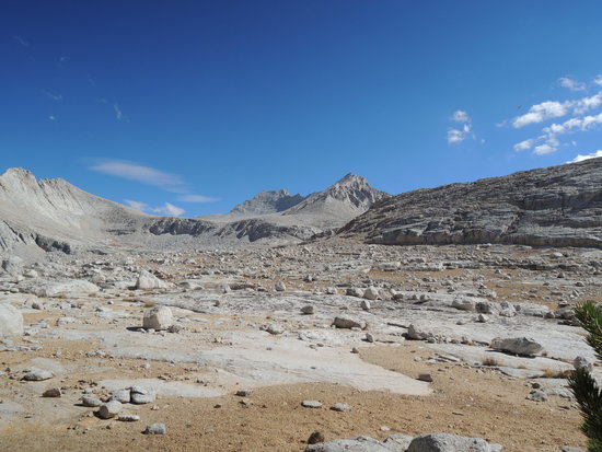
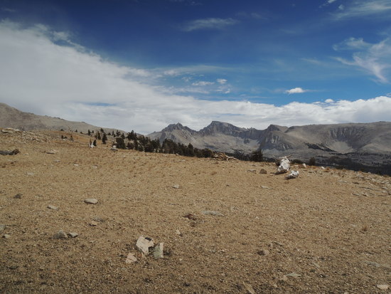
After a getting off to a great start, with 2 quality trips into Upper Kern Basin and Vidette Lakes-Center Basin, I watched with dismay as my next two planned trips to the Middle and South Forks Kings River drainages went up in smoke along with 143,000 acres of the Sierra National Forest, due to the Rough Fire. However, the topography of the Kern Basin further south held out hope for an alternative hike to Wright Lakes and Wallace Lake Basins, located just beneath the Whitney Crest. After monitoring the satellite smoke map of the Rough Fire for 3 weeks, it became apparent that the lofty barrier of peaks exceeding 13,000' that form the Great Western and Kings-Kern Divides was effectively blocking the smoke generated by the fire from drifting into the Kern Basin. I was initially reluctant to schedule a trip over rugged Shepherd Pass. It would be my second of the season, and I am at a point in life where the physical cost is forcing me to evaluate the concommitent rewards very carefully; but the destinations were among the most beautiful in the Sierra, my partner, Fred, had never visited them, and I had not been there in a while, so we swallowed our trepidation about the slog ahead of us and decided to go for it. Day 1 Anvil Camp Fred had reservations about taking his rental car over the rough road that makes up the final couple of miles to the hikers trailhead, so we parked at the horse packers corral and hiked from there. It added over a mile and ~600 feet of elevation gain to the hike, but it was his call and I could not fault him for being conservative. The tradeoff was that the slog up to Anvil Camp at 10,300' became even more arduous than usual, at 10 miles with 4900' of elevation gain. We were both ready to call it quits by the time we got there, even though it meant spending the night in an increasingly unattractive area instead of moving on up to our traditional bivy site about 300' above The Pothole, a mile or so further up the trail. Anvil Camp suffers grievously from the effects of an increasing number of irresponsible hikers, who feel free to litter at will and build large, unsightly, and highly illegal fires in a forested area that is tinder dry. It is a sad commentary on the sharp decline in hiking ethics that is becoming increasingly evident in recent years. I didn't bother to take pictures the first day this time, so I have included a few from previous trips to give the reader a feel for the lower section of the Shepherd Pass trail, up to Anvil Camp. 


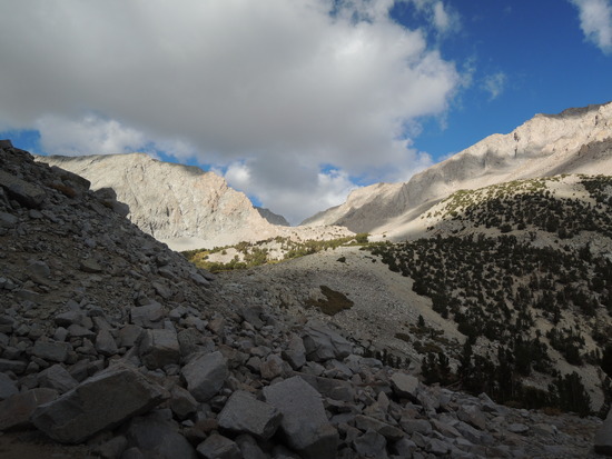
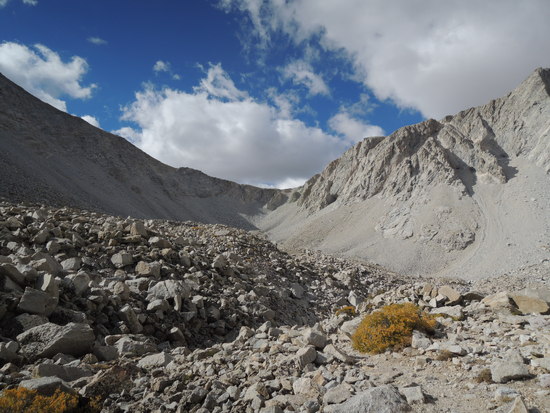
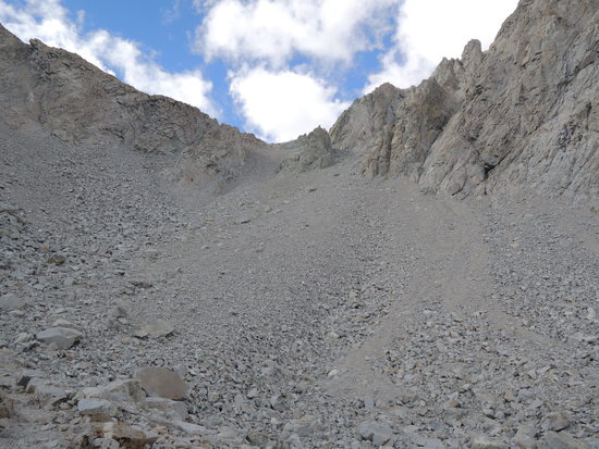
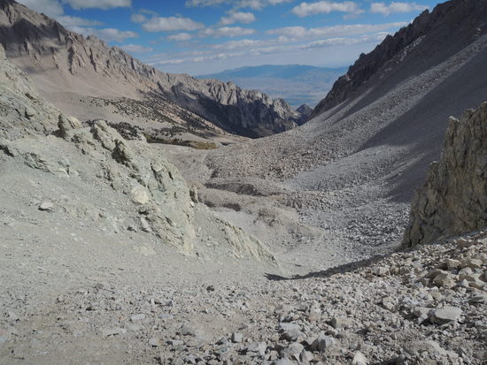
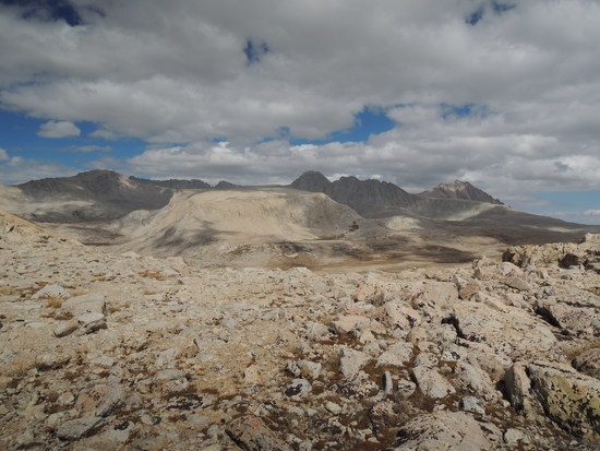
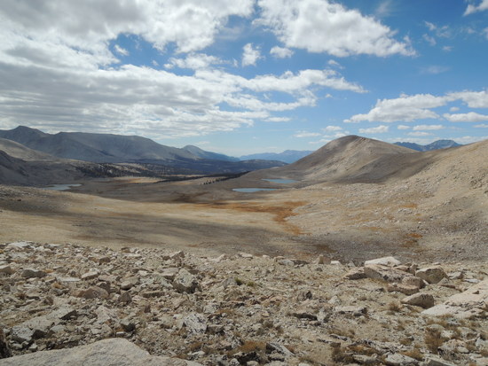
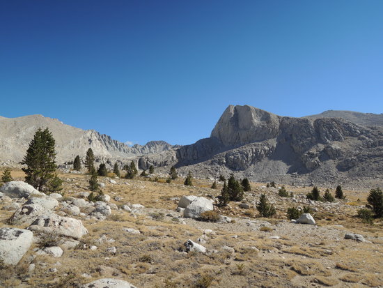
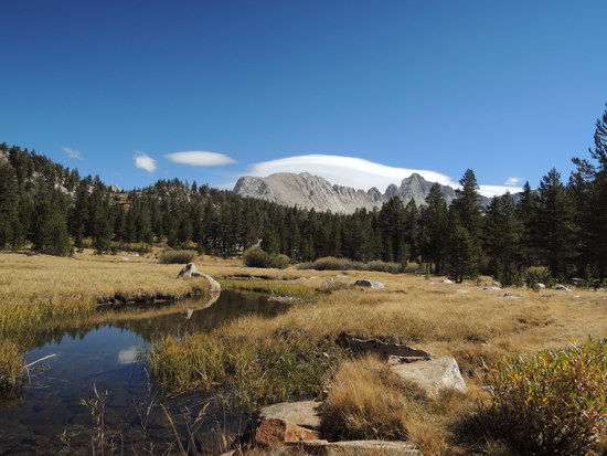
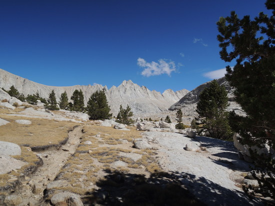
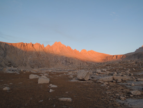
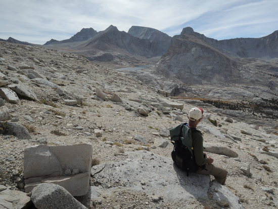
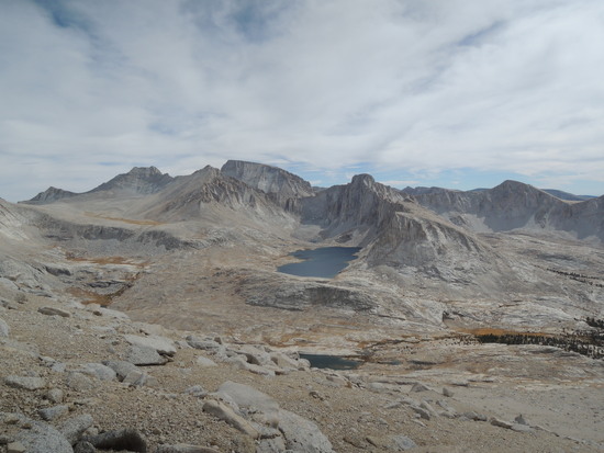
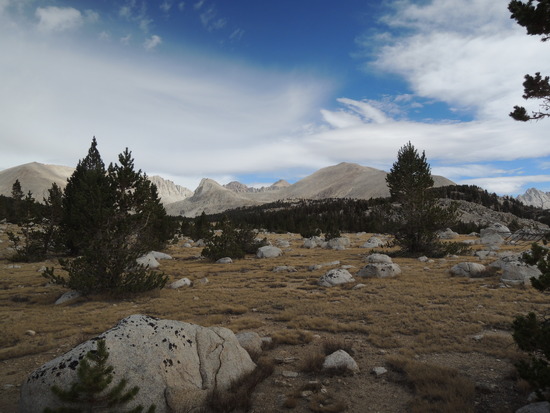
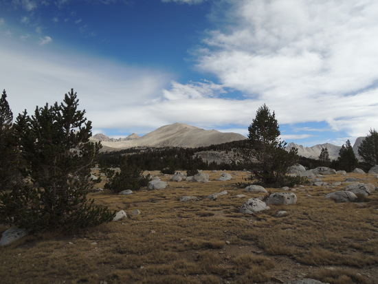
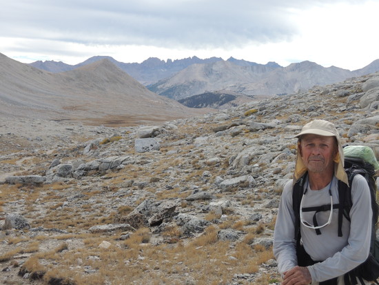
 Day 2 Upper Wright Lakes Basin We arose to a beautiful sunrise that promised a glorious day of fall Sierra hiking. After a leisurely breakfast, we made our way up the steep, rough section of trail that leads to Shepherd Pass. The strenuousness of the hike has always been compensated for by the majestic beauty of the terrain, and this time was no exception. Although it costs me more physically with every passing year to do this hike, I never tire of gazing around in wonder as the nature of the terrain changes gradually from sagebrush scrub to juniper-pinon, then to alpine scrub-forest, and finally to the stark beauty of the jumble of glacial moraine debris that leads to the pass, all of it dwarfed by the majestic granite ramparts that tower over the route. Once over the pass, we hiked down the Tyndall Creek trail to a point just about even with the saddle on Tawny Point ridge that offers direct access to Wright Lakes Basin. After perhaps a half mile of easy cross country, we picked up the old way trail that leads steeply up over very loose rock to the saddle. After pausing for a few minutes to appreciate the expansive views in all directions, we ambled down the broad side valley that leads south to lower Wright Lakes Basin. We arrived at the old horse packer campsite above the main lake in lower Wright Lakes Basin around midday and took a long break for lunch in a copse of scrubby Lodgepole pines that looked out over the broad expanse of lower Wright Lakes Basin to the Great Western Divide on the horizon . From there it was an easy 20 minute hike up a stream to the upper section of the basin, where we would camp for the night. We found a perfect place to throw down our bags on a sandy bench set back a hundred yards or so from a lake, beneath the lofty peaks that stretched from Mt. Tyndall to Mt. Barnard and formed the eastern rim of Wright Lakes Basin. It would be hard to find a better location to spend a night, with plentiful water that required no treatment, level ground, zero likelihood of bear encounters, and stunning views all around. We settled in for the evening and were treated to a glorious sunset and then stark granite peaks illuminated by a nearly full moon as we drifted off to sleep.
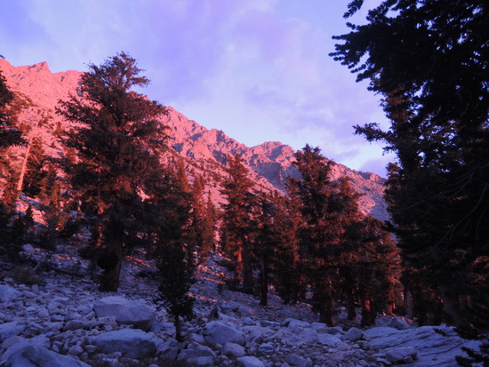
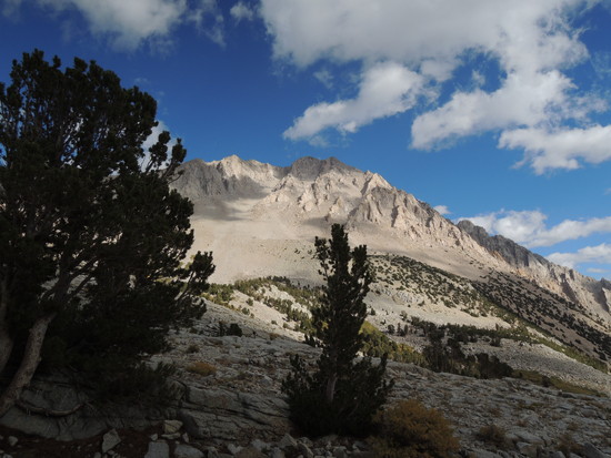
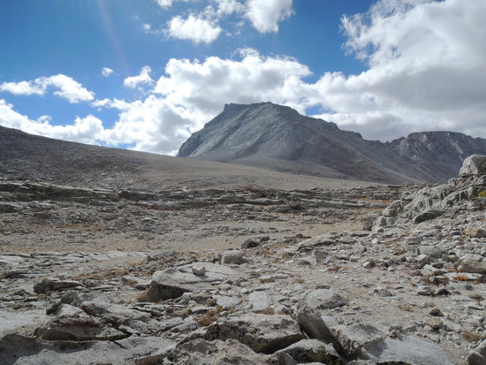
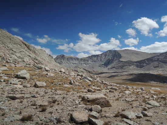
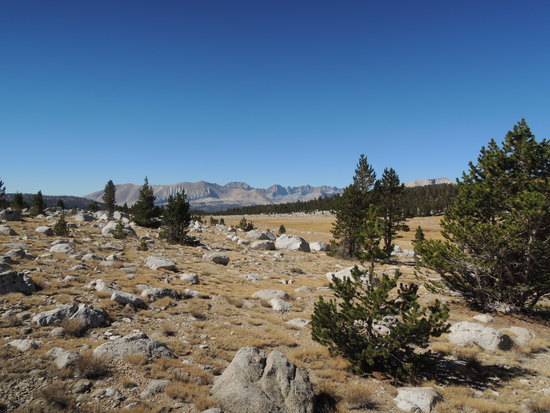
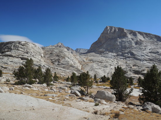
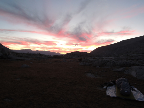
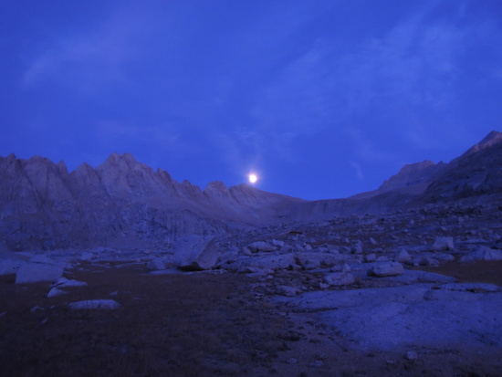
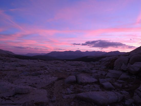 Day 3 Wallace Lake Basin We awoke to another cloudless sky and, after enjoying a second cup of coffee while waiting for the sun to evaporate the considerable condensation that had accumulated on our sleeping bags, set off for Wallace Lake, our destination for the day. Our route would take us a mile or so down lower Wright Lakes Basin before ascending over the low ridge that separates it from Wallace Lake Basin. It was easy, slow walking as we were in no particular hurry. We had all day to hike less than 6 miles, and the beauty of our surroundings gave us numerous excuses to pause and give it the attention it deserved. We even managed to sneak up on four mule deer so focused on grazing that they were unaware of our presence until we were within fifty yards of them. Eventually they became aware of our presence, but even then they did not take flight, instead dropping down for one last mouthful of grass before slowly trotting away. I like to think they realized we meant them no harm. Soon enough we reached a point where the ridge had changed from talus to pine forest interspersed with rocky rubble, and we turned south to begin our crossover to Wallace Lake Basin. It was an easy ascent, with views of the Great Western Divide occasionally glimpsed thru the trees. The descent proved to be a little steeper than I remembered from long past trips, primarily because I had chosen to cross prematurely. It was more an inconvenience than a major error, and soon we were hiking upstream along Wallace Creek. We had missed the trail, which is easy to do as it is quite sketchy in places, but it didn't really matter as the terrain was very forgiving and there was no possibility of getting off route. A couple of miles later the terrain dictated a stream crossing and, sure enough, there was the trail. We stopped there for lunch in a pleasant little meadow which offered the first real view of the massive peaks that stand guard above Wallace Lake Basin on its eastern and southern boundaries, Mts. Russell, Hale, Young, Vacation Peak, and other nameless giants. It was a sight to behold, and remember, long after my hiking days are over. The remaining mile and a half or so to the flat, sandy-grassy bench we would call home for the next two nights, a few hundred yards west of Wallace Lake, was easy hiking on an unmaintained, but well defined, trail. As was the case the previous night, we had found a nearly perfect campsite, with all the attributes we had enjoyed there, only with even more spectacular scenery. In addition to the peaks we first saw at our lunch stop Mts. Whitney and Barnard were also visible, which meant we were now closely surrounded by peaks that were either over fourteen thousand feet or within a few feet of it. Any discussion of "best views" in the Sierra must, of necessity, be subjective, but I can say with conviction that this would have to be a top ten candidate on my list. Two more glorious sunsets over the Great Western Divide and a full/blood moon on the night of the 27th/28thwould elevate our experience to another level entirely, making this one of my most memorable camping experiences in 42 seasons of Sierra rambling. The first two days of hiking had taken their toll on ageing bodies. We both felt pretty poorly that evening, even though the hike over from Wright Lakes Basin had been an easy one. Our initial plan had been to do a carryover ascent of Mt. Barnard and return to Shepherd Pass via Williamson Bowl, but that was now clearly out of the question. With hindsight we both realized it had been foolish to even consider that option. The question now was whether take a rest day and just lounge around camp before hiking back down Wallace Creek to the JMT and then out via the Tyndall Creek trail and Shepherd Pass in two days, or divide the return leg into three shorter sections and start back the next day. We decided to sleep on it and make our decision after a good night's sleep.
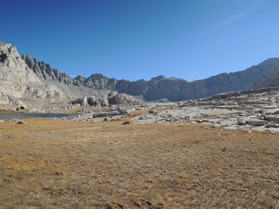
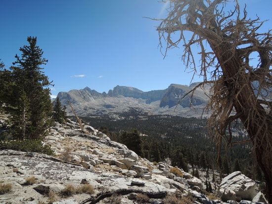
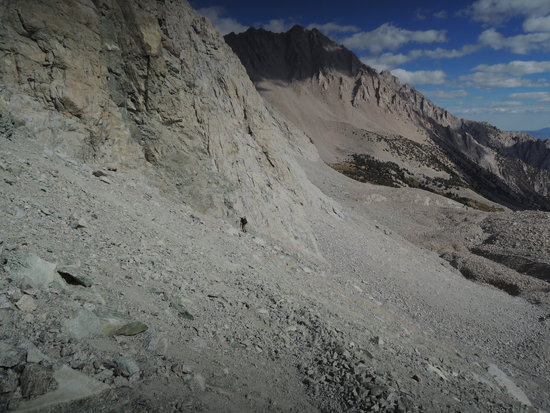
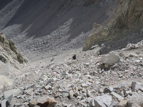
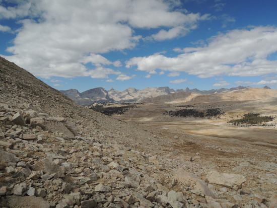
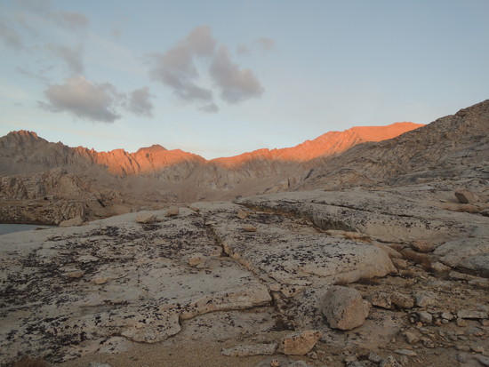
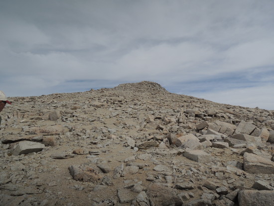
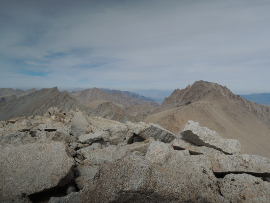
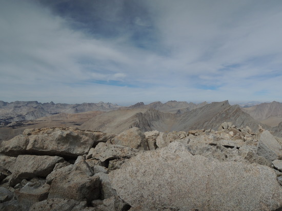
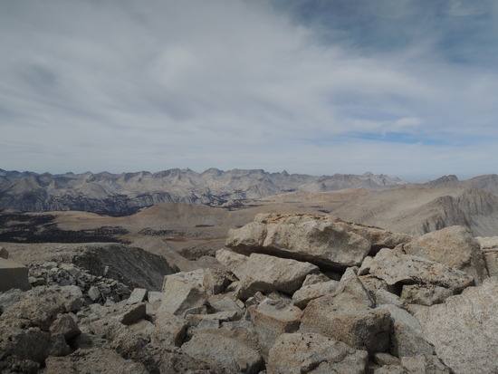
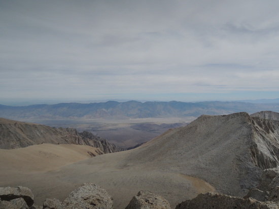
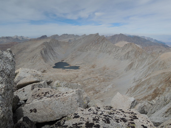
 Day 4 Mt. Barnard It is amazing what a difference ten hours in the sack can make. After coffee and breakfast, there was a different feeling in the air. No longer feeling like I had one foot in the grave, I asked Fred how he felt about doing Barnard; his reply was "I'm good", and that settled it. No more talk of retreat with our tails between our legs. We had examined the SSW slope of Barnard closely the day before. There were basically two options, slogging directly up the very steep, sandy scree slope directly north of our campsite or skirting a cliff band running west in hopes of finding a route with solider footing in a rock strewn gully that cut into it after a few hundred yards. We took one last look and decided to take our chances with the gully, rather than the certain slog up that energy sapping scree slope. It turned out to be the right choice. A short scramble up the gully on solid footing bypassed the initial 600' steep scree section and put us in perfect position for the long trudge up a lower angle Class 1 sandy scree slope, broken by two short Class 2 sections of rocky outcroppings, that would take us to the summit of Barnard. It seemed like we were wading in molasses at times, but we were on the summit in just under three hours. To say we were elated would be an understatement, given our sorry state the previous evening. We felt great, and the views were incredible. Mt. Barnard(13,990') sit just north of center on the Whitney Crest, with Mts. Williamson(14,389') and Tyndall(14,025') less than a mile to the north, and Mts. Russell(14,094') and Whitney(14,494') less than 2 miles to the south, interspersed with numerous peaks well in excess of 13,000', Mts. Hale, Young, Versteeg, Tunnabora, and Vacation, to mention a few. On the western horizon is a panoramic view of the entire Great Western Divide, to the east the White and Inyo Mountains. All in all it is a perspective well worth the effort, unarguably one of the finer in the Sierra. We did not linger overly long, as banks of clouds were flowing in from the west and even earlier had begun to accumulate around Mt. Tyndall. The possibility of getting caught out in a thunderstorm was not pleasant to contemplate, so we headed down as quickly as we could without risking a fall, making excellent time down the scree. We got back down to camp in a little over two hours, well satisfied with a day that had turned what would have been a good but not exceptional trip into one for the books. We may not have achieved our original goal of doing a carryover into Williamson Bowl, but this was not a bad consolation prize. Toward sunset, the weather improved, leaving just enough clouds for us to enjoy a beautiful sunset, followed by a blood moon. It was a perfect ending to a perfect day.
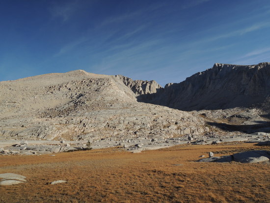
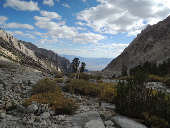
 Day 5 High Bivy Our attention now shifted to the return journey. Cumulative fatigue was setting in at this point, so we decided that it would probably be easier to just hike back down Wallace Creek to the JMT and then head back up Wright Creek with the intention of retracing our route over the saddle on the Tawny Point ridge. It would be easier than re crossing the ridge that separates Wright Lakes and Wallace Lake Basins, and was the next most direct route to Shepherd Pass. We set off with the goal of following the trail the whole way down to the JMT. We had missed it initially on the way in, as I had on my last trip a number of years ago, and I was very curious to know if it had become nonexistent in places, or if we had just not been paying close enough attention. We found out that the trail is there the entire way down to the JMT, but it becomes very indistinct in places, and easy to miss if one is not following it in the first place. That was the case both times I had previously tried to intersect it when descending from the ridge on the way from Wright Lakes Basin. We arrived at the JMT in good time and after a short half mile or so left it to hike the way trail up Wright Creek. The trail soon petered out into terrain that was not particularly pleasant walking, so we crossed over to the north side and worked our way up into sparse pine forest that offered better footing. Soon we came across a very nice trail paralleling the creek and took it. I was not aware of any trail on that side of the creek, which should have been a warning that if something seems too good to be true, it probably is. Gradually the trial began to diverge from the creek, but we soldiered on. I grew increasingly uneasy until finally, when we popped out onto Bighorn Plateau, it became obvious that we had been hiking on the JMT. I had just committed a major navigational error bordering on stupidity, the kind that happens when I am tired and focused on pounding out the miles. It was the third of my career that qualified for the "exceptionally stupid" label, and I was suitably upset and embarrassed. There was no question at that point of hiking a direct line over to the saddle that had been our original goal, because the intervening terrain was a jumble of very unpleasant talus and boulders for over a half mile, and retracing our steps on the JMT would have balanced out the extra miles we would have to hike by continuing north on the JMT. So, we did our penance by continuing on to the junction with the Tyndall Creek trail and then heading up it to Shepherd Pass, adding ~2.5 miles to the day that neither of us really needed Fatigue was now becoming an issue, especially for me. Fred is eight years younger than I and probably could have kept on going, but I was tired enough that I was happy just to have gotten down the headwall below Shepherd Pass and the rough trail below it without busting myself up, so I lobbied for bivvying above the Pothole. Fred didn't argue the point, so we quickly made camp in and set about replenishing our seriously depleted energy stores. I was feeling really crappy and it must have showed, because Fred went into trail angel mode and brewed me up a steaming hot cup of miso soup. Now, I am quite fond of miso soup, but this cup was truly the nectar of the gods. It made the difference between a miserable evening and crawling into my bag feeling like I was still a member of the human race.
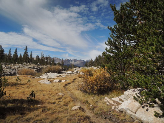
 Day 6 Civilization The hike back to the car was routine to the point of being anticlimactic. We had both done it many times before, and our attention was predictably shifting to the amenities of life in the civilized world. It had been an excellent trip, one of the better ones we had done in fact, and now it was time to enjoy a hot shower, a good meal accompanied by one of the excellent ales on tap at The Mountain Rambler in Bishop, a good night's sleep in a clean comfy bed, and reconnecting with our long suffering partners. It was a fitting end to a memorable trip, one we felt very fortunate to still be able to complete in good form.
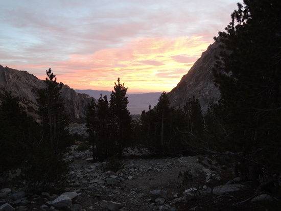
Topic
Wright Lakes-Wallace Lake Basins via Shepherd Pass 9/24-29
Become a member to post in the forums.
- This topic has 29 replies, 13 voices, and was last updated 9 years, 7 months ago by
 .
.
Thanks for sharing.
"Thanks for sharing." I'm glad you enjoyed it, Ryan. Thanks for reading.
Another delightful trip report Tom. I need to get back to that area soon!
"Another delightful trip report Tom. I need to get back to that area soon!" Thanks, Doug. I was hoping you would check it out. I figured you'd realize that we only got half the loaf last time around. Sure enough, you took the bait. ;0) Seriously, Shepherd Pass isn't getting any easier and you aren't getting any younger, so soon it should be.
Tom – I always appreciate the depth of your reports and the time you take to relate the beauty of the Sierra. Thank you for a great read.
this is great! i was just finishing the high sierra trail (our first time in the southern sierra in fact!) when you were walking in. out of curiosity, since you mention it quite a bit – how old ARE you? or is that a state secret :)
"out of curiosity, since you mention it quite a bit – how old ARE you? or is that a state secret :)" Who do you think introduced John Muir to the Sierra?
Thanks for posting your tr and photos. I enjoyed following along with your route decisions and I can relate to the feelings of exhaustion after a long day and surprising reinvigoration after a good nights sleep. I also went through Wright and Wallace Lake Basins via Shepherd earlier this summer but did not go up Mt Barnard. Your trips are always inspiring!
haha doug – i thought i recognized tom from the ken burns documentary…
Thanks for sharing. Much of the scenery looks familiar as I went down Wrights Lakes basin and over to Wallace Lake, which we also thought was beautiful. We went on up from there to Lake Tulainyo, which was a highlight of our trip. I need to follow your lead and do a write up. We similarly enjoyed some exceptional brews made at the Mountain Rambler.
Great Stuff Tom. Of all the available forms of exercise, and ways to get the heart rate, breath rate and pores to open up, steep E side trails take the cake…esp from Symmes Creek Trailhead! Thanx 4 sharing.
"Tom – I always appreciate the depth of your reports and the time you take to relate the beauty of the Sierra." Thank you for the encouraging words, Dylan. I always struggle to convey in words and pictures what I see and feel up there. Comments like yours give me hope that I at least partially succeed occasionally. "out of curiosity, since you mention it quite a bit – how old ARE you? or is that a state secret :)" I'm 75, Ben. I guess I do mention it more as I start to feel it more; part of trying to convey my changing perception of some old favorites up there with the passage of time. It's a bittersweet feeling, to be honest. Not looking for any sympathy, but it does color how I write of late. BTW, where did you exit the HST? "Thanks for posting your tr and photos. I enjoyed following along with your route decisions and I can relate to the feelings of exhaustion after a long day and surprising reinvigoration after a good nights sleep. I also went through Wright and Wallace Lake Basins via Shepherd earlier this summer but did not go up Mt Barnard. Your trips are always inspiring!" Thanks, Andy. I always look forward to hearing from you. We sure do seem to end up in a lot of the same places. I'm guessing you'll get up close and personal with Barnard in the not too distant future. I hope to at least share a beer with you one of these days, perhaps even a few days up there. "Thanks for sharing. Much of the scenery looks familiar as I went down Wrights Lakes basin and over to Wallace Lake, which we also thought was beautiful. We went on up from there to Lake Tulainyo, which was a highlight of our trip. I need to follow your lead and do a write up. We similarly enjoyed some exceptional brews made at the Mountain Rambler." Thank you, Ben. Tulainyo is a pretty cool place to visit, but a bit of a hump to get to. I think the sun cups would have have been less of a hassle this year. Was that the case? I'm glad you got all the way in there. Most folks stop at Wallace Lake, or maybe Wales, unless they're climbing or going on out over Russell Col. Isn't the Mountain Rambler a great place?! It fills a huge gap in what Bishop has to offer when it comes to good food and great beers. I'll look forward to your write up. Edited for grammar and punctuation.
After Tulainyo, we went over the col and down to Boy Scout Lake. The fishing was great at Boy Scout. We then went up the mountaineer's route to Whitney, which was also a lot of fun. I loved Mountain Rambler. I'm a home brewer so I really appreciated the owner spending time to show me around his brewery. There were no sun cups up there at all for us, just some small patches of snow. But the walk down to Boy Scout was a steep and slippery mess.
"Of all the available forms of exercise, and ways to get the heart rate, breath rate and pores to open up, steep E side trails take the cake…esp from Symmes Creek Trailhead!" For sure, Brian. Each of "The Big Four", Taboose, Sawmill, Baxter, and Shepherd present their own set of challlenges but, in my book, Shepherd continues to be the granddaddy of them all. I personally consider it to be the most beautiful as well, by way of compensation.
"After Tulainyo, we went over the col and down to Boy Scout Lake. The fishing was great at Boy Scout. We then went up the mountaineer's route to Whitney, which was also a lot of fun. I loved Mountain Rambler. I'm a home brewer so I really appreciated the owner spending time to show me around his brewery." Nice route, Ben! That is what I would call exiting in style. Where did you start your hike? "There were no sun cups up there at all for us, just some small patches of snow." That doesn't surprise me, given the last four years of drought.
We started at the Big Pine Creek trailhead near Glacier Lodge; through first thru seventh lake; over to Thunder and Lightning lake; South Lake; Bishop Pass; a few days on the JMT;over to Wright's Lakes after crossing Forester Pass; then Wallace Lake; Tulainyo; Boy Scout; and mountaineer's route up Whitney. We, likewise had a wonderful trip.
"We started at the Big Pine Creek trailhead near Glacier Lodge; through first thru seventh lake; over to Thunder and Lightning lake; South Lake; Bishop Pass; a few days on the JMT;over to Wright's Lakes after crossing Forester Pass; then Wallace Lake; Tulainyo; Boy Scout; and mountaineer's route up Whitney. We, likewise had a wonderful trip." That is impressive, a great route that definitely belongs in the BPL trip report collection. You really should give some thought to writing it up.
Thanks, Tom I will write it up. It's really unfamiliar territory for me. But spectacular. Thanks for bringing the memory back
tom, it is truly fantastic that you are still out there where you want to be. something to aspire to and i wish you many more seasons! we exited the high sierra trail allll the waaaay down at whitney portal. it was a sublime trip and i hope to be back as soon as i can.
" i wish you many more seasons!" Thanks, Ben. I think it's a mostly matter of maintaining a healthy lifestyle, and paying a lot of attention to not breaking anything, either when training or on trips, by knowing one's personal limitations. No one knows for sure when their time up there will come to an end, but I hope to eke out a few more seasons by taking that approach. The rest is up to the mountain gods. "we exited the high sierra trail allll the waaaay down at whitney portal. it was a sublime trip and i hope to be back as soon as i can." That is an excellent route, especially if it was your first major Sierra hike. Whitney, in spite of the crowds, remains an iconic experience that every Sierra hiker should have at least once.
Thanks Tom. Many great shots in there…. Hope to be out with you this winter.
Beautiful Tom
not to hijack this thread, but since you mentioned whitney, tom – i had relatively low expectations for the highest point in the 48, and was utterly blown away. i'm not sure photographs do it justice, especially the views west-ish, back into the park. hiking up in the dark and spending an hour or so at the seeming roof of the world is something i'll never forget. also we were lucky – the middle of the week in late september meant there were only six or seven other folks up there with us. though a couple of them spent the entire time barking at each other about the pizza they were going to eat in lone pine. a less discussed form of acute mountain sickness i guess. ;)
"Thanks Tom. Many great shots in there…. Hope to be out with you this winter." Thank you, Craig. You came into my mind a couple of times when I was up there. We didn't have time in June to even detour into Wright Lakes Basin, let alone Wallace; I thought, in a couple of particularly beautiful spots, about how much you would have loved it back in there. I'm definitely looking forward to that winter trip, too.
Become a member to post in the forums.
 Ultralight folding polesCarbon fiber, adjustable, 15" collapsed length.