Topic

Why it’s best not to rely on cellphone navigation when hiking


Forum Posting

A Membership is required to post in the forums. Login or become a member to post in the member forums!

Home Forums General Forums Philosophy & Technique Why it’s best not to rely on cellphone navigation when hiking

Viewing 25 posts - 26 through 50 (of 210 total)
  • Author
    Posts
  • #3626702
    Brad P
    Spectator

    @brawndo

    Always take a map. Study the map ahead of time.

    Always take a phone with a good app like Gaia with appropriate maps downloaded to the phone.

    The phone can tell you with certainty where you are on the map very quickly.  Still know how to use the map without the phone in case the phone dies.

    It’s not an either/or.  You’re always safer with both if you know how to use both.

    #3626707
    Dale Wambaugh
    BPL Member

    @dwambaugh

    Locale: Pacific Northwest

    It’s not an either/or.  You’re always safer with both if you know how to use both.

    If you are going to take a phone anyway, you might as well have the navigation options. My only objection to maps is wet weather. Every now and then I find a laminated Green Trails map and it goes in my collection without hesitation.

    #3626736
    jscott
    BPL Member

    @book

    Locale: Northern California

    “You’re set in your ways, I get it”

    funny: when I see people walking down the street or driving or standing in line on their phone, I think, ‘they’re addicted’. Which is another form of being set in ones ways.

    #3626754
    BlackHatGuy
    Spectator

    @sleeping

    Locale: The Cascades

    “Which is another form of being set in ones ways.”

    We do have many forms, to be sure.

    #3626761
    nunatak
    BPL Member

    @roamer

    For an experienced hiker well versed in both paper and GPS mapping there should be no doubt whatsoever the phone option is far, far superior for real time close-up navigation.

    It is so quick and intuitive it leaves much more time enjoying the terrain, thus gaining further bits of navigation aid.

    Instead of discussing if we’re here or there we now talk about if we should go precisely this way or precisely that way.

    Paper maps are still along on the trip, as they are good for nightly group discussions re route progress and changes; and during the day to identify distant landmarks.


    #3626762
    AK Granola
    BPL Member

    @granolagirlak

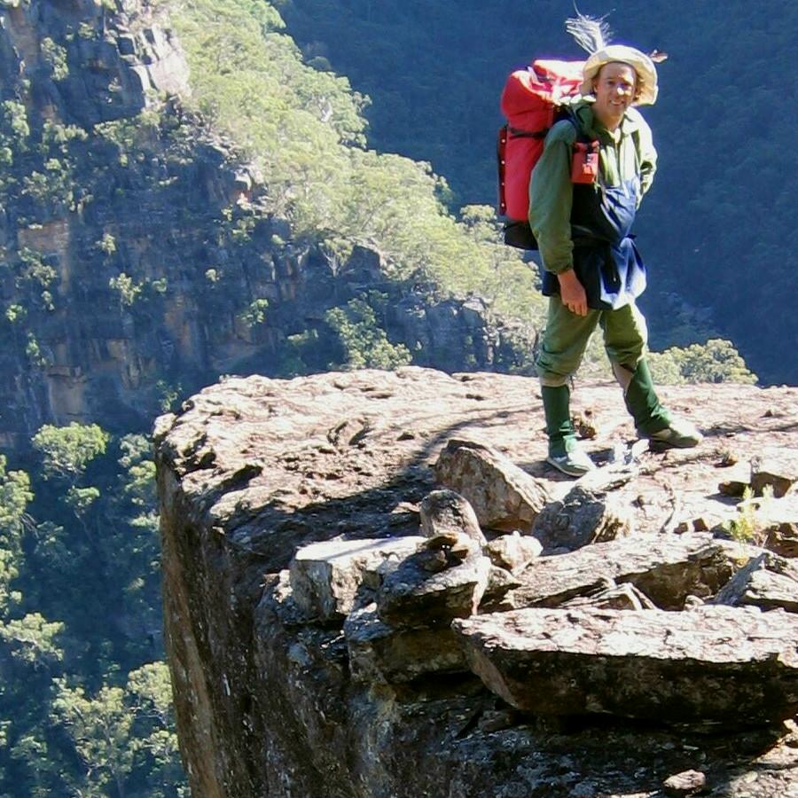
    I just finished reading the biography of Geraldine Largay, and I have to say, I’m glad I understand how to read maps. I’m ok with a compass but could stand some live testing. I can totally imagine wandering far enough from the trail for privacy and being confused on how to return.

    However, in her case, having wilderness skills might have been more important, once she was lost. And anyone can get lost. She was unable to find any food at all to sustain herself, although apparently there were edible plants and berries all round, not enough for living off of but enough to sustain her longer. She built fires but then put them out (possibly for fear of creating a wildfire? which I would risk doing if there were search planes flying overhead). That plume of smoke would be a dead giveaway and the fire should have been a top priority. She didn’t leave any traces of her path as she was wandering around; she could have left piles of branches, rocks, something to let searchers know where she had gone, something that looked human-made. She could have left a trail of pee (how many days would dogs still be able to follow that trail? long enough to be found?)

    I’m not faulting her; she made mistakes and paid a heavy price and it’s very, very sad. She sounds like a wonderful person. But I wonder how many long distance trail hikers know how to build an emergency shelter, start a fire using natural materials, use a knife to prepare tinder, etc. I don’t think “just stay on the trail” or having a phone is sufficient advice; you have to know what to do when you’re suddenly no longer on the trail. Your gps and phone can get dropped into a river, frozen and dead battery, maps can get lost, etc. No matter what, keeping yourself alive until you can be found is pretty essential. If only…

    I really like having maps as well as phone nav. I can see so much more with a map – things that are off screen on the phone unless you spend lots of time on it. A quick glance at a paper map is so much easier.

    A colleague and I were talking about this issue. He has lived in Alaska all his life and had never really heard of walking on trails until recently (seriously! true story). He cannot understand why anyone would want to be on a trail. He hunts, fishes, and never on a trail. That would scare the bejesus out of 90% of today’s backpackers. But he is experienced, knows how to find his way, and knows lots of ways of catching and eating tasty critters. Good skills to have, even today.

    #3626854
    Ben C
    BPL Member

    @alexdrewreed

    Locale: Kentucky

    If you haven’t tried, Gaia, I would highly recommend giving it a try, unless you just aren’t comfortable with a smartphone. Like most, I learned on map and compass.  I still take them on trips.  But I also download Gaia GPS maps for my phone. I only rarely look at the map anymore. Gaia GPS is like a map with a “you are here” indicator. It’s so useful if you aren’t sure if you are on the right path – trail or otherwise. It’s great with confusing trail junctions with little or no signage.  It’s even better for off trail navigating where you have to spend a lot of time navigating your route. I will still look at a map every now and again, but usually a t night for an overview.

    #3626861
    obx hiker
    BPL Member

    @obxer

    Daniel Boone, when asked if he ever got lost out in the wilderness, replied, “I can’t say I was ever lost, but I was once bewildered for about 3 days.”

    There’s a place for Gaia: It’s a precision tool and especially helpful in off-trail or cross-country situations where eventually you must hit the mark, like for example getting into or out of a canyon by the one way that goes somewhere between say Moab and Flagstaff.

    There’s a place for the big picture of a map.

    There’s a whole collection of books and instruction about not necessarily needing either with for example classics by Harold Gatty and a series of books by Tristan Gooley

    One thing I find to be fun is to take a space with a defined perimeter, like paved roads on all 4 sides; or the mountain over there, the river over there and roads at each end and then practice going cross-country through that. Try to hit a specific target on the other side and make the space bigger or more confusing as you get better.

    What would we advise each other as regular users of this blog and what the person on the street might need could be pretty far apart. I’d agree you wouldn’t advise people to rely on mobile phone gps but OTOH it probably keeps lots of people “found”

    What would you advise someone to do when they come to the realization that they are lost? I’d start off with something like sit down and just breathe for about 10 or 15 minutes.

    #3626865
    Jerry Adams
    BPL Member

    @retiredjerry

    Locale: Oregon and Washington

    since I’m mindlessly posting here, obviously, I’ve never been lost : )

    #3626868
    Jerry Adams
    BPL Member

    @retiredjerry

    Locale: Oregon and Washington

    the story of Largay teaches us that you should not just hike off without thinking about how you’re going to get back..  Occasionally looking backwards to see the route back.  Look for large features like ridges and canyons and where you want to go relative to them.

    remembering a story like Largay’s might help to remember this

    I sometimes make the mistake of taking off on a trip, enthusiastically, and forgetting that I’m going to have to figure out how to get back.  The most common mistake – I’ll get to a junction, and take one direction.  Then when I go back I’ll forget which way at the junction to go to get back to trailhead.


    #3626869
    Jerry Adams
    BPL Member

    @retiredjerry

    Locale: Oregon and Washington

    “Paper maps are still along on the trip, as they are good for nightly group discussions re route progress and changes; and during the day to identify distant landmarks.”

    Same here.  The only time I ever look at a paper map is back at camp, plotting the next day’s route,  I have mileages on the paper map.  There must be some way to add mileages to a Gaia map.

    #3626871
    jscott
    BPL Member

    @book

    Locale: Northern California

    As someone who easily gets lost I’ll change my earlier view and say that the ‘you are here’ function is very helpful. I hate the anxiety of worrying that I might be on a wrong route, even when I’m not. In the winter when I’m on a snow route I take a heftyish gps that of course has the you are here function.

    I’m mostly hiking on trail in three seasons, with some snow in the spring. But I usually go to familiar places in those times. What can I say, I don’t like having a phone while backpacking. I’m set in my ways that way. I’ve seen people on a straight trail hiking while holding and looking at their phone. !!!

    But I bring an original kindle with no back light strictly for reading. So I’m not entirely device free.

    #3626895
    Roger Caffin
    BPL Member

    @rcaffin

    Locale: Wollemi & Kosciusko NPs, Europe

    something like sit down and just breathe for about 10 or 15 minutes.
    We weren’t lost, just a little confused. Turned out we were on the wrong spur, parallel but offset.
    So we sat down and had a cup of coffee. Always a good solution.

    Then having figured it out, we got onto the right spur and trundled along to the end of it, only to find continuous 40 m cliffs all round. A story for another day :)

    Cheers

    #3626897
    Ben C
    BPL Member

    @alexdrewreed

    Locale: Kentucky

    Kindles are starting to get GPS (says google). It would be pretty cool to have a screen as big as a Kindle for your GPS.  I assume they are a little heavy, but if you’re carrying it anyway, it would make an awesome GPS.

    #3626906
    Roger Caffin
    BPL Member

    @rcaffin

    Locale: Wollemi & Kosciusko NPs, Europe

    Why would a Kindle make an awesome GPS? All you need is room for the display of two numbers. A watch face would do.

    Or do you mean that the larger area of a Kindle would be better at displaying a map? Probably so, but that has little to do with displaying GPS coordinates.

    Cheers

    #3626908
    Diane “Piper” Soini
    BPL Member

    @sbhikes

    Locale: Santa Barbara

    The nice thing about my Gaia GPS app is that it will tell me where I am on the map for sure.

    I’ve gotten lost with a map and compass. I was pretty sure I located myself on the map, and I could identify all the mountains around me, but I couldn’t see any trail to follow that would take me where I wanted to go and the brush was too thick to bushwhack. I could see a trail that went the wrong way, so I took that because it was the best I could do, and then got I got even more lost.

    This spring I returned to the scene of that crime with my phone and Gaia and I found the exact location where I went wrong and this time I got lost a little bit closer to my goal. Lost in the Buck Creek Triangle again, 2-for-2. I solved my being lost again with a good night’s sleep and a clearer head in the morning.

    I did not use a phone/GPS on the PCT at all. Or a map. I used the data book and a watch. I was out of water once and when it was time to search the trees for a lake in the viewless green tunnel of Oregon, I kept an eye on my watch and when the hour to start looking for the lake arrived, I found it in about 5 minutes. I wouldn’t have been able to find anything with a compass. All I could see were trees.

    There are many ways to navigate and when newbs get lost on day hikes its because they haven’t been paying attention to where they’ve been going, they’ve gone further than they’re physically capable, or they just otherwise lack experience. They haven’t done the hardest thing there is to do, so hard that I haven’t even mastered it, and that is to turn around 180 degrees and hike back to your last known location.

    #3626916
    Roger Caffin
    BPL Member

    @rcaffin

    Locale: Wollemi & Kosciusko NPs, Europe

    to turn around 180 degrees and hike back to your last known location
    We have done that once, albeit under full control. The terrain was just so weird we were slightly freaked out. It was seriously harsh and difficult country, so we retreated.

    We came back some months later with a new mindset and enjoyed ourselves. It is all in the mind.

    Cheers

    #3626924
    Jerry Adams
    BPL Member

    @retiredjerry

    Locale: Oregon and Washington

    I’ve stopped for a break, then continued on my way, then after a while realized I was going the wrong direction

    Once I realized I was going the wrong direction, turned around and walked a ways, then realized that originally I had not been going in the wrong direction in the first place

    I sometimes just don’t pay that much attention.  Looking around at things.  It doesn’t make that much difference which direction I’m going, it’s the journey, not the destination

    #3626927
    Roger Caffin
    BPL Member

    @rcaffin

    Locale: Wollemi & Kosciusko NPs, Europe

    It doesn’t make that much difference which direction I’m going, it’s the journey, not the destination
    As long as you end up at Maccas (or your car) of course.

    Cheers

    #3626932
    Jerry Adams
    BPL Member

    @retiredjerry

    Locale: Oregon and Washington

    thanks goodness for google

    you aussies call MacDonald’s maccas?

    and you admit going there?

    okay, I go there sometimes, the wife likes Egg McMuffin and potato patties.  They are disgusting but in a sort of good way.

    #3626946
    W I S N E R !
    Spectator

    @xnomanx

    Following handrails and looking at maps seems to do the trick for 99% of backpacking travel, on or off trail.  Not that the compass is to be discarded, but knowing how to actually look at a map- digital or otherwise- and visualize contours well enough to translate them into real-world handrails seems to be a far more important skill than using a compass.

    So far it’s been hunting that’s taken me off the beaten path and into the realm of needing pinpoint accuracy more so than backpacking.  It typically requires starting the day hiking off trail and in the dark as well as finishing in the dark, all in more obscure places, well away from trails and more obvious hiking corridors. Thus far the greatest gift hunting has given me is a far more intimate knowledge of my local mountains and watersheds than backpacking/running/mountain biking have ever provided.  Time and time again this has put me in situations where trying to find my position with a compass would be useless; trees too thick, ridges and fingers too plentiful, and light too low to have anything to take solid bearings off of.  GPS has been an absolute blessing in this arena.  Carrying a backup is not hard: I run my phone with GAIA for primary pinpoint navigation/dropping waypoints and my Garmin watch for UTM coordinates as a backup if needed. Neither have ever failed.  When not actively tracking, the watch will run for well over a week but still spit out UTMs instantly.  Don’t know about the newer Garmins but I downloaded the UTM app for my Forerunner 230- pretty handy.

    The map and compass are there, but they sure get buried pretty deep in the pack when hunting.  And yet when backpacking I prefer a paper map for the big picture, kept close at hand.

    In either case I rarely if ever need to break out the compass.

    #3626950
    Mike M
    BPL Member

    @mtwarden

    Locale: Montana

    there seems there are a lot of times that an altimeter would come in really handy- might have to look into a watch that has one

    #3626952
    Jerry Adams
    BPL Member

    @retiredjerry

    Locale: Oregon and Washington

    A compass is good for going in a straight line

    Get on a ridge, see where you want to go, see which direction that is on compass, keep going in that direction

    Otherwise, like going through forest, you can start deviating from where you want to go, or go in circles

    #3626961
    Geoff Caplan
    BPL Member

    @geoffcaplan

    Locale: Lake District, Cumbria

    This is one of these perennial debates, but I feel the real answer is that the right balance of GPS vs paper maps really depends on the situation, and needs to be thought through for every project.

    I greatly enjoy navigating with map and compass – I’ve been doing it for over half a century and take pride in my skills. But there are many situations where I would prefer to have a GPS available, or even rely on the GPS alone.

    One example is walking in countries with poor mapping, like Italy and Spain. The lack of detail on the maps can make it very hard to get oriented in poor visibility – major features on the ground are simply missing or in the wrong place. With a reliable GPS track in your phone, it’s much easier to find the route.

    Another example is navigation in bleak and featureless terrain. For example solo navigation in a whiteout on the Cairngorm plateau in Scotland can be extremely slow and demanding. You might have to cross miles of plateau aiming for a small gap between cliffs overhung by dangerous cornices. The results of a small inaccuracy can be fatal. Much less stressful and dangerous to know exactly where you are.

    Another scenario is a long trail where carrying paper maps could be expensive, heavy, or logistically difficult to organise.

    Yes, GPS devices can fail. But you can lose paper maps too. I once had a map blow away in a gale when I was using a new jacket with badly designed pockets. I recently had to guide a party off the hill on Dartmoor when their map became a saturated pulp before they noticed their pack was leaking.

    One well known UK long-distance walker has pretty much dispensed with paper maps. In serious terrain he takes a second lightweight phone as backup to his main phone, and keeps it well protected in his pack. You can always supplement this with larger scale maps to give overview, and some print-outs of more detailed strip maps for more challenging or technical sections of a route. When it makes sense you can supplement this with pre-made route cards listing the bearings, waypoints, altitudes and distances.

    So my own approach is to be flexible and match the tools to the task. What’s better – a saw or a hammer? It all depends what you’re using it for.

    #3626982
    Pedestrian
    BPL Member

    @pedestrian

    A lot of good points but this entire thread is missing a key point: the Washington Post article from the OP is talking about using a cellphone for navigation using something like Google Maps of whatever a novice would try to use when lost/disoriented on a hike. The article is definitely not talking about backcountry navigation apps (like Gaia, Backcountry Navigator, Viewranger etc with maps for the area preloaded) that a prepared hiker/backpacker would use.

    My experience running into “lost” hikers is that most rarely carry maps; if they carry a map, they may not know how to use it. Same with a Garmin GPS or the cellphone that they may have.

    As has been pointed out earlier in this thread it’s mostly about lack of skill and lack of experience more than the “cellphone”.

    A smartphone with something like Gaia, Viewranger etc is at least as good as a purpose built Garmin GPS, if not better, for most purposes with the usual caveats about battery life, ruggedness, etc.

    Knowing how to read a topographic map and matching the terrain and the map is a crucial skill.

    Many GPS watches are now excellent for getting exact coordinates and altitude (when equipped with a calibrated barometric altimeter). I own a Suunto Ambit3 Peak which is excellent in this regard as are many other offerings from Suunto and Garmin. I rarely have to pull out my phone app anymore as I usually carry a paper topo map for the area I’m hiking that day. With the watch I can locate myself very precisely on the map (it can be configured to display current UTM coordinates and the current altitude) without the hassle of pulling out the phone etc.

    And yes using handrails with location/altitude is a far more reliable way to navigate than trying to triangulate using a map and compass when surrounded by thick foliage or in whiteout/low visibility conditions.


Viewing 25 posts - 26 through 50 (of 210 total)
  • You must be logged in to reply to this topic.
Forum Posting

A Membership is required to post in the forums. Login or become a member to post in the member forums!

Get the Newsletter

Get our free Handbook and Receive our weekly newsletter to see what's new at Backpacking Light!

Gear Research & Discovery Tools


Loading...