I had heard some conflicting reports between the snow course measurements that CDEC conducts (described here) and what the automated SWC content plots show (available here). The SWC plots show that we are very comparable to 2017, but through the grapevine, I have heard that the snow surveys seem to describe otherwise (specifically, John Dittli, on the snow survey at Bishop Pass).
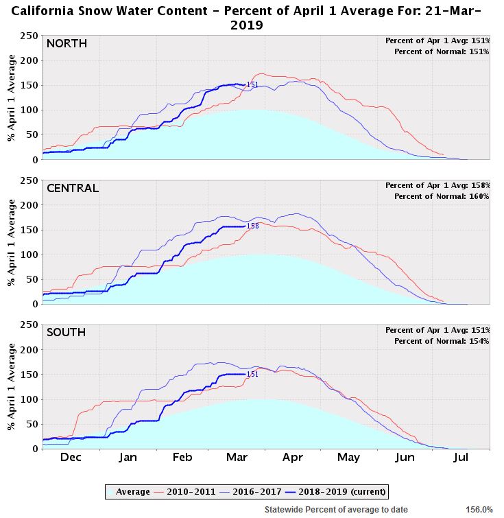
Here is a current snapshot of the snow water content chart, generated from the automated sensor data, as of today:

2019 is the thick blue line; 2017 is the thin blue line, and 2011 is the red line. The three years all look pretty comparable, today!
That chart is generated based on the sensors.
The snow surveys are independent of the sensors. They are part of the state snow course; people go out to specified locations and stare at the snow, and do science-y kind of things to answer the basic question of: “how much snow is that?” It makes me happy when we fund these sorts of things.
Those snow surveys should be quite accurate, while sensors can fail, report erroneous data, etc.
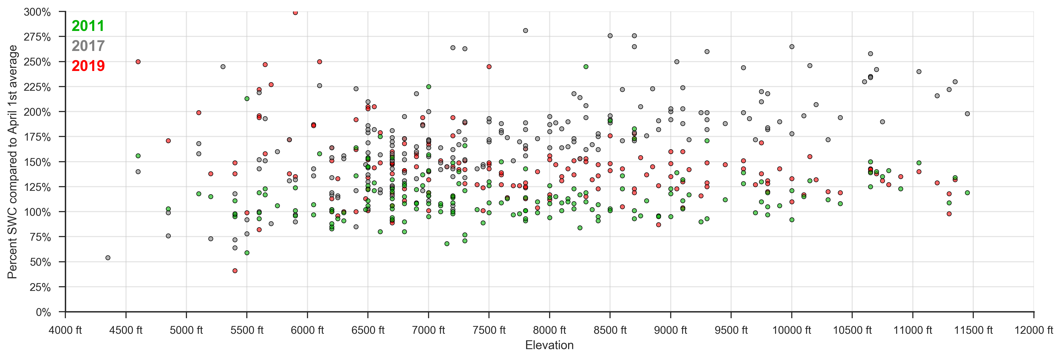
I looked at snow course data from March of three years: 2011, 2017 and 2019.
I parsed the data available from the CDEC. Below is a plot of all of the snow survey data from those years, with the y-axis denoting the percentage of snow water content (relative to an April 1st average), and the x-axis denoting the elevation that that particular survey site is located at:
It’s a smorgasbord of points at lower elevations, but at higher elevations, it certainly seems that 2011 (green) and 2019 (red) are similar, but significantly lower than 2017 (gray).
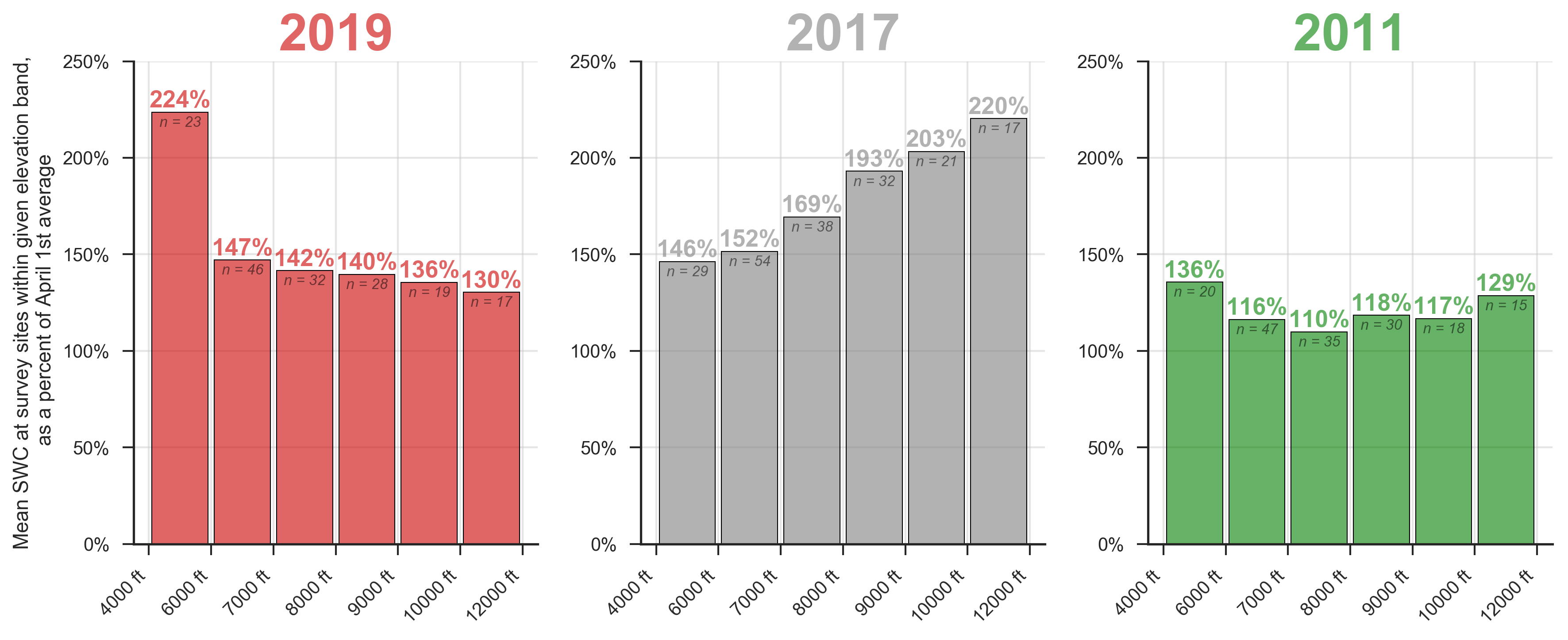
I binned the data into elevation bands, and plotted:
Sure enough, there’s an interesting trend–we appear to have more snow at lower elevations this year (red) than in 2017 (gray). The trend within those years is the opposite–2017 seemed to accumulate more snow up high, whereas this year, it appears to decrease with altitude (again, of course noting that this is relative to an April 1st average, so that statement isn’t necessarily true in an absolute sense).
There are some high outliers in the 2019 data at low elevations that probably should be rejected, but I didn’t bother to, because snow below 6,000 feet may exist or it may not, but by the time I get up there to check, it will definitely be gone :).
To summarize: At this point, the snow up high (>10k feet) looks a lot more like 2011 than 2017. Also, it is interesting that elevational* snow distributions vary so much year to year. Certainly the snowpack up high from the three years differ significantly, based on the snow survey data, whilst the total SWC from the sensor system was fairly similar (note: there is a little bit of fuzz in that comparison, since the surveys are done at finite dates–the actual dates of the surveys probably came from late February and early March, prior to some of the 2011 snow that made it more similar to 2017).
*not a word, but as a reward for this post, I think it ought be wordified.
Anyway, I’m not sure what we’ve proved today, but I hope you enjoyed it :).