Topic

school me on gps's

Viewing 13 posts - 26 through 38 (of 38 total)
Jerry Adams BPL Member
PostedApr 10, 2016 at 8:34 am

A weird error I saw once:

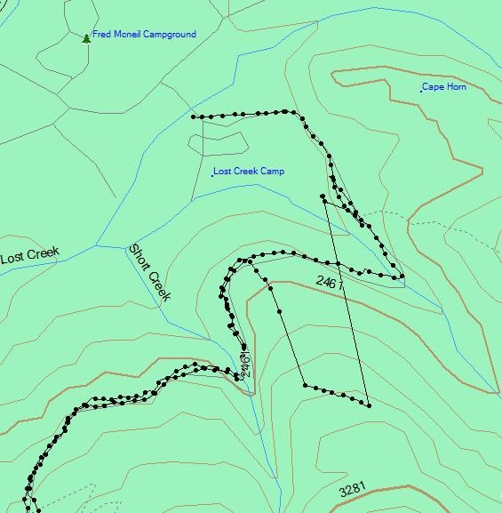
I walked up the trail and everything was okay, but on the way back it started reading 0.1 mile off, paralleling the actual route, then all of a sudden snapped back

Occasionally there are other similar weird errors

The compass on my 60CSx has never worked very good.  I just turn it off.  I just look at my track after about 0.1 mile and can see which direction I’m going

I always fear I won’t find my way back.  Go down a canyon in the wrong direction or something.  Better to be constantly thinking about the way back to the car.  I think fear is more important than any gear like map or GPS.  Same thing for hypothermia.

Like, I remember descending Mt St Helens.  Half of my party went down the wrong ridge.  At the top is was 100 yards away from the correct ridge, but at the bottom it was a mile off.

Roger Caffin BPL Member
PostedApr 10, 2016 at 3:16 pm

Hi Jerry

Which is why many of us still do not trust a GPS all that much. When the GPS says you are going south uphill, but the compass says you are going east and slightly downhill, which should you trust?

That sort of thing happens quite often with many brands of GPS units. Sometimes it’s because of reflections of the signals, and sometimes because the algorithms in GPS units  get confused. One time, while testing the SPOT I for BPL, the unit had me 1 km away on the other side of a big estuary.

Cheers

Jerry Adams BPL Member
PostedApr 10, 2016 at 4:07 pm

another time I walked down to a road, then went one direction on it, but the GPS error position just happened to have me going the other direction on the road.  After a while it snapped back.

another time my GPS failed on acquiring satellites.  I had to reload software from the website to get it to work.  But, it was obvious the GPS didn’t work from the start – not like it failed in the middle of a trip.

just glancing at my folder, I took the GPS on 100 trips over 9 years.

On one trip it didn’t work at all so there was a 1% total failure rate.

Twice I had an error like I described above, but it was an obvious error so it didn’t confuse me or anything.

Occasionally it loses acquisition of satellite, like in a canyon, but it’s easy enough to know approximately where I am and it starts working again after a while.

Occasionally I forget to turn it off so it’s discharged the next day.  I just put in my spare batteries.

Once my NiMH batteries were old and had a really short lifetime because it was really cold.  For that trip I think I turned it off some.  Then I bought new batteries.

GPS has been very reliable for me.

And let’s say that I get into trouble and really need the GPS to save me (which has never happened but it’s possible).  What’s the chance of this happening, and the GPS failing – lottery winning level odds.

Bruce Tolley BPL Member
PostedApr 10, 2016 at 8:41 pm

@ Lori “Four people with Garmin 60csx units with a single UTM coordinate. Three of the four units attempted to navigate the group on a bearing that was 20+ degrees off the fourth — and all three were wrong.”

So what went wrong?  The electronic compass in a GPS is still a magnetic compass (I think). It could therefore get biased bearing readings from sources of metal, other magnetic fields ,galvanized trash cans, a parked automobile, I would think. Perhaps some GPS expert knows.

I only use my GPS to check my location with UTM coordinates versus a paper map when I feel a bit bewildered.

PostedApr 10, 2016 at 8:52 pm

Not sure what the length requirements are, but I kept getting error messages when this post was one long post.  So I split it into parts and it posted no problem.  The other issue that I still don’t understand is how to post links.  peace


Jesse,

Lots of food for thought in this thread.

Of course, you want to have a good understanding of map and compass nav before relying on GPS.  As others have pointed out, the best option will depend on what you are wanting to use a GPS for.

Smartphone/Garmin:

  1. Garmin will (generally speaking) be more durable
  2. Garmin will (generally speaking) have longer battery life.
    1. This depends on what model Garmin vs what model phone.  The large screen garmins do not have nearly as good battery life as the more basic etrex series.  The etrex 20 series without barometer will have better battery life than the etrex 30 series if you use the barometer.  Also, it is easy to carry extra batteries for the garmin whereas, depending on the phone, you need an external charging pack which will lose efficiency charging as compared to a swap in battery.
  3. Garmin will likely be waterproof.  Some phones are waterproof and others require a case/plastic bag.
  4. Garmin will be marginally more accurate.  This matters most when you are wanting to track distance traveled or elevation gain loss.  One time location fix is not as big a deal unless you are trying to find a food cache or other small object.
  5. Garmin will find and keep location fix in situations where you don’t have a clear sky view better than most smartphones.  I can get a GPS fix in the house with my garmin and not with my phone.  In canyons or very very dense cover, the garmin will do better.  However, for 98% of my hiking, my phone is able to keep a sat fix no problem.
  6. Smartphone is a device many already own and carry, so no extra weight or cost.
  7. Smartphone GPS app interface is generally better and also updated more often.
  8. Smartphone GPS app generally have much better map selection.
  9. Smartphone GPS app generally has more screen area to see maps.
    1. It is always good to have a paper map, but sometimes you may not.  When I travel, there are many times that I don’t have a access to paper maps, but do have access to maps on my phone.
  10. Smartphone can use maps such as Caltopo which can also be printed.
    1. This means that the map on the phone lines up exactly with the paper map.  Very nice for using them together.
  11. Smartphone waypoints, tracks, routes measurements, are much easier to export for sharing, GIS integration, uploading to sites such as GPSies.com, mapmyrun, Strava, etc.
  12. Smartphone apps with cell reception can live track multiple users similar to the functions of Garmin’s Rhino series.
    1. Off course, the Rhino series uses non-cell radio to communicate and doesn’t require cell signal.
PostedApr 10, 2016 at 8:53 pm

post continued……

Android vs. Iphone and apps:

As others have mentioned, there is always a healthy debate between which platform and app are the best. If you already have one or the other, the merits of the platform as GPS may not be something that influences you to switch, however, if you don’t have a smartphone yet, its usefulness as backcountry navigation tool may be something to consider.

I bought a smartphone specifically to replace my garmin units as a navigation tool.  I have both mac and pc laptops and considered (in 2012) my options for phones.  Android, Iphone, and windows phone were on my radar at that time.  I am extremely glad I didn’t go the windows phone route.  They do have some good maps (what was Nokia Here, now simply Here), but not the best and are likely dying as a platform.

iPhone has the advantage of simplicity.  There are not 1000s of models and options.  Buying an iPhone doesn’t require much research to know which model to get.  It also means that accessories and apps are aa given.  There are not nearly as many offline map apps for iPhone.  This makes it easier to get the best one available for the platform, but also means you don’t have the options available to Android.

I have not personally used the Iphone, but have used what seems to be the highest rated GPS/Maps app (Gaia) available to iPhone users. I think the interface is mostly the same, if someone has used the app on both, feel free to correct me.   Comparing Gaia to other apps, such as Backcountry Navigator, Locusmaps, it is an okay app, but I feel that the reason it gets as much notice as it does is because it is the best app available for Iphone, not because it is better than the other options for Android.

So, if you use/have an iPhone, Gaia may be the best option for you.

However, if you own an android, or simply want the best GPS/Maps app for backcountry or travel use, I think that Gaia is not as good as other options.

GaiaGPS, cost 20$ plus in app purchases, pro supscription 6$/month, or 40$/year

Backcountry Navigator, cost 12$ plus in app purchases

Locus Maps free/pro, Pro cost 7.50$ but free version gives most functions.

Oruxmaps, open source, free, donate version has identical functions.  both are ad free.

Of the above apps, my personal favorite is Oruxmaps.  I have all of these installed on my phone and keep coming back to Oruxmaps.  I appreciate the idea of open source software but more than that, I think that Oruxmaps is the most functional as a replacement to a garmin handheld.  Its user interface is efficient while also giving the most options.

All of the apps offer basic waypoint, tracks, routes, and maps.

PostedApr 10, 2016 at 8:57 pm

Gaia:

  1. Gaia looks great but has limited options compared to the other apps.
  2. Does offer the option of property boundary maps in the subscription version
  3. Has a web version for uploading tracks, planning etc.
  4. Available on both Apple and Google app stores, so if you switch back and forth a lot, you can use the same interface.  (I would probably still use Oruxmaps on Android and Gaia on iPhone as the actual data can be used in either-KML, GPX, etc transfer no problem. )
  5. Gaia has better tutorials on Youtube, etc.
  6. Does not offer the option for immersive mode on Android, which means you may lose up to .5 inch of screen that could be used for the maps with the status bar and navigation bar.
  7. Does not offer control over how often the GPS is queried.
  8. Map tilting support
  9. Timeline feature shows all activity in one place.  Very nice implementation.
  10. can use external bluetooth gps

Backcountry Navigator

  1. BCN has a long history on Android and their app is well developed.
  2. BCN gives a number of map sources, as well as the option to use prebuilt maps
  3. BCN has extras available for purchase at (in my opinion way to high) prices between 10-20$.
    1. I could spend almost 500$ if I purchased all the options.
  4. Supports OpenAndroMaps.org maps, and can be pointed to a folder of your choosing where they can be stored.
  5. Waypoint alerts
  6. Integration with GPSies, everytrail, etc.
  7. Full screen mode hide the upper status bar but does not hide the nav buttons along the bottom.  This wastes about .3 of an inch of screen space.

Locus maps, free or pro

  1. Locus has many add-ons for free and if you are a dev, you can make more.
  2. Locus is relatively cheap, 7.5 for the “pro” version
  3. Locus gives many map options and if you want to add your own, you can.
  4. Locus can use maps from openandromaps . org
  5. supports maps overlays
  6. Off route warning
  7. External sensor support, ANT+, bluetooth sensor
  8. Integration with sites, such as GPSies, ikiMap, etc.
  9. Immersive mode support

Oruxmaps:

  1. Open source and free.
  2. Oruxmaps gives the widest options of maps, and the user can edit the mapsource file to include more.  Including garmin maps from gpsfiledepot, supports choosing where to store map files.
  3. Supports multimaps and overlays
    1. It is possible to use multiple maps and adjust the opacity to show the desired features
  4. Oruxmaps allows for integration of DEM (digital elevation model) files to show 3D maps or calibrate atlitude.
  5. audible warnings/alerts, such as waypoint warning, far from route warning, waypoint voice message, etc.
  6. Photo waypoints
  7. ability to make combine tracks into one kml/gpx or separate segments
  8. Area calculator
  9. Profiles enable different settings for different activities, such as hiking, mountain biking, high accuracy or battery saver
  10.  Integration with GPSies, Everytrail, MapMyTracks, Email, etc.
  11. Can use external sensors including ANT+, Heart Monitor, Cadence, GPS (such as bluetooth GPS)
  12. SOS message function (requires cell coverage)
  13. Immersive mode support
PostedApr 10, 2016 at 8:57 pm

Best of both worlds:

In my opinion, the best of both worlds where weight is not the highest priority is to use a smartphone along with a GPS receiver.  Garmin makes a bluetooth GPS receiver (Garmin Glo), which pairs with your phone so you get the accuracy of the Garmin GPS chip, and some battery advantages, while also being able to take advantage of the maps and user friendliness of the smartphone.

If you want the ultimate setup, in my opinion, use the inReach with a smartphone. The inReach provides accurate GPS benefits, satellite comms, and smartphone pairing.  I have not personally used the inReach, but there are many good reviews.  They were recently purchased by Garmin, so take that into consideration.

Summary:

All of these apps are (in my opinion) better than buying a garmin or comparable standalone gps.  Having used them all, I think Oruxmaps is the best.  Why? Because I like the user interface the best, I think they have the most maps and options, it is simple and has a really clean interface (if you select to have the buttons hidden), the cost is great, and it is open source.

If Oruxmaps cost the same as or slightly more than the other options, it would still get my vote as the best option.

I apologize for the length of this post, but hope it is helpful. Someday, I’d love to see a better comparison written up, but I don’t have time at the moment.

Peace

Ross Bleakney BPL Member
PostedApr 17, 2016 at 12:56 pm

@Garrett — Thank you very much for all that information. I really appreciate it, and it will definitely influence my decision. Since I own a smartphone, I’ll just load some software on it, and figure out how best to deal with the battery issue (which may prove to be no issue at all).

Right now I own an older eTrex model. It can get me out a jam, like a sudden whiteout when skiing. It doesn’t have any maps associated with it, but I always carry a map and compass, so I can figure it out. Right now, though, I want GPS capability with a built in map.

In general, as everyone said, if you do your homework and keep an eye on the terrain, you can often navigate quite quickly using just a map, or a map and compass. But a GPS device, especially one with a built in map, can really make life easier. As I see it, there are only a few things I want out of GPS software:

  1. Good maps. Just about every GPS has the ability to put me on the map, but the quality of the maps are probably different. For the U. S., I want something similar (if not identical) to this: http://caltopo.com/map.html#ll=47.42639,-121.53686&z=15&b=t. This is a scanned USGS map without hill shading. I find this very easy to read, which makes a big difference.
  2. Be able to easily pre-download the maps. In some cases, I assume it comes when you install the app. But if not, then I want to easily be able to load them up at home.
  3. The ability to quickly pick a spot on the map, and have the phone point me in that direction. This is probably 90% of what I use a GPS for. If I’m hiking along on a trail that is half snow and half dirt, it is common to lose it and pick it up again without bothering to check with a GPS. But then you get into a situation where you lose the trail, and don’t want to wander too much. Pull out the GPS, find the trail on the map, tap that point, and then head that direction. Or simply being able to rotate the device until an arrow points that direction is fine.
  4. Make a track of where I’ve been.

I realize that all of the software does this, but it seems like some make it easier than others. It also seems like a lot of the software does all this and more, and as a result it is rather complicated to do these simple things. I downloaded OruxMaps, and quickly got overwhelmed. Perhaps it was because I was reading about things that I really don’t need to do (like modify XML files) but I couldn’t figure out how to do the basics. It doesn’t help that I am playing around with it in the city, and as a result, it is giving me options that I will never use (such as street by street navigation). I did manage to find a layer that has topographic lines, but the hill shading was so intense that it was very hard to read the lines.

I realize some of the things I’m requesting may be in conflict. For example, the best map selection may be with Orux, but you have to spend some time configuring (which I would rather avoid). But if you (or anyone) want to suggest software that might make these tasks relatively easy, I would appreciate. I may also just play around with the other packages (especially the free ones).

Thanks again.


PostedApr 17, 2016 at 8:15 pm

Ross,

After playing with a bunch of phone GPS and map software, I think that Oruxmaps, while being the most complex and full featured, also had the ability to be the most simple.

<span style=”line-height: 1.8;”> You can hide the buttons that aren’t relevant to what you’re doing, and use only the functions you want while also being able to stick with one app for the long haul, whether you continue using only a few features or end up using more of the advanced features. </span>

With oruxmaps, you can choose which layars to show and also choose the theme.  The theme is what tells the map to render more or less info at any given zoom level.  In the back country, you want more info shown by default as there is less total info to show,while in urban settings, you want less info shown until you zoom in.

I also recommend downloading oruxmaps directly from oruxmaps website and using the newest (beta) version.  It is very stable and has a lot of improvements over the play store version.

Here are my steps for setup:

1. Download Oruxmaps from website

2. Download map of States or regions from openandromaps.org website

3. Downlaod GPS status app from play store

4. Open oruxmaps app, go to global settings, user interface, buttons and deselect vibration and select hide buttons (only the first hide buttons box not the upper or slider options)

5. If you downloaded the beta oruxmaps version from their website, go to settings, select show advanced preferneces at the top, then select user interface, misc UI, and select the first four boxes: immersive mode, transparent action bar,  status bar and scale.

6. Take downloaded map zip file from step 2 and move it into sdcard, oruxmaps, map files folder using your file manager.  If you don’t have a file manager that handles zip files on your phone, you can unzip and store maps with your Mac or PC and then move them while you phone is connected to he computer via USB. Or downlaod ES File manager from the play store.

7. If you want the mapsources file that includes Caltopo and some others already set up, shoot me a PM. Or Google it and you may be able to find it already made.

8. Close oruxmaps and then reopen it after you have moved the map there and it will show up in maps, switch map, offline maps.

9. Go to openandromaps and downlaod themes version 3 to use different rendering for back country/front country use.

10. I think that even though oruxmaps may take a bit to setup, once you take an hour or two to become familiar with it, it is really efficient and simple.

Peace

PostedApr 18, 2016 at 1:14 am

Thanks so much Garrett i have a Delorme inreach and Garmin 60 csx that i always use at the same time  for navigation i also bring along my itouch to operate the Delorme but now i see i can get the Garmin Glo to pair with my Itouch so i may be able to leave the Garmin  at home.Wow .Good to know i was just about to upgrade my GPs .


PostedApr 18, 2016 at 10:51 am

Dan,

Glad the info could be of use.

One other thought on external GP receivers:

Garmin GLO is one option but not necessarily the best for your application.   Here’s one link along many that compare various options.

http://www.mypilotstore.com/mypilotstore/Aviation-GPS/Bluetooth-GPS.asp

I haven’t personally used an external GPS via Bluetooth, Burt know several people who have and each did a little research to find the best one for how they wanted to talk stuff.

Peace


Viewing 13 posts - 26 through 38 (of 38 total)
Loading...