Adam I’m not sure I understand exactly what you are asking. The question(s) may be difficult to frame on a complex subject but questions are always good. The Prophet Amos said something like “The wise man seeks council”
The Cherokee pretty much always followed the ridge lines when they wanted to get somewhere in a hurry; and if there weren’t some really deep pass with nice wide valleys on both sides. The AT from about Harper’s Ferry south probably basically follows a series of Native American trails.
Following a drainage is usually problematical because of the typically steeper terrain (left/right and up/down, water follows the quickest path) and heavier vegetation; not to mention the sudden transitions that give us those lovely waterfalls and the need quite often to cross and re-cross the drainage (wet- maybe dangerous) because of steep obstacles (anything higher than about 8 feet can often be impassable – think pour-offs in the desert southwest) Plus wet slippery footing. Elisha Mitchell the geologist for whom Mt. Mitchell, the highest point east of the Black Hills is named; died from loosing his footing and slipping over a waterfall on the slopes of that mountain.
The book mentioned by Geoff should acquaint you with all the geometry/math and technique.
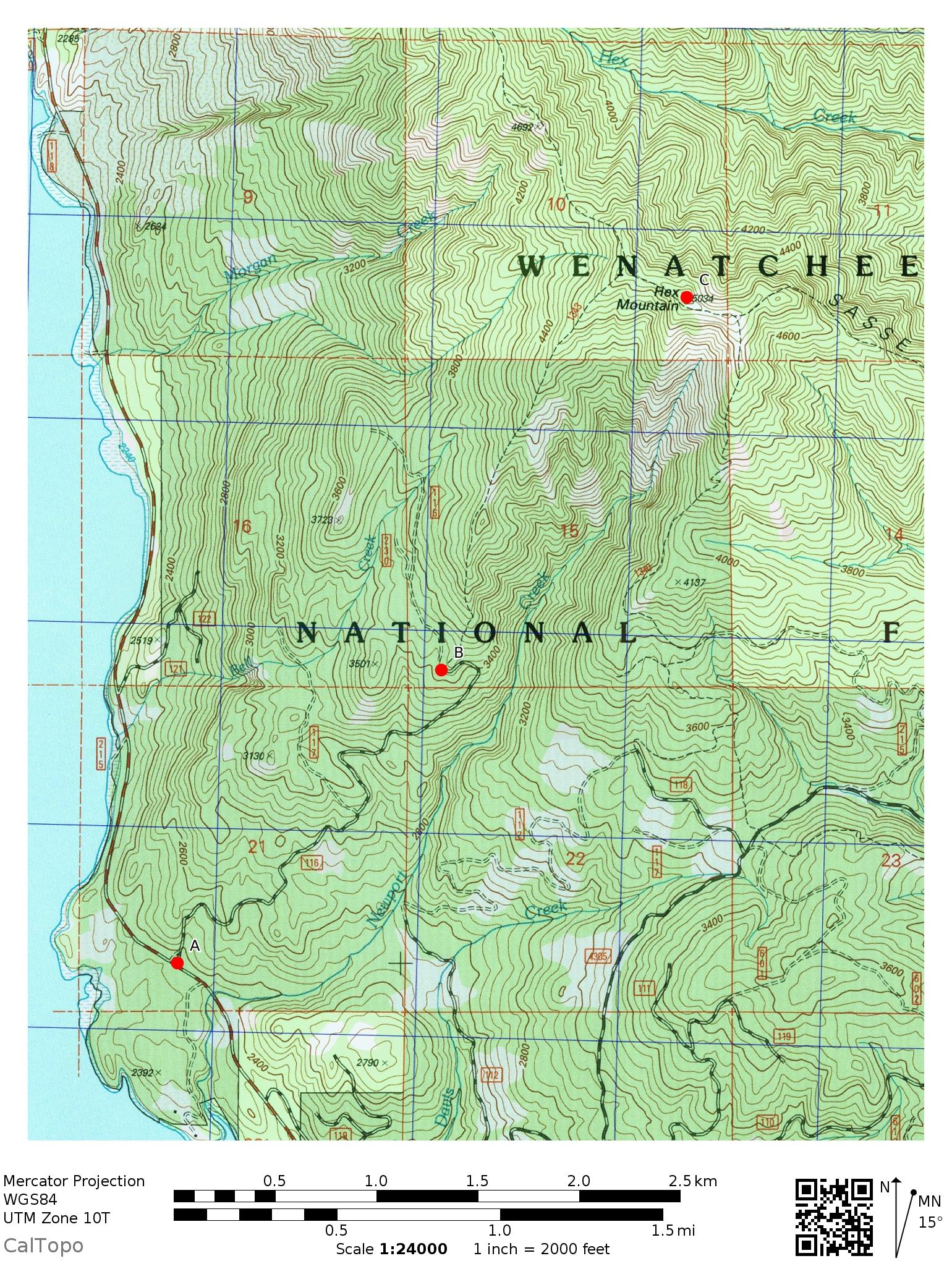
A general rule of thumb might be that you extend the distance between contour line crossings as much as practical. You also avoid spots where the contour lines are close together! Following this “rule” you pretty much end up with the road in your example. You’ll note that in the steep lowest part it runs parallel beside the tighter contour lines for the unavoidably steep lower very first part until crossing them at right angles. Those types of contour lines where the line runs roughly perpendicular to the fall line to a “V”turn tend to follow the easiest grade. The road then sort of parallels the contour lines as they widen and run parallel to the slope until again it’s forced to cross going up. Once the route gets near enough to B it follows the ridgeline from B to C which also follows the rule. Maybe another generalization would be that its good to go parallel to contour lines wherever or whenever possible but it also helps to have the ground under each foot basically about the same level which is why ridges are better than side-slopes.
Of course vegetation, fire and flood damage and fun stuff like Talus can change the route calculation. Nothing like a laurel hell or an alder thicket to make things interesting.
There are lots of good comments copied upthread and I really like this one from Paul:
“Another technique I use for learning and fun is to fire up Caltopo and Google Earth side by side and do some comparisons of the same area I’m going to hike or have hiked. The 3D in Google Earth isn’t perfect, but it’s fun and free.”
Like Paul I’ve found that looking back over terrain I’ve covered on foot (and from the virtual air in 3-D!)can really help to put everything into perspective. This can really help those maps take on a 3-D shape.
And like pretty much everyone I agree that practice makes perfect; or good enough until perfect comes along.




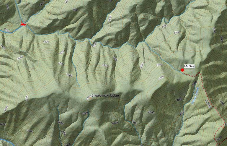
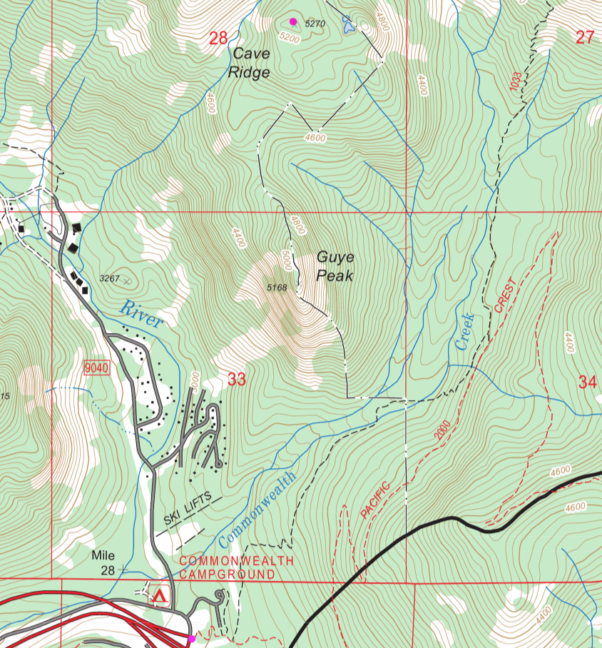
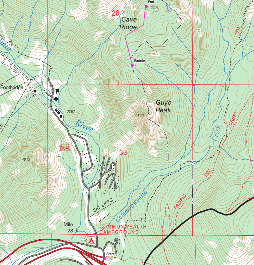

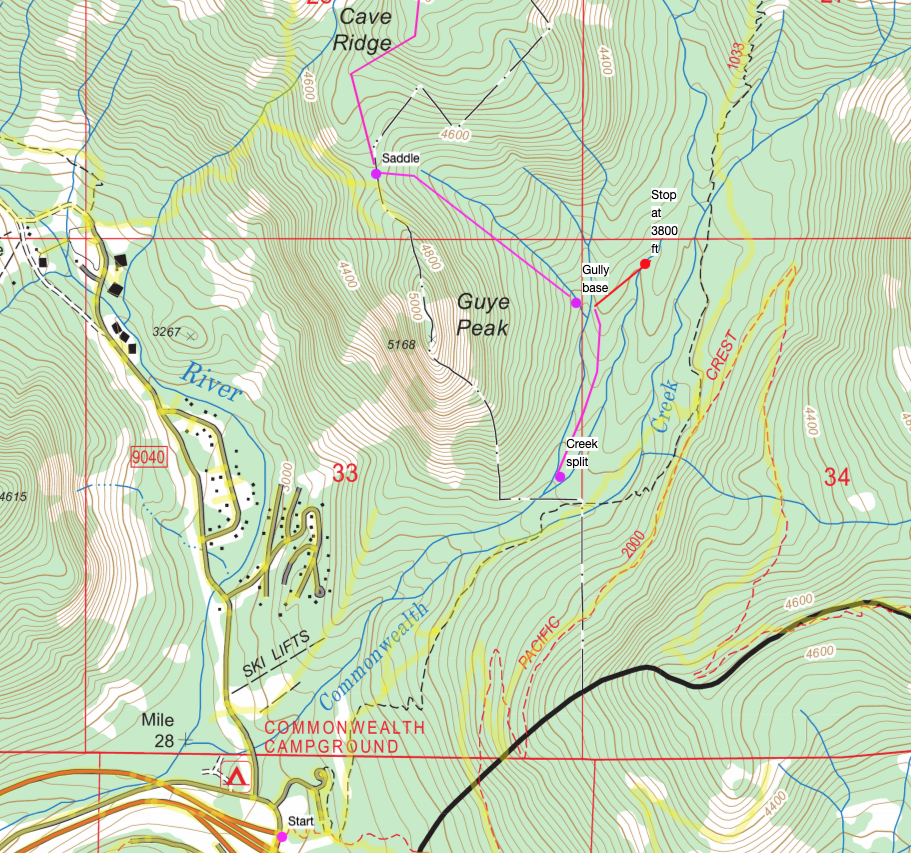
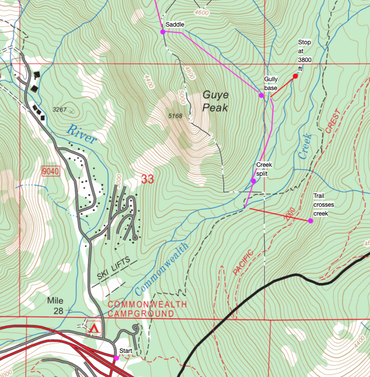
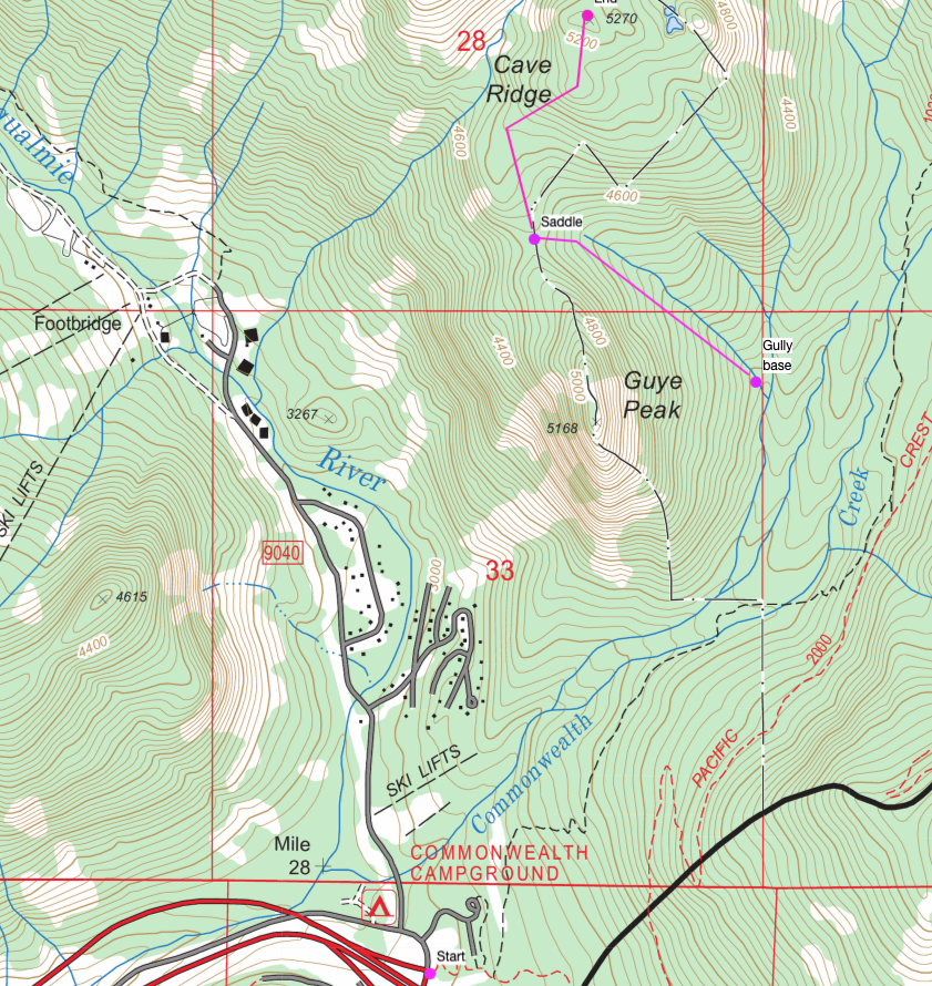 Finding the gully is a bit trickier. You can follow the northernmost creek from the split in the two creeks. Hopefully, this is obvious, but may not be so if there is little water flowing. You find the next split and you are where you are, around 3800 ft. If you continue and hit the second split of the creek, the bearing up the slope is quite different, and it’s a bit higher in elevation.