Well Adam might I suggest that knowing (now) you’ve had boots on the ground and experience with your hypothetical problem one might be again wonder what you are trying to determine? BTW I have not been nearer than @ 4 miles from Breakneck Ridge or 3 Forks but I do understand that terrain and so can make somewhat informed guesses about how the terrain and ground cover might affect the route.
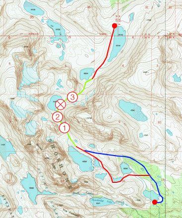
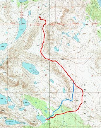
As Erica points out the most gradual grade is between the 2 blue line streams or I guess in this case streamlets. That’s probably why the thick stands of firs are there.
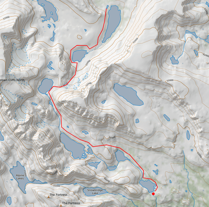
As I understand it one picks out a target where one needs to arrive. Then the leg or legs is chosen based on the more direct or the least troublesome way to reach that target. Lets say its the most efficient way to reach that point.
This is fine in good visibility when the target is in sight but lacking good visibility every time one zigs or zags the angle is going to change. I’m not sure how that works out perfectly with a compass. I guess one technique is to keep the legs short. I’ve also tried picking out an object as far away as I can see that’s directly on the line; like a distinctive tree or rock, and then zigging and zagging as necessary until I reach that and repeat. This usually works ok if the legs aren’t too long, and is the part of the problem where a pre way-pointed gps comes in really handy. I’m curious to see how people who rely strictly on compass solve this one. Curious enough that I’ve picked up the Brotherton book as well.
As pointed out upthread often times the ground cover or other facts on the ground, can change the calculation of most efficient route.
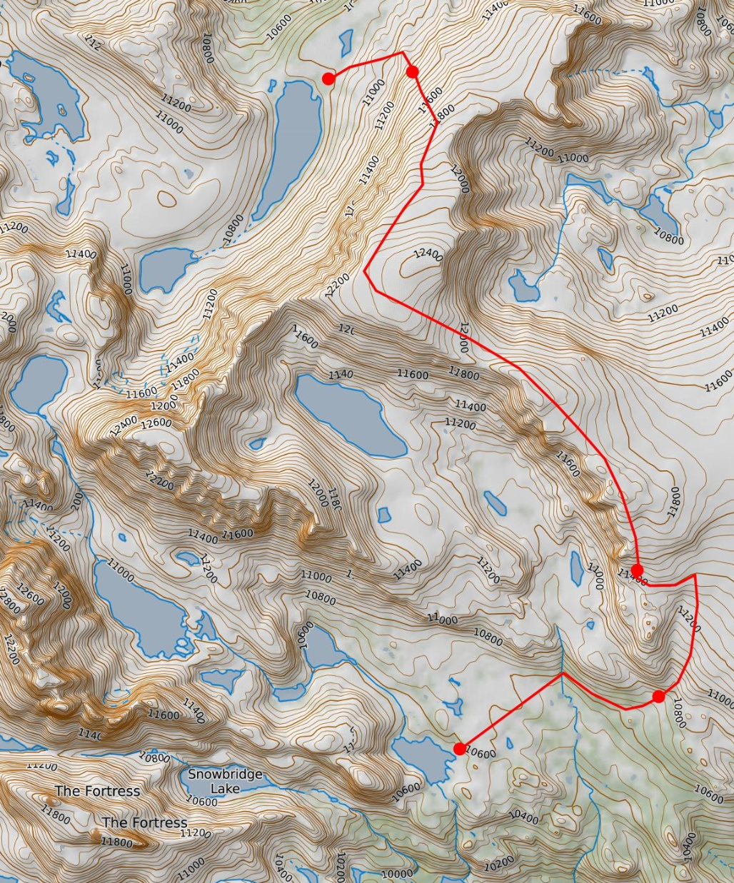
Here’s another rule: A lot of terrain, obstacles and trouble can completely hide between 40′ contour lines.
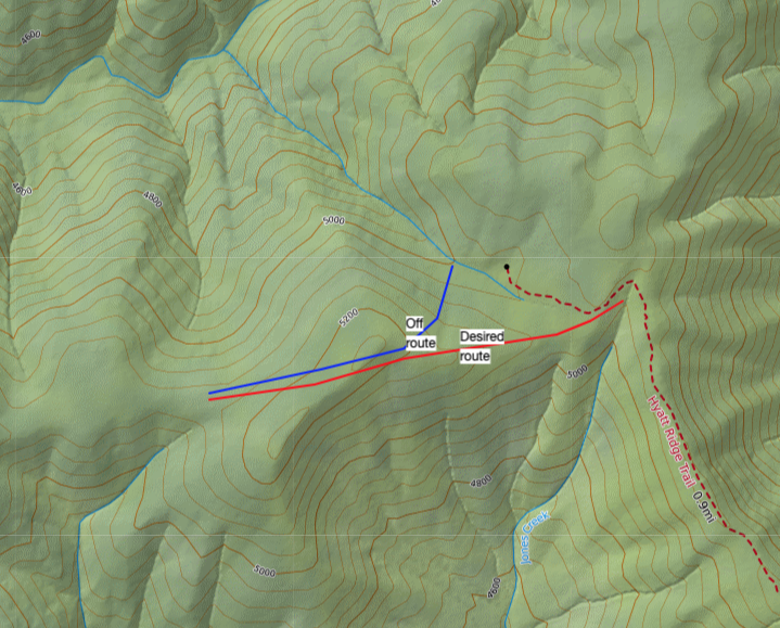
This is the route to your goal I would pick based strictly on what I perceive to be most efficient. The first part follows the existing trail to the crossing point and is drawn straight by necessity. On the ground you found the south side of the first blue stream line to be the best route to ascend to the saddle and little wonder if the brush and what appears to be talus of some sort weren’t a big problem. Further along with the black leg and the ziggy red final leg I’m following the 4800 contour as long as possible. Anywhere along that black leg the most efficient route bending or curving to the east to cross the 5000 contour and get to the flatter part above 5120 should become apparent.

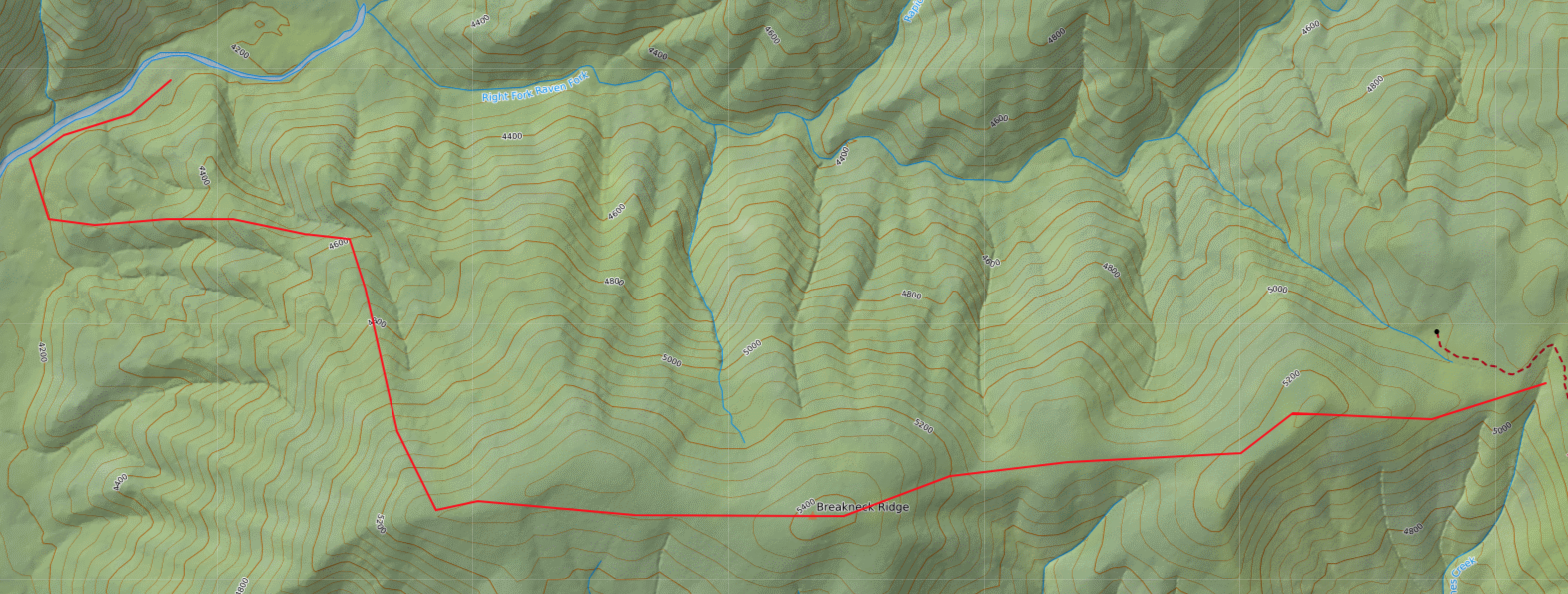
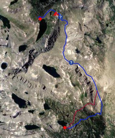
Below is an example of a route with no trails I followed just this September and so have recent experience with the conditions on the ground. The co-ordinates for the rough center of the image so you can zoom in more closely are: 43.1049, -109.5283
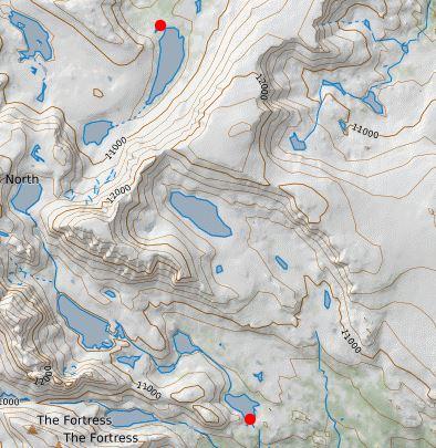
How would you get from the bottom right lake outlet to the top lake outlet?