Jamie,
I think we are talking about the same trails but didn’t realize it.
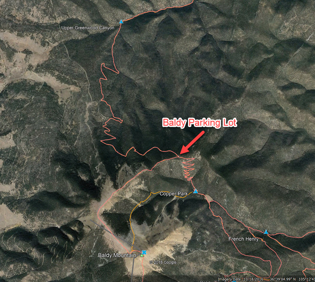
I did as you suggested and looked at Google Earth, Maps, then entered Philmont and bingo, a topo with trails came up. I scrolled up to Baldy Mountain and I see 3 trails coming up to Baldy’s summit; Baldy to Baldy Town and Black Horse Trail up the south side, Baldy to Greenwood Canyon Trail and Baldy to Copper Park Trail that intersect on the north side.
Is this the map and trails you are looking at?
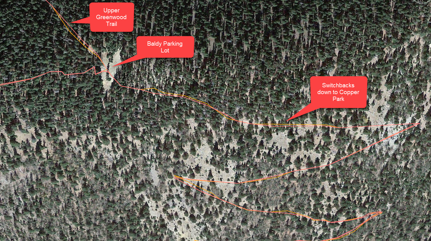
The Baldy to Greenwood Canyon Trail is a short trail from the intersection with the Baldy to Copper Park Trail just below the summit that runs northeast along the relative flat (500 feet climb overall) treeless ridge line to the intersection just above the switchbacks of the Copper Park to Greenwood Canyon Trail.
The Copper Park to Greenwood Canyon Trail is the trail (road) you will be coming up from Upper Greenwood on. We hiked it in 2001 from Greenwood Canyon to Copper Park (before Upper Greenwood was established). It is a very tough continuous steep uphill climb on a 4WD road with no shade or water the entire way. Leave well before dawn.
The Baldy to Greenwood Canyon Trail is the trail and along the ridge line I have been speaking of. We hiked it from Copper Park to the summit in 2014. We have summited Baldy 6 times on all three trails and it is the best (easiest) of all the approaches.
If that flat treeless bald at the intersection of the Baldy to Greenwood Canyon Trail and Baldy to Copper Park Trail is the “Baldy parking lot” you’ve been speaking of there is no parking lot or road to it and no trees to hang bags. But it is only about 253 feet below the summit though it is a very steep and rocky climb up from there. I believe you can carry your packs up that short hard climb rather than leave them on the ground for the mini bears.
“Philmont should be enjoyed, not endured”, Moonshine
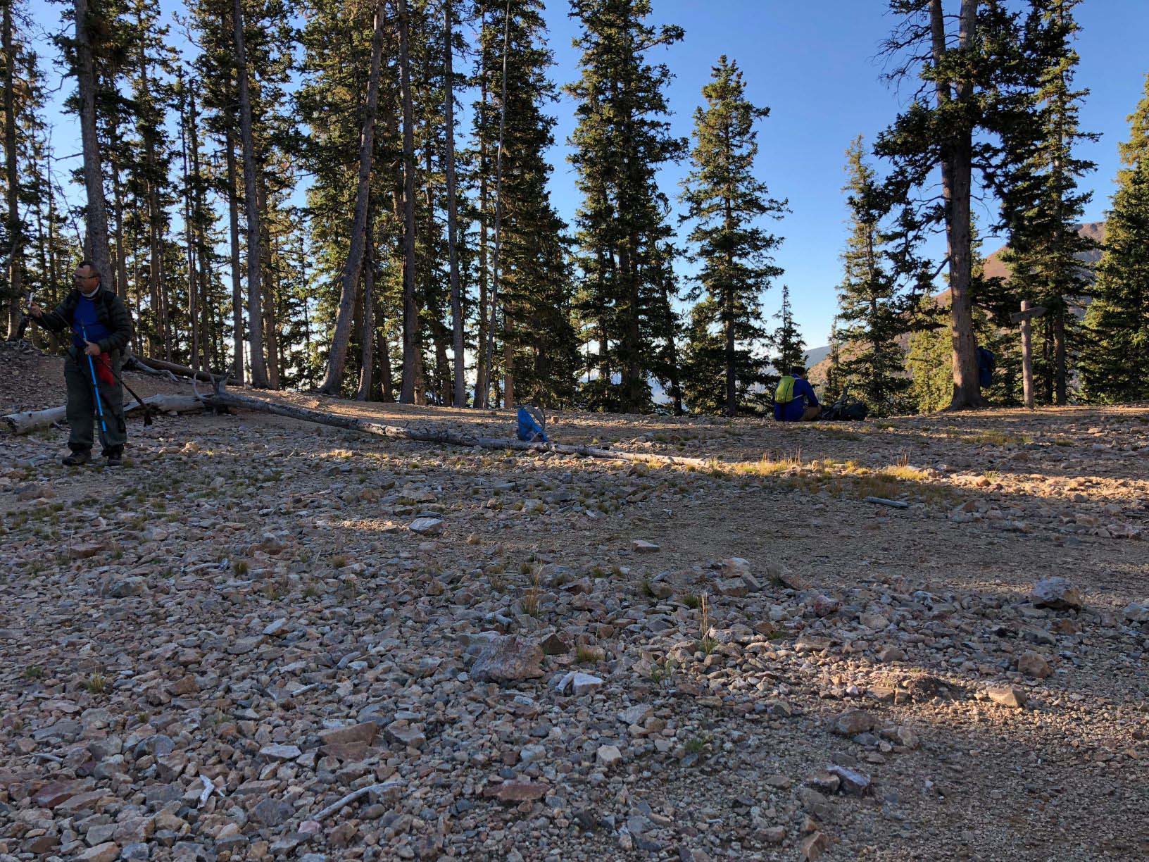 Baldy parking lot.