Well, I guess this belongs in “On the Web”, because there’s no sub-forum titled “The Intersection of Math Geekery and the Sierra Nevada”.
I’ve had an un-explicable urge to render USGS elevation data with rendering software for a while now. I don’t know where the urge comes from–Google earth already kind of does this. So do other things. But they’re not pretty.
The basic equation is:

I already had the USGS elevation data. The challenge was getting that in Blender, my rendering software of choice (because free. Also, because Python).
That step took a little doing, but eventually I did it. The full-resolution mesh for a single USGS quad is 10,812/8 x 10,812/8 faces, or around 1.8 million mesh elements. Yikes! A million is a big number!
Fortunately, computers are also big these days; although sluggish to manipulate, I was able to import the mesh in full resolution with no optimizations. Hooray for brute force!
I started with a simple one: the Mono Mills topo. Simple, because it’s at the upper right corner of the (-120, 37) (-119, 38) elevation dataset.
I threw on the texture from the 90s era quad, added some lighting, rendered, and… voila!
(if you click on any of the following, they should open in a new window in full-and-obscene resolution)

I wandered over to a place with a real mountains: a Mammoth Mountain!

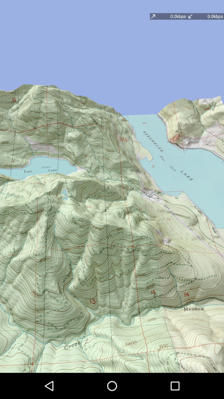
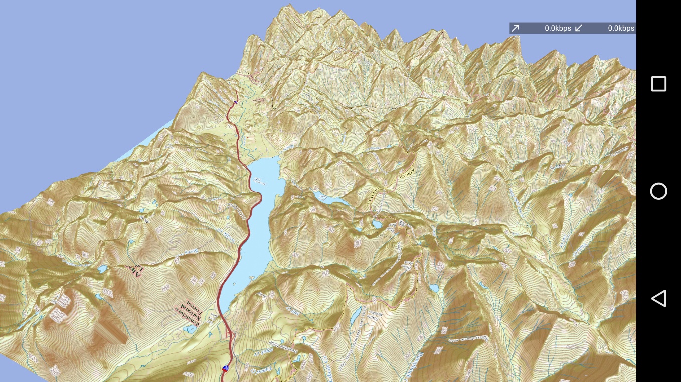
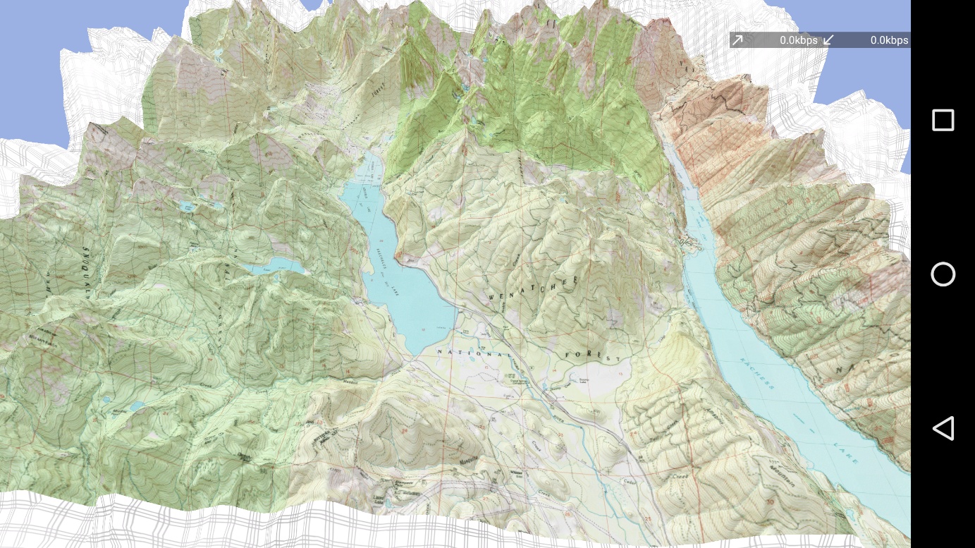
I can put two together…

…or many (at the cost of mesh resolution–these and the above are reduced by a factor of around 10x in mesh size):

I can take the USGS quad that I’m using as a texture, and export it to a shader map, then add that to the model such that the water has a specular reflection:

I can visit an old friend, like Mt. Ritter:

Then, because I never know How Far Is Too Far, I can create an animation, with the camera flying around Mt. Ritter and the minarets with moving sun-like and moon-like lighting (now with more alpenglow!):

(Realists may note that my sun rises and falls in the wrong directions. I noted this too–after 40 hours of rendering. You get what you pay for.)
In summary: neat! Not particularly useful for route-planning. But useful to stare at, useful to ogle. Perhaps useful to make a pretty awesome wall-poster out of.
Please enjoy! And if you think of a way that this can make me instantly wealthy, please notify me. My endeavors seem to always lack this trait.