Topic

The Southern Sierra High Route – A Guide (a southern extension of the Sierra High Route to Mt. Whitney and beyond)

Viewing 16 posts - 26 through 41 (of 41 total)
PostedJun 27, 2016 at 6:03 pm

Are there any updates to the Acrodectes variation to avoid Woods Hole ?If anyone has done the SoSHR route recently, is there anything you can tell us.

Good Q Art. As far as I know, nobody had made it over the Acrodectes ridge. I keep meaning to make the time to get down there seriously scout out a route but it hasn’t happened. (Ended up doing BC climbing north in the Tuolumne area http://www.adventurealan.com/technical-peak-climbing-yosemite-backcountry-part-1/)

So much to see and do in the Sierras and so little time. Have a great trip. Mt Sil is a fantastic choice! All the best, -alan

Art … BPL Member
PostedJul 12, 2016 at 8:08 pm

Does anyone have any info on the saddle between Acrodectes Peak and Baxter Peak ? Is this what Alan calls Grasshopper Pass earlier in this thread ?

the south side of this saddle is just 2nd class, but I can not find any photos or info on the north side, the approach from Stocking Lake.

We will be starting the SoSHR on July 24, and would like to attempt the Acrodectes version if it is at all possible at 3rd class or less.

Pedestrian BPL Member
PostedJul 13, 2016 at 2:30 pm

I suggest you look at pages 78-86 of “Sierra Crest Route” by Leonard Daughenbaugh.

From page 81:

“3. Leave the Crest Route east of the largest Baxter Lake, and ascend northwest to “Baxter Col” (“Grasshopper Pass”), the low point between Mount Baxter and Acrodectes Peak……..”

PM me if you need any more detail. I’ve never personally been up in that area myself but have been planning some trips later this summer/early fall.


Art … BPL Member
PostedJul 13, 2016 at 4:12 pm

Pedestrian, I don’t have a copy of that book, they are asking $177 for a used copy on Amazon. so reading the pages you suggest is just not gonna happen.

thanks for your reply though.

Pedestrian BPL Member
PostedJul 14, 2016 at 12:51 am

I have a copy of the book and could scan some of the relevant pages and send them to you if you like; please let me know…..

Art … BPL Member
PostedJul 14, 2016 at 7:43 am

Pedestrian – PM sent regarding your offer.

Dave – thanks for the link.


PostedJul 14, 2016 at 9:35 am

Hi Art,

A friend and I completed a thru-hike of the SoSHR just a couple weeks ago. We went Jun 27 – Jul 3. Did not do Acrodectes b/c the only available beta out there right now says it’s a no-go.

I wrote up a trip report with photos and also made a youtube video. Would love to share them, but unfortunately there’s something wrong with my Backpackinglight account and it’s not letting me create any new forum topics in the post-trip reports section right now. Will let you know if the issue is resolved before you head out though.

In the mean time, here a link to the youtube video: https://www.youtube.<wbr />com/watch?v=cytnCr8WOKA

PostedJul 14, 2016 at 9:38 am

Sorry for the faulty link to the youtube vid. Not sure what happened to it.

This link should work fine. Here’s the URL too just in case.

Youtube video

Art … BPL Member
PostedJul 14, 2016 at 9:39 am

Austin Great !

looking forward to your trip report.

PostedJul 14, 2016 at 10:12 am

<span style=”font-weight: 400;”>Hi folks. As you know, In our hike of the route we scouted this section but did not climb over Grasshopper Pass. </span>

In Secor’s The High Sierra [page 176, 3rd edition], he describes the ascent up the north side of Grasshopper Pass “The pass is class 3 on its northern side (loose rock!)…” If Secor  puts an exclamation point on loose rock it is certainly worth paying attention to.

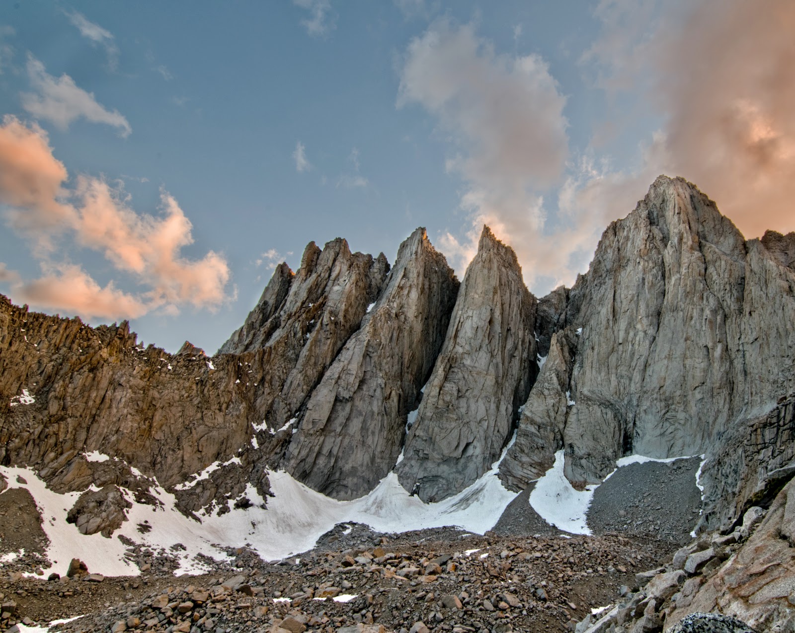
For what it’s worth here is a pic https://drive.google.com/open?id=0B0kTYChKY8wmby1HSUtubEJQRFk of “Grasshopper Pass” that I took on our Aug 2014 trip. We walked to near the base of it before Don decided that it looked to have too much loose junk for his taste. So the pass doesn’t look particularly technically challenging, but it does look like a ton o’ loose crap.

As a guess (but no means certainty), conditions may have changed for the worse since the info roper’s class 3 was based on. I couldn’t find any reports of anyone attempting the north side of the pass on foot (wood’s lake side) in like the last 30 years. At first blush, it appears it might be “post climate change” talus. My experience with this talus is that is far more unstable than regular talus. As such, it may not be very safe if you get on it and it turns out to be unstable. BUT the only way to find out is to actually put your shoes on the stuff. Could just be class 3 with loose rock.

Safe travels, -alan

PostedJul 14, 2016 at 10:17 am

Oh, and that taus field is a lot steeper than it looks in the photo.

Art … BPL Member
PostedJul 14, 2016 at 11:12 am

Alan – thanks

we are currently considering and trying to gather info on the following alternative :

  1. from Woods Lake continue up to Sawmill Pass
  2. from Sawmill Pass take north ridge of Mt Baxter to summit. this ridge supposedly goes at class 2 with proper route finding
  3. from Baxter summit head down to col (Grasshopper pass) this is confirmed class 2
  4. from col head south to largest Baxter Lake, this is confirmed class 2
  5. head west to Dollar Lake
PostedJul 14, 2016 at 11:52 am

If you do, please send the route info. I will include it in the SoSHR Guide.

And the Woods Basin is very nice. Hard to go wrong hiking there. -a

Art … BPL Member
PostedJul 14, 2016 at 2:43 pm

Austin – your short video is Excellent !

hope you can get your trip report up and running soon.

PostedJul 19, 2016 at 10:44 am

Hi Art,

Thanks so much for your kind words! Unfortunately, after much trying, I wasn’t able to get my post of the entire trip report + photos up on BPL. However, I at least got an overview up, with a link to my blog for full day-by-day details and photos. BPL TR is here (https://backpackinglight.com/forums/topic/a-thru-hike-of-the-dixonwilson-southern-sierra-high-route-627-732016/) and the full TR on my blog is here (https://austinlillywhite.wordpress.com/trip-reports/247-2/).

I’m super excited for you to attempt the Acrodectes connection to Baxter via Grasshopper Pass!! If you can confirm that that is a solid option, then the low point of the trip will be avoided and the long JMT stretch will be neatly broken up, and then the SoSHR will really be a perfect extension of the SHR. Wishing you the very best of luck with the terrain out there, and looking forward to your TR when you get back (and hopefully and official update to the route line of the SoSHR trip guide!).

And of course, many many thanks to you Alan Dixon for taking the time recon and put together such an incredible experience for us all. Really indebted to you for your fine work. Can’t tell you how much I loved the experience.

Best,

Austin

Viewing 16 posts - 26 through 41 (of 41 total)
Loading...