As always, Wunderground provides a great summary of the situation.
The fat lady didn’t sing yet, but we’re far enough along that some folks making plans for big CA hikes in 2014 ought to keep an eye on this. 99% of people who might be hiking in 2014 Sierra know this, but for the 1% who don’t know, here is some basic info…
California receives the vast majority of its rainfall in the winter. The heart of the rainy season is November to March. October and April are shoulder seasons. Here’s the data for San Francisco. Other locations in the state are variations on the same theme:

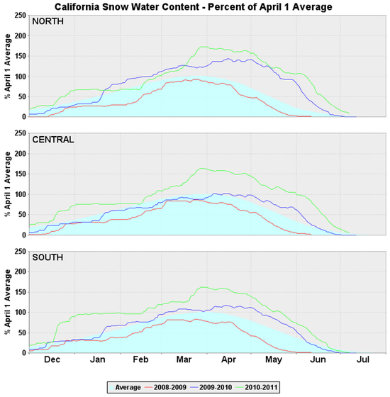
The 2011-12, and the 2012-13 rainy seasons were not very wet. As a result, the snowpack in the Sierras was very poor. The following graph puts it into perspective. Neither 11-12 nor 12-13 were as dry as the record low snowpack in 76-77, but the past two winters achieved only ~50% of normal snowpack. Pink line shows the 12-13 season; green shows the 11-12 season.
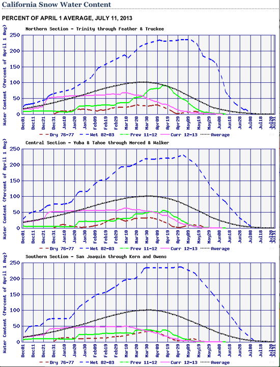
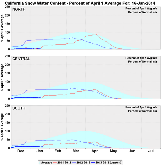
Here’s a link to the current version of these same graphs (which includes 13-14 but drops 11-12).
If we’re lucky the high pressure system that has been blocking the storms we normally receive will find a new parking place, and we’ll finally see the arrival of winter. Maybe we’ll reach the 50% of normal snowpack numbers that we had in the past two winters. Chances for something better than 50% of normal are rapidly diminishing.
If I were planning big trips, I’d think about five things.
1. Mosquitoes will not be a problem in August. They may peak by early or mid July. In a “normal” year, there are still swarms in the southern Sierra in late July to early August.
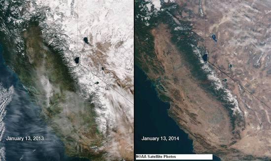
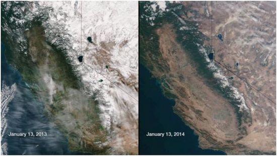
2. Fire season has the potential to be horrendous. That might mean closures. And it might mean crummy visibility. In a troublesome preview of what might be in store for us, there was an unprecedented wildfire in Big Sur a few weeks ago – in a normal world there should not be wildfires in Big Sur in December or January, that’s just weird. Many (most?) CalFire stations close down for the winter, we just don’t have wildfires this time of the year.
3. High passes will be snow free earlier in the season than is normal. “Normal” varies based on the pass, so there’s no magic date. But if you look at the snowpack graphs you can see that in the past two years the snowpack at the measurement stations was down to 0% in mid-May instead of early-July.
4. Drinking water in the High Sierra (Mammoth to Cottonwood) will not be a problem. There are plenty of lakes and rivers. Small creeks will dry up earlier than usual, but lakes and rivers will be AOK as water sources.
5. If I were planning to hike in parts of the state without permanent alpine lakes or rivers, I’d get local info about the status of seasonal water sources.