Day 0
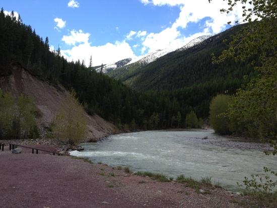
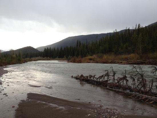
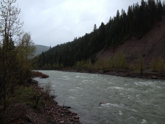
I arrived at the Bear Creek Trailhead at about noon and slowly the group began to assemble. I sat looking at the Middle Fork of the Flathead River wondering if the raging torrent in front of me foretold what I would have to cross in two days time, thirty miles upstream. We drove the 168 miles to get to the start point, looking to the west at storms brewing at elevation. It was great putting faces to another BPL group and you could tell that there were many in the group that were hardcore adventurers. Luckily we avoided the rain at Benchmark and I was able to cowboy camp in the woods.

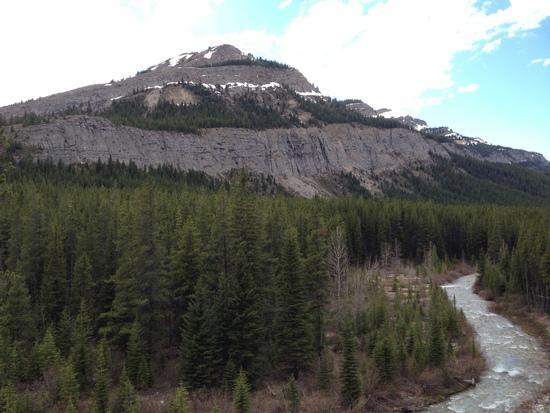
Middle Fork, Flathead River at Bear Creek
Day 1 – The Wall
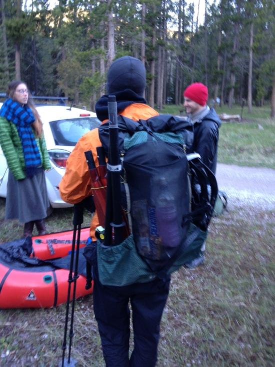
The 8am start time couldn't come fast enough. I was up at first light, body still on eastern time, like a crazed griz ready to hit the trail. It was very cool to see Dave setting up his pack raft. I could really see getting into pack rafting though I doubt there are many good streams to raft in PA. Ranger Craig met us at the trailhead to kick off the festivities. Take a cowboy from the 1800's and you had Ranger Craig. He asked about routes and when I described where I was heading and asked if he had any concerns, his response was "it's pretty Straight-Forward." That brought back memories of the Sierra High Route and Roper's "Straight-Forward" descriptions that he used for several of the more challenging passes on the route.

Dan ready to paddle through deep snow.
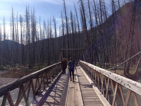
We were off. Soon Dave peeled off to raft the South Fork of the Sun and I continued with the Other Greg and Dan until the bridge over the West Fork.
Bridge over West Fork – Last Human Interaction for 80 miles
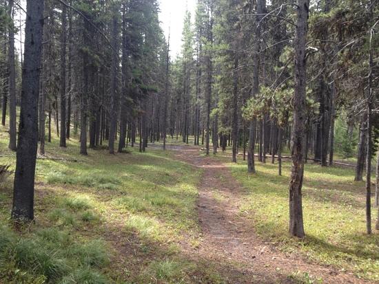
At that point, I pretty much zoned out and flew up the trail making very good time. This was some of the nicest trail I have ever hiked.
Perfect Trail
This lasted until mile 13 when the snow started to appear at 5800' and was solid at 6000'. While this slowed me down it was pretty straight-forward and soon I arrived at Cliff Mountain where the scenery became spectacular.
Cliff Mountain
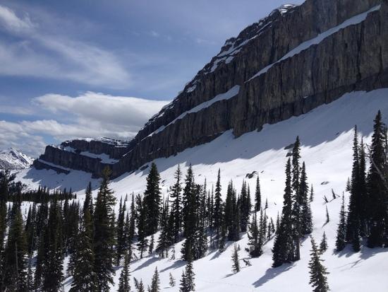
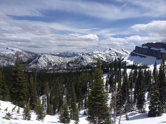
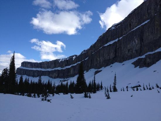
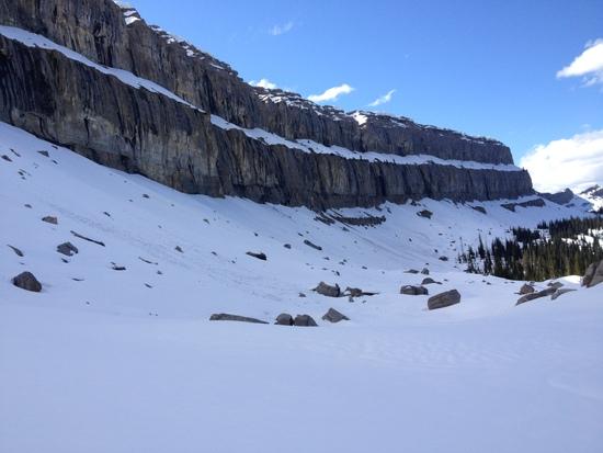
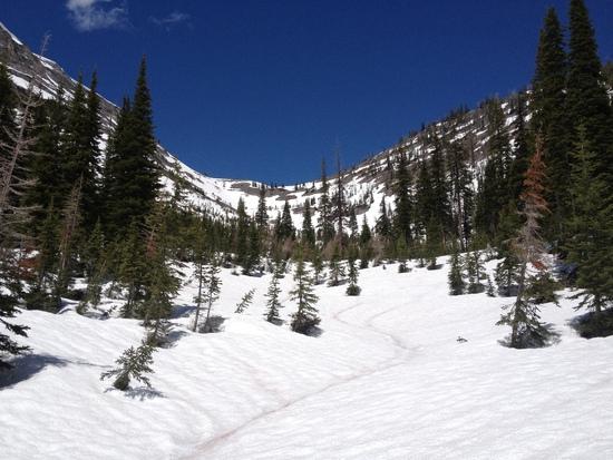
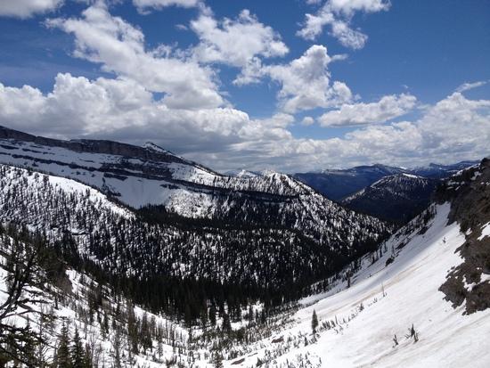
The next 6 miles followed just below the Chinese Wall and was one of the coolest places I've ever hiked, especially with complete snow cover. Thankfully the snow was consolidated and relatively posthole free.
View from the Wall
Chinese Wall
I had a cornice break off the wall directly above me, the crack sounded like thunder. Routing was critical to keep me safely out of avalanche danger as well as avoid some steep terrain below. All in all, it was everything you want a trip like this to be. At the 26 mile mark I made my only navigation blunder of the trip. It was caused by a combination of fatigue, the fact that it was at the intersection point of three different maps and failure to pay attention. My data sheet had a waypoint labeled "near Larch Hill Pass" and I read Larch Hill Pass. I followed the map to Larch Hill Pass instead of continuing on the snow covered CDT to Spotted Bear Pass.
North End Chinese Wall with Larch Hill and Larch Hill Pass
I realized my error then decided it was the same difference in mileage going around the northern side of Larch Hill instead of the intended southern side. But when I hit the ridge coming off the north face I could see the route in front of me and I didn't like it. It was about 6:30pm and there was very steep terrain with cornices and I was losing daylight in a less than ideal area. I took my time and matched all terrain features with the map and soon discovered that there was a pass/saddle just the south east of Bungalow Mountain that would drop me directly into the Spotted Bear drainage via Hoop Creek. But to get there I would have to drop 1000' into the White River Drainage and climb up the south face of a mountain which looked to be snow free to reach the saddle off Bungalow. The distance was longer, it would require about 3 miles of off-trail bushwacking down to Spotted Bear River but it looked like 3 miles were free and clear trail.
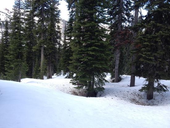
I quickly bombed down Larch Hill and reached the clear trail without fanfare. It was great flying on good trail and I raced the setting sun to the top. Next, decision time. I was in solid snow at 6800'. Continue off-trail down steep terrain in the dark or crawl into a tree well and sleep. Wisdom won and I have never had a better night sleep in a tree well. It was just large enough to fit my body and I had to use my full food bag to level out my feet. I wasn't too worried about being attacked by a grizzly, he wouldn't have fit in the hole.
The day ended with about 30 miles, 14 on snow. I was happy with the progress especially with an 8am start. This would position me to cross the Middle Fork on Day 2 which was about 30 miles to the north.
Day 2 – The Mission – Middle Fork Flathead
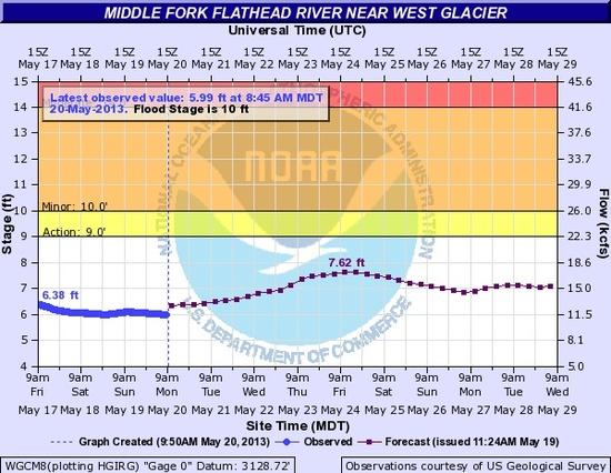
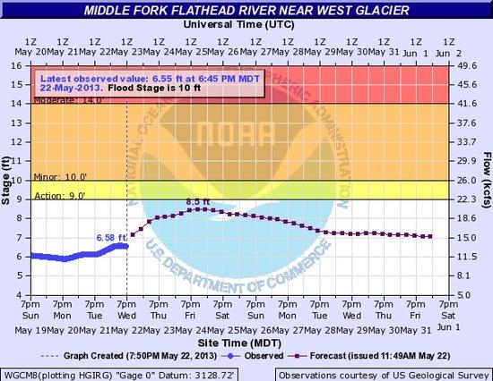
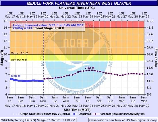
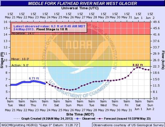
I wanted to reach the Middle Fork today because the river forecast predicted a minimum level on Sunday. But first I had to come off the high ground and negotiate Pentagon Pass. I slept in a bit until 6:00 allowing the snow to soften, at least that was my rationalization. After packing up and hitting the snow I soon discovered ideal snow conditions, firm but with traction.
I flew down toward Hoop Creek, swerving and swooping to avoid some very steep terrain, definitely type 1 fun. At 6200' the snow turned to crap and I was off trail in a maze of fallen trees. There was no fast way through the mess and the last half mile took close to an hour. In spite of having a map and GPS it took forever to find the actual trail. It was only the bear prints that hinted at the trail below the rotten snow. Now some may say "but Malto you said that in snow it doesn't matter if you are on the trail or not.” That’s true when there isn't a million fallen trees to climb around vs. a relatively tree-free trail route.
At 5200' I was out of the snow and again the trail was very fast. I saw my first human footprints, though no print-making humans were visible. I took a much needed break at the empty Pentagon Ranger Station and plotted my assent of Pentagon Pass. The clear trail continued for several miles up Pentagon Creek until I walked into one of my least favorite snow conditions, residual snow drifts at about 5500'. These were four to six feet high and you go up and down repeatedly. I rediscovered how exhausting these conditions can be. But all bad things have to come to an end and soon I climbed away from Pentagon Creek into perfect snow conditions. Many feet of flat consolidated snow. I rounded the ridge and Pentagon Pass presented herself. She was drop dead gorgeous and looked similar to many of the Sierra Passes with a very steep and well defined head wall. The climb up was straight-forward but steep. I soon hit rock and I climbed to the top. The view was breathtaking and I could see for miles in all directions.
Pentagon Pass
View from atop Pentagon Pass
Coming off Pentagon Pass was incredibly fun. It was a half run, half shoe-ski down over deep snow. I made decent time but the snow continued below 5500' with 50/50 snow as low as 5200'.
Snow conditions north of Pentagon Pass
The next few miles were rather boring, completely flat straight trail through trees. There was one highlight when a great view of the Argosy Mountain appeared.
Argosy(?) Mountain
I hit the Middle Fork at 6:30 just as the rain started. The river looked very straight-forward and I packed everything away and stowed the trekking poles preparing for a swim. I started crossing upstream from an obvious exit point and soon the water was waist deep. I wasn’t using my trekking poles and just as I was mentally preparing to dive in, I realized the water wasn't getting any deeper and I walked across. Bottom line, it was a waist deep fairly slow crossing, no major issue.
Middle Fork Crossing
I was still very wet and I needed to hike some warmth into my body. It continued to rain and I was within easy hiking range for tomorrow so I stopped at the first flat spot and setup my tarp at about 8pm few miles beyond Shafer Air Field. This is rare for me to stop this early but I had plenty of time to finish tomorrow. My final mileage for the day was about 32 with about twelve miles in the snow.
Day 3 – One last challenge
I was home free, just a few minor stream crossings but nothing compared to the volume of the Middle Fork. A couple of miles into the day I hit Lodgepole Creek. Looked easy enough, I went in full of confidence from yesterday's crossing. Just before climbing out, my foot slipped and the waist deep fast water spun me around and I face planted fully into the stream. There were three casualties at that moment. My pride, which was no big deal. I also lost my map, also no major issue other than leaving a map in the Bob. But my iPhone was in my shoulder pouch in a ziplock bag. Safe enough…. Not. I was careless and left the pouch slightly open and the force of the water found some way of getting to the phone. Soon an Apple symbol appeared on the screen and the flash came on to drain the battery.
But between me and drying out my phone were many miles of trail with a few more stream crossings but more irritating were the hundreds of blowdowns. More on that in a minute. I had one more challenging stream crossing at Twenty-Five Mile Creek. I ended up scouting out my route more carefully than any previous crossing and I was able to cross intact. By this time I was soaked and I decided to change into my shorts since they were dry. This added a few minor war wounds but it beat having chaffing which was starting. I had one major encounter with a blow down. A branch broke as I crossed and I fell backwards getting hung up by my gear upside down. My former PCT hiking companions would have laughed themselves silly. I started laughing thinking about it and I soon felt better.
Before long the shorts were wet from the overgrown areas of the trail and chaffing was coming full steam. Not pleasant for an additional 15 miles. So I sped up the summer solstice and went butt naked from the waist down, drying my shorts by using them as a loin cloth in case any unsuspecting girl scout troop appeared. I will admit that it was refreshing and there could be something to the whole kilt thing, chaffing solved! Two miles from the end point I saw a group of four hikers in the distance. I quickly ducked into the woods and put on my now-dry shorts and met this friendly group. I found out that Dan and another hiker(I thought it was Dave, it was actually the Other Greg G) had already finished. That was good news. The final two miles were great, easy trail and I hit the trailhead at 3:30. finishing off the final 26 miles at a 3mph pace even with blowdowns and stream scouting. It was a fine day, great weather, just doesn't get any better this
Middle Fork gaining strength. Last picture before iphone crash
Gear
I took my 2011 PCT gear (see profile, few changes) with the addition of Cap 1 bottoms, my cuben rain suit and GPS. I did not take a short sleeve shirt. With 20/20 hindsight I wouldn't have changed a thing as far as gear. I used every single piece of clothing and gear that I carried and neither snowshoes or micro spikes would have provided any benefit.
Route
I had multiple routes planned depending on conditions. The route I took exceeded my expectations. I was originally going to do the Sun River Pass route but a friend told me I had to do the Wall if I was going to the Bob. Pentagon Pass ended up being the hidden surprise, and worth the extra miles of snow. The trip ended up being about 88 miles with 26 miles in solid snow. But it was the snow that turns the extraordinary into the super extraordinary. Seeing the Chinese Wall with solid snow and only my set of prints stretching behind me was some of the finest miles I have hiked. It also starts me thinking about whether I could pull off a CDT thru hike in the next few years.
Finally I want to thank Dave for pulling this together as well as exposing me to pack rafting. It adds yet another outdoor activity to my long list of pursuits. Now as I sit on the plane flying back to PA the question on my mind is "What's next?"