September 9th to September 12th, 2010
4 Days, 37.5 Miles
Daytime Temperatures: 50F to 70F
Nighttime Temperatures: 28F to 40F
Wilderness Press Topo Map: Lassen Volcanic National Park & Vicinity
Note: I would not recommend this map. The Tom Harrison Maps have the mileage between way points printed on the map and more accurate elevation listings than the Wilderness Press map.
Trail Head: Kings Creek Picnic Area
Grid C3/80 x 30
Website: Lassen Volcanic National Park
Day 1, 9.25 Miles Approximately

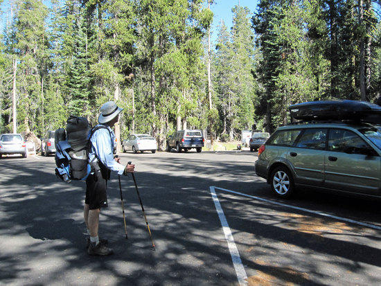
Southwest Entrance/Lassen Chalet 7:46 AM
Having driven up the night before, we stayed at a motel and woke up early to enjoy the free breakfast that they offered. Then on the wet road we set off for an hour and a half drive on a chilly and gray morning. Upon reaching the parking lot, we used the restrooms and stretched out stiff limbs while waiting a few minutes for the Ranger Station to open to pick up our permit. The others took advantage of the cafeteria here to buy coffee or hot chocolate to warm themselves up after standing outside with jackets and hats to try to stave off the chill that was slowly creeping into us.
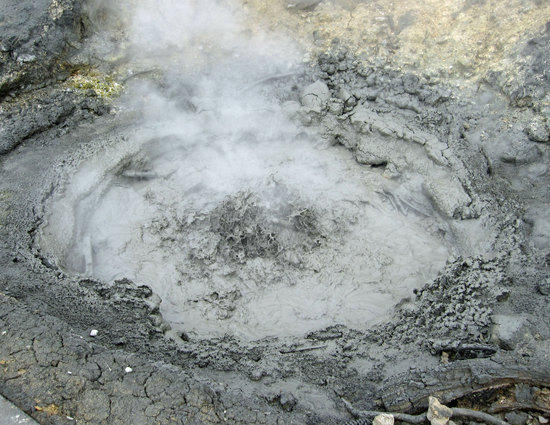
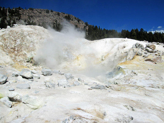
Boiling Mud Pot
After obtaining our permit and gazing into the skies for any sign that the blue above might poke through the gray mist, we drove a short distance to a small parking lot along Lassen Park Road to the Sulfer Works, which gave us a glimpse of what geothermal marvels might await us later in our trip. This angry mud pot must have recently erupted up through the ground as it was just next to a side walk along the road and was cordoned off with portable metal fences.

Painted Colors of the Earth Steaming and Simmering Away Deep Below and By the Road
600,000 to 400,000 years ago, Lassen National Park was once one large 11 mile wide volcano/mountain called Mt. Tehama, which rose 11,500 ft or 1,000 ft higher than today’s Lassen Peak.

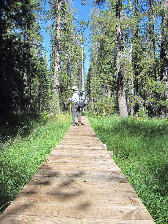
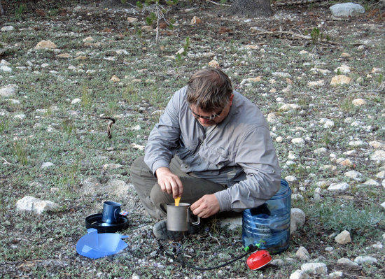
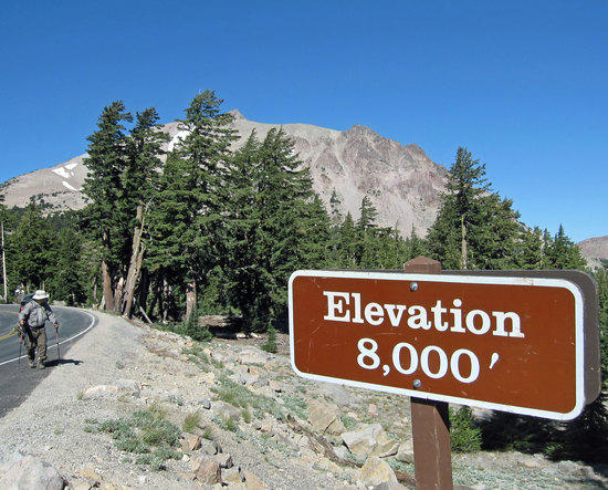
Kings Creek Picnic Area 7000 ft approximately
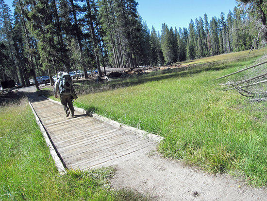
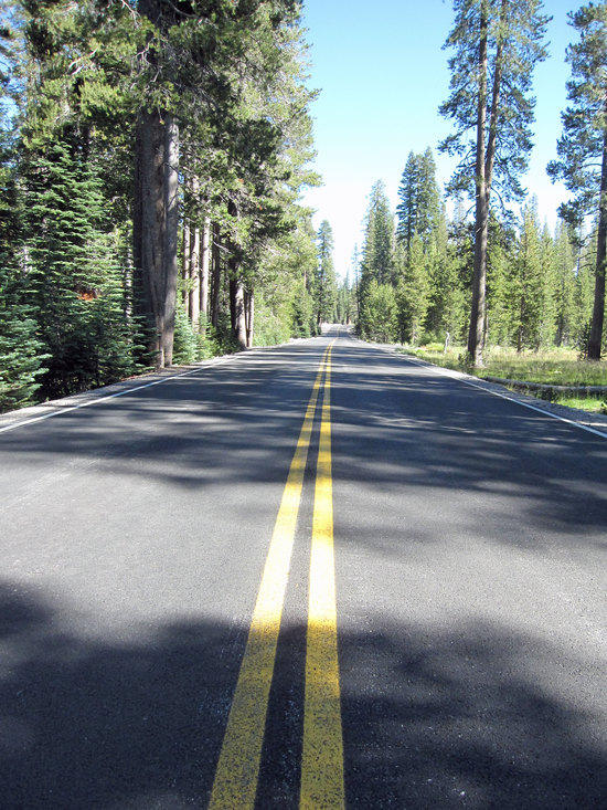
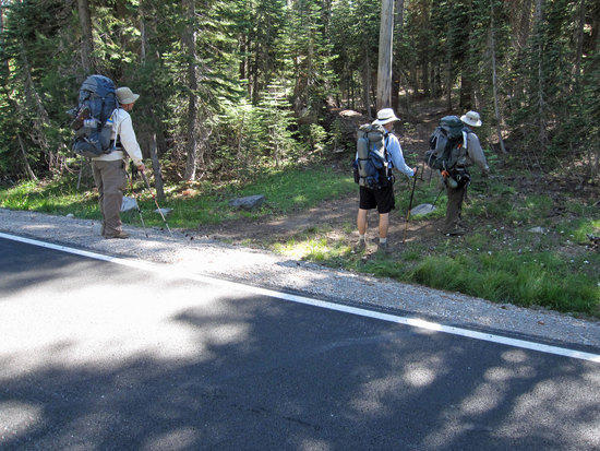
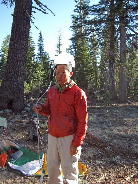
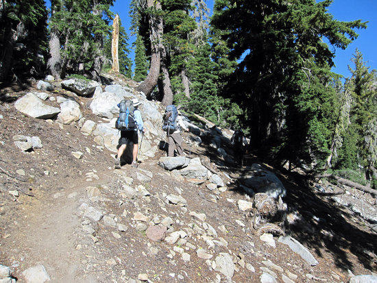
Returning to the warmth of Jeff’s vehicle, our noses having been filled with the expected stench of sulfur that had been belched from deep within the earth, we traveled perhaps another 4 miles up Lassen Park Road/Hwy 89 and turned off into the Kings Creek Picnic Area where we hauled our packs out and did our final check to make sure we had all our gear. Setting our hiking poles to proper length and a few more quick stretches to warm up cold muscles, we set out for the trial head.

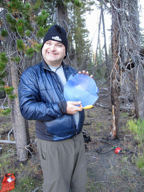
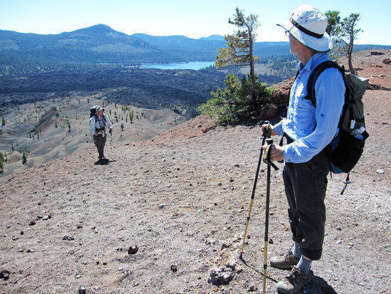
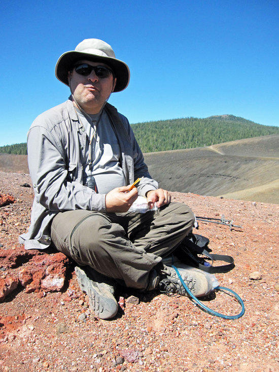
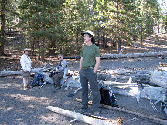
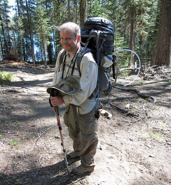
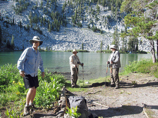
Left to Right: Mark, Jeff, and Scott
Jeff and Scott, brothers, who I have known since I was 9 years old.
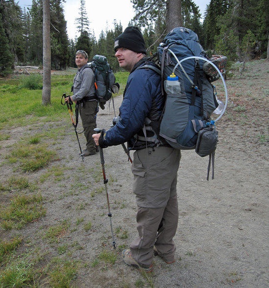
Jeff and Scott are Traditional Backpakers that have adopted a few of my light weight habits. Actually, Jeff is the only person that I know who has gone light weight and then returned to traditional backpacking- preferring not having to bother with carefully packing tiny Ultra Light Packs or worry about the limited durability issues that can accompany Ultra Light Gear.

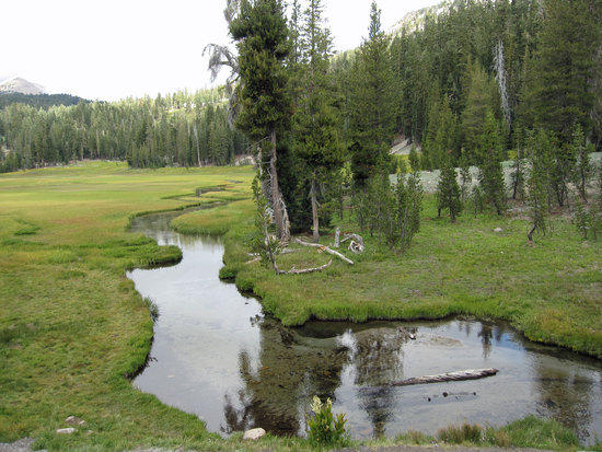
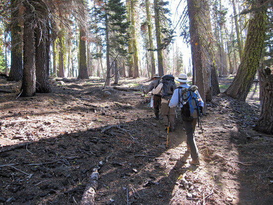
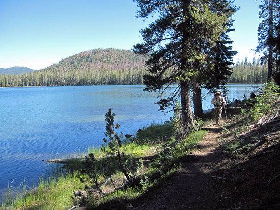
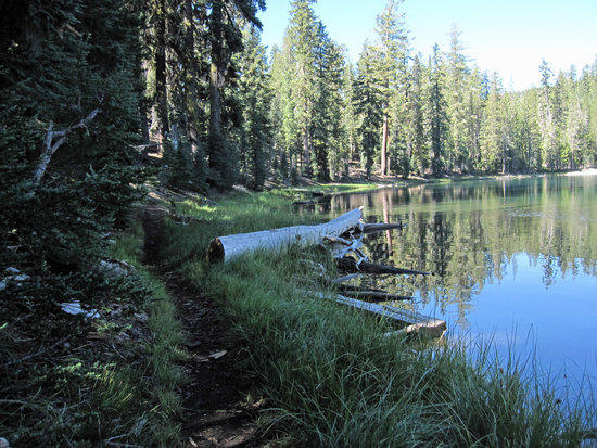
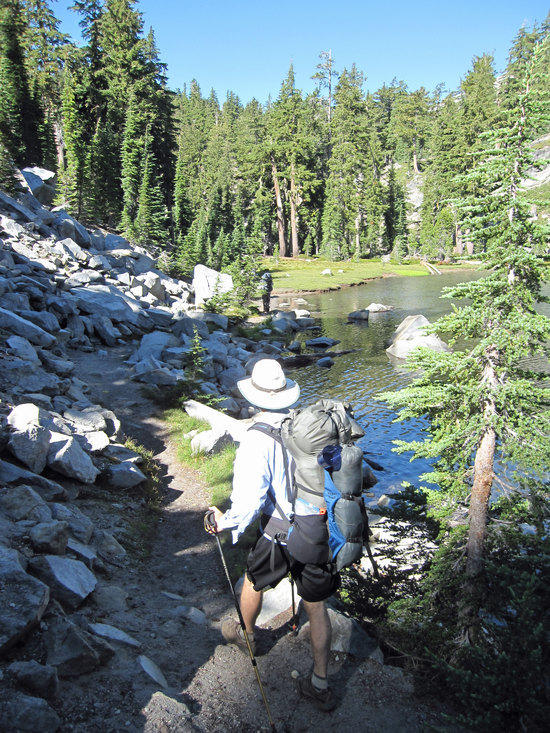
Kings Creek Along the Trail
Crossing Highway 89 with Reading Peak in the distance about 1.0 mile out
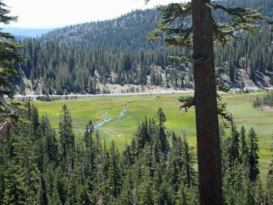
Upper Meadow
Following the Water’s Course
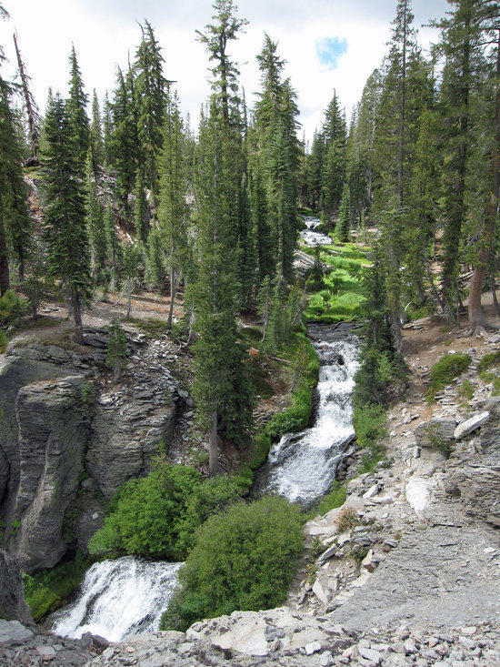
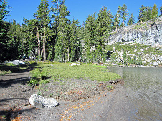
A short 0.75 miles from Upper Meadows we continued along the Kings Creek trail skirting the Northern portion of Lower Meadow and onto Kings Creek Falls.

On the Way to Kings Creek Falls
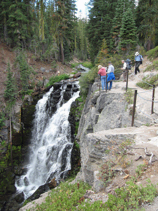
Kings Creek Falls
Elevation 6800 Ft Approximately
2.0 Miles approximately from Kings Creek Falls to Summit Creek Trail Intersection
Taking a short break to enjoy the views, we pressed on getting a little muddled about where we were and where we were going. Jeff’s GPS was either malfunctioning or the operator of the GPS was malfunctioning. That said, we did have topo maps with us, which served us well to quickly help us sort out where we were along the trail.

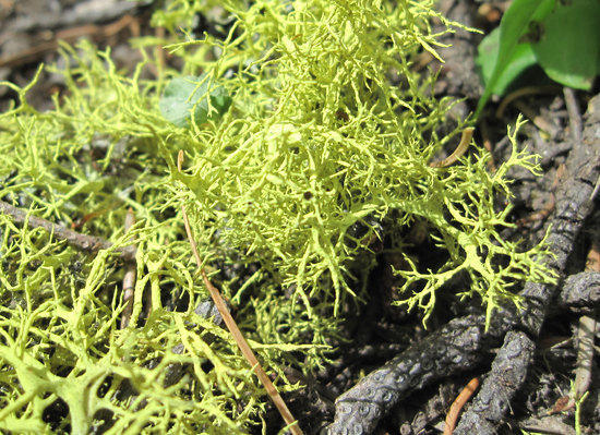
Things Along the Trail
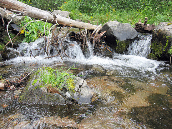
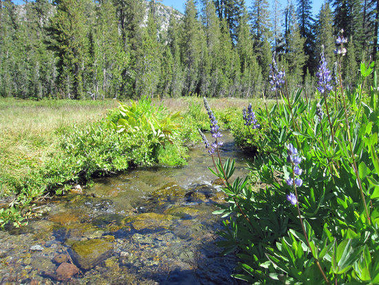
A Constant Friend, Waters Along the Trail

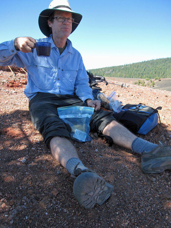
Lunch Time
Tortilla, cheese, salami, with slivers of red onion. The red onion is what makes this so nice! Finished off with fruit dehydrated at home with my Excalibur Dehydrator. (Sulfides in store bought dehydrated fruit triggers my asthma)

Having Lunch about 0.15 Miles South of Summit Creek Intersection
At a point just where a creek cuts across the trail, we decided to stop on the trail to take a leisurely lunch break. Given the relatively short distances we were traveling the tone and pace of this trip was quite leisurely, leaving plenty of time for us to chat and simply take our time.
Moving on After Lunch
Shortly after lunch, we reached the intersection with the Summit Creek at 6096 Ft and turned South East towards Corral Meadow. Approximately 0.75 Miles to Corral Meadow.
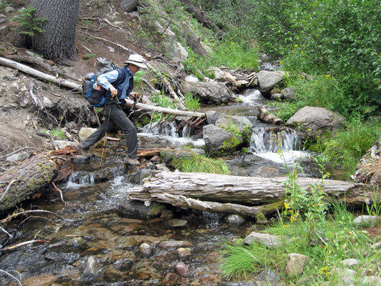
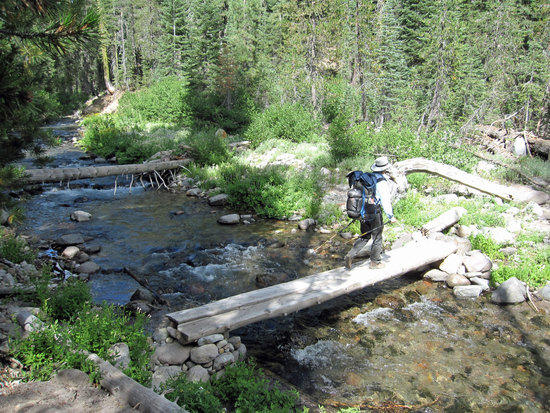
One of Many Short Crossings
4.75 Miles from Corral Meadow to Swan Lake
After reaching Corral Meadow, we cut North East on the PCT/Grassy Swale trail.
Elevation approximately 6400 Ft.

Scott Working Across on His Own
At one particular stream crossing, we danced about on some fallen trees and branches to make a crossing. Scott, leery of injuring himself forded the stream with his sandals and put his hiking boots back on to continue.
Last Water for While as the Trail Turns North

Easy Traveling
Mark is sporting a Granite Gear Vapor Trail pack.
When I first met Mark on a day hike trip with Jeff a few years ago, it was readily apparent to me that he was already a light weight backpacker before I started on my own UL/light weight transformation. With a few more tweaks in his kit, he could become a full on UL Gear Geek.

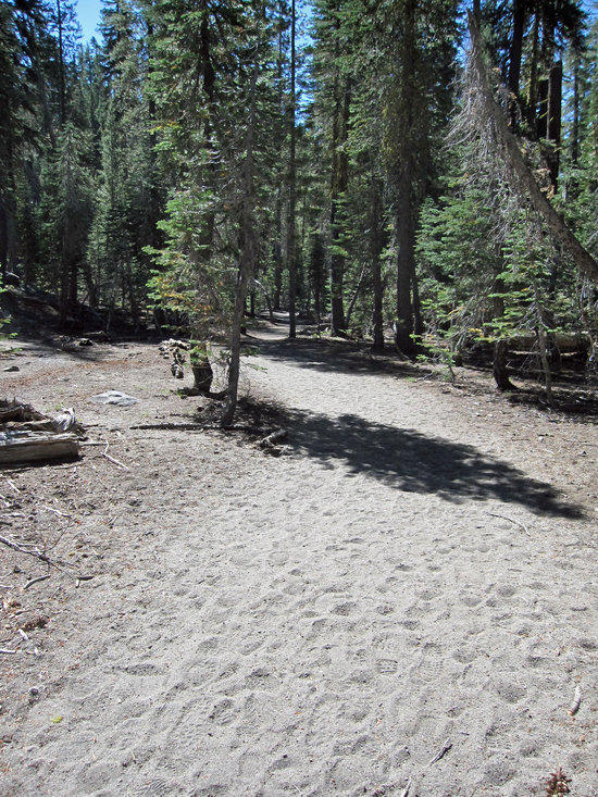
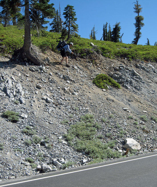
Exposed and Dusty Trail
At this point the trail splits into two and meets back together about a mile North. We took the Western trail, while the Eastern one comes close to Creator Butte and also allows you to head to Horseshoe Lake.
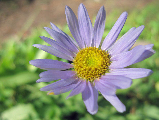


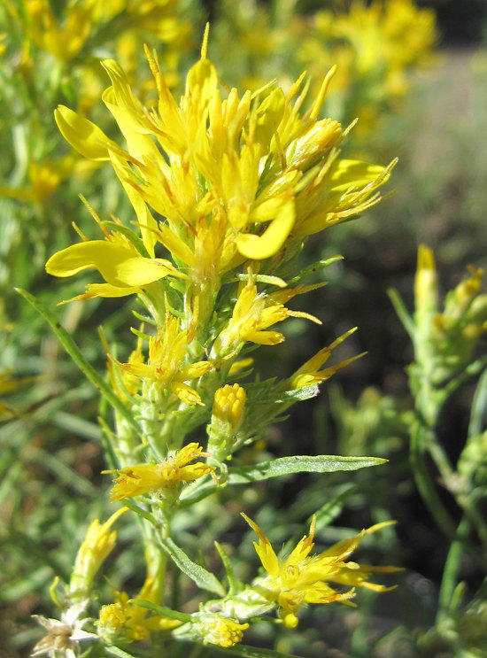
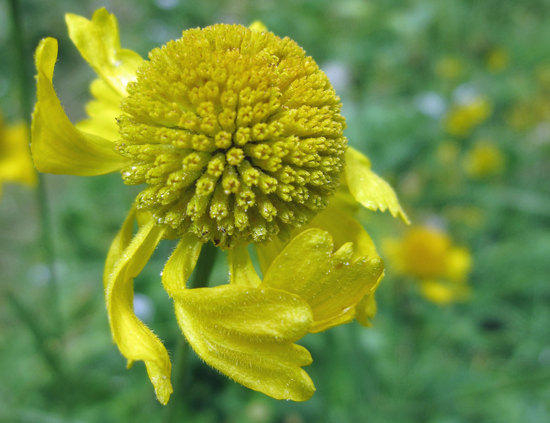
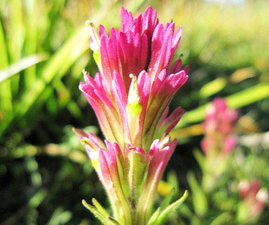
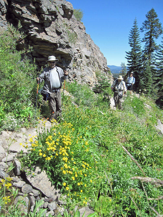
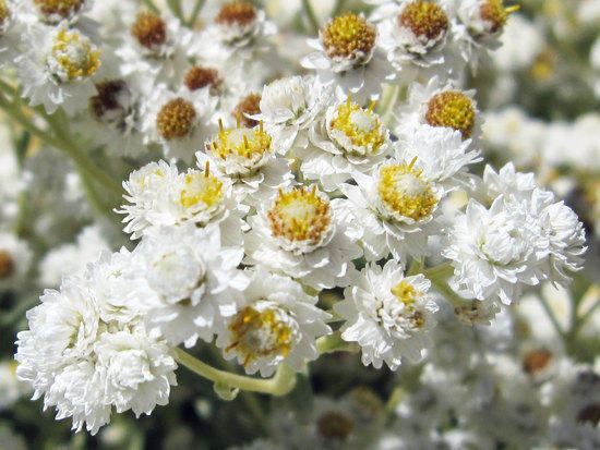
After Meeting Linda & David Vassallo, I have gained an appreciation for flowers. Though I completely lack the expertise that they have for identifying them and knowing their Latin names. To me, they are just pretty colors along the trail. Taking photos of them helps to slow my pace down so that I may better appreciate the beauty around me. In doing so, for a moment, I can ignore the voice in my head that urges me forward as fast as I can move.
Working Our Way Up to Here
It was at this point along the trail that the steady match on a gentle upward slope seemed to level off. On this section of the trail, we seemed to spread out with me often in the lead with Mark following close behind with Jeff and Scott bringing up the rear. No surprise given that the order of our unintended march seemed to follow the weight of our carried packs, with mine being the lightest. My pack for the four days may have been 20 to 25 lbs. Given that this was not a high mileage trip, I did not worry too much about my pack weight.
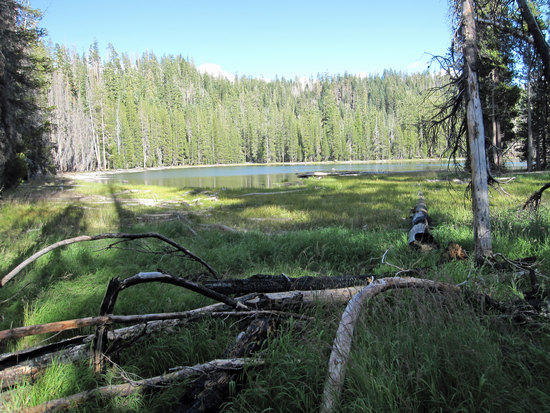
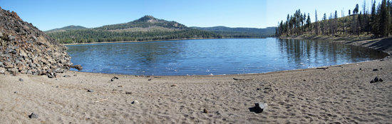
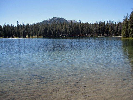
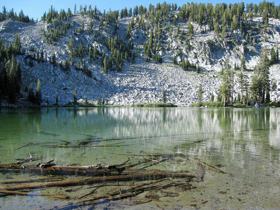
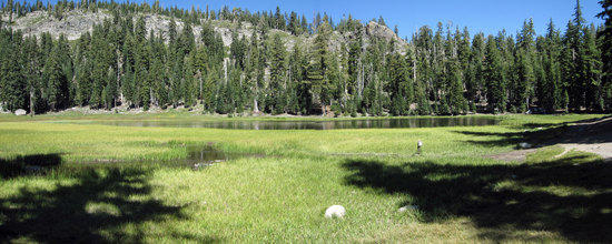
Swan Lake
Swan Lake to Lower Twin Lake 1.0 Mile
Lower Twin Lake to Rainbow Lake 1.0 Mile
Lower Twin Lake Elevation 6537 Ft
Mark’s Double Rainbow Tarptent at Rainbow Lake
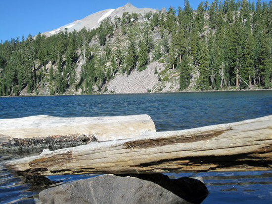
After reaching Swan Lake, we pushed steadily onward past Upper and Lower Twin Lake and then followed the trail East by about a mile to reach Rainbow Lake. Despite the pace being leisurely, I realized that what wears on me is not the pace of travel, but simply the number of hours on the trail itself. Whether I was traveling slowly or quickly, my body still seemed to need the same amount of water and food. I was happy that we made it to the Northern End of Rainbow Lake to settle in.

Mark Getting Some Water for Dinner
Note: Interestingly, Mark does not filter his water and has not for years without any ill effects.
The shore was nothing more than a thin band of short grass with a few fallen trees. Less than 20 feet from water to dense tree line of many young pine trees. All over the forest floor was an abundance of dead, dry trees and a tangle of fallen branches, which would serve my Bush Buddy Stove well.
Finding a campsite among the mix of patches of clear and open ground and the dense thicket of trees by the water seemed to be a bit of a challenge. Often there were a number of open spaces that were just below dead trees or branches that could be considered widow makers, should they fall. I settled for a spot at the base of a small tree in the middle of a natural fort of small fallen trees to setup my bivy.
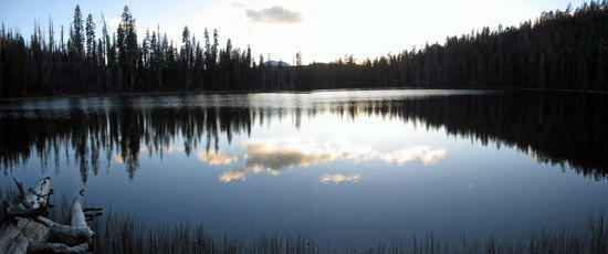
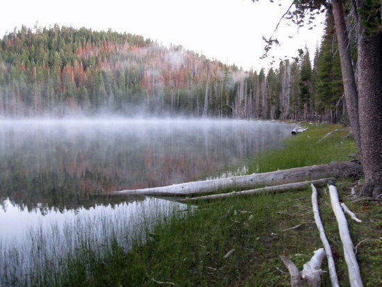
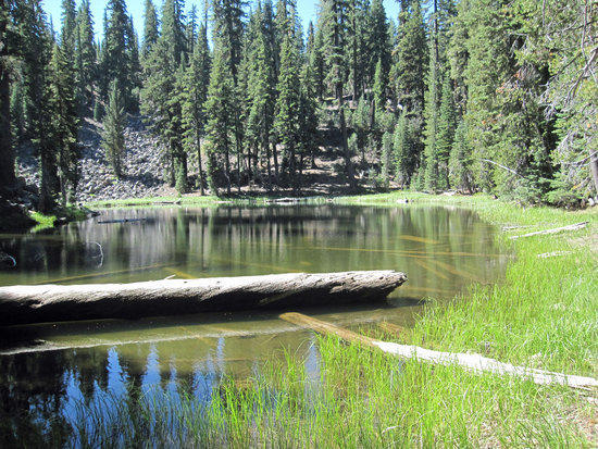
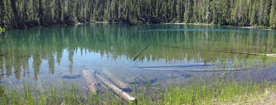
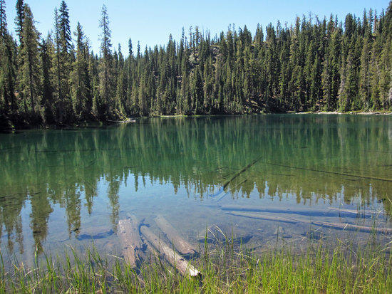
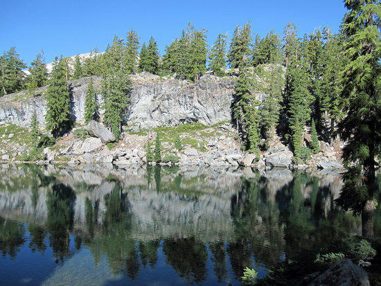
Rainbow Lake
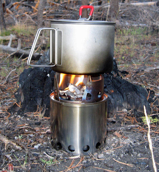
Breaking in the BushBuddy Stove
How can I count the ways that I love thee my shiny monument to the gods of fire?
On this trip I realized a whole possibility of new opportunities that opens up when you don’t have to worry about conserving fuel. Want to cook food vs. just re-hydrating it? Want to simmer your food for a long time? Want to have 4 cups of hot water to drink? How about having hot water to wash your cook pot and spork? How about having hot water to wash up with? Knock yourself out!!! While eating my food, I would simply toss in a small chunk of wood into the stove once in a while to keep a constant bed of hot coals in the bottom of it. So when I wanted to boil up some water, I was ready to go. Of course, this works well when there is no precipitation and plenty of wood laying around.

Scott Working Up His Multi-Stage Meal
As night fell upon the lake, the wind blown ripples washing across mirror that was the dark waters, we watched the sunset in silence. Across the lake we heard the intermittent chatter of voices, the sudden outburst of laughter, the winking of a headlamp through the trees. A singular campsite across from us to keep us company. The voices did not bother us, but simply reminded us that this was a place for everyone to enjoy and, like us, a place to share with the company of friends. Within an hour or two the voices disappeared as the night skies opened up and the stars came out to sparkle against the faint shimmer of star dust that seem to be the canvas against which the stars stood. Soon our chatter faded too as each of us left the shoreline to find the warmth of our beds. Alone I sat on a log by the shore and let my mind drift off into the dark waters that I was gazing into, the faint smell of smoke from my stove hanging in the air. At that moment, I wondered what my family and those dear to me were doing. How much I wished they could see me at this place, to share with me and understand the reasons why I chose to do this, why I am compelled to do this. My mind, done swimming in the waters of my imagination, I turned away and retired to my bivy and pulled my quilt over me snugly for what would be a chilly night.
Day 2, 9.25 Miles Approximately
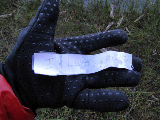
Love Note Slipped into my Jacket by My 7.5 Year Old Daughter, Mei Ling.
I woke up a few times in the middle of the night, as is normal for me, and found the temperature steadily getting colder and colder. My Jacks R Better 25-30F Sierra Sniveler quilt did a great job of keeping me warm. In the morning, there was the tell tale sign of bits of ice in my Platypus water bottle. My mini thermometer told me that it was 28 Degrees F, which surprised me. Quietly, I unzipped my bivy, slipped my trail runners on and zipped my Montbell Thermawarp Jacket up, and walked to the edge of the lake with my gloves on. Hands in my pocket, I found a carefully folded and taped scrap of paper. Opening it up, I found a simple little joy that maybe only a parent could fully appreciate. It was 5:35 AM and I was happy.

Misty Shores

BPL Mini Fire Steel
By 6:00 AM, the others were stirring from their slumber and slowly getting up to be greeted by the sharp chilly air. Getting my BushBuddy Stove started up, I managed to break the handle of my BPL Mini Fire Steel. The end of the rod only seemed to sink into the handle by less than a half an inch. The stress of pressing against the steel and handle over the few years that I have owned it cracked the handle, spilling the rod out. Fortunately, I was able to use the rod by itself to get my fire going. For tinder, I use Spark-Lite Tinder-Quik Firestarting Tinder Tabs, which I have coated in petroleum jelly and store in a small zip lock bag. Tear them open a bit and put a spark on them and they light up easily and burn for a minute or more with the petroleum jelly slathered on them. Though, a simple cotton ball with petroleum burns longer and is probably cheaper than the Spark Lite Tinder Tabs. Despite that, I do appreciate the convenience of having them. Something I now carry is a small bullet shaped tampon, which is a very compact and large source of cotton for fire starting material. I have since taken a page from my friend, Cameron, and bought a simple fire steel and hot glued a cork to the end of it for a lightweight handle.
FireSteel.com has a huge variety of lengths and thicknesses of fire steels at a bargain price with quick shipping. I was able to find a replacement for my broken BPL firesteel that was a little longer, which was a criticism that I had when using the BPL fire steel.
Mark Preparing Breakfast with His White Gas Stove
Jeff with his Origami Bowl
Striking out for a Day Hike at 8:18 AM
After a very leisurely start, we headed out for a day hike. Me being, me I opted to pack up all of my gear and carry it with me. To me, every hike is just another reason to train for the next trip, so carrying a full pack is normal for me on my day hikes and this would be no exception. Plus, everyone knows that it is the day hikers who get screwed and die in the wilderness, right? So why not have all your gear with you? He who dies with the most gear wins???

Jeff’s Load Out: Platypus Big Zip Hydration system on his hip with Sawyer In Line Filter. Top of his pack detaching and becoming a fanny pack, with his DSLR on his right hip.

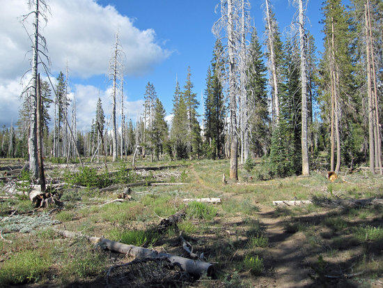
Burned out Area
After leaving Rainbow Lake, what struck me was who dry it was. There were no streams, puddles of water, nothing at all. The volcanic soil here a sponge for any moisture.
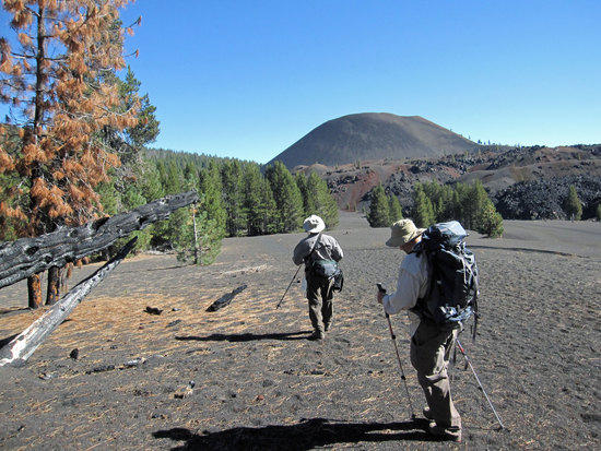
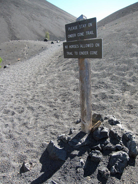
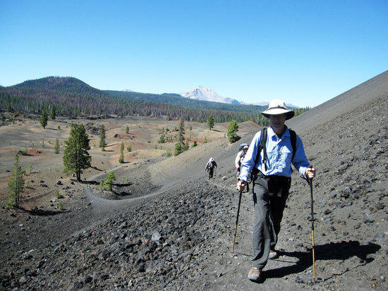
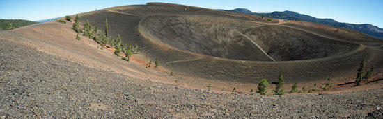
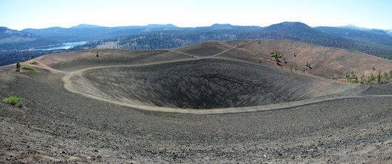
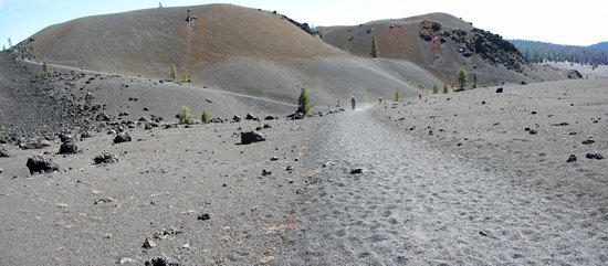
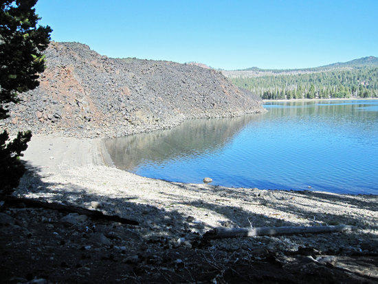
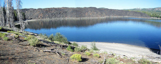
First View of the Cinder Cone
The spares trees opened up to this clearing to reveal where we were headed. I was awe struck with how stark and barren this landscape was, which was something that I had never seen before.

Life Always Finds A Way

Foot Steps on an Alien Moon Scape
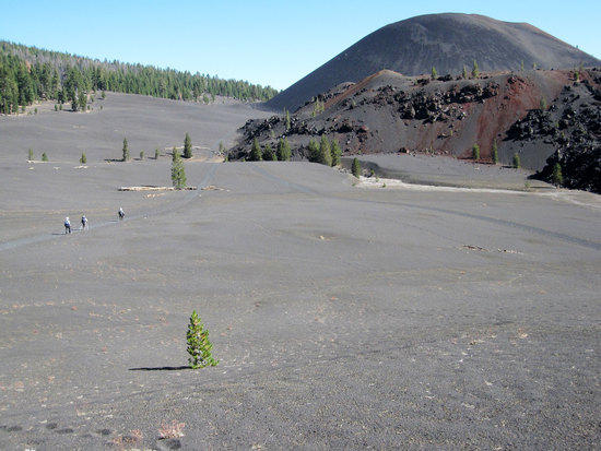
Faint Trails in a Volcanic Desert of Gray
Taken by the amazing scale of the gray scenery before me, I quickly fell behind the others as they trudged across the sandy landscape where each step seemed slow and plodding.
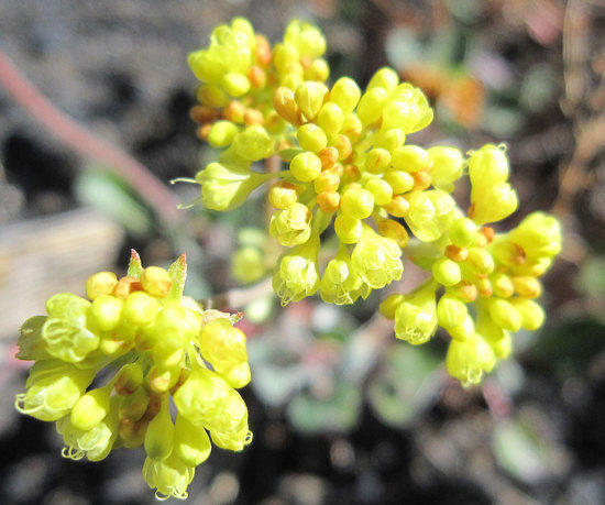
An Unexpected Cluster of Color

Walking Up to the Giant
Lonely Trial Maker

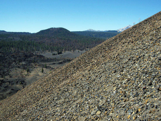
The Scale of Things Big and Small

The Trail Turns Upward
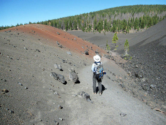
Coming to South Western edge of the Cinder Cone, where the trail forks, we cut East along the Southern edge to steadily gain elevation. Despite the treeless landscape void of any shade, the sun did not beat down hard upon us. Temperatures comfortably in the 70’s F.
Traveling Along the Edge of the Painted Dunes
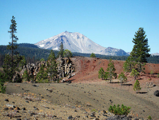
Mt. Lassen
Elevation 10,457 Ft.
Wrapping North Around the Giant
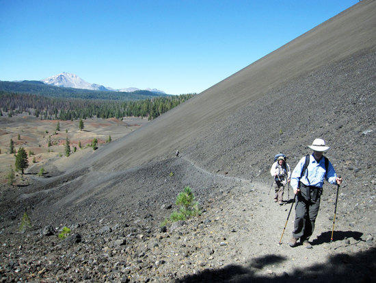
Marching a Steady Pace Upward
Angle of Ascent
Burning Lungs and Bright Skies
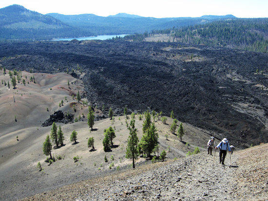
One foot in front of the other, a steady beat in time with the pounding of my heart in my chest. The constant tapping sound of my hiking poles striking a rock strewn trail of volcanic soil filling my ears. Sweat runs down my neck as I push myself faster and further so that I can turn around to take a shot with my camera, which gives me a moment to pause to catch my breath. Snag Lake is in the distance and below us to the left of the shot is the Painted Dunes and to the right is the Fantastic Lava Beds.
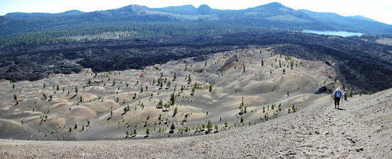
Painted Dunes

Butte Lake
Elevation 6043 Ft.
North East of the Cinder Cone
Mark Enjoying the View from the Top as Scott Comes to Join Us
3.0 Miles from Rainbow Lake
10:49 AM

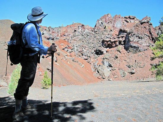
Tony at the Eastern Rim
Elevation 6907 Ft.
Mark Enjoying Lunch in the Shade of a Singular Scrawny Tree
Scott
Jeff
Stopping just a few feet from where the trail reaches the rim of the Cinder Cone, we enjoyed a pleasant breeze and a small patch of shade by a scrawny tree that was brave enough to perch up here. Perfect spot to take an early lunch while taking in the 360 Degree views. Despite not seeing a soul upon the trail, we were surprised to see a fair number of people strolling along the rim with more coming up the opposite, Western trail that leads to the top. Apparently, a road leads to Butte Lake, leaving a relatively short hike to the Cinder Cone.

Gazing into the Center

Quick Path to Run Down to the Bottom
Call it stupid, childish fun, but I love running down trails like this where your poles can help you ski down the soft slopes of loose soil. While the others looked on, I quickly descended and took a few forgettable snap shots. Then jogged back up partially, running out of breath. Pulling myself back to the top to the others, I took small satisfaction in my minor accomplishment.

View from the Southern End as We Walk Clockwise Around the Cone

South Eastern View from the Rim
South Eastern View of the Cone

Jeff and Scott Hiking up to the Highest Point on the Northern Rim
Northern View

Slaloming Down a Snow Less Run
Adam, who I had met on my BPL hike into Henry Coe State Park would have loved this. Half running, half skiing down this slope, I would bunny hop side to side, turning on my poles with each bounce of my two feet sinking into the trail. A steady and exciting rhythm of jumping, turning, and moving forward rapidly with little time to think beyond the next exhilarating twist of my body. For a moment, I caught the tip of my foot on my pole during one turn and felt myself lurch forward with me thinking, “I am going to face plant aren’t I?!” Fortunately, I am didn’t and made it down to the bottom, only stopping to respectfully let other heading up to past by. Surely, many a person on the trail thought I must have been nuts or just plain immature like a teenage boy allowed to run wild.
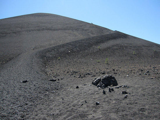
Looking Back at My Ski Run
Panting heavily, with a silly grin of satisfaction on my face, I looked back at where I had come from just moments ago. Pushing further down the trail, I found a large tree to sit under and to enjoy a snack. After regaining my breath and sipping some water, I briefly contemplated hiking back up to do it all over again. Common sense prevailed and I hauled out my quilt to air out in the sun while the others came down to join me.

Heading South Along the Western Edge of the Cone
After we all had plenty of time to rehydrate and have a snack, we moved to Snag Lake, which would be about 3.0 miles away.
Colors in the Gray
Mark at the South Western Edge of the Fantastic Lava Beds

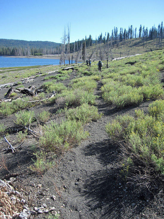
Trail to Snag Lake
By this time, it was about 1:45 PM and it was nice to get into the shade provided by the trees that grew along the trail. The air was still and a soft breeze would have been nice to evaporate the sweat that was quickly drying on my neck and shoulders.
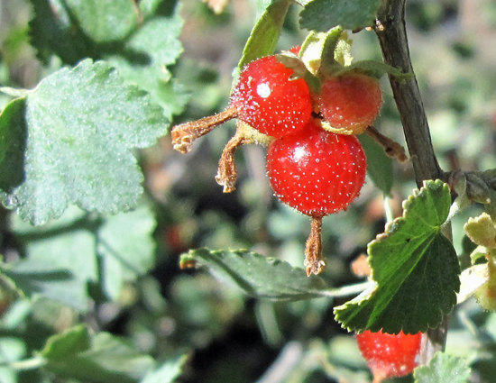
“Sierra Currents. If they are completely ripe, they are good to eat.”
Information Courtesy of Bob Gross.
Can’t remember if I tried to eat one of these, but if I did, they are not poisonous. They however were pretty looking.
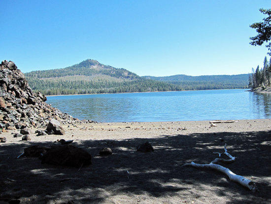
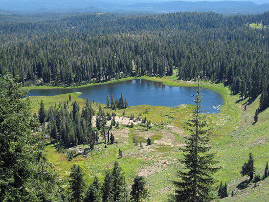
First View of Snag Lake
Elevation 6076 FT
Near Panther Springs as printed on the map….though we never saw a spring.
Feeling the need for more water to rehydrate, to wash the sweat from our bodies, and to kick off our shoes and feel the sandy soil between our toes, we left the trail just a stones throw away and headed down here.

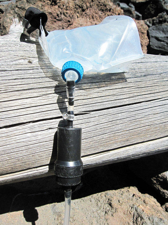
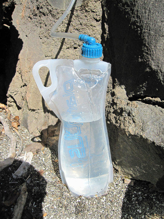
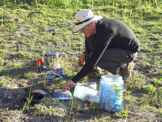
My Sawyer Inline Gravity Filter that I have been using since 2007
It was great to feel the sun on my body after taking some time to rise off and wipe down my body with the cool waters from Snag Lake. Drinking down the last drops of water that I had rationed on the dry trails around the Cinder Cone, I pulled out my gravity filter and took time to filter a few liters which I drank immediately, and then loaded up on two liters for the trail and dinner.
For more information on how to build a gravity filter and use this filter:
The Gang Takes a Leisurely Break
Taking in the Lake Side View
Hitting the Trail and Looking at the Lava Bed
Looking at how the Lava flow has created a natural dam, it makes me wonder if Butte and Snag Lake were once part of a river that flowed freely and was cut in two by the lava flow.
View from the Western Shore of Snag Lake
We traveled about 1.25 miles along the shore and then turned West to head 2.0 Miles back to Rainbow Lake.
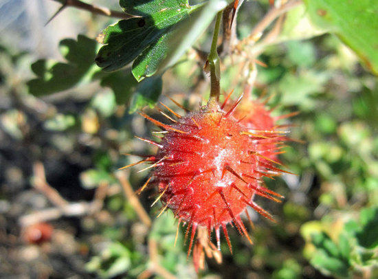
Thorny Berry
Moving South along the Western Shore
Shortly after hitting the trail I started to feel nauseous and was rapidly falling behind the others. Realizing that I had felt this way many times before, I quickly stopped and took a Salt Stick electrolyte pill to replenish my body. With a few sips of water to wash it down, I quickly felt the pangs of nausea disappear and worked to catch up to the others.

The Trail Turns West and Gradually Ascends
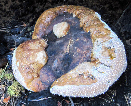
Large Mushroom in a Burnt out and Fallen Log
Coming to the Top of the Rise
After working our way steadily up this completely dry section of trail, our path leveled out and then dropped us back down to Rainbow Lake
Last Stretch Down to Our Campsite at Rainbow Lake
4:42 PM
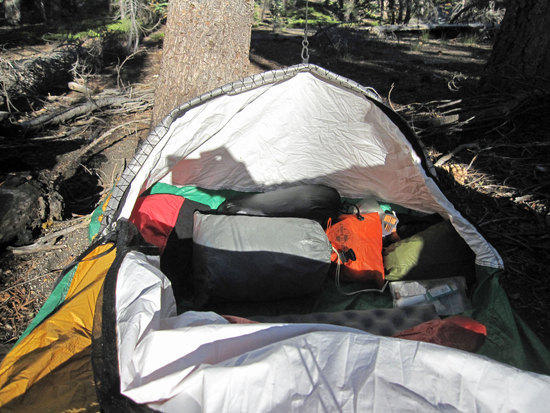
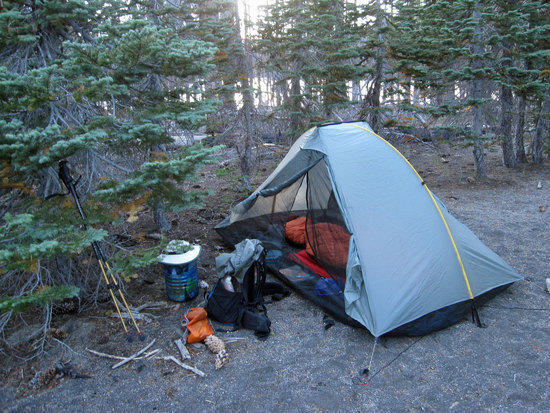
Bivy at the Base of a Tree
With all of my gear and clothing that I might need for the night tucked inside my bivy for easy access, I simply zip it up to keep the bugs and critters out.

Mark Dipping His Pot for Water for Dinner
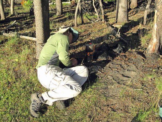
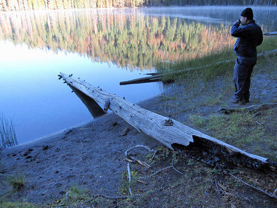
Tony Nursing His Fire Along
It is important to have a nice pile of small sticks at the ready to feed the fiery beast that is the Bush Buddy Stove. I found that what worked really well were chunks of wood that were about 2″ x 2″. Simply taking the pot off the stove, I would toss a few chunks in, which would alleviate the need to constantly stuff small twigs and sticks into the stove. Often, this would hold me over long enough to leisurely eat my dinner and have a nice hot bed of coals laying at the bottom of the stove, which I could quickly bring back to an open flame for heating up water for a drink or to wash my pot.
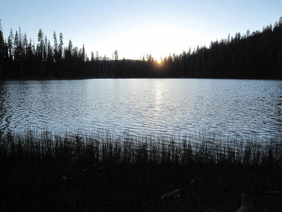
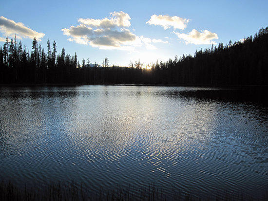
Another Beautiful Sunset at Rainbow Lake

Mark and Jeff Enjoying a Hearty Meal
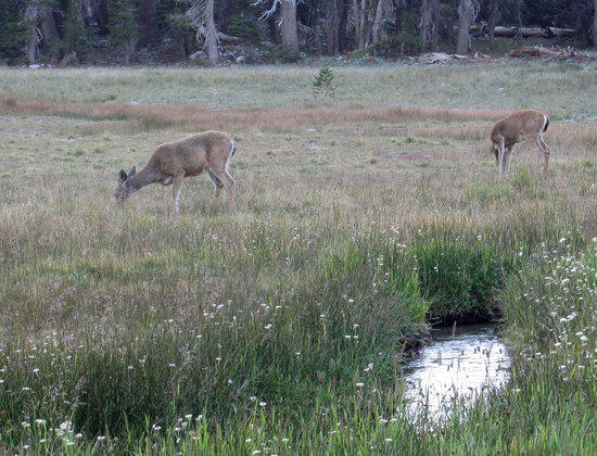
The day ended not unlike the first night with voices from the other side of the lake calling out into the night. We spent time listening to them, the laugh of a young woman breaking the silence, the flash of multiple headlights making their way around the water’s edge and into the trees…trying to guess how many people there were over there. The stars were out like before and it was a marvel to behold them without the light pollution that is so common at home. So many more stars and the subtle details of faint ones never seen when at home. At one point, Scott and I were standing by the water’s edge in the dark chatting away to pass the time. From behind us, in the woods, we heard a rustling. Slowly, I reached up and turned on the singular red light on my headlamp and turned around. To our surprise, the shimmering eyes of a large dear were reflected back only some ten feet from us. Staring back at us, seemingly unaware of the head light shining in its eyes, it started to walk by us and continued through the trees boarding the shoreline.
Day 3, 8.5 Miles

Blackened Pot, Price of Playing with Fire
6:04 AM, never too early to start playing with fire.
Woke up once again early with the sound of birds and the creaking of sunlight into my bivy. My Jacks R Better quilt keeping me warm. Though, I have had to adapt to using a quilt by wearing my thermawrap insulated jacket to keep my shoulders warm and free from drafts vs. simply draping the jacket over my chest like a blanket; which provides more warmth vs. wearing it. Once more, I quietly got out of bed and got my Bush Buddy stove going to boil up water for my oatmeal.
Note: Using the Bush Buddy left my MSR Titan Kettle covered in a thick layer of soot, which required storing it in a plastic bag to avoid getting the soot all over my gear and pack. Once home, simply spraying my kettle with oven cleaner and then letting rest for about 15 minutes and rinsing off removed the soot with little scrubbing needed.
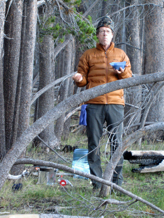
Morning for Mark
Jeff Enjoying Something Hot
After another leisurely morning, we hit the trail at 8:26 AM and left behind out home for the past two nights. Crossing to the other side of the lake, we past the campsite where all the other people were. To our surprise, it was a group of about 12 college age co-eds, with a huge Coleman sized car camping tent. Not sure how they got it there, but it worked for them. Traveling back to Lower Twin Lake, at the trail intersection about 1.0 mile South West of Rainbow Lake, we were spotted by a group of gray haired women who were camping there. One of them spotted my light weight gear and soon was bombarding me with a series of questions. Soon a small group of some five or six ladies were huddled around me while I gave a mini lecture about light weight backpacking, pulling out each piece of gear that I had in my pack. I was fair and balanced in my impromptu lecture and cautioned them to the limitations of the gear that I carried and the need to move slowly and methodically into the process of safely transitioning to light weight backpacking. A few of the ladies were even taking notes regarding the brands and manufactures of some of the clothing and gear that I had with me. Mark, Jeff, and Scott were very patient with in giving my trail side lecture for some twenty minutes. After giving them my email address and encouraging them to email me with any questions and to visit the BPL website, we pressed on.
Scott Walking Along the Eastern Shore of Lower Twin Lake
Morning Shadows of the Trail

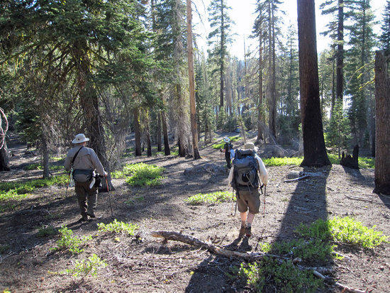
Jeff & Mark Rolling Along the Trail

Upper Twin Lake
Sherpa Scott
Note: Scott has the Sawyer Inline Filter plugged into the end of his Camelback hydration system, choosing to fill his hydration system with dirty water and filtering as he sucks on the end of his filter like a straw.
A Beaten Path
Unmarked Pond
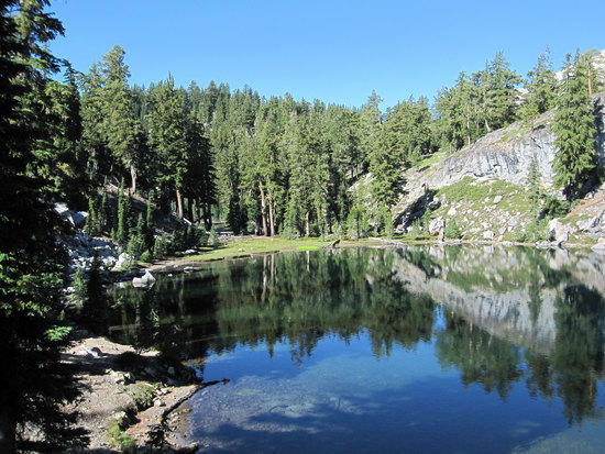
Echo Lake

Early Lunch at Echo Lake
11:15 AM
As with the rest of this trip, the pace was leisurely. Big mileage was not the goal of the day and we had ample time to get where we were going. Coming across a shady spot under a tree right next to the trail, we dropped our packs and pulled our packs open for an early lunch filled with chatter amongst ourselves and enjoying the emerald blue waters of Echo Lake.

Last Look Back
An Easy Trail

Mt. Lassen Comes into View
Shortly after reaching and intersection that headed North to Little Bear Lake, we continued to descend towards Summit Lake Campground. In doing so, a clearing in the trees gave us this wonderful view of Mt. Lassen.
Summit Lake
Elevation 6864 Ft.
Walking Through the Campground
We stopped here to use the restrooms and to tank up on water before heading off to rejoin the trail.
Mark at the Campground Parking Lot by Highway 89
Crossing Hwy 89
Jeff Receiving a Sign from a Higher Power: Approximately 2.0 miles to go

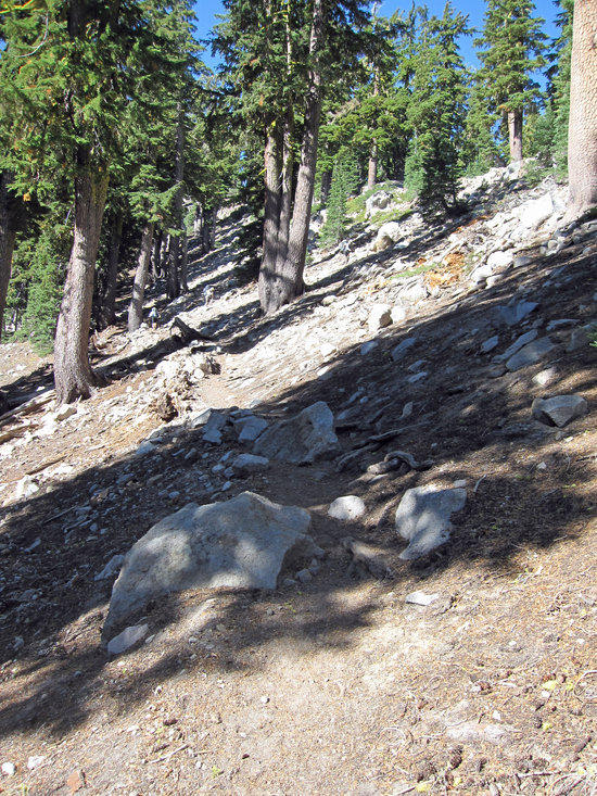
Steady Climb Up, Exposed to the Sun
After crossing the highway and rejoining the trail we started to gain elevation, ultimately climbing to 7200 Ft. With the afternoon sun shining upon us, Mark and I would wait in the shade of a few short trees along the trail to wait for Scott and Jeff to catch up with us. Taking time for all of us to rest up, I felt the familiar sensation of my sweat soaked shirt sticking against my back with the weight of my pack on my shoulders.

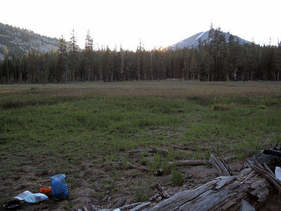
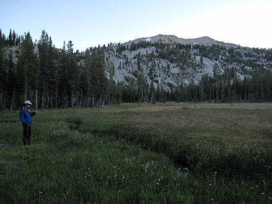
Meadow Along the Trail
3:19 PM and we found our campsite for the night just North of the trail where this meadow was, about half a mile from Cliff Lake. Camping is not permitted at Cliff Lake. We found a sloped clearing to the right of this photo that was surrounded by trees and overlooked the meadow. Plenty of dry wood laying around. Sadly, open fires are not allowed, but it did mean that there was plenty of fuel for my Bush Buddy Stove.

Time to Dry Out the Quilt
After setting up my bivy, which was simply rolling it out and slipping my Gossamer Gear thinlight and torso pad inside, I took my quilt, gravity filter, and a Cliff bar and headed down to the small brook that ran through the meadow. Taking my quilt out from my compression bag, I shook it a few times to fluff it up and laid it out in the sun to evaporate any moisture/condensation that might have wet the top of the quilt that came in contact with the inside of my bivy from the night before.
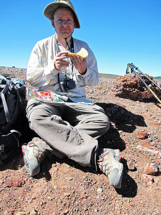
Tony Enjoying a Cliff Bar
Finding a small, flat rock to sit on, I peeled open another Cliff bar and enjoyed the late afternoon sunshine, while finishing off the last of my water that I had carried on the trail.
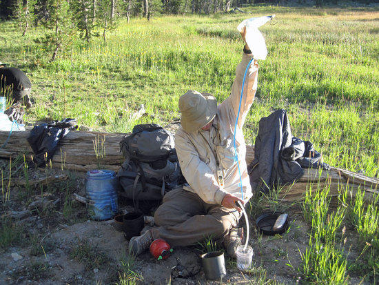
Gravity Filter: How to Use your Head
Lacking anything to toss my dirty water bag onto like a log or rock, I simply balanced my 4L Platypus Water Tank on my head and hoped that I had sealed it shut nice and tight. Letting gravity do its work, I contemplated how silly I must have looked to the squirrels out there.
Color in the Meadow
Mark Setting up for Dinner
After all of us had a chance to wash up and tank up on water for the evening, we headed East up into a large opening in the meadow, jumping across the brook that seemed to zig zag a few times back and forth across our path. We found an open spot by a fallen tree that was getting the last of the quickly disappearing sun.
Scott Filtering Water with his Sawyer Inline filter.
Platypus Big Zip hydration system holding unfiltered water.
Last Glimpse of the Sun
Jeff Getting Started on a Late Dinner
Scott’s Backpacking Yard Sale
Dinner and a Show
These two came close to where we were having dinner, content that the brook was serving as a moat to keep them safe from us.
Mark Enjoys a Drink as the Last of the Sunlight Fades Away

The Meadow
Dinner really was quite pleasant with plenty of dry wood laying around to feed my Bush Buddy Stove. Unfortunately, they do not allow campfires at this park. At times, I found that I was boiling up extra hot water to have, well, hot water. The warmth of the sun quickly left us as it winked away behind the trees. We donned out insulated jackets and beanies. With plenty of light lingering, we ate our meals and enjoyed the wide open space we were in. Cameras pulled out by all of us, we captured the sight of the dear that wandered past us, hardly concerned about our presence. Bellies full, pots washed, we gathered up our gear and hiked back with headlights on to our campsite. Watching the moon rise up to take the place of the fallen sun, we continued to chat in the dark amongst ourselves. When all our words had been said, we drifted off to our different shelters and turned in for the night.
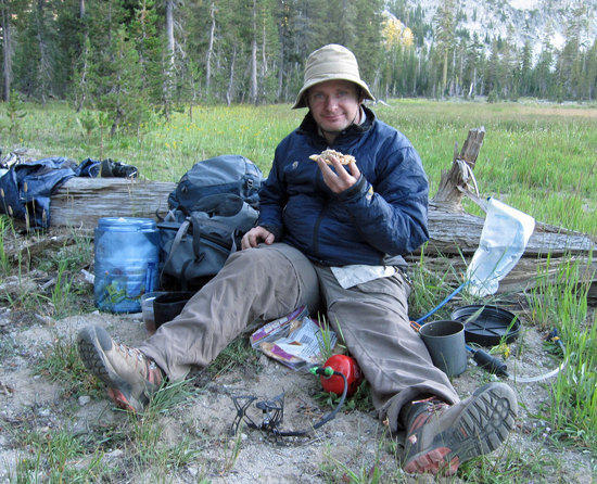
Day 4, 10.5 Miles

One More Breakfast Together
6:22 AM
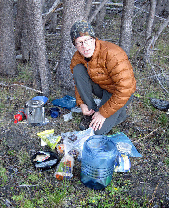
While the others had brought their Bear Vaults, I had decided to carry my green Ursack, which can be seen in the lower left of the shot. What we were all quite happy about was how much lighter our packs were with almost all of our food having been eaten. My pack felt more like a day pack than anything else.
Tony Embracing His Inner Lightweight Dork
At least this is a lot easier than holding my water tank in my arms.
After another leisurely breakfast, we broke camp and loaded up our packs for our final day. Hitting the trail at about 8 AM, we made our way up the trail by about a half a mile to reach Cliff Lake.

Cliff Lake
Unfortunately, you are not allowed to camp here.
From here we would push on 1.0 mile to pass Shadow and Terrace Lake, moving from 7200 Ft to 7600 Ft.
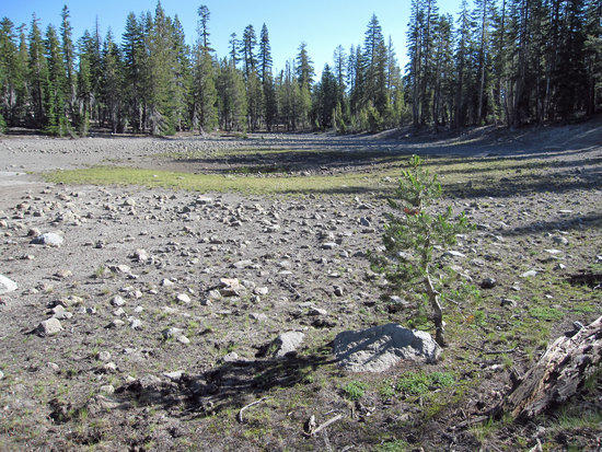
Unknown Dry Pond along the Trail

Shadow Lake
Gaining Some More Ground
Terrace Lake
Mark Moving Briskly on a Cool Morning
Just a Pretty Shoreline
Looking Back that the Winding Trail
Last Push to the Highway
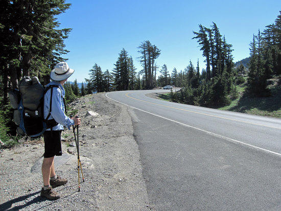
Mark Checking for Traffic
From here we would have about 3.0 miles traveling along the road to get back to Kings Creek Picnic Area.

Lassen in the Distance

Ready to Move Out

Scruffy Tony, Self Portrait
Where Are We?
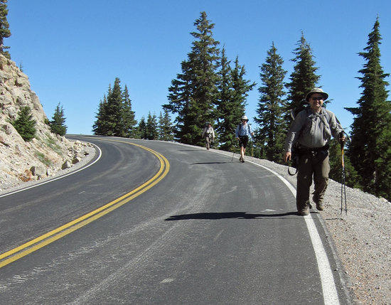
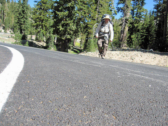
Moving Along the Road, Mindful of on Coming Traffic
Mark Blazes a Short Cut to Outsmart Me
I am not a runner and typically I only run if I am being chased by someone or something. However, more boredom of trekking along the asphalt pushed me to jog with my poles in hand, which surely made for an odd sight to passing motorist. Part running, part jogging, and panting for breath, I left the others behind to burn off some of my pent up impatience. More than a few cars slowed or stopped, perhaps to offer me a ride. Grateful for their thoughtfulness, I waved for them to go on. As I turned another bend and jogged along, to my laughing surprise, Mark appeared above me on the other side of the highway. He had cut across the switchbacks of the road to try to get a head of me! With age, there is wisdom and I have much to learn from those wiser than me.
Looking Down to Where We Are Headed

Pulling into Kings Creek Picnic Area

Lunch Back at the Vehicle
10:45 AM
Stream Going By the Picnic Area
After having an early lunch and lazing about a bit, we reloaded our stores of water that we had left in Jeff’s vehicle. The others dumped most of their gear, bear canisters, and set themselves up for a day hike. My pack already ridiculously light, I continued to carry with for the remainder of the day. We had 2.75 miles to go to reach Bumpass Hell.

Jeff Leads the Way
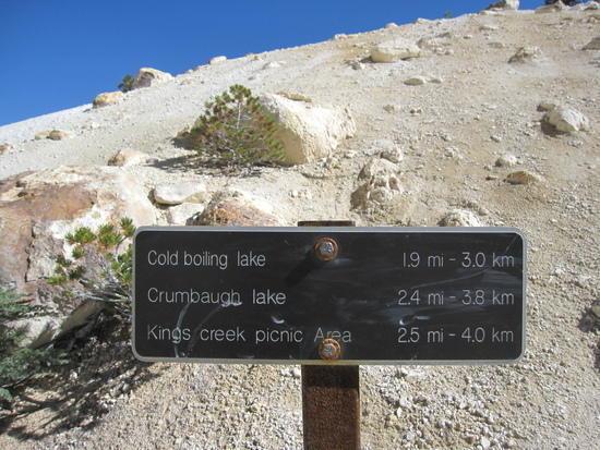
The trail left the Picnic Area and headed South West toward Cold Boiling Lake, which was 0.75 miles from the parking lot.

Dropping from Dusty Trails into the Green
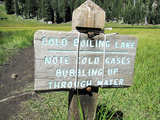

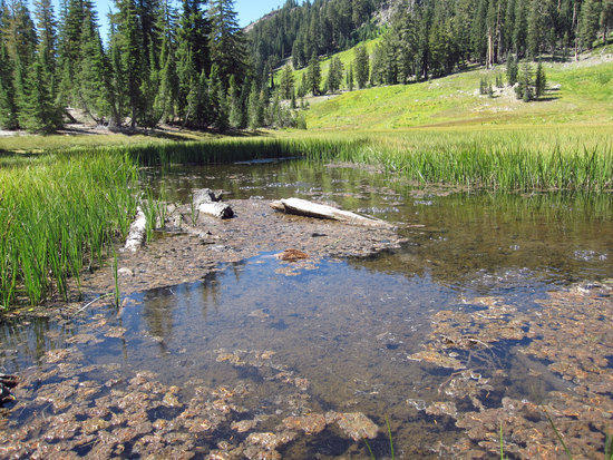
Cold Boiling Lake

Ribbons of White Surround the Sun

Rising Up Sharply and Leveling Off
After Leaving Cold Boiling Lake Behind and Skirting along the North Eastern Edge, the trail quickly traveled upwards maybe starting from 7000 Ft and eventually over 7600 Ft. At this point, the trail leveled out and gave us a very easy path to follow with open views of everything below and out to the horizon.

Into the Cover of Trees
The trail alternated from being completely exposed to the with a muddy trail to areas shaded by the trees devoid of moisture on the ground.

Nature’s Path Descending on the Trail from Above Us
Crumbaugh Lake Elevation 7204 Ft
Rounding a Narrow Bend

The Path We Follow
Clusters of White

A Clear Change in Topography
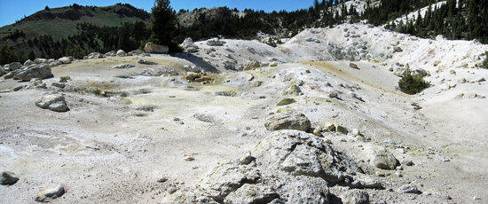
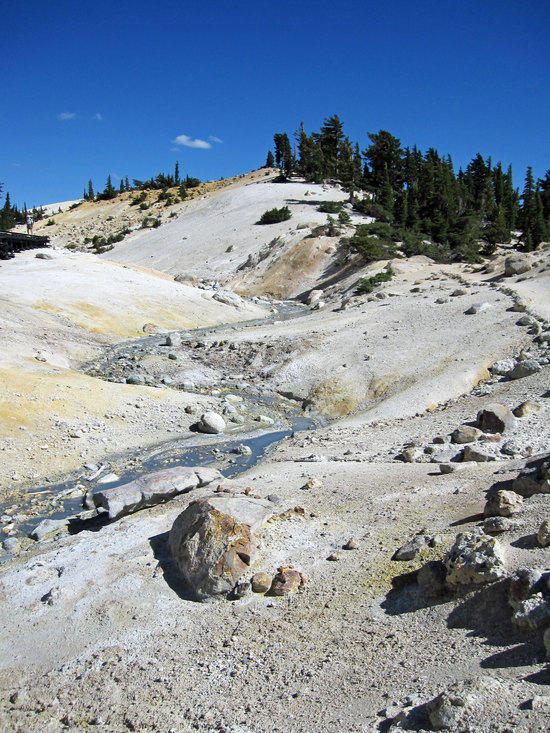
The trail turned a bend and abruptly headed North and we could see the sulfur yellow stained soil across from us, which hinted to where we were headed to.

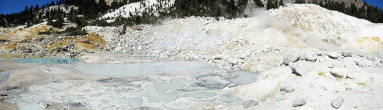
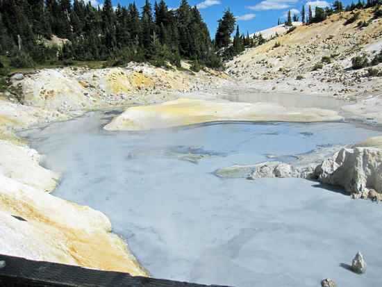
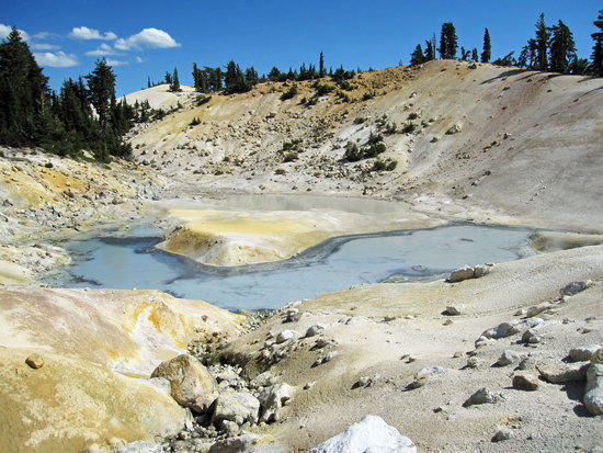
First View of Bumpass Hell
As we came to this rise, we could smell the strong smell of sulfur- that familiar rotten smell of decaying eggs that rises up to fill your senses long before you eyes could lay upon the source of the foul stench.
Jeff with Camera at the Ready
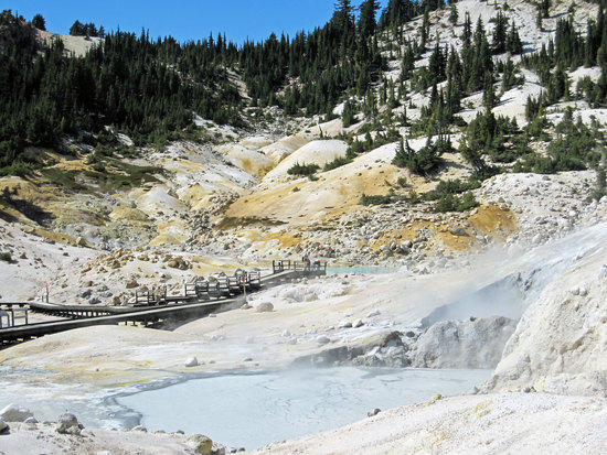
A Place for Everyone to Marvel At
Lake Helen Picnic Area off of Highway 89 was less than a mile away from here, allowing easy access and a relatively short hike South down to Bumpass Hell.
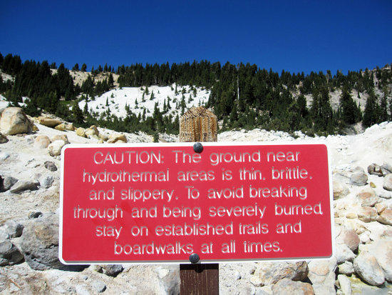
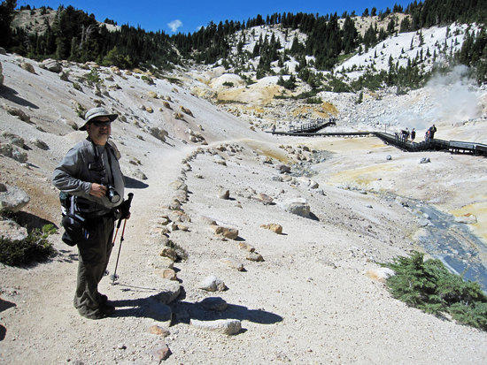
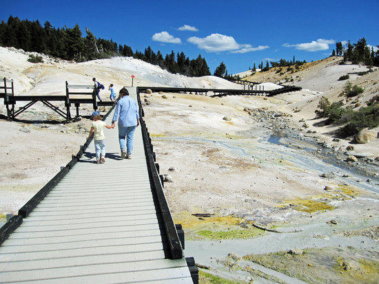
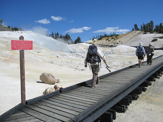
Why You Should Obey the Signs and Stay on the Boardwalk
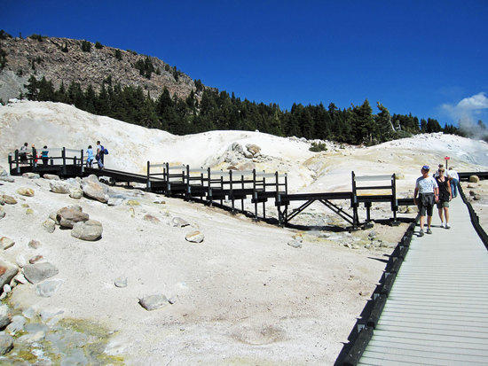
Taking you Everywhere you Need to Be
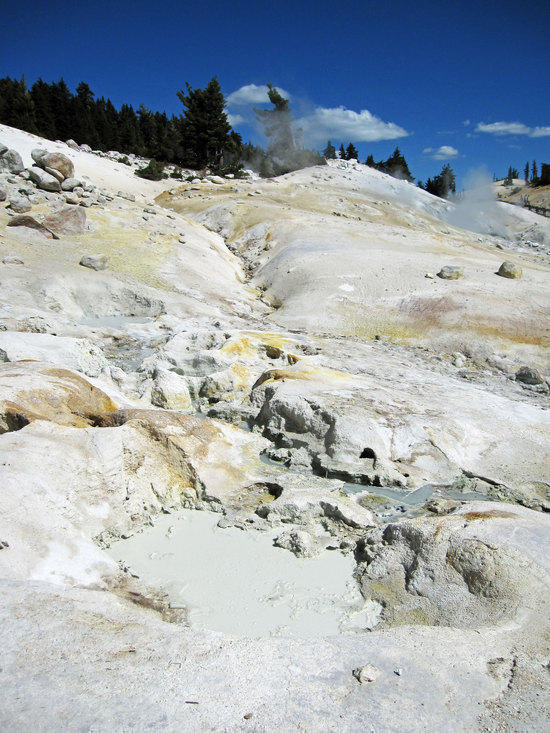
A Boiling Moon Scape
Dazzling Array of Stark Colors
Steam Bellowing Out from the Earth
A roaring hiss of steam filled our ears as the clouds of steam spewed out deep from the earth, only to be caught by the wind and moved about like a curtain of cotton that obscured our views.
Cloudy Pools in Hell
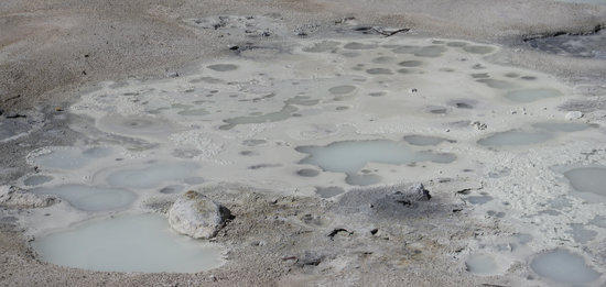
Spots of Boiling Mud and Murky Water
We Silly Band of Brothers

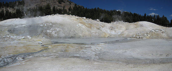
An Angry Pool
Bubbling Waters Churning the Mud and Minerals melted by the Steam cast columns of rising steam. Sometimes the steam was hovering just over the surface of the water and at others it would be rising up quickly from it cauldron.

Eating Away at the Earth that Spawned It
Stark Colors

Looking Back
The Whole of It

The Dry Belch of Hot Dragon’s Breath
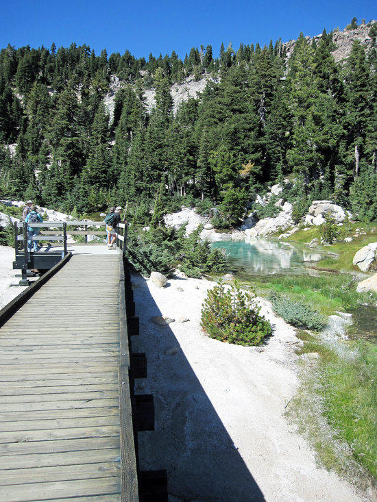
Walking to the End of the Board Walk


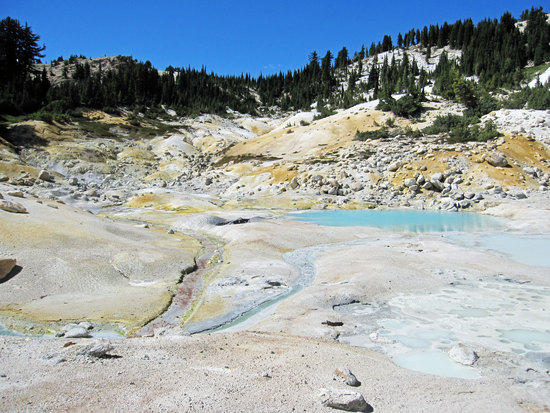
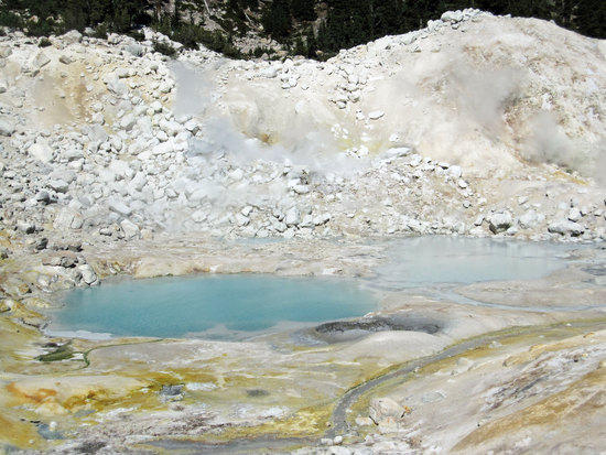
Mineral Blue Waters
Alien World Called Earth
Stains of Sulfur
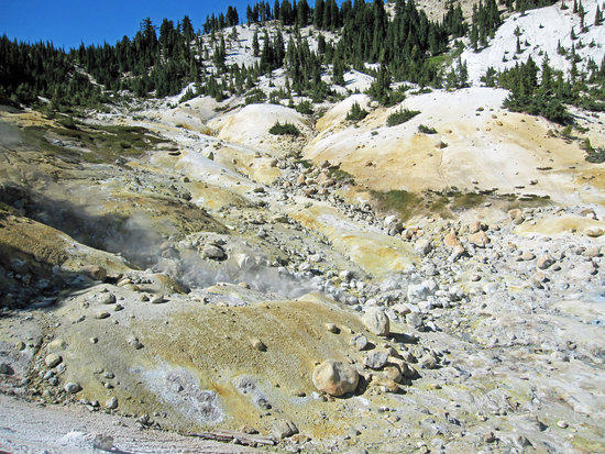
Rivers of Steam

Tale of Two Pools
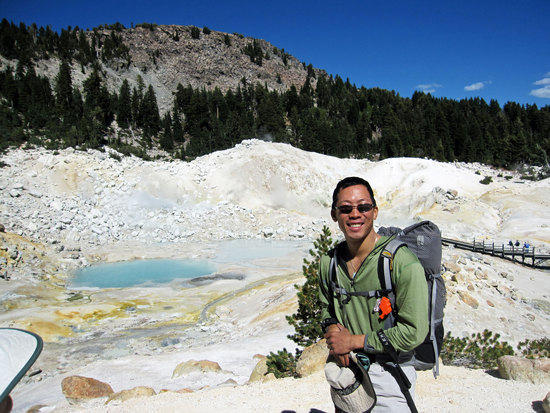
Your Tour Guide, Tony

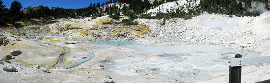
The Whole Boardwalk
Last Glimpse at the Pools
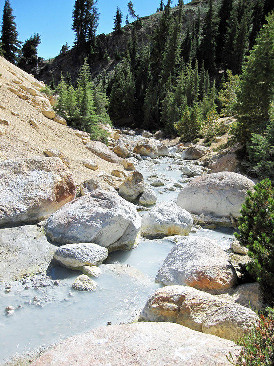
A Different Type of White Water Rapid
The Road Home
Leaving Mars
The day was a short one with us returning the way that we had come back to the picnic area and to Jeff’s vehicle by 3:36 PM. However, we had been rewarded with a tremendous variety of scenery and ending at Bumpass Hell seemed to make the trip all the more special with its other worldly feel. Driving into a town close by, we checked into a motel and had time to shower up and get clean to wash away the past few days of trail dust. As is tradition and reward for our efforts, we found a wonderful place to eat and drink and to toast our good fortunes to have been able to experience all of this.
Thank you for taking the time to read and see all of these photos.
I hope you enjoyed it.
-Tony
Other photo essays by Tony Wong:
BPLers GGG: Henry Coe State Park, CA.
BPLer’s GGG: Point Reyes, CA. 2nd Annual Trip
BPLer’s GGG: San Francisco Bay Area, CA.; Mt. Diablo
BPLer’s GGG: Yosemite: Hetch Hetchy Resevior to Rancheria Falls
High Sierra trail to Mt. Whitney
Sequoia & Kings Canyon National Park: Deadman Canyon
Yosemite: Glacier Point to Red Peak Pass to Lake Merced

