Straight Creek needs a few hundred more cfs to be really good, but at current flows it was a fun, scrapy, splashy float that averaged about 4.5 mph. Only the lower 8 ish miles are clear enough to be efficient. I’m not sure what the formula is for a float to be time efficient when you consider a windy stream versus straight trail and factor in transitions and the benefit of time off of your feet. It certainly would have been beneficial if we had the daylight and warmth to float to the WF Sun as planned.
Topic
2016 Bob Marshall Wilderness Open
Become a member to post in the forums.
- This topic has 377 replies, 28 voices, and was last updated 10 years ago by
 .
.
Well looks like the end of day 2.
Adrian detoured up to Black Bear bridge and then back south to where he’s camped at Little Salmon Creek. So he’s headed for Lion pass with ~31 miles and ~4000′ to the finish. He’s been moving well all day (36 miles?) and should finish around dinner tomorrow.
Derek is 8-9 miles up Little Salmon and should finish mid-day although he was moving slower the last while (8-9 miles in 4.5 hrs) so he might be hurting a bit or it could be tougher trail.
The difference between Adrian and Derek really shows what a raft can do in the right conditions. They were both at White River at the same time. On foot Adrian put in a good effort to cover ~25 miles to Little Salmon via Black Bear bridge in 9.5 hrs. Derek floated right there (~12 miles) in 3 hrs without doing much work at all other than the work of carrying the 8 lbs of rafting stuff for the rest of the way. 4.5 of that extra 6 hrs was the detour though, so the actual rafting saved ~1.5 hrs plus some wear and tear on the body. Swimming or having some sort of lightweight pool toy to cross the river could make foregoing the raft much closer.
Mike is a mile or two south of Big Prairie. I don’t see him getting out tomorrow but Tuesday looks like the plan.
Cyrus has arrived at Benchmark :)
Weather looks rainy this evening/overnight but not too bad tomorrow. Monday night looks colder (28F at 4000′).
I’m looking forward to some Trip Reports soon.
Dan, I really appreciate the updates, details, and educated speculation you are sharing with us. Thanks.
Looks like Adrian got an early start today, getting moving before 6am and topping out on Lion pass at 12:30. From there it’s just ~7 miles to the road plus another 10 of probably the most painful miles to the finish. Looks like he’s moving well and should be in around 7pm.
Derek didn’t get his spot on right away but it’s on now. He probably started around 7:30am and crested Lion Pass, the last obstacle, at 10:20 am. He might be rolling in around 5pm although his current pace is down a bit (2 miles in last 90 min). If that’s due to injury/fatigue and not trail conditions or breaks then he might be in later.
Mike’s been hustling from South of Big Prairie where he woke up. He made it to the Little Salmon drainage for 1:30pm. Tough to say whether he’ll push Lion Pass today or lay up.
What an awesome adventure and challenge for me. I bailed at Benchmark around 1pm yesterday (Sunday) nursing a swollen knee and irritated ankle. I knew there was slim to no chance of me making it to the finish with my time constraint of 3 days and more so my experience. Coming in at a svelt 225lbs bodyweight :) I think I put in a good effort for myself and certainly pushed my limits. I made it over straight creek pass around 6pm and had been following what must have been Tanner and Adrians footprints most of the way. I camped at the Green Fork trail / striaght creek intersection around 8pm for a cold night. Woke up chilled and achy after my sleeping pad had a major blow out (perfect timing). I contemplated hoping over Elbow pass to the Sun River valley but with a bum knee I knew it wasn’t smart and about 5 miles down the trail Sunday the ankle tendons really started to hurt so Benchmark was the easiest bail point and really was my goal in general. Suprisingly i had no blister or feet problems. I learned a ton about my capabilities, my gear needs and had a lot of fun in some great country. You guys are truley exceptional athletes. I hope to join you again next year with a little more experience and conditioning under my belt and a few more days off.
Best piece of equipment i brought: Treking poles
Best snack: rice crispy treat /hershy bar sandwich
Take away: My body needs to catch up to my minds expectations, Lol
I got mad respect for you guys putting in 30+ mile days consecutively. Crazy!
Looks like Derek made nice time floating the Swan River instead of road walking. That’s a great way to finish. He made it to the Cedar Creek around 6:45pm in a great effort. Congrats Derek.
Adrian looks like he continued to make good time but missed the turn into Cedar Creek. It looks like he walked 1.5 – 2 miles past before turning around. That extra 3-4 miles of road was probably painful. He would have been there just 15 min after Derek but ended up pulling in 1.5 hrs later around 8:10pm. Congrats on pulling off a foot route in a similar time as a rafter on that route.
Mike has had a big day, making all the way up Little Salmon Ck to Palisade Lake. He’ll probably camp there and finish early afternoon tomorrow.
A few thoughts before I head to work this morning;
According to Amy (Adrian’s GF) Les and Micah aka the runners from Helena finished sometime Monday around noon. Derek and I followed their tracks up to Lion Creek Pass where they went off left for no particular reason. They reappears in the mud miles later down in the valley. Sounds like they topped the pass in the dark and made the best of a gnarly navigational situation by dropping straight down the avy path to the creek, no doubt enjoying a heinous alderfest in the process.
I caught up with Derek around 930 Sunday night up Little Salmon. We camped together and hiked together all the way over the pass, until he let me go a few miles from the road due to “sore feet”. Turned out the sneaky bugger had a shortcut, as I floated by him lounging at a fishing access a few hours later. I finished at 5:55 pm, and Derek 50 minutes later. The trail up to Palisade Lake was tough, and the miles out Lion Creek unending.
We passed Adrian at 745 as we were driving home, and got him turned around back to Cedar Creek. He walked within 200 yards of our beer and pizza party by the side of the bridge.
I ran into Tyler at noon Sunday as I was getting read to raft Danaher. He seemed in good spirits. He had reportedly camped with Seth that night between Observation and Elbow passes.
I floated from a bit above the White down to Little Salmon with the Teton Trio. They flipped in the nasty current line at the end of the main rapid in Burnt Park and swam into/under a log (same log Spencer swan under on our trip in 2014) and broke a paddle. They hiked 5 miles down to warm and were putting back in when I caught them. They did well with three people in the Gnu, in spite of having 3 paddle blades total. I reckon they finished late last night.
Dan, thanks for the play by play. You’re bummed you didn’t come, this was a total sleeper route. My way was every bit of 120 miles on the ground, and while not as visually spectacular as last year was quality, and hard.
My route:
Day 1: Dearborn, Whitetail Creek, N Fork Blackfoot, Dry Fork Blackfoot. 34 miles walking, 5 miles floating. Camped a mile north of Canyon Creek. Floating wasn’t any faster or slower than walking, but was more fun.
Day 2: Danaher, South Fork, Little Salmon. ~20 miles walking, ~30 miles floating. My body was slow getting moving, and I went against good judgment and prior experience and wasted time putting in too high on Danaher. The South Fork was fantastic as always, and lower Little Salmon was nice trail without too much deadfall. Camped ~2.5 miles from the trail up to Palisade Lake.
Day 3: Lion Creek Pass, road walk, Swan River. ~19 miles walking, 8 miles floating. Aside from the river the miles came slow as heck today, due to fatigue and tough trail conditions. Quite a bit of nasty deadfall both sides of the pass. Snow started at 5800′ on the east side.
I made 4-5 logistical/navigational errors over the whole trip, which taken away probably would have saved 3-4 hours, but that is the game and I/we did well not making them worse once they were made. This route certainly took more effort to finish than any previous one.
I walked in the ditch from the forest road all the way to the campground. I walked in 100 ft and stopped. I had noted leaving Van Lake that there had been no sign for the campground…and the bear signs next to the road where I was standing were similar to those at the bottom of Van Lake CG. Reason would have had me walk a little farther to check for the campsite, but in my dehydrated state I just couldn’t grasp it and turned around. I may have well expected a giant banner and a rock band at the finish. I walked in the gravel after that until Dave turned me around 30 minutes later. I’ll admit that I strayed from the rules and ran/walked on the pavement back to the CG. I’ll have a full trip report next week.
If anyone is still in town, the Woods Bay Grill just south of Bigfork has some of the best breakfast I’ve had in a while.
Nice effort guys.
Dave: Wow I didn’t think a route that far south would finish that fast. Nice job. There’s a good chance I’ll be there next year.
Looks like Mike is out of the woods and putting in road miles. Should finish in a couple hours.
Cold and snowy bivouac for Mike last night. The west side of Lion Creek pass drops quite steeply for the first few hundred feet, moreso than it looks like it would on the map. With a choice between swinging out onto the talus on a goat trail or downclimbing from tree to tree on a 35+ degree snow slope its little wonder he decided to wait for dawn.
Just got back from Alaska and was catching up on this years event. Good job to everyone! Anyone else notice that Mike seems to be a little misplaced at the moment?
Wow, great jobs by everyone! I will issue some notes later but wanted to let you know that I am back home safe and sound. I can’t make big mileage days through all the deadfall–I am so impressed by the high mileage days you post through tough terrain. Bailed out after about 35 miles. Had a great time regardless:).
Here is one of the best photos from my trip across The Bob. Adrian was a welcome sight atop White River Pass. More to follow…

Browsing GoPro footage and realized my critter count (already good, with two bear sightings) was one higher than I realized. I floated right past this mountain goat on the upper North Fork of the Blackfoot without even noticing:
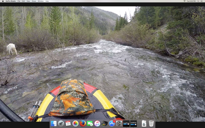
Worth noting that this is on a willow-choked river at 5000′, probable moose habitat, and in an area of the Bob complex where goats are supposed to have fairly small populations.
Wow, that was intense! A quick report of my experience while it’s fresh:
Depart from Bean Lake and cruise up the road with the gang, that was fun, on to beautiful walking up Dearborn canyon.
At the junction of Whitetail creek I stop to consider Dave’s route, which I had failed to consider prior. I decide to stay the course and instead latch onto Seth for motivational and organizational support. We have a good day walking until nightfall, stopping after 33 miles on a wet bench below Observation pass.
Sunday, Seth rolls out at 6 and I make coffee in my enormous, warm jacket. We reconnect down the trail along Rapid Creek after independent adventures following misguided footprints over the pass. I leave Seth after a creekside rest, and bump into Dave inflating his boat shortly thereafter.
I continue down the SF Flathead, broken by the thought of everybody elevating their feet, icing them occasionally, under bluebird skies, as they make quick progress downstream. I shuffle onward. I’m caught in a hail storm just south of Big Prairie, and things look dark until I arrive at the volunteer cabin and I’m offered tea and quick sit by the fire. Probably disqualified. Somewhat refreshed, but way behind schedule, I hike until dark and camp on a bench south of Holbrook Creek, 62 miles deep.
Day 3, I wake up motivated but cankles hurting after pounding down the SF. Wind my way around Salmon Forks and up Little Salmon, where the pace slowed further due to downfall and sore feet. Began picking my way up the Palisade Creek trail at 4pm. Was surprised how much snow there was, but it was good motivation to push over the pass. Fortunately the route was a veritable catalogue of ultralight footwear, and the climbing was a relief to my ankles. Topping out at 6-7 was exciting and so was skiing scree down the other side. I descend with a lot of pain, and dunk crossing Lion Creek. I realize how far I have and that hitching at night would be foolish, so I camp in a dank cedar grove a few miles down around mile 87.
Today, Lion Creek trail is beautiful but goes on endlessly. I finally get to the road around 1130. Wrecked, I shuffle down the road deliberating whether to walk down to Cedar Creek or stick my thumb out. I get to “Cedar Creek Campground” (quotations reflect lack of signage, sucks Adrian!) at 2 pm. I wait for the pizza and beer party for about 20 minutes before heading back to the road. I wait for 2 hours until, by a miracle of the universe, get picked up and driven all the way to my car at Bean Lake!
Thanks everybody!
Also, how did I not see Mike?
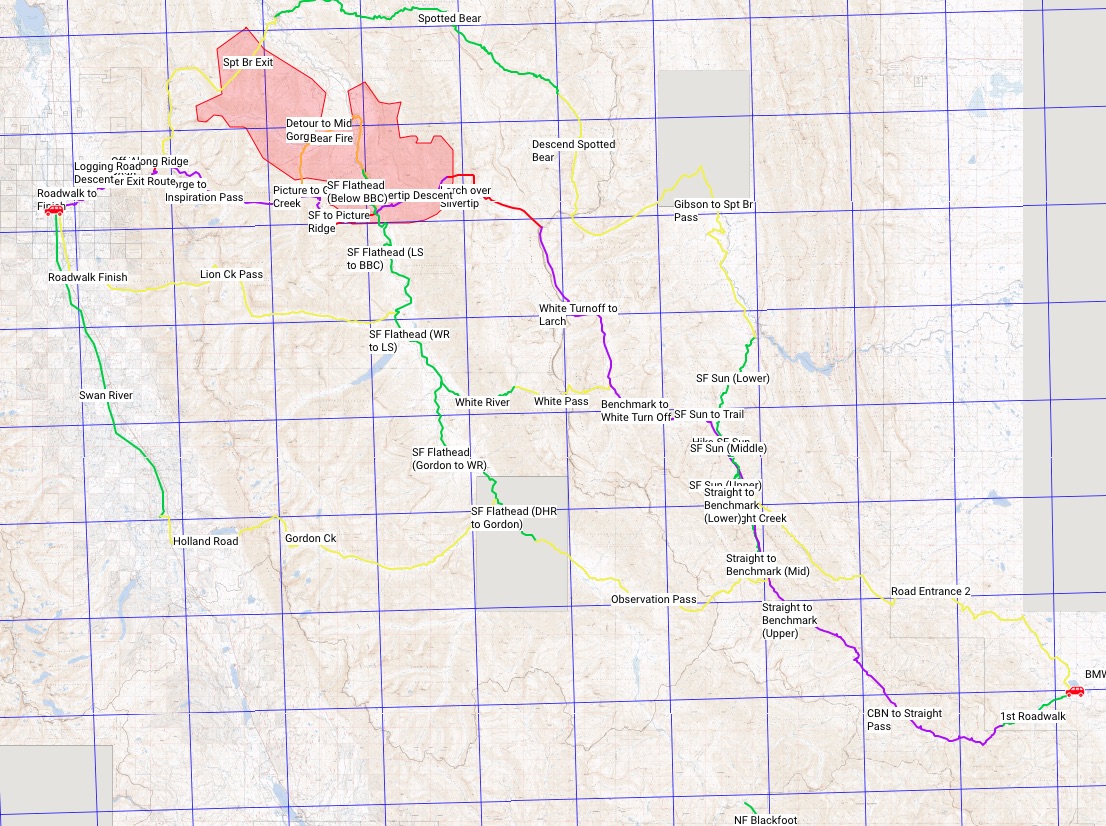
FWIW, the route in purple is the one I really wanted to do. Nice trip up the Chinese Wall, interesting off-trail over Silvertip, epic SF crossing on a suspended log and then an ill-advised off-trail push over Picture Ridge to Inspiration Pass. I think it’s a reasonably efficient route until the Picture Ridge area where there’s a lot of extra vert and burn zone issues.
103 miles inc. 20+ on snow, +21’000 vert. I reckoned flawless execution at 42 hours of moving time – a clean run would have been mid-day Monday with 4-5 hrs sleep per night. With more snowpack it would have been a viable ski route.
Well done Tyler!
Morning everyone. Sitting at the Atomic Cafe waiting on a green chili pork breakfast burrito :)
First let me say this- Wow! Spectacular route and very challenging to say the least (holy blow down!).
Cliff note version- hiked with John and Thad for a good bit of the route- day 1: 32 miles to N Fork guard station, day 2: 31 miles to Cayuse Prairie, day 3: split with John and Thad at Big Salmon- they wanted a down day to fish and relax; I pushed on to Little Salmon and bivied at the pass, it was dark and I wandered onto a goat path (thinking it was the trail) with my headlamp and thought better of it and turned around- good decision. Day 4: Lion Ck and then instead of taking the Highway connected several old logging roads and some bushwhacking eventually putting me on the Goat Ck road near the finish. It definitely would have been quicker going the highway, but I did find a dandy place to hunt bears!
Finished at 3:45, sounds like I missed Tyler by a little bit.
Have some swelling in front of my right ankle and looks like it may bruise, but other than not too worse for the wear.
Was great to some familiar faces and some new ones too!
Thanks again Dave for what is the highlight of my year.
Nice one Mike.
The video is up.
Saturday, May 28th (day 1):
The goal for this day was Indian Point Shelter, roughly 46 miles from Bean Lake. To get there, I stayed on dirt roads that often crossed private land to the east of the Rocky Mountain Front (RMF). It would’ve been impossible for me to track down every single land owner prior to the event, so I decided to use a “request permission while asking for forgiveness” strategy in case I came across anyone along the way. My first run-in came only a few minutes north of Bean Lake. A gentleman walking with his rather large German Shepherd motioned for me to come over to him, and I was thoroughly briefed on the fact that this was private land and that I must proceed to Augusta if I intended to hike to Benchmark (where I told him I was going). He then granted me permission to cross his property and was shown where to promptly exit. Phew! Once out of sight, I proceeded on my planned route, constantly looking over my shoulder, but saw nobody for the next several hours. On the last private land crossing, two young men in a pickup pulled along side me and politely asked where I was heading. After asking if either was the landowner (the driver said he was), I explained where I was heading, and was granted the right to continue. Double phew!
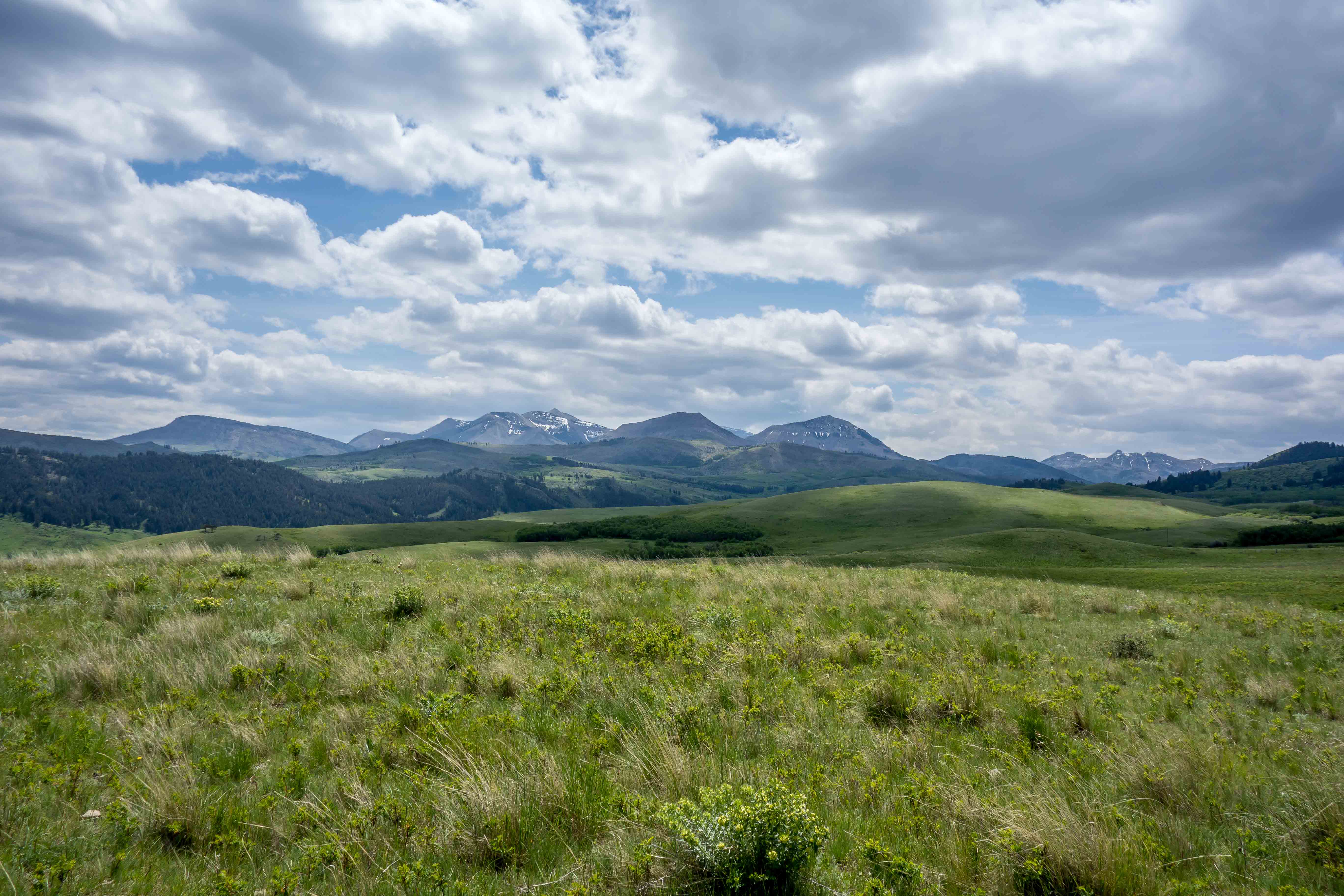
Not all of my miles along the RMF were on the road. Here, I walked on top of some grassy hills on the last stretch before the road to Benchmark.
Once I was made is out of the private land areas, I had a long haul on a dirt and gravel road to Benchmark. The surface was fine, but not nearly as enjoyable as walking though the mostly dirt & grass prairie. At Wood Lake (28 miles’ish), I decided to let my feet breathe for a few minutes, as I could feel a hot-spot on the heel of my left foot. I was horrified after taking off my shoes, and snipped open a heel-sized blister. The rest of my foot wasn’t much better, with the right equally rotten-looking. I spent a few minutes contemplating pulling the plug on the BMWO, with almost 70 miles to go on bad feet. I slipped on a pair of neoprene socks for the first time to see if they would keep my feet from falling apart and pushed ahead to Benchmark. At Benchmark, I made another feet-breathing stop, and my feet didn’t look worse than before. So far, so good.
The trails from Benchmark to Indian Point were quite pleasant and mostly deadfall free. At a few points, I could see the South Fork of the Sun River below, and was glad to have not paddled that section given my inexperience in a packraft. I arrived at the Indian Point patrol cabin around 10:00pm, and camped on the porch with no planned wake-up time for the next day.

Pack Bridge over the West Fork of the Sun River

The views on the way to Indian Point made me forget about my feet
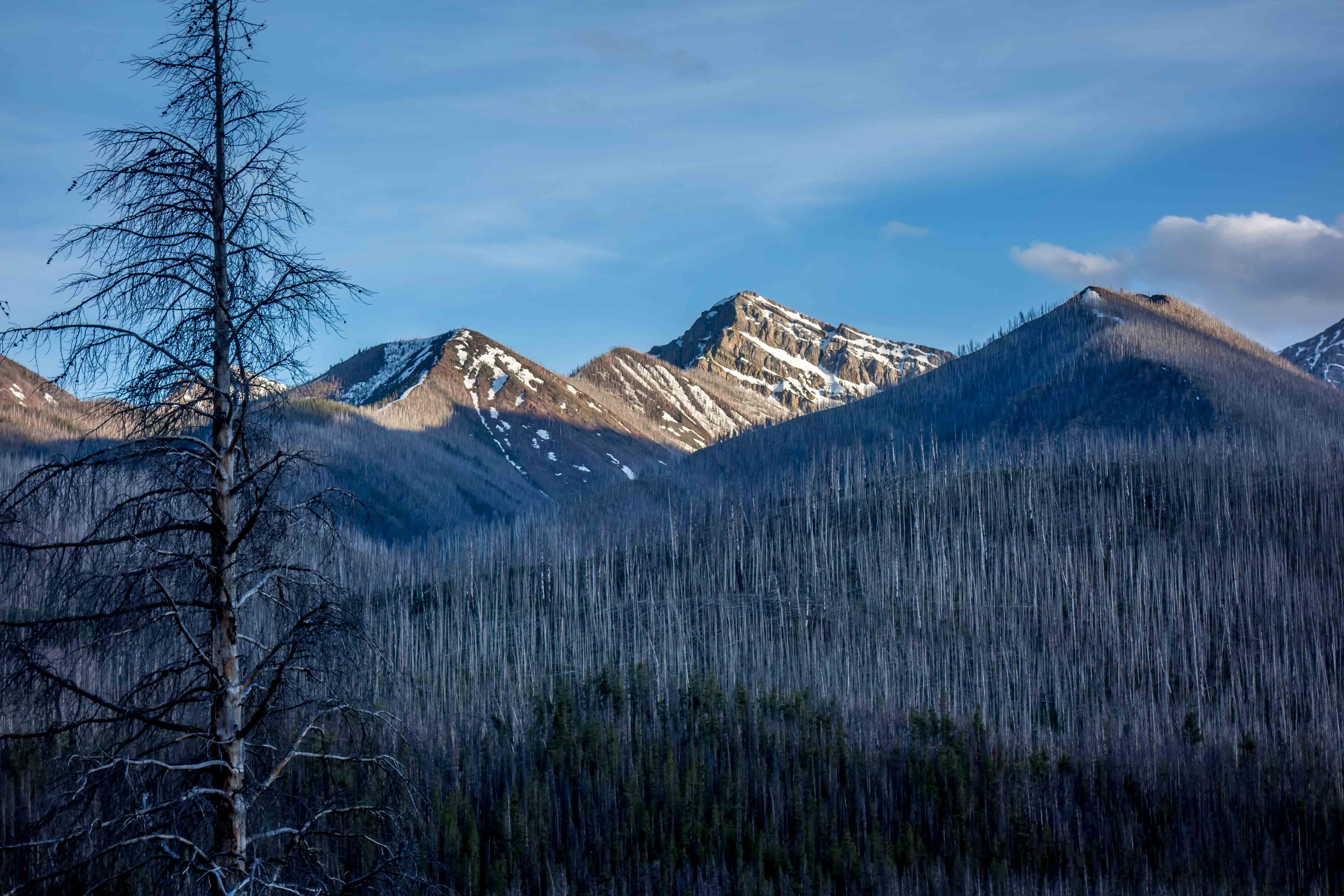
More awesome looking mountains…
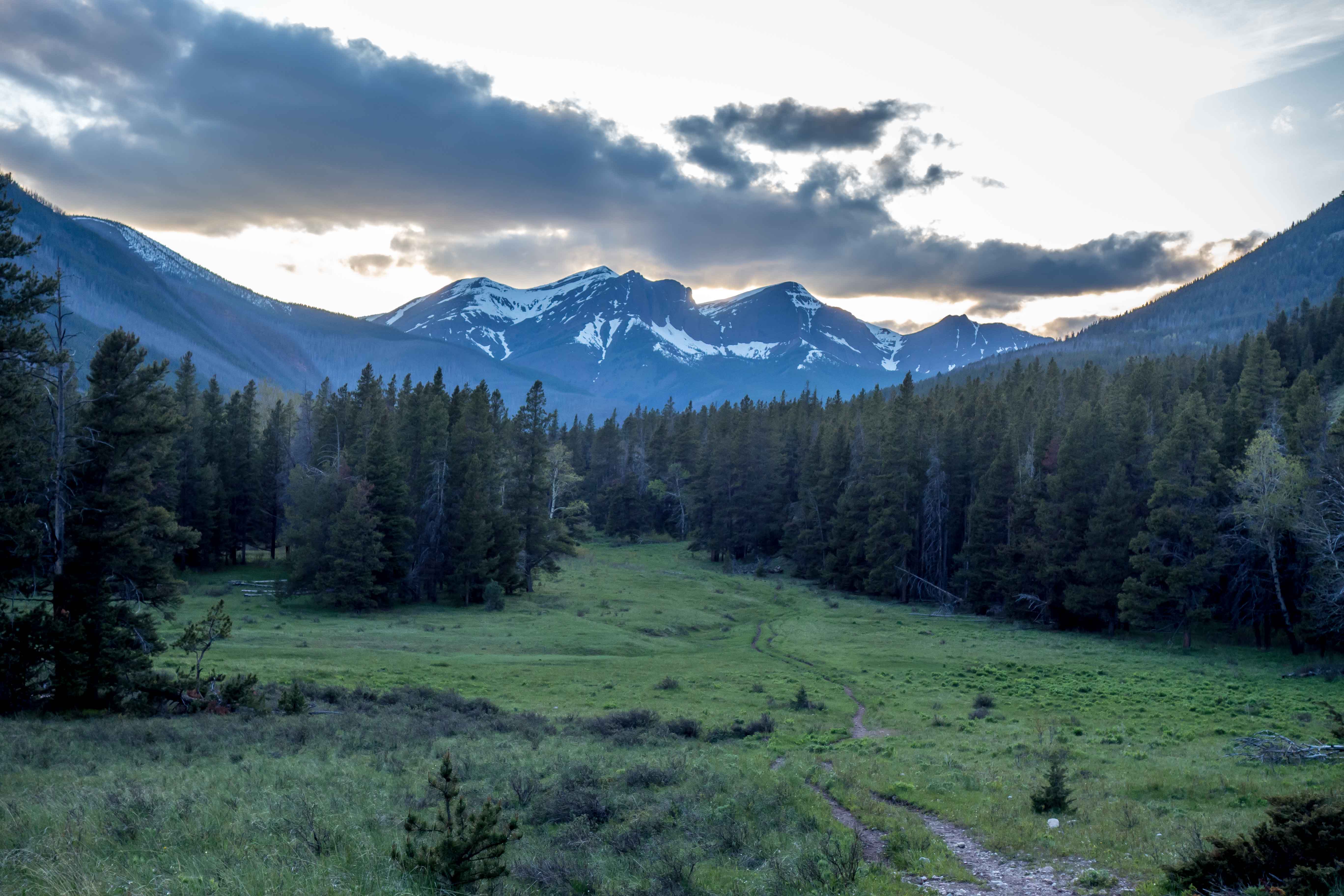
Getting dark as I approach Indian Point
To be continued…
Sunday, May 29th (day 2):
I woke up sometime around 6:30am. COLD. Damn. I pulled my sleeping bag back over my head and just lay on the patrol cabin porch trying to find the courage to get going. After maybe 20 minutes of internal debate, I quickly put on my wet shoes and socks and packed-away my gear. Once down the trail, I was back to normal, with better feet than the day before. The first non-human obstacle on my journey came within the next mile. I had been told that the first creek crossing on the trail to White River Pass can be tricky, and can confirm it was. Having brought no hiking poles, I found a large branch and used that to brace myself as I crossed. Mission complete, I pressed-on to the pass.
The white stuff on White River Pass came sooner than expected, and I quickly lost the trail. The snow was firm, so I just meandered along. On the southern “turn” to the pass, I climbed too high (not as high as Adrian I later learned) and was forced to “side-hill”. Soon, I was post-holing and side-hilling and was not having much fun. Actually, it sucked really bad and felt like I was stranded for an eternity. A few hundred feet below, I could see that the angle was less-severe and decided to glissade to that point to pick up the hidden trail beneath the snow. Using my paddle shaft to slow the descent, I quickly made it to better ground, and had a much easier time walking in the snow from this point forward. Once on top of the pass, I was caught by Adrian, and we chatted all the way to the White River. From my questions during our hike, I learned Adrian was an accomplished runner. I also gave him a heads-up of what I knew of the river crossing site, since he didn’t have a raft.
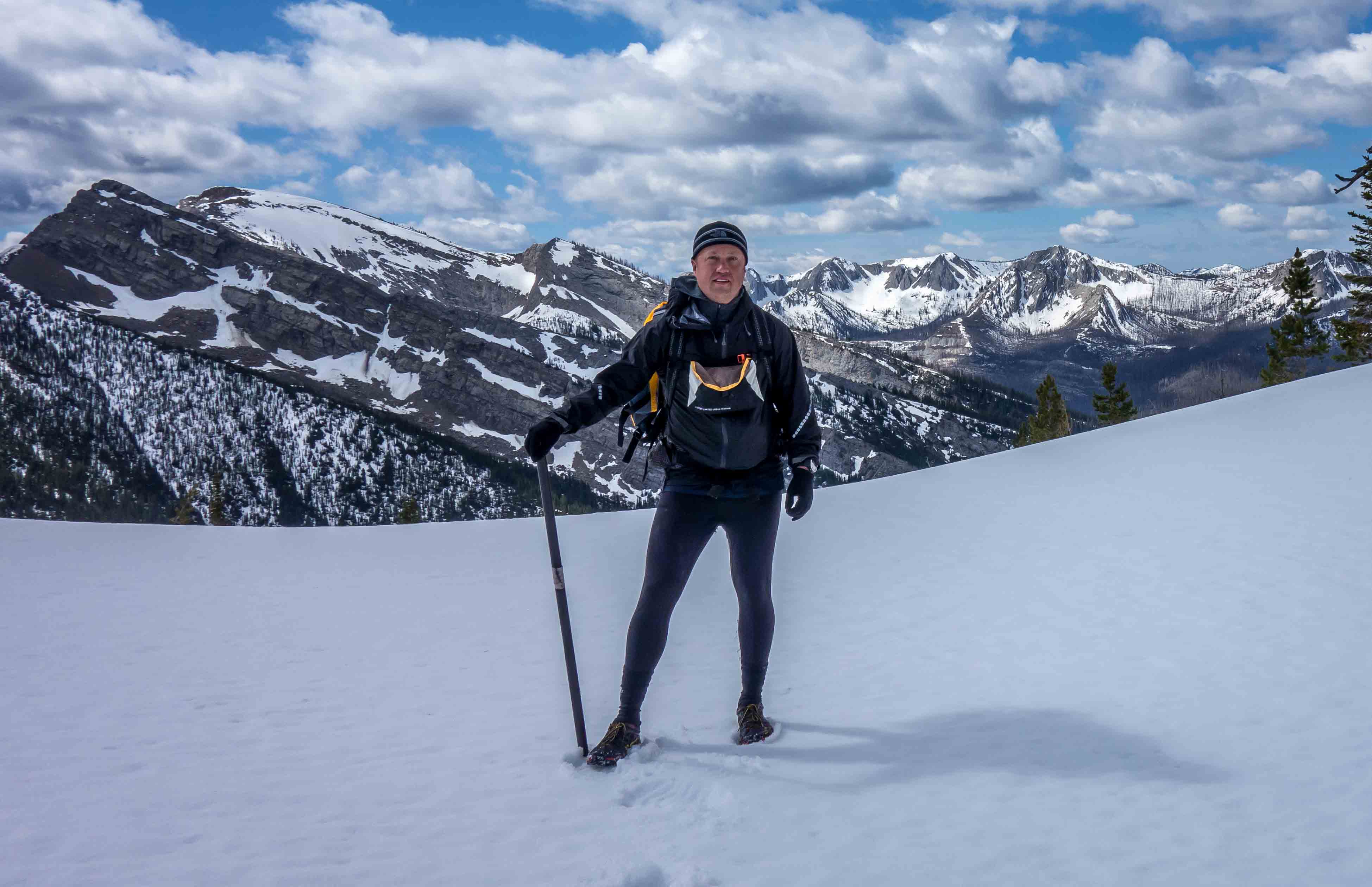
Me with my multi-purpose ice axe, hiking pole, bear baton, kayak paddle shaft
Oh Nelly! The White River was moving rather swift and Adrian wisely headed towards the pack bridge at Big Prairie, while I got the packraft ready to go. Once on the water, I felt like I was on a ride at an amusement park. Every so often, I drifted too close to shallow rocks and had to push off to get back to deeper water. With each turn of the river, I began to learn the best lines to avoid these delays and forgot about time, distance and my feet. I was having fun! Soon, the river began to break-off into smaller channels as I got closer to the South Fork of the Flathead. I didn’t remember seeing such an endless maze on the map, but I just continued to zoom downstream. Eventually, I made it to the South Fork and headed north. A rain storm created a nasty headwind within this stretch, and I was forced to duck for cover in a small cover in the east side of the river. I tucked my arms under the cruiser deck skirt to keep them warm and waited until the storm had passed. The river swept around big bends on the river, and at no point did I feel in danger of what was to come. I used the compass of my watch to look for a north-south bend in the river, which was an indication that I was passing Salmon Forks. Little did I know that Salmon Forks also had an elaborately constructed wooden fence along the river’s edge which also confirmed my location. At the next east-west bend in the river, my packrafting adventure for the day was complete, and I beached the raft just east of the pack bridge over Little Salmon Creek. I could see another storm approaching, so I quickly started a fire to get warm. This storm was shorter than the last, and after putting out the fire I headed west down the Trail of Deadfall Death and Gloom.
My goal for the day was to either stop short of Lion’s Creek Pass, or, if things were going really well head over it before dark. It quickly became apparent that I needed to stop short. My pace slowed considerably with each successive Spartan Race-worthy tree obstacle. Sometimes, I would just stare at a tree and consider the possibilities that existed (hmmmm, should I go left, right, under or over?). At this point, I wasn’t in a hurry, since I knew that I was going to stop short and I had a few hours of light left. Enter Dave. Holy S@#$! Dave! OK, maybe it wasn’t quite that dramatic, but I now had a reason to move a little faster, because now I had to keep up with “Deadfall” Dave (I would later change this personal nickname to “Buchwack” Dave). After several miles of tree-gymnastics we made camp at some point short of the trail to Lion’s Creek Pass. The time was between 10-11pm. Life was good. The stars were out. Heck, I don’t even need to set-up my tarp. I think I’ll just breakout the non-waterproof bivy and sleeping bag and call it a night. Dave and I talked about how good the weather had been so far. What could go wrong?
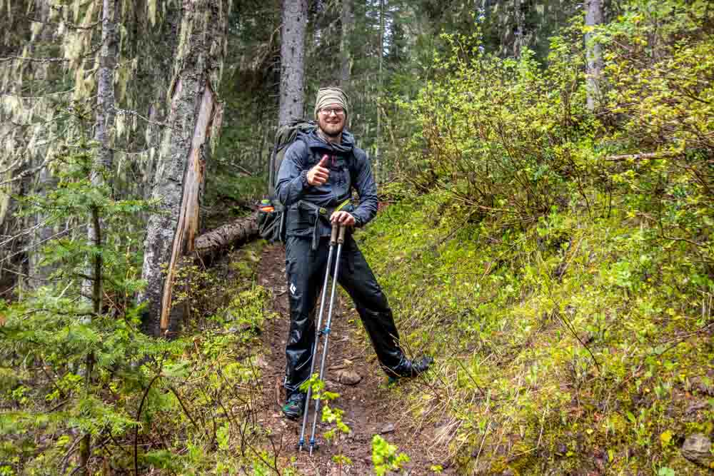
Dave Chenault, happy in his element
Monday, May 30th (day 3):
“FUDGEEEEEEEEEEEE!!!!!” I thought, as I heard thunder in the distance. Soon came the rain. Slow drops became faster until it was a full-on rain. This night was beginning to suck, but it was the last night. Even though I was tucked underneath a good Christmas tree-sized pine, I felt like I was in a good position to be immune to the wetness pouring down around me. Oh man! My bivy was beginning to soak through. I had been using my tarp as a ground cover, and quickly pulled that over top. The rain finally passed and I was still fairly warm and my 40-degree bag just a bit damp. Dave and I got up sometime between 6-7am, and proceeded to Lion’s Creek Pass.
Like White Creek Pass, the snow started sooner than anticipated, but the snow never got too soft. For the first time, I started to feel tired and just followed Dave and we headed uphill. The trail was impossible to follow, and all we had were two sets of tracks to use as a guide, although at times we drifted elsewhere. We trudged-along and eventually crested the pass. There was a goat trail to the north that we initially thought might be the trail, but then we opted to descend the pass on a super-sketchy snowy slope over the hidden switchback trail. We didn’t die. Phew!
From then on, it was deadfall after deadfall, then a little bushwacking after we lost the trail at a packers camp, then more deadfall. We also noticed that we couldn’t see the two sets of tracks anymore and hoped that the others were ok.
As we closed towards the trailhead of Lion’s Creek Trail, I told Dave to move along so that I could go at my own pace. My feet were throbbing the whole day and I’d had enough. Once past the trailhead and onto the road, I began to feel a bit better and made my way to the Swan River for the final packraft to the finish.
note: will edit later…about to board my plane
Become a member to post in the forums.
advertisementYour privacy is protected: We do not transmit your user data to third-party ad platforms or advertisers, and we do not host third-party tracking pixels. Backpacking Light serves ads on its own custom, native, and internal platform.
 Titanium Pot GrabberUltralight titanium pot grabber weighing just 4.5 grams.