Topic

2016 Bob Marshall Wilderness Open


Forum Posting

A Membership is required to post in the forums. Login or become a member to post in the member forums!

Home Forums Campfire Hiking Partners / Group Trips 2016 Bob Marshall Wilderness Open

Viewing 25 posts - 326 through 350 (of 378 total)
  • Author
    Posts
  • #3406412
    Jason P
    BPL Member

    @jpopilsky

    Been so fun to hear all your adventures!  We were thinking about everyone quite a bit while we were out there.           “Teton Crew” Overview

    Day 1:

    Feeling very well the first day considering the pack weight we were carrying.  We walked and trotted to Straight Pass and got there with Adrian at 2:35…. very happy with our decision with taking our shoes off for every crossing!  We hardly had wet feet the whole first day.  We noticed the runners took Welcome Creek/ Honeymoon Creek way and passed them near that junction. (they caught up with us at the straight creek crossing seconds after washing my ass in the stream)  They almost had a nice show!  Don’t know when we topped Elbow Pass, but we caught up with the Helena guys at the junction before Sentinel Mtn. Had some nav. troubles on the way but made it to Basin Creek Cabin at 12:12. (runners seemed to get misplaced near the cabin or just decided to set up in a meadow somewhere)   48ish mile day.

    Day 2:

    Instead of dealing with portages we started hiking to Youngs Creek at 8am.  Hopped on the South Fork and cruised along until we hit the Dead Tree rapid at the wrong angle and went for a good swim.  Got out pretty quick, but lost a couple water bottles, broke a paddle shaft, and lost a blade.  We were cold and shaken up.  Unsure we could handle the water with 3 people in 1 Gnu and 3 blades we decided to hike down to Holbrook Ford and try to cross the South Fork.  Just as we were getting ready Dave rolled up and ensured that the rest of the paddle to Little Salmon Creek was doable considering the situation.  We floated almost all the way with Dave but got out just before him (hope you didn’t wait for us!)  We had a nice slow 5ish miles up the Little Salmon and set up camp at 10:00pm.  We were shaken a bit from the day and needed another good rest.  15ish miles on foot / 16ish miles floating

    Day 3:

    Left camp just before 6am.  Abby was having knee troubles, my cold continued to nag me, Fred was tired but solid!  We topped out on Lions Creek Pass at 10:50am. Saw Adrian again just before the bridge to the trailhead.  We bushwacked to the forest roads and headed north.  I think Adrian thought we were wack and took off to Van Lake.  The road was easy once we found it. One little bushwack connector to another road and we were on the home stretch.  Just before highway 83 we crossed Goat Creek, walked through a gravel pit, and crossed the road to the campground at 8:40pm.  30ish mile day.

    Straight to Seeley Lake and caught a bar/grill by closing for a burger.  Camped at Big Larch Campground and headed home.  Feeling wrecked, but what a trip! and what a place!

    #3406449
    Tyler H
    BPL Member

    @ctwnwood

    Locale: Madison

    Anybody know how Seth made out? Holler if you’re alive buddy!

    #3406457
    Seth Cunningham
    BPL Member

    @seththesailor

    Im alive and still hanging out in montana. Had an awesome trip and enjoyed meeting all of you guys. Trip report to come when I get home.

    #3406466
    John N
    BPL Member

    @airlocksniffer

    Locale: Montana

    Just checking in.  Thad and I finished today about 3:15.  116 miles total.  After Mike left us at Big Salmon we had a good afternoon fishing, resting and tending to hurting feet.  Out of nowhere a dog popped over the hill w/o an owner in sight.  We gave him what food we had, caught and cooked up some fish and made a nice stew for him. We took him up Little Salmon and over the pass by around 4 and stumbled through snow and nasty blowdown until about 8 pm where we camped in a nice cedar grove last night.  Once we got cell reception we called the owner, who basically said we could keep him.  Thad is the new owner of Bob (a new name, seemed fitting).  More to come in a full trip report.

    #3406522
    Dan @ Durston Gear
    BPL Member

    @dandydan

    Locale: Canadian Rockies

    Thanks for the reports guys. Great stuff.

    #3406646
    David Chenault
    BPL Member

    @davec

    Locale: Queen City, MT

    The dog thing is a new one. Saw horse packers camped by Big Salmon ranger station which is also unusual.

    My long report is here.

    #3406666
    Mike M
    BPL Member

    @mtwarden

    Locale: Montana

    excellent report Dave!  I keep thinking I should join the fun and invest in a raft (and plenty of seat time), but some of your previous video has me thinking not :)

    my report https://backpackinglight.com/forums/topic/2016-bob-marshall-open-2/

    #3406684
    Jason P
    BPL Member

    @jpopilsky

    ok,…..  Where does next years adventure begin and end?:)


    #3406687
    David Chenault
    BPL Member

    @davec

    Locale: Queen City, MT

    West Fork Teton cabin/campground to somewhere near Seeley is my current thought for 2017.

    One could divide floatable waters in the Bob into three categories. The first is generally bigger stuff which gets flushed yearly and usually has modest wood complications. The two forks of the Flathead, the major forks of the Sun, the White, and the lower 2/3 of Spotted Bear fit here. The second is larger creeks which get cleaned out occasionally, and whose floatability depends on gradient, the terrain it flows through, recent fire activity, and chance. The upper part of the N Fork Blackfoot and Danaher Creek are good examples; both have good and bad parts depending. The third category is creeks that are big enough to float, but seem to usually have enough wood that they’re just not worth it. Lots of stuff in this category.

    As Dan alluded to earlier, if you’re really on the edge in terms of trying to go fast, you need a lot of miles on first category waters for a full-on packrafting setup to be worthwhile. Note that un-worthwhile in terms of speed could still be much more fun than just walking.

    #3406805
    Tanner K
    BPL Member

    @tannerk

    Locale: Montana

    Good stuff everyone, I love reading about everyone’s adventures. We are disappointed by how our trip turned out this year, but suppose it is better in the long run. I will continue to jealously read through the trip reports.

    I don’t have much more to report that everyone else won’t cover in their reports. I think all the animals were cleared out before we walked through, so we didn’t see much for critters. Scapegoat Mountain… I need to go there, soon. As I mentioned, Straight Creek is a fun float but would be much better with the SF Sun at 1000 cfs or more. Do not bother putting in anywhere above about a quarter mile below Park Creek but from there down it is great with just a handful of short portages. We found it to be a chore to stay warm and dry in a packraft. I think the 30+ mile hike contributed to that, because I was much warmer when I floated Straight the week prior in 40 degree, rainy weather.

    It was nice to see and meet everyone. What a unique group of folks standing in a giant circle at Bean Lake Friday night. Some photos from our trip are here.

    #3406822
    Derek Larson
    BPL Member

    @derek-larson

    Locale: La Sierra Gorda

    Can someone post the Bean Lake group photo to this page, or provide a link?

    Once again, thank you Dave, and everyone who was there. I hope to see all of you again. Having the 2017 finish on the Seeley Lake island where the Montana Island Lodge is would be cool. ;-)

    #3406827
    John N
    BPL Member

    @airlocksniffer

    Locale: Montana

    #3406837
    Derek Larson
    BPL Member

    @derek-larson

    Locale: La Sierra Gorda

    Thanks, John. I brightened the image up a bit.

    #3406838
    John N
    BPL Member

    @airlocksniffer

    Locale: Montana

    Much better.  The iPhone camera isn’t the best in low light.  Thanks!

    #3406893
    Sam Haraldson
    BPL Member

    @sharalds

    Locale: Gallatin Range

    You guys all rock for getting after it again.

    #3406947
    Mike M
    BPL Member

    @mtwarden

    Locale: Montana

    out of curiosity, did anyone ford or attempt to ford the South Fork for those folks coming down the White River?

    it looked a little lower this year than last, but still looked like a swim vs ford

    it’s the main reason we took the southerly route (snow also being a concern) putting us at Big Prairie stock bridge w/o back tracking


    #3406999
    John Klinepeter
    BPL Member

    @johnzotk

    Locale: Northern Rockies, USA

    I am more of an admirer than a full-fledged participant of the BMWO :). I bailed out after about 35 miles, just couldn’t deal with any more downed trees and couldn’t get myself motivated to start moving early enough in the mornings. Nevertheless I will add a few points that might serve some use for future planning for newbies or others.
    Nobody has talked about stream crossing water depths or difficulty. Here is my assessment:

    Dearborn River at Whitetail Creek: knee deep, medium swift water, no problem crossing.

    Twin Lakes: below the knee, still water, easy to cross. Yes, the trail crosses a lake!!!

    Dobrota Creek north of Carmichael: water about 4 inches above the knee, medium swift, a slight struggle. I crossed about 100 feet upstream of the trail. The water depth at the trail crossing was hard to determine, sort of spooky dark, so I moved upstream where I could see rocks on the stream bed and get an idea of the depth. Bushwhacked back to the trail.
    Minimum temperature measured 24 degrees, naked sensor exposed to the sky, on the morning of May 29. The next morning minimum was about 37 degrees; forgot to reset min/max thermometer :(.
    Bug report: one mosquito, no ticks, one miniature gnat swarm.
    Animal sightings: none, unfortunately, but lots of tracks and scat.
    Food storage: remarkably, one night of a near-legitimate bag hang, about 10 feet X 3 feet! Won’t talk about the rest. Was using Ursacks so hangs were somewhat less important.
    Navigation: Our leader David talks about slight navigation issues in one of his postings. I had the same concern in what I believe is the same spot. I continued straight ahead whereas I think (?) David turned right and went uphill steeply. Sounds like they both worked. This is above Whitetail Creek. I was concerned enough to used my GPS to confirm that I was on the correct path some time after passing the intersection.
    Way off topic but my type of OCD fun and its application to downfall in the Bob: Quite often on my weekend day hikes with friends some of us will count the number of trees across the trail. When we get back to the cars the counters will ask the others “How many trees do you think were across the trail?” The estimates are always very low by a factor of 2 to 3. So if I thought I hopped over 200 trees in the Bob (no, I didn’t count) does that mean there were really ~500?


    Edit spacing/paragraphing glitch

    #3407042
    John Klinepeter
    BPL Member

    @johnzotk

    Locale: Northern Rockies, USA

    Does anyone know if Kevin is out of the woods yet? Not sore-knee Kevin but Kevin who arrived after dark Friday at Bean Lake. I ran into him at the Dearborn River trail junction with Whitetail Creek trail early pm the first day. He said he was on the one-week-to-finish plan and was headed over Observation. We were the cabooses of the group :).

    #3407197
    Seth Cunningham
    BPL Member

    @seththesailor

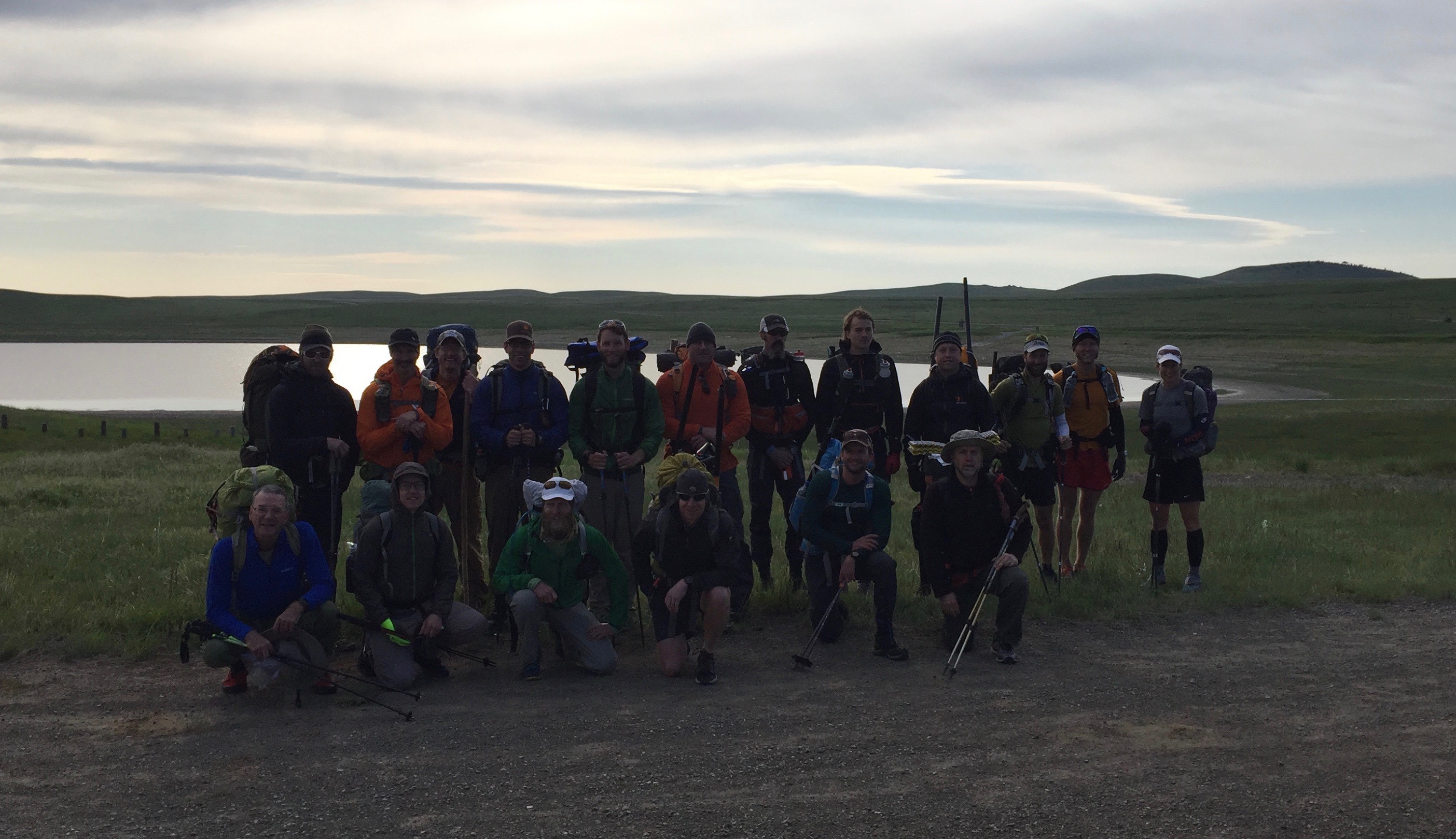
    Just got back to Texas after spending the week adventuring in Montana.  I have some catching up to do reading everybody’s trip reports, but here is mine:

    Saturday

    Headed up the road towards dearborne with the peloton.  The road miles flew by as I chatted with Dave and Adrien.  As typically happens at any race, everybody started out too fast.  I knew from experience that you can do some real damage in the first few hours of a long event by starting this way.  In a familiar routine from road cycling, I tried to identify who had the fitness to start this fast and who was hanging on not taking care of themselves.  After I caught myself not stopping to drop layers and feeling rushed every time I stopped to pee or take a picture, I realized I was one of the hangers-on and tried to justify staying with the group a bit longer to make the miles go faster.  I compromised by making an effort to eat and drink more than I felt like and promised myself I would take a break after the group began to split up.  Even still, I think I did damage that wouldn’t become evident until the following morning.

    After Dave split off at whitetail creek, Tyler and I took a nice shoes-off break along the dearborne, then continued on together for the rest of the day.  I was glad of the company as it made the miles go by more quickly. We frequently saw tracks of the teton crew in cascadias, but Adrien was a ghost.  I swear his Innov-8’s rarely touched the ground, and I made a game of trying to find his tracks.  For several hours I wondered if he had run ahead at the start and was hiding somewhere… Enjoyed the views over straight creek pass, and soldiered on thru the deadfall over elbow pass.  Crossing the SF Sun was the only concerning river crossing, but ended up being knee deep and only a bit pushy.  Made my goal for the day on a bench below Observation pass, 33 miles in the bag and feeling pretty good.  I didn’t bother to pitch my tarp or hang a bear bag, just brewed up some soup and crashed out in my bivy.  In retrospect, starting out too fast and not eating enough before bed were setting me up for failure the next day.

    Sunday

    Sunday was all about wasting time and trying to get back in front of the recovery/feeding/hydration curve.  I woke up feeling foggy at 6 am, but didn’t have the layers to sit around making breakfast.  I left Tyler to make breakfast in his huge puffy while I moved out over observation trying to get warm.  As I had hoped, we had a good freeze overnight, with a nice walkable crust all the way to the pass.  The trail disappeared shortly after snow line, and I observed the teton crew’s tracks wandering around trying to find it.  I decided I was smarter than them and headed straight for the pass without so much as looking at the topo.  After my brain finally woke up, I realized I was headed for the wrong pass, but that correcting my mistake would involve a lot of nasty sidehilling on frozen snow.  Instead, I followed grizzly tracks over the other pass and walked the ridgeline back to observation.  The view was almost worth the mistake, but I was annoyed at myself for making such an obvious error in judgement.  As is usual, the headspace and balance are the first things to go when you haven’t been taking care of yourself, so I took this as a warning to slow down and eat more.  I think the calorie debt from going too fast early on finally caught up to me, and it showed for the rest of the morning.  I took a break to eat some breakfast and clear my head until Tyler came into view.  Still feeling annoyed with myself and antisocial, I moved out before he caught up. The rest of the morning was uneventful except for some very fresh bear scat as the trail passed thru some thick regrowth.  I heard a twig snap behind me and whirled around only to see Tyler.. We hiked together for a while longer until I decided to put on Danaher.

    I was overeager to put on danaher and left Tyler as soon as the creek looked clear of wood.  Too early, as the wood came back with a vengeance, and I probably wasted an hour+ climbing over and around what seemed like constant logjams.  Unlike my navigational error over Observation, I think this was a fairly productive mistake.  (1) As my first time in this sort of landscape, and with little wilderness packrafting experience,  I had no feel for the creek based on reading a topo.  This will come with experience, but now I see how low gradient and spruce result in winding s-turns and massive logjams. Lesson: I need more experience reading topo with boatability in mind.  (2) The section of trail along upper Danaher was really muddy and torn up, and my legs were having none of it.  Already annoyed with myself for making slow miles all morning, I followed the siren song of fast float miles instead of the beta I had (too much wood above basin creek).  Lesson: make decisions based on fact (beta) instead of how I feel.  (3) I also learned how to move more efficiently through the logjams and pick the right channels to minimize them.  I stopped to reposition my pack on the bow with the straps out so that I could wear the boat on my back for portages.  This configuration made the portages a lot easier as well.  I did see tracks of the elusive Dave C portaging around several logjams, so he must have put on too early as well.  This made me feel a little better about myself.  I also resolved to spend the rest of the day getting myself back on track mentally and physically.

    After two big mistakes for the morning, I was behind schedule, but enjoyed an awesome float down the south fork to the white river.  I tried to use the easy float miles to get back on top of the fueling/recovery curve, and this slowed me down a bit but was highly beneficial.  For instance,I was getting cold after a rainstorm around the white river confluence, so stopped to brew up some soup.  I regretted stuffing my fleece in a dry bag at the bottom of my pack as layering up earlier would have kept me on the river, but the added calories and warmth were a good decision.  It was an hour before dark when I arrived at little salmon, and I contemplated continuing on for a few hours, but decided that pushing now would undo all of my efforts of the afternoon.  I pitched the tarp and crawled under my quilt with wet baselayers to try to warm up.  Too cold to fall asleep, I got up and built a big fire and then waxed poetic as I sat out until 1 am drying gear and enjoying the stars.   I thought about my relationship to wilderness, on why I was out there. I decided that wilderness is as much an emotional construct as a spatial one.  Sitting around the fire, I felt so small in relation to this big wilderness and was satisfied.   I fell asleep to the patter of rain on my tarp, behind schedule, but satisfied that I had found what I came for in the Bob.

    Monday

    I woke up shivering at 6 am, and packed up feeling good and ready to bust out the miles to cedar creek.  After taking time to eat breakfast, my headspace and legs felt great, and I was proud of myself for getting back ahead of the fueling/recovery curve.  I put on my pack and started off thru the brush towards the trail when I felt a twinge in my right foot.  I have been nursing a tendonitis issue since a trip last month, and knew from experience that if I continued to irritate it, I would probably not be able to walk soon.  I still can’t decide if this was bound to happen given my previous injury or if my going too fast on day one had finally caught up to me.  Given how good my legs and feet felt that morning, I am inclined to think that it had little to do with recovery and that I would have tweaked it at some point climbing over deadfall over Lion creek pass and been in a world of hurt.

    The decision to bail came unexpectedly, but I didn’t want to jeopardize plans for later in the week.  The elegant choice was to float out to mid creek, so I blew up the boat and enjoyed some incredible river miles to the mid creek takeout. Free from the need to make miles, this may be my favorite part of the trip.  I ran into a sign advising boaters to take out at the head of a small gorge.  Confused if this was already meadow creek gorge, I took out and missed a few good rapids.

    By mid creek, my foot had tightened up enough that walking was very painful, validating my decision to bail.  Fortunately, the miles were easy and lots of trail work has been done to clear out deadfall after the fire.  Given how bad going over lion creek pass sounded, I wonder if taking bunker creek to Inspiration pass would have been the better, if longer choice.  Too bad nobody went that way, because floating down to mid creek was awesome!

    I hitched a ride out and arrived at cedar creek just as Derek was loading his gear into the car.  I also witnessed Adrien running back down the road after missing the finish.  What a monster!

    Despite my disappointment at not finishing, the trip ended on an excellent note, and I feel like my first experience in the Bob was a resounding success.  I learned a lot, floated a huge stretch of the south fork, and enjoyed watching the fast guys kick my butt.  I’ll likely be back, hopefully injury free and ready to rock!

    The rest of the week

    After retrieving my car from bean lake on Tuesday (thanks Derek), I played car tourist on the east side Tuesday and Wednesday as my legs recovered and my mind got antsy to be in the backcountry.  Thursday and Friday, I rented a bike and at Dave’s suggestion bike-rafted the North Fork of the Flathead after riding the inside North Fork Road and camping at Kintla lake.  The upper North Fork was incredible with views all morning into West Glacier.  Saturday, I meet up with Dave and Little Bear for a fantastic ride up Going to the Sun Road.  Definitely takes the cake for the most scenic road ride I have ever been on.

    **Edited for formatting

    #3407211
    Derek Larson
    BPL Member

    @derek-larson

    Locale: La Sierra Gorda

    Excellent report, Seth. Bike-rafting the North Fork must have been amazing. Maybe we can put together a 2017 BMWO train-up for next year? Something like this?

    #3407223
    Seth Cunningham
    BPL Member

    @seththesailor

    Some other notes as BMWO rookie:

    In retrospect, I was not particularly well trained for this years course.  I did a lot of cycling volume, trail running, and at least one hard backpacking trip a month this spring with lots of slow off trail miles.  I was forewarned, but neglected specificity in the form of lots of trail miles with a pack on.  Except for the stress of going fast, I was suprised to find that there was much less environmental/routefinding/excecution stress than my typical trip.  I was actually getting bored with all of the easy trail miles.  Probably just the mild weather…

    Starting out too fast is a real problem.  With running races, I use heart rate to keep myself from going out too fast, but that doesn’t really help at hiking speeds.  Not sure if there is a reliable way to force myself to slow down when nerves and fast company are at play.

    Feeding, hydration, and recovery are so important.  I was disappointed at how little I recovered on saturday night, but I think this may be partly due to not eating enough and being slightly dehydrated.  Waking up feeling fuzzy was a good indication that I was behind on fueling.  Also, I think some rafting miles (a la Dave and Tanner) could be very valuable in limiting damage done by pushing late on the first day when you are still excited and feeling good.

    Really studying the trouble spots (passes, where to put on the river) during trip planning could save a lot of time by minimizing mistakes.   I tend to like some uncertainty so it feels more sporting on the ground, but this certainly cost me time.

    I took a small Ti cup,and cannister stove.  Adds nice margin of safety/comfort to brew up something hot. Next time, I will take more soup/tea and maybe one more hot meal.  Cooking meals also forces me to stop and take time off my feet to rest during the day.  I took almost 13000 calories, mostly in junk food with 1 hot meal a day. This would have been perfect for a 3 day finish had I not bailed.  This seems like a lot to me, but my metabolism is raging right now due to all the cycling volume I have been doing.  I still lost a few pounds.

    Sleep System:

    Poncho tarp, bivy, quilt, neoair were all spot on.  No bivy would have worked this year with mild weather, but I wouldn’t leave it at home.

    Clothing:

    Running shorts, softshell pants, nrs endurance paddling pants.  L/s running top, 100 wt fleece, OR helium 2.  Clothing system worked well.  I probably could have ditched the pants.  Upper body layers were great for hiking, marginal for paddling.  If it had been colder, I would have needed another paddling layer.

    **edited for formatting

    #3407357
    Dan @ Durston Gear
    BPL Member

    @dandydan

    Locale: Canadian Rockies

    Thanks for the report Seth. Fun read. Nice job. The trips were you learn the most are the most satisfying in hindsight.

    Regarding rivers, Google Earth is a powerful tool for checking out waterways (maybe too powerful). If you can’t get a good look at water with this then there probably isn’t enough water. As you found, the upper Danaher has quite a bit of wood. Even below Camp creek it’s woodier than I like.

    Here’s a shot of Danaher in that upper woody section:

    #3407360
    Cyrus Dietz
    BPL Member

    @cyrus

    Locale: Midwest

    Very Cool! I enjoyed reading everyone’s account of their adventure.  I was surprised by how warm and dry the east side of the Bob was last week.  I was camped at the South Fork of the Sun River campground on Sunday and wish I would have ran into a few of you.  I also really wish I would have run most of the water Dave ran.

    Derek, If you had wondered what the South fork of the Sun River was like to float, here is a short video of Kate and I running it on Monday.

    #3407365
    David Chenault
    BPL Member

    @davec

    Locale: Queen City, MT

    John, the area I got off the new/main was shortly after it began to climb out of Whitetail Creek. The new trail took a hard 180 left, and an at least as obvious trail continued straight. A sign on a tree provided little clarification. I kept straight, pretty sure it was wrong and just wanting to confirm. I saw that the old trail continued uphill, and that it had very fresh elk sign, so I followed, assuming I’d be able to catch the new trail again fairly easily. When I was sidehilling to find it again after my bear encounter I could hear Mike, John and Thad a few hundred vertical yards away down in the woods.

    Great stuff everyone, very enjoyable reading. Regarding hot food and recovery, especially overnight; I brought two ramens and two mountain houses, along with 8 vias. I could have done better with half again of all three. Neither the pace for the first 12 miles nor the total miles on day one made me so slow the next day, it was not eating enough dinner and starting the night cold.

    #3407374
    Seth Cunningham
    BPL Member

    @seththesailor

    I spent a few hours yesterday catching up on everybody’s trip reports and looking at photos/videos.  It is almost as fun (and less painful) re-living everything after the fact.  I need to get better at documenting my trips.  Derek, Dave and Tanner, your pictures and video were awesome!

    I need to get better about exploring the route via satellite, especially for big complicated traverses.  Although I generally enjoy it more when I have to work things out on the ground (at least when I get it right), I guess sat images aren’t really cheating any more than a good topo is:).  I do think I could learn a lot by zooming around the Bob on google earth and comparing wood/floatability with the topo to develop a general feel things.

    And yes Derek, a post-BMWO bike/raft shuttle link up would be awesome! Let the planning for next year begin…

Viewing 25 posts - 326 through 350 (of 378 total)
  • You must be logged in to reply to this topic.
Forum Posting

A Membership is required to post in the forums. Login or become a member to post in the member forums!

Get the Newsletter

Get our free Handbook and Receive our weekly newsletter to see what's new at Backpacking Light!

Gear Research & Discovery Tools


Loading...