
MYTH: a multi-year thru-hike
A goal deferred
Hiking the PCT has turned into something of a life project for me.
My brother and I started north from Walker Pass in 1976, headed for Lake Tahoe, 500 miles to the north. A torn cartilage in my right knee forced a bailout after a hundred miles.
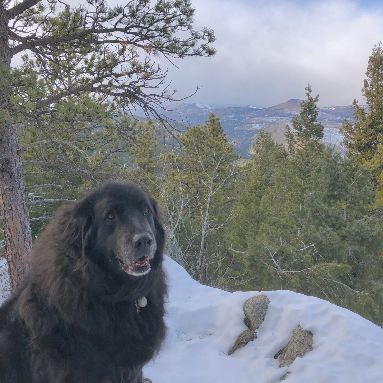
I didn’t resume the trail until 2013, having acquired an education, a family, and a career in the meantime. Also a dog. When I returned to the PCT, Bonny, a 125-lb Newfoundland-sled dog mix was my companion. She had joined our family a few months before, an adult rescue dog who had apparently led a pretty rough life.
Or maybe her incorrigible food stealing, fear of tall teenage boys, and separation anxiety were just who she was. But her need for affection was matched by her ability to give it. We became friends.
She accompanied me north from Lake Morena in 2013. She had no trouble keeping up and would dash around meadows and up and down hills when we camped, delighted to be free and wild.
That went well enough until the winds shifted from cool Pacific westerlies to hot desert easterlies. She was a snow dog, and it was clear that bringing her on a desert hike was a mistake, even in March.
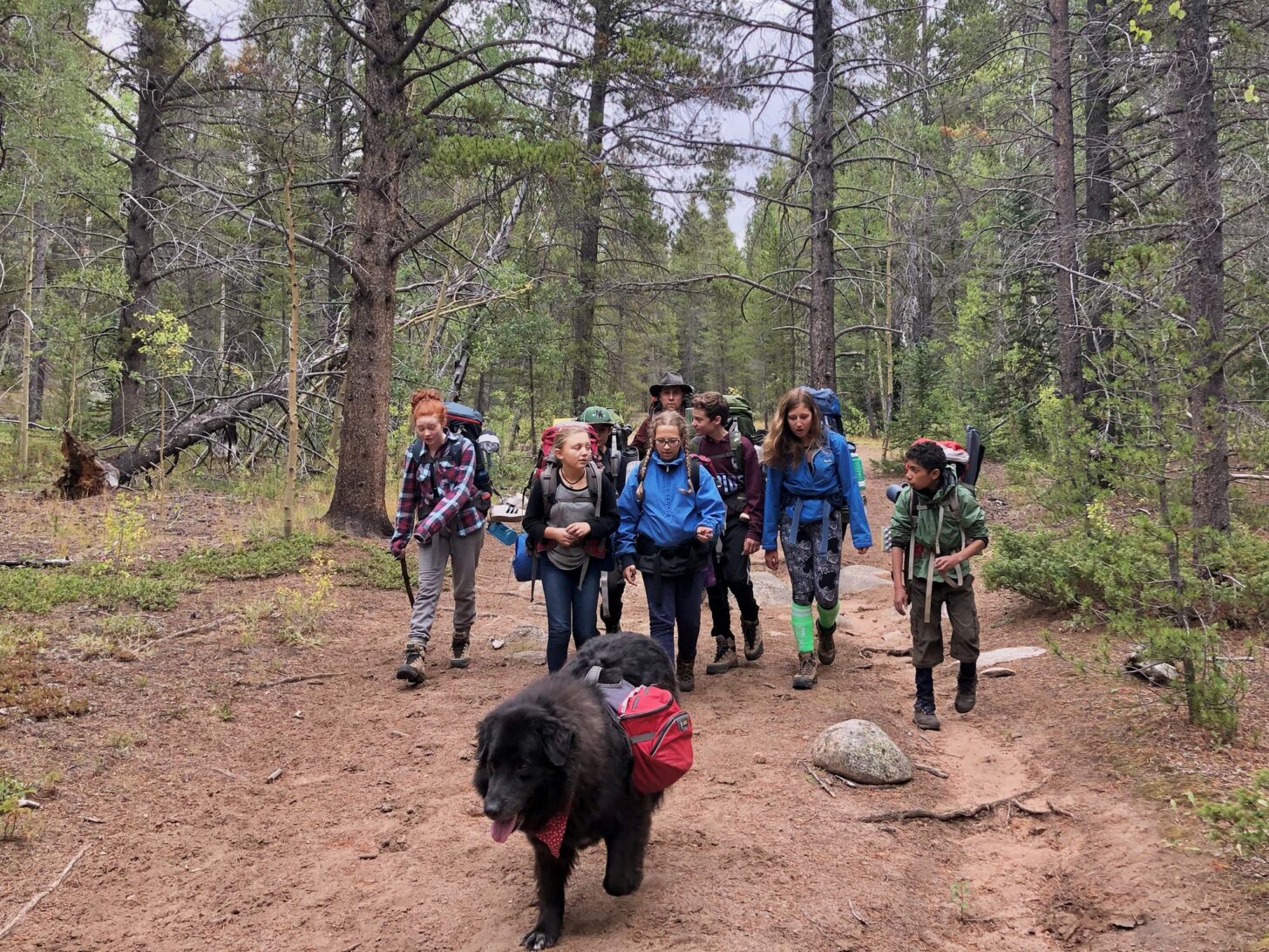
That ended Bonny’s long-distance hiking career, but she went on plenty of shorter trips in cool mountains. She especially loved going on trips that I lead for the Sierra Club’s ICO program: short hikes, kids to fawn over her and give belly rubs, and plenty of leftovers to clean up after dinner time.
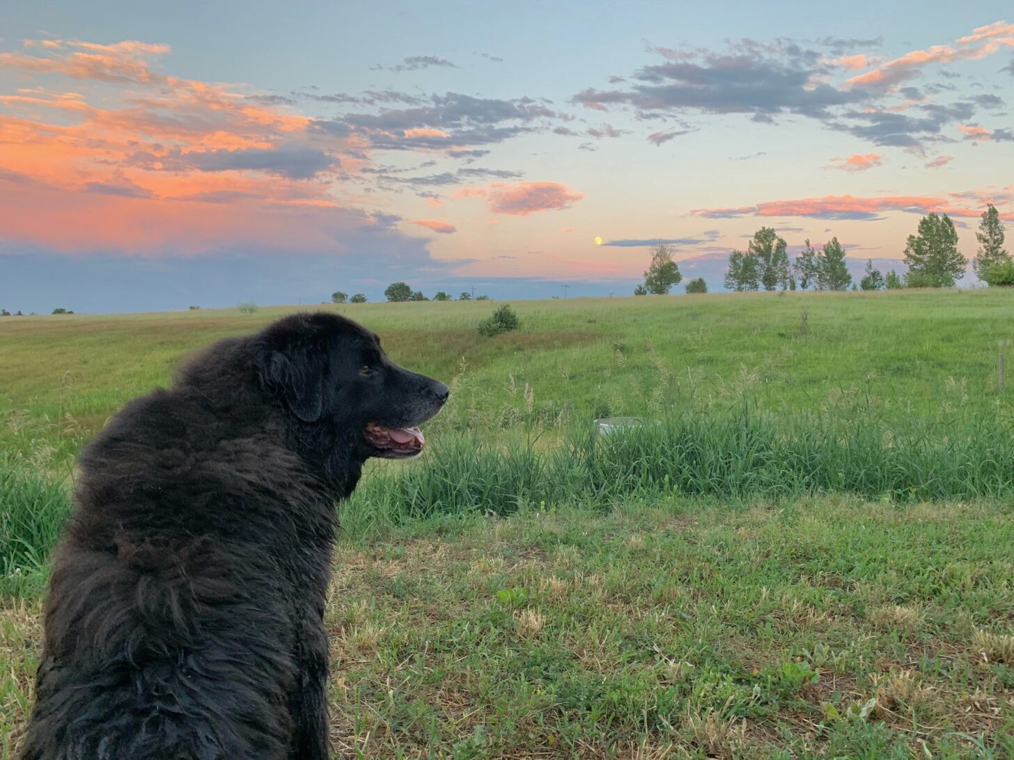
Big dogs have big hearts but short lives. Bonny was nine or 10 when she began to weaken. Backpack trips became shorter and then I had to start leaving her behind. Day hikes and ski tours dwindled from five miles to two, and then from one to zero.
Neighborhood walks got shorter and shorter as progressive paralysis set in, weakening not only her legs but closing her windpipe until a walk of half a block left her gasping and needing multiple rest stops.
I put off the inevitable as long as I could but it was time. Bonny departed this life as she lived it, with grace and affection.
On the trail again (Castle Crags to Etna)
I arrived at the Redding Airport and received a text from my ride wondering just where exactly at Castle Crags Campground I was. She had gotten the directions reversed. A phone call set the matter straight and we headed from the airport to the nearest sporting goods store to pick up a butane canister.
A turn around the store revealed no canisters. I asked a clerk and she unlocked a cabinet, pulled one out, and asked for my driver’s license to document the sale. Butane is useful in methamphetamine synthesis. Apparently, there are enough tweakers in Redding, CA to necessitate control of a simple 4-carbon alkane.
Steering clear of degenerates would be an issue for another day, though. My immediate concern was the heat. Even at 5 PM, the temperature at Castle Crags was near 100 F°. I compounded the issue by making an immediate wrong turn that took me over a superfluous ridge before joining the PCT.
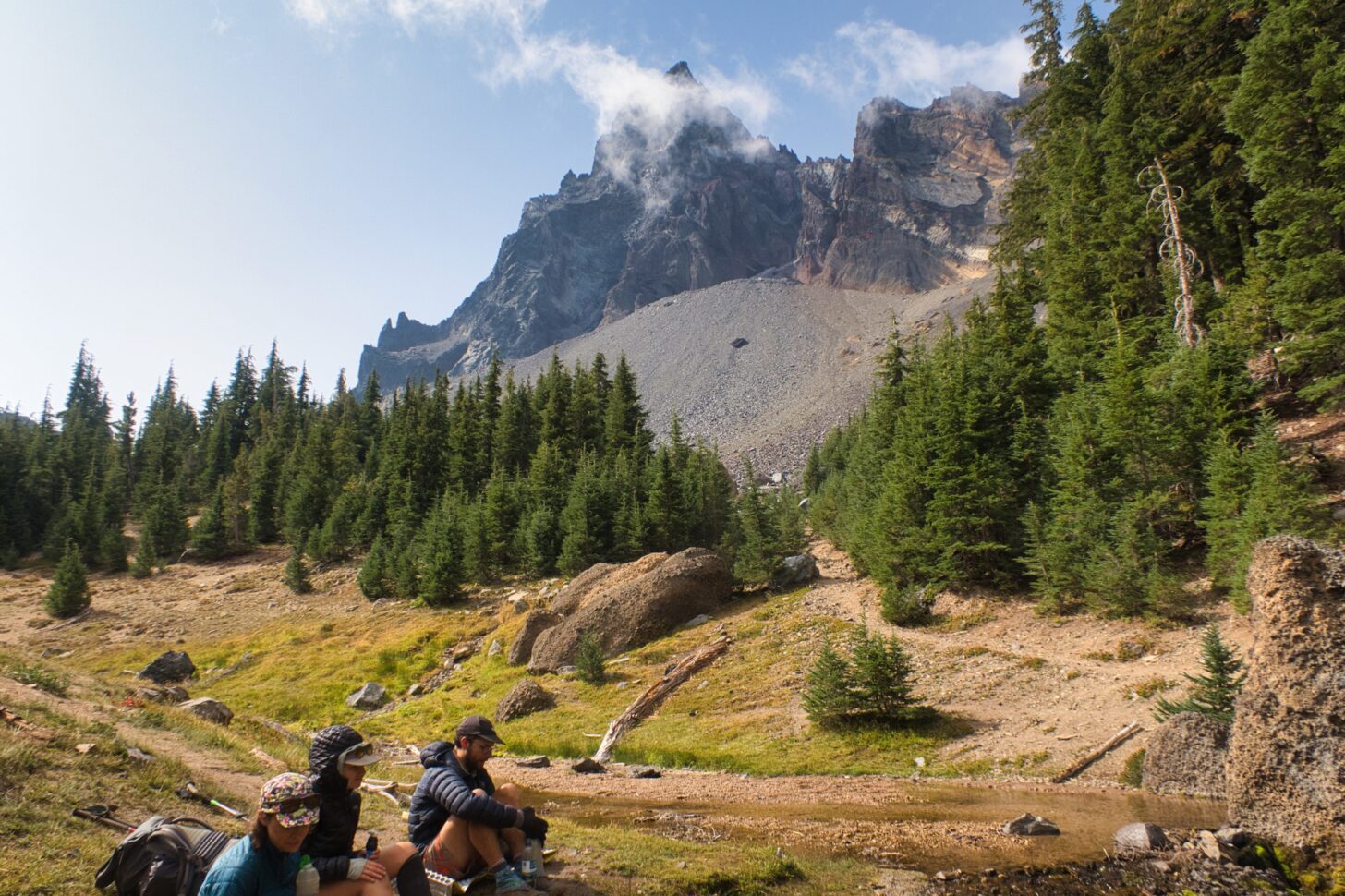
It was near dark by the time I made it to a pleasant camp spot along Indian Creek, located in a deep leafy gorge that offered some relief from the heat. It was already occupied by two hikers. Fomo and Princess not only welcomed me but offered to paint my nails as well. I was back on the trail, back with the goofy, welcoming community that populates it.
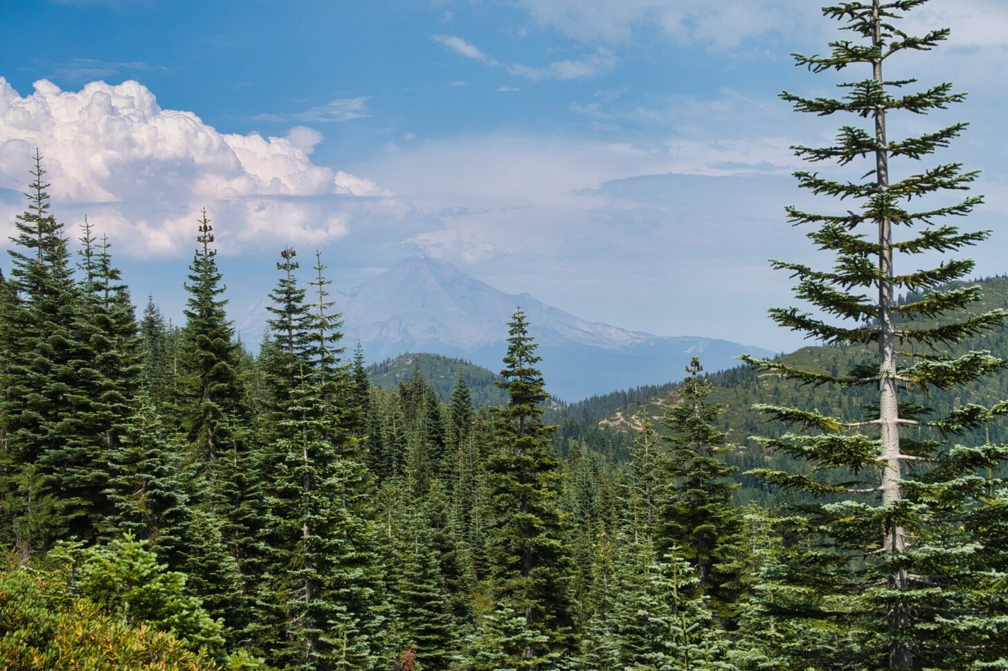
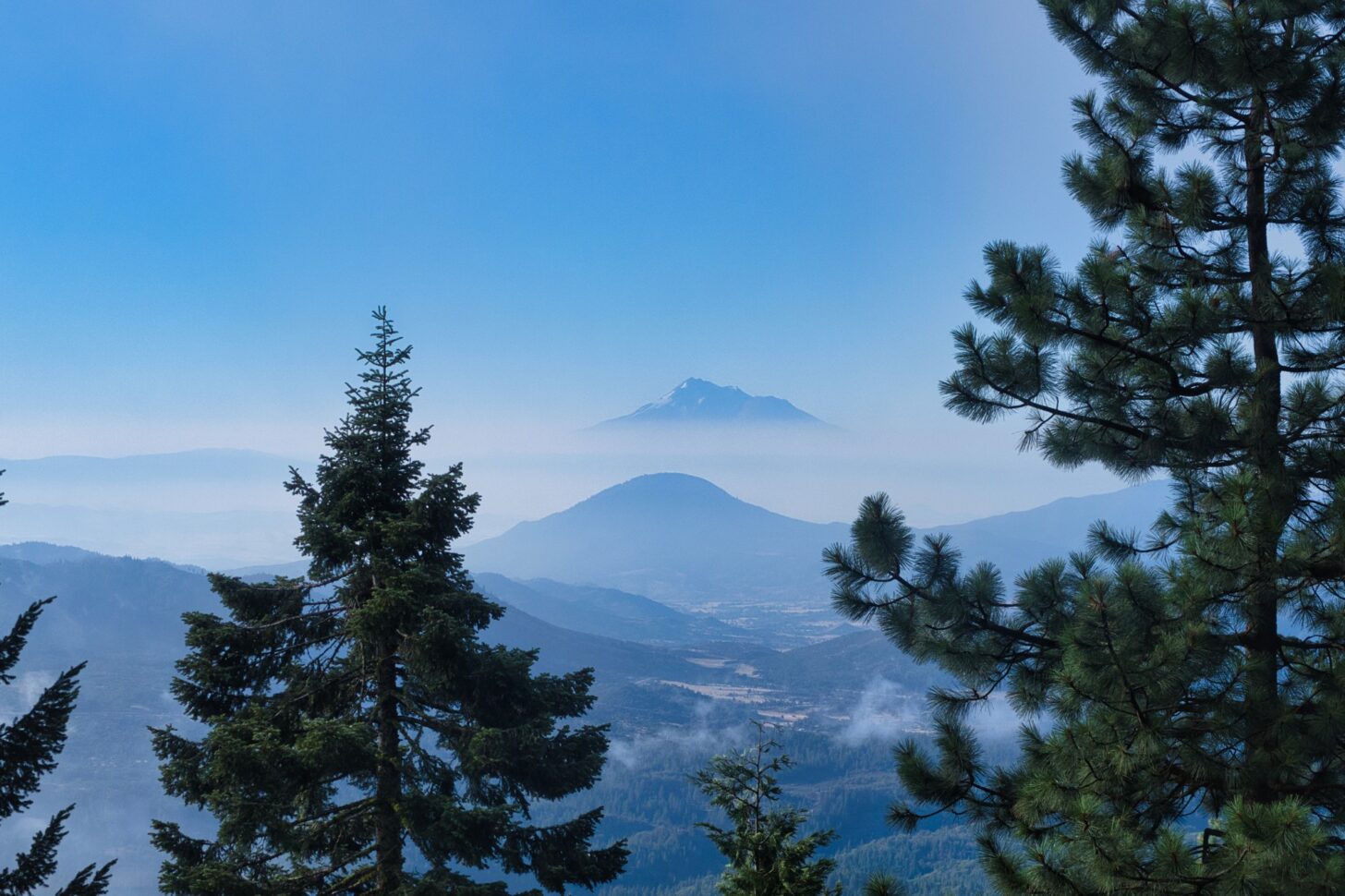
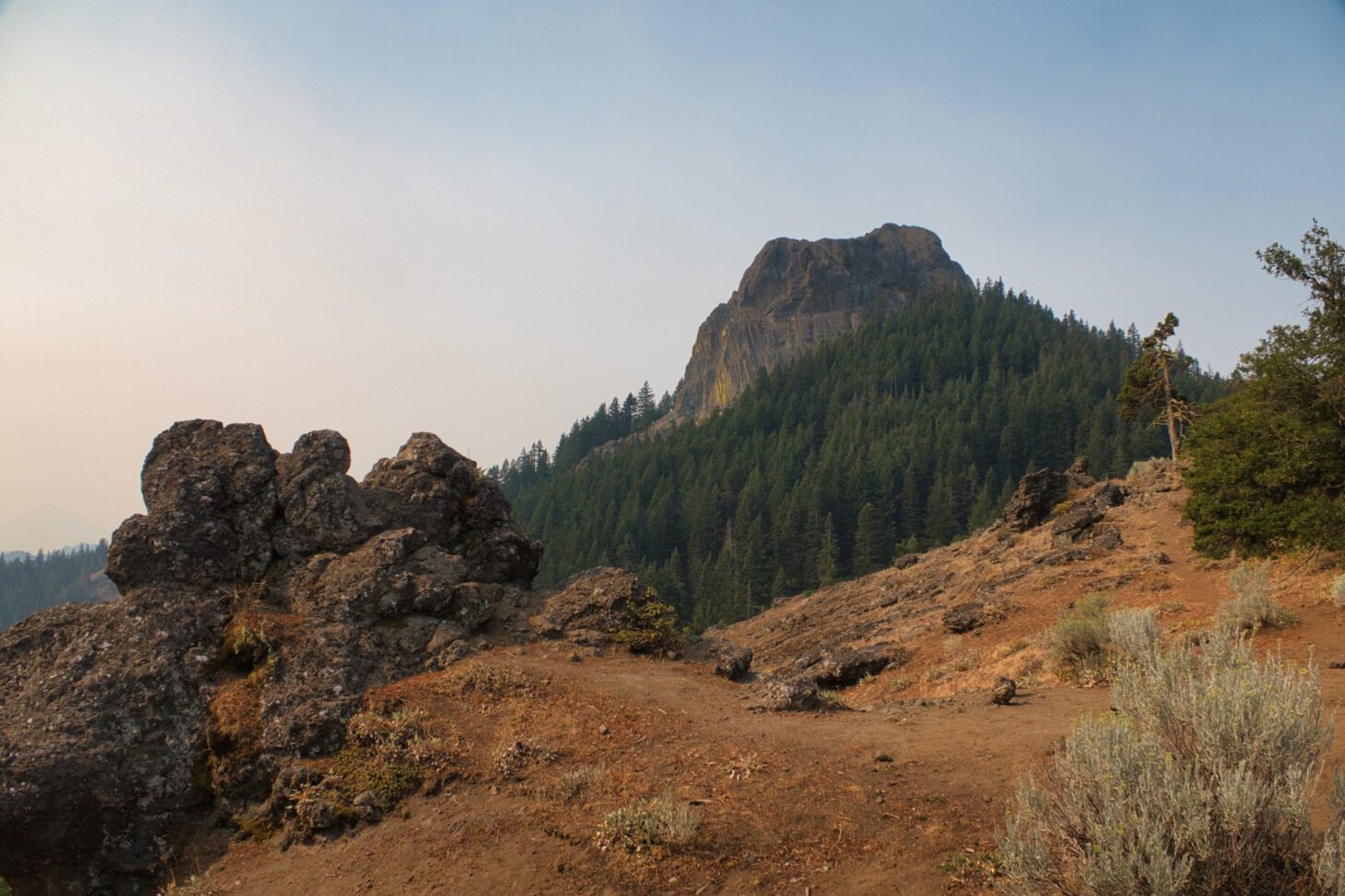
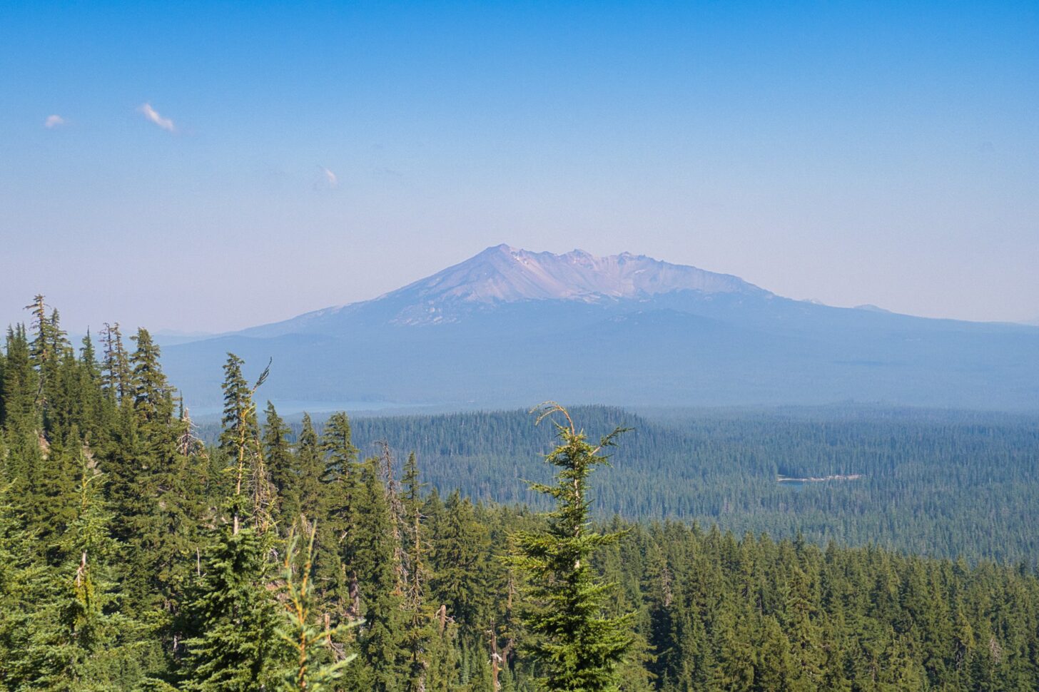
The night was warm and I started the 4000-foot climb well below dawn, hoping to get high before it got hot. Although that hope was not realized, I did get my first PCT views of Mt. Shasta. In 2018 I hiked from Lake Tahoe to Castle Crags without a glimpse of the iconic peak, visibility limited to a few miles at best by smoke from the terrible fires that year. Although the mountain was snowless in this drought year, I hoped at least to be spared a smoky hike.
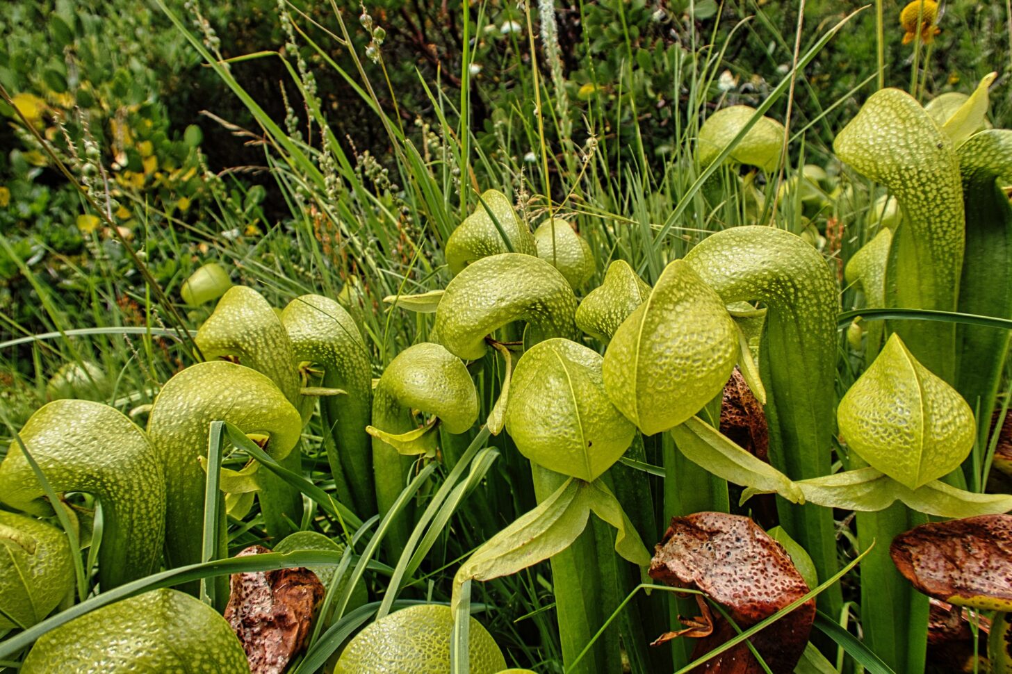
The trail leveled off at Gully Spring, where I lunched in the company of carnivorous pitcher plants and one-striped bumblebees attracted to the swirling patterns of my gaiters. Both are probably endemic to these mountains, well-known to be a hotspot for biological diversity: more than 3500 plant species are found here; some 280 are found nowhere else. I intended to enjoy and appreciate this region of the PCT, a region that is often overlooked by hikers hurrying toward Canada.
One of the advantages of MYTHing a long trail is that you get to start each section with the same anticipation and eagerness that most single-year PCT thru-hikers feel only in the desert ranges of Southern California. Read or watch any account of a single-year thru-hike and you’ll notice that half the story covers the desert sections, another quarter covers the Sierra, and the rest of the trail – NorCal, Oregon, and Washington, about 60% of the total mileage – gets only a quarter of the narrative.
By the time PCT hikers get to Lake Tahoe, they have walked 1100 of the trail’s 2650 miles. Hiking has become a job. You get up at dawn, put in your 25 miles, eat some crappy food, make your camp, and lay down to sleep. And then do it again. And again. And again.
Your choice is either to quit (as many do) or to become a hiking automaton obsessed with grinding out the miles before fall snowstorms close the passes. The trail – which started out as a road to freedom and adventure – begins to look more and more like the Land of Toys. I may bear a pack, but I will not become a donkey.
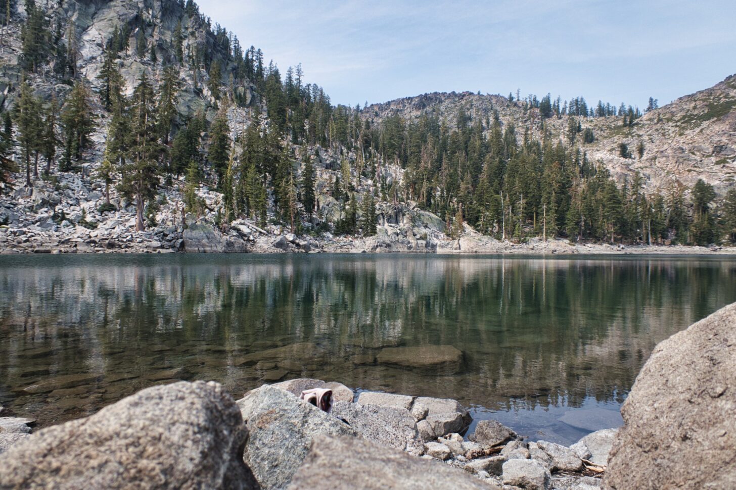
So I laze in the shade another hour; stop for a swim at Porcupine Lake the next day; stop at Deadfall Lake intending another swim. But clouds have rolled in and a light intermittent drizzle commences. A helicopter appears, dips its bucket in the lake, flies up to an adjoining ridge, and dumps the water. It repeats this sequence three times. I can see no sign of smoke on the ridge. Surely the copter was not practicing; there are plenty of real fires in California.
I hike on through increasingly heavy rain, which is now accompanied by loud thunder overhead. The rain should fireproof this parched area for a few days, but the thunder, soon distant, might well spark fires elsewhere.
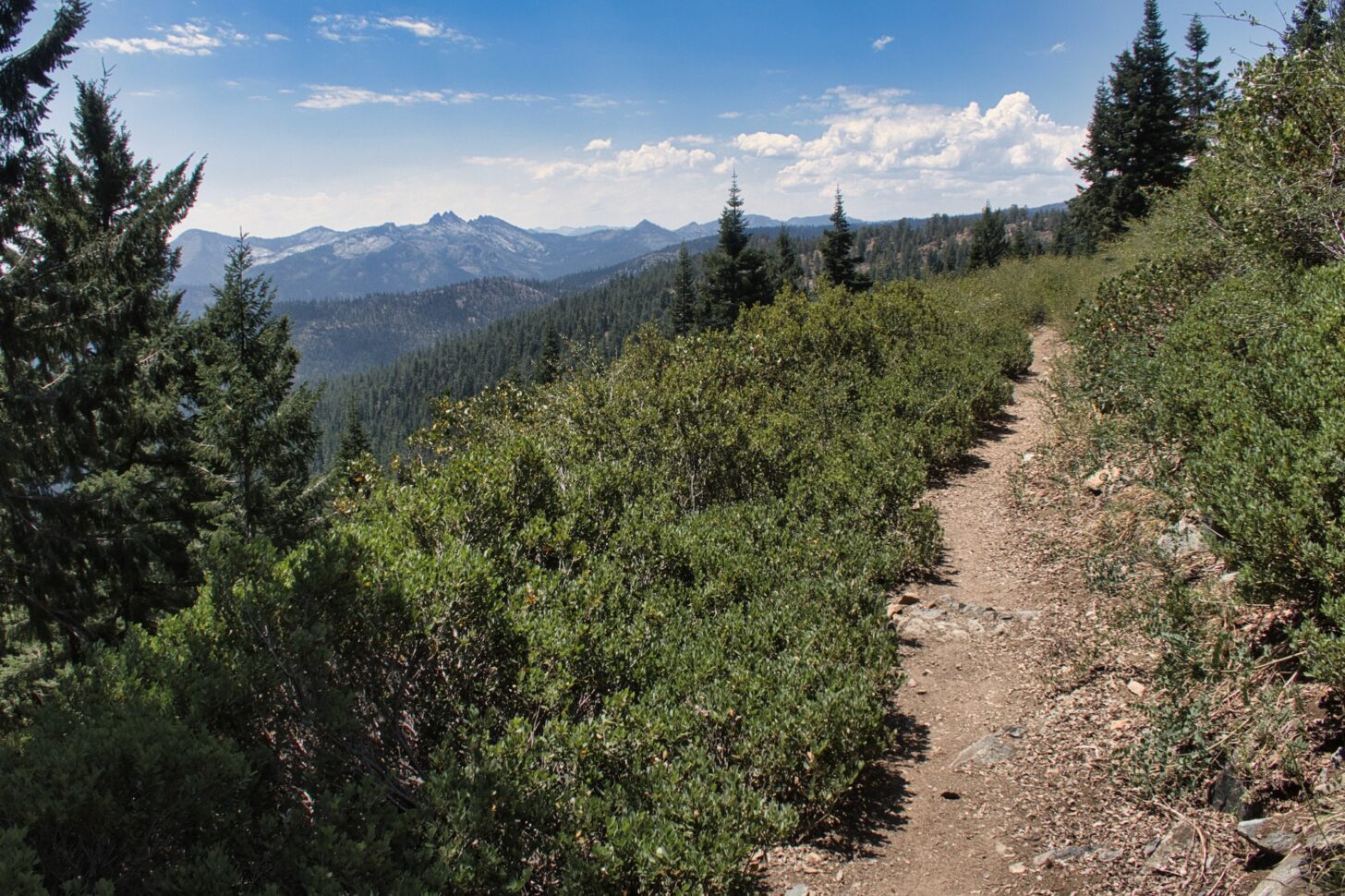
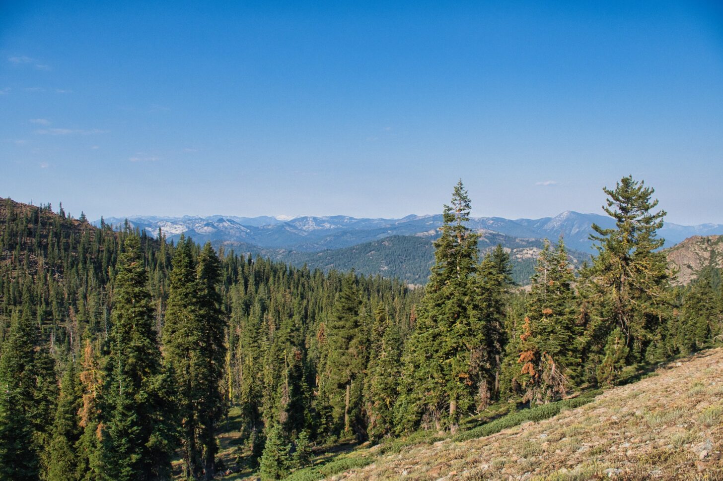
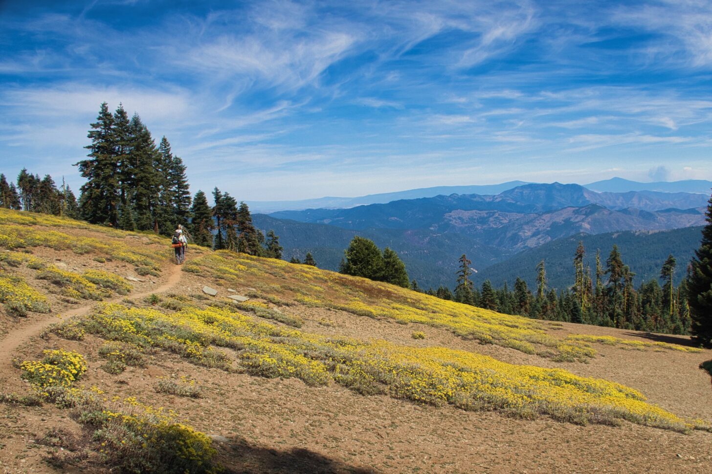
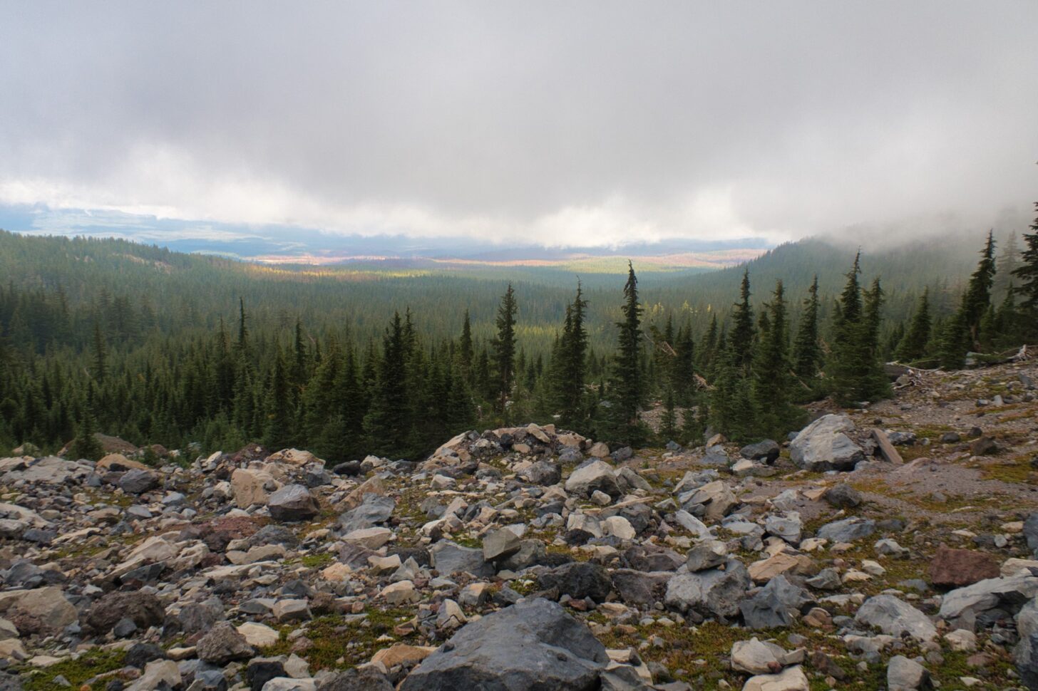
After a soggy night, the heat returns, but the hiking is mostly easy. Though the mountains are rugged the trail contours around them, staying between 6,000 and 7,000 feet.
There are cold springs to drink from, fringed with flowers and attended by butterflies.
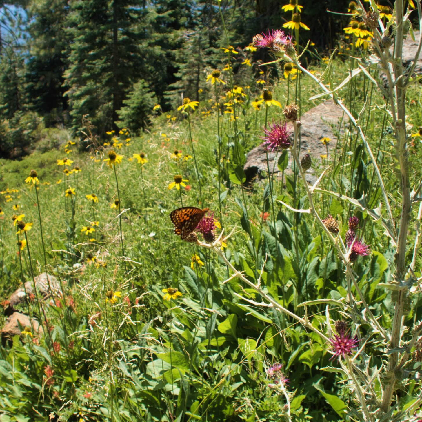
The Marble Mountains appear, gleaming white rock mimicking long-melted snow.
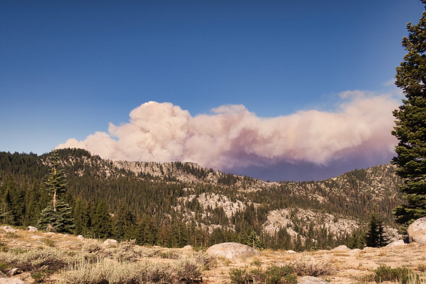
A cool morning breeze makes for delightful hiking weather. But rounding a ridge, a column of smoke appears, rising fat and thick above the ridge. Another hiker – trail name TimeWarp – comes up and we confer. Is this a small fire nearby or a large fire far away? The fractal nature of smoke clouds defeats any sense of scale. We decide to proceed, even though the column is directly on our course toward Etna Summit. The wind is blowing left to right, not into our faces, and we can retreat back to highway 3, some 15 miles back, if the fire blocks our path.
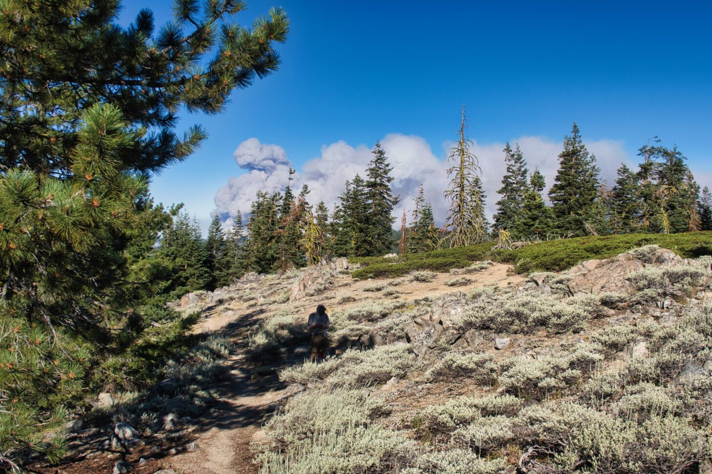
TimeWarp finds a spot with reception and calls the Forest Service. They tell him the fire is 10 miles west of the PCT, we are in no danger. But that column of smoke gets bigger and darker and redder on the underside. We catch up to yet another hiker – Tumbles – confer again, and agree that we will stop at the Callahan Road crossing a couple of miles ahead and consider bailing.
As soon as we get to the road four volunteer fire trucks whiz by, not a good sign. One pickup comes back and we flag it down. It is driven by Bill, a retired firefighter who says the fire has blown up in the last few hours and nobody knows what is going on, especially not the Forest Service. He offers us a ride into Etna and we accept. It would probably be ok to keep hiking but “probably ok” is not the standard we want to apply to this situation.
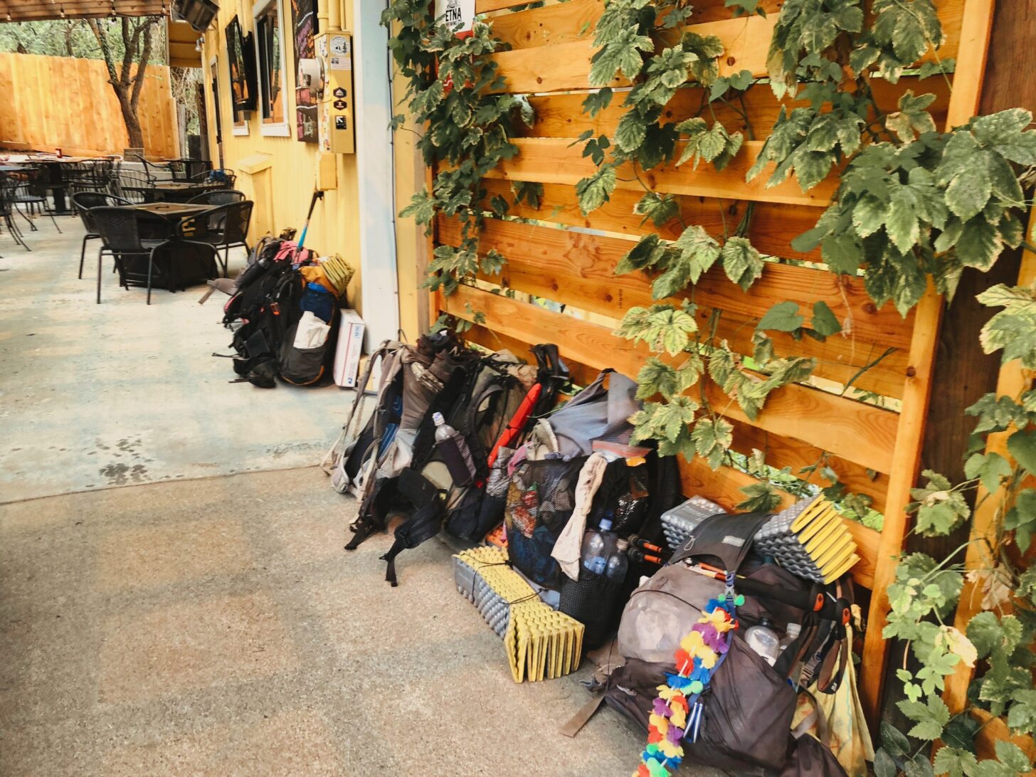
The town of Etna (population 750) is amazing. It sports two brewpubs and a couple of good coffee shops. For a minimal fee, it lets hikers sleep in a park that features not only restrooms and water but a shower (cleaned daily by volunteers), wifi, tables, a shelter, and outlets to recharge phones. The townspeople are friendly and welcoming. An easy place to hang out, as attested to by nearly a hundred hikers milling about the town. Not just easy, amazing.
Through the state of Jefferson, Seiad to Ashland
All of us were hoping for some more information. But word is that hikers who attempt to resume the trail are being turned back by thick smoke or by rangers at the trailhead.
My plan (and that of many others) was to skip ahead to Seiad Valley to bypass the fires and smoke. It’s about 60 miles by trail but twice that by sparsely traveled roads and reputedly a very hard hitch.
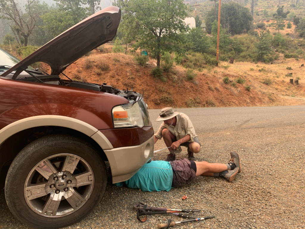
A ride was arranged with a hiker named SoleSaver, who was to ferry me and six other refugees northward. All went well until the car overheated on the remote road connecting Ft Jones with Seiad Valley.
I hopped out and while everyone was milling around, saw some blackberry bushes lining the road and walked toward them, thinking to score some fresh berries.
An angry man with no shirt but a beard down to his belly ran out of his house and yelled up at me.
“What the FUCK do you think you are doing!”
“Just curious as to what’s here,” I replied. Wrong answer.
“Take your curious ass and get the hell away from my property and keep going.”
One of the women tried engaging him with reason: we can’t go anywhere, we are broken down, etc. Studio, a public defender in St. Louis and thus a man familiar with criminal psychology, walked her away, hoping to de-escalate the situation before any weapons were involved. There was no phone service, no law nearby, and no one was going to protect us if things got ugly. We were deep in the State of Jefferson, home to secessionists and outlaws, a refuge no doubt for illicit grow operations and cook labs. Hikers were most certainly not wanted here and we would not be missed.
SoleSaver was flummoxed by the breakdown. I went back to the car, took a look under the hood and saw the lower radiator hose had popped off. All I had to do was reconnect it, fill it with water and we would be off.
An elderly gentleman was walking up his driveway toward us and I prepared to be cussed out again. Instead, he offered help. His name was Carl, he was 90 years old, a retired gold miner, and he volunteered to go back down to his well and get some water and haul it up.
I got under the car and tried reconnecting the hose but the hose clamp was stripped and would not tighten down. I asked Carl if he had any duct tape and he slowly walked down to his shed and returned with a roll.
Fortunately, there was another hiker (Cocacola) willing to get his hands dirty and we took turns tearing off strips of tape and wrapping them around the hose. We poured water into the radiator. Despite high hopes for our handiwork, the water ran right out again. The hose had been repaired in another spot and was leaking where the plumber’s putty had failed.
By this time another Jeffersonian from across the road was shouting at us to move on and to not even think about coming on to his property. He returned to his porch and sat there with a rifle on his lap, glaring down at us.
The other hikers decided that maybe it was time to hitch onward to a place where there were no angry armed hillbillies yelling at us. It was getting late and this was not a good spot to be when the sun went down. They promised to call SoleSaver’s husband from Seiad so he could come get her. SoleSaver was in the car, sobbing into the steering wheel.
Cocacola and I got back under the car, scraped off the putty with our knives, wrapped the connector with tape, then wrapped the whole assembly over and over (its hose clamp was also stripped), and poured in the water.
This time it held. We made the remaining 15 miles to Seiad just a few minutes after the hitchhikers, who insisted on buying us beers at the store.
It was a hot and heinous climb out of Seiad the next morning. The smoke had thinned a bit, but some of the ridges were dead zones, places of orange metallic soil where little grew. The effect was ghastly and unnerving, but eventually, the forests returned and a few springs popped up. We were in the last bits of California. With a clearing west breeze, we could see Oregon from the high points.
It looked just like California of course, the 42nd parallel having no particular biological or geological significance. But it felt like progress. I had started this MYTH in 2013, walking from Lake Morena to the San Jacintos; continued in 2014 to Walker Pass; to Lake Tahoe in 2016, and then to Castle Crags in 2018.
Hike the trail over a stretch of years like this, and you notice changes. I started in the pre-Wild era when only a few hundred people attempted the PCT each year. Now there are thousands. Permits are required to regulate the traffic, and several iconic trail angel stops have had to close up, unable to cope with the crowds. Although the megadrought was already well underway in 2013, the new normal of wildfires and smoke had not yet taken hold. It was easy then to believe that it was just a dry year. Next year would be normal.
The sociology of the trail has also changed. There are far more women hiking now, and a far larger proportion are hiking without male companions. In 2013 and 2014 there were plenty of Iraq and Afghanistan vets walking off the traumas of war; in the plague year of 2021, they have been replaced by nurses.
Nurses with a wicked sense of humor. When TimeWarp asked Tumbles for some free medical advice regarding a bothersome ankle, she shot back that “I can’t help you unless your pants are off and you have a vagina,” (she is a labor and delivery nurse).
The trail has changed and it will continue to change. It is a living thing, and change is the essence of life. All we can do is keep moving and appreciate what good remains and work for more good to come. The west wind continued to blow the smoke away as I walked the ridges toward Ashland, the north slopes of Mt Shasta receding but revealing that a bit of snow remained there, holding on through the heat and the drought.
Feeling the heat – Ashland to Crater Lake
After a zero in Ashland, spent mostly at a brewery where I managed to hold the cornhole court until closing, I hitched back to Callahan’s. The free hiker campground there, I learned to my displeasure, is a grassy island in a parking lot that boasts many bright security lights. So I was up and out early, making the climb south and east from Siskiyou Pass back into the higher mountains. Smoke built through the day, as did the heat. Much of the hike was through arid oak and pine forests separated by meadows dried to a crisp by the drought.
I holed up for the night near one of the few sources of water, the outflow from Little Hyatt Reservoir. The water was low and distinctly skanky, but there was no other water on offer, so I treated it with chlorine dioxide drops and made the best of it.
The evening’s entertainment was provided by a frisky yearling blacktail deer. It dashed by through the creek meadows and so I was on the lookout for a lion stalking it. But then it dashed back the way it had come. And then diagonally across the creek. And then back again. In all, it made six or seven passes through the forests and meadows, all by itself, delighted to be wild and free, in love with its home.
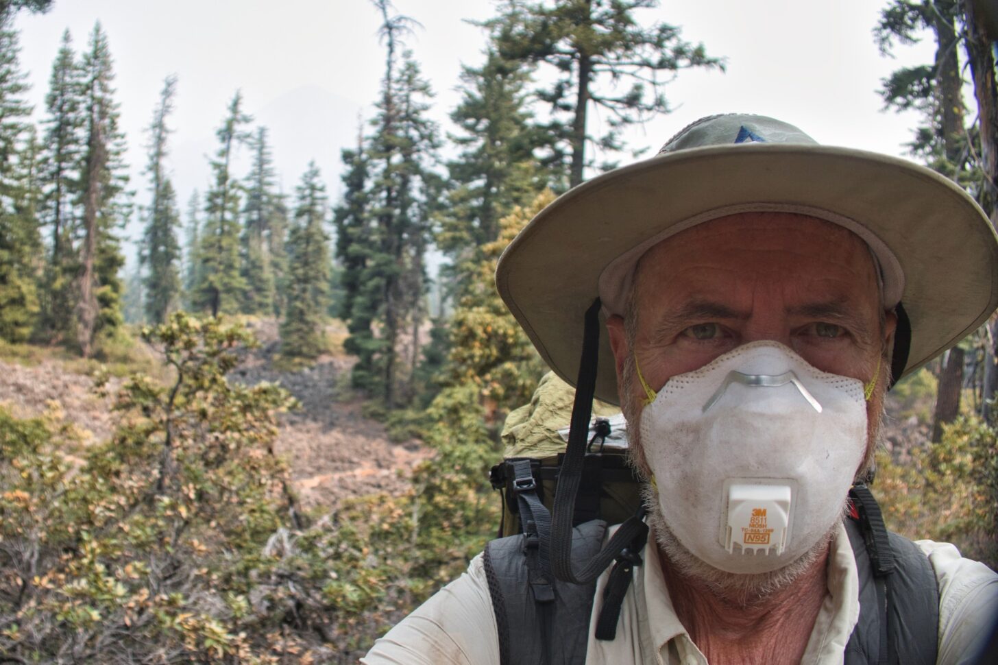
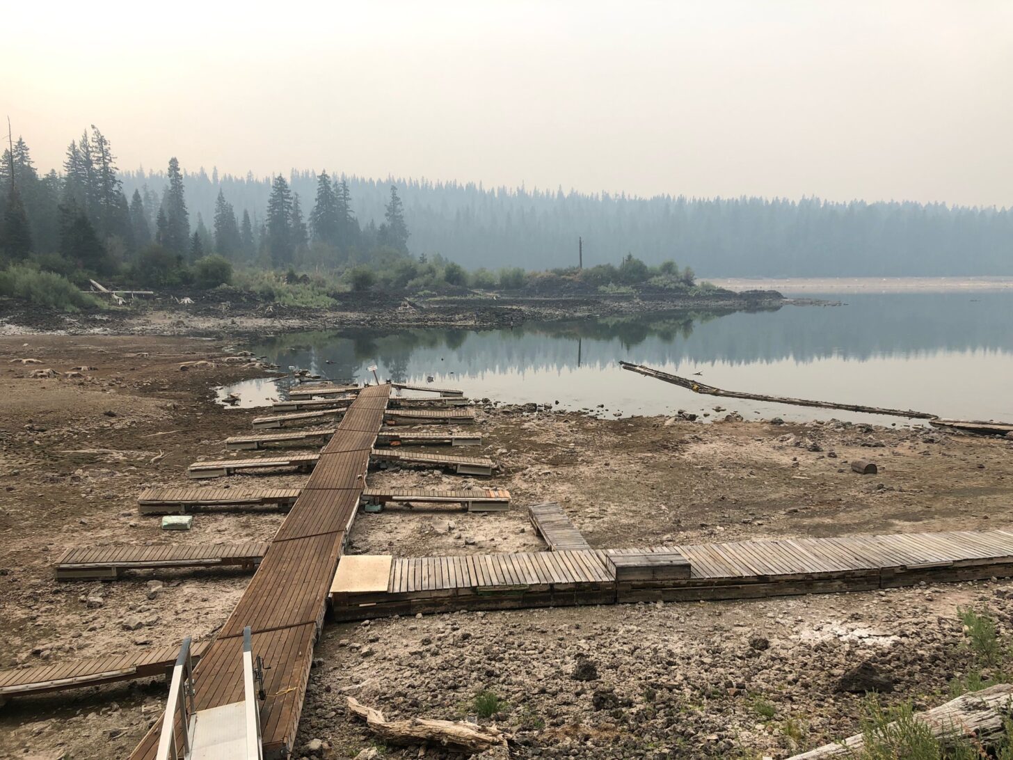
Another heat dome set itself up in Oregon, making it way too hot and way too smoky. Fearing damage to my lungs, I wore an N95 mask despite the heat. The dust was fine and thick on the trail, combining with my copious sweat to create a kind of tar on my feet and legs. The springs and creeks were dried up and 15-mile water carries became the norm, not what I was expecting from Oregon. When I came to the trail junction above Fish Lake it was an easy call to cut down to the resort where showers and cold drinks awaited.
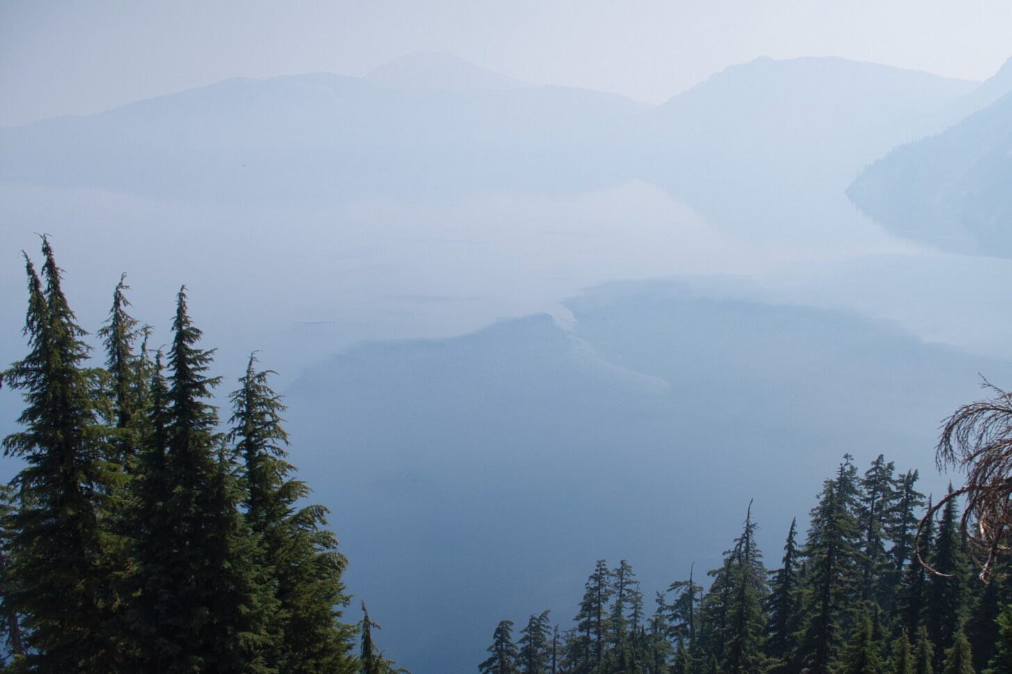
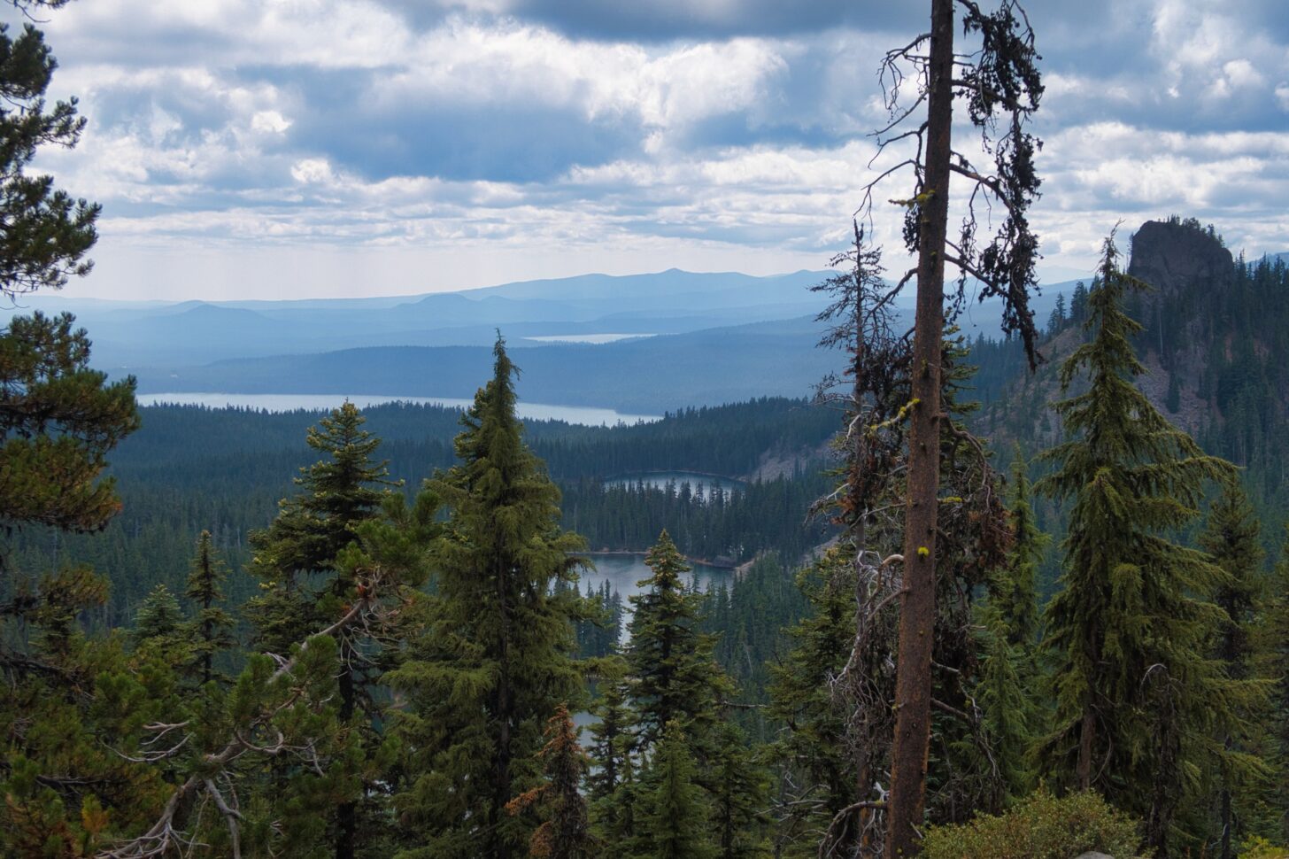
But hanging out in a resort was only a temporary respite. The heat and smoke continued to oppress. The PCT is mostly a ridgeline trail in southern Oregon. It overlooks any number of lakes (this was the Sky Lakes Wilderness), but they were only faintly visible. Mt McLoughlin loomed through the smoke but quickly disappeared again. The skies cleared a bit one night and a number of Perseid meteors appeared, a good omen. However, the relatively clear skies of morning did not last. Ten miles of hiking through a shadeless burn area on the south side of Crater Lake National Park depleted my water and forced me off-trail to dip from a warm tannic pond.

The mood at the Crater Lake hiker campground was subdued bordering on sullen. There was little sign of the usual hiker lightheartedness. No one here signed up for this kind of punishment. Hikers who walked 1800 miles to get here from Mexico – obviously not wimps or quitters – were ready to quit. Or take a week or two off. Or just hitch up to Washington where surely the skies would be clear, the air would be cool and the springs would be flowing. Where a hiker could hike, not just slog through smoke and heat. Washington would be better. It had to be.
Reprieve – Crater Lake to Elk Lake
Like everyone else not hitching out, I took the Rim Trail around Crater Lake, rather than the official PCT which runs in parallel a few miles to the west. Because why would you not want to walk around the rim of one of the most spectacularly beautiful lakes in the world?
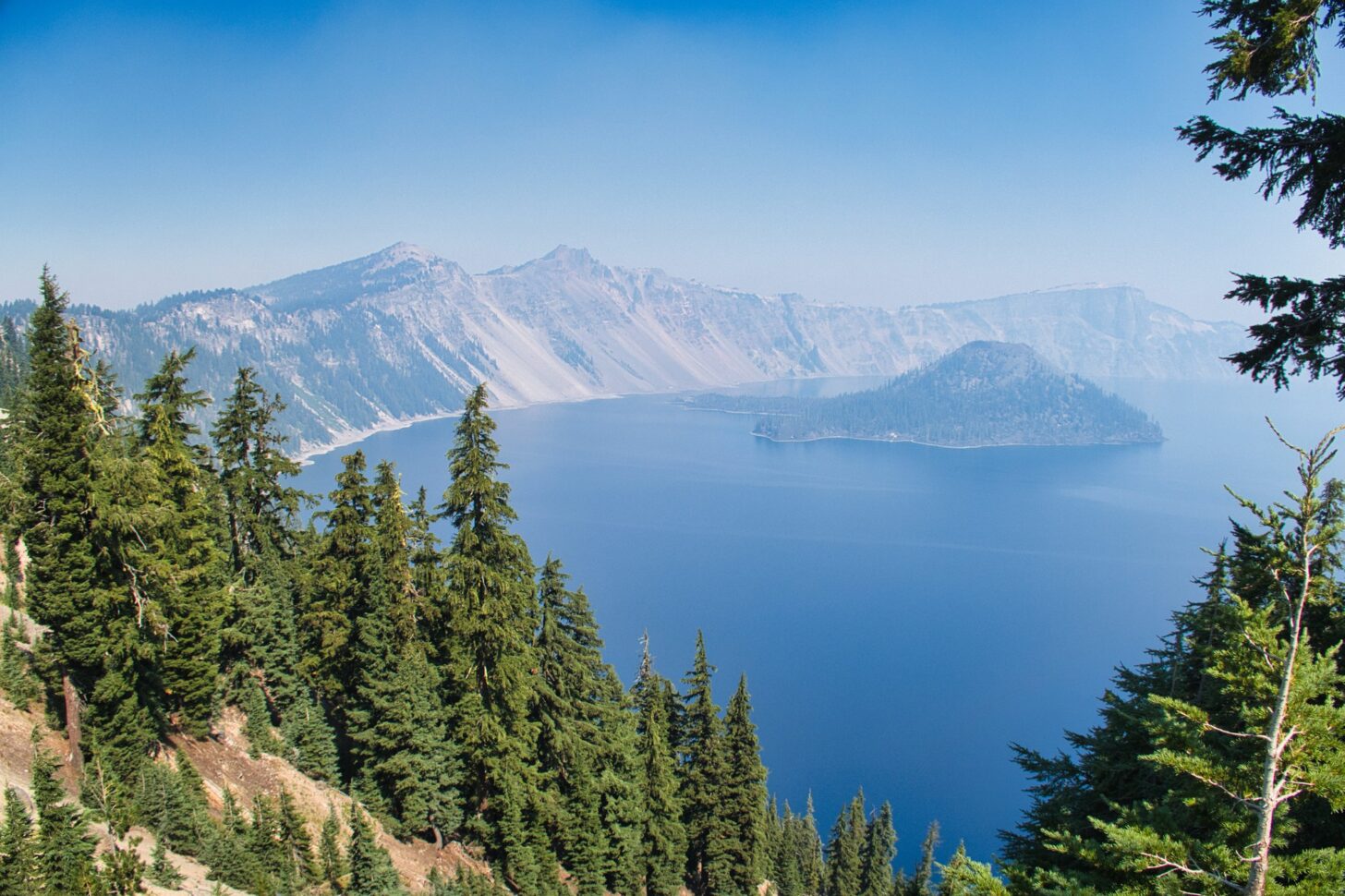
The smoke was not bad in the morning and in fact imparted a bit of hazy mystery to the scene, not unlike a Japanese watercolor. But it got smokier through the day, and by the time I got to the north end of the lake, I had my N95 mask on again.
The next morning was cold and windy, with wet clouds whipping up the mountainside. I was thrilled to put on my down sweater and wind shirt, and even fantasized about having to hike in the rain.
Although it didn’t rain, fog dripped from the trees. The trail was transformed from a hot, dusty, smoky slog to something cool, dark, and somewhat mysterious. After days of misery, I was hiking in clean cool air. It made hiking fun again and I took advantage of the opportunity to stretch my legs and cruise through the forest.
The clear air brought views of the isolated conical peaks of the Oregon Cascades. These mountains are very different from the ranges I know best – the Rockies, the Sierra, the Transverse Ranges of California, and the Sky Islands of southern Arizona. Sharp volcanic peaks rise out of a skirt of rolling forested hills. They seem scattered about more or less at random within a north-south corridor that must be a tectonic plate boundary.
There are plenty of lakes here but little running water.
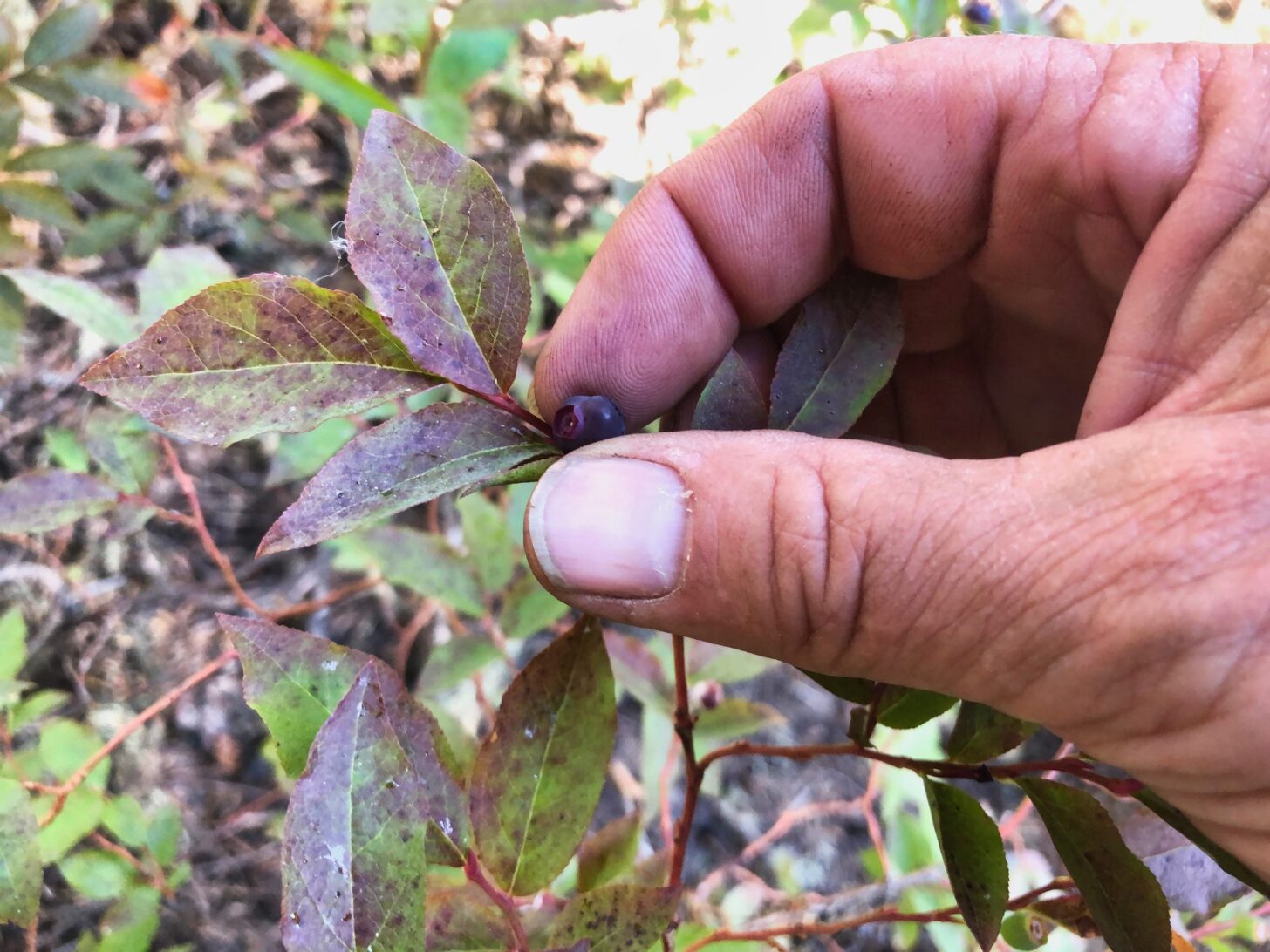
The miles beyond my last resupply at Shelter Cove rolled on, pleasant but unremarkable. The smoke was never wholly absent, but in the deep forest, it was easy to ignore, to avoid thinking about what was happening in distant forests. Lakes appeared, beautiful and sparkling in the summer sun. They were low, but not obviously low. Patches of blueberries crowded the trail at times, and maybe if you didn’t know better you wouldn’t realize that delicious as the berries are, they are also sparse and a bit desiccated.
I will be exiting the trail soon, but it feels like the trail is making its own exit. A walk through another burn area festooned with fireweed makes the point. Change is coming, change is already here.
I walk knowing I will never see this place again. Not just because I am old, but because this world is old. We’ve lived for the last 10,000 years in a world of mild and stable climate, an anomaly in climate history. That anomaly gave us the chance to invent agriculture, and thus invent cities and, eventually, the notions of progress and freedom and wilderness.
A stable climate regime also let plants and animals engage in exuberant rounds of diversification and specialization, each new species a bit better at exploiting a niche environment, each one a bet that the niche would persist and not leave it stranded. With our specialized dependence on agriculture, we have made the same bet: that we would know what crops to plant and when and where. Now we are losing that bet, victims of our own success.
I come to the place where I will turn right and leave the trail. I stop, unwilling to make my exit just yet. I drop my pack, lean back against a fir. Regard the scene. The forests, the meadows, the lakes, the birds, the bugs, the pitcher plants, the yearling deer skittering through the woods: all beautiful, all on their way out. They too have lived lives of grace and affection. I say a few words of gratitude for this and depart.
Related Content
- Read more by Drew Smith.
- Check out Andrew Marshall’s own reckoning with the changing nature of hiking in the west.
- Browse more stories of adventure and reflection at Backpacking Light.
DISCLOSURE (Updated April 9, 2024)
- Backpacking Light does not accept compensation or donated/discounted products in exchange for product mentions or placements in editorial coverage. Some (but not all) of the links in this review may be affiliate links. If you click on one of these links and visit one of our affiliate partners (usually a retailer site), and subsequently place an order with that retailer, we receive a commission on your entire order, which varies between 3% and 15% of the purchase price. Affiliate commissions represent less than 15% of Backpacking Light's gross revenue. More than 70% of our revenue comes from Membership Fees. So if you'd really like to support our work, don't buy gear you don't need - support our consumer advocacy work and become a Member instead. Learn more about affiliate commissions, influencer marketing, and our consumer advocacy work by reading our article Stop wasting money on gear.

Discussion
Become a member to post in the forums.
Companion forum thread to: MYTHing the PCT in a Time of Change
Searching for grace and gratitude through the smoke.
A captivating read. Really well-written and thought provoking.
“A thru-hike is an end-to-end hike of a long distance trail completed in one calendar year.”
https://thetrek.co/definition-thru-hike/
I loved that. Bittersweet in the best way. Thanks for sharing it.
I truly enjoyed this. I, too, am engaged in a MYTH of the PCT, but on a shorter timeframe than you. I’m trying to do it over two years — 2021 and 2022. Although it may now stretch to three given injuries I’m dealing with.
It seems like much of this is written about your section hike last year on the PCT. I was ahead of you, also heading north. If you use FarOut, I was that crazy guy reporting on all the water sources from Sierra City to Santiam Pass.
The part I loved the most in your article was this: “The trail has changed and it will continue to change. It is a living thing, and change is the essence of life. All we can do is keep moving and appreciate what good remains and work for more good to come.”
I hadn’t thought about the trail changing. (By “trail,” I’m focusing here on the PCT.) In fact, it seems like the trail doesn’t change at all, that only we do. But you’re right. It’s true given climate change and wildfires in the West. A single-year thru hike of the PCT is not a given anymore. It feels like it’s now a rarity, that it requires incredible luck or an extremely early start. This makes me sad. I’m desperately trying to find an upside to it.
Sorry about your dog. I’ve had two I’ve hiked with in my life on overnights and short multi-day hikes. One is dead and gone. The other is now old with hip problems, Dogs are incredible companions on the trail.
I’ve also been fortunate to have human companions, too. My dad who got me started hiking when I was a kid. My younger brother whom I hiked with when we were young adults. My adult son who I currently hike with once or twice a year. I feel blessed to have been able to pass my love of the woods to him. After all, my father passed his love of the woods to me. Now if only my wife enjoyed more than just a day hike. :-)
Take care. Thanks again for your article.
Enjoyed your thoughts/words immensely, and can relate. My first serious hike was to the top of Mt LeConte in the Smokies in 1956. Things have changed and will continue to change. I’m 78 now and each time I arrive at a campsite I toast to it’s with a good beverage, knowing I very well might not pass this way again. Happily, I now see many more females and persons of color enjoying the gifts of the wilderness. They make me smile as I saunter along.
All I can say is…AWESOME article. I really enjoyed the read. Made me feel connected. Thank you for sharing.
This was a heart-wrenching read. With 35 years of hiking behind me, witnessing how things change, and feeling pretty good about having the capacity to hike a few more decades, this story really made me pause and wonder about the future of wild places.
Nevertheless, I’m about to embark on one of my big summer trips in a spur range west of the northern Colorado Rockies, and I’ll remind myself to be hopeful at the start and grateful at the end.
Thanks for the great read, Drew.
Really enjoyed reading this, Drew. Always a treat to read your observations and insights.
Getting used to the notion that I will never again see beloved sights has been difficult. And painful. Coming to grips with that suite of concerns has made me more mature…and led to growth. This last is important. This article starts with a beloved dog who grows old and passes away. That sense of passing is everywhere. How odd, in a way, since when backpacking, we also find geology that’s been around for thousands of centuries. Backpacking, we see deep time much more than in everyday experience.
Old loves give way to new, if we know how to look. What’s the difference between a philosopher and a backpacker? The backpacker loves what she finds, so much so that all of the pain and effort seem welcome, if only she can be with nature. The philosopher thinks about all this…but doesn’t know it.
Think there were some years young UL hikers could more easily hike all the miles continuously but the Lionshead is still off limits (on either side of Ollalie Lake). It’s not only light gear anymore, it’s probably taking more sacrifice (in terms of short town stops) to make miles before NorCal/Oregon start to burn.
A youngish hiker just finished a PCT NOBO in 77 days equals a late May start,
… his last gear list (major items) being a Pa’lante pack, Deschutes Zero-G (no inner), Katabatic 15°F quilt, Xlite (length not specified), Pocket Rocket 2, Toaks pot, Frogg-Tog jacket, and Melenzma fleece. His mileage averaged 34 or so MPD.
That said hitting the right time is critical. Was following another semi-young hiker trying an FKT at 40ish MPD with a early-mid June (!) start, whose gear was based on an according foam pad, quilt, and a WPB bivy sack (guessing OR brand Ascensionist ~18 oz) .. just throw on ground, .. and cold soaking (fwiw think I had more comfort in military basic training) with posts stopping as the trail closes for the McKinnley fire along the CA-OR Border.
So it’s still doable but seems to require a high daily mileage/low gear wt.-fuss to get as many steps in as possible.
Add that parts of the trail are closing as of now due to fire. From Etna authorities got a school bus to drive hikers across the border to get around the McKinley fire closure.
https://thetrek.co/pacific-crest-trail/60-pct-hikers-evacuated-from-trail-as-mckinney-fire-burns-near-ca-or-border/
The PCT is also closed between Crater Lake and “Bend” OR, guessing McKenzie pass?
California and Oregon border, and inside Oregon itself for now despite some record precip earlier iirc in the year in the latter.
So quite a few hikers will need to go back to the area between the Shasta area (the last real transport hub) and Ashland to complete those miles, though most are headed towards Timberline/Govt Camp due to other Oregon closures. So they’ll need to hike almost all of Oregon if experiencing those miles is of any importance.
Not quite a MYTH but there’s still the definition of what constitutes a true thru with more fires … though in the PCTs case, the permit requires following the law, and even without a permit, there’s sheriff/ranger patrols of mandatory closure areas.
Then there’s sacrificing a little sleep and town days to average 35 MPD to make the hike in almost record time.
Become a member to post in the forums.