Topic

Wind Rivers questions

Viewing 25 posts - 1 through 25 (of 50 total)
Sam Sockwell BPL Member
PostedJul 5, 2016 at 7:55 pm

Doing a loop up Fremont up to Grave then Valentine Lakes back down lizard Head down Big Sandy.

Does the direction make a difference at all? Can it be done the other way just as nice?

Is there a campsite after Marms Lake but before Grave that is nice?  Or are there lots of nice spots, not to worry?


Thanks,  Sam

Brad Rogers BPL Member
PostedJul 5, 2016 at 8:25 pm

Are you going up and over Hailey Pass?

Shadow Lake is a really nice spot but perhaps a little out of your way.

On the other side of Grove Lake, Ranger Park is a decent spot on the way to Valentine Lake.  I didn’t intend to camp there, but a strong thunderstorm had me stop early.

Lots of nice spots in WRR though, you won’t have a problem.

I will be back in that area of the Winds this August and plan on going off trail through that area.

Sam Sockwell BPL Member
PostedJul 5, 2016 at 8:28 pm

Yes over Hailey.  Can the loop be done both directions equally well?  Thanks for any advice

Will check out Shadow on the map

Brad Rogers BPL Member
PostedJul 5, 2016 at 8:36 pm

I haven’t gone over Hailey but will be going over it this year.  I am coming in from Bonneville Basin to Desolation Valley and then over Hailey Pass and then cut up the Valley before Grove Lake into Rabbit Ear Lake.

I did Shadow Lake to Illinois Pass to Ranger Park and then over by Valentine Lake and Lizard Head Plateau in 2014.

Randy Nelson BPL Member
PostedJul 7, 2016 at 5:24 pm

I agree with Brad that camp spots are easy to find. I’d just warn to get off Lizard Head plateau before the afternoon. A thunderstorm caught us (mid-September) up there and it was, uh, exciting, to say the least.

Sam Sockwell BPL Member
PostedJul 7, 2016 at 5:27 pm

Hey thanks Randy

Any thoughts on clockwise vs counterclockwise for the loop?

Randy Nelson BPL Member
PostedJul 7, 2016 at 9:24 pm

Probably doesn’t matter much. If you go counter you can camp at Lizard Head meadow and get an early start over the plateau. But that’s probably just the lightning talking. :)

PostedJul 7, 2016 at 10:38 pm

A couple of minor points. Traveling Hailey Pass from South to North–it is nice to have hiking poles for the descent. My fuzzy memory recalls BB-sized pebbles on a hard surface. Don’t let this be anything more than a microscopic factor in choosing a CW vs. CCW route or in your choice of using poles at all. Just a friendly hint.

If you take drinking water from Washakie Creek or that general area be sure to treat or filter it. Lots of domestic sheep graze in that area.

Brad Rogers BPL Member
PostedJul 8, 2016 at 6:46 am

I did my loop from Big Sandy clockwise in 2014 as I wanted to finish coming into Cirque of the Towers. Having the last day be the Freemont trail just seemed anti climactic to me but the trip could certainly be done in either direction.

I went over Lizzard Head plateau in near white out conditions that August and I passed one other hiker who got disoriented and tried to turn around and follow his footsteps back but they had been covered by new snow. He was happy to have my tracks to follow back to Cathedral Peak. Even when I told him I was going to the Cirque he didn’t think it was possible and was going down low to wait it out. I can’t say that I followed the trail on the plateau, but I made it across and there was no snow in the valley below.

Thanks for the info on Washakie Creek, I usually treat my water but I treat it longer if I think domestic animals have been in the area :).

Randy Nelson BPL Member
PostedJul 8, 2016 at 9:26 am

Brad has a good point. Would you prefer to start or end the trip with the Cirque of the Towers? It’s all great but that is the most spectacular part of the trip.

I haven’t been thru Haley’s Pass as we were basically doing a modified version of Palister’s Central WInds Scenic Tour route which goes up to Rabbit Ears Lake and then over Macon Lake Pass instead. But you can definitely camp in the Washakie Creek area. And she mentions Skull Lake as a destination in another route so you can definitely go past Marm’s Lake and have good camping.

If you camp at Grave lake, there’s a really good spot near the Grave Creek inlet. As soon as you cross the stream (going clockwise), you’ll see a campsite next to the trail. Go up the hill above it for a much better site. It’s right up against the Indian Reservation. If you keep going past that campsite, there’s actually signs on trees in the forest, not on a trail, warning that you are about to enter the reservation.

Sam Sockwell BPL Member
PostedJul 8, 2016 at 9:36 am

I really appreciate comments.  Lizard Head has a lot of memories for people, based on this small sample-


Yes prob nicer to end with Cirque since so dramatic.  However if camping at Bear Lake, maybe hard to walk out past Cirque and the out to Big Sandy TH and then drive back to Jackson Hole airport by noon  Seems like that would take a day too really enjoy, or even more time.  Maybe we will plan it so stop at Big Sandy Lake and then try to get to Jackson Hole airport the same late morning.

The Wind Rivers trip comes after we are going to hike first up and then back down the Teton Crest Trail.

Sometimes you get a sense of an area and then return, though, and likely that will be the case with Wind River hikes.


Arthur BPL Member
PostedJul 8, 2016 at 9:51 am

I would go clockwise.  the first day or so is just a steady climb to the pass, great meadows and lots of camping sites.  Good for flatlanders to get acclimatized.  Getting up to Lizard plateau from the Cirque on the east side of Lizard is a sharp, steep, switchback climb and makes it harder to get off the plateau by early afternoon.  Agreed on the east side of Haley’s.  It is safe, but gravelly on the path down. If you fall, you just shortcut to the next switchback. It is one of the classic WRR hikes, so expect to see some people.

I personally could not predictably get from the middle of the Cirque to the TH and then drive to Jackson by noon.  I have always stayed on the west/south side of the pass and then driven after a short hike the next morning.  There are tons of places to camp between Jackass pass and the TH.

Sam Sockwell BPL Member
PostedJul 8, 2016 at 10:08 am

If you could pick 4 campsites for nights going clockwise what would you choose?  Unsure if we can reach Grave Lake day 1  prob stop short

Twin Lake or Skull then Valentine then Bear then Big Sandy lake?

PostedJul 8, 2016 at 10:42 am

Here are some of the places where we camped in 2006.

Washakie Creek meadows near trail #111 junction with trail to Shadow Lake. West of the trail IIRC. This is only about 9 miles from the TH so you may want to go farther. Sorry, my memory of Skull and Twin Lakes is nil.

West of Grave Lake near junction of trails #111 and #716. West of the trail near the creek IIRC. This would seem to be a little farther from the Reservation than Randy’s suggestion?

Near Loch Leven Lake.

My notes indicate that on August 26 at 9:15am it was 31 degrees and snowing :).

PostedJul 8, 2016 at 11:43 am

Adkison’s book Hiking Wyoming’s Wind River Range, states that there are campsites next to Skull Lake. Also sites south of Maes (or Mae’s) Lake near the inlet. Mae’s is the larger of the two lakes at the junction of trails #111 and the trail to Pyramid Lake–it may not be named depending on which map you have.

Brad Rogers BPL Member
PostedJul 8, 2016 at 7:43 pm

Randy-

How was Rabbit Ears Lake and Macon Lake Pass.  I will be going by both this year and was thinking about camping at Rabbit Ears Lake.  I haven’t read any trip reports of anyone that has been that way.

I haven’t been thru Haley’s Pass as we were basically doing a modified version of Palister’s Central WInds Scenic Tour route which goes up to Rabbit Ears Lake and then over Macon Lake Pass instead.


Randy Nelson BPL Member
PostedJul 10, 2016 at 10:29 pm

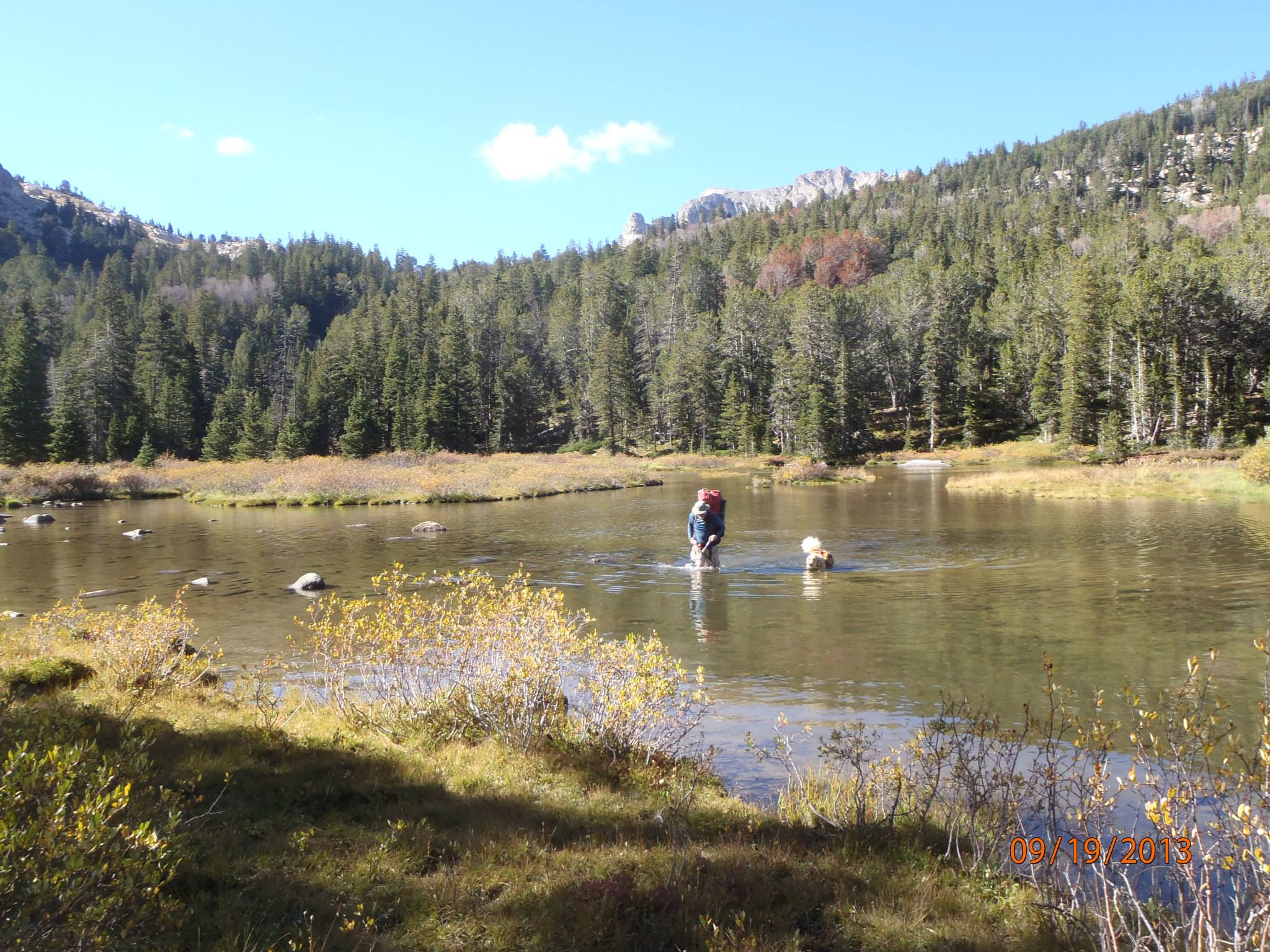
It was fun. Wading the end of Grave Lake was new to me. River yes. Lakes no.


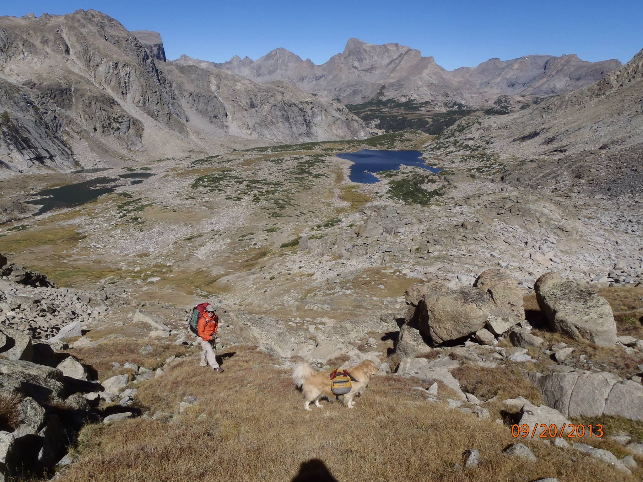
We didn’t find anything decent at all at Rabbit Ears Lake. Really bumpy and rocky.  We  continued on to the southwest and there was a great spot. Here’s Buddy and I going up Macon Lake Pass. The campsite is the flat spot you see dead left middle in the pic.


Brad Rogers BPL Member
PostedJul 11, 2016 at 8:42 am

Thanks for the help Randy.

I will be coming from the west (Hailey Pass) and it looks like I could cross the Grove lake inlets prior to the lake. Is that possible or is wading the lake near the inlets the obvious line? How is the bottom of the lake? I could imagine it being a silty shoe eating mess.

I don’t mind crossing the lake if that is the best (or only) line.

Randy Nelson BPL Member
PostedJul 11, 2016 at 9:33 am

It was fine, and fun, crossing the lake. That’s how Nancy says to go. Looked a lot easier than crossing the multiple inlets with all the foliage. Really it’s easier than a stream crossing. Smooth bottom so you don’t have to be careful about how or where you step. I just kept an eye out to make sure I didn’t hit any deeper pockets. And it wasn’t mucky at all. I did have some Vivobarefoot Ultra Pure’s with me (I bring those for wading when I think I’ll be do much fishing) so I used those. They didn’t get mucked up at all. Would have been just fine in trail runners. Or even probably even barefoot in this case although I don’t go barefoot as a rule. I just don’t chance it.

PostedJul 12, 2016 at 5:22 pm

I’m also planning a trip in the Winds for later this summer and had a question about a section of off-trail route. Is it possible to cross the Divide from the upper end of the East Fork Valley into the Baptiste Lake Basin? Judging by zoomed-in satellite pics and contour lines, it looks as if the saddle directly northeast of Mount Bonneville (separating the East Fork Valley from Bonneville Basin) may be doable, and from that saddle one could traverse east to the saddle separating Bonneville Basin from the basin containing Baptiste Lake. I wasn’t able to find any info on this route in Pallister’s or Adkison’s books.

Thanks!

Spencer

Brad Rogers BPL Member
PostedJul 14, 2016 at 2:57 pm

The general route from Bonneville Basin to Desolation Valley (East Fork) is over Bonniville-Raid Col which is south-southwest of Mt Bonneville. You end up crossing into The East Fork Valley from Bonnivelle Basin more west-east than north-south.

I see the saddle you are talking about and it might be doable. Try it if you are up for adventure but be prepared to turn around if need be.

I will be coming into Bonnivelle Basin from the pass past Lake Donna (no name as far as I know), and exiting over Bonneville Raid Col.

John Vance BPL Member
PostedJul 14, 2016 at 7:01 pm

I have been over the saddle you are talking about.  It’s doable but doesn’t really save any time and puts you at greater risk.  The Bonneville Raid col is fine and you can come up it easily directly at the end of the lake approaching from the west side of the lake, if south bound.

There can be lots of ice on the rocks and wet conditions as you work your way through cliff bands but it’s pretty straight forward.  It’s the way I have gone half a dozen times from both directions.  Most go farther west down Bonneville basin and then turn back east and begin the climb to the col, but that isn’t really necessary if you are ok with class III and sketchy traction at times.

John Vance BPL Member
PostedJul 14, 2016 at 7:07 pm

I should add that you want avoid an approach from the east side of the lake.  I have done it once and it is tedious and very slow going.to say the least.  I believe Alan Dixon called it “heinous” but it may have been Andrew Skurka.

PostedJul 14, 2016 at 8:30 pm

John,

When referring to the west and east sides of the lake – which lake are you referencing? Lake 10,566 in the East Fork Valley at the base of Raid Peak?

My route of travel will be north, going up the East Fork Valley from the Hailey Pass Trail. I want to find the least time consuming route from the north end of the East Fork Valley to Baptiste Lake without having to cross the Divide south of Mount Hooker. I’m in good shape, so I’m not too concerned with effort expended, just finding the quickest route over the divide. Class III also does not bother me in the least.

Brad – thanks for the input!

Viewing 25 posts - 1 through 25 (of 50 total)
Loading...