Topic
Wind River Range 8/2 – 8/7
Forum Posting
A Membership is required to post in the forums. Login or become a member to post in the member forums!
Home › Forums › Campfire › Member Trip Reports › Wind River Range 8/2 – 8/7
- This topic has 11 replies, 7 voices, and was last updated 5 years, 4 months ago by
 Brad Rogers.
-
AuthorPosts
-
Dec 23, 2018 at 6:59 pm #3569870
Trip report to follow…
Dec 23, 2018 at 8:06 pm #3569874Wind River Range August 2-7, 2018
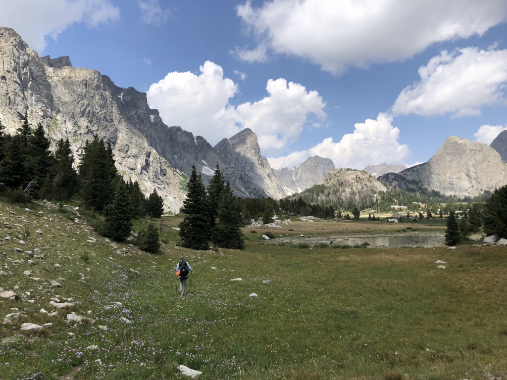
My daughter and I spent 6 days in the Winds from August 2-7th, doing a loop hike from Big Sandy trailhead. We followed Route 16 (South Central Winds Tour “Lite”) in Nancy Pallisters book “Beyond Trails in the Wind River Mountains of Wyoming”. A wonderful route for our first time in the Winds, with spectacular scenery, some off-trail travel and other than the Cirque and Lizard Head Plateau, lots of solitude.
I was attending a conference at the Greenbrier (yep, from 5 star resort to the wilderness in 24 hours) so we flew out of Greenbrier Valley airport to Chicago and then on to Jackson Hole. Our flight was delayed in Chicago, so what was going to be a late arrival turned into a really late arrival – we landed in Jackson Hole around 11 PM, got the rental car and left for Pinedale. We made it to Pinedale around 1:30 AM, which felt like 3:30 AM to us – not a fun drive. We stayed at the excellent Chambers House B&B and luckily were the only guests that night so we didn’t disturb anyone upon arrival.
The next morning, after sleeping in until around 7:30 AM, we hit the Great Outdoor Shop and picked up bear spray and canister fuel and also a few last minute grocery items at the store, including some cold medicine since I managed to come down with a cold the day we flew out. After packing all our food, etc. into our packs, we stopped for lunch and then hit the road for the trailhead. We arrived to cloudy, threatening skies, which promptly started dumping rain and hail on us after we had hiked 1/2 mile or so. Fortunately, it only lasted 20-30 minutes and the rest of the afternoon it was just mostly cloudy.
The hike into Marm’s Lake was uneventful with the exception of me taking a quick glance at the map and looking at the wrong lake, so we went the long bushwack way around Dad’s lake. Just after we arrived at Marm’s lake and setup the tent, a thunderstorm blew in with 40 mph+ winds – it actually inverted the pole on my Tarptent Double Rainbow for a couple of seconds, but the tent withstood it well.

Sunset over Marm’s Lake
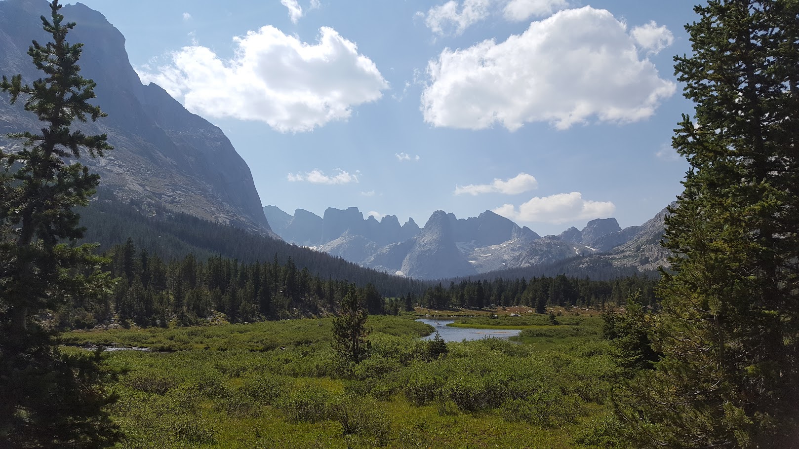
The next morning we hiked around the lake and a couple of miles to the entrance to the East Fork valley. The entry to the valley is semi-hidden as you approach but becomes more obvious after you cross the creek. The walk up the East Fork was very scenic. This was our first entry into the heart of the mountains and it did not disappoint! We sat out an early afternoon hailstorm under an overhanging rock (does it ever just rain in the Winds without hail?) before making our way up to the head of Desolation Valley and camping at Lake 10,566. This was our favorite campsite of the trip, remote and scenic, with wildflowers all around.
East Fork – Desolation Valley
Our campsite at Lake 10,566. Our tent is just a tiny mound left of center.
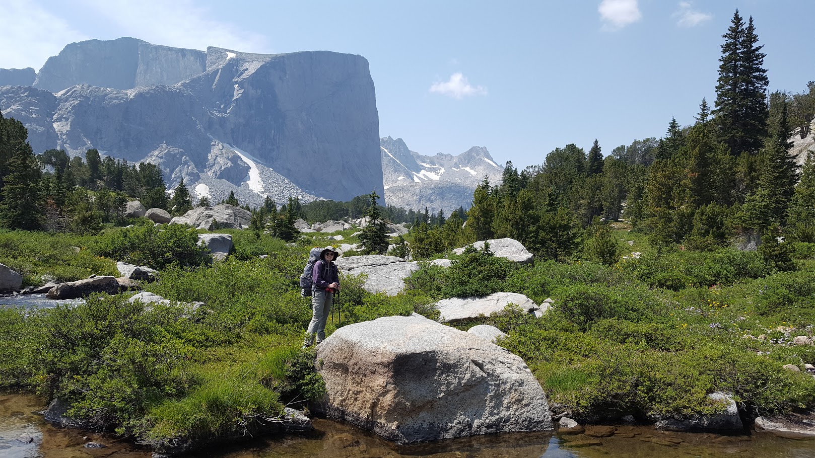
The next day saw us work our way back over a saddle and down past Pyramid Lake, shortcut across the top of Mae’s Lake and then up Hailey Pass. This was a steady climb but not really steep anywhere on the ascent. A great view down to the Baptiste bench is your reward on top. The descent is pretty steep and gravelly for the first few hundred yards, but then levels out for some outstanding hiking down to the intersection with the Bear Ears trail. Think rocky meadows, lots of wildflowers and mountains everywhere – nirvana. We had lunch along the creek with a spectacular view of Mt. Hooker and then worked our way up and across Baptiste bench to Baptiste Lake. Really pretty spot in the shadow of Mt. Hooker. Mosquitos were more abundant here, probably due to the somewhat sheltered campsite we chose. You have to pick your poison sometimes, either the cutting wind or the mosquitos…
Baptiste Creek with Mt. Hooker in background
Heading up to Baptiste Lake
Baptiste Lake
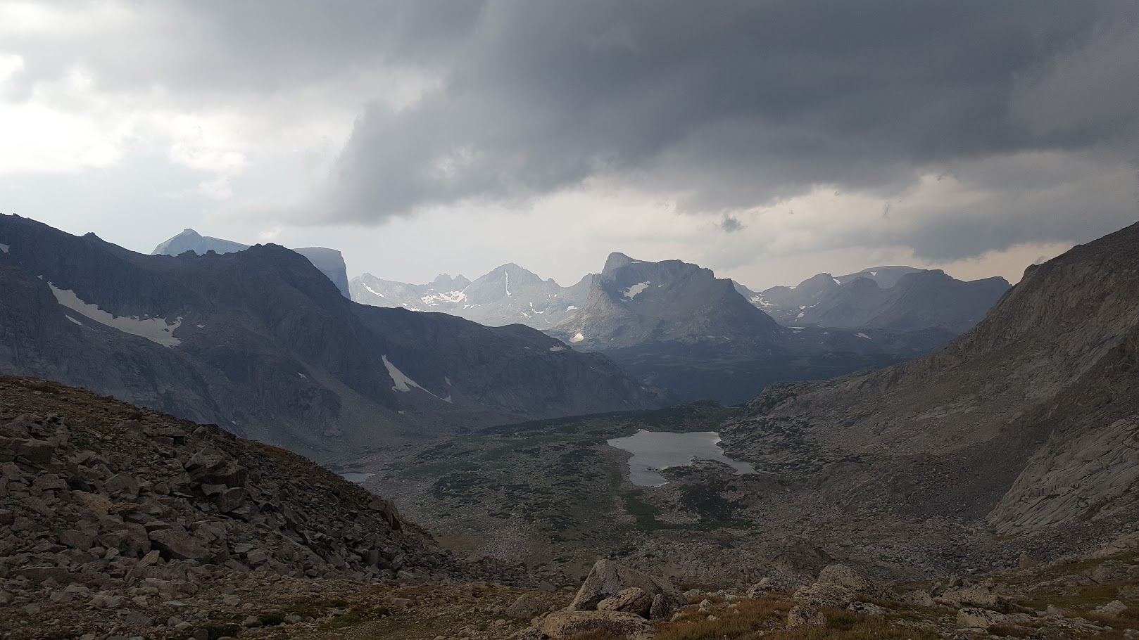
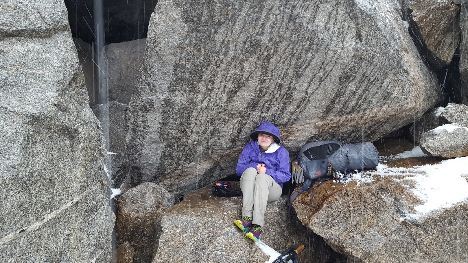
The next morning, hopes for some sunrise shots of Mt. Hooker were not to be as the day dawned cloudy and spitting a mix of rain and sleet. Most of the day would be alternately overcast with patches of sun, but after the first couple hours, it didn’t rain again until afternoon. We trekked back the way we came to the intersection of the Bear Ears trail and followed it down past a nice waterfall to the inlet of Grave Lake. We left the trail here and ascended a very steep hillside and made our way up towards Rabbit Ears Lake. We had lunch on the shores of the lake while contemplating whether to try to go over Macon Pass or camp here. Our original plan was to camp here, but by crossing the pass today and then having a bit of a longer day tomorrow, we could turn three days into two and shorten the trip by a day. The skies were still cloudy and threatening but seemed stable so we decided to go for it and head over Macon Pass. The pass was not overly difficult, but steadily steep all the way up. We made it to the top for spectacular (I know I’m using this word a lot, but it is what it is!) views back down to Rabbit Ears Lake and down to Macon and Washakie Lakes on the other side of the pass. We made it about a third of the way down the other side of the pass when the first ominous rumbles of thunder echoed overhead. We boogied down the slope as quickly as possible and took shelter near the bottom under some large rocks. As soon as we made it under the rock, a prodigious hailstorm ensued, with hail up to an inch in diameter. Before it ceased, the ground was covered to an inch deep. We were only partially sheltered and occasionally the wind would blow the hail in on us – if you’ve ever been shot with a paintball gun, that’s about what it felt like! After the storm subsided we made the trip down to Washakie Lake and found a nice site out on the peninsula. We had to clear a spot of an inch of hail before setting up the tent. This was the coldest night of the trip, getting down into the upper 20’s or low 30’s as there was ice on the puddles in the morning.
Macon Pass in center from Rabbit Ears Lake. Doesn’t look too bad from here….
Rabbit Ears Lake from Macon Pass. Looks higher from up here!
Macon Lake with Washakie Lake visible far left
Our refuge from the hail
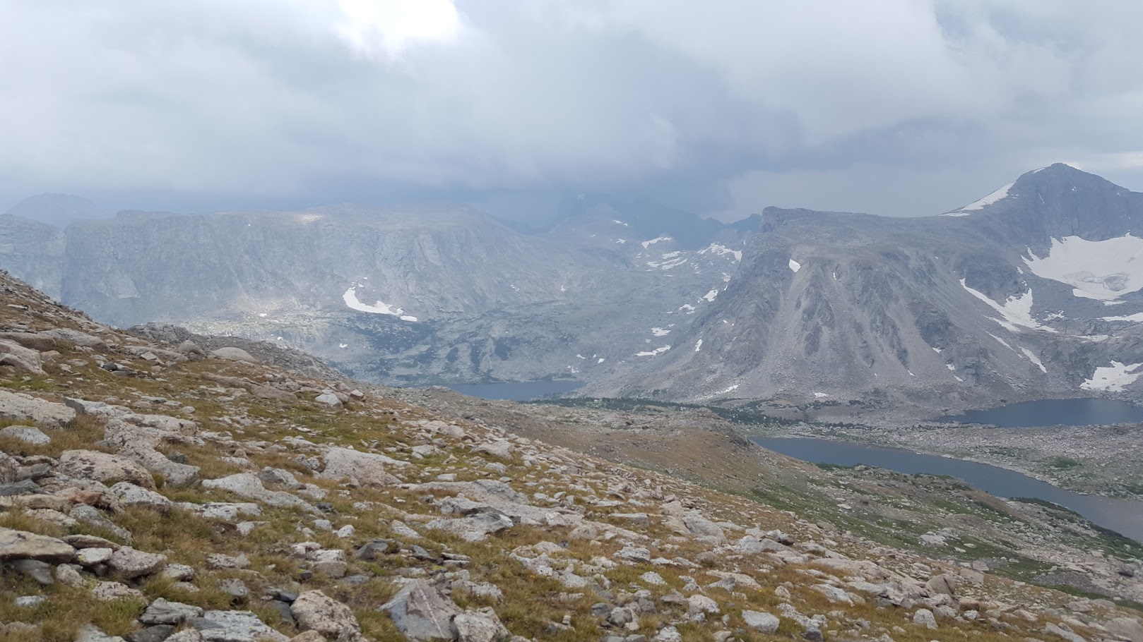
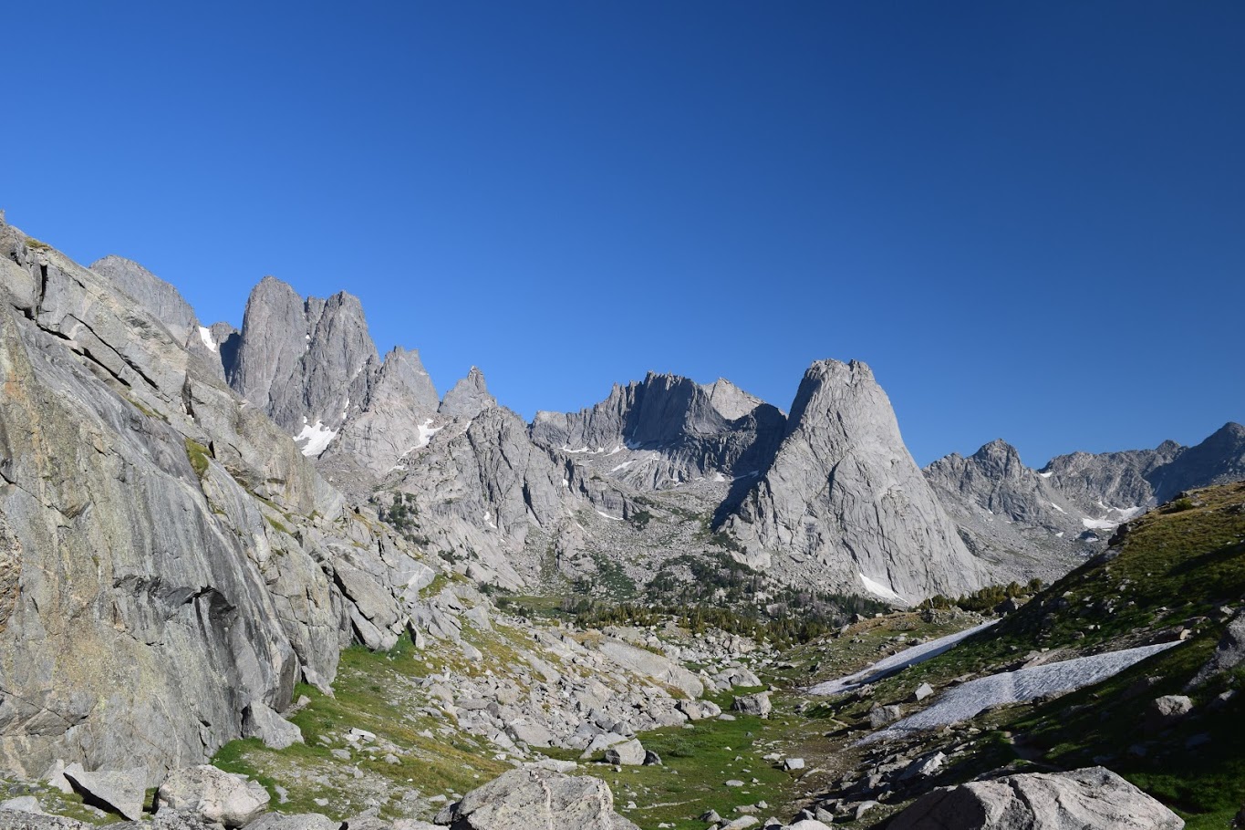
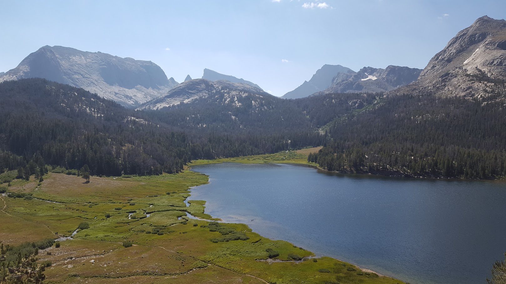
The following morning dawned bright and clear and turned out to be one of the nicest weather days of the trip with clear skies and temps in the upper 50’s to around 60. We skirted the shore of Little Washakie Lake and climbed up and around ledge systems on the nose of Payson Peak and worked our way through some wooded areas with house size chunks of talus scattered about towards the South Fork Lakes of Helmet and Holster. It was a little tricky finding a spot to cross the creek below Holster lake due to deep water and thick brush but we eventually found a spot and walked up along the shore of Helmet Lake, where we stopped and had breakfast. On most mornings, we ate a Clif or Luna bar while breaking camp, hiked an hour or two and then stopped and had breakfast and some hot tea. By now it was around 11 AM and we began our ascent to the Lizard Head Plateau via a gully to the northeast of Helmet Lake. This was the most difficult climb of the trip and was quite steep in sections. The views down to the South Fork lakes as we climbed were amazing and helped take our minds off of our burning quads. We topped out on the Lizard Head Plateau, which is amazingly large and flat. Views abounded in all directions of neighboring mountains. As you traverse the plateau, you have views down to Bear Lake, the Lizard Head Meadows and into the Cirque of the Towers. Breathtaking. We stopped for a snack break during the long descent along a small stream flowing down off the plateau and spent 45 minutes just lounging in the sun and soaking up the scenery. Another couple of hours of hiking brought us to Lonesome Lake in the Cirque of the Towers. We found a large rock a hundred yards back from the lake along a stream and cooked dinner. A friendly dog came by to keep us company during dinner. We started running into many more people the closer we got to the Cirque and the solitude we had for the first several days was definitely not present here. This area is extremely popular with both rock climbers as well as day hikers who hike in from campsites along Big Sandy Lake on the other side of Jackass Pass. We also noticed several people camped well inside the ¼ mile distance allowed for camping near Lonesome Lake. This was a long day, and by now my daughter had caught the same cold I had, so we were pretty bushed. We eventually found a nice campsite a mile or so up the trail near Climbers Camp.
Helmet Lake from the ascent to Lizard Head Plateau
Lizard Head Plateau
Bear Lake, Lizard Head Peak, with the Cirque of Towers in far background
Cirque of the Towers from Lizard Head Meadows
We ate breakfast at camp the next morning and were packed up and on the trail by 8:15 AM. In my mind, this was going to be relatively easy walk out over Jackass Pass and down the valley below Big Sandy Lake. I was pretty much correct about the section below Big Sandy Lake, but there are tons of use trails everywhere coming out of the Cirque and we took one of them and ended up missing the correct trail around Arrowhead Lake. I think we ended up on the old trail, which traversed a big talus field west of Arrowhead Lake. Definitely not the recommended route! Took maybe half an hour to traverse the first couple hundred yards and involved some definite rock climbing and bouldering in places. We intersected the correct trail south of the lake and continued on the trail, very rocky, down to Big Sandy Lake passing lots of day hikers headed for the Cirque. From Big Sandy Lake, it was a nice easy 5 mile cruise back to the trailhead. Funny story, on the way out, probably no more than a mile and half from the trailhead, we pass a kid, maybe 20, carrying a backpack, sleeping bag under one arm and a frying pan in the other. He asks if he is almost to the turnoff to Jackass Pass. LOL. I’m like, “no dude, you are not even halfway there yet and then it is several more miles in to the Cirque. He looks crestfallen, but carries on up the trail. We chuckle at the thought of him lugging that stuff all the way there, but hey, hike your own hike. We make it back to the trailhead around 1:30 PM and despite a wrong turn on the way back, we are back in Pinedale hitting the motel shower by 4:00 PM.
Looking back towards the Cirque from Jackass Pass
Looking back towards Jackass Pass
Big Sandy Lake
Since we make it back a day earlier than planned, we kill the day doing laundry, eating, and visiting the Museum of the Mountain Man (recommended). We hit the road at 4:30 the last morning since we had a 7:30 AM flight out of Jackson Hole. I wish I could have seen a little more of the terrain on the trip back to Jackson Hole, but it was dark on both trips. The Tetons looked impressive from the plane window!
We ate at The Den, which was up the road near Cora (excellent), Wind River Brewing Co. (meh), and lunch twice at Heart and Soul Bakery (good).
All in all, an epic trip. Not a day goes by that I don’t think about it and smile. I am already planning another trip back to that area, maybe the Winds again, or perhaps Absaroka-Beartooth, the Tetons, or Glacier.
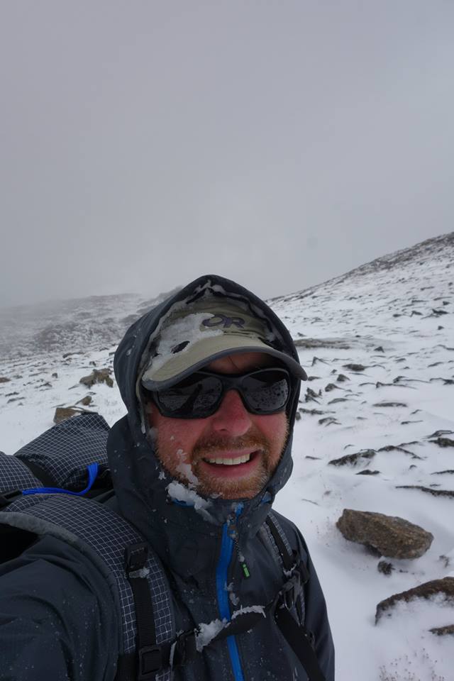
Happy backpackers on the Lizard Head Plateau!
Dec 24, 2018 at 1:34 am #3569899Thanks for the report. Glad you had a good time. One of my favorite ranges on the planet.
Dec 24, 2018 at 1:51 am #3569901That area is high on my list for a 2nd Winds trip, whenever I can make that happen. ‘Course, lots of spots are high on that list.
The hike into Marm’s Lake was uneventful with the exception of me taking a quick glance at the map and looking at the wrong lake
Ain’t it the truth. I read somewhere that there are over 1600 lakes in the Winds, and my minimal experience up there says that might be conservative. I often found myself having to concentrate to find myself among the blue patches on the map.
Great report on what looks like a memorable trip. I actually envy all the hail you got. I got nothing but blue skies when I was there–except during the solar eclipse! :-)
Dec 24, 2018 at 3:38 am #3569906Thank you for sharing, it looks like an awesome trip. I went over Macon Lake Pass a couple of years ago and I couldn’t find much information about about it, but it was pretty straight forward.
Dec 25, 2018 at 1:41 am #3570015It sounds like the route you took around Arrowhead lake is the “climber’s route” meant to take you into the climber’s camp rather than directly down toward Lonesome Lake.
On caltopo.com, the trail is shown on the Mapbuilder layers, but not on the Forest Service or USGS layers.
Thanks for the trip report. I was there once in 2013 for an aborted trip (person got AMS), and again in 2015. It does seem like the Winds gets a lot of weather, doesn’t it?
I wish flying into Jackson Hole was cheaper… looking forward to my next opportunity to go there.
Dec 25, 2018 at 4:50 pm #3570048Yes, that’s exactly what we did, which makes sense since we camped near Climbers Camp and then just followed what we thought was the correct trail over the pass.
Dec 25, 2018 at 11:17 pm #3570065What a great trip. Adding this to my dream list.
Dec 26, 2018 at 6:09 pm #3570122Thanks George for sharing your report and photos. Your Lizard Head Plateau – Baptiste Lake route looks very scenic – that area is part of an east slope WRHR I’m putting together for an upcoming summer trip.
Dec 26, 2018 at 6:37 pm #3570123This what Lizzard Head Plateau looked like when I crossed it in 2016. Quite the difference!
Dec 26, 2018 at 10:44 pm #3570171Yeah, glad it didn’t look like that! What month was that? I think they did get 6″+ within a couple weeks after we were there this year. We hit it on a spectacular day, not even any t-storm clouds around.
Dec 26, 2018 at 10:51 pm #3570172It was the last week in August.
-
AuthorPosts


- You must be logged in to reply to this topic.
Forum Posting
A Membership is required to post in the forums. Login or become a member to post in the member forums!
Our Community Posts are Moderated
Backpacking Light community posts are moderated and here to foster helpful and positive discussions about lightweight backpacking. Please be mindful of our values and boundaries and review our Community Guidelines prior to posting.
Get the Newsletter
Gear Research & Discovery Tools
- Browse our curated Gear Shop
- See the latest Gear Deals and Sales
- Our Recommendations
- Search for Gear on Sale with the Gear Finder
- Used Gear Swap
- Member Gear Reviews and BPL Gear Review Articles
- Browse by Gear Type or Brand.
