Topic

Teton Crest Trail Route suggestions Help a teacher out :)

Viewing 16 posts - 1 through 16 (of 16 total)
Brian BPL Member
PostedMar 12, 2016 at 8:54 am

*Changed the title to reflect my current question. I am looking for a route that can span around a week. Unless I am better off going with a 3-4 night hike with other exploring while I am there. I have up to 2 weeks.

I am in the beginning stages of planning a hike this summer. The timing is pretty open because my summers are open (2nd week June- beginning of august) but I would like to keep it under 2 weeks. I am capable of going anytime within those weeks but I understand the need for permits so I am trying to get it planned. I have been searching and have found some amazing trails but the issue is I am going to be doing them solo. I am newer to the backpacking world but have had some experience (as stated below). I don’t have many friends who like to hike and the ones that do are occupied with jobs/business. Backpacker caught my attention with the “37-mile, six-day Teton Crest Trail” but there are so many mixed opinions out there about hiking parts of that trail solo because of bears, particularly grizzly. I get the risks and understand precautions need to be made. Each time I look somewhere else I keep coming back to the Tetons because of the serene landscape!

If any of you have any suggestions on routes, or even a better trail suggestion. I am not worried about driving. To get to the Teton Crest Trail it is going to take me around 14-15 hours but I consider driving is just part of the adventure. I love traveling.

My background:Ā I currently live in Iowa, 28 years old, and am an Elementary Education teacher so summers are pretty open. The issue is all my friends either work or can’t take time this summer. Gear is not an issue unless I am encountering snow (I don’t have much of a snow gear setup). I have been backpacking on a short section of the Ozark Trail (6 nights), day hikes in the badlands, and grew up car camping. I won’t lie, I have been relying on a GPS during those events, but am currently working on my navigation using a map/compass. Ā I have never tried rock face climbing so that is out of the question for now.


Brad Rogers BPL Member
PostedMar 12, 2016 at 10:06 pm

The Teton Crest Trail wouldn’t be a bad trail, but I think you would have a hard time making six days out of it.Ā  I was going to do this with my wife a couple of years ago but it fell through, but I chose it because of the easy logistics (fly into Jackson, shuttles availible and reasonable) and that it was an easier high elevation trip for her (the tram takes you up to 10K) as it would have been her first trip at elevation.

The downsides to me are that it is in a NP with lots of people and regulated campsites.Ā  I much prefer the Wind River Range just to the SE where I see few people and can camp where I want.Ā  TheĀ  navigation in WRRĀ isn’t always as straight forward (but it can be if you stay in more popular areas) but that can be a plus or minus depending on what you are looking for.Ā Ā  You can camp anywhere and permits are not requried.

The downsides are that logistics are more difficult and the trailhead roads are long and in poor condition.


Other areas to consider would be the Bob Marshall WildernessĀ of Montana, the Sawtooths in Idaho, the Unitas in Utah, the Sierras in California, or the RMNP or Wimanuche areas of Colorado.

Luke Schmidt BPL Member
PostedMar 13, 2016 at 12:15 am

There are a lot of things you could do but here is one idea of a progression.

  1. Do an easy overnighter to test all your gear. Either do this before your summer trip or just a quickie once you get there. If you forget batteries or toilet paper on an overnighter it is much more manageable. There are tons of possible overnighters, I’d just go to the backcountry office and talk to the rangers. If nothing is available go into the Gros Ventre Wilderness or the Jedidiah Smith wilderness for an overnighter.
  2. After your overnighter go through everything, make sure you have fresh batteries, etc. andĀ take care of anything you forgot. There are outdoor stories in Jackson Hole in case you are missing something (expensive though).Ā Now you’re ready for the Teton Crest! Have fun.
  3. Since you don’t need 2 weeks to do the Teton Crest you might check out Yellowstone,Ā the WindsĀ or go up to the Absaroka Beartooth Wilderness. You could backpack there or just do day hikes off the highway. Floating the Snake River is always fun, you could bring a spotting scope and watch wolves.

Solo hiking in a NP is not as risky imho as solo hiking out in wilderness area (I do both all the time). Things are pretty well mapped out and rangers will be keeping tabs on problem bears and closing campsites if there is an issue. I’m not saying to be foolhardy but don’t let people scare you away from going solo.

I’m a teacher to but I’m moving this summer so my schedule is a bit uncertain. Hopefully I’ll be in Canada most of July which is probably when you’ll do your trip. If I am around though maybe we could meet up.

Aaron Madsen BPL Member
PostedMar 13, 2016 at 12:18 am

The Teton Crest Trail is a spectacular trip and doesn’t require quite the work that you would anticipate given the elevation. I hiked it last summer with my father (63 yo), wife, and two sons. We took the tram to the top and exited at Cascade Canyon after 5 days, 4 nights. It is incredibly scenic, but many of the wilderness areas out west are. No route finding skills needed. Trail is well marked and easy to follow. We saw a ton of wildlife, including grizzlies, but managed to keep our distance. It is a NP, and so everything is very regulated, but nearly every night we camped within earshot of another group. Normally I would count that as a big negative, but if you’re concerned about bears, that should make it a bit less scary. If you don’t want to deal with the Bears, then I would suggest California. The black bears can still cause problems, but they are “generally” less aggressive than their grizzly cousins.

Richard Lyon BPL Member
PostedMar 13, 2016 at 7:44 am

Brian, the Teton Crest is one of the scenic wonders of the Rockies. The earlier posts accurately describe its pluses and minuses (especially not solitary). Definitely a trip of a lifetime. By all means start with the tram.

If you’d like a bit more solitude there are many, many wonderful hikes in Yellowstone Park. Also regulated but it’s one party per campsite and they are spaced out so you’ll be alone. Consider Heart Lake, Slough Creek, Gallatin Crest, or if you are really adventurous the Thorofare.

Brian BPL Member
PostedMar 13, 2016 at 7:51 am

First off, thank you for all of your tips and help! Very good information here.

Brad: That makes a lot of sense. Since this is my first trip there, I will probably opt for the NP trail for those reasons. However, that is definitely something I will be thinking about next time.

Luke: What you said helps. I have the first two checked off, although I will check my setup again before I go. Plus it will be towards the end of the summer so I would be camping locally before then.

Aaron: So you guys started at the top using the tram? I would also agree that generally camping within earshot would be a negative, but for this first trip I am not as worried. I thought about California and the JMT but I think I am going to stick with the Tetons this time. It is definitely on my list.

Richard: I am definitely going to look into the starting with the tram route. The whole process of reservations is still a bit foggy to me, but I think there is enough information guides to help.

So, would you guys say going late July/early August would be ideal? (can’t go when school starts around the second week of august) Ā I know I need to get on reservations soon. I also saw the rangers advise taking pick axes? I have never used one of those before and I am assuming I won’t need it for what I am doing correct?

Brad Rogers BPL Member
PostedMar 13, 2016 at 12:46 pm

I would probably go the first week of August if I were you but you may encounter some bugs that you wouldn’t later in August, but I would think even the first of August may be better than July.

You need to pick your campsites and get your permit soon as that early in the year they fill up the permits pretty quick.Ā  Starting on an odd day (like a Wednesday??) might help as most people will be taking time off from work.

You will not need an ice ax that late in the year.

Aaron Madsen BPL Member
PostedMar 13, 2016 at 6:11 pm

Definitely go as late as possible. We went the first week of September and it was great. You should start checking on reservations ASAP. And a night on Death Canyon Shelf is a must!

Brian BPL Member
PostedMar 15, 2016 at 4:12 pm

Thanks Aaron and Brad! I am going to try and go as late as possible. I am trying to find my route right now. Ā I am having a hard time deciding on the route though! Thank you all for your help.


Brad Rogers BPL Member
PostedMar 16, 2016 at 12:18 am

Did you decide on the Teton Crest Trail, Wind River Range, or something else?

dreamer BPL Member
PostedMar 16, 2016 at 2:54 pm

Teton Crest Trail

Here is a link to a similar thread from 2013.

and a few additional thoughts.

Permits. If you can’t plan that far ahead don’t worry about it. Been on that route four times with walk in permits. Show at the office an hour or two before opening and have a flexible attitude. Perhaps wait a day to start. There are areas on the route outside the park not requiring permits. Get the map. Look at the camping zones and sites and think about how much or little distance per day that you can handle and what might be possible combinations.

Tram!? Are you going to the backcountry to ride mechanical contrivances? The drive out there should be enough. One can launch on the Granite Canyon Trail and achieve The Crest in around ten miles of moderate climbing on their own two legs while you travel through all the beautiful Western backcountry zones from sage flats to the alpine. Plus you save a few bucks.

Ā 

Barry P BPL Member
PostedMar 16, 2016 at 3:12 pm

Here’s some of my humble thoughts. I think the Tetons are more scenic than Wind Rivers. But that’s different with everybody.

A little note: the TNP allows all canisters on the IGBC list.

http://www.igbconline.org/images/pdf/160226_Certified_Products_List.pdf

If you don’t have one, they’ll loan you one for free (if you like an extra 3 lbs).

If I get a campsite in the park I backpack with an Ursack. This is the lightest option. If I’m slightly outside the park, then I’ll do a regular bear hang like Yellowstone allows (and with a nylon bag — lighter than an Ursack).

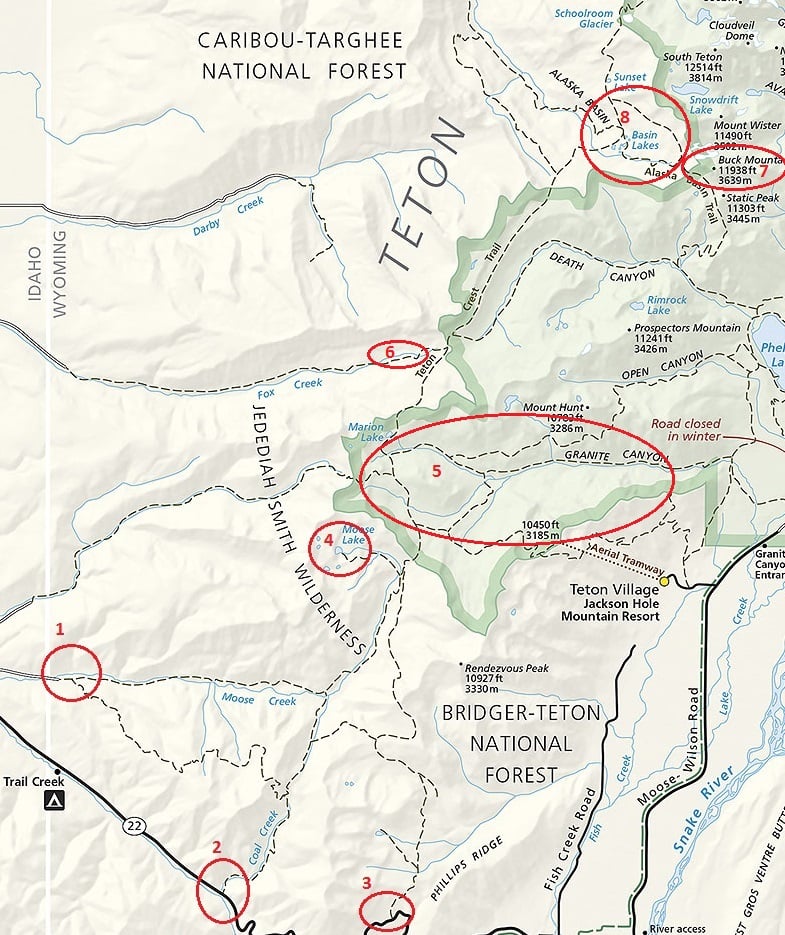
I do a lot of Teton hiking but I usually camp right outside its boundaries (hmm, I wonder if this map will show).

Ā 

Three good places to start (and free parking) are along WY 22:

Moose Creek (1), Coal Creek (2), Phillips (which starts you at a cheating 8k) (3). Then allow all day to make it to Moose Lake for a camp (4). Another day you can hike to Mount Hunt or down and back Granite Canyon (5). And then camp along Fox Creek (6). Another day go down (East) Death Canyon and up Alask Basin Trail. As I walk by Buck Mountain (7) I’m amazed at the granite trail that was blasted out from the side of the mountain in the 1930s. Camp anywhere in the Alask Basin area (8). At the top of this map is ā€œSchoolroom Glacierā€. It’s also called Hurricane Pass. That’s a gorgeous spot where people will sit for an hour and take pictures of the Tetons. If you want to continue to keep it free (camping), I usually go down the Cascade Canyon for a bit, turn around and recamp in the Alaska Basin area. There’s usually snow in the Schoolroom Glacier area; i.e., on the trail but in August I do fine walking and climbing on it with just my sandals and trekking poles. Poles help me keep balanced on a steep snow covered trail.

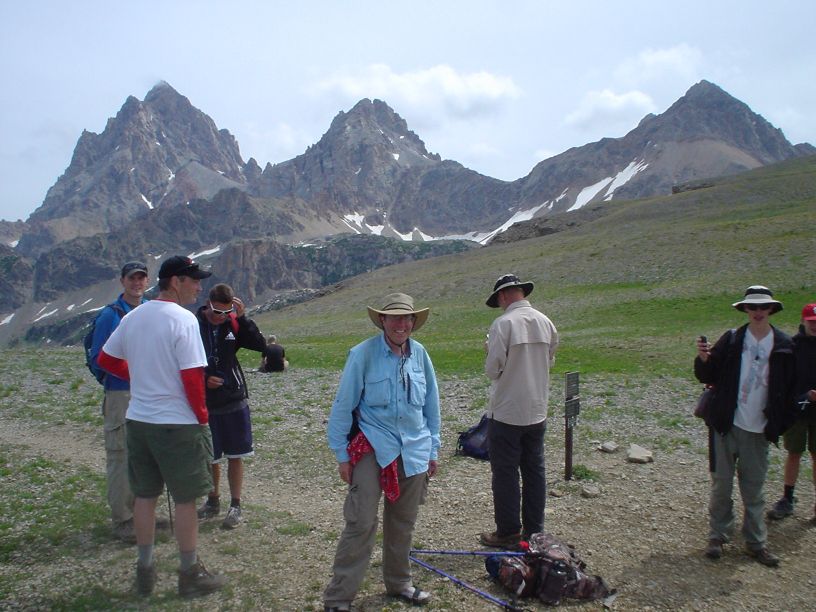
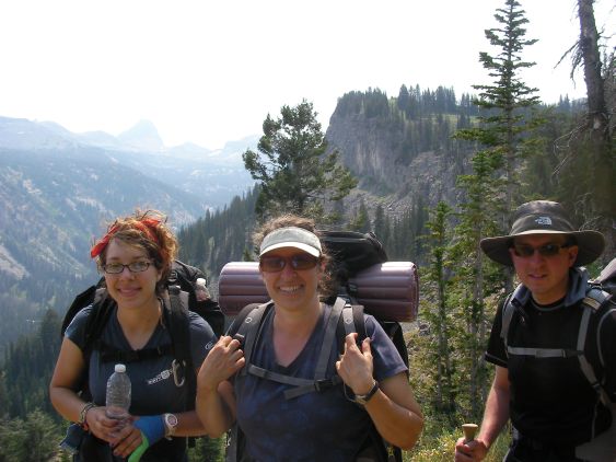
Here’s me at Hurricane pass with a scout troop:

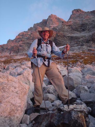
Then (way later) I go to the other side of the Middle Teton and start climbing it:

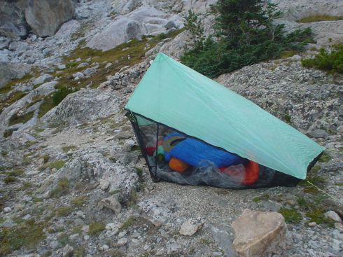
Here’s my Hexamid halfway up the Middle Teton:

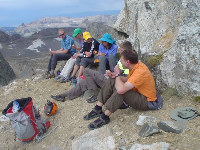
Here’s our hiking group taking a lunch break up the Middle Teton. Note most of us are in sandals.

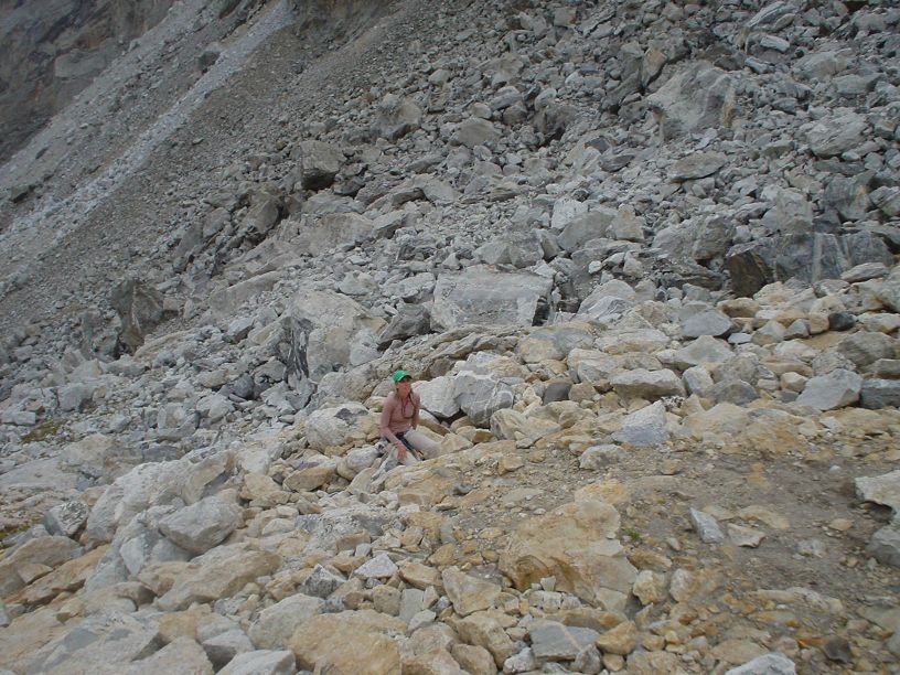
Here’s one of the hiking ladies looking up our Middle Teton Route. Mountaineering is a little trickier than staying on the Park trails. The rocks are bigger :) And in this shot she’s looking up at a rescue helicopter with a gurney hanging from it. Us men were helping a man who decided to shortcut a mile and slide down a Middle Teton glacier. It was ugly. We stayed with him for 2 hours until the helicopter arrived… That’s another story in itself.

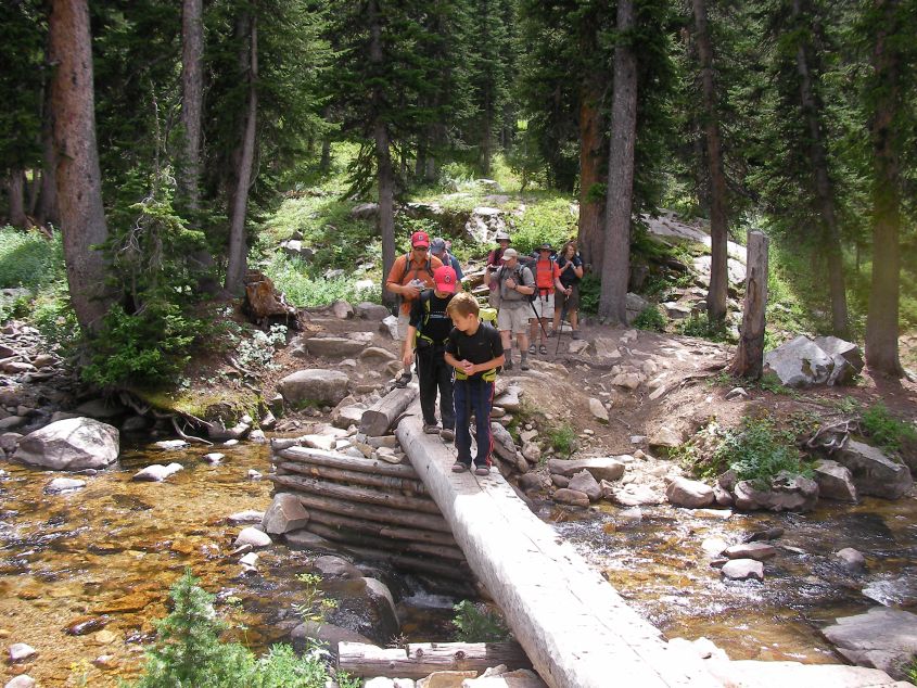
Here’s a Death Canyon shot with another group. The 2 little boys up front set the pace and they carried their own gear for 30 miles (a 3-day trip). Their dad carried the TT Rainshadow tent and alcy stove for all 3. This left the boys with an 8lb pack (including food and a pint of water).

If you time it right, I can probably backpack with you for a couple of days – and I’ll bring a couple of friends/family.

-Barry

-The Mountains were made for Tevas

Brian BPL Member
PostedMar 28, 2016 at 1:24 pm

Thank you for the help guys! Good points were definitely brought up.

My current thoughts are not leaning towards not reserving, and just showing up early like recommended. I will have some flexibility if I did end up needed to wait a day to get my desired route.

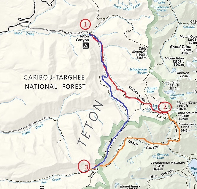
You mentioned good places to start on Y22. I am assuming you use other vehicles so you are not trekking back to your vehicle from where you end. I am guessing that would be current dilemma. Like the photo below (found online), only if I started at Coal Creek or Moose Creek.

Teton-Crest-Trail-map.jpg

Between Coal Creek and Moose Creak, what would be your desired start point? I have been told by many different people to get a camping spot on the shelf. Thank you for all the photos and explanation, that really helps!

Barry P BPL Member
PostedMar 30, 2016 at 1:06 pm

ā€œI am assuming you use other vehicles so you are not trekking back to your vehicle from where you endā€¦ā€

I/we have done it both ways.Ā  We leave a car at the ending point. And you need at least 2 cars to do this. Or you can try a taxi service (which I have never tried). Most of the time I/we just do a loop; park at one place and do a loop. For example, Park at South Jenny Lake and do a big loop from there. Or if you don’t want to pay any entrance fees, our group likes doing this route:

We park at Teton Canyon (1). First night camp in Alaska Basin (2). The next day we go into the park through Basin Trail and Death Canyon and camp along Fox Creek (3). The 3<sup>rd</sup> day we head along the ā€˜blue’ route back to (1). Ā Where the ā€˜blue’ meets the ā€˜red’ is called ā€˜devil’s scaircase’, I mean Staircase. That’s a place where poles are very helpful. And even though you’re backtracking the last 3 miles, it looks way different going down than going up. In fact a lot of places are like that; going up looks and feels so much different than going down. It’s like you’re on a totally different trail.

ā€œBetween Coal Creek and Moose Creak, what would be your desired start point?ā€ Well Moose Creek parking is off the main road. For longer parking I’d feel better at Moose Creek.

ā€œI have been told by many different people to get a camping spot on the shelf.Ā ā€ Yes. Those are gorgeous areas. I think the area they’re talking about is along the Teton Crest Trail in the blue area above (within the NP). That’s a very popular area and it appears to fill up every night in the summer (from what I have seen). So there may be 60% open spots for walkins but you need to get that reservation that morning at the ranger station — and pay the fee of course. And a couple of those spots have nice springs for water where we always fill — though I don’t see it on the map.

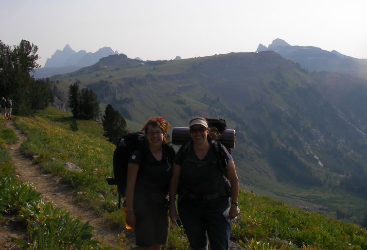
Here’s a pic of my cousins on that shelf; and the drop to the right is Death Canyon. You can see some of the Tetons in the background.

Here’s a pick of my brother and cousins at the top of Devil’s Staircase — about ready to descend; practically straight down 1000’.

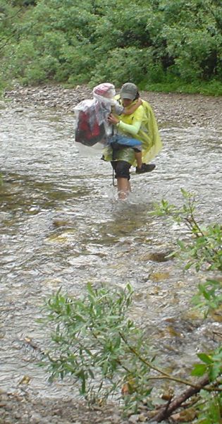
Here’s a pic of my daughter-in-law carrying my grandson across Moose Creek – in the rain. This is why I love sandal backpacking.

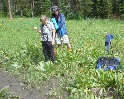
A down pour along a Teton trail causes a lot of flooding. It was easier to walk in the flowers vs the deep muddy trails. Here my bother and his son– stop and take off rain coats/ponchos.

Keep on hiking,

-Barry

-The Tetons were made for Tevas

Viewing 16 posts - 1 through 16 (of 16 total)
Loading...