Manfred,
Thank you for sharing your adventure with us!
Topic
Become a member to post in the forums.
Manfred,
Thank you for sharing your adventure with us!
Now that my children are all adults, new additional backpacking opportunities are presenting themselves from time to time. After spending Thanksgiving with all my children at home, I found myself with a free week around Christmas that was a perfect opportunity to pursue an idea that had crossed my mind several times over the years. Visit every spring in Henry W. Coe State Park.
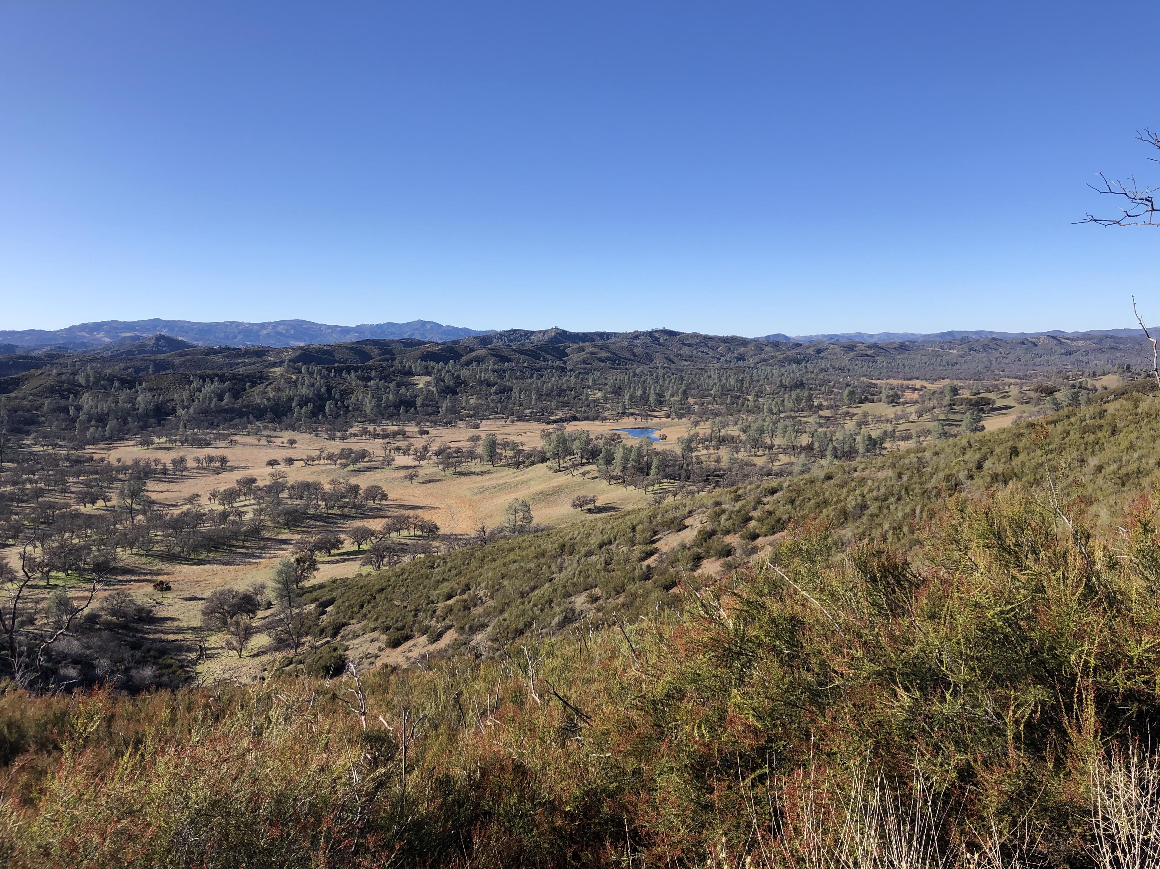
Henry W. Coe State Park is the largest State Park in Northern California, with over 87,000 acres across Santa Clara County and Stanislaus County. The ridges in the park reach up to 3,500 ft and afford great views that include sights of the Sierra Nevada.
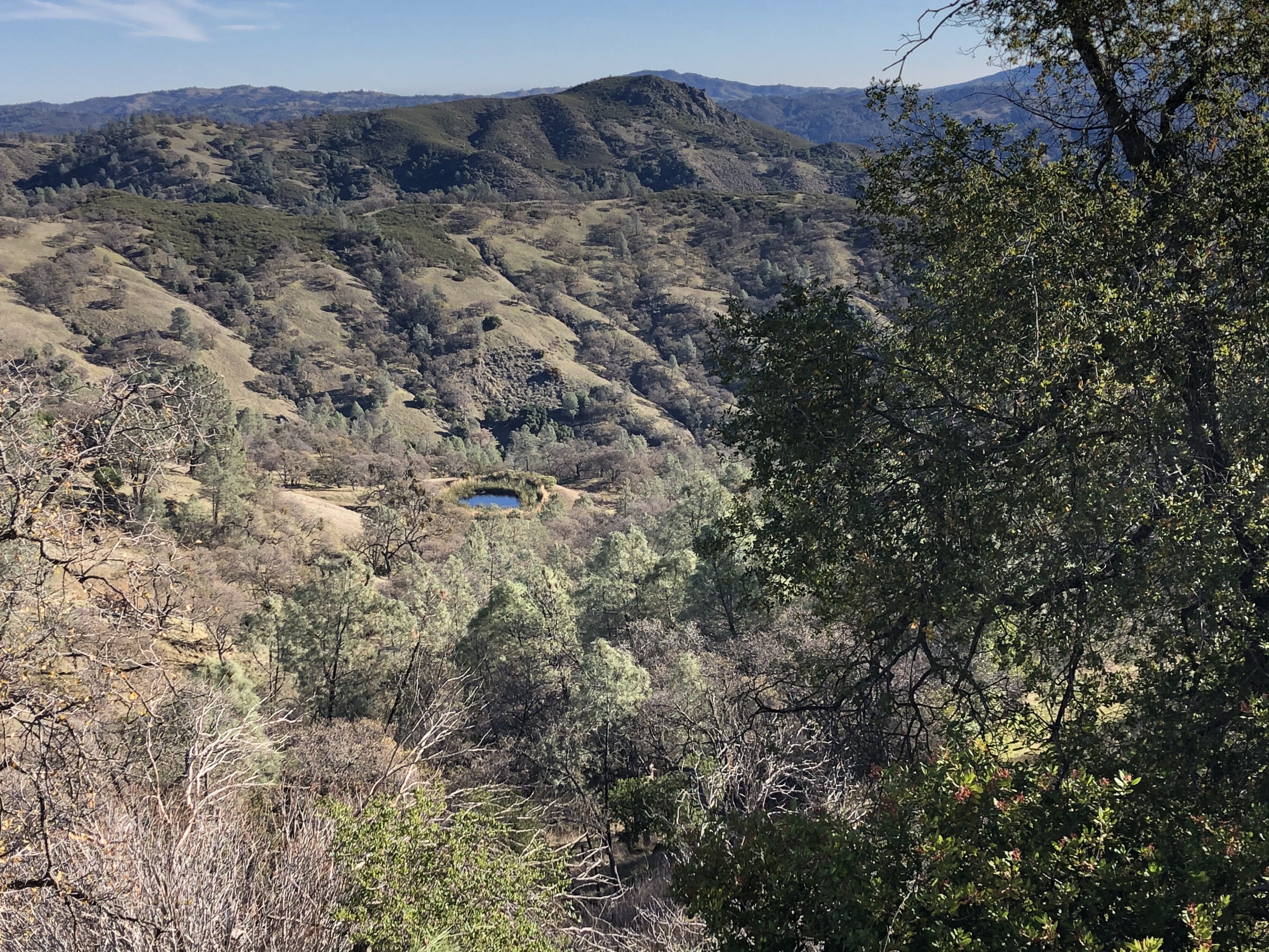
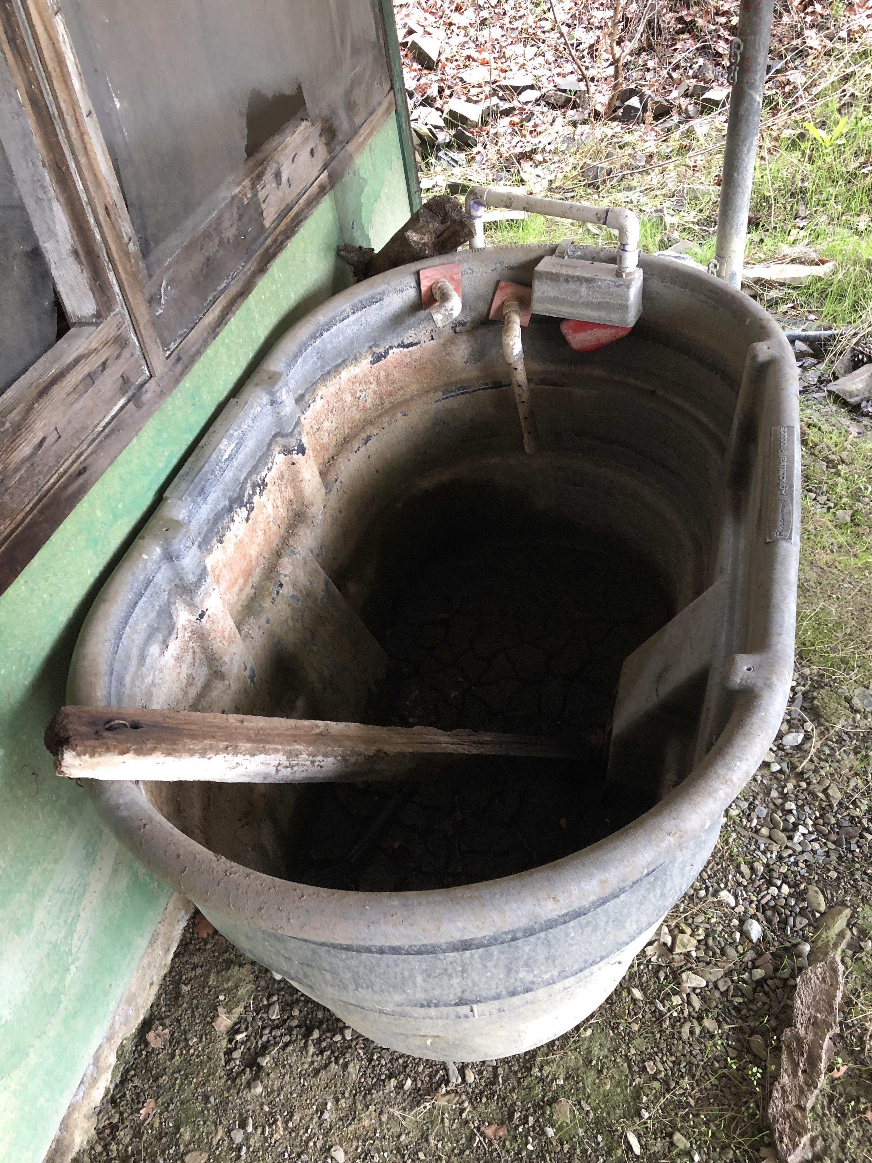
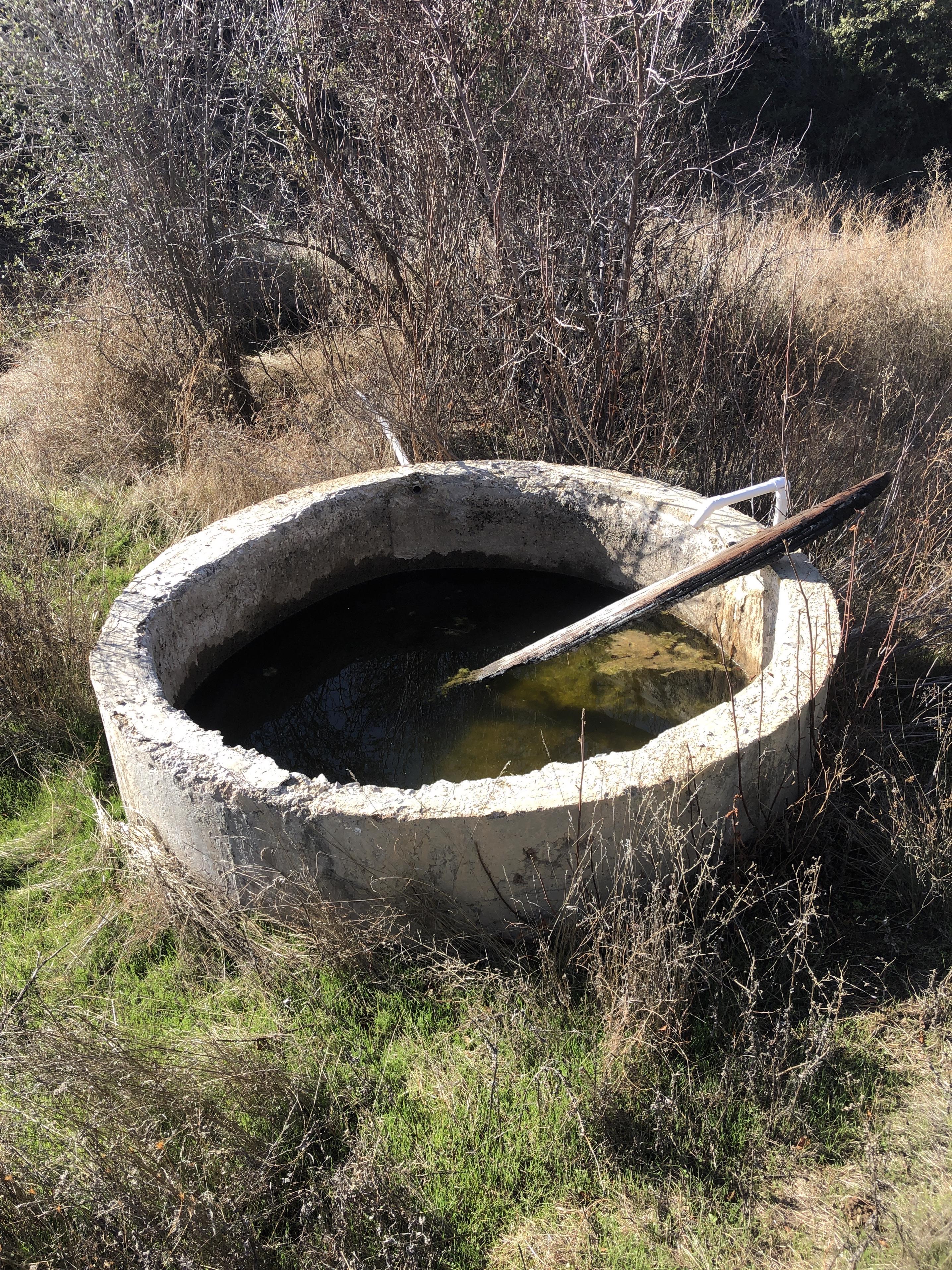
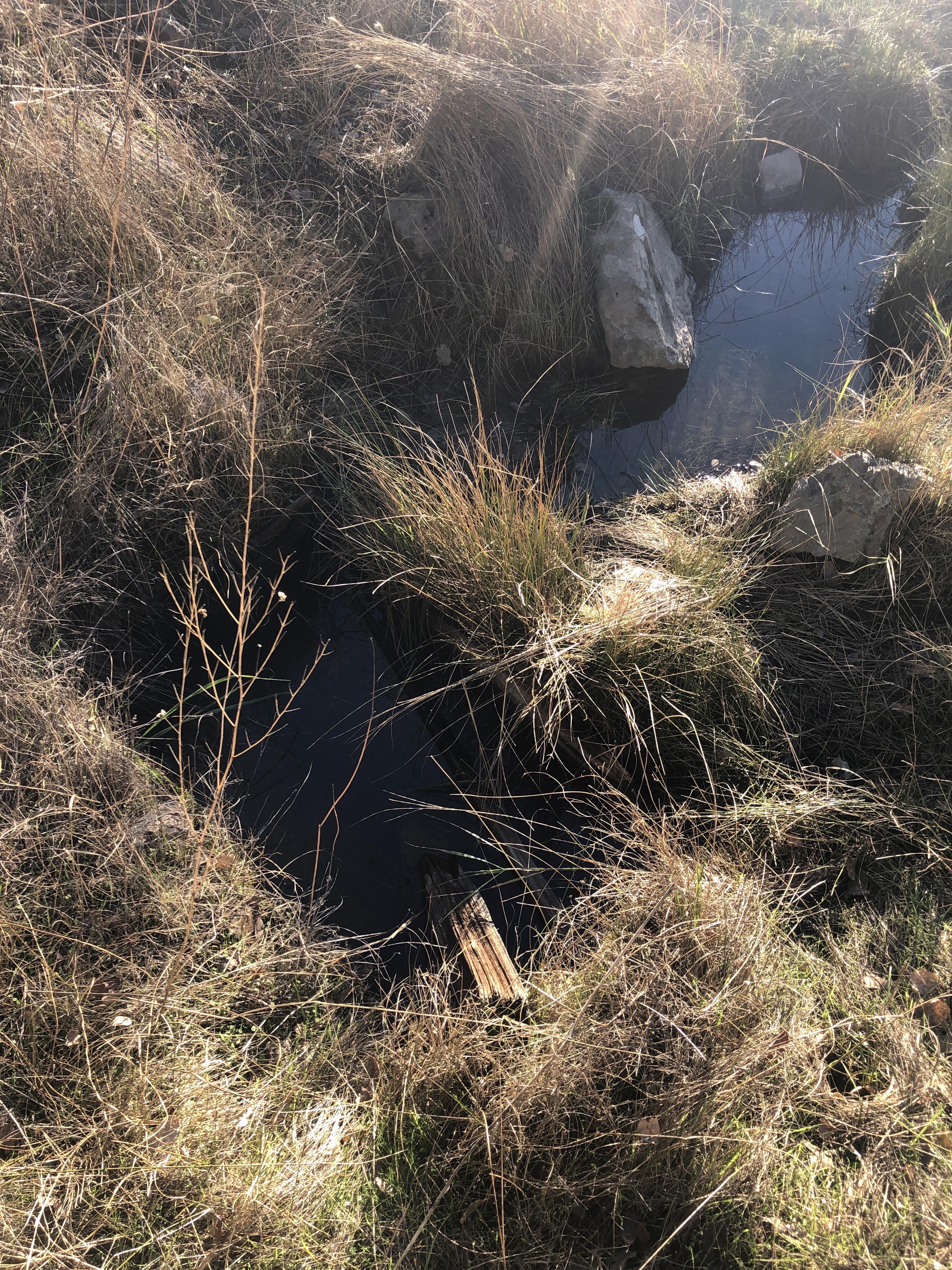
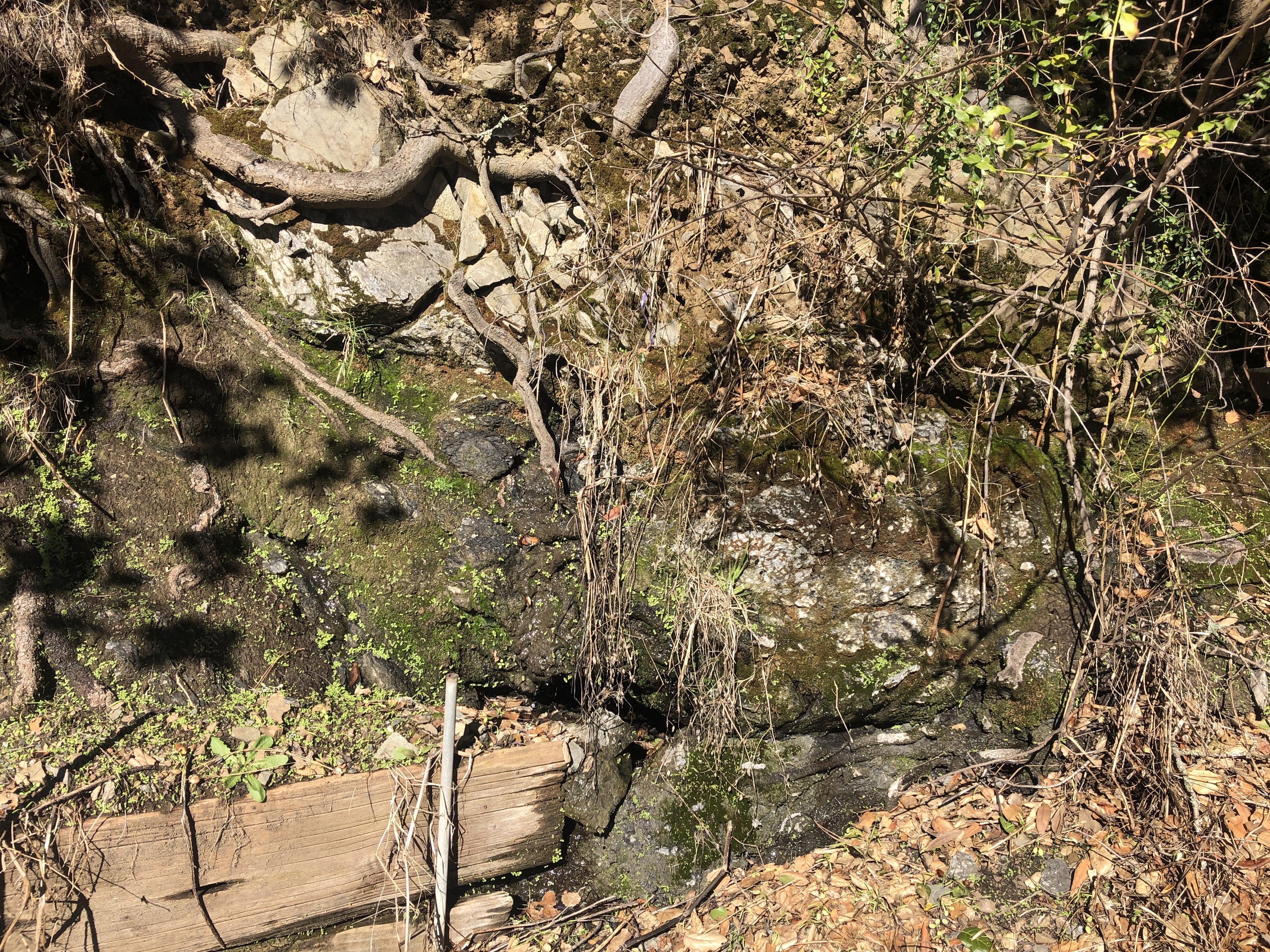
Before it became a state park, the land was used for cattle ranching. As water is scarce during many months of the year, the ranchers used many means to provide water. Some creeks were dammed to create lakes like Mississippi Lake, Coit Lake and Kelly Lake. Ponds were built to catch runoff from the hills. Springs were developed with catch basins or spring boxes and troughs. Some of these springs are maintained even today by rangers and a group of volunteers who do wonderful work at Henry W. Coe State Park. They maintain a website with the status of these springs that contains 76 entries. When planning my trip to all these springs, I noticed on the park map additional spring symbols. Some with interesting names like Dry Tree Spring or Sada’s Soda Spring and others without name. There were altogether 40 additional springs, I could find between the map by the park association and old USGS maps. Many of them in the ‘middle of nowhere’ that seemed hard to reach due to brush or steepness of terrain or both. Visiting these 116 springs across 87,000 acres during my week of vacation looked like an opportunity for a splendid adventure right in my backyard.
My first rough plan had me walk over 150 miles and climb around 40,000 ft. That seemed like a perfect fit. By including both weekends around my vacation, I planned for 9 days.
The following photos give only the slightest glimpse of my experience. An experience that ranged from wildlife sighting of deer, quails, pigs, bobcats, hawks and a majestic tule elk with enormous antlers to fantastic views of the valleys and ridges – especially at sunrise and sunset. An experience that included hour-long bushwhacking though thick chamise and manzanita brush to a seemingly impossible-to-reach spot on the map to the deep satisfaction of knowing to have found the needle in the haystack when there where remnants of a developed spring at that point.
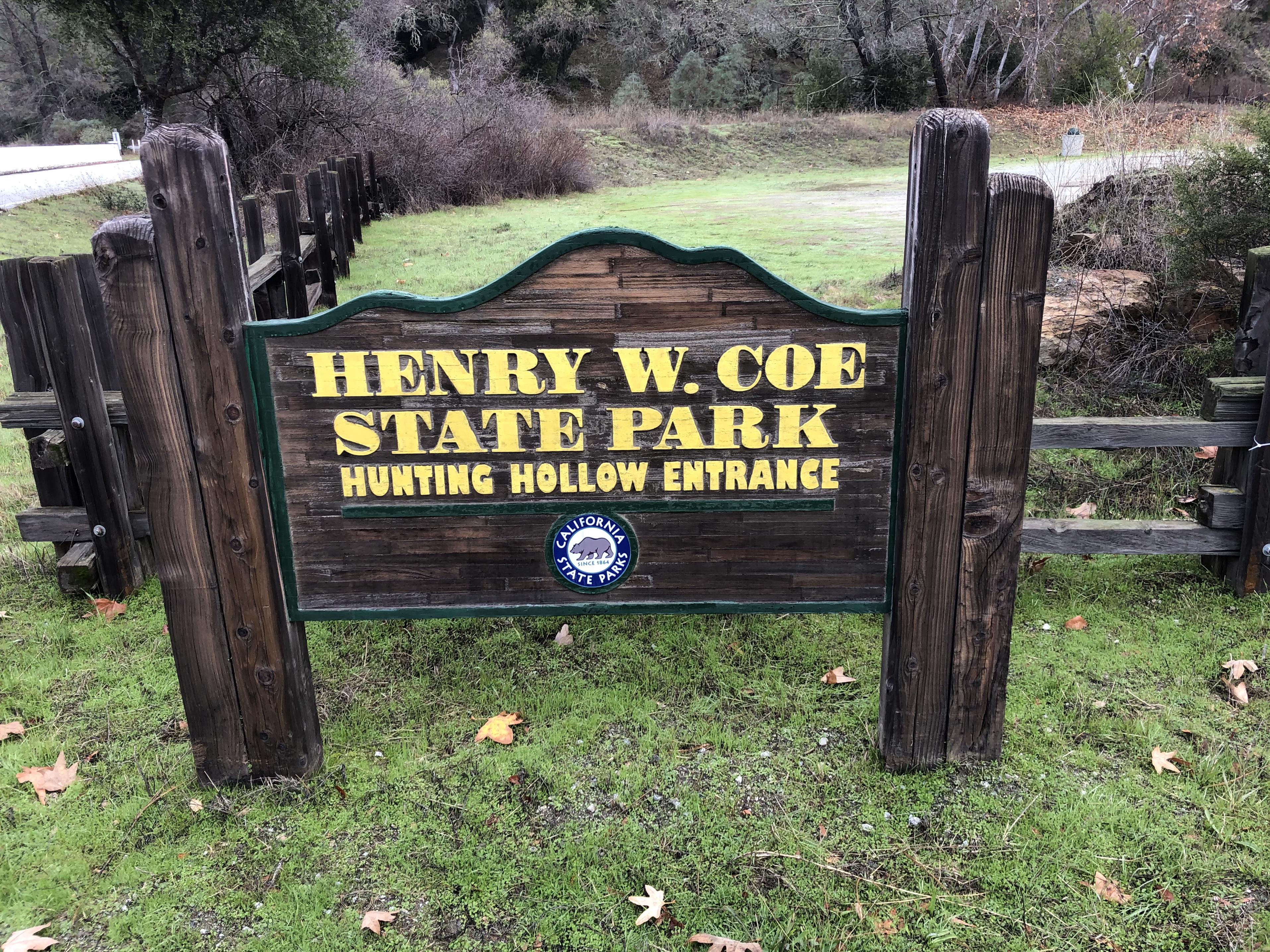 Picture 1: I visited all three entrances to the park during my trip. Headquarter, Hunting Hollow and Dowdy Ranch
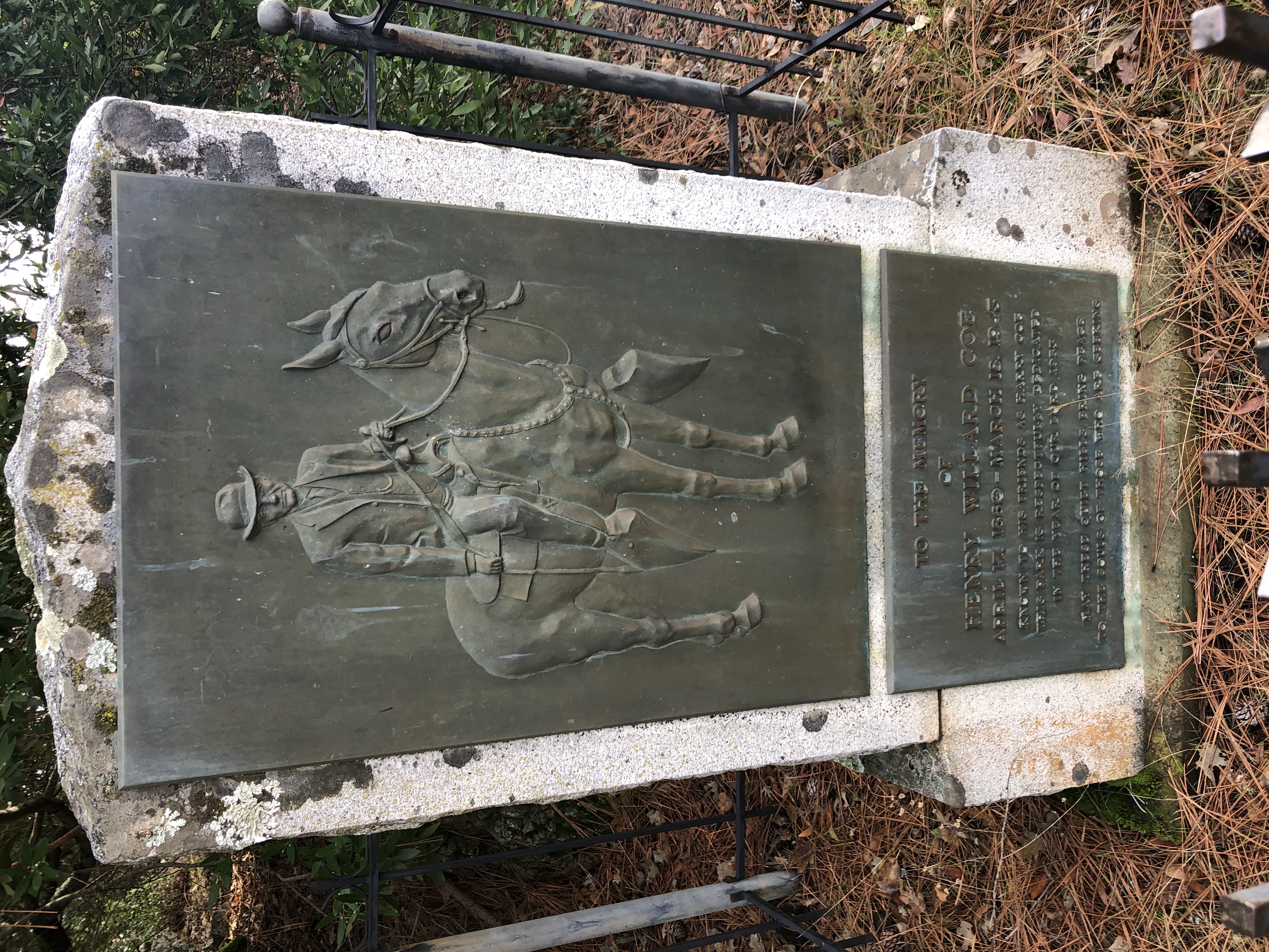 Picture 2: Henry W. Coe Monument near HQ entrance. “May these quiet hills bring peace to the souls of those who are seeking”
 Picture 3: Old restroom at “Mexican Flat” an old campsite that has long fallen out of use
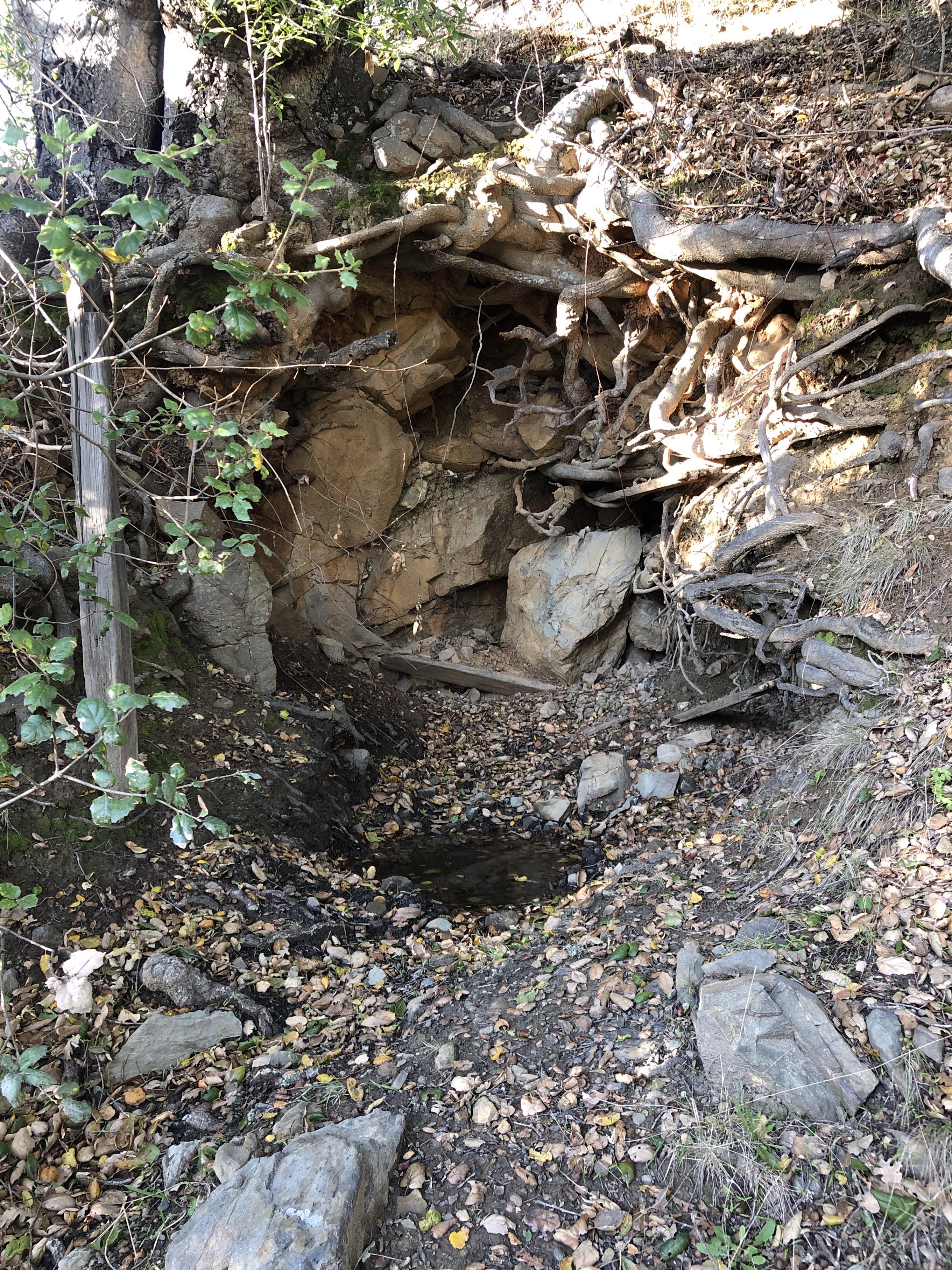
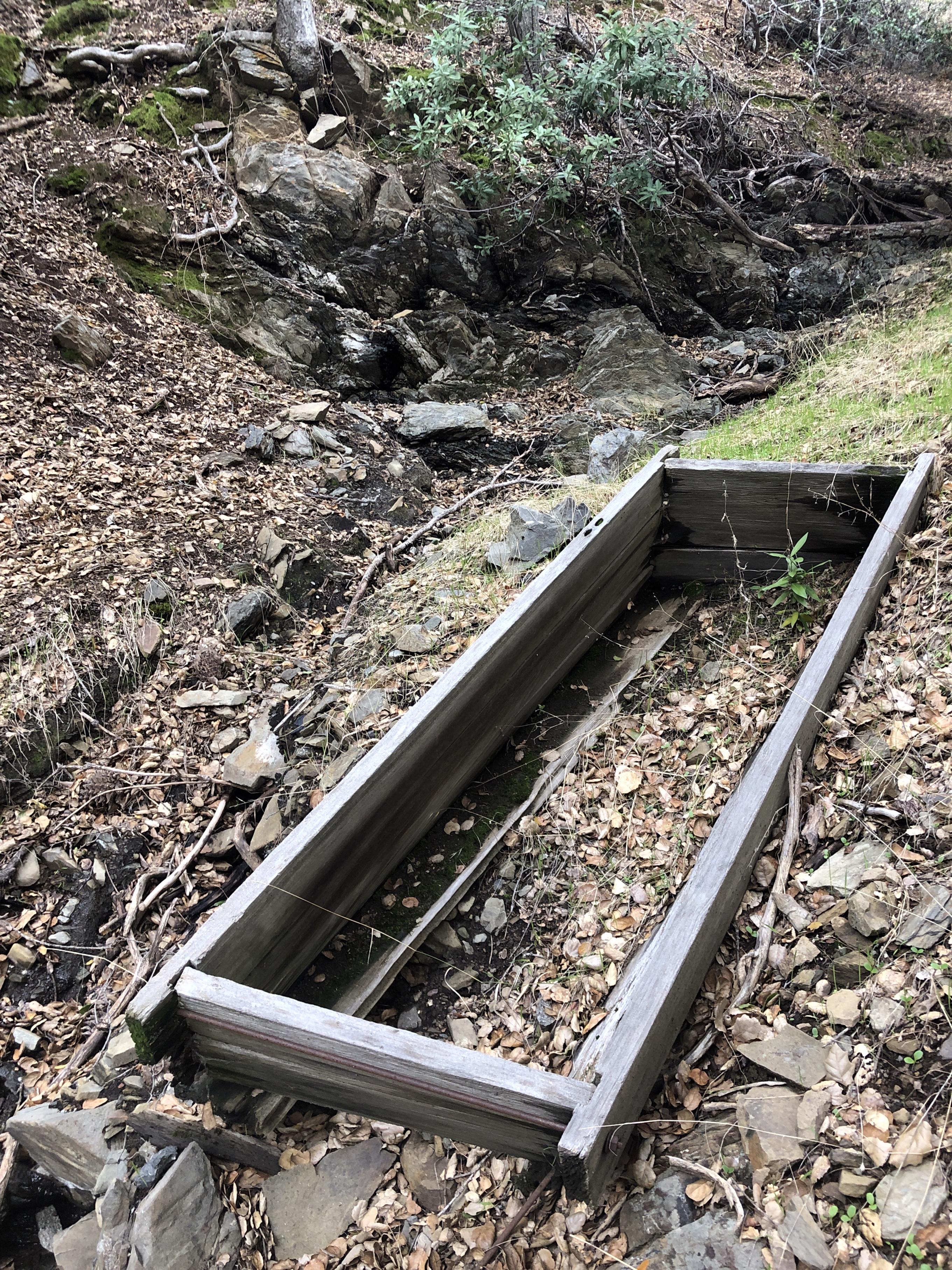 Picture 4: Unnamed Spring
 Picture 5: Frog Pond
 Picture 6: Bridal Veil Spring
 Picture 7: Unnamed spring
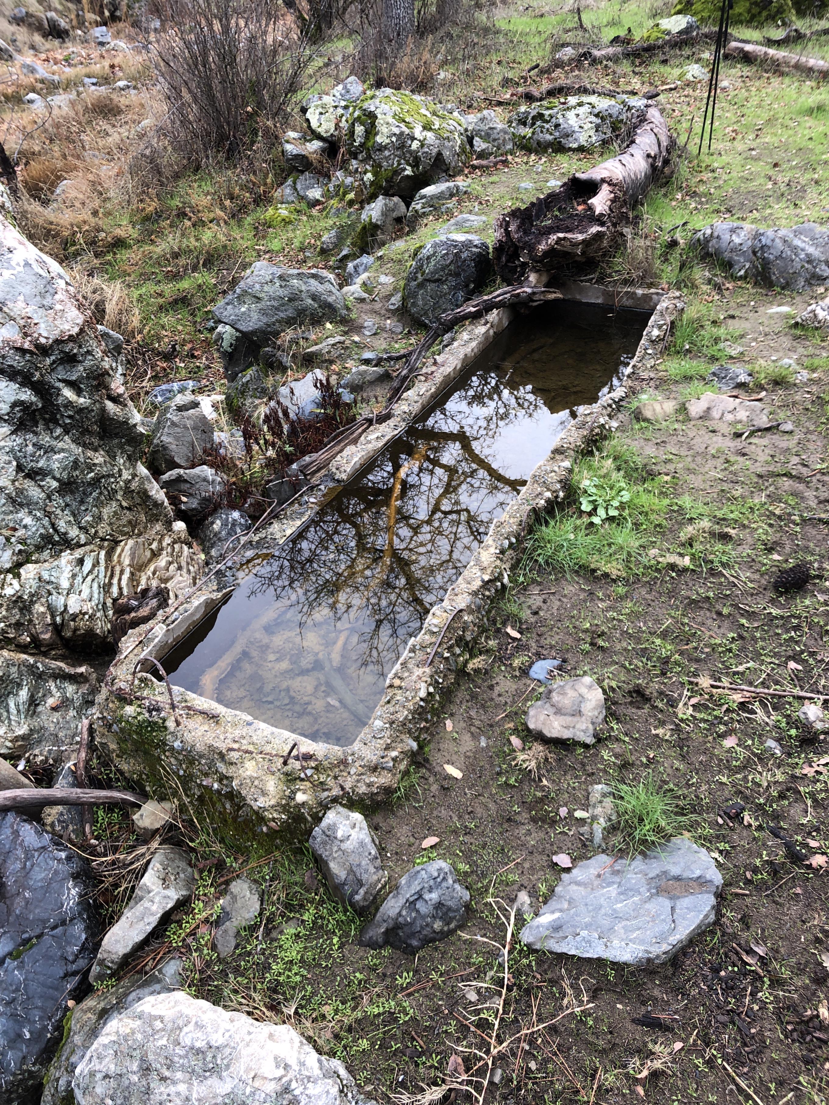
 Picture 8: Tin Cup Spring
 Picture 9: Madrone Soda Springs
 Picture 10: Rabbit Spring
 Picture 11: Upper Cullen Spring
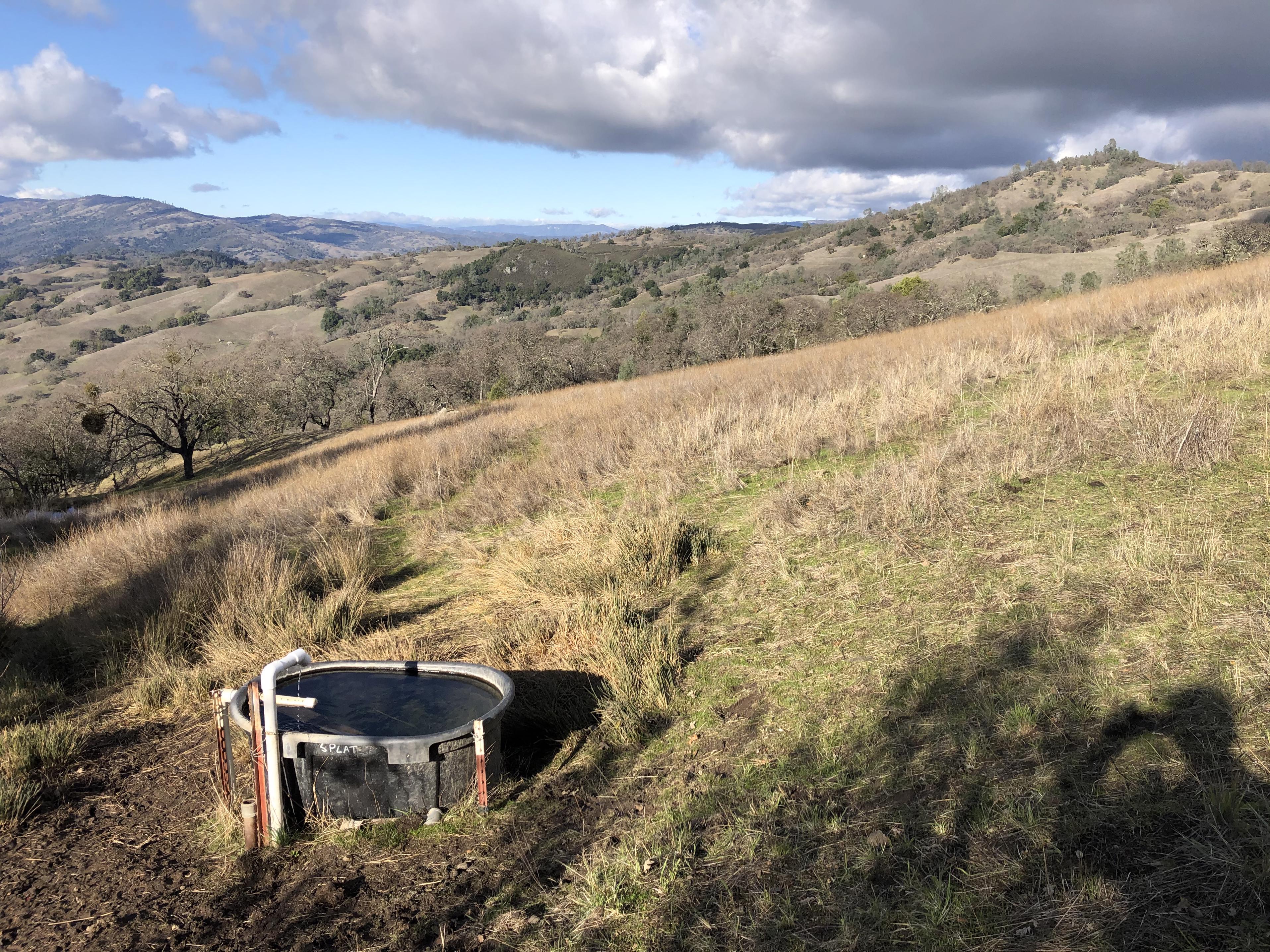
 Picture 12: Brem Horse Camp Spring
 Picture 13: James Spring
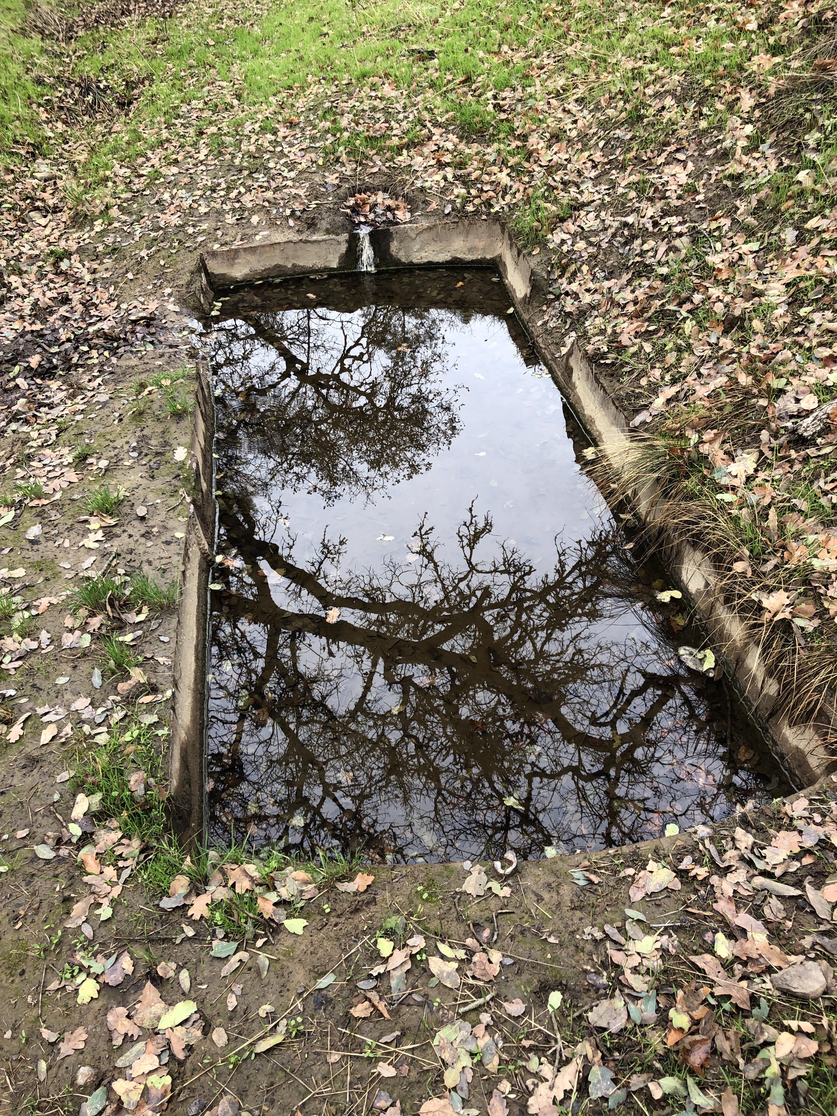
 Picture 14: Elderberry Spring – one of the many still maintained springs
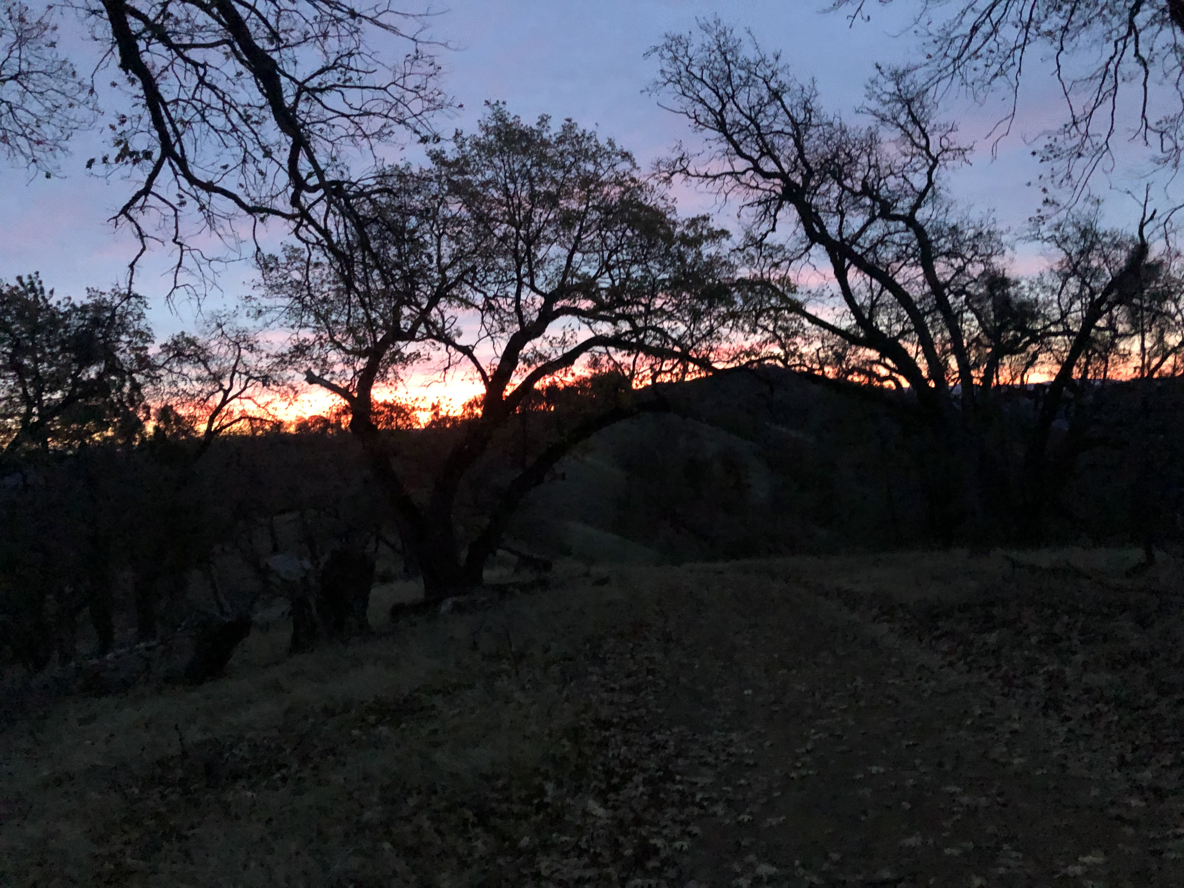 Picture 15: Sunrise on Rockhouse Ridge
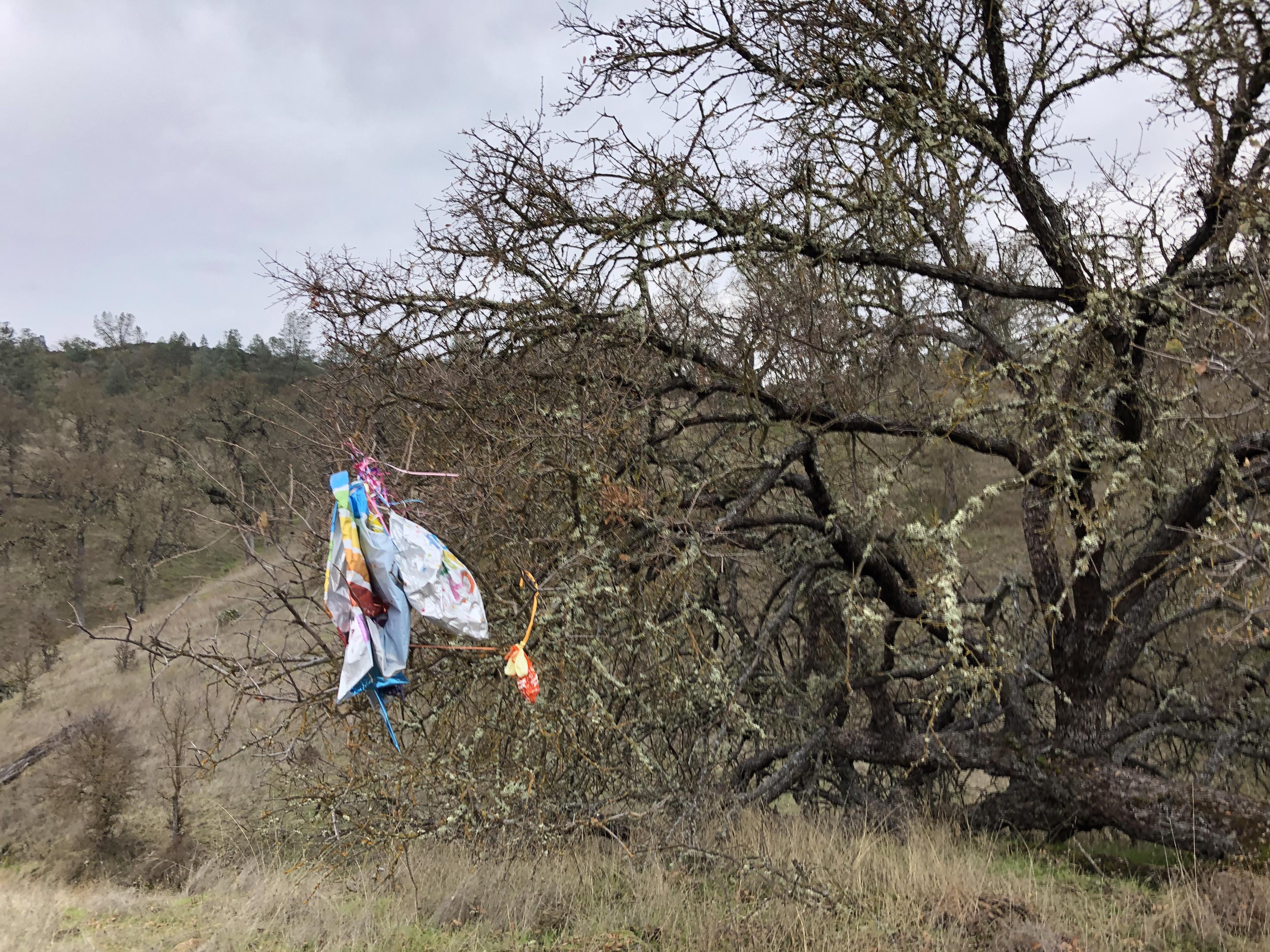
 Picture 16: One of 36 balloons I picked up on that trip – and I saw many more hanging in the trees. May be people would reconsider buying helium balloons if the would see what they do to the wilderness.
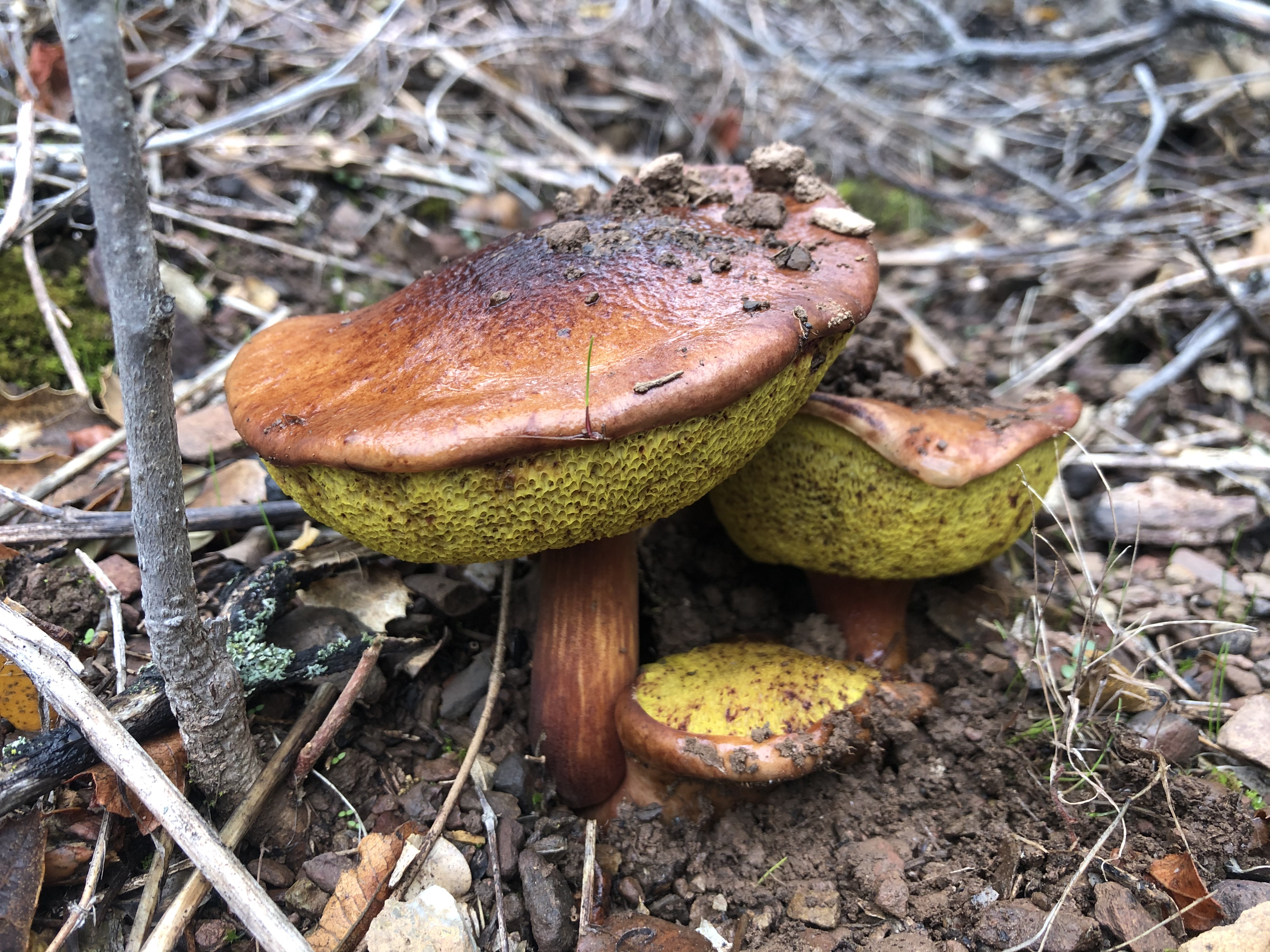 Picture 17: Mushrooms
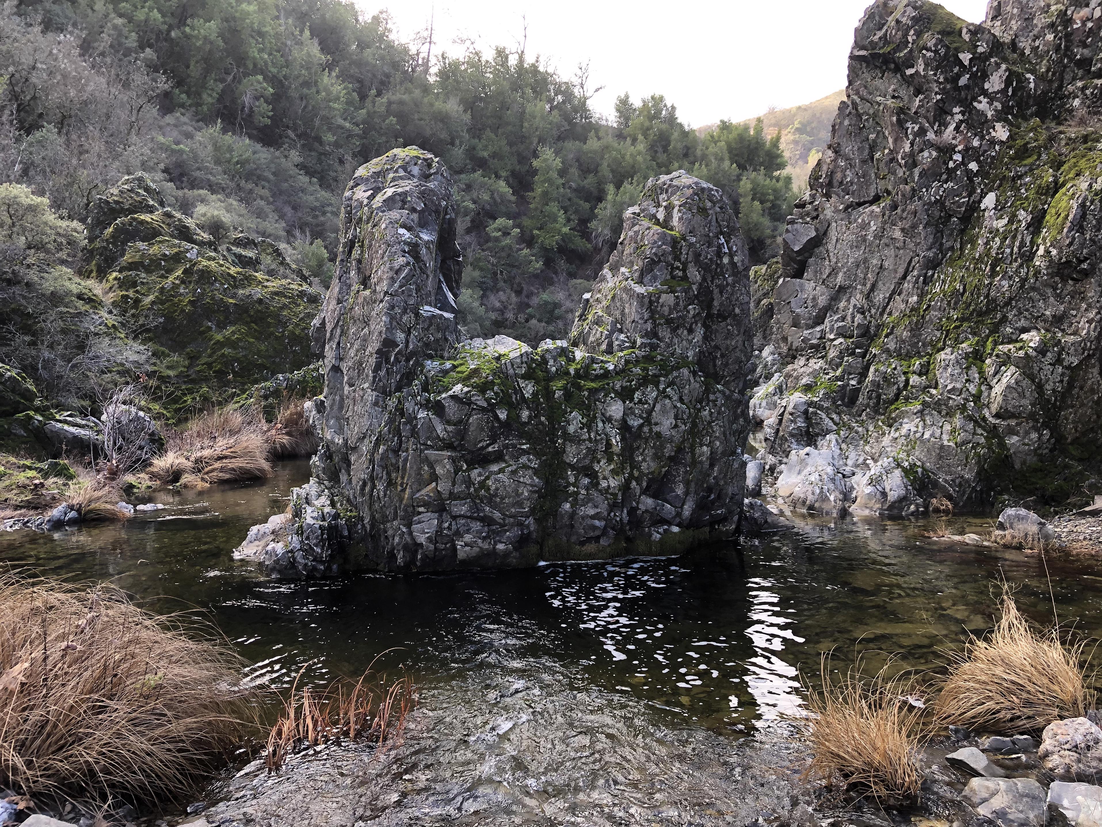 Picture 18: The Narrows – hiking knee-deep in the creek
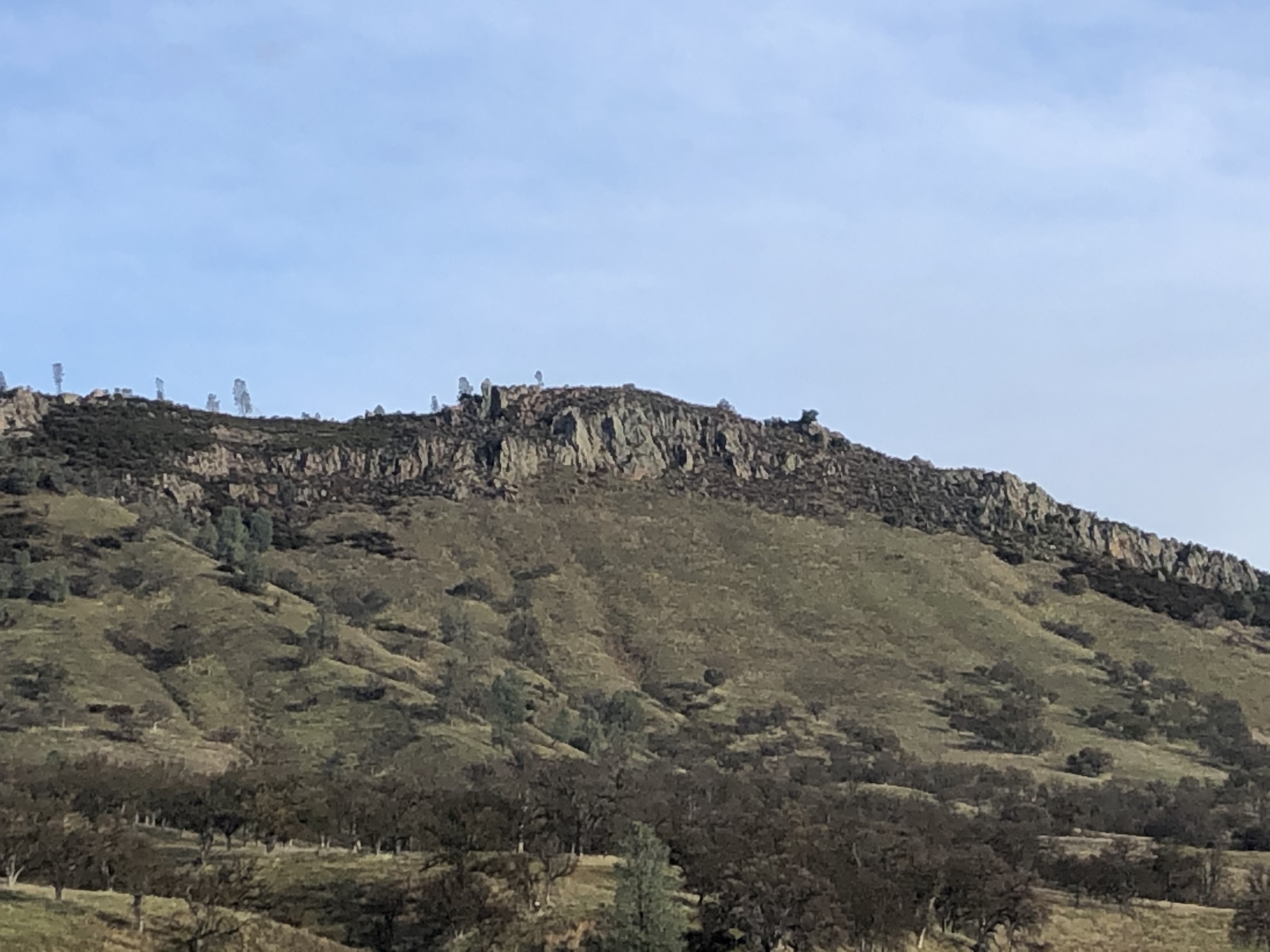
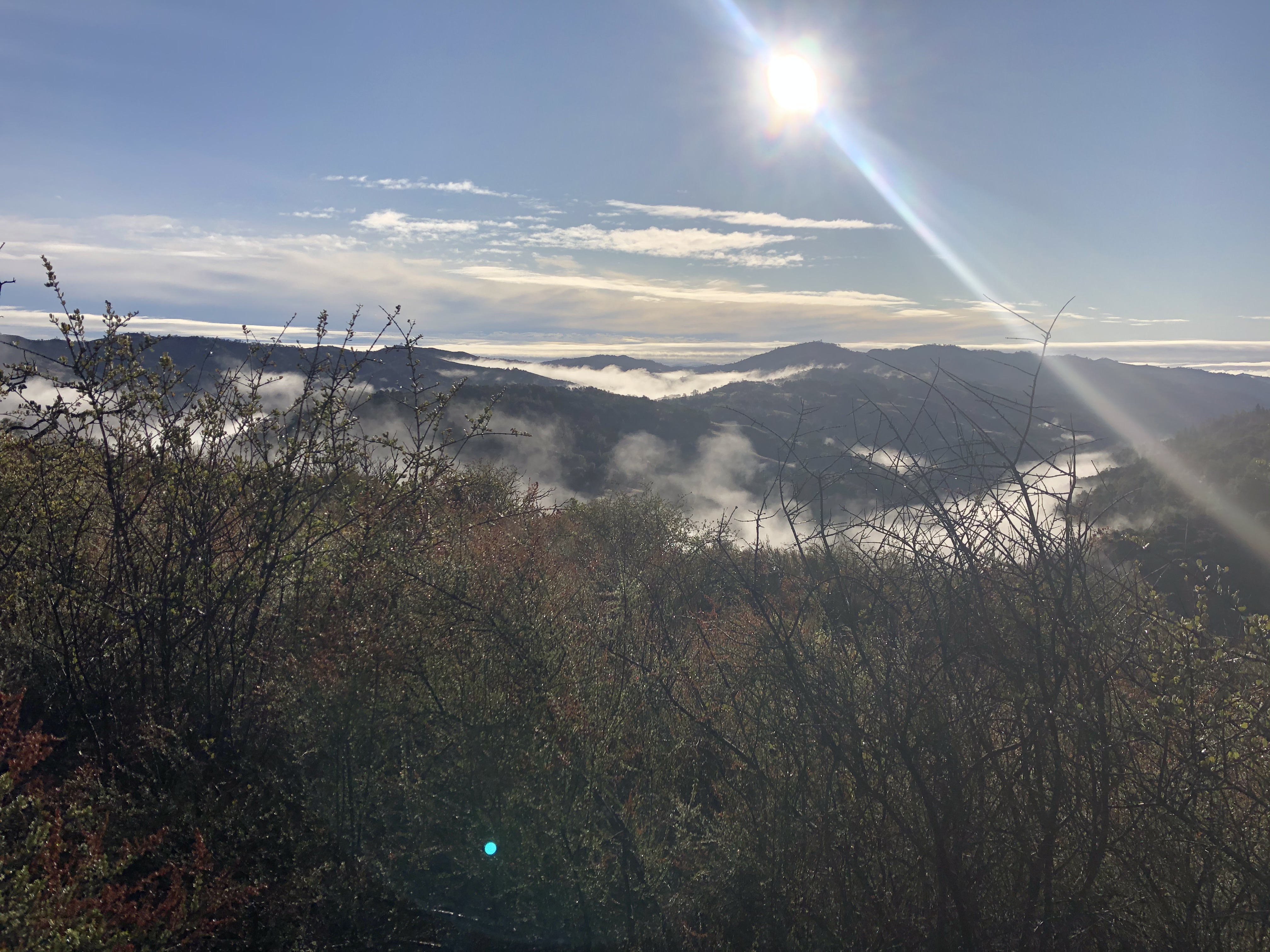 Picture 19: View across the ridges
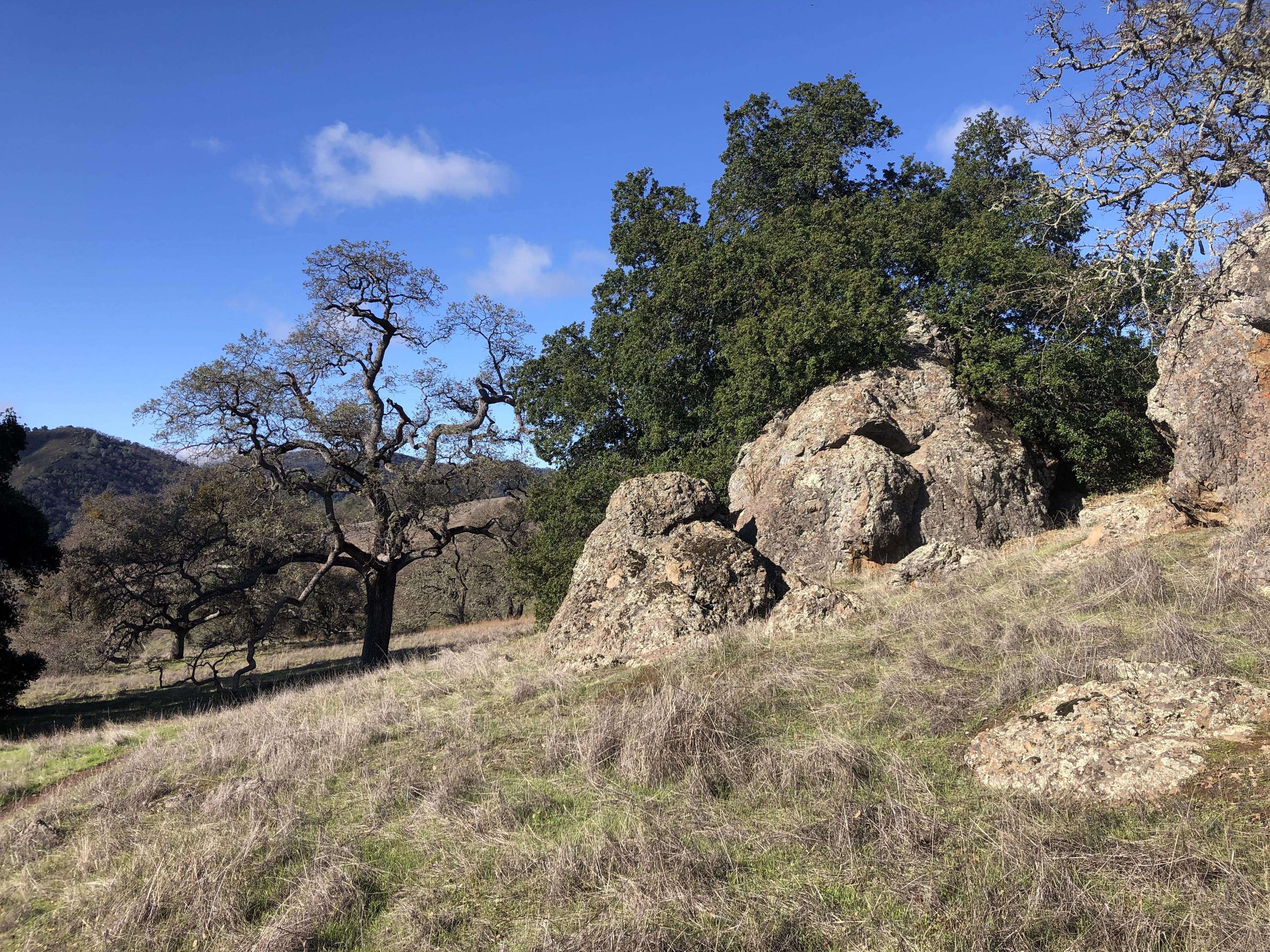 Picture 20: Grass, trees, rocks – a perfect combination
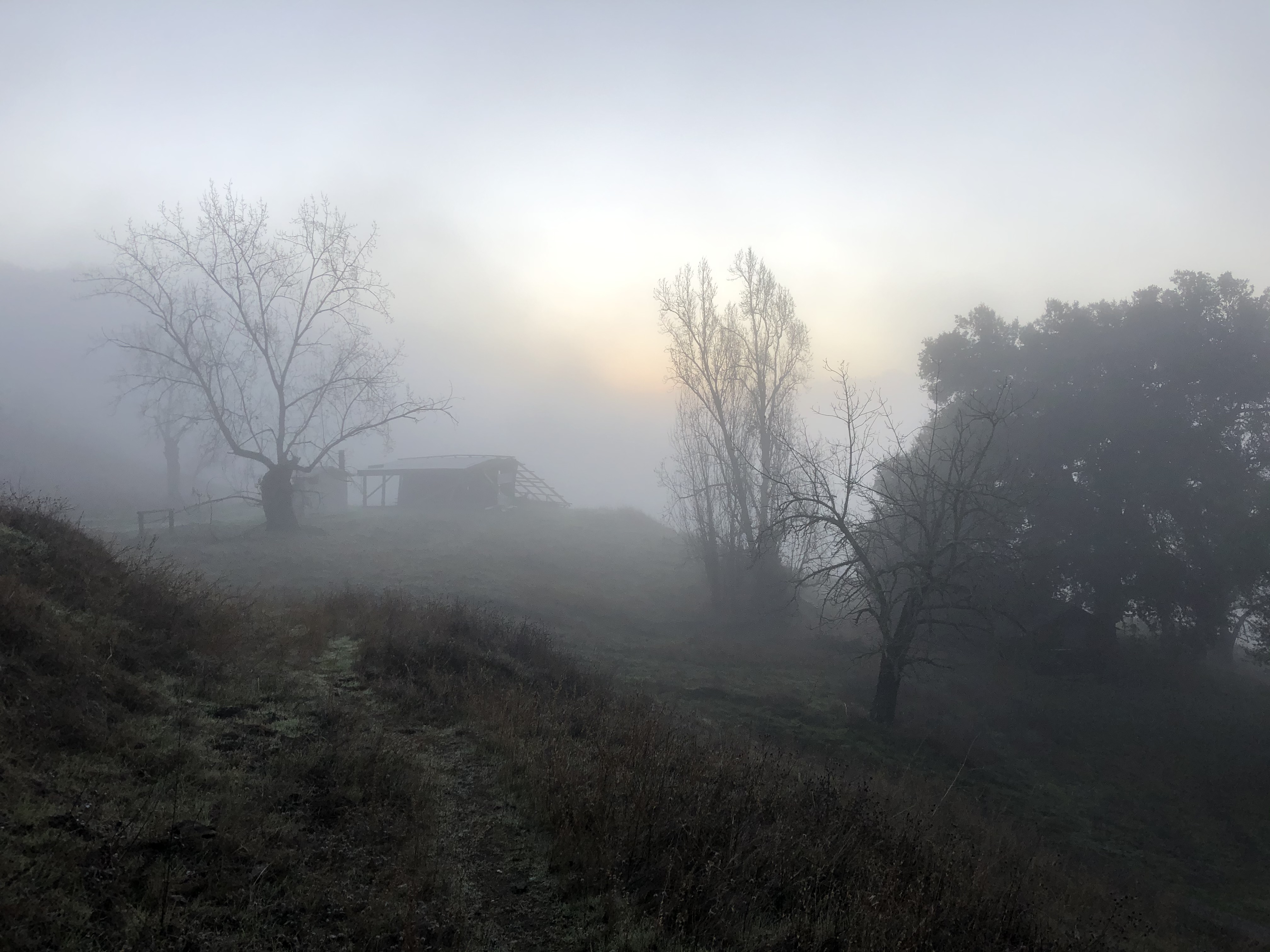 Picture 21: Willson Camp at Sunrise
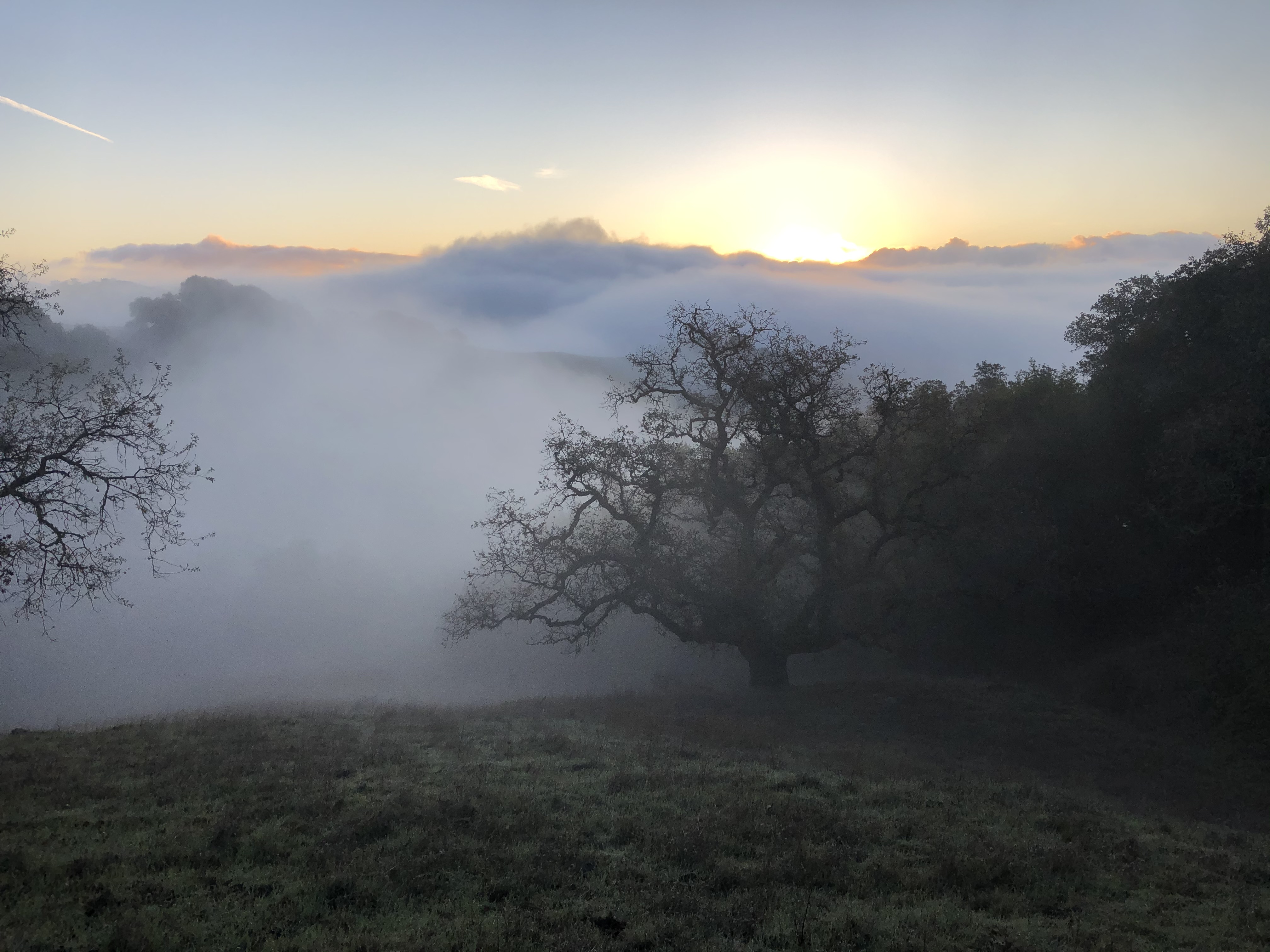 Picture 22: Sunrise on Bowl Trail
 Picture 23: Sunrise along Bowl Trail
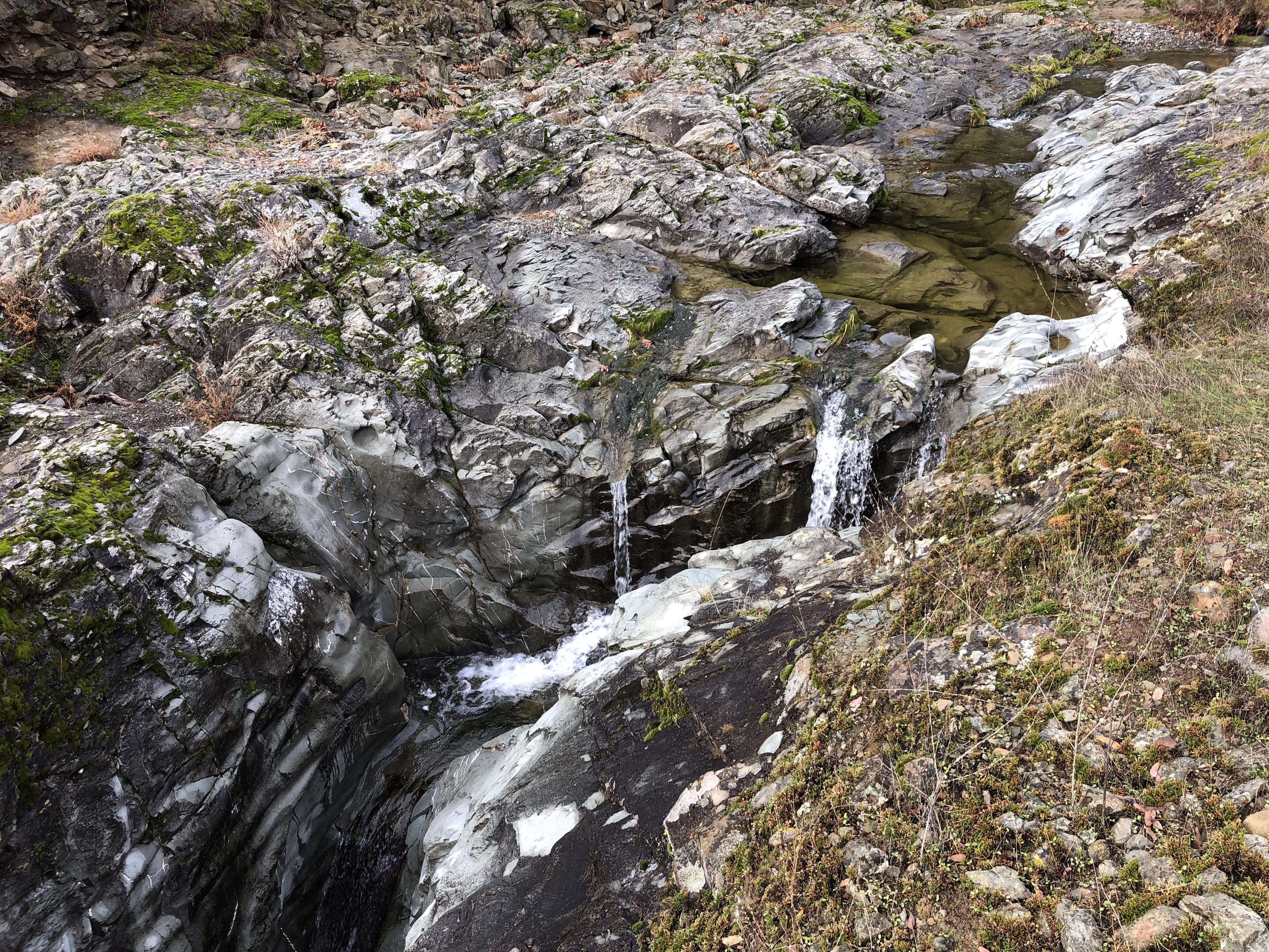 Picture 24: Hole-in-the-Rock Waterfall
 Picture 25: December 25 – Christmas tree decoration saying, “Oh Happy Day”. This balloon came from Lodi, roughly 100 miles away.
 Picture 26: Rooster Comb
 Picture 27: Paradise is lost -– the dam at Paradise Lake broke
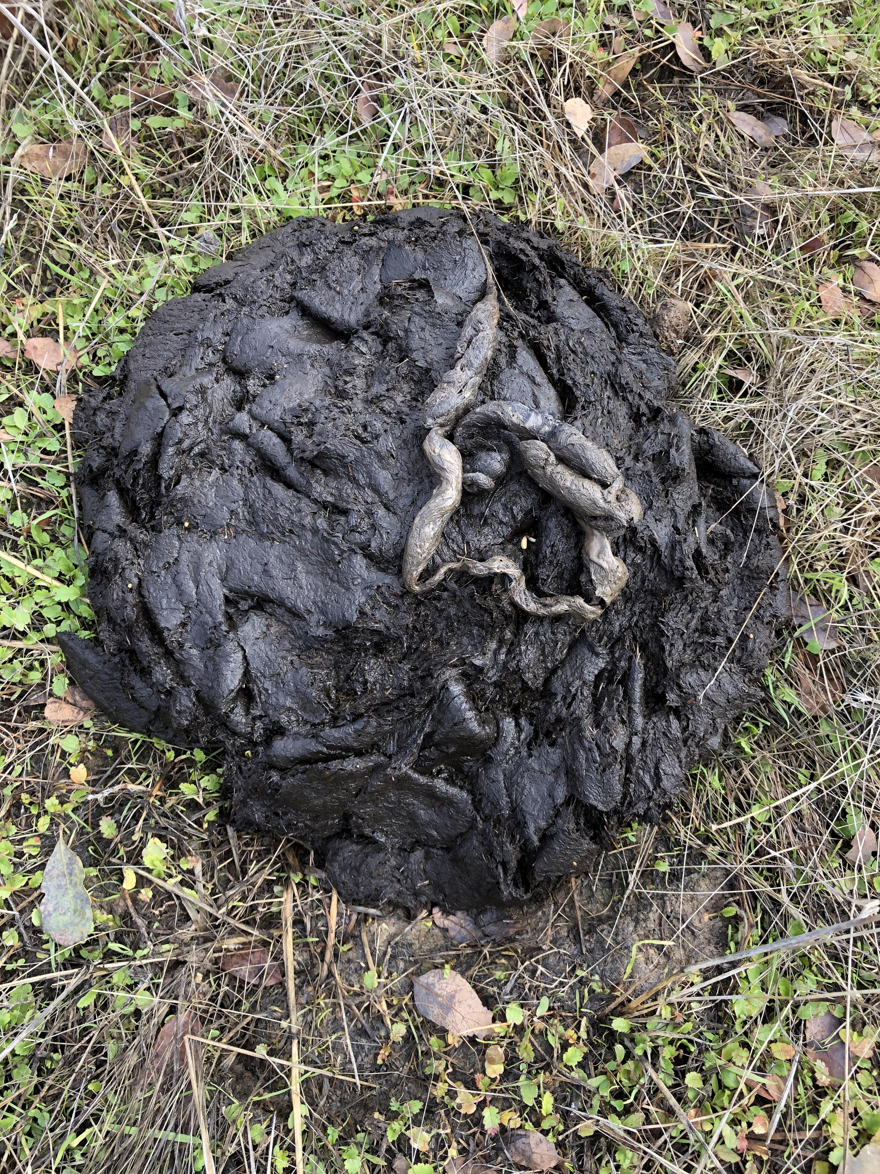 Picture 28: I shit on your shit 😊
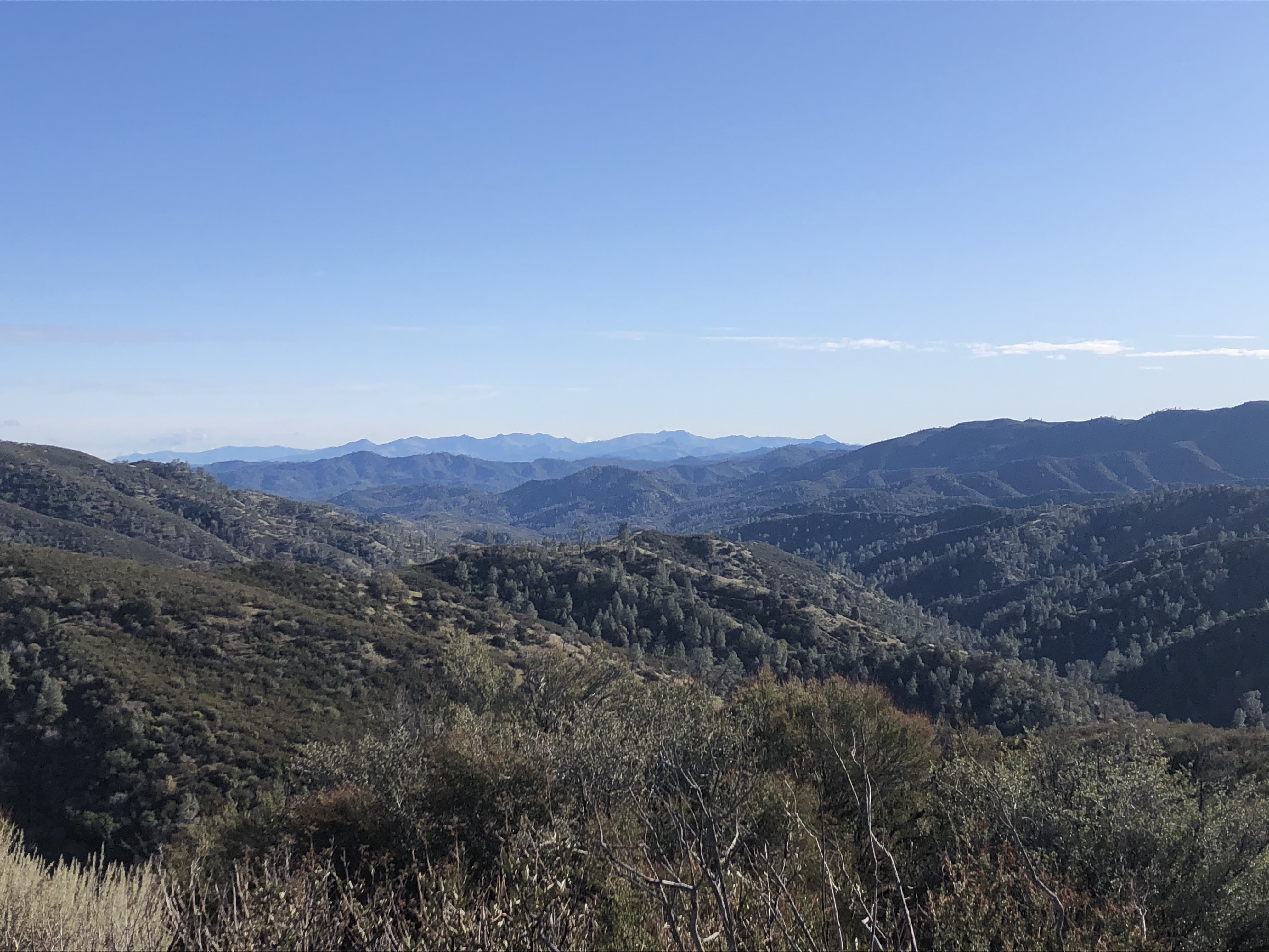 Picture 29: Views everywhere
 Picture 30: San Antonio Valley
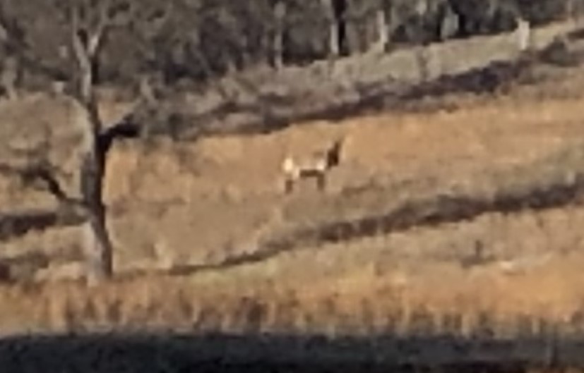 Picture 31: Tule elk with impressive antlers. This is the one time where I wished for a real camera instead of my iPhone.
 Picture 32: Sunrise at Mississippi Ridge
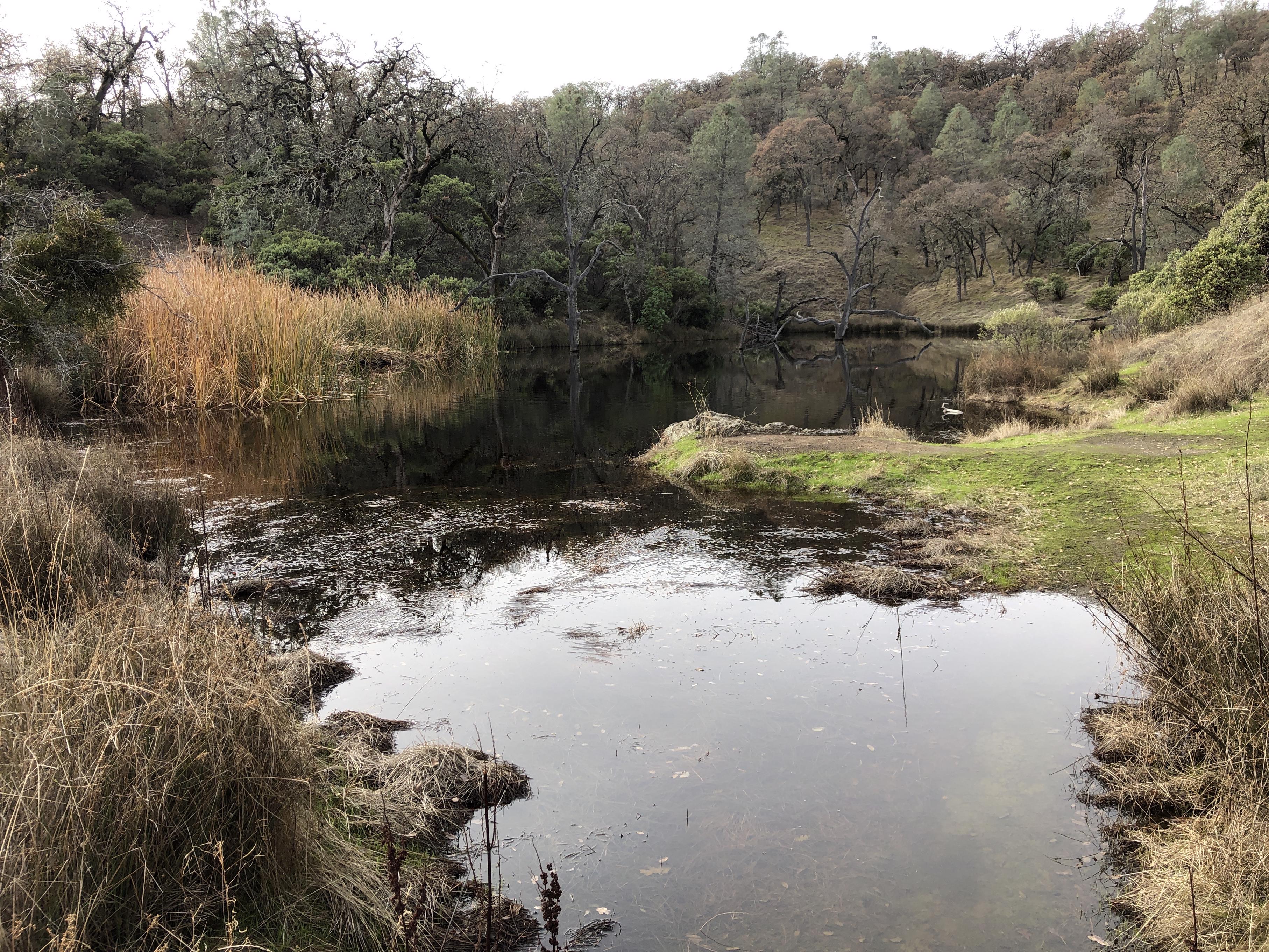
 Picture 33: Wood Duck Pond
While these pictures can provide only a small glimpse into the experience, they nevertheless convey what is so fittingly written on the Henry W. Coe monument: “May these quiet hills bring peace to the souls of those who are seeking”
Thinking a little out of the box – visiting all 116 locations with spring symbols on the map – resulted in a wonderful, quiet, peaceful backpacking trek. Neither the shortest days of the year nor the occasional rain created any obstacles, but enriched the trip with wonderful sights, sunrises and sunsets, fog in the valley and lots of time to look at the stars at night.
Happy Holidays and a Healthy New Year to Everyone!
Manfred
Happy New Year Manfred. Thanks for sharing here. Nice to see plenty of water.
BPLBO
Thank you, Manfred! What a wonderful trip that must have been. Love the pictures – they evoke the essence of that place so well. I still treasure my memories of the Mississippi Lake trip several years ago.
Happy New Year Debbie!
Yes, I had to think about our trip too, when I took a lunch break at the very same spot at Mississippi Lake where we camped. This time I didn’t bring my packraft and had to eat Moutain House instead of fresh bass.
Will you come to the GGG? It has been a time since I had some of your brownies …
Manfred
Thanks for the report Manfred – an inspiration to get out and enjoy the areas right around us.
Happy New Year Ken!
What is going on with the GGG? Right now mid-March has been proposed and saw your reply. Will you be involved at any level?
Manfred
BPLBO
Happy New Year Dave!
Any chance you will come out for the MLK weekend? Would love to see you again.
Manfred
Manfred, that’s an awesome report!
Have you reported the conditions of the various springs to the park’s springs maintenance team? If not, it would help them if you did: water-reports@coepark.net
It would be cool to see a map or track of your route!
Steve,
glad you like the report. Yes, I contacted the maintenance team and informed them right away about springs like Arnold Horse Camp and Lower Bear Spring where the pipes are broken.
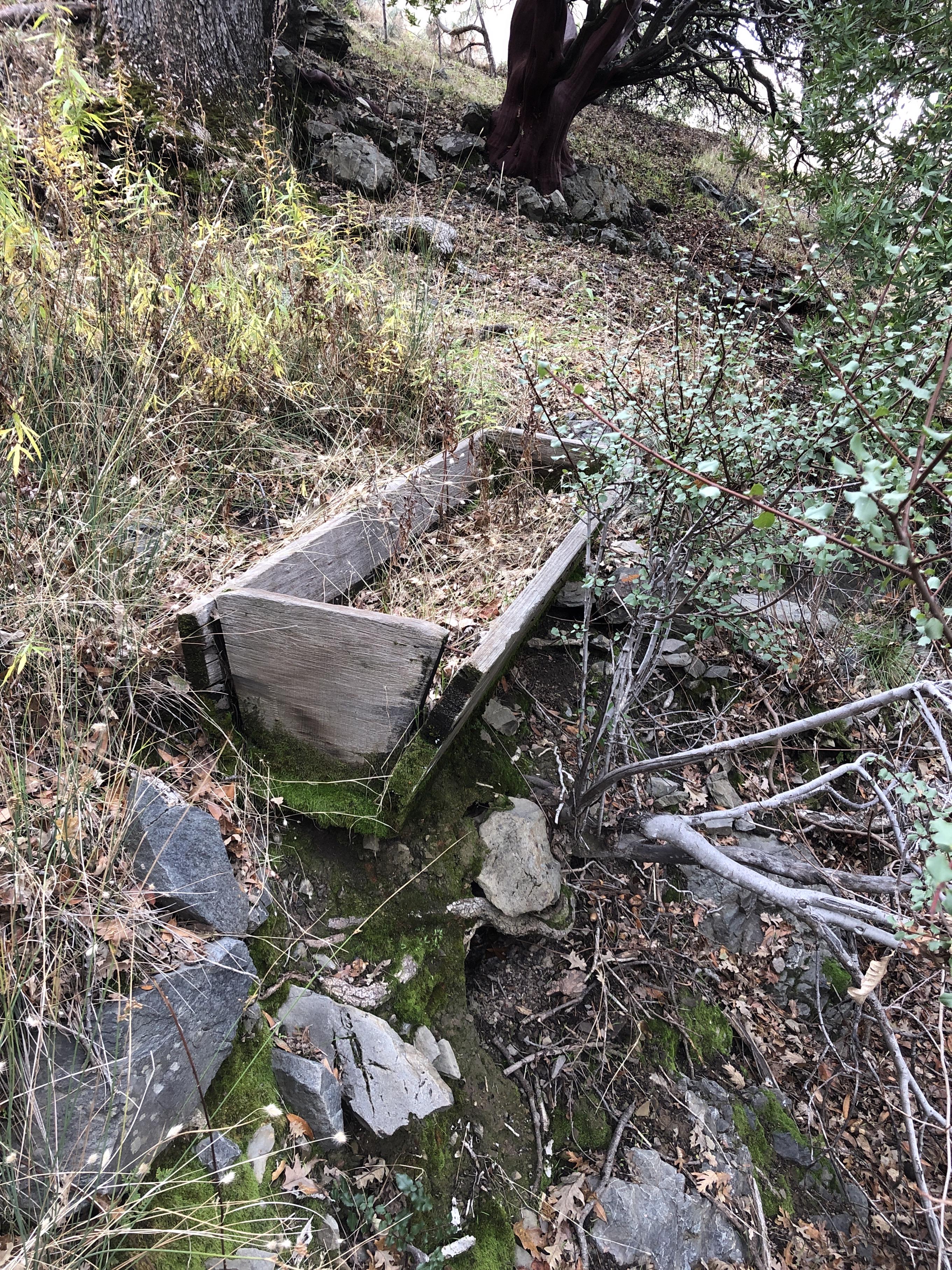
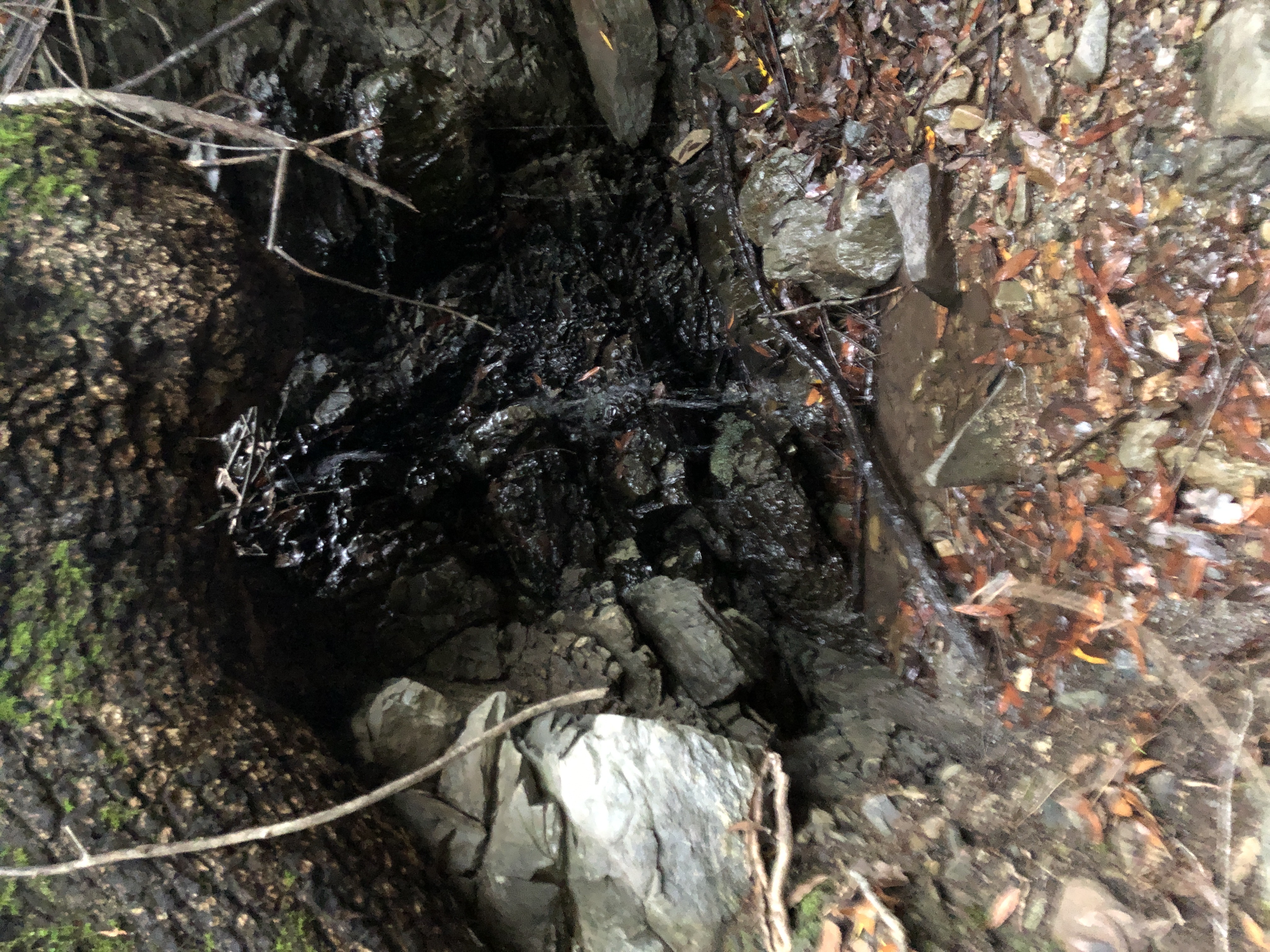
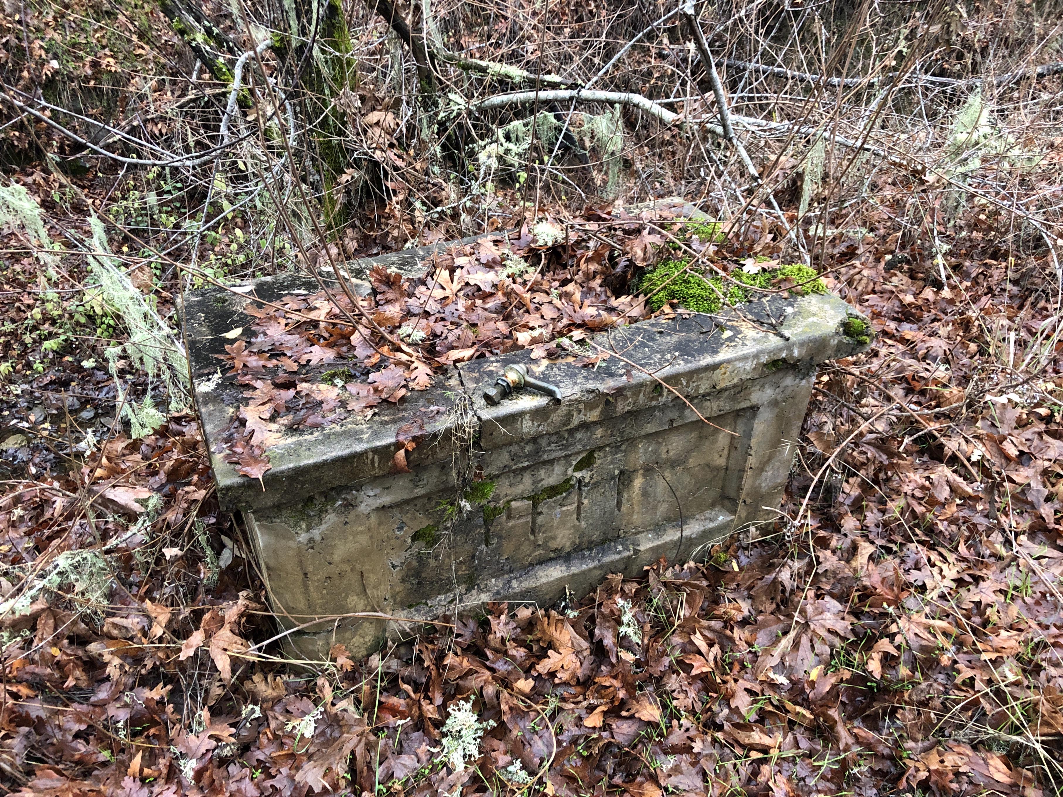
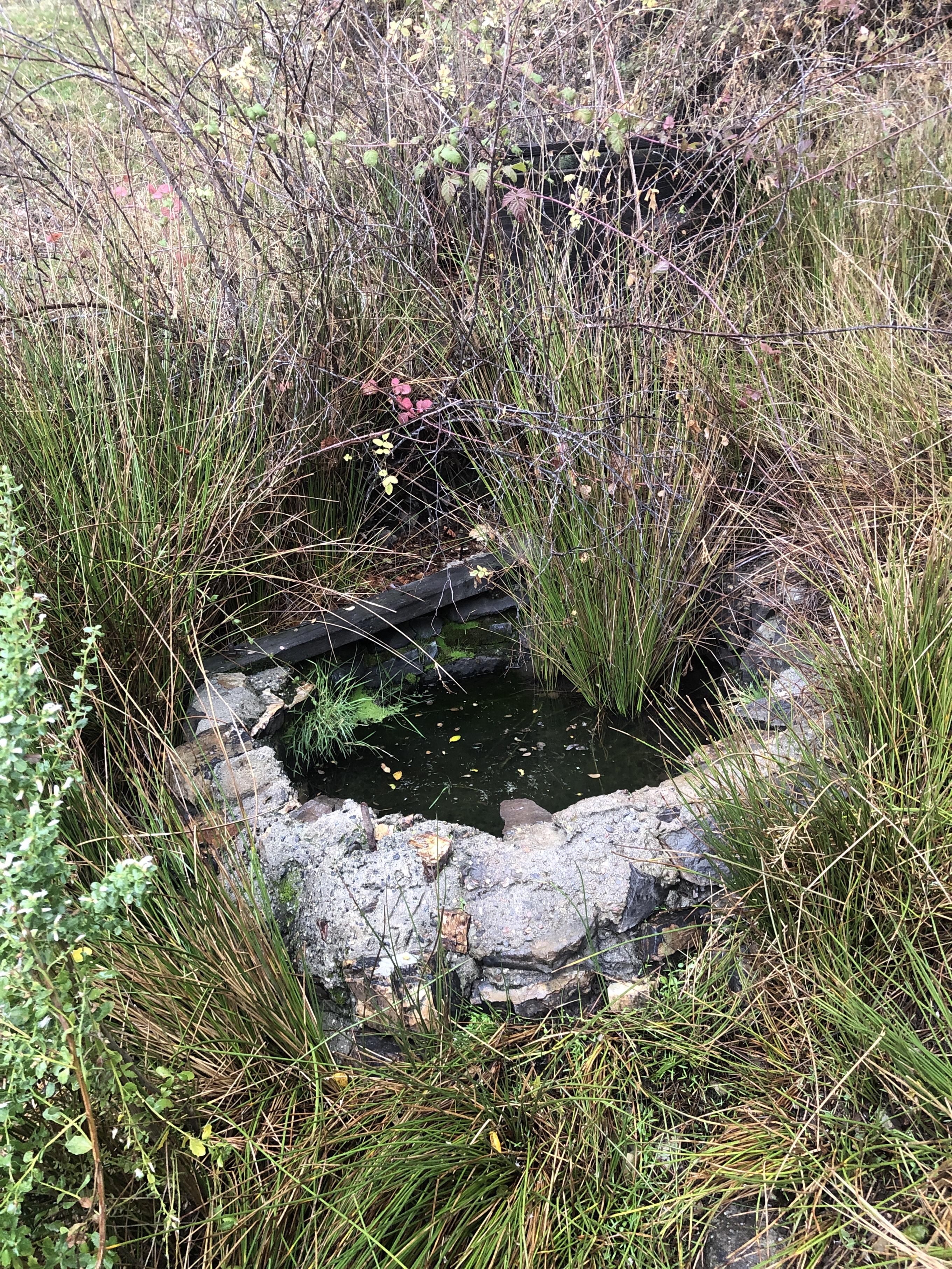
Now I’m working on putting geo-referenced photos on the track to document archaeological sites, where remnants of old ranching activities exist in the ‘middle-of-nowhere’ at unnamed springs like these
That will include also photos of all the other springs where I didn’t find anything but the spring itself, like this one

It was a fun adventure to visit all the spring symbols on the Henry Coe map. The navigation through dense brush on overgrown hillsides was often very hard, but the elated feeling of knowing to have eventually found it was well worth it.
Manfred, Sorry, I owed you reply on that. I won’t be in CA that weekend. Drake is home for winter break then so we’ve trying to do a bunch of family activities since we don’t see as much of him now (a Europe trip, Wall Street and Hong Kong internship last summer). Hope it’s a fun party!
I’m not sure yet, Manfred. Maybe a day trip out, but nothing’s decided yet.
Steve,
I’m finally finished with uploading and labeling all the relevant spring photos and my track. I had to remove all additional information like elevation data, time stamps, heart rate and temperature from my Garmin GPX file to get down to the 8MB limit that AllTrails allows. Now on AllTrails the track is listed as roughly 10 miles shorter with roughly 10k feet less climb. For this purpose it doesn’t really matter though. Along the track you will find red dots to click on to see the photo of the spring. Or you just click on the first photo on the left and then click “>” to get to the next photo in order of my walk.
Best Regards,
Manfred
P.S.: I named each spring that was not named on the map, so I can reference to it. So don’t wonder if you have been at Henry Coe and never heard of “Reed Spring”, “Buckeye Spring”, etc. At the waypoint you will find an unnamed spring symbol on the map.
Become a member to post in the forums.
advertisement
Discover under-the-radar ultralight gear from small brands.

 Loading...