Topic

Do I need a better printer or am I missing something?

Viewing 19 posts - 1 through 19 (of 19 total)
PostedSep 12, 2022 at 8:38 am

Hello, I’ve been lurking for awhile here and finally have a question I can’t seem to find an answer for in the forums; so here goes; first post.

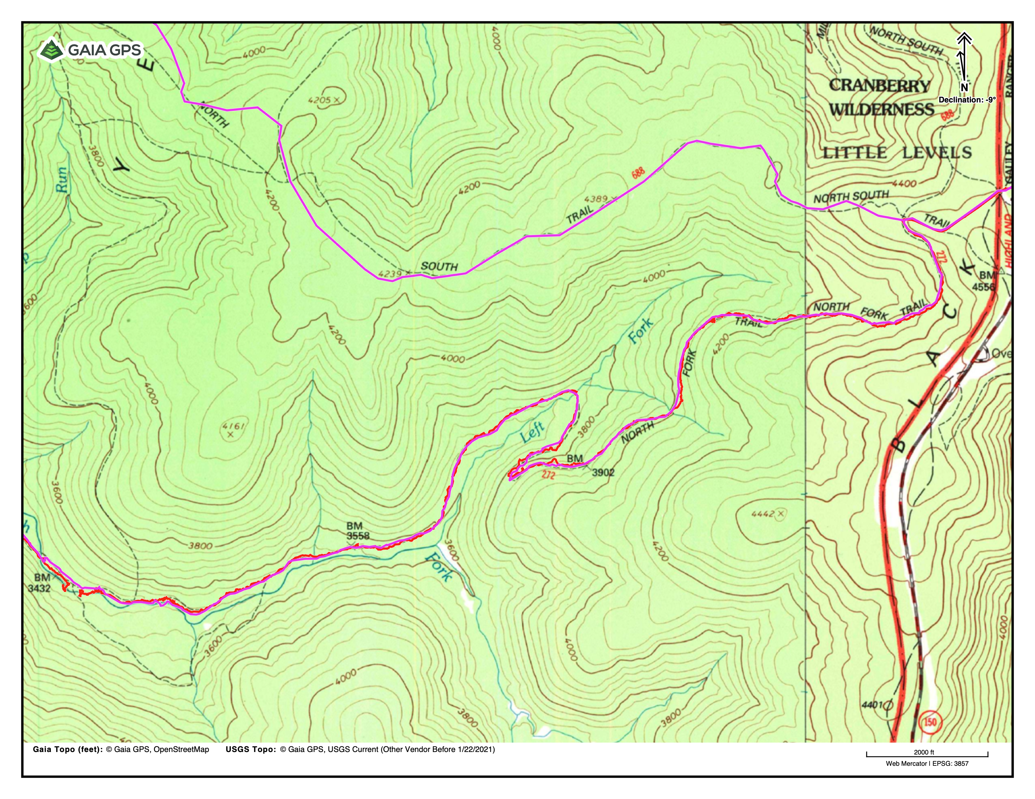
When I print maps from Gaia using my laser printer I can’t seem to see the topo lines or any of the words on the maps very well. They are just very faint and the words are too blurred to make out and would not be usable if I broke my phone or something. I’m primarily printing USGS topos from Gaia. Not sure if I just need a better printer or to print a different scale map or what. I’m using Gaia so there is no official numeric scale to go by but I’m printing in landscape on normal 81/2 x 11 paper and the little scale bar shows that the full length of the bar is 3000 feet. I’ve tried adjusting the settings between “fine” and “normal” and it makes no discernable difference

Do I just need a nicer printer? If so can someone give me an idea of what to look for in the specs?

Here’s the printer I’m using: Brother HLL3210CW

https://www.brother-usa.com/products/hll3210cw

Thanks in advance, Jeffrey

PostedSep 12, 2022 at 9:33 am

<p style=”text-align: left;”>That is unlikely to be a printer problem as the resolution should be fine.  What can make a difference is your output settings.  There are several, usually from black and white to grey scale and other options.  Try those settings.  My 2 cents</p>

PostedSep 12, 2022 at 1:17 pm

There are exposure settings that see the contour lines as imperfections.  If you adjust from text or text/ photo to photo mode it should override the software trying to “clean up” the image.  Some print drivers actually have a map or detail mode to make sure that they are not edited out.

You could also try printing to PDF first, and using the image mode on the print driver, which basically dumps the PDF to the printer directly.

Kevin Babione BPL Member
PostedSep 12, 2022 at 2:15 pm

I just used Gaia and printed a section of my last hike in the White Mountains where the scale bar was 3000 ft and it was pretty blurry to these tired old eyes.  I realized that I tend to print my maps with the bar set at 2000 (just zoom in) and it was significantly better.  You may need to print more pages, but at least the maps will be useful.  I usually try to put just one day on a page, but if I’m knocking out miles I may print two pages per day of hiking (usually front and back).

Jerry Adams BPL Member
PostedSep 12, 2022 at 3:38 pm

I don’t think it’s the printer, but gaia

I have a Brother 3180 laser printer.

I used to use an ink jet, but the ink wasn’t waterproof and if I didn’t use it for a while, and the ink would dry up so I’d have to get new cartridges.  Laser much better although expensive.

I tried to print something out using gaia.  You can barely see the topo lines.  And the labels.

Then I tried caltopo.com – that was better, although I don’t like the wide margins

PostedSep 12, 2022 at 3:44 pm

I’m guessing it has something to do with the diver or printer settings because even when I zoom further in where the scale bar is at 2000 feet the smaller topo lines are still just barely even printed on the page and I also tried black and white with the same results.

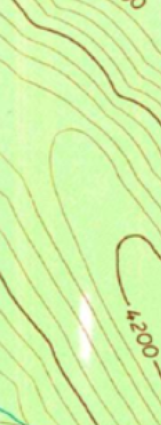
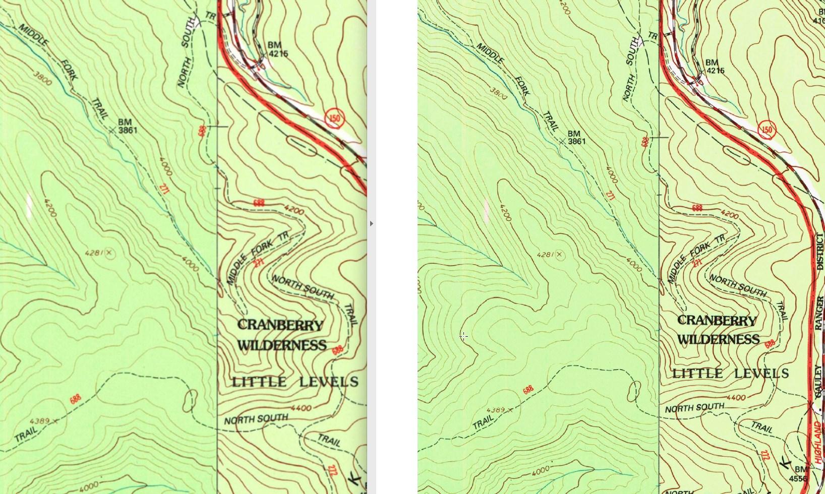
I converted the PDF to an image so I could share it here. Notice how on the right side of the map the coloring is different. Those colors show up pretty decently and are not a problem to see at all but the majority of the USGS topo maps and the default Gaia map have this problem of the lines being very faint and hardly printingblurry when printed example

Christian White, I’m not seeing any real driver options to adjust on the MacBook here. Seems like back when I used to mess with printer settings on windows there were a lot more options. Tried updating the driver but it just directs me to use apples default ‘air print’.

Any ideas where to find those setting adjustments?

Thanks again

PostedSep 12, 2022 at 3:48 pm

Yeah I did use to use caltopo a bit a few years back and never seemed to have any problems but I was printing with ink on a different printer at the time.

I sure hope it’s not just Gaia because I’ve spent a while converting from TOPOmaps+ and learning how to use gaia instead but that may just be it.

Jerry Adams BPL Member
PostedSep 12, 2022 at 4:46 pm

I use gaia on my phone while I’m hiking

It has a few minor peculiarities, but mostly it’s pretty good.  I can see contour lines, trails,…

I always take a track of my hike and that works pretty good.  Has good statistics on my route.

Jerry Adams BPL Member
PostedSep 12, 2022 at 4:50 pm

just to whine a bit because I haven’t whined about anything recently

gaia used to display the time duration and distance of the track I’m taking, and the elevation of where I am

then, I think they updated the software and now it will only display two fields – I choose time duration and distance.  I can see my elevation from the topo lines, or I can temporarily change the distance to elevation

too bad I can’t figure out how to display elevation continuously

jscott Blocked
PostedSep 12, 2022 at 5:16 pm

Actually, that map looks pretty clear to me. Maybe you need (new) glasses?

Kevin Babione BPL Member
PostedSep 12, 2022 at 7:21 pm

Okay – Perhaps this is a stupid idea, but it’s an inexpensive test…If you have a FedEx/Kinko’s or other print shop near you (OfficeMax, Staples, etc.) upload one of your PDF’s and let them print it.  It will set you back all of $0.30 (yes – they will print one page, at least where I am).  Or print a couple of different pages with different scales.  You could then compare them to what your printer is capable of before you buy a new printer that is, potentially, no better.

Brian T BPL Member
PostedSep 12, 2022 at 11:39 pm

Looking closely at the area you are trying to print, it’s not a good scan.  There even appears to be some exposure artifacts from the scanning process.  The lines are inconsistently shaded and I’m not surprised they aren’t printing well.

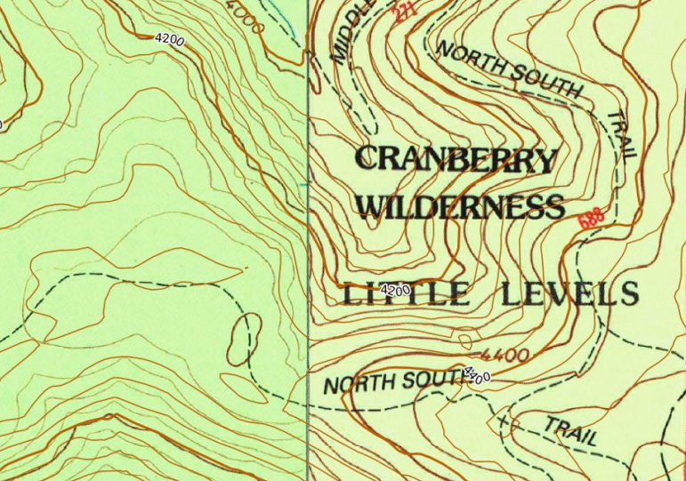
You can get a little better quality out of CalTopo (on the right, below). This is because CalTopo doesn’t simply create a PDF of the browser screen. It is rendered independently and with the premium version, you can specify a higher resolution output (which I have done here).

Overall, though, this is a limitation with a scanned raster image. You may want to simply use a different map overlay for this area.

In CalTopo you can optionally have it add contour lines over any map, but the elevation data is different (newer) than that used in the USGS scans and so where they both show up it can look a little busy.

PostedSep 13, 2022 at 7:22 am

Another option:  stop using the old USGS layers on both Gaia and Caltopo.

For Gaia, use the “Gaia Topo” layer, but of course the downside is that you’ll also get relief shading in that layer, which has its downsides.

For Caltopo, I’d suggest for the Cranberry Wilderness that you use the US Forest Service layer.   Another option for Caltopo:  Base Layer is OpenStreetMap.  Then turn on Contours at 20 meters, plus “Mapbuilder Overlay” and “Mapbuilder Features”

I like that Caltopo gives a lot more control over the generated PDF:  scale, dpi, etc.  Gaia prints/exports to PDF at an arbitrary scale depending on how your window was zoomed at the time you hit the print button.


PostedSep 13, 2022 at 7:23 am

P.S. It’s really unfortunate that Caltopo moved the ability to create more customized map layers into the more expensive “Desktop” pricing tier.   :-(

PostedSep 13, 2022 at 7:43 am

I found that GAIA Gps does have the “US Forest Service 2016” layer.  But it’s VERY blurry.  I don’t understand why they allow it to be that bad.  Ugh.

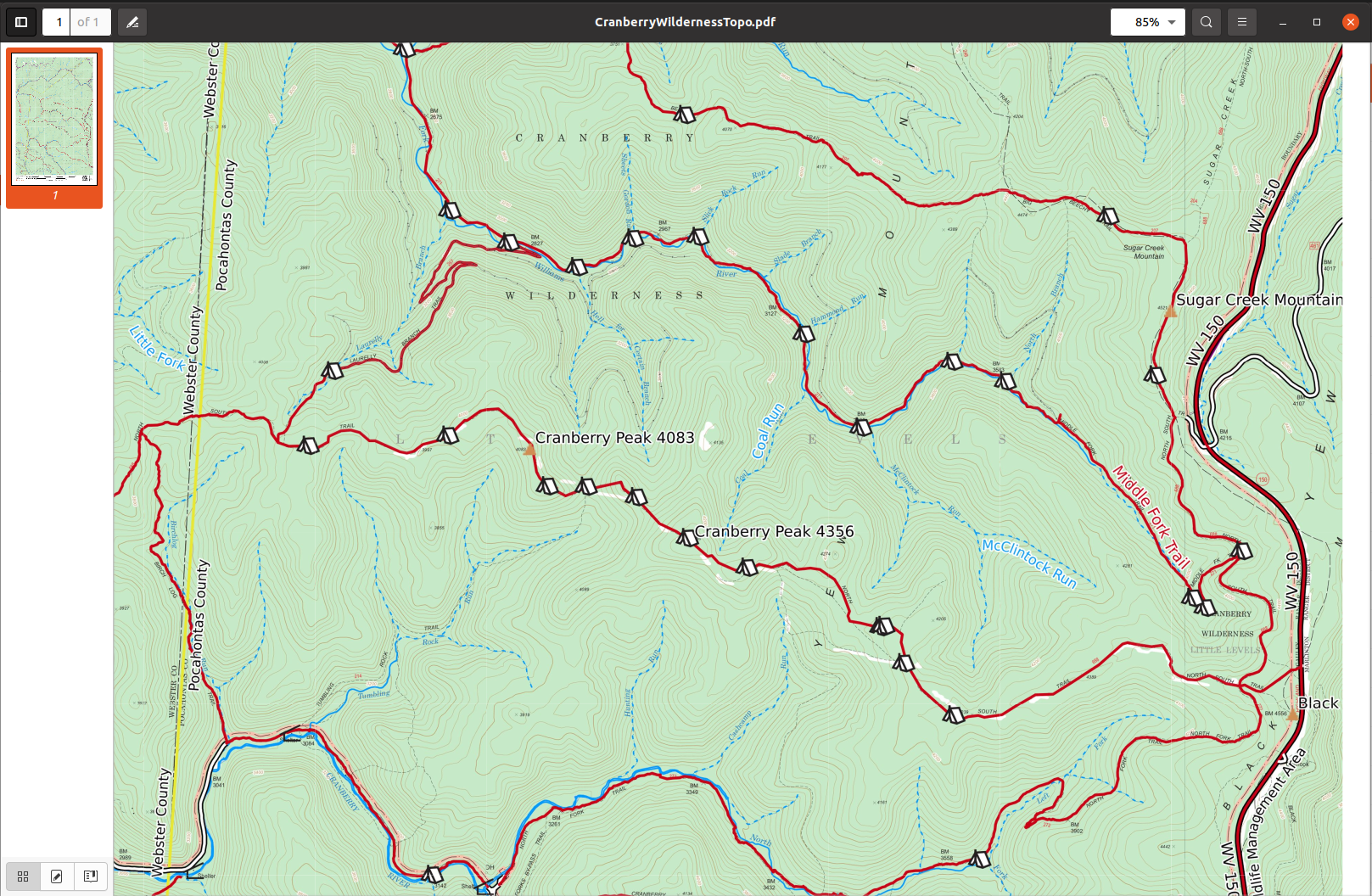
In Caltopo, I created an 11×17 PDF of the Cranberry Wilderness at 1:50000, 400dpi, and then opened the PDF in my PDF viewer and zoomed in. The lines are quite crisp, and I think that on a good printer (like at Kinko’s), it should print quite nicely.

Right-click on the image below and select, “Open image in new tab” to see it at the full upload resolution.

Desktop screenshot

PostedOct 2, 2022 at 5:28 pm

Trying all the different services and maps you all mentioned helped me to figure out what it was.

Finally figured it out. Had to update the firmware and delete the printer to change the driver. It never worked well when I first got it (at the beginning of covid) because there was no driver for it just generic “AirPrint” but now it seems like I was finally able to get one that was up to date and that actually works.

Still have to turn the contrast all the way up to see the very faint Topo lines in between the bold ones but I can see them a lot better.

Kevin Babione BPL Member
PostedOct 3, 2022 at 5:35 am

Good for you for figuring it out – and I’m sure it will make anything else you print look better too.

Viewing 19 posts - 1 through 19 (of 19 total)
Loading...