Topic

Ascent of Matterhorn Peak


Forum Posting

A Membership is required to post in the forums. Login or become a member to post in the member forums!

Home Forums Campfire Member Trip Reports Ascent of Matterhorn Peak

Viewing 22 posts - 1 through 22 (of 22 total)
  • Author
    Posts
  • #3672631
    David Gardner
    BPL Member

    @gearmaker

    Locale: Northern California

    Just got back from a 4-day trip with my brother and his son to scale Matterhorn Peak, the northernmost high peak (12,285′) in the Sierra Nevada.

    Matterhorn Peak sits on the border between Hoover Wilderness in the Humboldt-Toiyabe National Forest and Yosemite National Park. A Wilderness Permit is required for camping, as is a Fire Permit that can be obtained online. There are only 8 Wilderness Permits per day for the Horse Creek Trail, 4 by reservation and 4 by walk-in. If there are no walk-in permits left on the day you get to the ranger station in Bridgeport, CA, permits for the next day are available after 1 p.m. We got there at 2:30 p.m., and fortuitously there were 3 walk-in Wilderness Permits left.

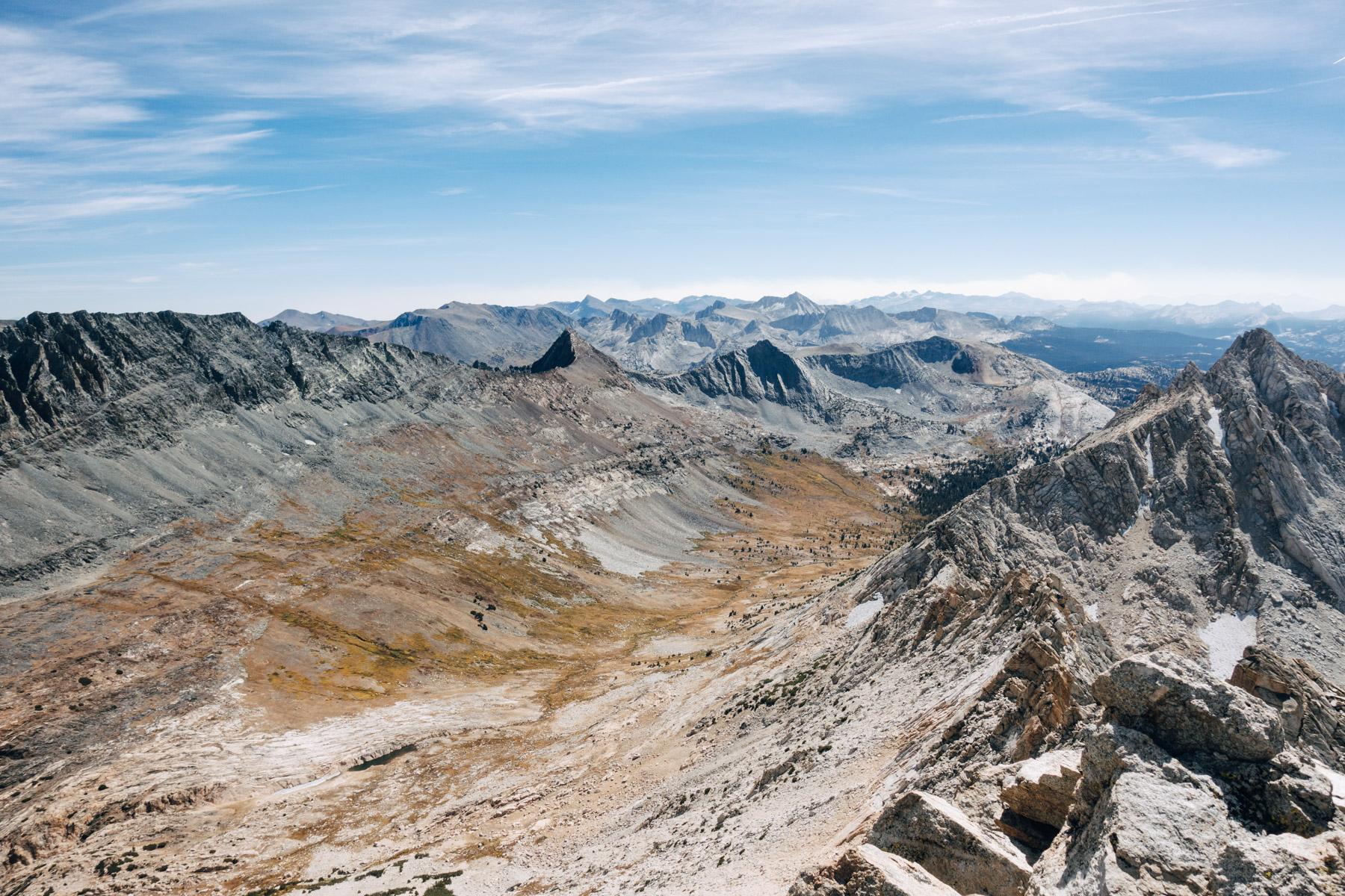
    We finally got on the trail late Monday afternoon, heading almost due south from the Twin Lakes trailhead (7,100′) up Horse Creek Canyon about 2/3 of the way to the pass (10,600′) into Spiller Creek Canyon at the northeast corner of Yosemite. We camped the first night near the last “lake” (9,600′) before the climb to the pass. This is a view of Mt. Virginia looking southwest up Horse Creek Canyon from our campsite. The pass where we were heading is up the canyon below the right side of the peak:

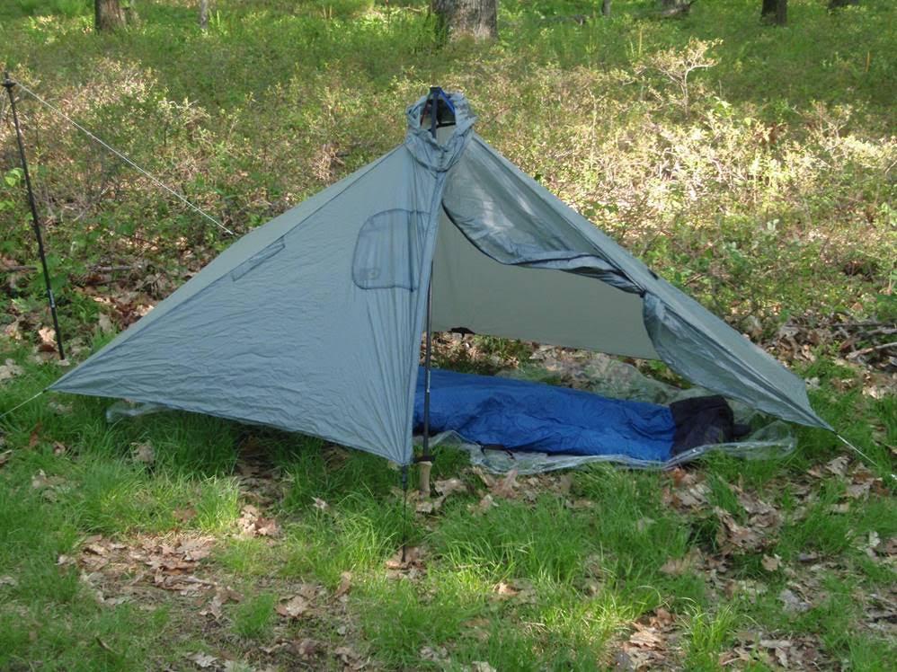
    My brother and his son setting up their tent the first night, and the Gatewood Cape I was using for the first time:

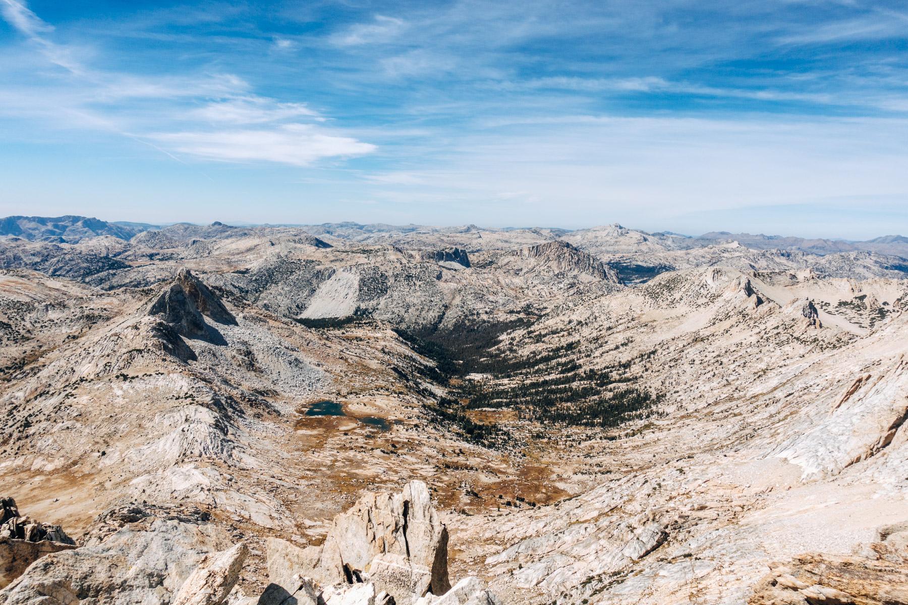
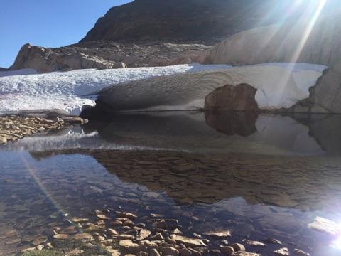
    From there we went up the right/north side of the canyon and over the pass into Yosemite and camped Tuesday night about 1/4 mile up towards Matterhorn Peak from a little slot lake below what’s left of a glacier:

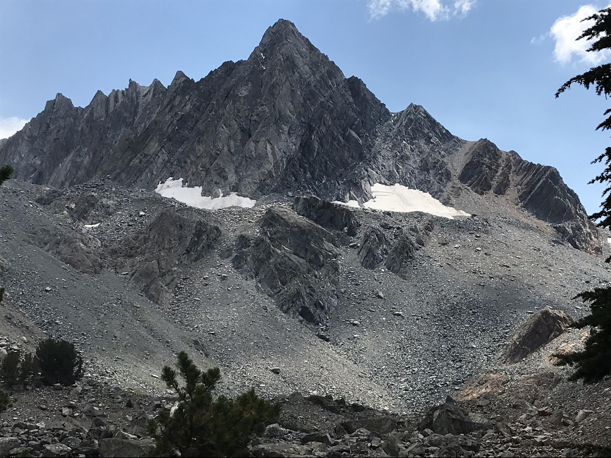
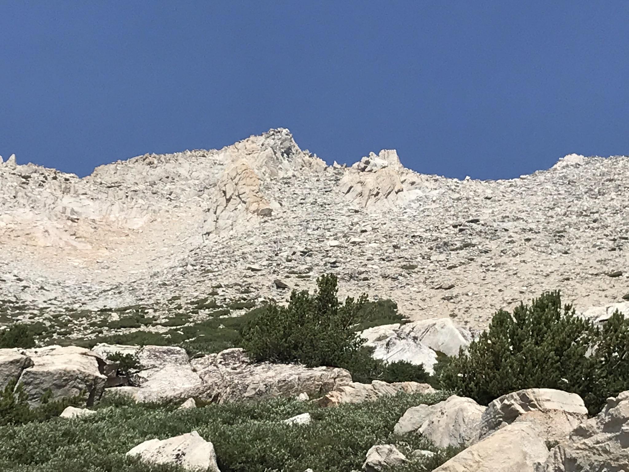
    We scaled the peak Wednesday afternoon by going pretty much straight up and down the main southwest bowl/couloir to the notch left of the peak in this picture, then along the ridge to the summit:

    This is a view from the top of the southwest couloir back down to our campsite and the glacial lake. On Monday we could see much of Yosemite. By Tuesday morning it was smokey  like this from the hundreds of fires raging in California:

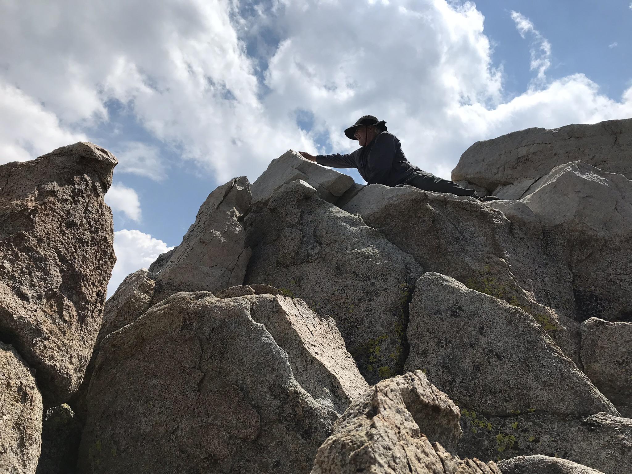
    It’s a dramatic peak. Shear cliffs on all four sides. After a nearly vertical 50′ scramble to the highest notch on the southwest ridge it’s an easy 200 ft. walk and 4.0 scramble with cliffs on both sides to the peak. Any other route requires ropes and serious climbing skills.

    We didn’t actually stand on the high point, an angled rock about 12″ wide that looked ready to tumble. So we reached out and touched it:

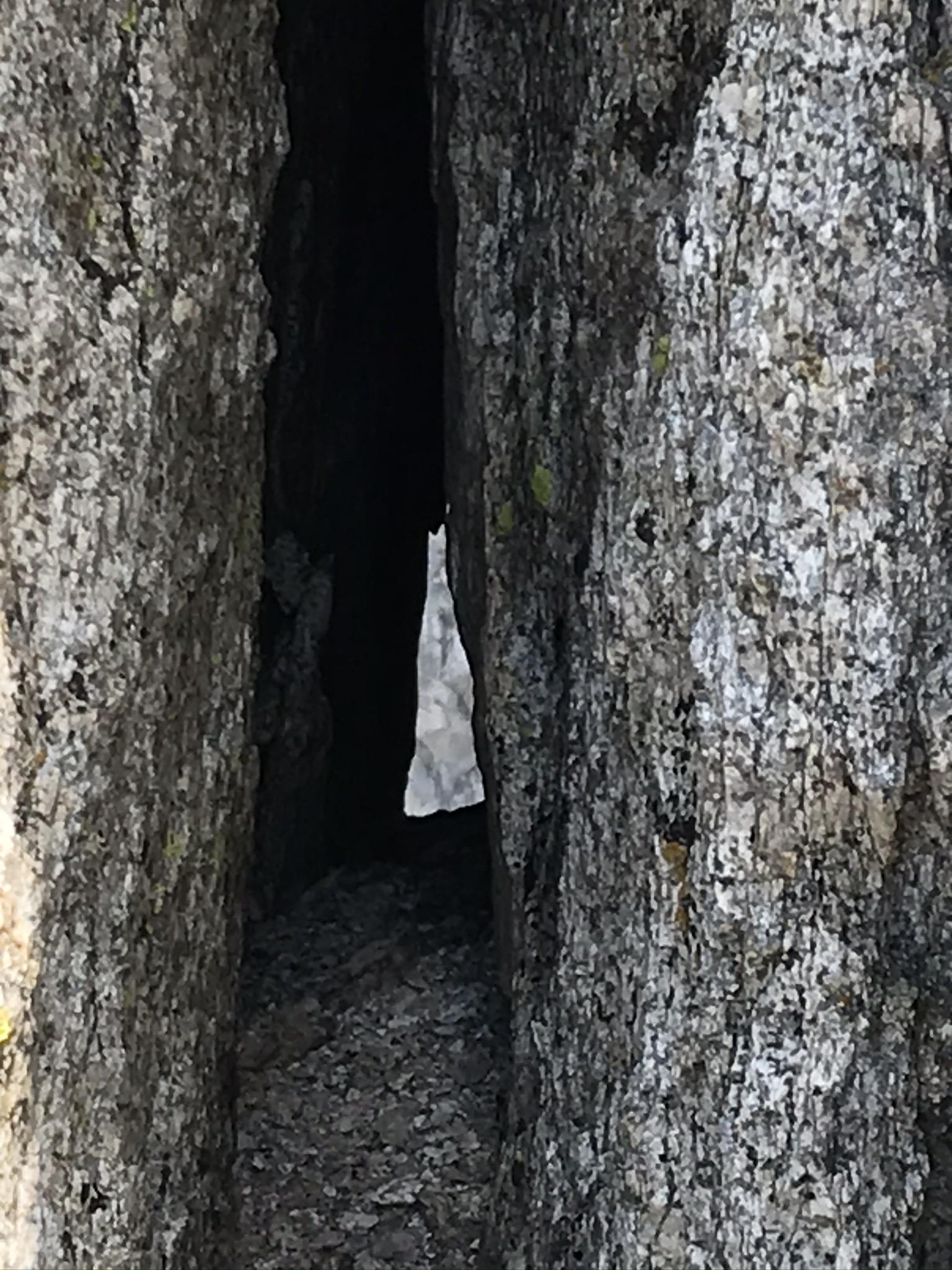
    The peak is more like a pile of boulders than a solid chunk. We could even see through a small eyelet about 12′ below the peak to the cliffs on the other side of the canyon:

    We exited back down Horse Creek on Thursday more or less the same way we came in and stuck to the scree and rocks, now on the left, because the snow on the other side of the canyon looked hard and slippery, although I didn’t check it closely.

    This is a strenous hike for those with at least moderate experience doing “technical walking” and scrambling over rocks, boulders, scree and talus. You look at a map and think “Oh, it’s only 4.2 miles from the trailhead to the peak? Easy peasy.” But it’s completely exposed to direct sun all day as you climb the east side of the Sierras, a lot of elevation gain from 7,100′ to 12,285′, a lot of walking over jumbles of sharply angled loose rocks and boulders, no water for the last 1.5 miles, and a nearly vertical 4-point scramble up 50′ to the final ridge to the peak. Not for beginners.

    But the views and scenery are absolutely incredible, and it’s totally wilderness once you get about 1.5 miles from Twin Lakes up Horse Creek Canyon. Looking southwest down the Spiller Creek watershed you can see much of Yosemite. The Sawtoot Ridge on the west side of Horse Creek is classic raw, craggy, east side granite. The rocks are many colors: red, beige, dark grey, light grey, green striped, white. I saw 6 different kinds of flowers in bloom near the summit. A tiny frog jumped on me the first night. The spectacular Mt. Virginia and Matterhorn Peak loom over the area. And I saw two animals for the first time in the more than 50 years that I’ve been camping in the Sierra Nevada: a Pika and 6 Tawny Grouse (2 hens and 4 chicks). With the 8 per day limit on permits it is still a wilderness experience and well worth the effort.

    #3672636
    Manfred
    BPL Member

    @orienteering

    David,

    Thanks for the trip report! We had been there just three weeks earlier when finishing our Sierra High Route trek. Too bad the smoke impacted the view so much. It looks like the snow is now melted even more. This was  low snow year. We will see in two weeks when we go back for a 100 mile loop on SHR and JMT.

    Best Regards,

    Manfred

    #3672651
    Paul Wagner
    BPL Member

    @balzaccom

    Locale: Wine Country

    Great report.  Thanks for posting it.  The view of Matterhorn Peak and the Sawtooths from Matterhorn Canyon us one of my favorites in the Sierra.  Nice to know what it looks like from on top.

    #3672652
    W I S N E R !
    Spectator

    @xnomanx

    Thanks David. Brings back good memories, Matterhorn was the first Sierra peak I climbed…25 years ago?

    #3672659
    jscott
    BPL Member

    @book

    Locale: Northern California

    Yes, strolling through the green alpine meadows on the ‘other side’ (west? south?) of the Matterhorns is one of my favorite parts of the Benson Lake loop.

    #3672667
    Pedestrian
    BPL Member

    @pedestrian

    Thanks for the great report and excellent pictures!

    Good you made it out while the air quality was still not awful – I was checking over the weekend and it looked just as bad up in the Sierra as here in the Bay area.

    #3672967
    David Gardner
    BPL Member

    @gearmaker

    Locale: Northern California

    @balzaccom: I’d like to see that view some day. We considered going in a big clockwise loop back to the trailhead by going over Matterhorn Pass into Matterhorn Canyon but decided the pass looked too risky without ropes. Hard to tell from a distance whether it was a cliff the way it appeared or if wasn’t that steep.


    @xnomanx
    : What? How can you be that old? You climbed it when you were 10?


    @book
    : Those meadows are wonderful. Many wildflowers.


    @pedestrian
    : Air quality in Petaluma when I got home was 167! I don’t think it got that bad up there, but don’t really know.

    #3672970
    Pedestrian
    BPL Member

    @pedestrian

    I was checking AQI up in the Sierra as I have a trip coming up. Last few days the AQI seems as bad in the Sierra as down here in much of the Bay Area (low 100s to 200s).

    From your pictures it didn’t look as bad as that but sometimes it’s hard to gauge AQI by simply looking at the skies as I’ve realized these past few days.

    Check out purpleair.com (many private sensors, perhaps not each perfectly calibrated) for a somewhat different view of AQI than airnow.gov (few “officially”  maintained and presumably better calibrated sensors).


    #3673003
    Dave @ Oware
    BPL Member

    @bivysack-com

    Locale: East Washington

    My wife and I went up there about 25 years ago. Circumnavigated the Dragtooth and came down the chute by the Doodad. Then had a 2 mile glissade in canyon north. But no pictures.

    Thanks for the photos.

    #3673043
    David Gardner
    BPL Member

    @gearmaker

    Locale: Northern California

    Would those of you who have been there, especially up and/or down Horse Creek, agree that it’s a strenuous hike not for beginners? Or am I just getting old and fat?

    Don’t answer that. Well, that second part. I already know the answer.

    #3673046
    jscott
    BPL Member

    @book

    Locale: Northern California

    I can’t imagine that smoke from all over coastal northern California hasn’t fouled the air in the Sierra. I’ve experienced that too many times.

    David: that route’s a rough go! I’ve never done it but I’ve been all around Matterhorn and the Sawtooths (sawteeth?) many times. I’m one who’d rather circumnavigate Mt Rainier than climb it. But I admire those who have the gumption to force an ascent.

    #3673047
    David Gardner
    BPL Member

    @gearmaker

    Locale: Northern California

    Oh, it was fouled for sure. Just don’t know to what extent while I was there.

    #3673053
    W I S N E R !
    Spectator

    @xnomanx

    “What? How can you be that old? You climbed it when you were 10?”

    I think I was 17 or 18, fresh off of reading Kerouac’s Dharma Bums in which he and Gary Snyder (Japhy Ryder) climb it. I thought…now there’s something I need to do. NOW.

    That might have been the beginning of more serious backpacking for me now that I think about it.

    My friend and I didn’t even have enough money to get there and back, panhandled for gas money starting in Bishop on the way there and all the way back. Got into Bridgeport in the middle of the night and slept (unknowingly, it was foggy) in a cowfield next to the ranger station. I remember waking up nearly underneath a cow…

    What days…


    #3673059
    David Gardner
    BPL Member

    @gearmaker

    Locale: Northern California

    @orienteering: Manfred, checked your link above. Nice trek! The peaks and ridges up there are so magnificent. It would have been amazing if our paths had crossed. That bird you called a ptarmigan looks like the birds I saw.


    @book
    : One of the interesting things for me on this trip was the difference between how the ascent looks from far below, versus what it looks like close up. The distance flattens your perspective, makes a slope look like a cliff. My third picture in the original post is the view from our camp up to the peak, and I could not conceive how we could make the final traverses and scrambles without ropes – the whole upper part seemed to be a sheer wall. But once we got up there I checked the average slope several times and most of it was about 30*, and the scramble up to the notch on the final ridge about 60*.

    #3674833
    Adam White
    BPL Member

    @awhite4777

    Locale: On the switchbacks

    Thanks for sharing David!

    I will be in that area next weekend, and have been pondering an ascent of Matterhorn Peak, if it fits into the schedule. Seems like a must-visit summit to me!

    #3675137
    David Gardner
    BPL Member

    @gearmaker

    Locale: Northern California

    Hey Adam,

    I guess you’re up there now. Definitely do the peak if you get a chance. It’s very doable and you get a fantastic view, even with the wildfire smoke. Post pictures!

    #3675333
    Adam White
    BPL Member

    @awhite4777

    Locale: On the switchbacks

    No, not up there now… Permit was for Friday the 11th, but I’m punting it back to the 19th. My intended route was from Tioga Pass to Twin Lakes, and with the Inyo closure, that requires some significant re-routing.

    I’m hoping that by the 19th, Inyo is open, but if not–and if air is reasonably particulate-free–and if no additional plagues have bestowed themselves upon California–I’ll give it a shot…


    #3675467
    David Gardner
    BPL Member

    @gearmaker

    Locale: Northern California

    Uh oh Adam. From the Los Angeles Times a few minutes ago:

    “With public lands throughout California menaced by wildfires and dismal air quality, state and federal officials have closed dozens of state parks and plan to close all national forests, including many that recently emerged from coronavirus pandemic restrictions.

    At 5 p.m. today, all 18 national forests closed access to more than 20 million acres across California because of “unprecedented and historic fire conditions.” Campgrounds, trails, picnic areas and roads shut to visitors until further notice, according to a U.S. Forest Service news release.

    Hikers with permits heading to Mt. Whitney, the John Muir Trail and the Pacific Crest Trail (where it runs on national forest land) also had to curtail their plans.”

    #3675480
    Adam White
    BPL Member

    @awhite4777

    Locale: On the switchbacks

    Yeah. I the plan right now is for the forests to reopen on the 14th (at least, as of the last forest order that I saw). If they don’t–but if Yosemite stays open–and if air is ok–I’ll still be fine. Just won’t exit at Twin Lakes and will loop back through Yosemite.


    #3675488
    David Gardner
    BPL Member

    @gearmaker

    Locale: Northern California

    Good luck! Hope it works out.

    #3675635
    David Gardner
    BPL Member

    @gearmaker

    Locale: Northern California

    Kevin Babione asked about my experience with the Gatewood Cape and pointed out that I hadn’t mentioned that in my OP. Thanks Kevin!

    The Gatewood Cape keep worked well for me, and I really like the 3 pound reduction in my pack weight. It’s lighter than my old poncho and don’t need a separate tent. Not difficult to pitch, plenty of ventilation for the conditions of this trip. I angled the pole under the Cape so I could keep the pitch taut and take up an slack that developed by pulling the bottom in closer to the center. But it was a tight fit for me at 5′-8″ tall.

    It was very breezy where we camped and I was using a very light through-stitched mummy (1 lb.) so I was concerned about staying warm enough if the wind was blowing straight under the Cape and therefore pitched it as tight to the ground as I could. Plus, I use a pair of MYOG 46″ fixed-length trekking poles and couldn’t really pitch it much higher than I did on this trip. With the breezy conditions, dry August air, and wide open peak vent there was zero condensation. Can’t opine about other conditions, as I haven’t tried them yet.

    If pitched higher off the ground it would have a lot more usable length inside, like 6″-12″, but the sides would be more exposed to wind-blown precipitation. I would also have had more room if I had figured out how to use the head pullout tab above treeline. It never occurred to me to use the trekking pole that I wasn’t using under the Cape, like Kevin showed me:


    But tight to the ground and no head pullout, I think anyone over 5′-10″ would not be happy.

    For cooler and more humid conditions I’ll be making a very light, simple “wind bivvy” to improve the wind resistance and temp rating for the mummy so I can pitch the Cape higher and have more room without sacrificing warmth.

    I also be making a couple of pole jacks so I can go up to 48″, then 50″, and try pitching it higher off the ground on my next trip with it.

    I plan to get the Serenity NetTent from SMD. It was not bug season on this trip in this location, but I don’t want to wear bug net coveralls or a head net while sleeping when it is bug season.

    #3677700
    Adam White
    BPL Member

    @awhite4777

    Locale: On the switchbacks

    Well, the right combination of wind direction and status of federal lands occurred this weekend, and I finally got up there.

    We came in from the Virginia Lakes TH and did some putzing about; summiting Matterhon Peak was amongst that putzing.

    Tremendous views! To compare the smoke conditions with when you were out there, here’s Spiller Canyon. You can see the barrier of smoke, somewhere around Tuolumne Meadows (though Lyell is still quite visible):

    Upper Slide Canyon:

    https://backpackinglight.com/wp-content/uploads/hm_bbpui/3677700/cbqybgqki2trs5mqms9way3uko4jjeel.jpg

    And this should look familiar (though I forgot to look for your entry!):

    Although you say you came up a gully on the SW side, I assume you meant SE? i.e., the Spiller Canyon side?

Viewing 22 posts - 1 through 22 (of 22 total)
  • You must be logged in to reply to this topic.
Forum Posting

A Membership is required to post in the forums. Login or become a member to post in the member forums!

Get the Newsletter

Get our free Handbook and Receive our weekly newsletter to see what's new at Backpacking Light!

Gear Research & Discovery Tools


Loading...