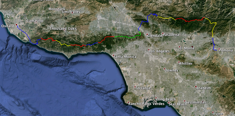
My route is taking me out my front door in Pomona, along the ridge of the San Gabriels via Mt. Wilson, over the Verdugo Hills, past the Hollywood sign, along Mulholland and finally linking up with the Backbone Trail and then PCH up to Oxnard train station. Total length is 152 miles and planning to average 17 miles per day.
Just wondering if anyone has experience doing the ridge from the San Gabriel Reservoir to the Arroyo Seco via Monrovia Peak and Mt. Wilson or the Backbone Trail in the Santa Monica mountains. The biggest challenges will be navigation and water.
For navigation I have planned out my route with Cal Topo and scouted it with Google Earth. I made a list of landmarks and directions to stay on track. All my maps are printed with plenty of detail. I carry an altimeter and a compass and since I am headed straight west, the sun will be another reliable option, weather permitting.
For water, I have identified sections where I will most likely have to stock up for the entire day, but nothing longer than 16 miles. This includes the ridge part of the San Gabriels and sections of the Backbone Trail. I have planned some water caches at certain points along the Backbone Trail.
There are some urban sections but all my overnighting will be done on the trail or at a friend’s house. I am planning for 9 days, but its possible I’ll finish it in 8. If anyone has experience with the sections mentioned I would be very curious to know. Very much looking forward to my 2016 LA Expedition.