


"Bob – OH MY GOODNESS!! Ha, I can't tell if your joking or not."
I was not joking. At first, I thought maybe the gal was joking. Once you got to know her, you realized that she was just that crazy.
–B.G.–
Topic
Become a member to post in the forums.
"Bob – OH MY GOODNESS!! Ha, I can't tell if your joking or not."
I was not joking. At first, I thought maybe the gal was joking. Once you got to know her, you realized that she was just that crazy.
–B.G.–
You do have to admire that level of dedication to ice cream.
Roughly what sort of temperatures should I expect during mid-May at elevations of 4000-8000 feet? I was planning on bringing a ~15-20F bag (Rab Summit Alpine 400), although I have a 30F bag as well. I am not quite sure what to bring insulation-wise. Somethings that I already have are: a 200g-weight wool baselayer, a 100wt-fleece pullover, and a EB down jacket. As far as sleeping pads, I have a hodge podge of foam pads: both a small and large sized Ridgerest, 1/8" Gossamer Gear thinlight pad, and a Gossamer Gear torso pad.
Any ideas on optimal gear combinations?
Also, the temperatures posted here: http://www.nps.gov/yose/planyourvisit/climate.htm say 72F-45F for the Valley (~4000ft), and 10-20 degrees less than that for "higher elevations". Just looking for a second opinion on these posted temperatures.
Those temps look about right to me. A rough rule of thumb is -3F per 1,000 feet of added elevation.
Was wondering if anyone had a link on a river gauging station for the Tuolumne… It looks like I will be finding myself on the morning of June 8th going from Pate Valley to White Wolf… I figure looking at past levels like 2010 from a trip report here in BPL will give me a good idea if I am turning back, going with rope, or just water shoes… Any thoughts would be helpful…
I'm guessing that the flow of the Tuolumne River will be low by June. Pate Valley can seem like a furnace by then, and the climb out to White Wolf may leave your tongue hanging out.
–B.G.–
I hiked White Wolf to TM the last week of May last year. No wading needed between White Wolf and Pate. There was only a few hundred yards of easy ankle deep wading anear Glen Aulin. It's drier this year and you are 1.5 weeks later, so I doubt you'll have to wade anything.
Edited to add link to the Gauging station above Hetch Hetchy:
http://waterdata.usgs.gov/ca/nwis/uv?11274790
Click on Peak Height to see year-over-year comparions.
Thanks guys… One can pick your nose but not always your trips… Any good fishing from Pate to HHR inlet area…
Thanks David, I was just being lazy by not looking it up myself… but I have found myself way bogged down in gov. sites trying to find something…
I think the only place where you might have to wade (seasonally) is 2-3 miles west of Glen Aulin, and it is a side stream. I once met a short, about 10 year old girl coming from there during a high flow year in latish May, and asked her how it was. She said it was easy. I assume she had family around, but she seemed like a through hiker in her attitude. She seemed very comfortable all by herself. When I asked her how high it was she said "only about waist high". LOL You will be ok.
Yes, the stream from Matte Lake floods a wide area about 1.5 mi below Glen Aulin.
Other potential wading spots I did not previously mention:
The Register Creek crossing about 4 mi upstream of Pate Valley is a simple stream crossing wade just below a nice waterfall.
A stretch of trail near Muir Gorge that is sort of a granite sidewalk along the river that probably floods in high water. It was ~2 feet above the river at the lowest point near the end of May last year.
I was intending on writing up a separate trip-report, but I went on a reply-spree on poor Arla’s thread about the conditions, so you can check it out here:
A couple of other things:
The entire trip was absolutely fantastic. Thank you everyone for the recommendations and advice.
My pack weighed in at 23.5 lbs with everything (gear, bear canister, 6 days of food) except water (I carried very little water as the hike was teeming with it–my strategy was treat-and-chug). Without posting an entire gear list, I carried: a ULA Ohm (original version…overall it is fine, but the hipbelt is abysmal), a Rab Summit Alpine 500 sleeping bag that I got for cheap a while back (~25F bag), a GoLite SL1, a 100-wt fleece hoody (Patagonia Micro-D), 200g-wt wool baselayer (Ibex something or other), silkweight long underwear bottoms, a Patagonia Houdini, Dryducks, and 4 pairs of light socks (all of which were needed–lots of water). I used a large Ridgerest as my sleeping bad, which I chopped in half (the top half was folded and used as a frame in my pack, the bottom part was tapered). I can post pictures later, but I liked that use for the pad quite a bit. I’m going to start supplementing the Ridgerest with a 1/8″ pad or a torso pad, as I’ve come to accept it’s not warm enough on its own (for me, a cold sleeper).
Overall, I was happy with everything, although I did wake up cold on the last morning (near Polly Dome lakes), and my shoes were frozen solid.
The only thing that I found surprising and slightly frustrating was how difficult it was to find the trail at times. Yosemite is so heavily used that in many areas, everything around the trail was flattened and also appeared to be trail. Compounding that problem was the fact that there are little or no trail markers or cairns. In parts, there was significant debris (fallen trees, etc.) on the trail, but I think this has to do with the fact that it was still early in the season.
Again, surprisingly, I completely and utterly lost the trail as I was attempting to descend into the valley via Snow Creek (just past Olmsted Point). I was trying to get down to the valley one day earlier than I had planned so I could enjoy sleeping at the backpacker’s camp and lounging around /enjoying the amenities of Curry Village, and I think I was partially distracted by that goal. Although I was fairly certain that I was headed in the right direction, after searching around hopelessly for the trail (there were no cairns or markers left standing, which again I suspect is due to winter), I decided to call it quits before I made any impulsive decisions to choose a direction try to blitz down into the valley as the weather was staring to turn cold and sour (although I’m sure it’s pretty straightforward–there’s a giant dome to help guide you…). I hiked back up to the parking lot near Olmsted Point and sheepishly asked for a ride down into the valley. A couple happily obliged, even though I smelled like a diseased rat at this point in the trip.
It turned out to be a wonderful choice–after 5 days of lots of miles and loneliness, I was met with pizza, cheaper-than-water beer, and plenty of company from other wonderful travelers.
When I get a chance tomorrow, I'll post some pictures / panoramas, as well as a map with my actual route and where I camped each night.
Excellent! Thanks for the report.
"Yosemite is so heavily used that in many areas, everything around the trail was flattened and also appeared to be trail. Compounding that problem was the fact that there are little or no trail markers or cairns. In parts, there was significant debris (fallen trees, etc.) on the trail, but I think this has to do with the fact that it was still early in the season."
Some Yosemite trails are heavily used, but the ones that are really heavily used are the really great trails (great for scenery, or whatever). There are lots of trails where you can't tell if anybody has ever been there except for the tree blaze marks made by the U.S. Cavalry back around 1910.
It used to be that Yosemite would have so-called trail maintenance go up and down the various popular trails in early season. They would remove the excess debris and cut up trees across the trail. This would be done as soon as the snow melted off enough for them to take horses in, and right before they expected the backpacker rush. However, now with federal budgets being as they are, lots of this expense has been dropped temporarily or permanently.
I've never seen many rock cairns in Yosemite. The rusty iron signs are ubiquitous at trail junctions and at a few other critical spots. Modern metal signs are ubiquitous at the park boundaries.
–B.G.–
Become a member to post in the forums.
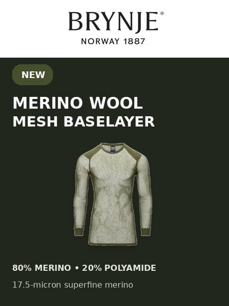 Tactical Wool Thermo ShirtSuperfine merino wool-blend mesh baselayer with a slim unisex fit and densely knitted shoulder panels for pack-carrying comfort. Weighs 4.9oz | 140g
 © Beartooth Media Group Inc.
 Loading...