First of all Im not a native english speaker so sorry for my spelling!
In 10 Days across Switzerland
Taking the Via Alpina green route across Switzerland. 370km and 26500hm over 14 alpine passes and through pristine valleys – from Montreux to Sargans.
Introduction
This route has been a dream since I first heard of it a few years ago. It was not important for me to do it in under 10 days or as fast as possible, instead I was driven to turn a dream into real – walking home from Montreux. I planned everything from my calorie intake to my daily mileage and my resupply points. I did this trip from 9.2 to 09.11.13
It turned out do be harder, more impressive and fulfilling then I ever thought.
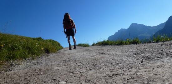
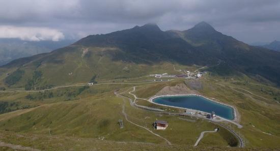
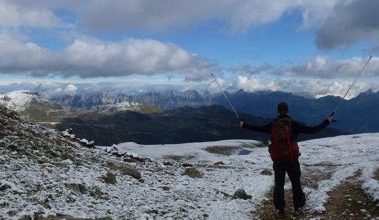
The Route

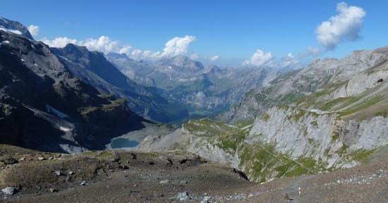
route across Switzerland
The official website says the trail is 370km (230mi) long. If you ask me its shorter.
They also say its about 27000m (81000ft) of ascent and descent, this time, in my opinion, its more!
Most people walk the trail from Sargans to Montreux but because I life near Sargans I turned it around and walked from Montreux towards home. The route goes over 14 alpine passes of which everyone is higher than 2000m (6000ft). After reaching a pass the trail drops right down into the next valley only to climb up again on the other side.
I divided the whole stretch into 10 stages. Sometimes I hiked further sometimes I knocked down before. I will not metion where I camped because its actually forbidden for most parts of the way….so I did mostly stealth camping. Pitched up my tarptent after sunset and was hiking away quite early. This way its no problem at all! Some farmers even offer you a place to stay after you talked to them.
1 . Montreux – LEtivaz

view down from Rocher de Naye
I started my journey 9 o’clock at the trainstation in Montreux. First I went down to lake Leman. I like to start as close to the French border as possible. After a couple minutes on the lake I started to climb up towards Rochers de Naye. Its a 1600m (4800ft) ascent and, even for a guy who is grown up in the alps, very steep. I also was not used to a backpack this early into the hike. But the views were just amazing!

lac del l`Hongrin
My legs were pretty good on the first day and soon I reached a good spot for the night near LEtivaz
2. LEtivaz – Lenk

concrete work up in the mountains
After a good night of sleep I headed towards Col de Jable. The weather was amazing and my motivation was high.

Wasseregrat
The walk over Wasseregrat was one of the best I ever did. The views were just stunning. There is no water for about 2hours so I carried about 1.5l of extra weight over the crest. There was nobody else up there. I did enjoy long hours without seeing anybody. It was pretty late as I reached Lenk so I went to the campground for a quick shower and soon hit the sleepingbag.
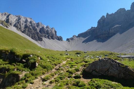
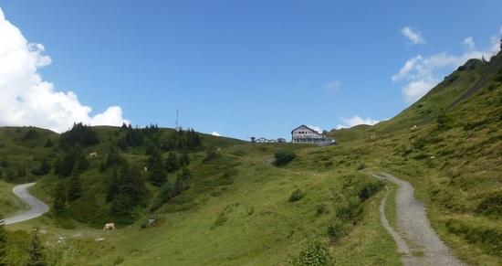
3. Lenk – Kandersteg
The Trail from Lenk to Adelboden and from Adelboden to Kandersteg is very pobular in Switzerland but I didn’t encounter very many people, mostly because it was a workday and no holiday.
hikers Highway from Lenk to Adelboden
Bunderchrinde
It was another “bluesky” day and very hot uncommon for this time of the year. Shorts and T-shirt up at 2385m (7200ft)
view towards Kandertal
On the downhill I was a little bit in a hurry because I had do get into town befor 6pm to get my resupplybox from the post office. A couple minutes befor closing time I reached Kandersteg and was lucky to find a full resupply packet waiting for me.
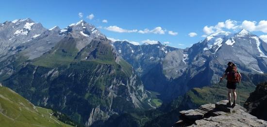
4. Kandersteg – Lauterbrunnen
This day is gonna be the longest and hardest on the whole trip. I had food for four days in my pack und will cross the two highest passes on the Via Alpina. I will walk past three mountain huts namely: Blüemlisalp SAC, Gspaltenhorn SAC and Rotstock SAC
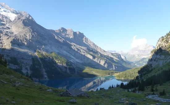
early morning at Oeschinensee
The trail up to Hohtülipass (2778m) was pretty busy and I did cross and pass alot of other hikers. Some did even carry glacier equipment such as ice axes and crampons… well there are enough glaciers around to use that stuff.
view back to Kandersteg

stairs down from Hohtuerli leading to Griesalp
Instead of going all the way down to Griesalp like the Via Alpine trail does I choose to cross the glacier higher and took a shortcut to Gspaltenhornhütte SAC
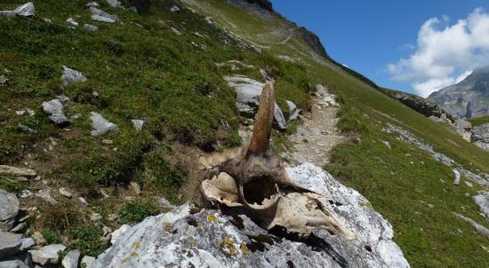
avalanche victim
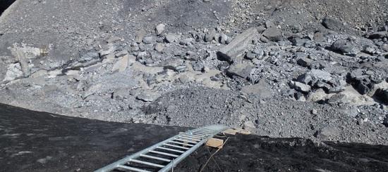
ladder down a moraine
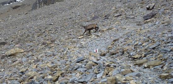
wildlife crossing the path
After a long push from Gspaltenhornhütte SAC over Serfinenfurggel I reached Rotstockhütte SAC and was definitely ready for a big coke and a coffee. From Rotstockhütte SAC it was a 90min hike down to Mürren were I took the train down to Lauterbrunnen. This was the first of three times I used public transportation during the whole ten days.
5. Lauterbrunnen – Meiringen
I was still a little bit tired from the day befor so I took the train up to kleine Scheidegg. This was by far the most boring day on the trip. Wide walking paths and alot of road crossing the whole day. To get away from the big crowd I took the highroute called the Eigertrail from kleine Scheidegg to Grindelwald.
Nothing special honestly. You just walk along the face of the Eiger your not even able to see it while walking because its right above you…so all you see is a ordinary alpine trail.
kleine Scheidegg
trail along the road up to grosse Scheidegg
I took a long nap on the top a couple hundert yards away from the restaurant. The way down to Meiringen was in my opinion still not very interesting . I needed alot of energy to maintain discipline and not taking the bus.
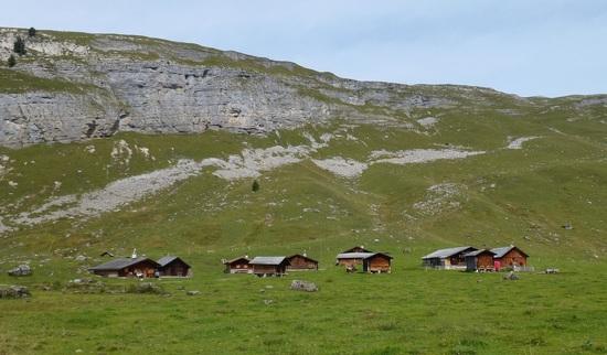
6. Meiringen – Engelberg
From Meiringen up to Planplatten it was a strenuous 1600m (4800ft) ascent. I started early and saw only a couple hikers all the way to the top . This is how I like it. From Planplatten the trail follows mainly the ridge all the way to Tannensee and Engstlenalp. From Engstlenalp the way goes over Jochpass down to Trüebsee and further down to Engelberg.

View back to grosse Scheidegg
Engstlenalp

trail leads to Jochpass
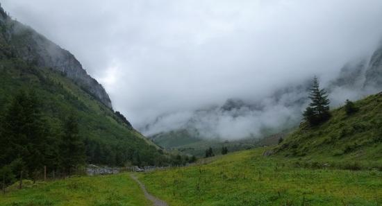
7.Engelberg – Altdorf
Day seven was the first day it rained on me. The trail follows a nice valley which also was nice to see while there was alot of clouds an fog hanging down the mountains. Down from Surenenpass the trail follows a nice crest but I was not able to see much because of the fog but I could almost feel how exposed I was.
trail to Surenenpass

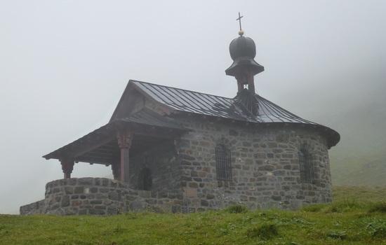
Church along the way
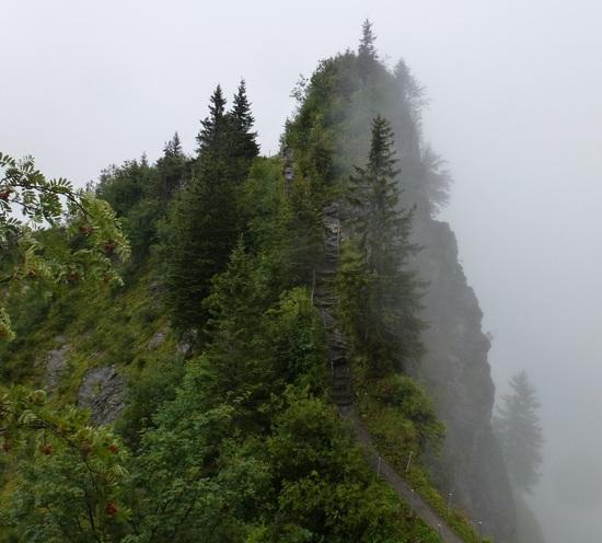
trail over Rueteli

it clears of for a moment
8. Altdorf – Lintthal
Altdorf was my second resupply point an I loaded up the last 3 days of food and a set of batteries for my GPS. Because it was still raining and foggy I took the Bus up to Klausenpass. I saved alot of time this way and decided to take the Clariden Highroute which will lead me to Urnerboden over Gemsfairhüttli and Fisetenpass.
Church on Klausenpass

Clariden highroute

Urnerboden
9. Linthtal – Matt
This was my second last day and I felt already bad about it. There was some fresh snow up on the high mountains and the temperature was dropping fast. I almost walked till dark and camped 800m (2400ft) underneath Richetlipass.
fresh snow on the mountains
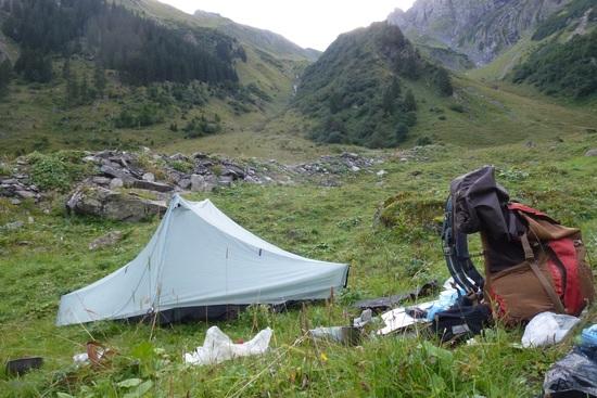
camp before Richetlipass

Richetlipass second last pass for this trek
10. Matt – Flums
I started the last day pretty early but forced me to walk slowly and to enjoy the last day. This stage is not really the Via Alpina trail (which would go over Foopass to Sargans) but it will lead me straight to my hometown.
Like the last nine days the trail goes through a valley and gets steeper and steeper till it reaches the pass.
There was some fresh snow on the ground and the trail was covered in white. Luckily Im very familiar with this area and navigation was no issue at all.

trail up to the last pass
done! Its all downhill now
Gear List & Review
Its interesting all the guys from the US and Canada like the brands from Europe (like Mammut) and all the guys from Europe like the stuff from North America (Patagonia, Arcteryx)
I dont care about the brand and just use what works best for me.
My pack weight was about 8.2kg or 18pounds. Wow thats heavy but hey those are the alps and I did encounter heavy rain and temperature between -1C up to 30C
Shelter: 870g
Tarptent Notch + solide inner 830g
+Groundsheet 40g
Nothing to say about that! Just a great tent. Would take it again.
Sleepingbag: 960g
Cumulus Panyam 450 860g
+ Silk Liner 100g
Overkill but was already available. Would take a quilt next time and save up to 300g
Sleepingpad: 475g
Exped SynmatUL7
Also on the heavy side but was also already there. I also own a Z-lite but the 100g more are worth the comfort.
Backpack: 1300g
Granit Gear Blaze A.C 60l
+hipbelt pockets
Once again heavy but I just love it!
Stove & Cookingkit: 780g
Vargo ti alc stove
2x120ml alc bottle
MiniBic
Trangia ul pot
Alu windscreen
Alu lid
Snowpeak cup 450
Spork
Swiss pocket knife
2l nalgene folding bottle
Almost perfect for me and you get alc in every town (drugstore). Stove takes long to prime. And you need round 35ml alc to get it going but then you have a lot left on the end.
Would only take one 900ml pot instead of the trangia pot and a 450ml cup.
Took a regular swiss pocket knife…a smaller one would also do it. Did not use it alot
Clothes: 2060g
2x Inov running socks (1x worn)
Smartwool heavy socks (sleeping)
2x icebreaker underwear
Odlo long underwear
OR zip/off pants
Pearl izumi running shorts (worn)
Patagonia t-shirt (worn)
Patagonia Zip-Neck longsleeve
Patagonia R1 hoody
Patagonia Nano Puff Jacket
ME fleece hat
Marmot fleece gloves
Buff
Arcteryx cap (worn)
ME Rainfall pants
Montane Air Jacket
LaSportiva Wildcat 2.0 (worn)
Inov gaiters (worn)
Electronics: 1070g
Iphone
Ipod shuffle+ears
Camera Panasonic tz22
Petzl headlamp
Charger for iphone/ipod/fenix
Belkine4000 accupack
Garmin Oregon 300
Batterys for the GPS
Toiletries: 400g
misc: 350g
All together I was pretty happy with all my gear and would take everything again except the gps. I also would leave the belkine4000 accupack at home and just only use the altimeter on the fenix.
A 600g quilt would also be nice. And I might give the z-lite another try just get used to it before at home.
Food & Resupply
I purchased all my food before the trip and sent it with some other supplies(e.g maps, batteries, razor) to Kandersteg from Kandersteg I forwarded it to Altdorf.
You could go far lighter if you would just buy as you go and eat lunch up in the huts. But for me this was the best way so I could control my calorie intake and learn alot for further trips. I also walked through towns before/after opening hours. I almost never carried more than 0.5l of water. There is plenty of water all over. I just drank right from the streams.
I did manage to eat up to 3800kcal a day which was about 900grams of food each day. I only had a couple crackers left after 10days. On the longest stretch I had four days of food in my pack. On the way I only bought 4 Kiwis, 1 Avocado, 1 Coffee, 1 Coke, 1 Milkshake and 2 Croissant.
Breakfast:
Homemade müesli with milkpowder 145g/640kcal
Snack1:
Homemade trailmix: 140g/680kcal
Snack2:
Trek'n eat oat snack: 65g/265kcal
Snack3:
Darvida crackers: 80g/500kcal
Snack4:
Swiss milk chocolate: 50g/250kcal
Snack5:
Linzertorte/pastry: 60g/250kcal
Snack6:
Cornybar: 50g/220kcal
Dinner:
Travellunch: 250g/approx. 1000kcal (double serving)
Navigation
Navigation was almost never an issue. The trail is very well marked. I carried a set of 1:25000 maps which cover the whole way as also a Garmin Oregon300. I used my altimeter on the Garmin Fenix alot to see how far up the next pass is or how much descent lies ahead of me. A nice to have but not necessary. The papermaps would just do it.
I did also GPS record some stretches using the Garmin Fenix watch. To charge the fenix I used a Belkine4000 accupack which is on 130g pretty light.
Final thought
I had a fantastic time out there and would do it again! Everthing went smooth. I was suprised how good my legs were. Next time I would try to avoid some of the road sections around kleine Scheidegg and Meiringen. Weather was awesome and I think September is the best time for such a trip. Not as hot anymore an the chances of thunderstorms are smaller than in July/August.
Well and Im looking for a longer trip next time ;-)
If anybody is interested in some gps track just drop me a line
Thanks for reading!