With the fires in SoCal and no doubt more to come, does anyone have a source for current information on smoke in the Sierra?
thanks,
Bill D
Topic
Become a member to post in the forums.
With the fires in SoCal and no doubt more to come, does anyone have a source for current information on smoke in the Sierra?
thanks,
Bill D
Nick,
thanks for that interesting page on CA fires…
However, not exactly what I am looking for…
it has lots of text, data, and fire maps… but tell me little if anything about where the smoke is going… or how bad the smoke is…
I guess what I'm looking for is a map like a weather map, but a smoke map instead… showing how the smoke is drifting from the fires and how bad it is in different locations… specifically for my purposes, how bad it is at various locations throughout the Sierra…
bill
The NWS offices were preparing smoke maps for the Mountain Fire last week… Not sure if it's something they do regularly or just every once in a while. Try the NWS Oxnard or NWS Hanford websites.
Thanks Nico… found this:
http://airquality.weather.gov/sectors/conus.php
not sure how accurate it is for the Sierra, but it's something…
bill
This is for plumes. You can identify them by their “point source” origin. Not so good for generalized smoke, but it will give an idea of what to expect. Clouds and overcast make it difficult to figure out what is going on. The only major fire in the west is the “Mountain” near Riverside, and that is obscured by cloud cover.
Select the region of interest, “4K”,”Visible”, and watch it loop.
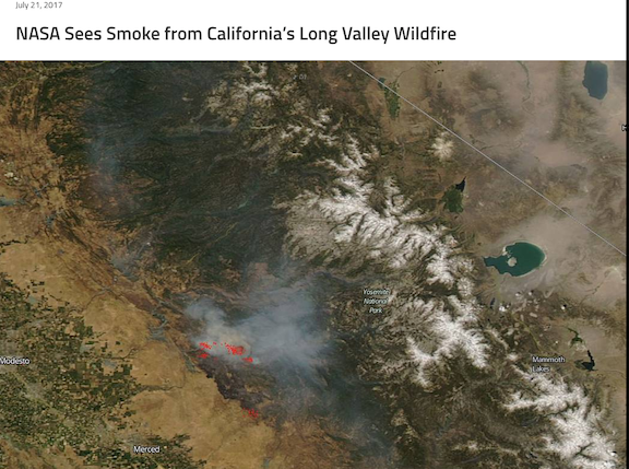
Hello. I am trying to find accurate smoke imagery like the screenshot image below. Someone posted this fire and smoke site on BPL originally, and it is not any of the ones in the thread of this post. The site was accurate, visually informative, and had some kind of animation loop. I am considering a last minute change to my plans, and need more information to proceed. Thanks.

nm
Awesome, thanks.
nm
Become a member to post in the forums.
 Ultralight folding polesCarbon fiber, adjustable, 15" collapsed length.
 Loading...