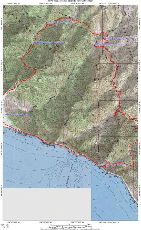
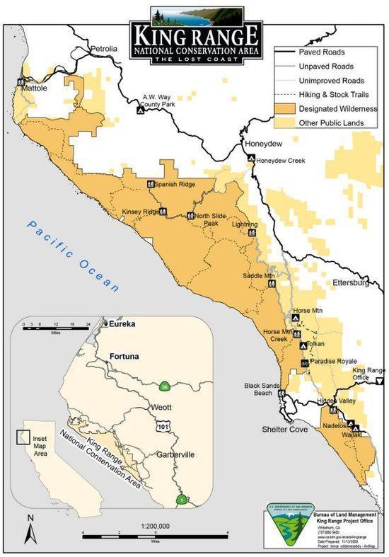
Here is the general vicinity

Saddle Mountain, Rattlesnake Ridge, Buck Creek Loop (Saddle Mountain Trailhead)
20.9 miles, 1200 ft. climb, 4,000 ft. descent, 3,300 ft. climb
This 2-3 day moderate to difficult hiking loop is a great alternative to the popular Lost Coast Trail, as it climbs to King Peak (4,088 ft.) and descends to the beach. Park at the Saddle Mountain Trailhead and a gradual climb through a mixture of chaparral and forest, topping off with the spectacular King Peak vista. Then follow the King Crest Trail to Rattlesnake Ridge Trail. It is recommended only for adventurous backpackers who don't mind some bushwhacking and stream crossings. Follows brushy Rattlesnake Ridge before descending through old-growth forest to Big Flat Creek. Ferns and mosses line the boulder choked channel of Big Flat Creek, which you must cross multiple times on the way to the coast (bring extra shoes). You will find a year-round spring at Bear Hollow Camp after leaving King Crest Trail (fill up water here). The stretch of the Lost Coast Trail between Big Flat and Buck Creek may be impassable during high tide; take a tide chart with you. Fill up water again at Buck Creek before heading up the Buck Creek Trail to the Saddle Mountain Trailhead. NOTE: The lower portion of Rattlesnake Ridge Trail is often covered by landslides during the winter storm season. It is recommended to go up Buck Creek and down Rattlesnake Ridge.
This is part of the scheduled fun.
Buck Creek Trail ( Saddle Mountain Beach-Trailhead )
4.5 miles, 400 ft. descent. 3,300 ft. climb.
Infamous as having one of the steepest grades of any Northern California trail, Buck Creek follows an old logging road through forests to the coast. Water is available only at the mouth of Buck Creek.