INTRODUCTION
This probably going to be one of the strangest trip reports you have ever read. First, I am not going to tell you where I went, and secondly many of the descriptions and normal logistics will be purposely camouflaged. The area of this hike is rich in Native American Petroglyphs, and sections have been heavily vandalized in the past – over 150 years worth of vandalism.
The place of the hike is in a designated Wilderness Area, and the Government Agencies charged with protecting it have limited resources. The good news is that Wilderness Designation has significantly reduced travel in the area, by making the use of motorized and non-motorized vehicles illegal. I visited the two agencies that are responsible for managing the area a got little information at all. Either the employees just did not know anything, or it is policy not to divulge information. I did get all the information I needed for traveling in the area and know what the rules and regulations are.
SECRET PLACES
I often avoid places that are well publicized on the Internet or which have been included in a Trail Guide. Some of these publicized places contain gems of solitude and beauty if one travels off the recommended “beaten path.” But to me, the absolute best places to go are areas that no one goes to visit – places without trails, without roads, without Internet mention, and without Trail Guide recommendations. These places offer solitude. They feature little or no trash, and often no footprints, not to mention people.
So how does one find a Secret Place? First step is to get a big map. A State Road Atlas is excellent. Look at places that have few roads or cities around them. From there, go online and look at the USGS Topographical Maps (they are free), or better yet BLM maps (where available) are excellent at only $3.00 each. These maps are 1:100,000 scale. While they won’t tell you where most exciting places are, over time you will learn to find them. Over the years, using this methodology, I have visited most of the mountains south of Death Valley to the Mexico border, and West of the Colorado River to the Pacific Ocean. There are dozens and dozens of mountain ranges in this area of California. Some so small you can circumnavigate them in a day and others so large it takes months to truly know them. Some of these mountains I have traveled extensively and intimately; visiting every side canyon, ridgeline and high peaks. Others I have just scratched the surface, and placed on my “To Do” list. I do not have a checklist of places to go, but often just head to a place I have never been before.
This trip was my second time in this particular mountain range. I remember the first time distinctly. It was soon after my daughter was born, in 1985. On that trip I had crested a desert pass, and below me lay a large “Bajada.” A bajada is an alluvial fan of sand, rocks and debris that turns into a fairly flat plain. This bajada was formed by two small mountain ranges on each side and I would be traveling through this to my next water source, which was between 20 and 30 miles away. But I was running short of water. I would either need to rest during the day and travel at night, or find water in either of these two mountain ranges. My map only showed a “dry spring” in one of the ranges. Hardly worth the extra time and effort, with little expectation of water. As I traveled down the gentle slope of the bajada, I eventually was directly opposite of the dry spring, and my binoculars showed an abundance of greenery in the area of the spring. Well worth the two mile round trip to find out, plus if water was not available it looked like a cool place to rest in the heat of the day. Not only did I find water, but found hundreds of Petroglyphs. Since I had a time schedule to keep, I could only place a note in my mind that this was a place to come back and explore further. In the early 1990’s this area was designated an official Wilderness Area, giving me hope that it would not be harmed for future generations.
THE PURPOSE OF THIS TRIP
This trip had several purposes
1) To walk around the entire mountain range, a hike that would take most people 3 or 4 days.
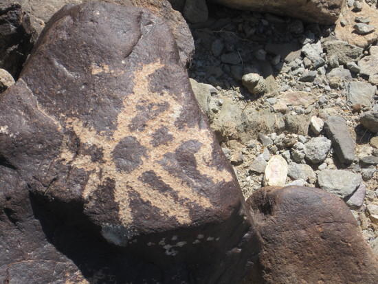
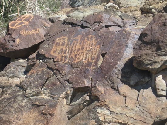
2) Spend time exploring and photographing petroglyphs.
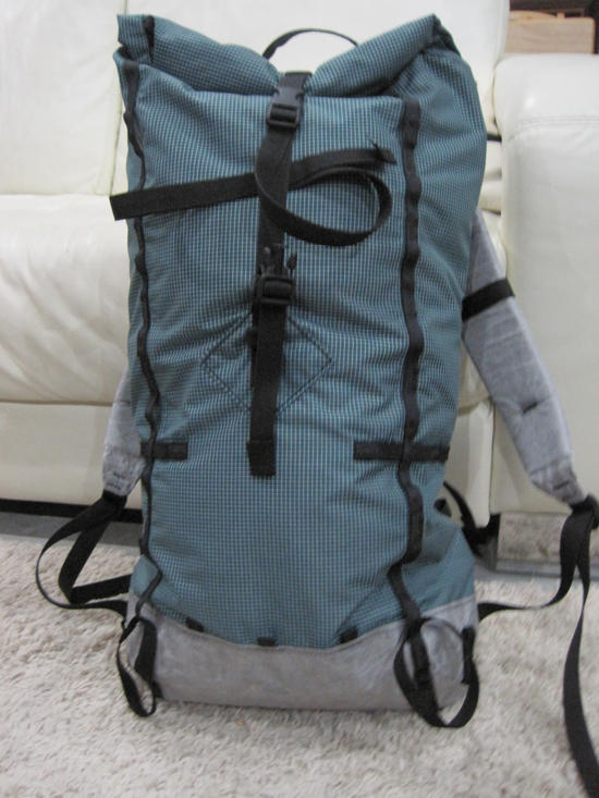
3) A shakedown cruise for my new McHale Bump 32 backpack.
LOGISTICS AND PREPARATION
To get to my starting point of the hike, I would need to travel about 20 miles on dirt roads. Not knowing the condition of the roads, and knowing the dangers of this kind of back country driving, I loaded the back of my SUV with 8 foot boards to be used a sand ramps in deep soft sand, several platforms for emergency work, 14 gallons of emergency water, air compressor, shovels, and extra tools. I got stuck in sand only one time, and two of the platforms got the vehicle moving in a few minutes.
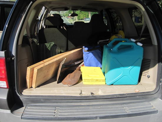
Tools for Vehicle.
Water. Tis is the limiting factor in most deserts. The way I planned the route, I would need to find water in the dry spring. If the spring was dry, I would need enough water to hike back to the SUV, I would not have enough to complete the loop. So I left the truck with 2.5 gallons of water in my pack, which weighed 22 lbs alone. I also brought 4 lbs of food, meaning 26 lbs of consumables, which I felt would be a good test for the Bump. I also brought two items I rarely use, Dirty Girl Gaiters and a hiking staff. Knowing that I would be traveling in areas with small pebbles and stones in abundance, the gaiters would help keep the debris out of my shoes. In sandy conditions, I usually don’t use gaiters because sand will pass through the mesh of my shoes anyway. The hiking staff would be helpful in moving rattlesnakes out of my way since early March can mean plenty of snakes, but I did not have to use it. I didn’t see a single snake on this trip. Temperatures would reach a high of mid 80’s and the lows in the 40’s. No rain was in the forecast, but a chance of nighttime winds with gusts up to 50 mph was a concern, so I brought a Hexamid for shelter. Instead of Ti stakes, I brought 4 Easton 9” nail spikes and 4 SMC snow stakes. They would be able to handle the kind of soil found in deserts. And as it turned out, winds were mild at night with no need to set up the shelter, but there was no wind during the day to help cool things off either.
THE TRIP
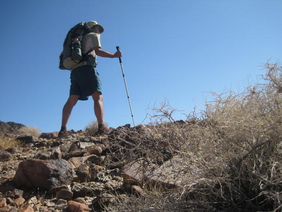
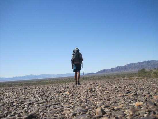
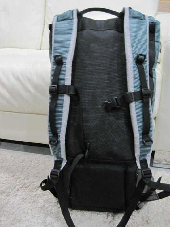
Total weight of pack was 35+ pounds. The volume of the main bag is 33 liters. The stays are bent to contour my back, keeping it close to my body, with no weight bearing on my shoulders, effectively transferring all the weight to the double-buckle hip belt.
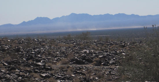
The only map I brought was the BLM map, as it would take too many 7.5 quad maps. I had studied the more detailed maps in advance, so they were not needed. However, the dozens of washes originating in the mountains were often 10 to 20 feet deep making travel slow and difficult and no contours where shown in the detailed maps, as intervals are 40 feet. Such travel was forcing me to consume too much water and travel too slowly, so I moved away from the mountain and traveled in the Bajada, after exploring two small canyons. Also the terrain between the washes was covered with “moon” rocks, a toe-stubbing, ankle-twisting gauntlet.
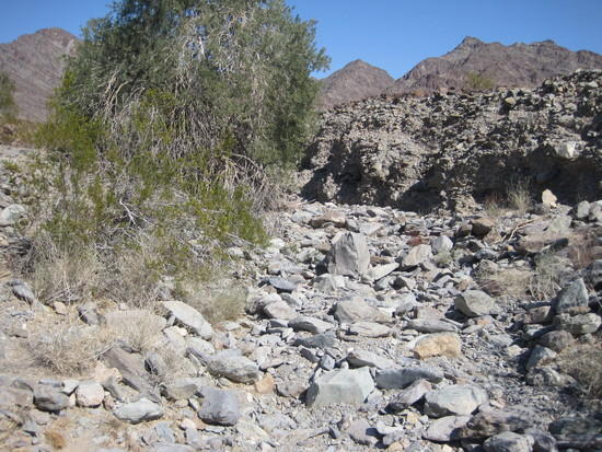
Typical Wash — there were dozens of them.
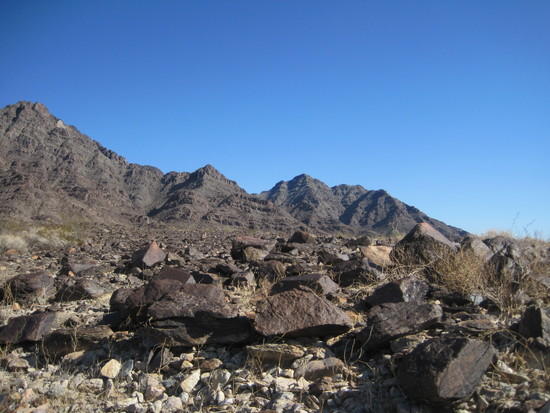
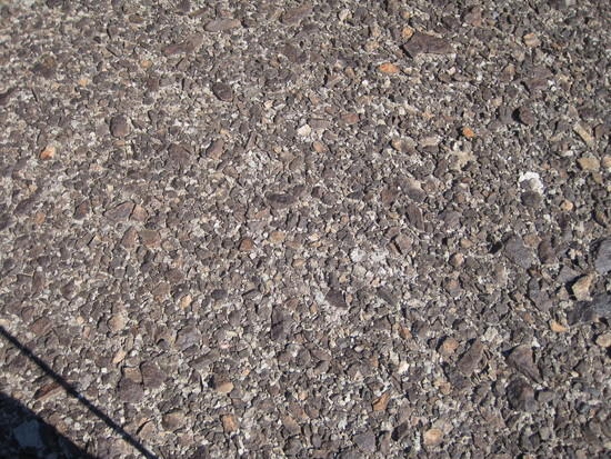
Moonscape.
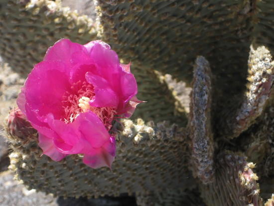
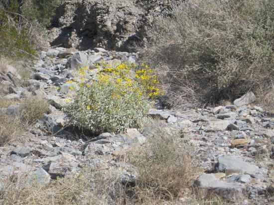
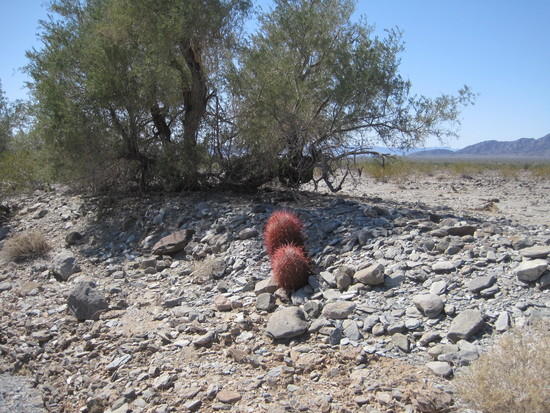
This winter has seen little rain in the desert and large blooms normally don’t occur until mid-April. But there was some flowers and plant life that encouraged time out for viewing and picture taking.
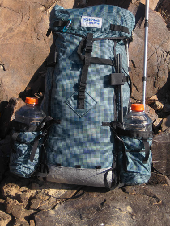
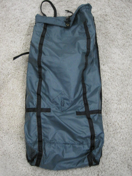
The small volume of the pack bag was perfect at 33 liters. The optional water pocket can each hold a 64 oz Gatorade bottle. I placed 6 one-liter Platypus bottles in the main sack, much easier to pack than two-liter ones. I also attached the optional hip pockets, shoulder strap pocket and top lid.
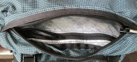
This top lid is a new design this year from Dan McHale. Small but extremely functional. There is a second pocket inside made from CubenTech that is very handy for those small items that get lost easily. Normally I strip my packs down for short trips, but I will probably take this on all my trips with this pack… it worked so well and is very convenient.
Every evening the wind picked up, and a wind shirt and beanie kept me warm enough for hanging around camp and doing chores.
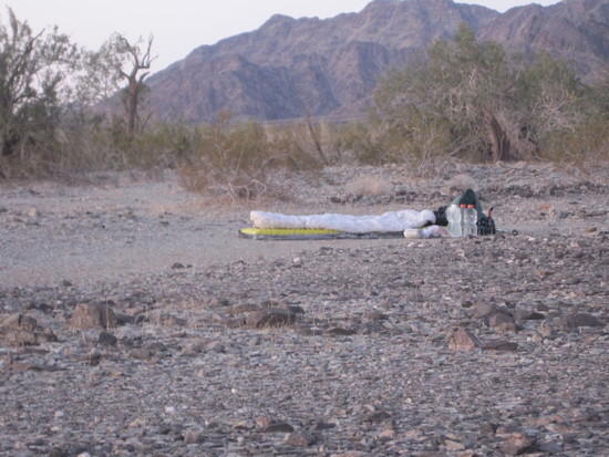
The best tent is no tent and where the sky is your canopy. So the difficulty is finding a level spot, soft enough ground to keep from puncturing your air mattress, and a wind break from the wind. Trees and shrubs work well to break the wind, but one must be far enough away so nocturnal creatures don’t feel they have an open invitation to your camp. This site offered wonderful 360 degree views, shelter from wind, and early morning sun. What else could one ask for?
People tell me they don’t like to hike alone; they get lonely with no one to talk to. They also tell me they get bored at night, needing reading material or music to keep them company. I don’t understand it. So here is my recipe for a wonderful evening and peaceful sleep.
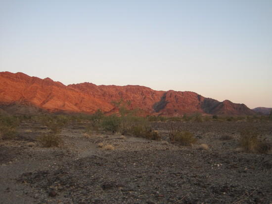
Watch the setting sun play with your surroundings. Here the normally black mountains are bright red.
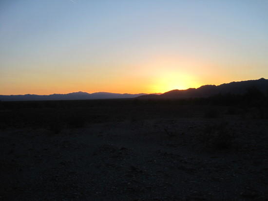
Watch the sun set. Observe colors and shadows.
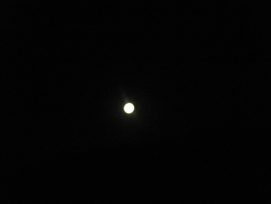
Learn of the night sky. My camp was oriented with the rising moon behind me. When nightfall arrived, I watched Venus and Jupiter play with the horizon. Once they set, I observed a nearly full moon and at times looked at it with my binoculars. Soon I dozed off. Awakening in the early morning around 3 AM, the moon was setting and I watched the winter sky, especially Orion. Next thing I knew it was daylight and I was awakening from a glorious night’s sleep. Pretty simple stuff.
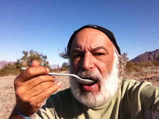
At home, I am not a big breakfast eater, but on the trail it is my favorite meal. Sleeping under the stars means there is little to do when packing up camp, so a leisurely breakfast is always in order, weather permitting. Umm, umm good!
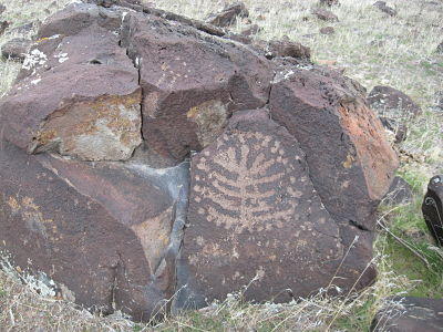
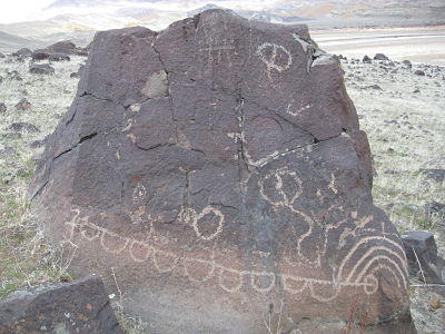
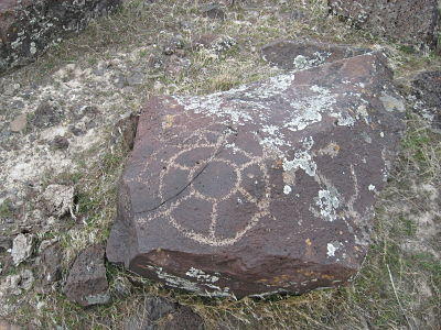
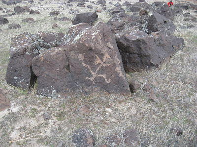
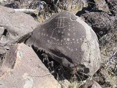
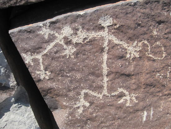
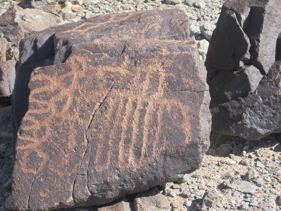
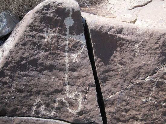
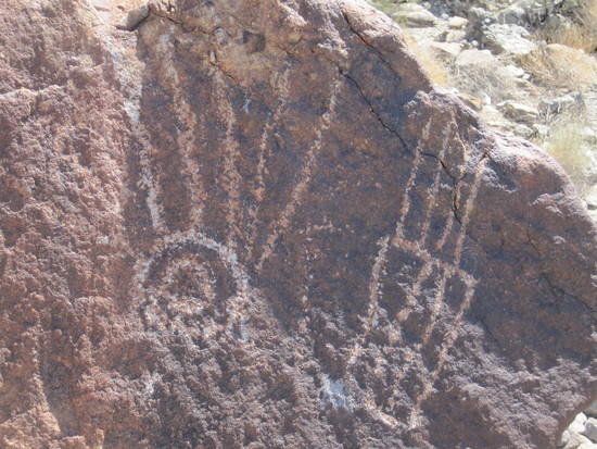
PETROGLYPHS
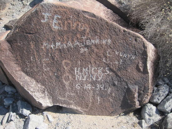
Here is an example of vandalism, and why I am trying to hide this Secret Place. Although with a little research you can find it. But it is not easy to get to. The petroglyphs that have been damaged in this picture are over 5,000 years old. Scientists can determine the age based on the amount of “desert varnish” that covers them.
OTHER
I did find water in the spring and was able to complete the loop. Here is my reflection.
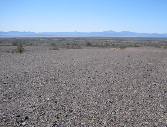
Many people think of vast mileage of sand when they think of deserts. And sometimes it in abundance. But I walked on very little sand. However in the distance is a dry lake and the wind has created a haze from the blowing sand. Probably hard to see, there are 3 large dust devils several hundred feet tall. But it is relatively calm where I am standing.
Desert pavement is the surface that is covered with packed and rather rounded rocks, almost as if someone laid them there. It is so hard that you can drive a vehicle across it at high speeds. Also, allows one to walk quickly!
GEAR FAILURE
I had two minor failures. :(
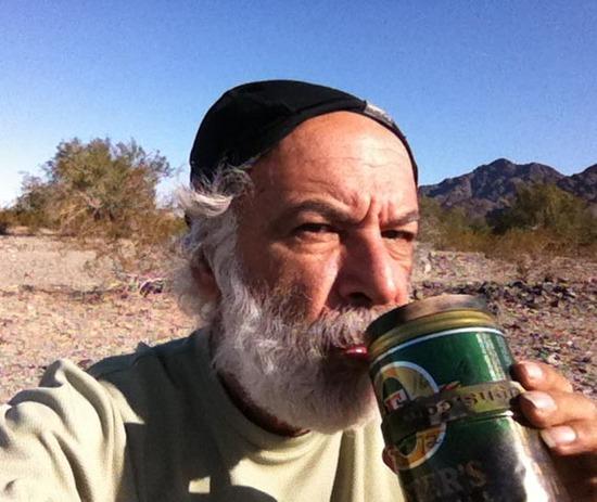
The first was a pinhole in my Foster’s can. Right at the middle fold. I have “babied” this can and it has been on many, many trips as you can see from the discoloring. To be honest, I am tired of arranging my pack to put it in a spot where it will not get crushed. So I will probably switch to a Ti pot Caldera system. I would much rather put the pot where it makes sense packing wise and stop worrying about crushing it.
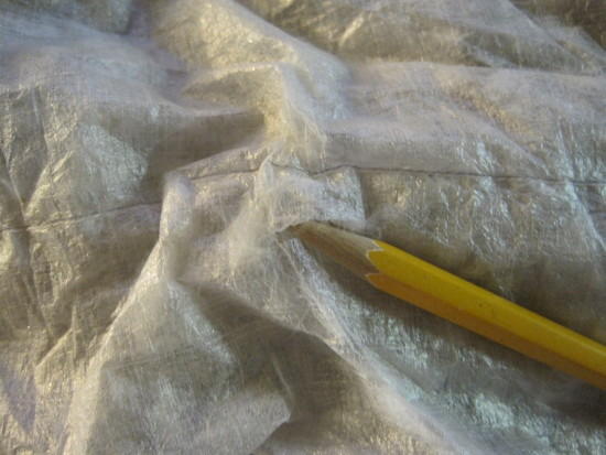
When I was putting away my quilt, I saw some feathers floating in the air. On closer inspection I noticed this tear at the top of the footbox. Since I always put the quilt in the stuff sack, and never have the top of the footbox on the ground, I think it might just be material fatigue. Duct tape will be an easy repair, but I will be on the watch for any other trouble. I just don’t see how I could have cut or torn the fabric.
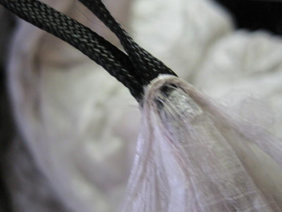
I also noticed that one of cord loops is pulling away from the cuben. These are the perils of truly UL equipment.
GEAR
The McHale Bump thoroughly exceeded expectations. Handles 35 lbs with ease, and the stays keep in close to my center of gravity. This was certainly an expense that was well worth the investment. The only difficulty through the entire purchase process was figuring out what material to make it from. Spectra is overkill for a pack of this size. I am leery of Cuben for the long term, as I expect this pack to last for at least a couple decades, and no one has used cuben for that long in a pack to report on its durability. The Cuben that Dan uses is a hybrid with a polyester laminate and he has tested it thoroughly. So I opted for Dyneema X Grid. The fabric Dan uses has the Spectra threads spaced at 3/16” of an inch, versus the ¼” most of the UL manufacturers use. So his has about 25% more spectra thread in it. The pack has a Spectra bottom and the pack of the straps is also made from Spectra. The front of the pack has a mesh panel to help with sweat.
Specs on the pack:
Main Bag Volume (excludes any accessories) ~ 2,000 cu in or 33 L.
Main Bag Volume (including the 11” roll top) ~ 3,000 cu in or 49 L.
The stays and internal pad are removable. The padded double buckle hip belt is removable.
Options included:
Top Lid
Water Bottle Pockets (easily hold 2 Liter water bottle); 2 each
Hip Belt Pockets; 2 each
Shoulder Strap Pocket; 1 each
Weights
Stripped down without Stays, Pad, or hip belt = 25.15 oz (1 lb 9.15 oz)
Note: stripped down you can add a simple web belt.
All Options Included = 51.92 (3 lb 4.92 oz)
Front of pack (stripped)
Back of pack (stripped).
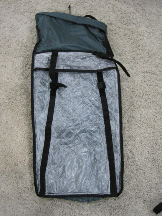
Inside of pack. Cuben pocket for foam pad. The black sleeves are for the aluminum stays.
Inside of pack. Notice the robust backing Dan uses for the daisy chains and attachments. It is not sewn directly to the material only.
Gear Summary


TRIP SUMMARY
I completed the planned loop.
I located and photographed hundreds of petroglyphs.
The pack performed brilliantly.
I did not see a single footprint or person.
:)