Topic

SHR trip report Aug 15th – 31st


Forum Posting

A Membership is required to post in the forums. Login or become a member to post in the member forums!

Home Forums Campfire Member Trip Reports SHR trip report Aug 15th – 31st

  • This topic is empty.
Viewing 23 posts - 1 through 23 (of 23 total)
  • Author
    Posts
  • #1278872
    Hannes Horst
    Member

    @hochtourist

    Hi folks,

    I hiked the entire Sierra High Route between August 15th and 31st. I have to say it was a very special hike for me – the longest, wildest, most challenging I have ever done. And I would like to thank everyone on this forum who helped me prepare for it.

    Having looked into Steve's trip report (http://www.backpackinglight.com/cgi-bin/backpackinglight/forums/thread_display.html?forum_thread_id=51727), I think I was lucky to start a bit later. I still encountered sections where Roeper's route descriptions didn't apply due to the snow pack, but it sure got a lot better during those two weeks.

    My itinery was:
    1. day: Road's End – Grouse Lake
    2: Grouse Lake – Horsehsoe Lake
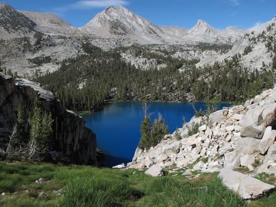
    3: Horseshoe Lake – Marion Lake
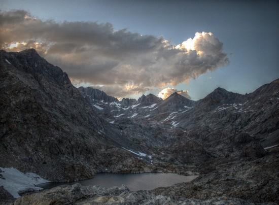
    4: Marion Lake – Palisade Lakes
    5: Palisade Lakes – Dusy Basin
    6: Dusy Basin – Evolution Lake
    7: Evolution Lake – Mesa Lake
    8: Mesa Lake – Brown Bear Lake
    9: Brown Bear Lake – Laurel Lake
    10: Laurel Lake – Ruby Lake
    11: Ruby Lake – Red's Meadow
    12: Red's Meadow – Iceberg Lake
    13: Iceberg Lake – Twin Island Lakes
    14: Twin Island Lakes – Coney Crags
    15: Coney Crags – High Sierra Mine
    16: High Sierra Mine – Soldier Lake
    17: Soldier Lake – Twin Lakes, Mono Village

    First some general notes on the route and my approach:
    – I didn't really go very light. My base weight was 11 kg (ca. 24 pounds), including a pair of 6-spike aluminium crampons. I also wore solid boots, though rather light ones.
    – I only really used the crampons on three days when crossing icy snowfields in the morning. But in all those three occasions I was extremely glad I had brought them along.
    – I had clearly underestimated the sheer physical strain of the route. I had hoped to find the time to climb some mountains en route but, in the end, was just glad to be able to get through with it within 17 days. At least I made the 10 minute diversion to the top of Mammoth crest which sports a truly spectacular view.
    – I had also underestimated the mental strain of routefinding and walking in complex terrain all day. Some section were especially tiresome in this respect, for instance crossing Cirque, Potluck and Knapsack passes all in one day.
    – On the other hand, I had somewhat overestimated the technical challenges. Here I was more withing my comfort zone than I had anticipated. Somehow, I got a good feeling for the prior unfamiliar granite slabs right from the beginning. The only type of terrain I really struggled with was the suncupped snow and I landed on my bottom more often than I cared for.
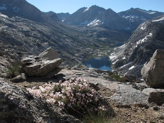
    – The bugs were pretty bad in some places (topped by Marion Lake). A headnet was the very last item I added to my gear list and it turned out to be essential.
    – Stream crossings were generally okay. I didn't encounter particularly high water levels anywehere.

    Some remarks on particular places:
    – I really struggled during the first three days because of the heavy load (food for twelfe days) and the lack of acclimisation. I started up to Grouse Lake around noon. I can only recommed to travel to Road's End the day before and then start the long ascent eary next day when you can do the lower altitudes before it is getting hot.
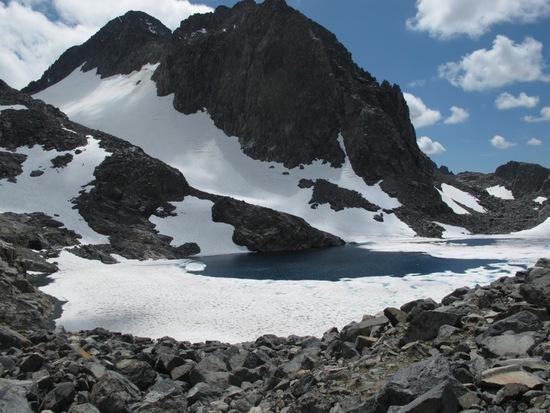
    – Crossing Muir pass was surprisingly tiring. I had hoped for a relaxed on-trail day but the snow and some diversions of the trail turned it into a tough day.
    – Snow Tongue pass was a major pain, increased by some routefinding mistakes I did on the approach which led me through talus already on the southern side. On the Northern side, it was horrible talus, heavily suncupped snow, horrible talus, heavily suncu… and so forth.
    – Decending Feather pass, Roeper's description was especially unapplicable. It was just all snow up there.
    – I concur that the the path from Lower Mills Creek Lake to the Second Recess is hard to follow. But not because of "downed trees" but because I often just couldn't find it!
    – On the map, the trail down Second Recess crosses Mono creek upstream of Mills creek. This has changed. The trail now leads to the creek downstream. I waded through it (kneedeep, strong current), as I did see a log but couldn't find a way to it. I later met someone who actaully crossed th elog. So keep bushwacking and don't wade! ;-)
    – The chute up to Cecile Lake, in my mind, is class 4, not class 3 (short, though). However, I can't rule out that there is an easier option than the obvious chute you see from below.
    – The traverse after crossing Mine Shaft pass was quite unpleasant. The rock is not completely solid and steep, hard snowfields (used the crampons for one them) were lingering in between.
    – Crossing the east ridge of Mount Conness was huge fun and lifted my mood after abovementioned unpleasant traverse.
    – The descent down from Horse Creek pass proved to be one of the least enjoyable parts of the entire High Route. I believe the talus has been specifically designed to keep the hiker from becoming sad to leave the route behind.

    A general summary of my experience: It was tough and challenging. I twisted my ankle, hurt my shoulder and my behind, ripped my pants, pretty much destroyed my boots, left my cutlery behind (man, did I get mad at myself over this) but still managed to enjoy it most the way.

    I will post a link to pictures in a few weeks, it will take a while to sort them all out.

    Cheers
    Hannes

    #1775774
    Mike M
    BPL Member

    @mtwarden

    Locale: Montana

    thanks for the report; I've yet to read a trip report on the SHR that didn't paint a clear picture of a very tough, but very rewarding route.

    carrying 12 days of food would be a killer, is there any decent way to break that up?

    #1775779
    Diana Vann
    BPL Member

    @dianav

    Locale: Wandering

    Hannes,

    Thanks for the write-up. I look forward to seeing your photos.

    #1775785
    Ken Thompson
    BPL Member

    @here

    Locale: Right there

    More please!

    #1775789
    Hannes Horst
    Member

    @hochtourist

    @Mike: Well, in the end, it took me only 11 days to get to Red's Meadow but I wasn't sure about it beforehand. To reduce the load further, I only see two options: Either you go faster (i.e. as Steve started off) or you make a detour (e.g. over Bishop pass, Piute pass).

    By the way: very tough and very rewarding sums it up pretty well.


    @Ken
    : More of what, precisely? ;-) I usually post longer trip reports (in German) on my blog. Maybe this time, I should translate it. Mhh, that may take a while as well, I am afraid.

    #1775790
    Ken Thompson
    BPL Member

    @here

    Locale: Right there

    More of your experiences out there. Photos of course. Your english is excellent. You could post a link to your blog and let Google translate do the work for you. Thanks for sharing.

    #1775811
    Manfred
    BPL Member

    @orienteering

    Hallo Hannes,

    leider kann man Dir keine persoenlichen Messages (PM) schicken, da Du Du das in Deinem Profil nicht erlaubst.

    Da ich in zwei Wochen auf den SHR gehe, bin ich sehr an weiteren Einzelheiten interessiert.

    Daher waere es nett, wenn Du mir eine PM mit Deiner Email-Adresse schicken koenntest.

    Viele Gruesse und herzlichen Glueckwunsch zur Bewaeltigung der Route.

    Manfred

    #1776017
    kevin smith
    Member

    @divr6347

    hi hannes

    glad to hear you made it thru the whole trip and had a wonderful time here in the sierras it was a pleasure to meet you and im glad i was able to get you to roads end before the permit office closed lol i arrived home around 4 pm and had a nice drive back stopping to look at some fishing spots along the kings and talking to a few fly fisherman to find out what they were biting on it was a beautiful day in kings canyon that day and roads end was pretty busy to no suprise

    looking foward to your photos when you get time to post them i hope you enjoyed
    the california mountains hopefully you can come back out sometime for a hike with other bpl members including myself that would be great

    cheers
    kevin

    #1776023
    David W.
    BPL Member

    @davidpcvsamoa

    Locale: East Bay, CA

    Thanks for the excellent report Hannes and congratulations on finishing you hike. Kevin, good on you for pick up and ride to Roads End. That's some excellent BPL and San Joaquin Valley hospitality.

    #1776029
    Hannes Horst
    Member

    @hochtourist

    @Ken: Google Translate – good idea! I will look into that. Anyway, of course I'll post as soon as pics, etc. are online. But let me get back to Germany first. ;-)


    @Kevin
    : It was a great pleasure to meet you, too! It would definitely be great to come back at some point and explore more of the Californian mountains with some of you.

    @Manfred: I replied to your PM.

    #1777501
    Steve S
    Member

    @idahosteve

    Locale: Idaho

    Hannes,

    congrats! way to go! Glad that your later start worked out for you. I was dissapointed in not being able to do the route, but am glad of the portion I did do. Everything you touched on I can remember so vividly! Especially the physical aspect! It never seemed to let up.
    Looking forward to seeing your pics and more.

    #1779557
    Hannes Horst
    Member

    @hochtourist

    Thanks, Steve! I definitely agree on the physical aspect – even though my pace was much lower than yours, there just were no short days. But of course that was one the things that turned this into a very intense and special trip. Well, I wish you better conditions for your next hikes!

    By now, I have finished the first part (of probably six – sometimes I enjoy writing) of my extensive trip report. The writing is in German and I am afraid Google translate doesn't do a vey good job on it but the captions in the gallery are also in English.

    Introduction: http://deichjodler.blogspot.com/2011/09/sierra-high-route-der-weg-nach-kings.html
    Part I (Kings Canyon to Marion Lake) : http://deichjodler.blogspot.com/2011/09/sierra-high-route-1-eine-frage-des.html

    The gallery links are located at the bottom of the introduction and the top of part I. Right now, however, picasaweb seems to have a little problem. I hope, this will be sorted out soon.

    I will complete the gallery as I write the following parts. And keep you updated.

    Cheers
    Hannes

    #1779864
    Hannes Horst
    Member

    @hochtourist

    I just completed writing part II (Marion Lake to Evolution Lake): http://deichjodler.blogspot.com/2011/09/sierra-high-route-2-immer-schon.html#more

    Picasaweb is working fine, my problems were due to some weird error in the system time on my machine. By the way, the gallery links of the different parts all link to the same gallery, only a different entry picture. Anyway, enjoy the pics! Some teasers here:

    Looking down on Marion Lake, Lake Basin in the back.
    Looking down on Marion Lake

    Looking back onto Palisade Lakes, halfway up Cirque Pass
    Looking back onto Palisade Lakes, halfway up Cirque Pass

    Wanda Lake and the impressive Goddard Divide
    Wanda Lake and the impressive Goddard Divide

    #1780399
    Hannes Horst
    Member

    @hochtourist

    I just uploaded part III (Evolution Lake to Laurel Lake) to my blog: http://deichjodler.blogspot.com/2011/09/sierra-high-route-3-ins-herz-der-sierra.html

    #1781244
    Hannes Horst
    Member

    @hochtourist

    Part IV (Laurel Lake to Red's Meadow) with according pictures is online now: http://deichjodler.blogspot.com/2011/09/sierra-high-route-4-zivilisationskontak.html

    I'd really love to insert some pictures here, but for some reason, the upload button doesn't seem to work. Maybe I should try with a different browser next time.

    #1781261
    francis siracusa
    BPL Member

    @fsiracusa

    Locale: Northeast

    google translate actually works pretty well on your links…nice write-up!!

    Frank

    #1782996
    Hannes Horst
    Member

    @hochtourist

    Thanks, Frank! And I am glad Google translate works for you. I guess knowing the much less awkward original text doesn't help for liking the translation. :-)

    Well, I have just uploaded part V of the story: http://deichjodler.blogspot.com/2011/09/sierra-high-route-5-zuruck-in-die.html#more

    Some teasers:

    Garnet Lake seen from Whitebark Pass
    Garnet Lake

    Lake Catherine; compare that to Gabriel's pic of the same lake taken about a week later: http://www.backpackinglight.com/cgi-bin/backpackinglight/forums/thread_display.html?forum_thread_id=53549Lake Catherine

    The Southern Twin Island Lake after sunset
    Twin Island Lake

    Cheers
    Hannes

    #1783318
    Sabine Funk
    Member

    @sabinefunk

    I'm surprised, how many Germans know about the SHR (I am one, too…). I never heard about it in Germany…

    Thanks for your great report. I am really glad, I didn't do it this year. I was going to do it solo southbound from Tuolumne and hitting the SHR just after Reds Meadow, but my startdate was July 20 and seeing how tough it was just hiking on trails with all that snow, I decided to stay on the JMT.
    But I'll be back!!!

    Just one question: Where did you resupply? Only once at Red's Meadow or before, too???

    For all others who still want to do it in the future: There are good maps online at http://www.onthetrail.org/shr.html
    They are especially helpful if you are going southbound and don't want to read Roper's book backwards all the time.

    #1783345
    Mike M
    BPL Member

    @mtwarden

    Locale: Montana

    little thread drift here, but is there any advantage (or disadvantage) going southbound?

    thanks

    #1783428
    Hannes Horst
    Member

    @hochtourist

    Sabine,
    I am not sure the two of us qualify as "many". ;-) Seriously, like you I had never heard about the SHR in Germany. I became aware of it when actively searching for hiking possibilities in the Sierra other than the JMT.

    Indeed I re-supplied only at Red's Meadow. That made for a heavy load during the first few days.

    In July, hiking the High Sierra must have been really tough. How was hiking the JMT? In any case I wish you good luck for your next attempt on the SHR!

    Mike,
    I am aware of several points you have to consider: Slope inclinations, altitude and elevation gain, sun position

    1) Most of the major passes are steeper on the Northern side than on the Southern. On the one hand, this means going South-North is less strenous than the other way around. On the other hand, ascending steep, rocky terrain is usually technically easier than descending it. Finally, I believe a major advantage of South-North is that most permanent snow fields are crossed in decent (glissading opportunities!).

    2) Most of the 12000+ ft passes are on the Southern half of the route. Thus, starting North should allow for slightly easier acclimatization. Furthermore, the elevation gain from Kings Canyon to Grouse Lake Pass is worse than Twin Lakes to Horse Creek Pass.

    3) South to North has the advantage that you have the sun behind you rather than in your face. Admittedly, during the high season the sun is so close to the zenith that this should not make a huge difference.

    Cheers
    Hannes

    #1783434
    Mike M
    BPL Member

    @mtwarden

    Locale: Montana

    thanks- that explains it very well :)

    #1785523
    Sabine Funk
    Member

    @sabinefunk

    Hannes,
    yip, it wasn't easy all the time even on the JMT. In fact, I was doing a lot crosscountry there because the trail wasn't visible anyway so I took some shortcuts and went wherever I thought it was the easiest way. The SHR was mainly impossible as you need to see some lakes to be able to navigate and they were completely filled with snow even as low as 10500ft.
    But the snow also had its positive sides: there were hardly any people on the trail. Some PCT-hikers and very few others. A month later I came across the Donahue Pass section of the JMT again and it was just CROWDED…. So actually I am glad I hiked in so much snow =)

    #1788004
    Hannes Horst
    Member

    @hochtourist

    @Sabine: Yeah, I would probably also prefer solitude and harsher conditions to easier walking and many people around (in fact that is why I chose SHR over JMT). I was surprised how much snow and ice I found on some lakes at the end of August, so I can imagine that in July you had a lot of that!

    @Everyone: I finally concluded my trip report here: http://deichjodler.blogspot.com/2011/10/sierra-high-route-6-endspurt-durch.html

    and added some thoughts on my bivy gear: http://deichjodler.blogspot.com/2011/10/gut-geschlafen.html

    Cheers
    Hannes

Viewing 23 posts - 1 through 23 (of 23 total)
  • You must be logged in to reply to this topic.
Forum Posting

A Membership is required to post in the forums. Login or become a member to post in the member forums!

Get the Newsletter

Get our free Handbook and Receive our weekly newsletter to see what's new at Backpacking Light!

Gear Research & Discovery Tools


Loading...