This is a classic outing located in the Ecrins/Oisans region of the French Alps. It is a circular route which can be completed comfortably in the summer season by reasonably fit backpackers, without the need for particular mountaineering skills or equipment (but see notes later), in around 7-12 days. For those coming from overseas and from lower altitudes it is probably worth allowing a full two weeks and either start with some day walks to acclimatise before setting out on the trip or do some sight seeing at the end. Having said that, the altitude is not dramatic (max is around 2800m unless you take in some peaks) and we arrived and set off the following day.
Trip Details:
This report is primarily to provide logistics information for the GR54 and provide some idea of the range of terrain the route passes through rather than any kind of narrative. We completed the trip late in the season (for this area) and many of the refuges and resupply points are closed or operate restricted hours after around mid September. The layout of the report is based on Amy Lauterbach's HRP report which I thought was an excellent example of the report I was trying to achieve.
• Dates: 9 days hiking, September 19 to 27, 2010. The weather is often excellent in the Alps at this time of year but many refuges close by mid September and some of the shops are also closed until the start of the ski season at the beginning of December. This can make the trip a little more awkward than during the summer but the route is very quiet and the temperatures are great for hiking.
• Route: We followed the main route described in Kev Reynold’s 2008 Cicerone Press guide. There are a few alternatives which avoid some of the high passes which could be useful in the event of poor weather. A number of the passes which the route crosses are formed because of slates and schists which have eroded more than the main granite of the range and the terrain can be a bit loose and slippery. Care would be needed in the rain, early in the season or after fresh snowfall.
The main change we made to the route compared with the guidebook was to go anticlockwise rather than clockwise as described. This had the disadvantage of finishing in less spectacular terrain but had some resupply advantages and turned out very much to our advantage as we completed all the most technical cols before a snowfall which arrived on our fifth day. The snow would have made some of the cols we had already been over pretty unpleasant and potentially dangerous without more gear. We combined our planned day 2 and 3 (day 8 and 9 in the guide) to give us a day in hand in the event of bad weather, which we didn't need.
• Accommodation: It is a little more difficult to wild camp on this route than my experience in the Pyrenees and the route is definitely set up for staying in refuges and gites which tends to be the custom in the Alps. We had a mix of wild camping, campsites, gite and one hotel (at the end of the snowy day); wild camping a bit less than we were hoping for (but the showers were nice…….)
The two municipal camp sites (sites owned and run by the municipality to encourage people to stay in the area) we stayed on were good, particularly the one in La Chapelle-en-Valgaudemar, but were operating in winter mode. This meant that there was loads of space (the site at La Chapelle was empty) while the facilities were only partially open.
Many gites were already closed for the season and most of the refuges were also closed.
Day 1 – wild camp by Lac Muzelle. Great location
Day 2 – Gite Epilob at Le Desert-en-Valjuoffrey. It is not permitted to camp in the valley bottom although a sign indicated that there may be camping by enquiring at the bar in the village but this was closed. There is good camping on a bench ~300m above the valley floor on the south side of the valley, which I would head for if doing the route again.
Day 3: Municipal campsite in La Chapelle. Good set up on grass amongst the trees with no-one else on the site. Unlike other sites there didn't seem to be any way to pay unless the campsite guardian turned up and they didn't….. Good little shop for resupply across the road from the site.
Day 4: Winter room at Refuge du Pre de al Chaumette. This was the only place we saw any significant numbers of hikers and they had stoked the fire to glowing. I slept outside (too hot inside) and it is also possible to camp in this area as long as you are at least 100m from the refuge!
Day 5: Campsite at Vallouise. This is a bit scruffy by French standards and the winter facilities need a code to access so hopefully the responsable will turn up for you… The 8 till 8 grocery store in the village is actually open 8:30 to 19:00 so it helps if you resupply as you turn up in the village rather than leaving it until later…….
Day 6 – Monetier – campsite outside town or accommodation in town.
Day 7 – winter room in Refuge de l'Alpe or abandoned campsite or Gite in Villar d'Arene (the gite was closed on the day we went through but we got the impression that their season extended for longer than many of the others. The campsite appeared to have been abandoned in 2008. We camped here after searching around for a wild camp and there didn't seem to be any problem.)
Day 8 – campsite Le Gay above Besse en Oisans. Minimal site (aire de bivouac) but great location.
Day 9 – plenty of accommodation in Bourg d'Oisans, ranging from camping to decent hotels.
• Cost: Not including transport to and from Bourg d'Oisans, we spent 280Euro each for accommodation, food and beverages.
• Weather: We had excellent weather for the first five days with cool nights (~freezing) and comfortable hiking conditions. We then had a day of rain/snow with the rest of the trip a little more mixed but no further significant precipitation. I would advise going a week or two earlier for a bit more daylight and slightly improved chances of uninterrupted good weather.
• Bugs: No bug problems at this time of year and this actually the main reason why we tend to do our trips to the Alps/Pyrenees (and USA) in September!
• Re-supply: Resupply is pretty easy; although many places were closed there was enough to avoid having to carry any more than three days food. We re-supplied at the following locations:
Day 0: Bourg d'Oisans: several grocery stores are available, including an excellent artisan bakery (which also does an excellent petit dejeuner) for your fresh bread on the first day (open on Sunday). The La Montagne shop on the east side of the square in the centre of the village sold MSR isopro canisters and was open on Sunday. We didn't see any canisters in any other shops along the route.
Day 3/4: La Chapelle: Good little shop for resupply across the road from the municipal campsite.
Day 5/6: Vallouise: The 8 till 8 in the village is actually open 8:30 to 19:00 so it helps if you resupply as you turn up in the village rather than leaving it until later……. Good bakery near the church in the main square.
Day 6/7: A couple of reasonable grocery shops in Monetier les Bains.
Day 7/8: Good little grocery shop as you arrive in La Grave.
Day 8/9: Artisan bakery on the entry into town but only opens at 10:30! There are other shops in the village but these seemed to have closed by mid Sept.
• Restaurants and Refuge food: we didn't eat in any of the refuges (most were closed) but we did eat in the restaurant in Vallouise opposite the huit a huit grocery store, which we would highly recommend. Classic reasonably priced French bistro.
• Peaks: There are a number of opportunities for taking in peaks en route but we weren't sure we would have the time and stuck to the main route.
• Water: Water was generally available from streams and rivers en route apart from the higher reaches of some of the passes and we carried no more than a litre. We treated water as a matter of course as there are sheep and cows grazing even at the higher levels.
• Gear: This is a great hike for going light with the route climbing over passes and descending to valley level each day. We each had base weights around 3.5 to 4.5kg. We all carried 3 season gear with light down bags and wore trail running shoes.
• Scenery: The scenic quality of the route is pretty high and the walking is interesting although the early part of the route (travelling anticlockwise) was better than the last couple of days. As is the general rule with the GR routes this is not a wilderness hike, with some form of village no more than ½ to 1 days walk away at any point, but the walk is enjoyable with the frequent resupply possibilities giving a light pack and the chance to enjoy fresh French bread at regular opportunities…
• Up and Down: As indicated in the introduction, the route is a walking rather than a mountaineering trip but there is a fair bit of total ascent and descent each day ranging from 2,000m to 4,000m per day if done over nine days (based on guidebook figures). The altimeter indicated that the true ascent/descent was around 5% higher than the guidebook figures.
• How much time? The route is around 180km and around 12,500m of ascent (and descent) and the guidebook recommends itineraries of 10 or 13 days to take advantage of the accommodation options. We did the trip in 9 days which worked fine for us and felt pretty relaxed but the trip would also work well as a week long trip for people who wanted to push on. I thought the total amount of effort was around the same as the GR20 which I have done in 7 days.
• Technical difficulties: There are no real scrambling sections en route but there are a few sections, notably the cols either side of Lac Muzelle (Col de Vallon and Col de la Muzelle), where erosion has left tricky trail conditions. The Col de la Muzelle was officially closed (we only found out as we approached) and there was clearly significant work being undertaken on south side of both of these cols to try and develop a stable route in the decomposing shales but this was still hiking rather than mountaineering. The northern slope below Col de Cote Belle gave us no difficulties but would be an interesting route in early season with a slip from the trail leading very quickly to a significant cliff. I would recommend some form of crampons/ice axe for a June/early July trip and these would have been useful if we had chosen to tackle the trip in the conventional clockwise direction when we would have been going over the trickiest passes after a snowfall (we carried Grivel Spiders which would have been enough for the conditions we had).
• The quality of the trails is pretty good with some significant work being undertaken to try and stabilise the looser sections. The sections of shale need care but generally there is plenty of terrain where you can cruise and enjoy the scenery.
• Altitude: The GR54 tops out at 2760m (9,100') so shouldn't give any problems for those who visit the high mountains reasonably regularly.
• Navigation was very straightforward. We used the 1:50,000 French Ecrins Hiking Map A6, which is fine as the waymarking is pretty consistent with the standard red/white stripes. We carried a compass, which I would always take, but not a GPS and felt that this would be redundant.
• Cooking: We carried a canister stove and a Bushbuddy Ultra. The BB was fun and, while it doesn't really come into its own on a trip like this, it meant that we managed with two 250g canisters between four over the 9 days.
• Refuges: We were not interested in sleeping in refuges, which was fortunate as most of them close in mid September! It would be possible to sleep indoors on every night of the trip during the main season, mid-June to mid-September, using a combination of refuges, gites and hotels.
• Crowded? Not in late September. We met a total a four people doing the complete circuit, who were all going clockwise, and very few day hikers. The French do seem to give up on the area after early September (I have also climbed in the area early to mid September and it is already quiet by that time).
Overall: This is a route I would recommend, particularly in September when the crowds have died down. Although I enjoyed the GR20 more and the GR54 is more developed than the sections of the HRP I have done, it is a good logical route with great views of the main peaks of the Ecrins Massif.
I can post a gear list if people are interested…..
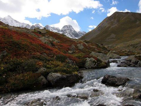
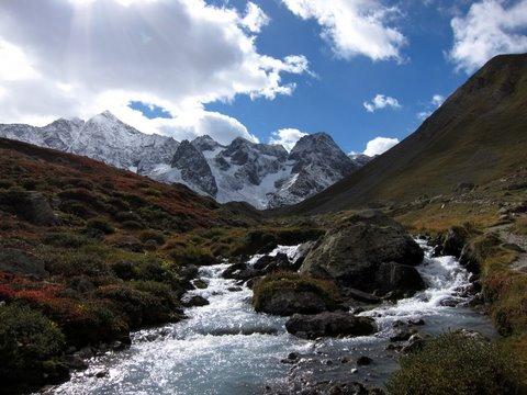
Some photos.

Lac Lauvitel on the first day

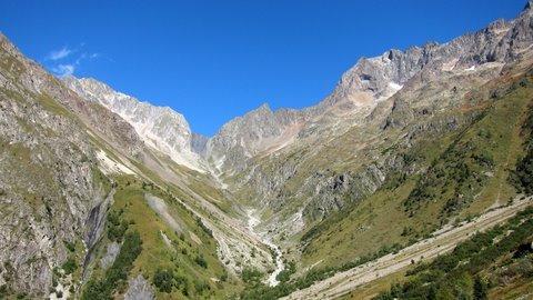
View from Col de Vallon towards the main Ecrins Massif
Col de Muzelle from the north side. The descent comes down the dark shale patch just left of centre.
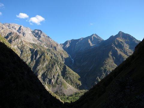
Col de la Vaurze from below Col de Cote Belle

Col de Cote Belle from below Col de la Vaurze looking across Le Desert-en-Valjouffrey
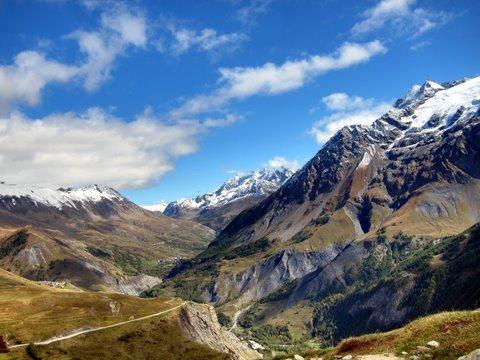
Heading down into the Valgaudemar valley from the Col de la Vaurze
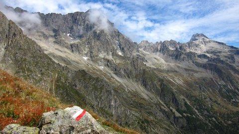
Typical GR marker on descent to La Chapelle from Col de la Vaurze
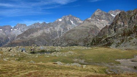
Refuges below Col de Vallonpierre

Below north side of Col de Vallonpierre

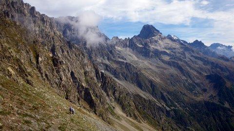
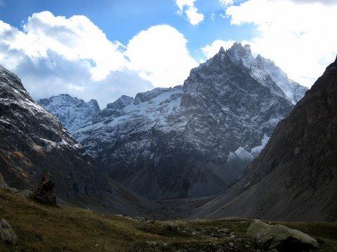
Descent from Col de l'Aup Martin
Approach to Col d'Arsine from west
Approach to Col d'Arsine
View to west from near Refuge de l'Alpe
View up the Romanche Valley from above La Grave

