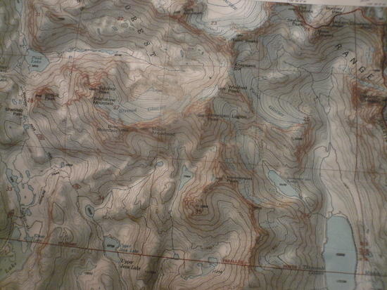
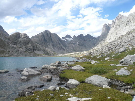
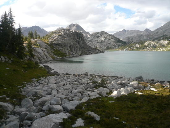
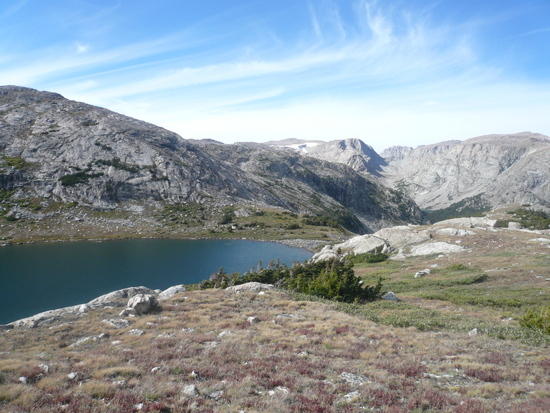
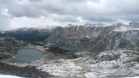
At the beginning of September I flew to Jackson WY, and traveled to the Elkhart Park trailhead in the Winds. I went with 10 days of food and a plan to string together as many of the highlights of the area as I could both on trail and cross country. There is zero public transport through the area and although I rented a car in Jackson and spent a couple days acclimatising in the Tetons I used the shuttle service offered by the Great Outdoor Shop in Pinedale to come and go from Jackson to the Winds – their service is excellent and although is cost a pretty penny it was still the least expensive way I could accomplish my goals. After riding the shuttle down during the afternoon of the 2nd I spent the first night at the Elkhart trailhead camp ground and then woke up and hit the trail. The first few hours of hiking were pretty ordinary stuff up through the lodgepole forest, by midmorning I hit Photographers Point and caught a glimpse of what was ahead but I won't even bother to post a photo of that because its paled by what was to come. I used the Beartooth Publishing WRR map for a trail and general overview map for which it works well, one sheet and easy to read but at 1:100 000 scale totally inadequate for of trail navigation For that I had three custom centered 1:24 000 usgs quads from offroute.com which covered a large part of my trip and all my intended off trail routes. I worried that I would be feeling the altitude by this point having come from about 900 ft and being by now at over 9000 but I'd had 2.5 days to acclimate and I made it to Barbara Lake for lunch and the Seneca lakes soon after and this is were the senery really started to open up.
Just past here I turned of the trail taking the crowds to Island Lake and headed up the Hightline trail towards the Jean Lakes. Late in the afternoon I came across a fellow BPLer just north of Fremont Crossing and then made camp for the night on the north end of Lower Jean Lake.

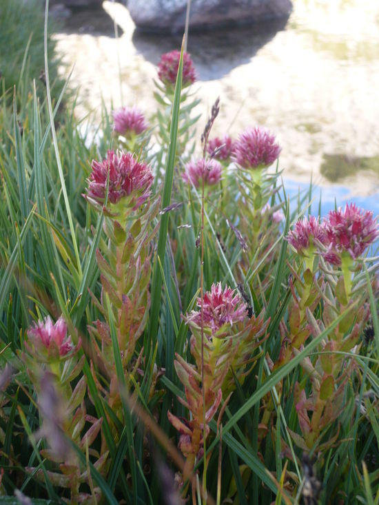
I camped among the last of the seasons wildflowers dipped water from the lake inlet, cliff hung my food bags and lay on a big rock still radiating the days warmth and counted shooting stars.
In the morning I kept heading north, the goal for the day being a crossing of Knapsack Col into Titcomb Basin but first I passed Upper Jean Lake.
And then the Highline Trail turnoff going down towards the Elbow Lakes.

I hadn't really been expecting anything from this area not knowing much about it but is spectacular and turned out to be one of my favorite parts, or maybe it was just that I was seeing it with "fresh eyes". Next I crossed Shannon Pass and started down the huge rock fall into Peak Lake.

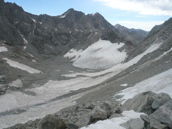
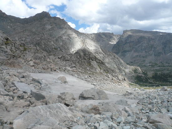
The trail heads down to the outlet to the left of the above picture skirts around to north side crossing over the large talus falls partway up and then heads up the valley to the right towards to Col and gradually peters out. This is the view done the outlet valley towards Stonehammer Lake.

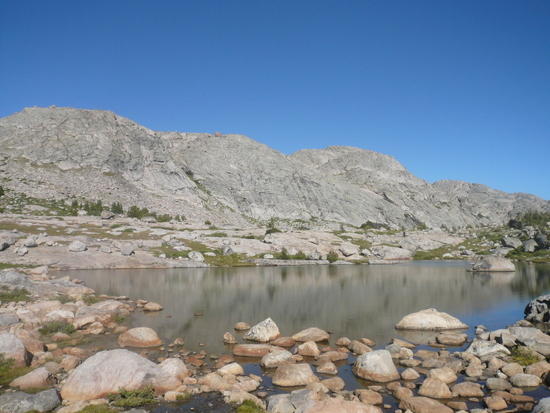
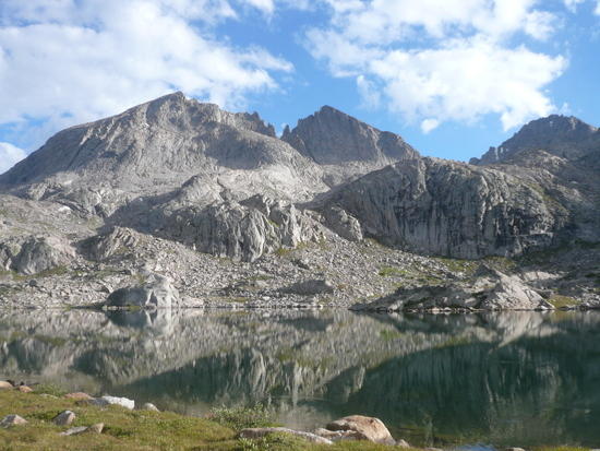
I started heading up the valley towards Knapsack Col which is normally a solid snow route but this was a low snow year and I was hoping to scramble over. Looking back at Peak Lake and Stroud Peak.

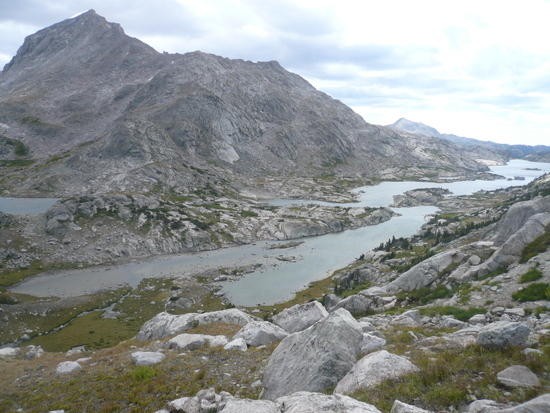
The route got steeper and rougher and windier but by 2pm I was standing on top of the Col and looking back at Peak Lake in the distance.

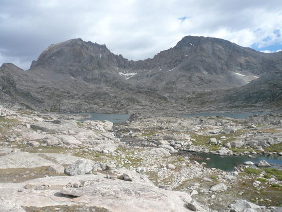
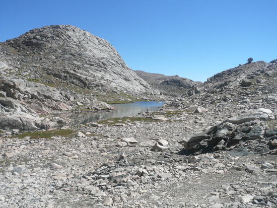
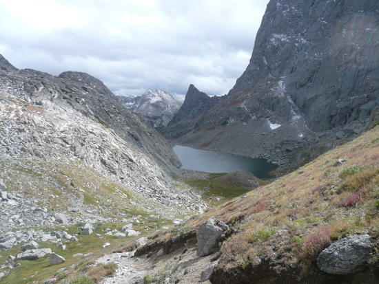
I could also look down to the east into the top end of the Titcomb basin.
The climb down the east side was a long scramble through some rather large talus but finally I came out at the bottom, crossed a little snow spit and followed the drainage down the valley.
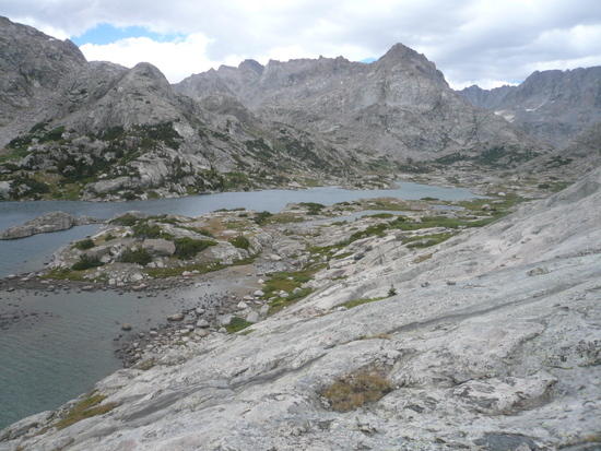
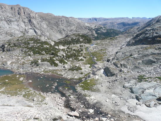
I picked up the trail again at the head of the top lake and spent the last of the afternoon hiking down through Titcomb Basin, there was no one else about and it was spectacular.
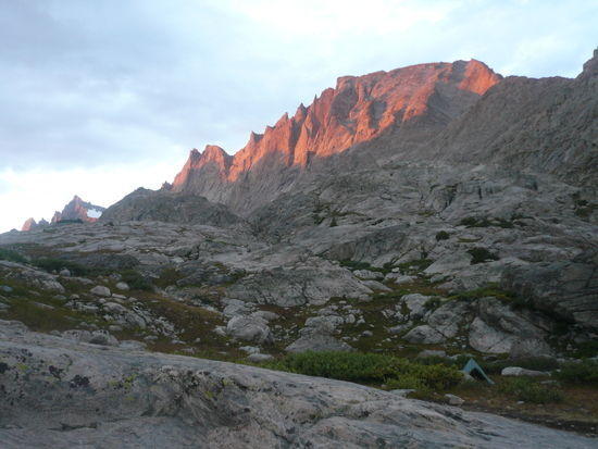
Near the north end of the lower lake I looked out and saw a bear swimming towards me across the lake about 100 yards away, just then it seemed to notice me, turned around and swam back. It would be the only large animal I saw on the trip. As the sun set I pitched camp at the lower end of the basin under Mount Fremont. It was a windy night with gusts testing the flexibility of my tarp poles till early morning.
In the morning I followed the trail up into Indian Basin passing a few campers on the way.
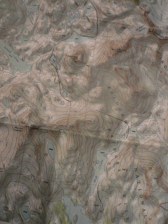
My goal for the day was do do the off trail route over Wall-Island Pass and down the eastern shore of Wall Lake. I had found this route in Nancy Pallisters excellent book 'Beyond Trails in the wind river Mountains' which came out just a few months before the trip. The Knapsack Col route had suggested itself to me as soon as I started looking at a map but pretty much all my other off trail route info was gleaned for this book. From Indian Basin I dropped down towards Elephant Head and skirted the shores of the large unnamed lake to its north.

I skirted some more lakes at one point catching this view down a talus filled valley to Island Lake.
As I started up the western side of Wall-Island Pass I came upon 3 guys eating lunch in the lee of a large boulder, they would be the last people I'd see for the next 2 days. Here's the view east form the top.
As I made my way back down I got a view down the whole length of wall lake. I would rock hope over the inlets and hike down the eastern side.
Halfway down the lake the "wall" forces you from the shore up some high slabs giving another view looking back to the north of this highlight area.
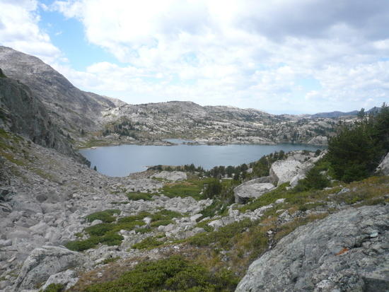
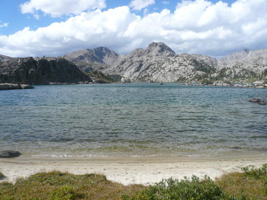
At the south end of Wall lake I skirted a hill and picked up the trail again for a short stroll into the Cook Lakes. I found this almost tropical looking beach for a frigid dip.
And then found a beautiful secluded campsite in the trees near this cove where I spent my third night and had my first little fire.
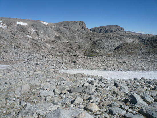
Next morning I immediantly struck out across country again into the Bald Mountain Basin past the Spider Lakes and up towards Cook Pass which would take me over the Continental Divide. The western side of the pass was steep but fairly easy, I scrambled up hanging onto tussocks and at the top could see clear out to the settled valley. I pulled my cell phone out here and with intermitant signal and in howling wind managed to leave my wife a message. It was the only time I could get any cell reception. The eastern side of Cook pass is not steep but it was solid talus in varying sizes and configurations with a little snow thrown in.
I dropped down into a remote valley of un-named saphire lakes.
I made my way carefully around their northern shores knowing that if I got stuck here it would be a week before anyone even started looking for me.

The next lake, the only one in the string to even be numbered (11065) had a section of house sized talus to clamber through.

In a normal year this would still be all snow, which in a way would make the going easier if you had the gear for it. Soon the valley started to drop away.
I made my way down the steep slabs in front of me and crossed the grassy patch that had filled in the lake then bore left around the little hill in the foreground and dropped into the Golden Lakes.

I hiked south past Upper Golden Lake, Lake Louise and Lower Golden Lake and then made the climb up to Dennis Lake with the Goldens down in the distance.
From here I crossed Hay pass started down the other side. It was late afternoon and I kept thinking I should camp but I didn't see anywhere appealing so I bombed all to way down to Lake Victor just before it started to get dark. It was my second longest day.
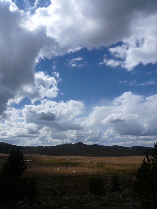
The next day was a trail slog, oh it was still beautiful but I won't bore you with pictures. I got out on the Fremont Trail and rolled South. I had been considering doing the loop up around Middle Fork Lake but missed to turnoff in my reverie so I took the trail up to Rainbow Lake. As I reached the lake I caught up with a guy packing with 3 llamas. I had decided to camp just south at Sunrise Lake to set myself up for the next day and he followed me over looking for grass for the Llamas. he was a highway patrolman from Bakersfield and we shared a campsite, a warm fire and a pleasant evening.
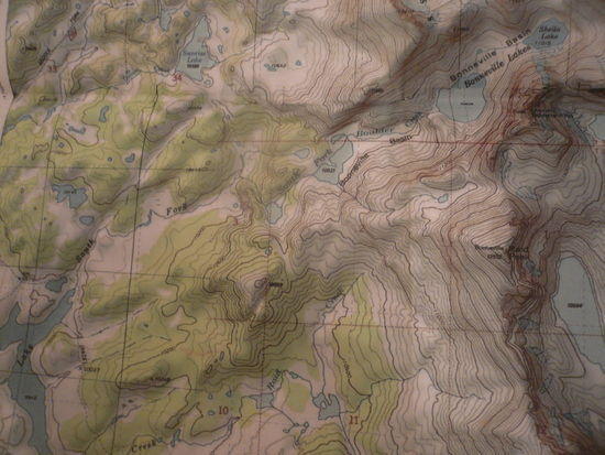
In the morning I struck out cross country again up into Bonneville Basin. It was cloudy and treatening rain but as I climbed up into the basin the clouds cleared just enough for me to get a view of Mt Bonneville.

I followed the drainage out of Bonneville Basin, picked up the Fremont Trail at Raid Lake and spent the rest of the day heading south under threatening skies.

This portion of the trail is also the CDT but I only passed on other hiker all day.
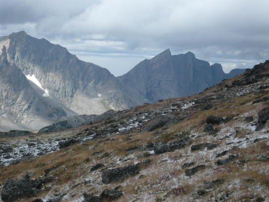
Towards the end of the day I got my first look at the back side of the Cirque of the Towers.

I left the Fremont at Washakie creek and made my way to Skull Lake as I was looking for a campsite I meet an older lady, part of a larger group, who had been packed in and were base camping there. She pointed out a nice site to me and then proceeded to, as she said, "Cluck at me" about being out there alone. I guess she looked at my pack which had started out bloated but was now much smaller and thought that I had just walked in from the trail head.
I woke up early morning to thunder and sleet, which soon turned to snow. The plan for the morning was to cross Washakie Pass but I did'nt want to go in a thunder storm so I lay in my bag eating breakfast till probably after 10 trying to decide what to do. Finally the thunder had moved on and I caught a fleeting glimpse of blue sky so I packed up quick and headed for the pass.
As I climbed there was snow on the ground but it seemed to be letting up.

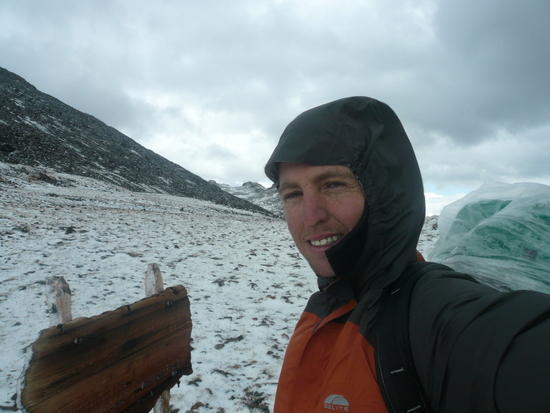
On top of Washakie Pass.
As I hiked down into Washakie Basin I passed one group hiking up and out and then a couple of more groups anxiously wanting to know whether they could get over the pass. No one wanted to get snowed in back there. I assured them they could make it and kept hiking down.
The further down into the basin I got though the darker the sky kept getting, it was starting to snow again, flurries at first and then heavier.

I made it as far as the Ranger Park trail junction. I hadn't been able to pick up any current weather information but the snow was coming down thick and fast, it was 2pm, I had Washakie Pass 3.5 miles behind me and over 9 miles in front of me including 5 miles of 11500 ft moonscape over the Lizard head plateau. I had to make a decision.
I decided I had to go back. I didn't know how much more snow was on the way, I wasn't going to be able to make it over the Lizard Head Plateau and into the valley before dark with any margin of safety and the only viable bailout was Washakie. I would hike back through the Big Sandy trail head and approach the Cirque over Jackass Pass and I really wanted to see the Cirque. So I turned around, cursed the stray patch of blue sky that had lured me here, and cranked back over the pass. This time I was leaning into the wind, it was really blasting the pass now I didn't take anymore pictures.
Back down at Skull Lake it was still a few hours to dark so I decided to keep going, rather than sit around in the dreary weather. After a will I could see a red coated figure on the trail ahead, eventually I could tell they had no pack and decided they must be hurrying back to their camp somewhere down the trail. It took me maybe half an hour to catch up to them. It was the "clucking" lady from the night before. Sometime just after midday she'd left her camp to get firewood, gone over the ridge, got turned around, and wandered through the woods all afternoon. She'd hit the trail just about the time I saw saw her. I told her if she turned around and went straight back up the trail she'd hit her group before dark. However she said that they had a SPOT and would have activated it by now and she was determined to make it to the trailhead to try forestall any search party.
So I walked her out. We slugged along down the trail. It got dark. It snowed some more. We worked trough the maze of trails leading up to the trailhead. We finally made it out at about 10 o'clock. There was now one around. The people who run the rental cabins by the trail head had gone home hours ago. There was no phone and she was wet from wading creeks. So I started hunting up firewood… and then the SAR crew and a deputy showed up… her friends had activated their SPOT.
To cut a long story short they took her back to Pinedale. I pitched my tarp and ate supper a little before midnight in the deserted campground and woke up in the morning to the rescue chopper circling the trail head on the way up to Skull Lake to tell her friends were she was. I packed and started for the Cirque of the Towers, this time up the Big Sandy Valley.
It was a nice day, still clouding but the snow had stopped in the night. I ate lunch by Big Sandy Lake and started the climb up Jackass Pass. Here's the view south to Temple Peak.

I scrabbled through some more talus will listening to ominous ice cracking sounds from the cliffs above, I don't know how many miles of the stuff I crossed on the trip but it was a considerable amount. There were a number of climbers coming and going over this pass all with staggering loads, one with a backpack and a frontpack. Here's the view back to the unnamed lake at the base of War Bonnet Peak.
And finally the Cirque of the Towers, or at least as much of it as can fit into a camera frame.

I hiked down into Lizard Head Meadows past the camping exclusion zone, pitched camp and made a fire. In the morning on the way out I got another look at the Cirque, this time in the sun.

I was back at the trail head a day early for my shuttle due to the extra mileage and was resigned to spending the night in the campground there, but some nice people who had heard about the SAR drama gave me a ride out to Pinedale for a shower and a bed.
I know people are going to be asking for a gear list so I’ll give at least a rough outline of what I took. I had about 11 lbs of base weight and about 13 or 14 lbs of consumables. I had temps down into the twenties.
MLD Zip pack
Spinntwinn tarp with poles and stakes
Custom Sil tarp floor
¾ thermarest
WM Alpinlite
Evernew titanium pot
MBD Trek2 Alc stove
Aluminum windshield & plastic fuel bottles
Long handle titanium spoon
Plastic cup
2 roll top sil food bags with mini biner and EZC line
Water treatment tabs, iodine & clorine dioxide
2L platy & 1L aqua fina bottle
Clothing worn and carried in various configurations
Underarmour compression shorts
Synthetic long johns
Prana hiking pants
Golite reed pants
2 pairs long smart wool socks
Columbia Kaibab trail runners
Icebreaker Tee
Patagonia R1 hoody
Montbell thermawrap
Golite Virga jacket
Wool and fleece hat
Billabong brimmed hat
Possum down gloves
Sunglasses
Silva Explorer compass
UTM grid tool
Garmin eTrex
Maps
Petzl Tikka Plus 2
Cell phone, cash and credit card
Spare batteries – not used
Panasonic Lumix DMC FX07
First aid kit in ziplock