Topic

The best the east has to offer

  • This topic is empty.
Viewing 25 posts - 1 through 25 (of 42 total)
PostedNov 4, 2010 at 5:35 am

I am looking for a place to go this winter. I will have 5.5 days to Hike. I would like a mountainous area within 300-350 miles of central kentucky. I will average probably 12-15 miles a day, i don't like to rush, i make frequent stops to explore. Any recommendations that would be great. I enjoy remote places with a mixuter of high mountains and streams. Becaues of life changes, I only have one time a year to hike, so give me your best trips!

Places I am considering:
**Smokies
**AT-BT Loop(my friend had to quit halfway through last time, as a result i couldn't complete the trek)
**Linville Gorge

Brad Rogers BPL Member
PostedNov 4, 2010 at 6:45 am

For the best 12-15mpd, 5.5 day trips the southeast has to offer, I would look at:

Appalachian Trail – GSMNP
Starting: Fontana Dam
Ending: Waterville School Road (Standing Bear Farm Hostel)
Miles : 74.4
Highlights: Shuckstack Fire Tower, Rocky Top, Clingmans Dome, Charlie’s Bunion, Mt Cammerer Fire Lookout

Appalachian Trail – Roan Highlands
Starting: Erwin, TN
Ending: Dennis Cove Road (Kincora Hostel)
Miles: 70.6
Highlights: Beauty Spot, Roan Mountain, Jane Bald, Grassy Bald, Little Hump Mountain/Big Hump Mountain (balds), Jones Falls

Appalachian Trail – Virginia Highlands
Starting: Damascus, VA
Ending: Marion, VA
Miles: 75.3
Highlights: Buzzard Rock, Mt. Rogers, Wilburn Ridge (bald), Wild Ponies in Grayson Highlands

PostedNov 4, 2010 at 6:54 am

Bradford, thanks very much for those recommendations! Can you elaborate as to which if any will need shuttles and where i can find shuttle information for those trails, i have only myself.

Brad Rogers BPL Member
PostedNov 4, 2010 at 7:23 am

All three hikes will require a shuttle.

For the hike through the GSMNP if you are going NOBO I would park at Standing Bear Farm Hostel (~$2 day) and have them shuttle you to Fontana Dam. If you wanted to do it SOBO, you can park at the Fontana Dam Visitors Center and have the Hike Inn (near Fontana) shuttle you to Davenport Gap.

Standing Bear Farm
c/o Curtis and Maria Owen
4255 Green Corner Rd.
Hartford, TN 37753
Tel. – 423-487-0014

The Hike Inn
c/o Jeff and Nancy Hoch
3204 Fontana Road
Fontana Dam, NC 28733
Tel. – 828-479-3677

For the Roan Highlands hike, I recommend parking at Kincora Hostel and have them shuttle you to Erwin and hike north, but if you wanted to go south you could park at Uncle Johnny’s Hostel in Erwin (~$2 day) and have them shuttle you to Dennis Cove.

Kincora Hiker Hostel
c/o Bob Peoples
1278 Dennis Cove Rd
Hampton, TN 37658
Tel. – 423-725-3039 alt 423-725-4409

Uncle Johnny’s Nolichucky Hostel
151 River Road
Erwin, Tennessee 37650
Tel. – 423-735-0548

For the Virginia Highlands hike, you can park in Damascus at the public parking lot near the old mill (across from the post office) and have Mt. Rogers Outfitters shuttle you to where the trail crosses near Marion. There is also a shuttle driver that I have used that has the username “Lonewolf” on http://www.whiteblaze.net that I have used in the past and been very pleased. I don’t know of a shuttle service in Marion if you wanted to go SOBO instead, but there probably is one somewhere.

Mt. Rogers Outfitters
110 W Laurel Ave
Damascus, VA 24236
Tel. – 276-475-5416

I have used all of the above shuttle services in the past multiple times with the exception of Mt. Rogers Outfitters, whom I have never used but heard good things about.

CW BPL Member
PostedNov 5, 2010 at 7:27 am

IMO, you don't need maps if you're only going to be on the AT.

PostedNov 5, 2010 at 7:45 am

While the AT is probably the best winter option, I'll throw another suggestion out there that will take you in to Linville Gorge and many streambeds. I am not familiar with winter trail conditions along this route, which is why the AT is probably the best option (unless you don't mind climbing over trees).

I did 150 miles on the Mountains-to-Sea Trail from Asheville to Blowing Rock, and if I could trim it down to a 5.5 day / 70-80mi. hike I would do the following on the MST:

Start: Balsam Gap North – Blue Ridge Parkway
End: State Road 181 (will have to road hike to shelter though)
68 miles.

This will start you out with a relatively easy summit of Mt. Mitchell, then take you through the Black Mountains, Linville Gorge, fording of the Linville River, Shortoff Mountain, Table Rock, and Steels Creek.

Go a little past 181 and you'll run in to a world of water in the Upper Creek and Harper Creek systems (you will get wet here). You would probably want to end at one of the following roads:

FR 464 (possibly gated in winter?): 81 miles
Roseboro Road: 84 miles
Beacon Heights – Blue Ridge Parkway: 91 miles

I'm not aware of any commercial shuttles out that way, but I know there are some generous people on Whiteblaze that occasionally shuttle the area. I live about 1 hour east of the ending points, but I would also be willing to shuttle.

If you're interested in the route, check out http://www.artshikingmaps.info for maps/route info and/or PM me. I spent A LOT of time between Linville Gorge and the Wilson Creek area this year; but unfortunately I can't provide much winter-specific info since I started exploring the area in the spring. I know Cola (on the board here) gave me some good info and also knows the area very well.

Brad Rogers BPL Member
PostedNov 5, 2010 at 8:05 am

I like the ATC Tennessee/NC map for the Roan Highlands Area and I think it also comes with Trails Illustrated #229 for the GSMNP as that is the official AT map through that area. For the Virginia Highlands I like Trails Illustrated #786, though I don't remember if it take you all the way to Marion or not. The ATC also makes a Southwest Virgina map set that includes that area.

Chris is right though, you don't really need a map on the AT. The only real reason I can think to have one is if you expect bad weather and might need to look at bail out options and routes.

PostedNov 6, 2010 at 10:15 am

Yea i know the AT is well marked but i am a topo/orienteering freak and i love checking elevations, getting my bearings, planning bug out points, matching the map to the terrain, planning water resupplys, etc.

PostedNov 6, 2010 at 10:49 am

I cant choose one, they are all so beautiful. Can you recommend which you think is best/most scenic? Peace

. . BPL Member
PostedNov 6, 2010 at 10:05 pm

"i am a topo/orienteering freak and i love checking elevations, getting my bearings, planning bug out points, matching the map to the terrain, planning water resupplys, etc."

In that case, I would recommend a solid bushwhack through the Red River Gorge – it is beautiful in wintertime and the snakes are asleep. The crops have all been harvested and there is generally no one around. You could potentially go 5 days without seeing a soul, if you are off trail.

PostedNov 7, 2010 at 7:49 am

THe gorge is my favorite in the tri state area, however, i've been there 5-6 times. Its amazing, im actually considering it again. Still haven't decided yet. The gorge is like a massive amazing park crammed into a small area. There is so much variety in appearance, its truly special.

Brad Rogers BPL Member
PostedNov 8, 2010 at 7:08 am

If I had to pick one, my choice would be the Roan Highlands hike. Unaka Mountain and Roan Mountain have beautiful spruce-fir summits that are unlike all but a few others in the southeast. Roan Highlands has about 8 miles of the best balds you could ask for, and you get a waterfall to boot. As a bonus, if you go a couple of miles north of Dennis Cove Road you can see the best falls on the AT, Laurel Fork Falls.

Secondly, I would pick Virginia Highlands as the balds there are stunning, more rugged than the ones from Roan Highlands and of course there are the wild ponies.

The AT Smokies traverse is spectacular too, but doesn't have as many of those 360* views that the other two have.

PostedNov 9, 2010 at 4:16 am

Should i expect snow in the area around the 16th-22nd? Im figuring out my footwear system.

Brad Rogers BPL Member
PostedNov 9, 2010 at 4:28 am

I wouldn't necessarily expect snow, but there could be some. I expect there is 5-10" up there now, but with the warm temps this week, it will likely melt.

PostedNov 9, 2010 at 5:02 am

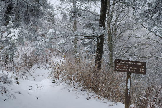
Below were the conditions on the AT at Newfound Gap during the early afternoon this past Saturday. A little more snow came later in the afternoon after I left, but it really wasn't too bad up there. I agree that most of it will melt off. There will be some patchy areas, but I wouldn't expect you to have to sink your feet in any snow.

Newfound Gap

PostedNov 9, 2010 at 5:06 am

i would like to shave about 10 miles off the total trip distance. I dont want to rush, i enjoy slowing down and being more Aware of the beauty around me than rushig to make it in time. Can you guys recommend a way to do that? Either 5 in the begining and 5 off the end, or 10 onlff one side. Please also list what i would be missing in each scenario. I will be rushing at 70 miles, 60 sounds about right. I will be doing the Roan highlands trip.

PostedNov 9, 2010 at 7:14 am

Brad Rogers gave you some great suggestions and I have hike parts of all of them. All outstanding.

If you are looking for something shorter and possibly a loop I would suggest the following:

Mt Rogers AT/Iron Mtn loop. You have several options for this trip and can change the mileage during the trip if you like.

– Start in either Damascus or Beartree Lake Campground. Both have good parking. Take the AT north to Mt Rogers
– After passing Mt Rogers you continue through wilderness area and grayson highland state park. After crossing VA 603?? you intersect with the IMT.
– The IMT will take you back to Damascus

I'm not sure of the actual mileage, but I did the Beartree/AT/IMT lopp and it was around 40 miles. I'm sure a Damascus start would put you in the 60+ range. You have several options to modify this hike to make it shorter or longer. I think the trail illustrated map for Mt Rogers covers the whole area.

You have plenty of good camping options (tent and shelters) given that over half is in wilderness. You will pass several good reliable water sources and it will be easy to check the rest.

Brad

You have options to make this trip shorter or longer.

Brad Rogers BPL Member
PostedNov 9, 2010 at 7:49 am

You could also keep your starting point the same and have them shuttle you to Iron Mountain Gap (TN107/NC226) and hike back to Kincora Hostel. This would cut the mileage down to 60.32. The downside is that you would miss Unaka Mountain (though it is very similar to Roan Mountain, which you would see)

PostedNov 9, 2010 at 12:40 pm

"I like the ATC Tennessee/NC map for the Roan Highlands Area and I think it also comes with Trails Illustrated #229 for the GSMNP as that is the official AT map through that area."

Are you saying that 229 covers the Roan 70 mile hike or that it covers the GSMNP trip only?

PostedNov 9, 2010 at 1:15 pm

We did the AT/Pine Mountain Trail/IMT

We got a shuttle from Damascus to Grayson Highlands State Park. We hiked over to Wise Shelter where we stayed for the night. We followed the AT up and over Scales to where the AT intersects with the Pine Mountain Trail (old AT). We followed it until it connected back with the AT at Rhododendron Gap. We stayed on the AT until we got to Deep Gap where we took the Mt Rogers trail down to SR 603. We crossed the street and followed the Flatop Trail until it connects with the IMT. We followed the IMT all the way back into Damascus. We only saw 3 people on the IMT and they were on horses. There are some really old shelters on the IMT.

PostedNov 9, 2010 at 1:55 pm

Good option Eddy. That hike would be much easier than the one I recommended and I do think the IMT is pretty cool. If you use the shuttle you could start about anywhere north and just hike the AT back into Damascus as another option.

Some many options, so little time.

Brad

PostedNov 10, 2010 at 10:19 am

I going to be staying in Elizabethton on the 18th then driving to kincora hostel in the morning of the 19th to catch a shuttle from Bob. I assume he will shuttle me and i will pay him, but i haven't been able to get anyone to answer the phone there, will keep trying.. Im going to do the shorter version (60 miles) since Bradford said the scenery is similar/better on roan anyway.

1.) Which footwear system should i use?

System 1:
Inov 8 roclite 315 Breatheable
X-static liner

System 2:
Inov 8 Roclite 390 Gortex

I will also have cuben waders as a waterproof layer for my feet, short gaiters, darn tough vermont boot socks and smartwool adrenalines.

The darn tough vermont boot socks are also my foot insulation at night, i wear the VBL cuben waders underneath and can layer the x-statics in there as well if needed.

2.) If i get done early could your recommend some places with 20 miles driving distance or so that i could check out that would only be an hour or less walk from a trailhead. I will definately check out the falls.

3.) Debating on leaving the stove at home. It would a save about 16oz including 1.3L ti pot, fuel, caldera cone, etc. I could still make FBC meals but just carry them in a cuben cozy in my jacket pocket til they were warm. I really dont have any problem eating lukewarm-semi cold meals. What do you guys think? That would take my packweight from 27.5LBS to 26.5LBS. My only concern would be the noodles being crunchy since they weren't in hot water, will they still get soft by just soaking?

Brian Camprini BPL Member
PostedNov 10, 2010 at 11:08 am

My opinion–crunchy noodles suck. And warm drinks are nice. Be comfy and enjoy yourself. Save the SUL stuff for summer. It's getting dark early these days. Take the stove, whichever shoes you prefer, and maybe some camp shoes too. And have a blast.

Just curious–packing the hammock?

Viewing 25 posts - 1 through 25 (of 42 total)
Loading...