


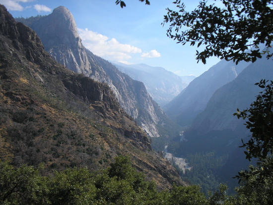
Remote & Pristine
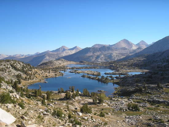
Marie Lakes

EVOLUTION

Lake Thomas Edison
Topic
Become a member to post in the forums.
Remote & Pristine
Marie Lakes
EVOLUTION
Lake Thomas Edison
Welcome back! I know I don't even need to ask if you had a great time.
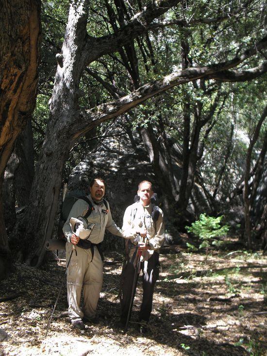
Thanks Ken, Wish you could of maid it! 7 days and 7 nights – Every thing went to plan with a case of Heineken waiting for us in my truck at VVR. Great weather, beautiful scenery and even better group dynamics with a lot of "Chatting" on the JMT with all the fellow hikers. We did not see a person for the first three days being deep in Tehipite Valley. When we finally hit the North Fork Trail at the JMT junction things really got social,interesting and FUN!!! Everybody is just so happy to be out there with a lot of opportunity to create good "Karma". Dave Lutz and Chris Benok were two great guys to hike with on such a remote and inspiring section of the JMT. Here are a few more pictures:
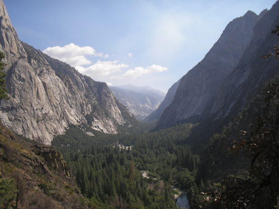
We did not see one other person in this valley for three days!!

Blue Canyon

The Hut

Evolution Valley
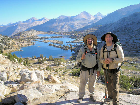
On the last day we manage to do 16.8 miles from Salley Keyes Lake to VVR. This was a great time to hike the trail because there was less people and hardly no mosquitoes!! 25 nights out this season so far–I am fortunate and grateful to be able to hike hike with such nice people.
Really nice pictures Jay. I haven't been out that many days in a row yet but I look forward to being out in the wild for longer periods like that.
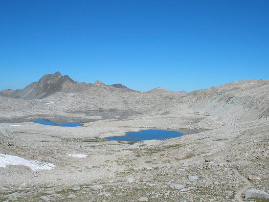
Lake McDermand at Muir Pass

South Fork San Joaquin River
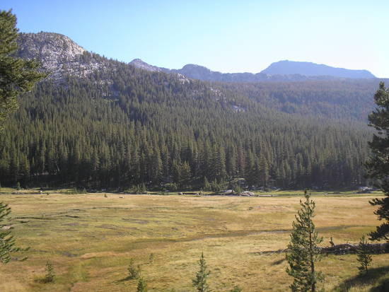
Colby Meadow
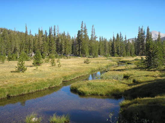
Just off the JMT-Marshall Lakes
Nice picture Jay, looks like some great hiking. I can't wait to get back out there. Did you do any fishing?
Hey Sean, We did not bring a pole but brought some line and hooks with some very small split-shot. There was a lot of fish at Salley Keyes Lake and the Middle fork of the Kings River…Basically we were to tired to fish in the afternoon after 12-16 mile days….We only fished once in Le Conte Canyon with no luck…..
Nice photos Jay! How was section from Wishon to the JMT in terms of trail condition, elevation change, scenery etc. ?
Was the route you took off trail? or is part of the JMT?
Great pictures btw.
Just curious, how fast do you guys hike? What's a typical day?
Glad to see your back is doing better.
Terrific pics. What was the trail like on the descent into Tehipite? Some reports have made this sound like a 3000' slippery slide.
Nice, Jay! Thanks for posting these.
Blue Canyon looks especially wild and remote, more of a moonscape than earthbound. Spectacular stuff.
cheers,
Rick
Jay,
Great photos….keep them coming!
Just have to love it when you are out that far and you don't run into anyone for days.
-Tony
Great pics Jay….very jealous!
Rancheria TH is the correct starting place with about a 3,700 ft descent to Tehipite Valley. There was a fire in this section about 2 year ago and the trail crews did a excellent job on the 1 MILLION switchbacks down to the valley floor. It is 18 miles from the Rancheria TH to Tehipite Valley. We camped at Hay Meadows near the rim before the descent to the valley- A very nice campsite with a spring crossing the trail near by. This section is a little sketchy because of all the cow trails in the area. You really need to pay attention at times in the beginning. We got off track a few times…but recovered. Tehipite Valley is as wild and pristine today as it was when it was first discovered back in the day(1800 hundreds). If you are a person who enjoys remote areas I Highly Recommend it!!! Our route was from Rancheria TH to the Tehipite Valley floor then crossing the Middle Fork of the Kings River at Simpson's Meadow connecting to the North Fork Trail which then connects to the JMT and we headed North to Lake Thomas Edison. Roughly 100 miles as the crow flies. NICE!!!!

Marie Lakes
Become a member to post in the forums.
 Wool Thermo Zip PoloMerino wool-blend mesh base layer with a 3/4 zip neck for venting and reinforced shoulders for pack-carrying comfort. Weighs 6.3oz | 180g
 © Beartooth Media Group Inc.
 Loading...