Topic

Grand Canyon, Thunder River/Deer Creek Loop – Memorial Week 2010


Forum Posting

A Membership is required to post in the forums. Login or become a member to post in the member forums!

Home Forums Campfire Member Trip Reports Grand Canyon, Thunder River/Deer Creek Loop – Memorial Week 2010

  • This topic is empty.
Viewing 19 posts - 1 through 19 (of 19 total)
  • Author
    Posts
  • #1259930
    Brian Martin
    BPL Member

    @xiled1

    Locale: AZ

    My wife and I were invited on a backpacking trip through some of
    the North Rim’s most beautiful trails for the Memorial week. The
    trip would take 4 nights and 5 days, covering 27 miles plus side
    hikes. Starting at over 7000 ft at the top of the North Rim, then
    dropping all the way to the Colorado river, and back again. The
    weather would test us as well with temps over 100 degrees at the
    bottom of the canyon and not much shade.

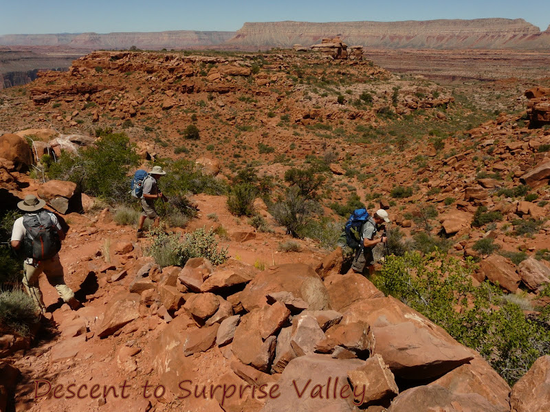
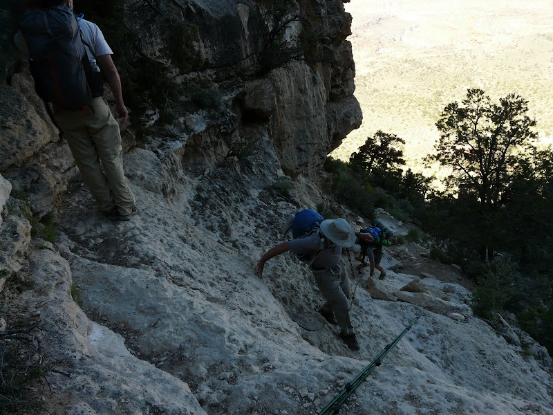
    We started out on Sunday, May 30th at 7 AM from the Bill Hall
    Trailhead.


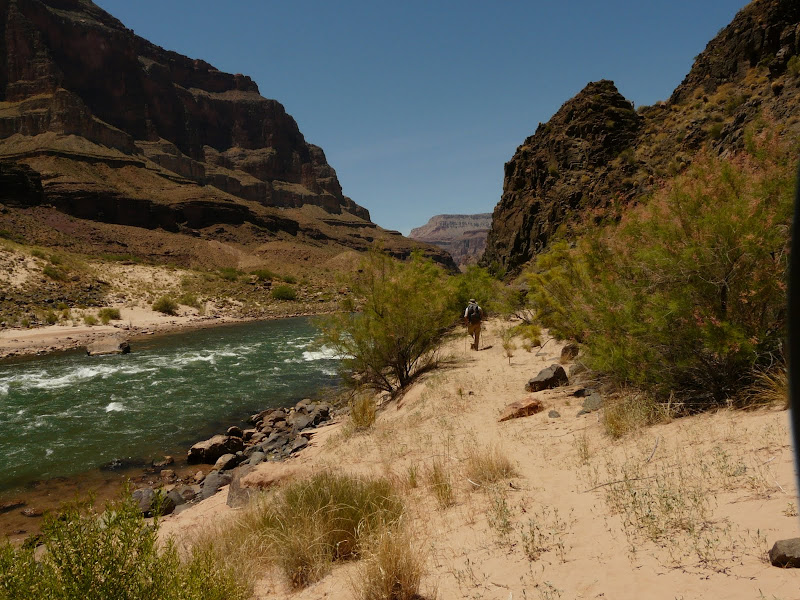
    Our Packs were loaded up with an extra gallon of water each for caching at the halfway point. Water is only available at the lower elevations, so this was for the return trip.

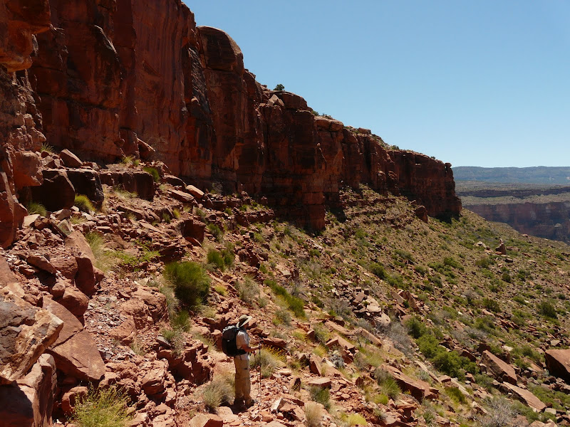
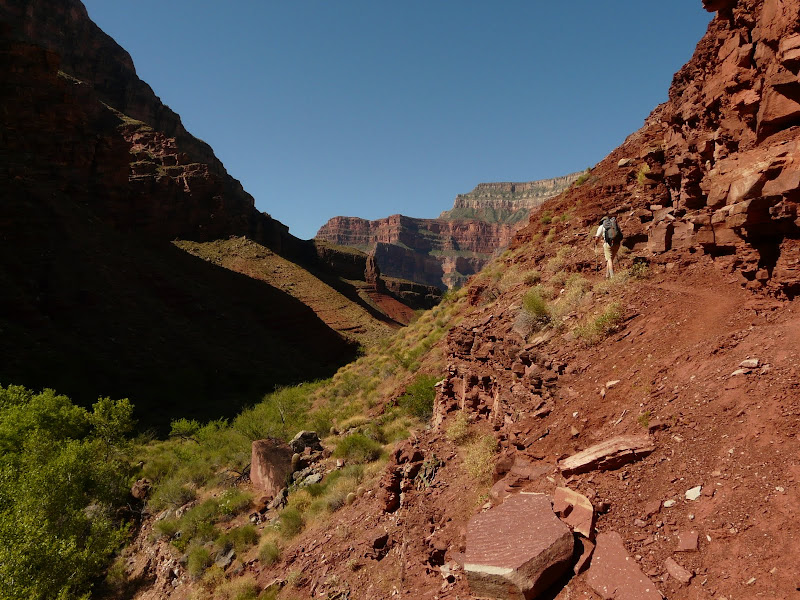
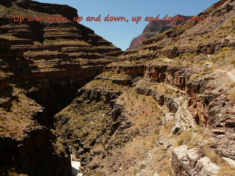
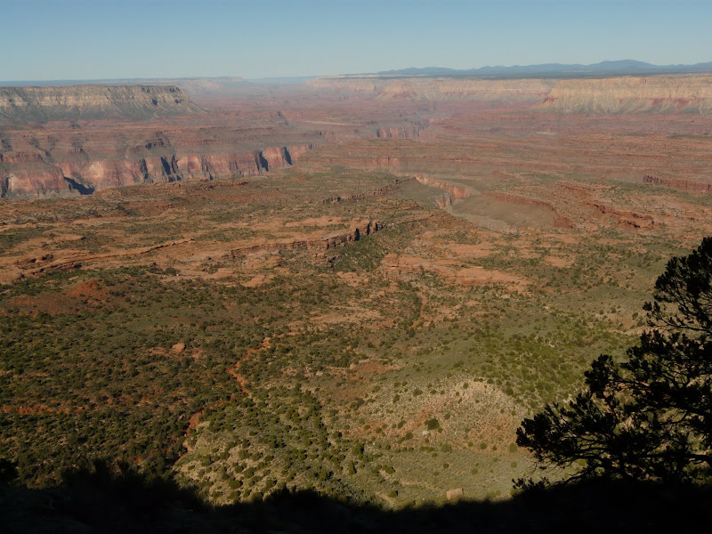
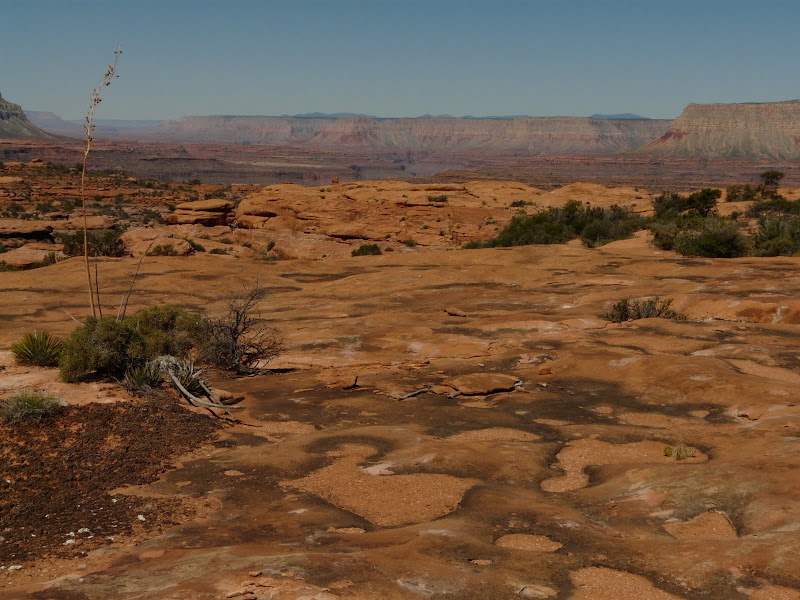
    Looking down on The Esplanade and the bottom of the first of three descents.

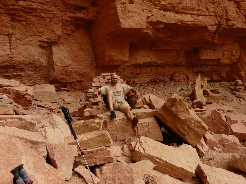
    The trail even had a few minor down climbs, minor without a water laden pack on the your back that is.

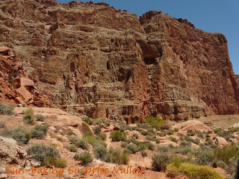
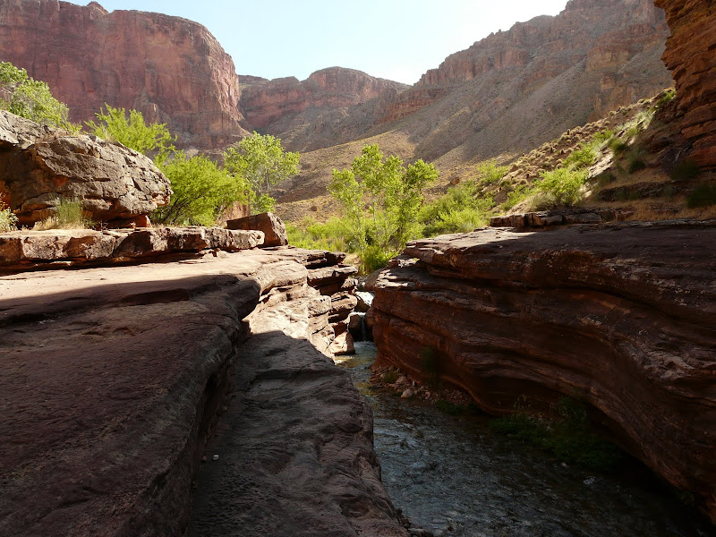
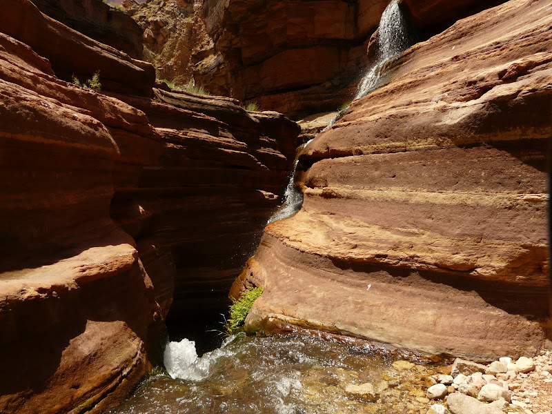
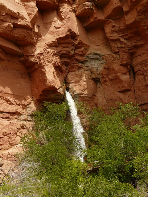
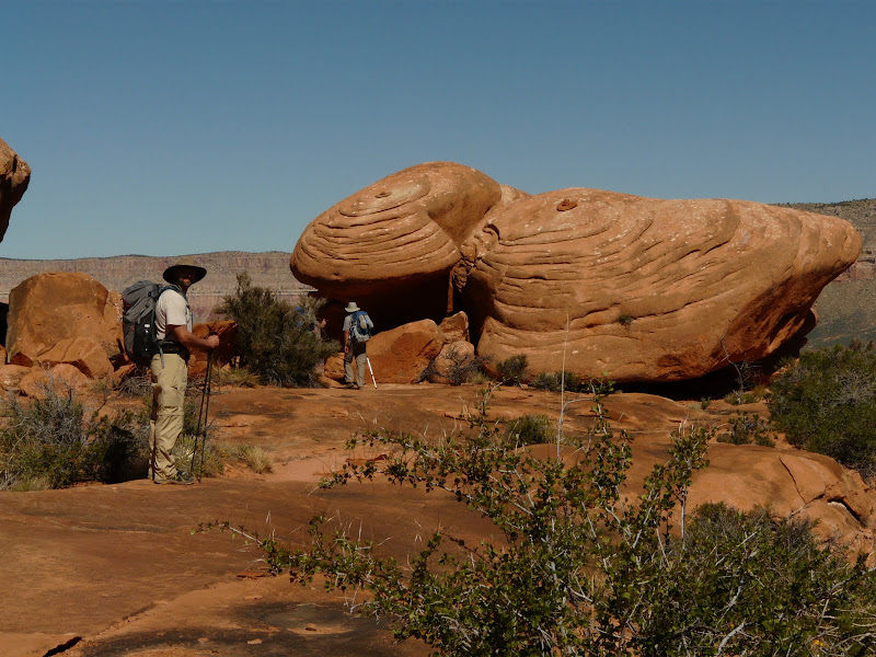
    We hit The Esplanade and got some rest for our weary knees, at least for a few miles. The Esplanade is a land of Red Rock formations and sandstone, extremely beautiful.

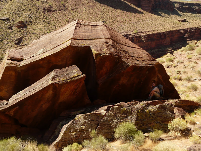
    Interesting formations J


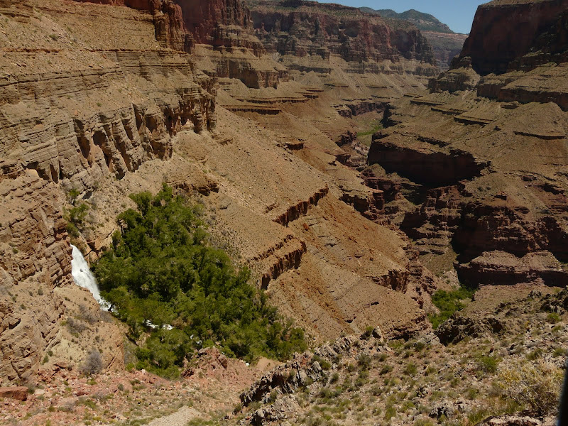
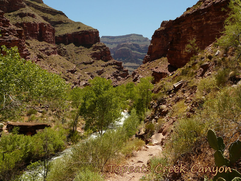
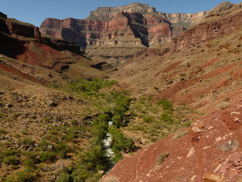
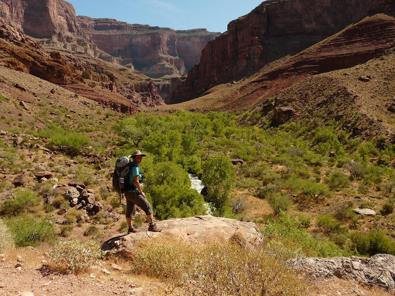
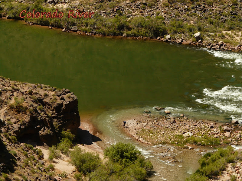
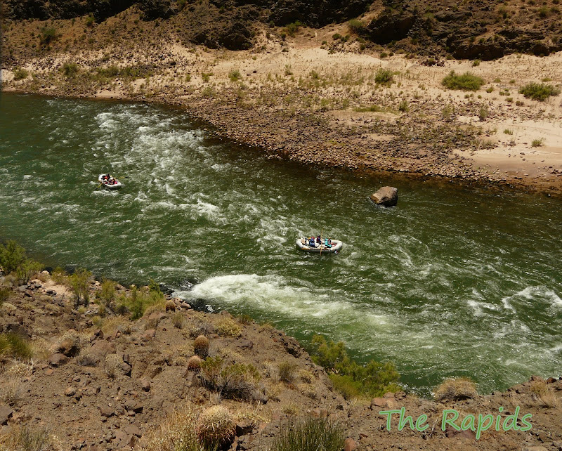
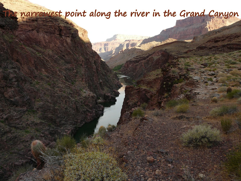
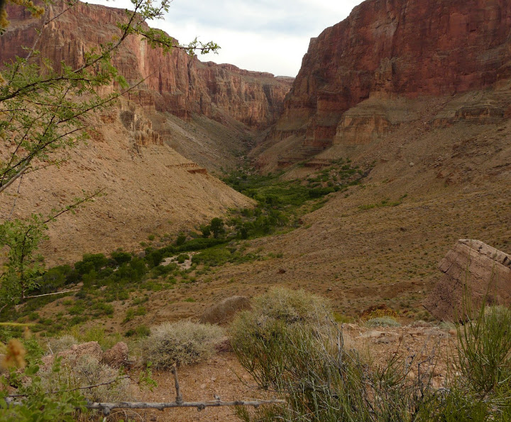
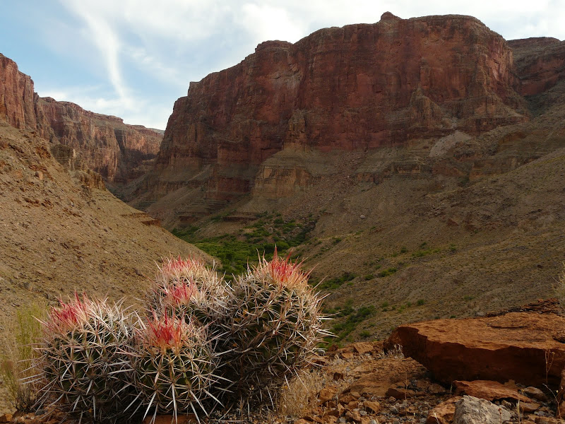
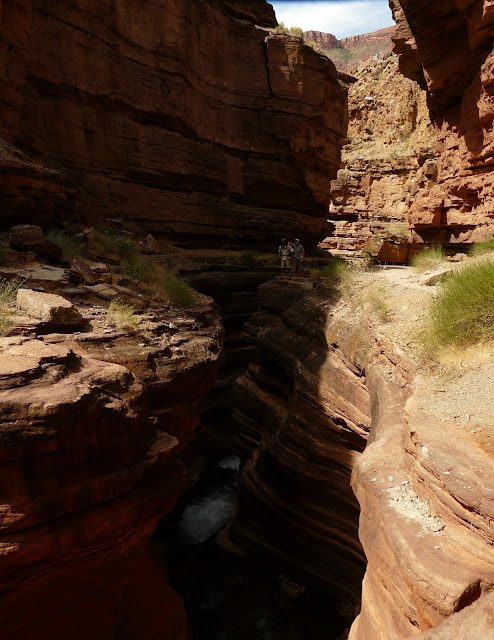
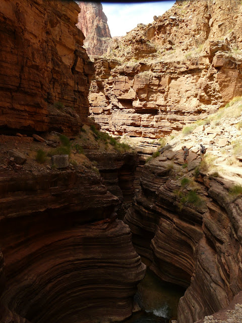
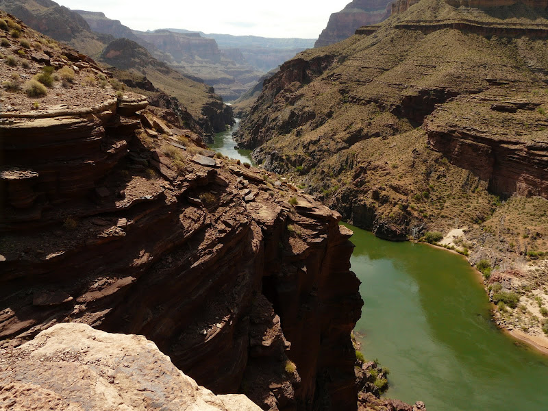
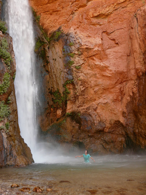
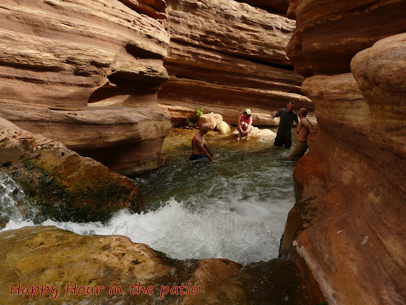
    We cached our water and headed for the next decent into Surprise Valley. They either called it Surprise Valley because they expected to see the Colorado River there or they were surprised by the amount of vegetation. They used to run cattle down these trails for winter grazing – tough cows. The Colorado actually used to run through the valley millions of years ago, then a giant landslide filled in and shifted the river further south.

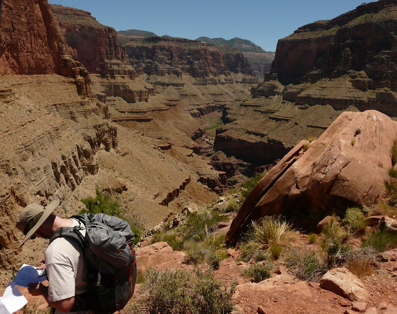
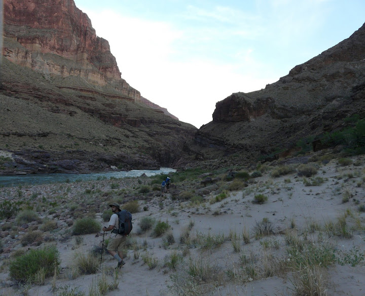
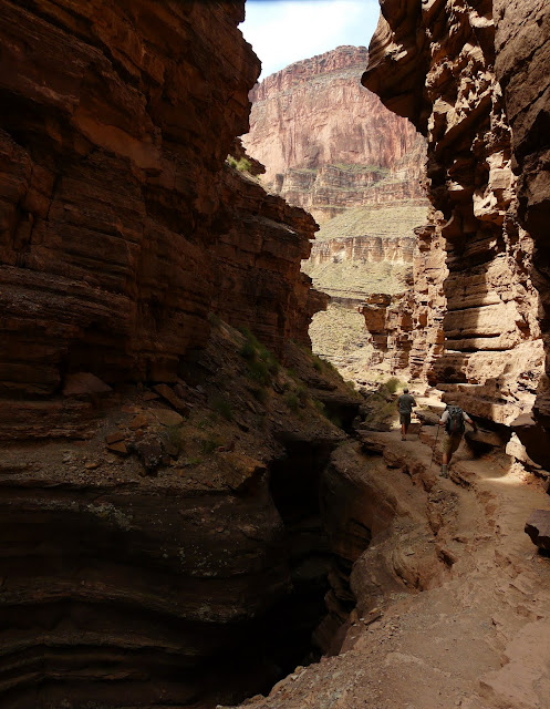
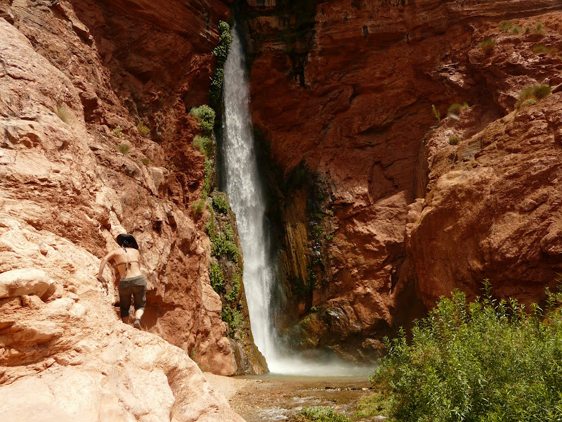
    The beginning of our decent down the Red Wall.

    #1618065
    Brian Martin
    BPL Member

    @xiled1

    Locale: AZ

    About ¾’s of the way down to the valley.

    We crossed the valley and the big surprise to me was how dang hot it was! We crested the edge of Tapeats Canyon and looked down. I had to check my maps because I though the hard stuff was behind us!

    We started the third and final descent and immediately caught our first view of Thunder River. We had heard it, but the 1st look was breathtaking, I felt cooler already.

    Thunder River blasts out of two caves in the side of the canyon wall and flows almost straight down. Its one of the steepest and shortest rivers in the country.


    After a cool down in the mist, we continued down canyon to Tapeats Creek and day one campsite.

    The water was a raging torrent with the record rain/snowfall from this year. After Thunder River joined the
    already high flowing Tapeats Creek, they formed a freezing cold barrier to any crossings or water play.
    This unfortunately limited the exploring we could do in this area.

    Our first nights camp.

    #1618067
    Brian Martin
    BPL Member

    @xiled1

    Locale: AZ

    After fending off mice and falling tents we awoke the next morning to great views.

    With nothing to explore in the area, we headed toward the Colorado.

    A fashion note: Why is it that men’s convertible pants always zip up high and end up with the ‘short pants’ look? And then women’s zip low and end up with the ‘Clam Digger’ look? Can’t we make something in between? I’ll be sporting these dork shorts for the rest of the trip….

    Moving along Tapeats Creek, closer to the Colorado. Great Thumb Mesa is in the background.

    A look back from where we came. No that’s only the Esplanade, not the North Rim.

    One of the few spots of shade along the way.

    Through the Tapeats Creek Narrows and…

    …to the Colorado. How did he get down there??

    Down at river level and checking out some boaters. The water was a chilly 58 degrees and made for some very short cool off sessions – I think 10 seconds was the record.

    Our little rock overhang was Chuckwala City

    Moving on down the beach for our second nights beach campsite.

    #1618068
    Brian Martin
    BPL Member

    @xiled1

    Locale: AZ

    Boaters through the rapids.

    We reached the Mile 135 rapids and spent the rest of the day hiding under rocks and jumping in and out of the water.

    It did finally cool off and we were able to enjoy it a little.

    Our Camp

    Our View

    Up early the next morning and on to Deer Creek.

    The Granite Narrows, the narrowest point in the canyon

    Looking down on Deer Creek.

    Just a cool photo

    Descending into Deer Creek, you arrive at the narrows. This is where the water has carved a slot canyon into the Sandstone and created some incredible formations, waterfalls, and swimming holes. This one is called the patio and is a great place to relax.

    #1618070
    Brian Martin
    BPL Member

    @xiled1

    Locale: AZ

    Pictures don’t do it justice.

    We dropped our stuff at the campsite and headed down the narrows towards the river.


    Some tight spots along the trail.

    We exited the Narrows and looked down on the river.

    The hike down was challenging, but with a great reward – Deer Creek Falls


    Braving the falls.

    Guess I’m not so tough after all..

    Lounging by the river.

    #1618071
    Brian Martin
    BPL Member

    @xiled1

    Locale: AZ

    Back at the top of the narrows and playing in the water.


    We hiked up to the source, Deer Spring.

    And the thrown room.

    Then headed back to the narrows for happy hour. Fun Fact: Did you know a liter of Crown Royal weighs 39.4 ounces?

    That was it for Day 3 and the best day by far, one of my all time favorites. BUT, now for the rest of the story ( props Mr. Harvey). I woke up in the middle of the night in cold sweats, stomach cramps, nausea and its associated results. Up and down till dawn, I woke up my wife and decided we better make a play for the rim before I got worse and was stuck. I had developed some sort of stomach flu and it was taking its toll. We had initially planned on staying most of that day at Deer Creek and then hiking up to the Esplanade in the evening. That split the climb into two for a more enjoyable trip. I knew I had to at least make it there before the heat of the day or I’d be in real trouble. So we headed out before sunrise on what turned out to be the most difficult journey of my life. I made it to the Esplanade at a slow but steady pace with short breaks. Fighting back the nausea to keep down the water was the hardest part. Once on the Esplanade my pace slowed to a crawl alternating 10 min of hiking and 10 min of sleeping. It was midday, but there was a breeze and I kept my clothes drenched to keep cool. We stopped in shady spots to rest. We reached the last climb and our pace slowed to 5 minute rest intervals. Halfway up we both stopped and took about a 25 min nap. We made the last push to the car with the last step being the hardest. I passed out in the front seat for about 45 minutes while my wife drove. Those last steps were purely mental as I was saying out load – ‘Don’t Stop’ ‘Don’t Quit’. Truly an ordeal, but you learn a lot about yourself and the what the human body can be pushed to do.

    The verdict is still out as to the cause. But the others who stayed ran across similar problems later that day and on into the next. We all drank untreated water, straight from the source of Deer Spring. But I was feeling a little run down before that. I also had symptoms others didn’t which led me to believe that I food poisoning. We’ll probably never know, but I will be taking extra precautions next trip. Less fresh food, treat all water, and more effort on clean hands. Oh yeah, and cache booze with the water.

    Here is a link to all the pics, my wife added a lot of titles, enjoy!

    http://picasaweb.google.com/ettienneaz/GrandCanyon#

    Here are a couple videos so you can get the feel for Thunder River

    http://www.youtube.com/watch?v=mZS69Oyawmk

    YouTube video

    #1618078
    Brian Martin
    BPL Member

    @xiled1

    Locale: AZ

    Here is the gearlist I worked up before we left. My wife snuck a few extra things into her pack so we were about equal. Far from UL, but better than before.

    #1618087
    todd
    BPL Member

    @funnymo

    Locale: SE USA

    Brian,

    Amazing pics and a great report!!! Scenery like that is why I hope to to desert hiking sooner rather than later…

    Congrats on pushing yourself thru illness, too! I know that was rough.

    Todd

    #1618120
    Dylan Snodgrass
    Member

    @truenorth

    Locale: San Francisco, CA

    Awesome pictures and what a stoke for all of us who do not live near the desert. I'm already planning next years trip to the canyon! Thanks.

    #1618205
    Philip Delvoie
    BPL Member

    @philipd

    Locale: Ontario, Canada

    Great pictures Brian…beautiful country.

    #1618240
    Rick Horne
    BPL Member

    @rick778

    Locale: NorCal - South Bay - Campbell

    Great report and pictures. Would love to take a trip there someday.

    #1618246
    Jay Wilkerson
    BPL Member

    @creachen

    Locale: East Bay

    Excellent pictures and a great trip report.I need to go visit the Grand Canyon for sure!!!!!! WOW

    #1618354
    Nick Gatel
    BPL Member

    @ngatel

    Locale: Southern California

    Great TR and pictures. Obviously everyone had a lot of fun.

    #1618372
    te – wa
    BPL Member

    @mikeinfhaz

    Locale: Phoenix

    these photos just made my day!

    FWIW, next time out get your fly rod in Tapeats, the trout fishing there is remarkable, so i hear.

    also, many of these springs and seeps have high mineral content, arssenic, mercury, etc. I wonder if this was a contribution? when i do the canyon the tablets stay behind and the katadyn comes along for the ride.

    (and can you believe, the profanity detector caught the word arssenic, hence the wrong spelling. shheesshhh!)

    #1618428
    Brian Martin
    BPL Member

    @xiled1

    Locale: AZ

    "also, many of these springs and seeps have high mineral content, arssenic, mercury, etc. I wonder if this was a contribution? when i do the canyon the tablets stay behind and the katadyn comes along for the ride."

    This was on my mind since Deer Spring water had a lot of 'texture'. I thought that maybe some of the minerals could have disagreed with my stomach. The initial symptons passed in a couple days but were followed by some random swelling/soreness and chest tightness. Hmmmm…..

    #1618434
    David Chenault
    BPL Member

    @davec

    Locale: Queen City, MT

    Awesome trip! Man, I miss that place.

    Arsenic. hehe. (Edit: It would seem if you capitalize it all is well.)

    #1618440
    Eugene Smith
    BPL Member

    @eugeneius

    Locale: Nuevo Mexico

    Thank you so much for sharing your great trip, those were some of the most refreshing photos I've seen in a while! There is nothing like a dip in cold water under the hot sun of the desert. I just got inside from a trail run, it was 102F out and this is like gold for my eyes to feast on right now.

    #1623680
    Tom Clark
    BPL Member

    @tomclark

    Locale: East Coast

    Brian,
    GREAT photos and report! I had never heard of Thunder River before…it mist really be something to see firsthand. The Patio looks so cool and relaxing. Shame about getting sick, but at least you got some terrific days in first.
    Tom

    #2181324
    Martin Stiles
    Member

    @lstiles09

    Hi Brian,
    Thanks for your post. Could you possibly reload your gear list? The link does not seem to be working.

    Thank you!

Viewing 19 posts - 1 through 19 (of 19 total)
  • You must be logged in to reply to this topic.
Forum Posting

A Membership is required to post in the forums. Login or become a member to post in the member forums!

Get the Newsletter

Get our free Handbook and Receive our weekly newsletter to see what's new at Backpacking Light!

Gear Research & Discovery Tools


Loading...