West Coast Trail (British Columbia, Canada)
May 9-11, 2010
My buddy Marc Lindenbach and I tackled the West Coast trail earlier this month and got through it in just over 48 hours from start to finish. We started on the morning of the 9th and finished on the morning of the 11th. This is the first trip report I’ve written up on BPL, so I’ll try and categorize everything for ease-of-reading:

Route/Planning/Logistics
Marc and I drove to the trailhead at Bamfield from Calgary, Alberta. Including the ferry, this made for a 16-hour drive out. The two options to thru-hike this trail are North-to-South, or South-to-North. Because we were trying to get through this trail pretty quickly, we planned to finish at the car so that we wouldn’t need to be done at a specific time of day. Parking at the North end (Bamfield) provided the easier option for driving in/out, and would also allow us to get through the toughest section of trail at the start. After parking at the Bamfield trailhead and camping at Pacheena Bay the first night, we caught the WCT Express Bus, which drove us down to Port Renfrew.
For such a short trail (75-77km depending who you ask) there are a lot of logistical considerations hikers have to make to hike the WCT. This trail is incredibly popular, and during peak season (June 15-Sept 15) you’ll have to book a reservation in order to guarantee starting on the day of your choice. Otherwise, you may have to wait around at the trailhead for a few days in order to get a walk-on permit.
From May 1st to June 14th and from Sept. 16-30, there is no need to reserve your permit ahead of time. Obviously, we were in the first window. It was nice not having to reserve, and obviously shoulder season means the trails are less crowded.
The downsides of shoulder season hiking? The trail maintenance won’t be up to the same standards as in peak season, and the weather is a bit more of a gamble. Also, the ferries, and buses are on more sporadic schedules and the trail towns of Bamfield and Port Renfrew have fewer amenities open.
The WCT has mandatory orientation sessions in order to obtain your permit. These sessions are held three times daily at each end’s trail office: 9:30am, 1:00pm, and 3:30pm. If you want to get an early start, you can attend the 3:30pm session the day before you hit the trail. The folks at the trail office were nice enough to let us take the 9:30am session the day before we started, and at the wrong trailhead. I think that flexibility is another plus-side of doing this trail in shoulder season, when there aren’t many hikers doing the trail.
As far as guide books and resources, “Blisters and Bliss” by David Foster and Wayne Aitken is probably the most popular. At your orientation, you’ll receive a Pacific Rim Nat’l Park map, and they will tape your tide tables to the map. This trail is pretty tough to get lost on, but the guide book is useful for detailing beach access points, water sources, different camping options, etc. so I would recommend checking it out.
Day One- Gordon River to Walbran Creek
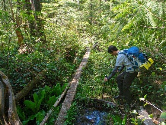
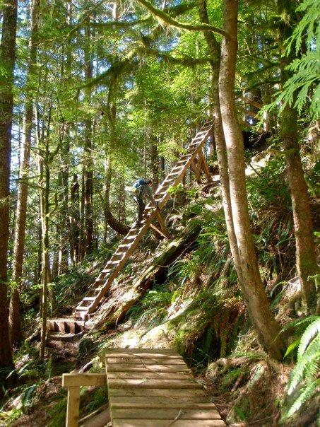
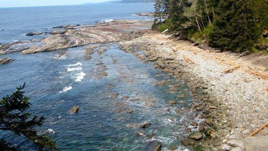
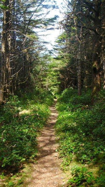
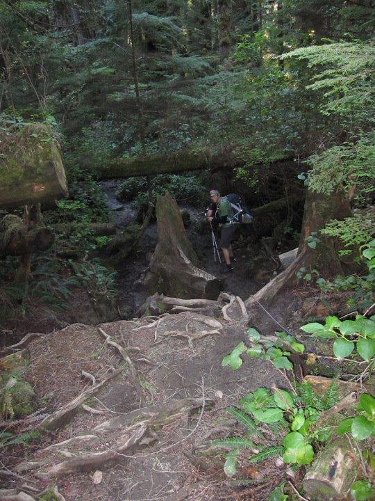
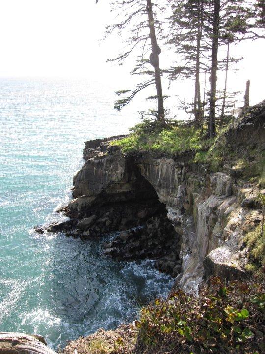
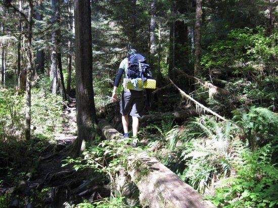
Everyone will tell you that the South section of the trail is the most challenging. This is absolutely correct. From the moment you hit the trail (you need to take a ferry from the trail office to the trail head) you’ll encounter the gnarliest terrain of the whole trail. We carefully moved over slick rocks and roots and soon hit the first ladders of the trail. These ladders would prove to be an integral part of the trail. In some cases, they extended for up to 50 rungs, and I’m sure we climbed up and down the equivelant of a skyscraper by the time all was said and done.

We bumped into some hikers who were nearing the end of their trip, and they were eager to know how the Vancouver Canucks were doing in the playoffs. Unfortunately, we’d been on the road for a couple days and had no clue. They warned us about some mud and a broken cable car, and we kept moving.
Not long after this, I tweaked my right knee stepping over a downed tree. This stayed pretty painful for the rest of the trip, but I minimized the pain by keeping the right leg as straight as possible and leading with my left over steps, ladders and trees.
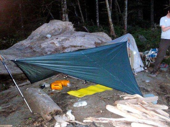
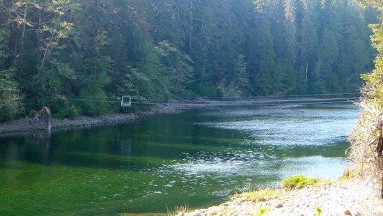
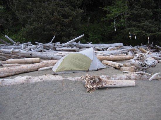
In total, we hiked for a solid 12 or 13 hours the first day, and stopped to camp at Walbran Creek. This site was right on the beach, and provided some great views. The Cable Car at Walbran Creek was broken (the hikers who asked about the Vancouver Canucks apologetically admitted to derailing it!) so I set my alarm for 4am the next day in order to coincide with low tides. We had totally lucked out with the weather on day one, with warm sun and temps around 16 degrees Celsius.


Day Two- Walbran Creek to Michigan
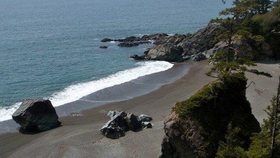
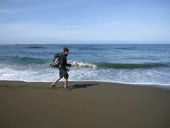
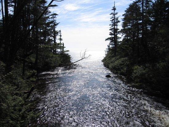
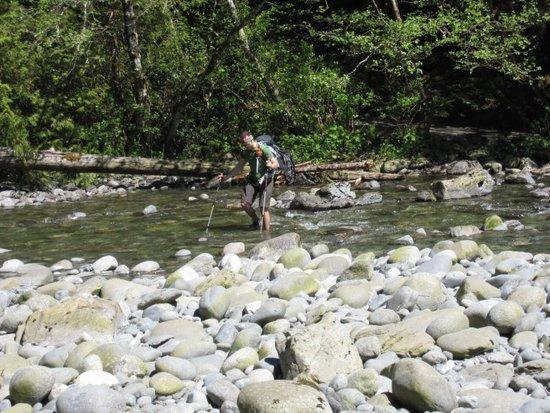
After filling up our bottles further up the creek, we crossed it and started hiking along the beach. After spending the previous day crawling through the technical inland trails at half the speed of smell, the ability to go on autopilot and motor along the beach was a welcome relief!

Before we knew it, a small dog was running up to us and we had arrived at Chez Monique’s, a small makeshift restaurant run by an awesome older lady named, go figure, Monique. Despite being in the middle of a speedy hike, we also wanted to take the time to enjoy the trail and soak up the whole experience, so we stopped for a few cups of coffee and some interesting conversation with Monique herself. She’s running a small organic farm at her restaurant and takes university agriculture courses during the winter months.
As we neared the boat crossing at Nitinat Narrows, I observed a huge heap of bear evidence on the trail. As we went through the brush, we were sure to make lots of noise. We had heard from some hikers the previous day that they’d seen a black bear cub near this area. As we neared the water, there was a loud rustling in the bush. I grabbed my bear spray and got ready. Much to my relief, it was the boat operator’s Labrador retriever! (And much to the dog’s relief, I realized this before bear-spraying him!)


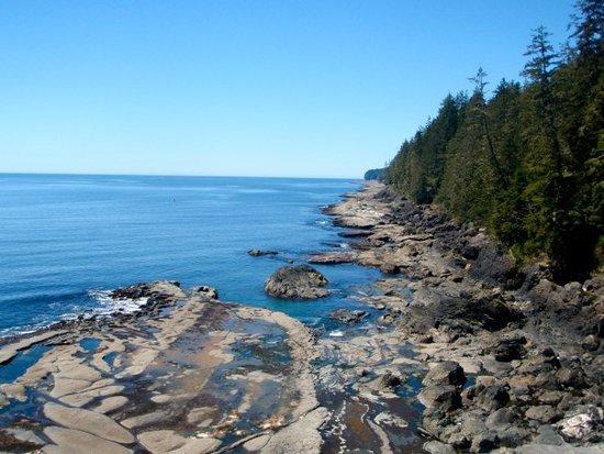
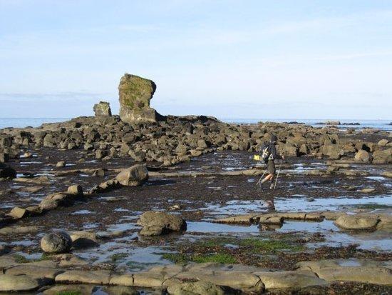
The rest of our day saw a combination of beach and inland trail, some more ladders, a couple cable cars and some amazing views. We considered hiking right out that evening, but opted to camp at Michigan instead. This way, we’d get off the trail in the mid-morning and be able to start the drive back at a reasonable hour.

Day Three- Michigan to Pacheena Bay Trailhead (Finish)
We got up early again and started the trek out. For the first time on our trip, we were getting some light rain. After motoring along the beach for the first part of the day, we finished with a few hours of inland trails. For your reference, we noticed that the kilometer-markers close to the North end of the trail seemed pretty close together. We zipped through this section pretty quickly.
The first thing we did upon finishing was run ahead to check Marc’s car- This area has had some major issues with vehicle smash-in’s. Luckily, everything was kosher.
We started the drive back and enjoyed some McDonald’s along the way. We hadn’t really planned where to sleep on the way back, but were lucky enough to sweet-talk an RV Park owner into letting us pitch our tents on her property. Unfortunately, at 20 feet from a highway with all kinds of engine-retardant brakes screeching, it still wasn’t the greatest sleep I’ve ever had!

Gear and Food
As some have hinted to on these forums before, I don’t think the WCT lends itself towards going super light. Marc used his Osprey Talon 33 pack, and I took my Talon 44. We both used trimmed-down ZLite pads. Marc used his hammock at the trail heads, and pitched its tarp for shelter while on the trail. My shelter was the Mountain Hardwear Helion 2. Marmot’s Helium EQ (-9 down with a waterproof face fabric) was my sleeping bag. Some weight was saved by not bringing a stove or cooking system. As far as footwear, I wore Montrail’s Sabino Trail Mid GTX. I’m a big fan of this shoe. 15.6oz isn’t a bad weight for a waterproof mid, and these things flex just like a trail runner.
I left my rain pants in the car, and the DWR finish on Arc’Teryx’s Palisade pant more than sufficed. One item I brought but never used were my gaiters. Most hikers take 5-8 days to do the WCT, and if I were to spend that long out there, I’d have been more concerned about keeping my pants dry and mud-free, but it wasn’t a big concern.
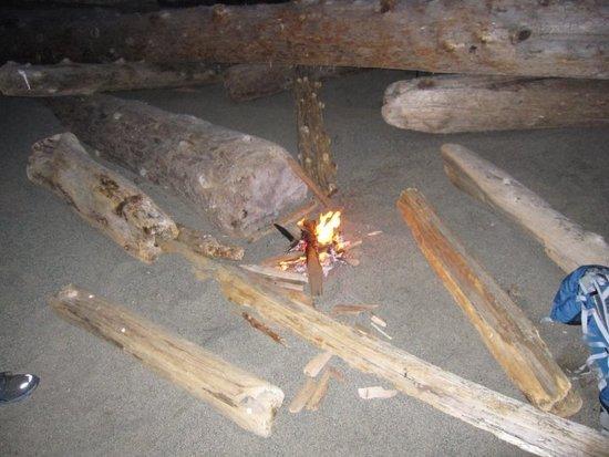
Food was pretty predictable; Lots of beef jerky, pepperoni sticks, chocolate-covered peanuts, dried fruit, granola and clif bars, etc.
Due to the weather you can experience on the trail, how exposed most parts of it are, and the fact that there are only three exit-points, I wouldn’t recommend going unreasonably lightweight on this trail. However, with all the technical sections, ladders, etc. I believe it would be equally hazardous to carry more weight than necessary.
All in all, this hike was a fantastic experience, and I think it’s one of those “must-do” trips in the Pacific Northwest. Any questions, feel free to PM me. Cheers!
-Colin Matthews

